#Weather santa cruz today
Explore tagged Tumblr posts
Text
State of California
I already implied multiple times how different yet imperative California is now in the BNHA-AU. How now there is a new ethnicity due thr mixture of Latin and Anglo (mostly Latin culture) culturr including a new language, how there is a new religion originate from here that now dominated Latin America, and just how different it is from today.
California is still have some similarity from today however; Sacramento is still the capital city with Los Angels still the most populous, it has the highest population (more than 80mil) and most powerful economy in the Union, and still important in the West Coast. Texas is still in second when it comes to population (around 50mil) and population, but ¯\_(ツ)_/¯. California also has the highest rail passengers by state alone, maybe similar to Japan ridership. It is likely it is only beaten by the Northeast corridor, but that region should have a population already at 100mil.
Geography
There is not much change when it comes to geography. It is not like there suddenly are topical rainforests (California actually has temperate rainforests). However, thanks to activists, technology, and laws, many damage to the environment by the Climate Crisis were alleviated. Many Redwood and Sequoia trees managed to reclaimed historic range and then some. There are bisons roaming California, too, with extinct animals brought by to life like mammoth and ground sloth, and mythical creature. California also change their agriculture practice, emulating how Dutch cultivated their products, using greenhouses, hydroponic for efficient water saving, etc. I not going get into more detail (go watch a YouTube about Dutch farming), but this method allowed majority of Central Valley be reclaimed by nature, making the land looks like what it did in the 19th century: Lake Tulare is now permanent, marshlands and has a huge delta.
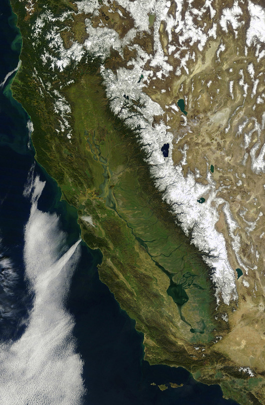
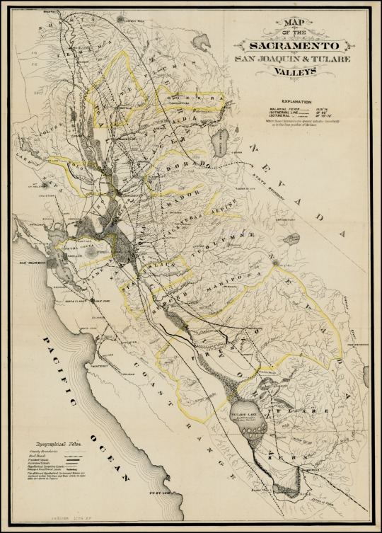
California also deurbanization (actually desuburbanization) many sprawling cities across the state. For instance, the cities I used to live in -Brentwood and Discovery Bay - are now gone, paved out. Many cities, especially in CV, have greenbelt, which also act the limited of their jurisdiction. I also think, with the Climate Crises alleviated, sea levels will drop by a meter or so, so now half of San Francisco Bay, especially south of San Mateo Bridge, is gone, mostly just salt marshes (and no, there are laws forbidding development on it).
There is a bit more rain due to El Nino and La Nina weather system now having a precedence. Like 2-3 years Nino and then 2-3 years Nina. So there could be a drought season. However, those also mean there's a lot more run, even during the mid-spring to mid-fall in Nino. Tropical storms are not uncommon during Nino, at least 1-2. This also means California will lose like a quarter of their desert are gone, so Antelope Valley and San Bernardino Valley biome are similar to Central Valley.
Cities
Bit difficult to talk about cities since some cities changed their name, some new ones, and that I need to make a map. I gonna try to convey the city position by only referring high population, North to South.
Redien- (Redding)- 500k. Know for rail connecting to Redwood Empire Corridor and to Oregon, high percentage of non-Kalifornáns, and high population of Therians/Lycan (Enid lives here).
Bí-Sierra (changing the name)(Chico) - 400k. Know for: ¯\_(ツ)_/¯
Yebu -250k. Know for: ¯\_(ツ)_/¯
Sacramento - 5mil. Know for being the capital, HQ of Golden State Railway Company.
Metropolis of San Francisco - 17mil. Know for the birth of Califity, Memorial of Califia, Angel of the Bay Statue (looks like a Japanese woman wearing a kimono, also know as Liberty of the West)/Museum of Asian and Latin Fredoians between early 19th century-1950s and Beyond.
Amid-Tu-Rifã (changing the name)(Stockton)- 500k. Know for looking like Venice and Amsterdam.
Tuolumne-ín-Estanislao (Modesto) - 500k. Know for: ¯\_(ツ)_/¯
Santa Cruz - 120k. Know for beaches and UCSC.
Salinas -1.2mil. Know for just having an HSR train.
Monterey -90k. Know for the aquarium.
Lafenia [Lafenã means Lavander in Californin (Madera)] - 3.5mil. Know for having the HQ of Rolosron (Golden Iron) Company (focus on rolling stocks), SU Laféna (focus on urban design, transportation engineering, and architecture), and vocation on public transit course.
Fresno - 3.2mil. Know for not being Fresno anymore and a dry port (ironically, it's adjacent by a massive river).
Nés Nakiśa (City near Visalia, between Tulare and Tipton)- 2.5mil. Know for being named after Nakiśa the Lover, the Innocent, and the Miracle-Worker.
Nés Anaís (Bakersfield)- 3.7mil. Know for being the birthplace of Anaís, the Lover, the Guardian, and the Martyr.
Santa de Nagasaki, also called Sanagi (in Santa Maria Valley) -6mil. Know for being a cyberpunk-like city (dont know if that's a good thing or not), cyberware and powered suits industry, and the few pro-hero academy in the world meant for non-quirks. It was a former city-state between the Dark Age to 2200s.
Santa Barbara- 200k. Know for just being a nice city.
Metropolis of Los Angels - 24mil. Know for the Gate of Angels (mixture of Brandenburg Gate and Arc de Triomphe, at San Fernando City), Los Angeles Central Station (mixture of Penn Station and Grand Central Station), Los Angeles Grand Park/The Meadow (bigger than Central Park and Golden Gate Park, at the former city of Compton, adjacent to LA River), The Sequoia (think Tokyo Skytree, have branch-like Observation deck, 670 meters tall, somewhere between Mid-Wilshire and Koreatown).
Rifãsíd (Riverside)- 500k. Know for ¯\_(ツ)_/¯.
San Diego- 9mil. Likely just the same as today.
All together, this brings it up to 78 mil people. There are other cities, towns, and villages in California like Eureka, towns around Lake Tahoe, and others around, but theses cities are considered either major, well-know, or important. All these cities, with the exception of Santa Cruz and Monterey, are connected by NAHSR, and Sacramento and Los Angeles are connected to the Continental wide Maglev network. I gonna explain California railways network later.
Most of the cities kept today boundary, however demolishing many of its sprawling suburban housing. Like I said before, most cities city boundary are tangible by its greenbelt, and they can't, by state-law, develop pass it unless their km density passed 25km, which many city, especially in Central Valley, haven't pass it. Actually, many cities in the Valley have an average of 250km land areas, with average of 12k km2 density.
Many cities, but especially to SF and LA, have patches of urban forest. Not parks meant for recreation, but forest that is meant for nature. SF and LA have many patches of those urban forests, many usually 1 km² but could be higher than 100 km². They used wildlife crossing to connect them all.
Many cities looks like a mixture of futuristic architecture (I will talk about that later) and somewhat traditional-like like Isabelan architecture (eclecticism of Spanish Colonial and SF-like Victorian architecture, need to talk about that). However, Sanagi is just straight-up cyberpunk city, like I will call it Capital City of Cybernetic, with having an unusually higher percentage of Non-Quirks. Non-Quirks are more likely to installed cyberware than Quirks, to the point majority of their bodies is cybernetic. (Lets not kid ourselves, with BNHA having robots the size of skyscrapers and artificial islands in the middle of the ocean, yeah they will stereotypical cyberpunk technology.)
Economy
I think I hinted this before, but California, and frankly majority of the world are what I considered social democracy, or at least, some form of socialist. In California (and Fredoia), almost every necessity goods or service like water, energy, internet, healthcare, public transportation (including airlines), etc. is own by the government. Meanwhile, some that considered necessity but needs some in-hand by the people like housing (majority of it), foods, etc collectively owned either by neighborhoods (districts), groups, or guilds. Now I think about it, it kinda similar to Post-War Britain, especially how it comes to Attlee policies.
In California, the state has a market socialism and guild socialism (Democratic Socialism). There are companies that are controlled by employees; democratically elected company leaders, a 1 to 5 ratio wages, input how the company should be headed, etc. Half the company stock is owned by the employees, and the other half is owned by the local governments, which is then controlled by the people. They voted how the stock revenue should be allotted and apportioned accordingly (either funding for transit, schooling, maintained, etc.). However, sometimes, thanks to public banks, they will give denizens the money through all the stocks in the city.
For guild, sometime a mixture of labor unions, company of laborers, or craftmanship. Many cities have guild in it jurisdiction. For instance, and this I have an idea for a while: biking is considered a one major ways of transportation in California. Because of that, bikes is a huge industry in the state, bikes repairers and retailers are common in cities. A guild that focus on biking will required those to join to and gain a permit. The permit is meant for laborer protects, universal bike parts, . Meanwhile, customer who have a warrant for the city bike guild could go to any bike repair: if they broke their bike kilometers away from their usual repairers, they could go to a close by repair shop and have it fix free thanks to the guild warrant.
Another city guild/company is like a group of crafter who also works together, but unlike something like a bike-like guild, it act more like a company whose own/control/manage by the city, like for construction company. It will be more efficient since the city will have experience with laborers, more efficient in talks and shit, and if there is unneeded constructions, many laborers will simply be put on paid leave (which kind of unnecessary because California is always either building or maintaining something lol).
Agriculture is owned by small farming communities. Honesty, they likely lived in Tipi-like housing similarly what I talk about in my last post. Their farming is just straight up just like the Dutch, which give higher yields for hecto without needing to use more lands. The government will give the community findings and buy their products so to keep foods extremely low. the government will then sell it, low price, to merchant/retailers who then sell it to consumer in again, low price. However, 1/3 of foods product in California is grown by urban farming.
The majority of housing is collectively controlled by locals/tenets. I based it on Singapore town council and House and Development Board. I know that anyone who knows about this is probably not a good thing, but the other synonymy or trying, think of example is Homeowner Association, which is worse. Each city (or ' special wards' for metropolis cases) have districts, which democratically handled housing (and other buildings). They also have delegates for the city council. The district receives tenets rents and is handling it by either paying utilities, repairs, or insurance (not like insurance company, "just-in-case" like natural disasters, hero/villain's battle, etc.). Prices are dependable on housing types (a duplex will be more expensive than an apartment, while a town house be more expensive than a triplex), rooms (if you have kids, the price will be lower), floors, material of the building itself, and construction method. But price are all fixated, meaning if there a housing that have all the characteristic in two different location, and one is consider far more desirable for its surroundings, the two housing are still the same price. In today markets, we usually handle this by outbidding another buyer, which increases house prices. This is the reason why San Francisco is so expensive. Instead, California housing is handled by a lottery system, fairness by fate instead of higher monetary. Some participant are allowed to have some advantage depending on their situation: if they live in the district/city majority of their life, if they have a family, they lost another lottery, they are about to be homeless soon, and such. Ironically, Frinsica (San Francisco) is still difficult to get a house there, lol.
In housing there, people either rent or buy housing. By renting, it usually cheaper- if we using today renting price, an average price for like an one room apartment will likely be $150 per month (people have limits of free utilities until hiting that limit. Parking isn't included and is optionable since like more than half of California doesn't have a car). It's for people living short-termin the area, occasionally students for either high school/college who doesn't want to live in dorms/SRO, newly adults, or people who simply want an easily life (which is not stigmatize in California). However, it usually has a maximum limit of how long someone could rent there (usually 5 years), so people are either evicted or pay an expensive extension. Buying a hosing is also preferable and also cheaper than today. I don't know what is considerably an average price, but likely a triplex unit will cost $150k (you not owning the entire building, just the unit. You do collectively share it with two other owners). Buying is likely similar to how Singapore housing (go look at a YouTube video, lol). One thing to note is that the owner cannot sell their unit or rent it to another tenet. They could only sell it to the district, which would likely be the same price with 5% add. The owner could allow their unit to be inherited or allow friends/families/associates to live in it, but that likely it. Selling or renting it will defeat the purpose of a lottery system.
There is a national bank, a public bank owned by the federal government. Each state have their own banks which connected to the federal bank. The benefits is there is no monthly fees, withdrawing money from other state bank atm without fees, easier gaining loans with lower interest rate (great for starting business ), better retirement account which also connects to social security. However, there is a limit how much someone could have in their account before they start paying a monthly fee: $100K, and the fees gets much higher along with the saving account. (Also, it is common for people to have two retirement, the average lifespan is 160 years, and there are also quirks that allow some people to have longer lifespans).
For artisan guilds like for writers and artists, there is likely an universal-like wage so writers/artists could allow to do their craft. However, there is likely a quota/requirement so they actually do what they meant to do.
For exports and well-known sectors, it likely will be the same as today with some key differences. For one, they know for rolling stocks, specifically for HSR, metro rails, and trollies. The company that handles it, Rolosron, is located in Laféna. Another is Kalimé, or sometimes called Kaliniśon, animations production in California. It has their own unique style, similar to anime in Japan: inspiration, and how I think it will look like are SPOP, Gurihiru works, and some comics like Specter Inspector. Produced in either Los Angeles or San Francisco. Cyberware is also well-known, many of which are produced in Sanagi. Maybe also biking manufacturers, revenues from Califinitan pilgrims, and likely that it.
Half the main energy source are renewable, including solar energy, wind energy, ocean tide, and hydroelectricity. The rest is nuclear fusion plants, and when I mean plants, I mean there are only four plants in the entire state (they needed imported huge amount of tritium gas, also yes, there are still fission plants). There are also room-temperature superconductors, which it is not as common so its usually use for either fusion reactors, transmission tower (almost all California's wind power comes from the Great Plains), energy storages for cities. They are also getting into the noireau (metallic hydrogen) industry.
California working hours is 6 hours, and could only work for 4 days. Cause of this, they have 3 day weekend. In Califinity, they viewed that person must time in three order: Friday for resting, Saturday for indulgence, Sunday for praying. They also get 2 four weeks vacation and 1 three weeks of vacation.
Transportation
YEAH! This is the one I waiting for; I keep indulging about California having an intricate rail network. For now, I gonna talk about non-rail transit because I dont fuck around with trains.
The majority of California used rails for transportation, with Los Angeles rails having 28mil passengers in a city of 24mil (wondering how, go look at Tokyo transportations section in Wiki). However, there are many people who also use either the bus or are preferable to either walk or bike to their destination. There are people who uses cars, but it a privilege to use it, and expensive too: there is congestion charge, parking fees, registration fees for battery cars, high taxes for either ammonia or noireau fuels , and high tolls for using Interstate/Expressways (maybe like $1000-1500 for per year, and higher for freight trucks) (many freeway/interstate were demolished in inner-cities however).
Not only that, many cities have streets design that are similar to Tokyo and European cities: having few boulevard that connect the city in boarder scale, but have streets that either one-way, or pedestrian only zone.

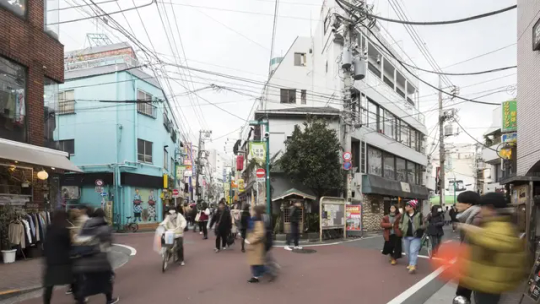
This kind of street are very common in California cities.
California owns a state-enterprise airliner, Golden Airline. There are only 5 major airports in California, 3 that deal with international (as in, non-UNEC member)/intercontinental destinations): San Francisco International Airport, Los Angeles International Airport, San Diego International Airport, East Bay Transcontinental Airport (Oakland Airport), and Santa Ana Transcontinental Airport (John Wayne).Not only are there fewer airports, but intrastate flights are banned in the state. Thanks to federal law, constitution, and UNEC, flights are also banned to Oregon, Nevada, Arizona, Navajo-Hopi, and the State of Baja California.
Rail
California owns a state-enterprise that deals with rail passengers called Golden Railways Company (HQ in Sacramento). Actually, it is one of seven subsidies of Amtrak, which is far larger than today, to the point there has to be smaller companies to deal with railways. The other is Lone Star Railways (Texas and California are the only states to have their own railway companies; HQ in Austin), Northeast Railway Company (Northeast region including Maryland and DC, HQ in New York City), Russet Railway Company (Midwest States that isn't under Lakotah lands; HQ in Chicago), Cascadia Railway Company (Oregon and Washington states; HQ in Olympia, WA), South Railways Company (can't think of a good name lol, compassed all other Southern States; HQ in Atlanta, GA), and Sunwest Railway Company (Southwestern States including Idaho, Montana and Wyoming (any left over lol); HQ is maybe either in Phoenix, Santa Fe or Denver).
California has a massive railway network; it's possible to go to any destination via rails in the state, via regional corridor like the Redwood Empire Corridor (talk about that soon), or intercity/hsr. California two important corridors; the Golden Corridor that goes through Central Valley all the to San Diego (and connects to other states and countries), and the Southern Range Corridor (also called Salinas) that started in San Francisco, goes through Salinas Valley, to Sanagi, Santa Barbara and then Los Angels.
The Golden Corridor used the legacy route of CAHSR, a project that, despite its flaws, was fundamentally crucial for the state. I gonna digress for a bit but people bitching about how the route "should be shorten" or go pass certain cities missed the point. California does not have a good connection with its cities. Yeah, there is Amtrak, but the issue is that it is too slow for conveniences, many of its tracks are owned by freight companies, and there are no direct routes for SF-Fresno-LA. The reason why there is such high population in Central Valley is thanks to CAHSR (and other things). The only reason there is some route change is because there are always things to improve on, some cities are just gone, and there are other routes that don't need HSR.

(What the majority of GC looks like)
There is some new routes and changes of route. For one, it goes further norths to Chico, Redding, and then to Oregon. Another is the corridor at SF-Jose. Right now, CAHSR will share with Caltrain, using the same rails. It is great because it electrified the rails. However, there are some flaws. There are still level crossing, which, admittingly, some are being constructed to have grade separation. Another issue is that it has double-track railways, and it's in the middle of an urban environment.
A few decades after Califia's death (maybe 2080s to 2090s), California has somewhat of a rail revolution, transforming the state railways. For one, the state converted half of state route 101 (SF-Mountain View) into quadruple-track railway. The benefits that it allows HSR trains to go faster, allowing other trains to share (the Bay Area has a RER/S-Bahn trains), and is more separate from urban neighborhoods. The corridor split off from MV: one goes to San Jose Central Station (dual-track again), another still going along US101 than merging with IS880 (still a quad-track). The former Caltrain corridor is converted into a BART line (which is owned by BATA- Bay Area Transportation Authority/likely succeeded Seamless Bay Area). Once the corridor enters SF, it follows the same route of US101 (there is now freeways in SF), which, instead following CAHSR terminating underground, it goes to SF Central Station at the former IS80 above ground. It's a through-station and follows into SF-O Bay Bridge, which either goes to Oakland 16th Street Station, or continues to Sacramento. The Bay Bridge (Golden Gate Bridge and San Mateo Bridge too) itself is similar to New York Manhattan Bridge and Brooklyn Bridge: railways in the bottom, 3x3 road, and a pedestrian/cycling route atop.
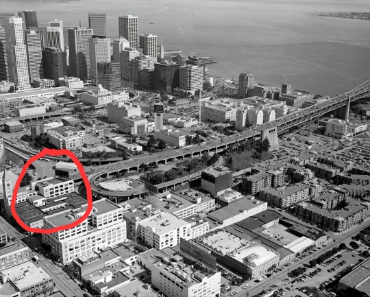
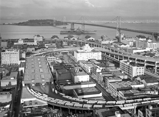
(Where SF/Frinsica Central Station will be located. Also note this is the only way for cars to enter the bridge. Also, i am hitting on my image limit, lol.
For the majority of the corridor, from Sacramento to San Diego, the majority is quadruple-tracks. Well, maybe six-track if you count Maglev, it fellows the Golden Corridor. Also, San Francisco is the largest city in Fredoia that doesn't have a maglev station (lol, lmao even). Some cities are gone, so the corridor does not stop there. Kings/Tulare is Nés Nakiśa, the one near Visalia, and then to Nés Anaís. If a city is adjacent along the corridor, it will have a station, but the HSR will bypass it. There are also minor corridors that connect to the Golden Corridor. Best metaphor, the Golden Corridor is an artery that connects capillary.
After Bakersfield, it bypassed Palmdale and continued to Burbank/LA. Like I said before, Palmdale is connected to the Golden Corridor and does have it own Corridor, its only that HSR does not go there. After LA, it continue down south; it does not go west to San Bernardino. Instead, it continues journeying to Anaheim and then cutting through Chino Hills towards Riverside. From there, it either goes to Las Vegas and/or Phoenix and/or Jeddito and the rest of the country. Or it continues to San Diego, Tijuana, Mexicali, and then all the way to Mexico City. It is quite common for Californians and Mexicans to travel for either places thanks to UNEC having a open border policy.
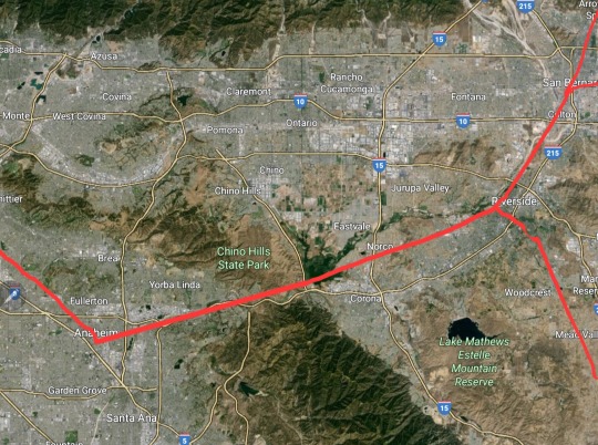
(Notices how once stopping at Riverside, it either goes south, north, or northeast). (Also, I mention before and forgot to said it here, HSR can go up to 450 kph (average likely 400 kph). How they achieved this, other then making sure the corridor is as straight as possible is by: having wireless power transfer beneath the tracks (not eroding the overhead lines), concretene (concrete that has graphene mixed in it) to withstand the vibration and have longer lifespan, and nistíl (neo-steel which is my own idea; just steel itron mixed with graphene) which also withstand the vibration, friction, and have a longer lifespan).
The Southern Range Corridor, or the Salinas Corridor, is another corridor that meant for HSR. The Golden Corridor became extremely congestion: not only regional and HSR trains are using it, but also interstate and international trains frequent the route. So GRC constructed another corridor (likely in the early 2200s) to alleviate the main corridor traffic. It also has many cities in this region, especially Salinas and Sanagi, that don't have proper train lines. The corridor started from Gilroy. Instead ofgoing east, it goes south, going to Salinas. Then it goes southeast through Salinas Valley, continuing all the to Paso Robles. Then it goes south through the mountains, going through San Luis Obispo, then stopping at Sanagi (Santa Maria Valley). It then goes southeast again to through another hills, stopping at Santa Barbara, then through the mountains again to Ventura, goes to Oxnard, Camarillo, and then to Los Angeles Central Station.
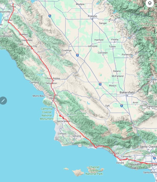
(What the corridor looks like)
Now, the Golden Corridor and Salinas Corridor aren't the only corridors, but those two are the most important, having HSR lines and high traffic. There are other corridors in California, local/regional ones that connect to either corridors. Small traffic yet crucial. One corridor I want to talk about is the Redwood Empire Corridor.
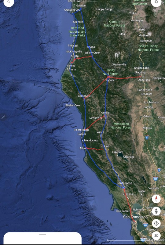
(red is dual-tracks and blue is single-tracks)
The Redwood Empire population, minus anything south of Santa Rosa, is around 750k. Once past Santa Rosa, the corridor goes in a counter-clockwise. The red that goes east-west allows the line to form a 0-shape route. There is like an average 15-20 on the line. I got the idea from Not Just Bikes video about Switzerland. Thanks to this, there are far more people who travel to Redwood forest, especially in spring and summer. There are other corridors in low-populated regions that use similar routes.
The state entire uses clock-fast scheduling- arriving or departing either at 0s or 5s- and pulse timetabling.
There are different categories and types of rail trains, basing it off from Germany and some from the UK. The reason why those two is because it's the only one I can find in Wikipedia, lol. Usually based on how important the hub is, intermittent trips, number of passengers daily, and huge the building is. If I properly made a category list, LA and Sacramento will be 1 (having a maglev stop) while San Francisco and Lafénia will be 2 (not having one. Also, being the last stop before an important junctions is the reason why Lafénia has such a high population).
Education
Before I startn I need to remind everyone that the average lifespan is 160. This means that people ages slower, including sexual maturity like some animals like giant tortoises and bowhead whales. So there people in their 50s who looks in their 20s, or in their 90/100s who looks like in their 40s, similar like Aragorn from lotr (this also means women/afab are averagely 2-3 inches shorter than men/amab, and menstrual cycle is 60 days. Average Ostrace age is usually 200-250 excluding Kitsune and Sanguinarians). So schooling lasts a bit longer than today. (Also, California schooling is implemented country-wide with some difference.) There are laws that require schools to be surrounded by pedestrian-only streets. School days are Monday-Thursday. Some schools also have Friday but it is only half-time
There is 4 levels based on age:
Elementary school, also have daycare :0-8
Primary School: 8-12
Lower Secondary School: 12-16
Upper Secondary School (referred to as Liséa in Kalifornán): 16-20
Elementary schools are far more common than the other 3 schoolings, with an average 1 elementary per 1.5 km. The reason is that is so young children could be closer to their schools. It compassed pre-school, kindergarten, and Grades 1 and 2. Elementary teaches students their primary language (Kalifornan), basic math, and such. An average elementary will likely have a body of 100-200 students, with teachers having a class of 8-10. The elementary playground will also act as a local park. Elementary students are also called Ducklings due teachers picking up their students and herding them to schools like a parent duck and students wearing bright coats.
Primary schools are a bit more widespread due to students being supposed to act more independently, maybe like 1 per 5-10 km. Students are supposed to learn their second languages (usually either English or Spanish, but in some cases, a different language if the neighborhood has a large non-Californian population). An average class has 10-12 students with 500 per school, and students stay in the same class all day. Parents pick their child schools. Schools last 8:30-1:30
Lower Secondary School is widespread too, with 1 LS per 10-20 km. Students again will learn another language, learn more complex subjects, and such. Average classrooms are 12-16 and like PS, students shared same classes. Students are allow to pick their schooling when entering Lower School. School last 8:30-2:30.
Upper Secondary School (or Liséa in California) is far more widespread, with 1 per 20-40 km. Unlike the last three, students do not share classes but go to classes individually. UP acts more like a university than the other schools. Students may learn another language, but it is not mandatory. Not only students may choose their schooling but they could go to another city's schools if desire. It is common for students from small cities and towns to go to bigger cities like SF and LA for schooling (staying at either schools' dorm, social single-room occupancy, or renting an apartment). Students also gain a counselor who guides them for post-US life and careers, especially if it's related to their quirks. It is dependable on the student's schedule, but Schools last 8:30-3:30.
From Primary to Upper School, all students are required to wear an uniform. However, dress code is only not strict but students are courage to customize their uniform, embracing California social individualism. Gender restricted is illegal, and students, regardless of gender, are allowed to wear either pants or skirts. In fact, it is common for boys and masculine genderqueers to wear skirts during summer classes.
Classes scheduling is dependable on cities and their school district, but there are causes where classes have hybrid scheduling of Block and Timetable, with all 8 classes the first Monday, and A/B for the rest of the week. However, some classes, like language and math, are required to be held daily. A school year lasted from late March-Late June = 4/5 weeks vacation= Early August-Late Nov./Early Dec. = 4/5 weeks vacation = Early Jan - Mid/Late Feb = 2/3 weeks vacation = New School Year.
There is a new legal status called Minor. When a student/child reached the age of 15 years-old, their legal status will be listed as Minor, a transition from childhood to adulthood. Under this status, they enjoy far more privilege than they did as a child:
Allow to consume alcohol that is under 5%.
vote in local election.
Go to doctors without parents permission and do minor procedures like HRT
Watch +16 movies at the theaters.
At age 20, they allowed to do:
Voted in State and National-wide election and run for local office.
Consume all levels of alcohol.
Watch +20 movies at theaters.
Allow to do major medical procedures like gender-assignment surgery.
At age 25, they allowed to do:
Run for state and national-wide lower-chamber office (upper chamber and executive branch is 35).
Join the military.
Allow to work in Pleasure Guild (adult films, sex workers).
Drive and operate machineries like cars, trucks, trains, planes, etc.
Culture
The majority of Californians are an ethnicity I already talked about, Kalifornán. Kalifornáns formed (how does a new ethnicity happen?) due to many other Latins ethnicities' culture, especially Mexicans, shared, borrowed, and merged their culture together with Anglo in California. The language, again called Kalifornán, formed from Spanglish. Kalifornáns is primarily found in California, but many are also found in either US states like Arizona and in Mexico states like Baja California.
Kalifornáns are usually energetic and cheerful, more so than non-Kalifornáns. They greeted one another with hugs and kisses on cheeks, regardless of gender (even in formal greeting, they do so, though only with other Kalifornáns). Informal and casual parties are common, lasting into 1-3 am. When guests come over, the host usually serves coffee like cafecito and some pastries. It is just like other Latin Americans' etiquette.
Small street parties are also more common, usually starting around 4-6 pm. Its due to how permits are not really required, only informing a police officer and asking permission of either store or restaurant owners if they throw one. This creates a stereotype of how Kalifornáns are always throwing parties.
Different gender and sexuality are far more acceptable and common in California, with at least 30% self-identified being queers. Even men who consider themselves cishet will wear skirts if the day is hot, and wear bright colors and showing off skin (think timothee chalamet venice film festival outfit).
In beaches and film, breasts are not stigmatized, and it's common for women or genderqueers with breasts to be top less (though some wears a wrap around their shoulder). Non-genital nudity in media is also non-censor and is known to be shown in media below rated-16. Breasts are not sexualize in California, they are more interested in hips, waists, thigh, and butts.
Kalifornáns celebrated their Quinceañera, regardless of gender. For Kalifornáns, especially Califinitans, a child reaching 15 years old, a Minor in legal status, is considered the second most important birthday of their life (behind their Awakenday). This age is considered a transition of childhood to adulthood, and so, many people celebrate their coming in age day. For girls is called Quinceañera, boys is called Quinceañero, and for nonbinaries and other genderqueers is called Quinceañere. It is commonly to celebrate Quinceañera-children all together in the end of the month, usually at a Califinitan temple, and the government pays half of the celebration.
It is common for Kalifornáns to have mini-vacation once a month or so, using their 3-day weekend. They usually preferred traveling 2 and a half hours away from their home, using HSR (hence the high ridership). It's also common for Minors, even young as 15, to have mini vacation by themselves or with friends. It also common for them to visit family or friends if they attend school in another city.
Kalifornáns usually started parenthood between their 40s-50s, usually having 2-4 kids. Parents use their parental leaves for childrearing; parental leaves could be used for up to 3 years, and both the workplace and government pay for their leave ( the workplace is only up to a year). However, it is common for parents to stay home up to six months, where either parents (or ternary or more parents) will agree upon a schedule where one either: work half day and the other take care of the child, one work full day while the other care, or do a hybrid with mixing both schedules. It's very common for families, friends, and amises (will explain that later) to help rear the child, including the community, too. Thanks to technology and different social norms, there are different ways to begotten a child: artificial wombs are becoming the most popular way, though queue are long. (For artificial wombs, gestation is much larger -16-18 months, but the benefits are that infants are more developed compared to natural ways. They will be born as a 6 months old infant and soon start crawling a month later). Vitro gametogenesis is already mainstream. Another method is synth-organ/glan: synthesizing tissue that does certain functions that can't be found in human biology initially ex: having a specific gland to filter carbon dioxide, or having freckle-like bioluminescent marks. Meaning, it is possible for ciswomen to have a synth-penis that produces estrogen and gamete and, likewise, for cismen.
In Kalifornáns, and frankly, Califinitans too, there are considered 3 important important group that fomrat into structures of an individual: families, friends, and lovers, and they all central around the person. In Califinity, one of the most important holidays (expect the day Califia death/transcendence) involves around this, celebrated in the first 3-day weekend of June (it is no coincident why it is in June). So, while romantic is important, platonic-ships are also very important. One such instance is called amís. An amís (or amise/amisa/amiśo) is someone most dearest, closest friend. A word that is similar to it is the Japanese word Nakama. Rarely will people have more than one amís. It is common between amís to have a civil union while also romantically marry to another person. Amís are known to be intimate, including cuddling, small kisses, and hugs (sex is uncommon but not unheard of). Amís will also raise child together, and sometime they will be both child biological parent. There is a genre in media that is meant for amís.
Snippet culture
Can't really think of categorizing this so I gonna type it out. Kalifornán parents don't genderize their child name. Since Kalifornán uses some Spanish rules, including grammatical genders (-a is feminin, -o is masculine, -e is nonbinary/genderqueer, and no vowels mean gender neutral; likely will use ä,ö, and ë), the parents uses gender neutral, and it's up to the child if they want a gender suffix.
It's common for children to call their parents by their first, especially if they're same-gender. For instance, Anne Boonchuy will usually call her mom Mami Oum. However, sometimes, they will have a nonbinary/gender neutral informal parent word, Parí (pair-e). Same uses if both parents are same-gender or one happens to be a genderqueer.
This isn't only done by Kalifornáns but also country-wide, but it expects for both couples to take each other's name, like how Latin Americans do so. For example, Anne Boonchuy full name is Anne Asnee-Boonchuy (Asnee is Oum's surname). Usually, women keep their mother surname and men likewise. Same-gender couple, like a sapphic couple, both will keep their mother surname and again likewise for gay men couple. Nonbinary/genderqueer couple or partner is a bit difficult, but they usually choose what name to keep or keep if one of their is nonbinary/genderqueer. There are also new surnames. (Disgressing a bit, but Emma Nolan full name is Emma Emdis-Nolan. The -Dis suffix means "daughter," and Em- is shortened for Emma. Also, she has two mothers, but she still gets disowned due to being a non-quirk (oof). Also, she has six other sisters).
There are some new dishes, one is which is sandwich/taco-like. It's similar to roujiamo (Chinese sandwich, which half the bread is halfway slice before stuffing food into) with using arepa (or any other flatbread). The bread is slice halfway, and then hallowing it inisde. Then, the ingredients uses spiced and shredded grilled meat (usually chicken), shredded lettuce, diced tomatoes, cutted green onions, maybe diced of white onions, and condiments of sour cream, and either BBQ or thousand islands sauce.
The majority of Southern California are non-Deitist Califinitans, and Northern California are Deitist Califinitans (especially in the Bay Area and Central Valley).
Romantic relationships with age gaps will likely be more common due to longer lifespan, especially if dating an Ostrace. Yoko Tanaka is likely twice the age of Divina, though Sanguinarians ages even slower than an average Ostrace. It will not be surprising if, say, a young Japanese lesbian dated a Kitsune and found out she was alive when Matthew C. Perry went ashore on Japan.
There is a balcony culture, similar to what Montreal has. Since most people in California don't own a single detach housing anymore, and that many housing has a balcony, people will convey their balcony in their own liking. An average balcony is likely a bit smaller than an average room, half which jutted out from the building. There are a lot of hanging plants, many of which are flowering that dangle from it (I based it on Cartagena historic district), and it is common to see people having conversations from across one.
Popular sports are association football that doesn't revolve quirks, girdfield that use flyers (flying broomstick) and non-mage-kind could play, and Metaball, which is the most popular sport in the world. Metaball is a quirks sport, meaning a person needs to have a quirk in order to play. The rules are malleable depending on players, but everyone is required to use a soft exosuit. Capture the Flags is also popular, which is mostly a pro-hero game that heros, usually forming a team based on their cities and playing against each other. The game could escalate very fast, and it is popular on pro-hero academies.
Don't know what else to talk about. The justice system is vastly different, like police officers (other than requiring to have some sort of degree) can't carry lethal arms. The US has a gendarmerie force, the National Guard, which revolves usually against highly dangerous quirks (justice systems are not allowed to use the term "villian")(raiding, capturing, and transporting), internal security, and all that stuff. Pro-heros operate differently than Japan, which are like private cops. Pro-hero is another branch of the National Guard, meaning it's a gendarmerie, different from that they focus more on their quirks individually. Pro-heros usually are put in team, squad, and operate individually and occasionally as teams like Justice League and The Avenger. The highest ranking team in the US is called Liberty Paladins, which usually involves protecting both the prime minister and president, dangerous missions, and stuff (California hero team is called Golden Costodian). Also, during the time of war, Peo-heros will act and operate like soldiers.
Pretty much that it. I planning on changing the US name, somewhat similar to Saoirse, got inspired watching a sex scene of Saoirse Ronan with Charlotte Murchison and I kinda like that name.
#bnha#boku no hero academia#my hero academia#mha#bnha au#mha au#bnha fanon#bnha fanfic#mha fanon#mha fanfic#bnha fanfiction#mha fanfiction#enid sinclair#the prom#railway#trains#high speed rail#urban#lore#sci-fi#sci fantasy#socialism#leftism#left wing#wednesday netflix#queer#yoko tanaka#divina wednesday#amphibia#anne boonchuy
8 notes
·
View notes
Text
Last night we went and got our favorite tacos in our town and went and ate them in the little side street that they blocked off during the pandemic and kept blocked off for people to gather and eat at picnic tables, feels like a little biergarden in the middle of Park. My tacos were sooo good and then we walked around town a little waiting for 7:30 when our movie was gonna start. Asteroid City was so good! It was a lot of fun :) we took our time walking back to where Id parked my car and it was almost 10 and still sooo warm and nice out and so many people were out on what feels like the first warm day we’ve had in so so long.
Im off for the next four days! And starting ADD medication today (strattera) which Im nervous but hopeful about. This weather is so lovely it just makes me want to cook and play music with all the windows open and eat fruit. Driving to santa cruz to have a backyard bbq with our former housemates/good friends at the sweet little home they rent in the mountains and will get to see their baby and their dog who is obsessed with us :o)
Then tuesday leigh and I are gonna take camp chairs a couple blocks down from our apartment and post up on webster to watch our town’s superr long 4th of july parade. People take it so seriously here lmao because its like 2 hours and so much fun. The sweet and kind of crazy hairdresser we both go to apparently is going to be in the parade lmao and invited us to come by to her party after where she said there’ll be a lot of her mma training friends so maybe we’ll drop into that! Happy and excited for all this time off!
4 notes
·
View notes
Text
A tornado touched down in the Santa Cruz mountains today. So my worst weather fear is now a very real possibility, and my whole life people said tornadoes couldn’t happen here!!
1 note
·
View note
Text
Endless summer
By Cynthia Brian
“Magnificent Autumn… It is the funeral anthem of the dying year.” Henry Wadsworth Longfellow
When I was young, I was a surfer girl. I spent many weekends catching waves in Santa Cruz, Bolinas, and Hawaii. My favorite movie was The Endless Summer. I dreamt of traveling the globe in search of the perfect ride.
Today, I surf gardening catalogs and magazines looking for the waves of new plant species and hardy specimens that are deer-resistant and drought-tolerant to thrive in our clay soils.
The first few days of autumn were refreshing. The cooler temperatures prompted me to start digging and enhancing the soil as I anticipated the joys of fall plantings. But Mother Nature had other plans and decided to shower us with an endless summer of sizzling sunshine and stifling nights. The winds have been so ferocious that I awoke to my patio umbrellas blown across my backyard. Until recent years, summer has always been a favorite season, but as our globe warms, an endless summer portends a major drought in the future. While the East Coast suffers from torrential rains, hurricanes, floods, and tornadoes, the West Coast endures another heat wave and increased risk of deadly wildfires.
As temperatures soared to 103 degrees, our street suffered a fire hydrant leak this week, resulting in our neighborhood’s water being shut off for twenty-four hours without warning. It was disconcerting to turn on the tap with no drip available. My empathy for those anguishing in disaster areas and war zones soared when water and basic necessities are unavailable. Water is life.
Before I provide tips on drought-tolerant plants that you may wish to include in your landscape, I want to remind you that although fire season in California is considered year-round, October is an especially monstrous month for wildfires. Make sure you have your home Go-Bag up-to-date and ready to go in the event of an emergency. It’s a smart idea to keep an additional Go-Bag in your car in case you get stranded and can’t make it home. Fill these Go-Bags with all the necessities you, your family, and your pets will need for three days, including water, protein bars, a first-aid kit, medications, masks, gloves, extra chargers, blankets, change of clothes, jacket, socks, headlamp, and a flash drive with your important documents, photos, or other digital items that you don’t have in the cloud.
When working in your yard, on red-flag days, scorching hot or windy days, refrain from using any equipment that could cause a spark: lawnmower, weed whacker, or chainsaw. Do not ignite a fire pit, cook over an open flame, vape, or smoke outdoors. Be fire-safe.
In September articles, I discussed how to prepare your soil for fall plantings (Prescription to Plant: https://lamorindaweekly.com/archive/issue1815/Digging-Deep-with-Goddess-Gardener-Cynthia-Brian-Prescription-to-Plant.html) and also suggested plants that are deer resistant, (Dear Deer! https://www.lamorindaweekly.com/archive/issue1816/Digging-Deep-with-Goddess-Gardener-Cynthia-Brian-Dear-Deer.html). But how do we move forward in an endless summer of heat and heavy winds?
The answer is to keep your landscape appropriately watered so that established plants and trees don’t perish. WAIT to plant anything until the weather cools. The soil will still be warm, but the air temperatures will be lower. In this scenario, with minimal watering, the roots can establish themselves and be less stressed.
If you are considering reseeding your lawn or adding sod, start preparing the soil. Turn the soil six inches, mix in compost, then WAIT for chillier weather. Double-check your irrigation system to make sure that your sprinklers will reach every part of your grass. If you are ordering sod, start now researching the type of grass you want to install and get a quote from a reputable landscaper or grower. In the past few weeks, I had to replace my irrigation controllers. I hired my handyman from HoneyHomes to help me. I also repositioned several sprinkler lines. Thankfully, everything is working perfectly now after several years of pulling hoses. If you need help, this company has qualified service people in Lamorinda and you can get a major discount with my code https://honeyh.me/eXEn. As soon as the weather cools, I’ll be reseeding and overseeding, knowing that when I turn on a sprinkler, it will work.
Drought-tolerant plants to consider for fall:
If you’ve been perusing my garden columns, you already have a list of deer-resistant plants and know how to prepare the soil with mulch and drainage that retains moisture without waterlogging. Here are a few of my favorite low-water options that can be planted before the winter cold arrives and after our endless summer has ceased. Remember, no matter how drought-tolerant a plant is, every plant needs some water. California natives will be the most tolerant, conserving more water and requiring less maintenance. Many natives are also deer-resistant.
Natives:
Manzanita
California Poppy
California lilac (ceanothus)
Muhly grass
Pink flowering currant
Blue-eyes grass
Salvia
Yarrow
California fuchsia
Blue elderberry
Shaw’s Agave
Other Drought-Tolerant Plants:
Lavender
Aloe Vera
Echeveria
Barberry
Sedum
Russian Sage
Feather Reed Grass
Black-eyed Susan
Pride of Madeira
Stonecrop
Succulents
Cacti
Many wildflowers
For a flash of annual border color, buy pansies. They use relatively little water, are low maintenance, and provide beauty in the winter.
You can create a beautiful and sustainable landscape with native and drought-tolerant plants. Biodiversity is increased, and you’ll cultivate a garden that will thrive in arid and water-scarce conditions. Save every drop of water by putting a bucket in your shower or a bowl near your sinks. I use the water for my indoor plants and patio potted plants. If you want to go the extra mile, install a rain catcher or barrel to collect the water from downspouts.
On a positive sunny note, my tomato plants are enjoying this endless summer. They have mingled with my Jacobinia Justica Carnea and continue to sprout new flowers which will provide me with tomatoes for a few more months.
As we look forward to a magnificent autumn, catch a gardening wave in this endless summer! Soon enough, the funeral anthem of a dying year will be playing, and we’ll be longing to surf the sunshine again.
Happy Gardening. Happy Growing!
Lamorinda WEekly: https://www.lamorindaweekly.com/archive/issue1817/Digging-Deep-with-Goddess-Gardener-Cynthia-Brian-Endless-Summer.html
For more gardening advice for all seasons, check out Growing with the Goddess Gardener at https://www.CynthiaBrian.com/books. Raised in the vineyards of Napa County, Cynthia Brian is a New York Times best-selling author, actor, radio personality, speaker, media and writing coach as well as the Founder and Executive Director of Be the Star You Are!® 501 c3 which was just honored as the 2024 Nonprofit of the Year by the Moraga Chamber of Commerce. Tune into Cynthia’s StarStyle® Radio Broadcast at www.StarStyleRadio.com. Her newest children’s picture book, Books in the Barnyard: Oh Deer!, from the series, Stella Bella’s Barnyard Adventures is available at https://www.CynthiaBrian.com/online-store. Hire Cynthia for writing projects, garden consults, and inspirational lectures. [email protected] https://www.CynthiaBrian.com


#cynthiabrian#endlesssummer#droughtolerantplants#dry#starstyle#goddessgardener#voiceamerica#presdcriptiontoplant#autumgarden
0 notes
Text
Top 4 Sailing Destinations of the Canary Island

Many individuals all over the world consider sailing to be both a sport and a passion. A location that provides wonderful weather, solid infrastructure, contemporary marinas, and the chance to sail in azure waters is the ideal sailing destination for sailors. Every sailor's ambition is to have a year-round sailing region that offers sophisticated navigation and sports sailing conditions. Having access to top-notch sailboats and yachts is crucial whether you're planning a fun day trip or a long-distance expedition. This article will examine the top Sailing Destinations of the Canary Island that provide these features and the reasons why every sailor should travel there. Prepare to set sail and explore the year-round sailing regions with the most cutting-edge marinas and the best sailing conditions for blue water and sport sailing.
Sailing in the Canary Islands
Weather and wind conditions
Some of the world's best sailing conditions may be found off the coast of Africa in the Canary Islands. With temperatures ranging from 20 to 28 degrees Celsius and consistent trade winds blowing between 15 and 25 knots, the weather and wind conditions are perfect for sailing all year long. Additionally, the water is a lovely 19° to 23°C, making it ideal for swimming, diving, and snorkelling.
Types of boats available for sailing
There are several different boat types that can be sailed in the Canary Islands, including monohulls, catamarans, and opulent yachts. These vessels can be rented at contemporary marinas that have all the amenities and services that sailors require. Along with restaurants and gas outlets, many marinas also provide repair and maintenance services.
Navigational challenges in the region
Due to the rocky shoreline, strong currents, and erratic weather, navigating the Canary Islands can be difficult. However, navigating the waters surrounding the islands is much simpler today thanks to advanced navigational instruments and current charting systems. The islands are situated on a major shipping path, therefore sailors must be aware of the potential risks and take the appropriate precautions.
For all sorts of sailors, the Canary Islands offer a superb sailing experience. In this breathtaking region of the world, sailors may experience the ultimate sailing trip thanks to ideal weather conditions, contemporary marinas, a broad selection of boats, and cutting-edge navigation systems.
Learn more about the Sailing Destinations in Itlay
Top Sailing Destinations of the Canary Islands
Tenerife, Gran Canaria, Lanzarote, and Fuerteventura are some of the finest sailing destinations in the archipelago and each has its own scenery, attractions, and sailing routes. We'll learn more about these four islands below:
Tenerife
Tenerife is one of the finest sailing destinations in the Canary Islands, offering the ideal blend of gorgeous scenery, excellent weather, and contemporary ports. With a wide variety of sights and activities to satisfy all tastes, the island is the largest and most populous in the archipelago.
With several ports and coves to discover, sailing routes around Tenerife offer a combination of coastal and open-sea sailing. Sailing can be done on a wide variety of watercraft, including sailboats, sailing yachts, and catamarans. A number of contemporary marinas, including Puerto Colón, Marina del Sur, and Marina San Miguel, are also located on the island and offer all the amenities needed for sailors.
The southern coast of Tenerife is one of the most well-liked sailing routes because it offers breathtaking views of the Teide volcano and the wild coastline. Another path will take you to the lovely national park on the island of La Gomera, which is immediately west of Tenerife.
The historic village of Garachico, the black-sand beaches of Los Gigantes, and the bustling capital city of Santa Cruz de Tenerife are just a few of the attractions and sites of interest available to sailors in Tenerife. The island is also renowned for its top-notch cuisine, with many eateries serving up fresh fish and authentic Canarian fare.
Overall, Tenerife is a must-visit location for sailors because it provides the ideal blend of excellent sailing conditions, cutting-edge marinas, and breathtaking natural scenery. Tenerife is the ideal location for a sailing trip in the Canary Islands due to its wide variety of sights and activities.
Gran Canaria
Another popular sailing destination of the Canary Islands is Gran Canaria, which is renowned for its gorgeous beaches, breathtaking scenery, and exciting nightlife. The second-most populous island in the archipelago has a wide range of attractions and activities.
From coastal sailing to open sea passages to other islands in the archipelago, Gran Canaria's sailing routes provide a variety of experiences. Modern marinas including Puerto de la Luz, Pasito Blanco, and Anfi del Mar rent out a variety of boats, including sailboats, sailing yachts, and catamarans, for sailing.
The southwest coast of Gran Canaria is a well-liked sailing route where you can visit lovely beaches like Playa de Mogán and Playa de Amadores and enjoy the well-known Maspalomas sand dunes. You can also go a different path to reach the stunning island of Tenerife, which is only 50 nautical miles away.
Sailing enthusiasts can find a wide range of attractions and areas of interest on Gran Canaria, including the magnificent Tamadaba Natural Park, the Roque Nublo rock formation, and the ancient city of Las Palmas de Gran Canaria. The island is renowned for its exciting nightlife, with a wide variety of bars and eateries serving delectable regional fare and energizing beverages.
Overall, Gran Canaria in the Canary Islands is a great place to go sailing since it has stunning scenery, up-to-date marinas, and a variety of attractions and activities. Gran Canaria is a great option for sailors searching for an unique and entertaining experience because of its vibrant culture, breathtaking beaches, and good sailing conditions.
Lanzarote
In the Canary Islands, Lanzarote is a distinct sailing location renowned for its breathtaking volcanic landscapes and crystal-clear blue waters. Numerous contemporary marinas, notably Marina Rubicón and Puerto Calero, are located on the island and provide all the amenities needed for sailors.
With several ports and coves to discover, sailing routes around Lanzarote offer a combination of coastal and open sea sailing. Sailing can be done on a wide variety of watercraft, including sailboats, sailing yachts, and catamarans. One well-liked sailing route takes you to the island of La Graciosa, which is home to stunning beaches and a charming fishing village and is situated just off the northern coast of Lanzarote.
Sailing enthusiasts may find a wide range of attractions and areas of interest in Lanzarote, including the Timanfaya National Park, which is home to breathtaking volcanic landscapes and geothermal activity.
Fuerteventura
The Canary Islands' Fuerteventura is a popular sailing destination thanks to its stunning sandy beaches, clear waters, and consistent winds. Numerous contemporary marinas, like Puerto del Rosario and Marina de Caleta de Fuste, are located on the island and offer all the amenities needed for sailors.
There are many ports and coves to explore along the coastal and open-water sailing routes that circle Fuerteventura. Sailing can be done on a wide variety of watercraft, including sailboats, sailing yachts, and catamarans. A well-known sailing path leads to the island of Lobos, which is just off the northern coast of Fuerteventura and has spectacular scenery and crystal-clear waters.
Sailing enthusiasts may find a wide range of attractions and areas of interest in Fuerteventura, including the spectacular beaches and sand dunes of the Corralejo Natural Park. The island is also home to Costa Calma's stunning beaches, the historic port city of Gran Tarajal, and the lovely village of Betancuria. If you’re looking for breathtaking places to sail then do visit Italy. The Coastline offers the best sailing destinations of Italy.
0 notes
Photo

The many and varied atmospheric moods of today's road trip through Santa Cruz/Bonny Doon/Davenport/Woodside ... The weather definitely had multiple personality disorder. (at California, USA) https://www.instagram.com/p/CprMwkHu3ZC/?igshid=NGJjMDIxMWI=
0 notes
Text
Weather santa cruz today

WEATHER SANTA CRUZ TODAY PLUS
Winds ease into Monday night and coastal stratus will slowly move inland into the night. Winds will be light to moderate through the morning, but become moderate to breezy for Monday afternoon as widespread VFR returns. Stratus will also filter into the SF Bay leading to IFR at OAK. Stratus is building along the coast and into the Monterey Bay, causing LIFR CIGs at MRY and SNS. Mid to high clouds continue to pass through the region. But its another solemn reminder that it is only mid September, and climatologically September and October are the primary months when dry, offshore winds develop around the Bay Area.ĪVIATION. It only just started showing up in model so for now it will be monitored. If this scenario plays out, that leads to the probability that winds can turn offshore and heighten fire concerns. Meanwhile, the Euro does not have a closed low, it keeps it a trough and brings it a bit more inland and Sunday through Tuesday. While there is not many impacts associated with this, for this discussion it is to note that this patter would keep consistent onshore flow present. The GFS and Canadian model have the upper level trough form into a closed low by Saturday morning just west of Seattle, moving southward into early next week. For now, there seems to be discrepancies in models. Speaking of next weekend, that looks to be the next time the upper level pattern changes. Temperatures will warm slightly back to normal conditions for the end of the work week and next weekend. An additional benefit for constant onshore flow is that it will help to blow most if not all the smoke and haze remaining around the Bay Area farther inland to the East. Prevailing onshore winds will be featured through the week with afternoon seabreezes each day.
WEATHER SANTA CRUZ TODAY PLUS
On the plus side, it will help maintain the marine layer and even deepen it slightly through midweek. Cold air advection behind it will drive temperatures at the surface to approximately 5 to 10 degrees below seasonal normal values for Tuesday and Wednesday around the Bay Area. A long wave trough develops over the Pacific and sets up along the California Coastline. At some point, it is expected on Monday that the radar eventually gets switched over to clear-air mode.Ī much quieter weather pattern is forecast for the work week. There remains a non-zero chance for a small pop-up shower today, given the higher precipitable water values and the influence of the local topography, but confidence is exceptionally low given how mostly stable the atmosphere has become. The upper level low associated with the higher moisture content will slowly leave the Bay Area and move eastward through the course of Monday. Winds have already switched around to the northwest providing additional onshore flow and cooling to the region. The radar remains in precip mode due to weak cells are are still present in the North Bay, moving northward out of the area. With the marine layer being below 1000 feet, Half Moon Bay has recorded visibility down to 4 statue miles, so patchy fog may be possible on the immediate coastline, but only expected to be in small pockets and not last too long after sunrise. Mid-level clouds remain in the area as the artifacts of the once tropical system. Temperatures remain mostly in the 60s overnight, with a few upper 50s along the coast and low 70s on the inland mountains and ridgetops. Slight warming forecast into next weekend.ĭISCUSSION. Cooling temperatures drop below seasonal normal values Tuesday and Wednesday. Lingering isolated showers are possible, but confidence is low. Cloud cover will slowly move eastward through Monday. Area Discussion for - San Francisco/Monterey Bay Area, CA (on/off) Help NOTE: mouseover dotted underlined text for definitionĪrea Forecast Discussion National Weather Service San Francisco Bay Area 433 AM PDT Mon Sep 12 2022

0 notes
Photo

Mumbai: Season’s heaviest rain, second-highest 24-hour Sept spell in 26 years – mumbai news Mumbai’s suburbs witnessed an incessant downpour between Tuesday evening and Wednesday morning with 286.4mm rain, categorised as extremely heavy rainfall.
#Andheri#IMD#Mumbai#Mumbai Rain News#Mumbai rains#Mumbai Rains 2020#Mumbai Rains Forecast#Mumbai rains LIVE#Mumbai Rains Today#Mumbai Rains Today Live#Mumbai Rains Update#Mumbai Weather#Mumbai Weather Today#Navi Mumbai#Santa Cruz#Thane#Vashi
0 notes
Text
Flee for Your Life? Wildfires transform hiking in California's mountains
This is an excerpt from an article published on August 21, 2022 in the Santa Cruz Sentinel. I wish so many of our posts were not related to wildfires but fires have become a critical issue in trip planning and trip safety. Make sure you read to the recommendations at the end of the piece.
By Ethan Baron
Andrew Schrock woke around midnight smelling smoke on a backpacking trip late last month in California’s far north.
“I heard what I thought was rain but was ashes on the tent,” said Schrock, 43.
Using a satellite-based device from the Klamath National Forest near the Oregon border, he texted family and friends back home to find out what was happening – but “no one was up.”
He’d had cell service a mile back along the iconic Pacific Crest Trail that stretches from Mexico to Canada, so he set out alone in the dark, got online, and discovered that the McKinney Fire – which has since grown to more than 60,000 acres, killed four people and required the rescue of 60 hikers from the California side of the trail – had ignited behind him to the south the previous afternoon.
Ask anyone who hikes in California’s mountains about wildfires and you’ll likely get an earful about canceled trips, detours, lung-burning smoke and, possibly, harrowing escapes. Backcountry travelers are increasingly finding themselves on the dangerous edge of a changing climate that is driving drought, parching forests, spreading tree-killing beetles and altering weather patterns. Add in heavy vegetation buildup from decades of fire suppression, and you have frequent, ferocious forest fires that scramble hikers’ best-laid plans and demand new tactics for staying safe.
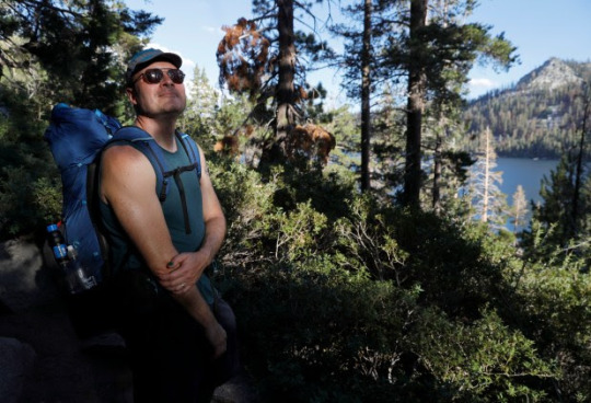
Schrock, of Long Beach, flew from Ashland, Oregon, to Fresno and then caught a bus to Yosemite to get back into the Sierra Nevada and finish his vacation covering more ground and enjoying the wilderness on his multi-year quest to complete the Pacific Crest Trail, he recalled while taking a snack break beside Lower Echo Lake near Lake Tahoe.
Dallan Clancy of Belmont, 68, finishing up a day hike 100 miles west of Sacramento at Carson Pass, said he had to cancel an overnight trip last September in the southern Sierra because the U.S. Forest Service shut access to all but one of California’s national forests over fire risks, including what the agency called “fire behavior that is beyond the norm of our experience and models such as large, quick runs in the night.” Clancy said he and four friends are aiming to do the trip this year, “unless it gets really bad.”
“We’ve always made note of escape routes, but on this trip, we actually planned our escape routes. We wanted to know the routes we could take to get out to a road,” said Jack Daro, a Southern California musician taking a break at Carson Pass during a backpacking trek to Yosemite National Park.

Hikers in years past “just went and did whatever you wanted to do wherever you wanted to go,” Wilkinson said. But 2020 marked a transformation, with the million-acre August Complex Fire, the Creek Fire northeast of Fresno that led to helicopter evacuations of hundreds of people including hikers on the John Muir Trail, and other massive blazes launching California into the age of mega-fires, Wilkinson said.
Nine of California’s 20 biggest fires since 1932 have occurred in the past three years, torching 4.1 million acres, according to Cal Fire. This year’s five biggest blazes have burned 116,000 acres, and “we’re just now getting into peak wildfire season,” Wilkinson said.
U.S. Forest Service spokeswoman Adrienne Freeman noted that fire can move much faster in today’s baked-crisp forests. “The window between OK and not OK,” Freeman said, “is becoming shorter and shorter.”
Backcountry journeyers who think seeing smoke but no flames means they’re fine may be mistaken, Wilkinson said. “Fire can move like a freight train, much faster than a person can run.”
Some hikers have dramatically changed the way they travel. Loetitia Saint-Jacques, 50, a Tahoe City veterinary technician, was on an overnight trip this month near South Lake Tahoe. Before the mega-fires, she and her companions would take long trips into deep wilderness. “We don’t go as remote now,” Saint-Jacques said. “Now it’s shorter trips. We do overnights, instead of five to eight days.”
Long-distance speed-hiker Ella Raff had multiple run-ins with wildfire and its fallout after embarking on the Pacific Crest Trail in June to walk from Mexico to Canada. Last month, the Washburn Fire in Yosemite shrouded her in smoke for two days. “I was just breathing heavy smoke 24/7. It’s not very fun,” said Raff, 29, of Portland. Farther north in California, traversing 85 miles of trail charred from last year’s nearly million-acre Dixie Fire left Raff covered in ash and dismayed by a “surreal” landscape with little animal life.

Soon after, she smelled smoke from the McKinney Fire. As she was nearing the Oregon border, authorities shut the trail ahead. More than 100 miles of the route remain closed, with the fire, which started July 29, now almost contained. Raff made her way to Portland, then to Washington to hike the trail southward from Canada.
Changing jumping-off points, routes, destinations, or timing to cope with uncertainty about fires is now routine for hikers in California. The Caldor Fire, which ravaged 220,000 acres southwest of Lake Tahoe last year from August to October, forced Truckee artist Danae Anderson, 63, to cancel three backpacking trips. “Everything was too smoky up here,” said Anderson, hiking beside Lower Echo Lake. She went to Yosemite instead.
Reckless target shooting by a father and son allegedly caused the Caldor Fire. The inferno’s scar stretches nearly 50 miles southwest of Echo Lakes in a swath up to 15 miles wide, much of it a blackened wasteland of lifeless trees, some downed, some standing without greenery, granite on many boulders shattered in places by the intense heat. More than 80 miles of the Pacific Crest Trail were closed from the fire’s start last August until early this year. Hikers passing through such areas may find water scarce, and standing dead trees can pose a deadly toppling hazard, said Matt Rump, a trail stewardship staffer for the Pacific Crest Trail Association.
Crews take down the most dangerous trees, but because there are so many dead, and they provide important wildlife habitat, officials accept some risk to hikers, under the calculus that “if you get whacked, it’s your time,” said Cheryl Bailey, 73, a volunteer for the Tahoe Rim Trail Association, as she walked along the 2 1/2 miles of the rim trail that run through the Caldor scar and that she’s been helping rebuild.
Some hikers console themselves with fire’s importance to forest health, but many of today’s blazes burn so hot they kill trees accustomed to lower-intensity fires.
In the Echo Chalet store where Schrock, who fled the McKinney Fire, bought snacks, cashier Georgia Sprague, 22, chatted with the trekkers whose ebbs and flows depend on fires and smoke. Many expressed urgency over climate change.
“They feel a lot of a push to get out,” she said, “and see the world before it burns up.”
Wildfire safety tips for hikers
Recommendations for staying safe while hiking in the age of mega-fires:
Check websites such as InciWeb for fire information and PurpleAir for air-quality information before, and if possible during, backcountry trips.
2. Give friends and family your itinerary, always know your location and pay close attention to your surroundings in case you need to retreat.
3. Know whether fires are prohibited where you’re going.
4. Carry paper maps in addition to any digital maps or apps.
5. Use cell phones and satellite-based devices to monitor weather, fires, wind, air quality and alerts such as Red Flag wildfire warnings, and to stay in close contact with people not in the wilderness who may have better access to weather and fire information. Many satellite-based messaging devices such as the popular Garmin inReach also act as rescue beacons; trekkers wishing to stay less connected may prefer personal locator beacons that are only for emergency rescue.
6. Pay attention to signs at trailheads and trail junctions.
7. Gather crowd-sourced fire and trail information from reliable websites and forums.
8. Carry an N95 mask in case of smoke.
9. Watch the sky for smoke, and use your nose to detect it.
27 notes
·
View notes
Text
Heavy Rain in California Causes Flooding but Offers Respite From Drought
https://sciencespies.com/environment/heavy-rain-in-california-causes-flooding-but-offers-respite-from-drought/
Heavy Rain in California Causes Flooding but Offers Respite From Drought
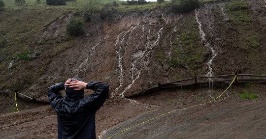
Rain, snow and wind were battering parts of California on Saturday less than a week after another “atmospheric river” pounded the West Coast.
LAKE ARROWHEAD, Calif. — Heavy rain and snow caused landslides and flooding in parts of California on Saturday, shutting down two major highways as another “atmospheric river” system pounded the West Coast, but also brought a measure of relief to the drought-plagued state.
An hourslong torrent of rain forced Highway 101 to close south of San Francisco because of flooding, cutting off a major route between the city and the Silicon Valley. The storm temporarily forced the closure of Highway 50 in the Sierra Nevada, a route that connects skiers to South Lake Tahoe.
The heaviest flooding and risk of damage was in Northern California, where rain was expected to let up by Saturday evening, but some rivers and streams were already reaching flood stage levels. In Sacramento County, officials declared a local state of emergency and warned residents in one rural area to evacuate because of rising waters.
Authorities issued evacuation orders for several Northern California communities where rising waters swamped streets on Saturday. The evacuations included parts of El Dorado County, east of Sacramento, and areas of Santa Cruz County, southwest of San Jose.
In Monterey County, further south, the local sheriff issued an evacuation warning for one region due to flooding. In San Ramon, east of San Francisco, the local police reported evacuation efforts were underway on Saturday afternoon. San Ramon police lieutenant Tami Williams said the department used armored vehicles to reach “senior citizens who needed assistance with evacuations due to flooding.” She said the department came to the aid of 13 people.
A rock slide blocked State Route 299 near Burnt Ranch, Calif., east of Eureka.Micah Crockett/Caltrans, via Associated Press
The Cosumnes River in Northern California exceeded flood stage and was expected to crest at 15.5 feet by Saturday night. Parts of the state have already had up to seven inches of rain from Friday to Saturday. Downtown San Francisco was pushing close to its record for most rainfall on a single day, with 5.33 inches of rain reported by Saturday afternoon, according to the National Weather Service. (The record, set in 1994, is 5.54 inches in one day).
No injuries or deaths had been reported in the region Saturday night.
In Southern California, light to moderate rain was falling in the Los Angeles area on Saturday and was expected to be accompanied by strong wind gusts through the evening, forecasters said. A high-wind warning is in place for most of the area’s mountains and the Antelope Valley.
The current downpour is being driven by an atmospheric river flowing from the Pacific Ocean, a meteorological phenomenon that carries condensed water vapor from other parts of the world.
An unusually strong and long-lasting atmospheric river on the West Coast just after Christmas led to the deaths of five people after trees fell on vehicles in three separate episodes, the authorities in Oregon said. Tens of thousands in the Pacific Northwest lost power.
More on California
U.C. Employee Strike: Academic employees at the University of California voted to return to work, ending a historically large strike that had disrupted research and classes for nearly six weeks.
Wildfires: California avoided a third year of catastrophic wildfires because of a combination of well-timed precipitation and favorable wind conditions — or “luck,” as experts put it.
San Francisco’s Empty Downtown: Tech workers are still at home. The $17 salad place is expanding into the suburbs. Today San Francisco has what is perhaps the most deserted major downtown in America.
Los Angeles’s New Mayor: Karen Bass was sworn in as the first female mayor of the nation’s second-largest city in a ceremony that celebrated her historic win but also underscored the obstacles ahead.
Significant flooding was expected in the Sacramento area until 10 p.m. on Saturday, and heavy snow at higher altitudes, National Weather Service forecasters said.
Officials urged drivers to turn around if they came upon flooded roads. Sacramento firefighters rescued several teenagers from tree limbs early on Saturday after their car was stuck in floodwaters. No injuries were reported, the authorities said.
A map showing the precipitation forecast for California and surrounding areas for December 29 to January 3.
/* based on rendered scss from key.scss */ <p>.hmap-segmented-key .g-key-block display: inline-block; margin-bottom: 4px; .hmap-segmented-key .g-key-block:last-child margin-bottom: 20px; <p>.hmap-segmented-key .g-key-block p margin: 0 5px 4px 0; <p>.g-center-leadin .hmap-segmented-key text-align: center; <p>.hmap-segmented-key .g-key-row p display: inline-block; vertical-align: middle; margin: 0; font-size: 15px; line-height: 19px; <p>/* Segmented key */ .hmap-segmented-key margin: 10px auto 0 auto; <p>.hmap-segmented-key .g-key-row position: relative; margin: 0; display: inline-block; .hmap-segmented-key .g-key-row .g-key-rect display: block; margin: 0; width: 35px; height: 10px; <p>.hmap-segmented-key .g-key-row p position: absolute; white-space: nowrap; text-align: center; line-height: 1em; margin-top: 3px; left: 0; transform: translate(-50%, 0); .hmap-segmented-key .g-key-row:last-child p transform: translate(-10%, 0);
Five-day precipitation forecast
1
2
3
5
10+ inches
.ditu-artboard display: none; margin: 0 auto;
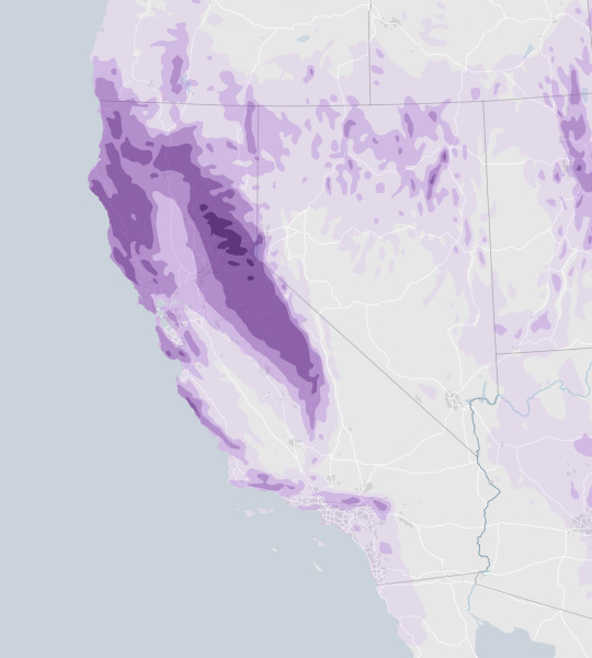
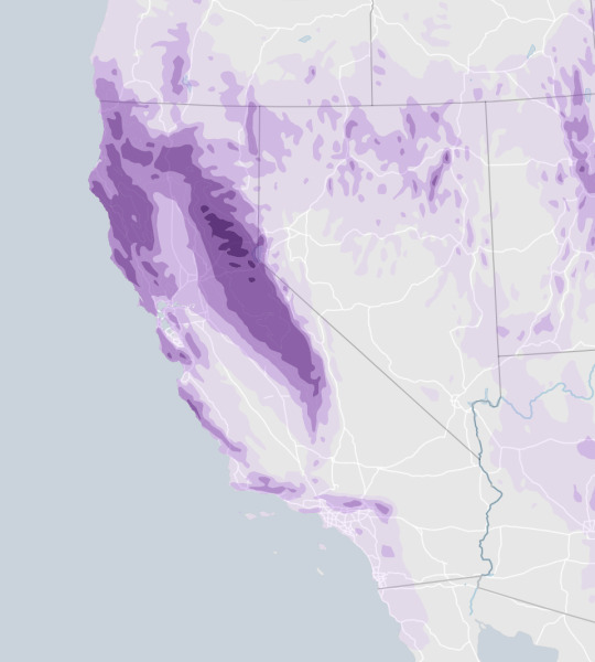
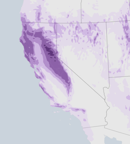
Source: NOAA
Notes: Estimates are for Dec. 29 at 7 p.m. Eastern time to Jan. 3 at 7 p.m. Forecast is as of 4:55 p.m. on Dec. 29. Values are in inches of water or the equivalent amount of melted snow and ice.
By Zach Levitt
Highway 92 from Skyline Boulevard to Main Street in Half Moon Bay was closed because of flooding.
The greatest risk of the extreme weather is in previously burned areas along the coast, William Churchill, a forecaster and meteorologist with the National Weather Service’s Weather Prediction Center in College Park, Md., said this week. Rapid, prolonged rainfall could cause mudslides or debris flows, he said.
But in California — where reservoir levels have fallen, major rivers have run nearly dry and residents have been under emergency conservation orders for months — a storm that is dumping rain and snow on the region brings hope that this winter could at last break the state’s punishing dry spell.
The National Weather Service issued a winter storm warning for parts of the Sierra Nevada in Central California, near Yosemite National Park, saying that as much as five feet of snow could accumulate at the highest elevations.
More rain is in the forecast across the state during most of the first week of the new year.
Water experts are normally circumspect when trying to explain the impact of a single atmospheric river on the state’s current drought, which began in 2020. But they have a glimmer of hope as a succession of storms are in the forecast.
“The whole weather outcome in parts of the West hinges on these atmospheric rivers,” said Marty Ralph, the director of the Center for Western Weather and Water Extremes with the Scripps Institution of Oceanography. The storm, he added, “is looking like a potent contributor to busting the drought.”
Karla Nemeth, the director of the California Department of Water Resources, the agency that manages the Golden State’s most precious resource, said that California must toe a fine line during intense winter storms. On one hand, the state desperately needs winter rain and snow to replenish water supplies before the annual dry spell that often persists from spring through fall.
But climate change has also intensified weather extremes in the West, and long bouts of heavy rain can cause devastating flooding or mudslides in areas that have recently burned. Warm storms in particular could melt snow prematurely and send a torrent of water down mountains and into already saturated cities.
“This is kind of a Goldilocks situation,” Ms. Nemeth said. “We’re cautiously optimistic.”
On California’s ski slopes, the unusually heavy snowfall was a welcome gift. Mammoth Mountain, a resort on the border of Yosemite National Park, expected to see several feet of snow on Saturday, with more snowfall expected through mid-January, said Lauren Burke, the resort’s director of communications.
The resort had already benefited from heavy snowfall this winter, including 10 to 15 feet of snow in the past month alone, Ms. Burke said. By midday Saturday, the resort was recording 90 to 131 inches of snow at its base depth, among the deepest in the country, according to data from On The Snow, which tracks snow cover at resorts nationwide.
“The snowpack holds up really well, even with this warmer, wet, heavy snow,” Ms. Burke said. “It just kind of slathers the mountain and builds up a really deep base.”
Significant snowpack has accumulated across the Sierra Nevada region, including, in the Southern Sierra, nearly 200 percent of the average snow water equivalent that is typically recorded at this time of year, according to data from the California Department of Water Resources.
While cautioning against the risk of flooding, experts say the storms are on track to be largely beneficial to the state. That’s in part because the water levels of the West’s major rivers and reservoirs are already so much lower than normal, so it would take an extraordinary amount of rain over a short period of time to fill them back up; the worst flooding takes place when big waterways and reservoirs spill over their banks in populated areas.
Ms. Nemeth noted, for instance, that the coming series of storms could boost the water storage supply by about a third at Lake Oroville, one of the state’s largest reservoirs and by some measures its most important. That would bring the stored water supply to about 1.5 million acre feet, which is still less than the 1.6 million acre feet that she said would be ideal.
Recent research has shown that atmospheric rivers are the source of as much as half of the precipitation along the West Coast.
Dr. Ralph and his colleagues have developed a system for categorizing the storms borne by atmospheric rivers that is similar to the system for categorizing hurricanes. And they believe that with the recent advances in the accuracy of forecasting, water managers can take better advantage of wet periods by more precisely releasing or holding water at reservoirs.
He said that the center’s high-tech forecasting tools and models show there could be more rain deep into January in California.
Jeffrey Mount, a senior fellow with the Public Policy Institute of California’s Water Policy Center, said that a rainy January would not only deliver relief to the state’s residents, but it would also be a lifeline to salmon, migratory birds and other species that have been struggling in the state’s ailing waterways and wetlands.
Still, he emphasized that one downpour will not end the extreme drought in the West, nor should it cause state leaders to bring any less urgency to figuring out how to live with less water.
Dr. Mount pointed to last winter, when an “epic snowfall” in December gave way to the three driest months on record in January, February and March, leaving California’s water managers scrambling.
#Environment
2 notes
·
View notes
Text
Tucson - Oro Valley
21 March 2022

I had time this morning for a longer ride, so I drove 15 minutes north from downtown Tucson and parked at Ted Walker Park at the northwestern tip of the ‘Loop.’ The ride was a simple 35-mile circuit north through Oro Valley, an upscale xeric suburban landscape north of the city.


The first leg was north on the bike path along the dry wash of the Canada del Oro (on a wide, smooth trail). The second leg was on the wide boulevards through Rancho Vistoso (smooth pavement, good shoulders, little traffic). The third leg was a bike path parallel to Tangerine Road (the shoulder would have been okay, but the new trail is a nice option, particularly as development and traffic continues to increase here).


At the intersection of Tangerine and Twin Peaks Roads, I turned south. I considered turning north and heading up to check out the Ritz Carlton at Dove Mountain, but I suspect there’s a gate to keep people like me away (most of the residential developments around here have gates, so they’re clearly afraid of something). Twin Peaks Road was downhill and there was a tailwind, so it went by quickly (the shoulder was fine, though there was also a wide sidewalk/bike path). The final leg of the ride was on the good bike path that follows the Santa Cruz River back toward the city.


I’m not keen on this kind of desert suburbia, but it was still a great ride. It wasn’t exactly flat, but it was close (see the profile). It was around 15C when I began riding at 7:45; a few degrees warmer at the end. There was a light breeze from the northwest, but not enough to impact the riding. There were still puddles in the shadows from yesterday afternoon’s showers. There was also some fresh snow on the higher peaks and the radio reported that the Mount Lemmon Road was closed due to weather (providing a tidy excuse for not riding up it today!).
After the ride, I tossed the bike in the back of the car and drove back to the Mercado San Augustin for a breakfast burrito and a latte.

11 notes
·
View notes
Photo

Channel Islands National Park – the Galapagos of North America
Channel Islands National Park – the Galapagos of North America: Comprising five gorgeous islands along California's Santa Barbara Channel, Channel Islands National Park enjoys a unique ocean environment. The islands of San Miguel, Santa Rosa, Santa Cruz, Anacapa, and Santa Barbara are shrouded in mist and close to the mainland but seem worlds away from the hustle and bustle of nearby Los Angeles. Yellow Coreopsis & the Anacapa Lighthouse Perhaps it is the more than 2,000 plant and animal species, of which 145 are found nowhere else on the planet, that makes these islands so special. The waters off-shore hold untold numbers of whales, dolphins, elephant seals, and some 30 other species of marine life. This abundance of wildlife and incredible scenery has given the national park the unofficial title of “The Galapagos of North America.” Sea Lion Rookery, Santa Barbara Island The Island Fox - It's found nowhere else on earth! Each season at this island park brings something special to visitors as California's mild weather allows the park to be open all year round. For spectacular views, Inspiration Point on Anacapa Island offers just that, while lounging sea lions can often be spotted on the rock formations of Cathedral Point. During the busy summer season, the blue whale (the largest animal on Earth) and humpback whales can regularly be spotted as they make their migration up north. Due to its location, it is one of the least visited national parks in America. Access is only possible via a short ocean voyage or a small-plane commercial flight, and this light visitation has contributed to its remote feeling and the continued protection of fragile natural resources. Protected by wind and waves, this is a place of solitude and adventure. Anacapa Island juts out of the sea with its craggy volcanic rock, holds an iconic lighthouse, and wildflowers that bring the rocky soil to life. Santa Cruz Island is the largest and most diverse of the islands and is home to 60 plants and animals found nowhere else. Santa Rosa island shelters rare Torrey pine trees, sandstone canyons, and contain vestiges of a ranching past. Water Canyon Beach and Torrey Pines, Santa Rosa Island San Miguel is an island of extremes. Its isolated beaches contain the largest rookeries of seals and sea lions on the planet. Fossilized trees from long ago dot the windy sand dunes. Lastly, the tiny island of Santa Barbara is a mesa framed by twin peaks and steep rock faces, where wildflowers and nesting birds remain untouched. All are surrounded by an underwater national park, one of the world's great marine ecosystems. A Bit of Channel Islands History Much like the Galapagos chain of islands in South America, isolation of these islands has given evolution carte blanche to proceed independently, which accounts for the unique species that thrive here. Dwarf Wooly Mammoth Archeologists have discovered some of the oldest known human remains in North America here. They have also discovered the bones of dwarf wooly mammoths, which thrived on the island until the last Ice Age about 11,000 years ago – an incredible insight into coastal southern California as it once was. This area, in addition to about 148 historic village sites spread among the islands, is a true peek into the ancient past. The native Chumash were one of the most advanced people of their time, flourishing for thousands of years. They developed a complex society where they traded with the mainland in plank canoes, using shell beads for currency. Then the Spaniards arrived in 1542, leading to a tragic end of their society as they were exposed to measles and smallpox, devastating their population. During the 1800s, the descendants of these proud people were moved to the mainland, where they still celebrate their ties to the islands today. The protection of the Channel Islands was ensured when Congress made this a national park, an international biosphere reserve, and national marine sanctuary in 1980. It established long-term monitoring of ecological information gathering so that scientists could predict future conditions in order to continue its protection, including conservation and restoration programs. Click here to see the Channel Islands National Park poster. Rob Decker is a photographer and graphic artist with a single passion for our National Parks! Rob is on a journey to explore and photograph each of our national parks and to create WPA-style posters to celebrate the amazing landscapes, vibrant culture and rich history that embody America's Best Idea! https://national-park-posters.com/blogs/national-park-posters/channel-islands-national-park-the-galapagos-of-north-america?utm_source=rss&utm_medium=Sendible&utm_campaign=RSS
3 notes
·
View notes
Text
March Madness - Tucson, AZ
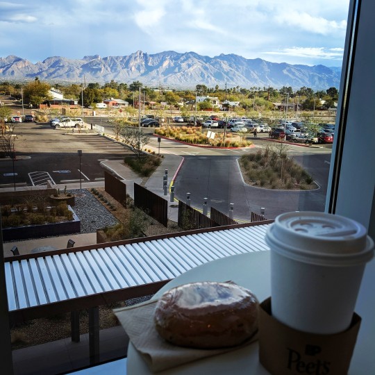
The above picture was taken from one of the cafeterias at University Hospital in Tucson, where I had breakfast while Doug was in surgery. I think the surgery lasted a couple of hours, the surgeon talked to me after the surgery - all went well and the atrial fibrillation should stop. After a one-night stay, Doug was sent on his way. We were grateful to have the surgery over with and to be on the road to recovery. Activities were limited for a week, then Doug was free to resume normal activities. Onward we go!

A week after his surgery, Doug was back on the golf course, awesome!
HOWE TIME FLIES
About 10 days after Doug’s surgery, our friends Art and Donna Howe came to visit us. It was their first time in Tucson, so we planned a whirlwind tour to give them a little taste of desert living.
On their first day in town, we headed south to the Titan Missile Museum, we managed to arrive in time to sign up for a tour (they fill up fast!) We have been on the tour three times now, we still love it. I would recommend a visit when you are in the area, it is just off I-19, about a 30 minute drive from downtown Tucson. After the museum, we drove further south to Tubac. We wandered around town, taking in a few of the artisan shops and some of the local artwork:
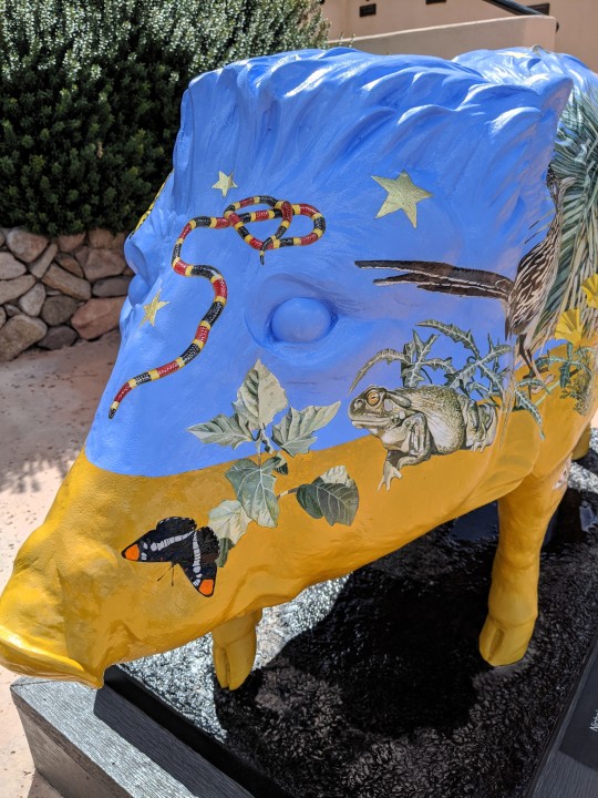
One of multiple painted javelinas in the village of Tubac.
Donna made a new friend in Tubac.
After a lunch stop at one of the local restaurants, we meandered back through the village for a little more exploring. Getting our fill of Tubac, we continued southward to the Santa Cruz Spice Company. We did a little spice shopping and then made our final stop of the day at the Tumacacori National Historic Park. It was a gorgeous spring day, which made for some fantastic photo ops at the mission.
Look at those spring flowers and the magnificent sky!
We stopped at the tortilla and beans stand inside the park - yummy!
Crystal-clear day, the Santa Rita Mountains in the distance.
The craftsmanship on the buildings is amazing.

This moth was on one of the sidewalks at the mission, such pretty markings!
What a fun-filled day! We headed back to our trailer for dinner and games. More adventures planned for tomorrow!
We filled the morning of the second day with a trip to Barrio Bread, a short walk along Pantano Wash, and then lunch on our patio. We went out to Saguaro National Park East to show them a crested saguaro on the Loma Verde Trail and for a sunset from Javelina Rocks. We ended the day with a trip to El Molinito for take-out and then went to the Arizona Beer House to enjoy our food and a few brews.
Day 3 - we headed to downtown Tucson. We walked along the Turquoise Trail, checking out the history of the area. We enjoyed adult beverages at The Congress Hotel Bloody Mary Bar and even found some ice cream for Art! We ended the day at the trailer, perfect weather for outdoor entertaining!
Day 4 - after a breakfast of sausage gravy & biscuits (vegan-style), we went to the range to whack a few golf balls around. We love the driving range at Fred Enke - the view of the Catalina Mountains is wonderful!
After golf, we made our way out to the Desert Museum. At this point, we were experiencing a mild shut-down and a few restrictions due to Covid-related concerns. A few of the exhibits at the Museum were closed and they were not doing the Raptor shows. However, we ran into a family on our way into the museum and they gave us 4 free passes. We had a great time wandering around the museum, it is always beautiful out there.
Brittle brush was blooming and the views to the west were spectacular!
Caught the javelinas during naptime.
March is usually a great time to visit the museum, the temperatures aren’t too hot and the cactus are starting to bloom. We were not disappointed:

We completed our exploration of the Desert Museum and made the long drive back to our place. Happy hour, dinner, and then more games wrapped up our final night with the Howes. We are so happy that they finally came for a visit, we hope they will make it an annual thing!
Thanks for coming to see us!
COVID INTERRUPTUS
The week following our friends visit things became more serious around the Covid virus. Restaurants and indoor spaces were closed down and we were forced to limit our activities with friends here in the park. Luckily, outdoor activities were a good option for us - we took lots of walks and bike rides. The weather was gorgeous and the flowers were blooming.
Pretty blooms along Pantano Wash during one of my many walks.
More desert colors!
Some evenings the sky just explodes around here, we feel pretty lucky to be in a place where we can be outside enjoying nature most of the time.
Photos from our 15 mile walk along Pantano Wash - the weather was cool, but we didn’t get wet, just a little wind-blown!
A nice rattler I came across on a bike ride up Harrison Greenway - yikes!

I was very grateful for my new e-bike, lots of great rides along the bike path here in town. Kept me from going stir crazy!
TANQUE VERDE RIDGE HIKE
During March Doug started training for his planned 2022 trip on the Continental Divide Trail (CDT). The CDT runs 3100 miles from the border of Mexico to the border of Canada, staying within 50 miles of the Continental Divide along its course. He is doing 3 consecutive days a week of 15+ miles each day with his backpack, just to see how his body holds up. Friday and Saturday he does his miles along the Pantano River Park path, then on Sundays he does an actual hike. I am joining him for 2 of those 3 days, my feet need a day off! Today we hiked around 16 miles on the Tanque Verde Ridge Trail. The hike is fairly steep and I think it is an understatement that my toes were REALLY happy to be done with the descent. Pretty sure I am going to need a few recovery days after this hike! In spite of the physical discomfort, it was a beautiful day in the desert and things were blooming along the ridge and Doug grilled us Beyond Meat burgers for dinner. Perfect end to the day!
REALITY HITS
By the end of March, we had come to the conclusion that our trip to Europe for this summer was going to have to be canceled. We had reservations to fly to England on May 9th and had planned to be over there until some time in August. Our plan had been to stay at AirBnBs, we were very disappointed to have to cancel all our plans, but Europe was closed down due to the spread of the Covid virus and things here in the United States were not looking any better. A large portion of our Canadian friends here in the RV park had already headed north, due to recommendations from their government. Social gatherings were frowned upon and we were doing our best to follow all of the social distancing guidelines in place. We decided that our best option is to stay in Tucson for the time being, as many RV parks and campgrounds are closed in the U.S. at this point due to Covid. We feel fortunate to have a place where we can wait this out. Guess we will just have to hang around for a few more Tucson sunsets.
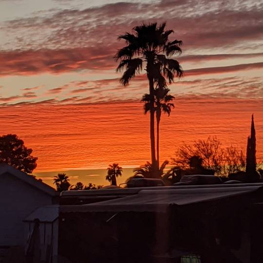
2 notes
·
View notes
Text
The Don Roman Santos Building
@ Escolta, Manila, Philippines – 17 Oct 2020
I have written an article for Renacimiento Manila's Manila Weekly last July about this Neoclassical wonder, but I believe that the write-up still lacked essential information. Upon alighting the train, a northbound rider at the LRT would be greeted by this dilapidated structure, though the Bank of the Philippine Islands (BPI) still generally uses the building.
Electric bikes have formed lines there, waiting for prospective passengers to pay them for a ride. There are also street dwellers who use the area as a shelter, depending on the time of day. At the Escolta side, the BPI branch is still rather active.

Despite the nine-storey building's catchy color of cream yellow while boasting its Ionic columns and a detailed tympanum, it remains to be obscured, being an ubiquitous sight and lately, with the imposing blue fencing around Plaza Lacson. There is also a high-rise building that hovers from behind, unfortunately.

I had always wanted to visit the huge historical marker on marble—but due to its sheer inaccessibility and impracticality to go there, I never had the chance. But when I and my mom hailed for a bus en route to PITX, it was then for me to come closer and take snaps of this marker. The text cannot be read in one standing, thanks to weathering, dirt, and apparently lack of maintenance.
I made a mental note to transcribe the text as soon as I went home, thinking that this marker details the much-needed information that had made the article better last July.
The marker reads:
THE ROMAN R. SANTOS BUILDING
Construction of this building was first conceived in 1884 by the Council of Administration of the Monte de Piedad y Casa de Anorros that, by a decree issued by Governor General Domingo Moriones Marquis of Oroquieta, had on February 3, 1880, been created as a bank of the poor. Laying of cornerstone took place on July 24, 1887, birthday of Her Spanish Majesty, Queen Maria Cristina.
The site, formerly that that of the residence of the Corregidor of Tondo and Jail of the Corregimiento, had been coded to the Monte de Piedad by the City Council of Manila upon petition of the then Metropolitan Archbishop of Manila Don Fr. Pedro Payo. The plans were prepared by Architect Don Jose Hervas, and the foundations were laid under the supervision of a commission composed by City Councilors Don Eugenio Netter, Don Jose Zaragosa, and Don Manuel Marzano. Construction was undertaken by Don Demetrio Caro.
Initial construction funds were furnished by the aforementioned Metropolitan Archbishop of Manila which funds were later augmented by subscriptions from private individuals and by loans from the Banco Español Filipino.
The building was finished and inaugurated on July 20, 1894. A special session of the Council of Administration of the Monte de Piedad y Casa de Anorros was held for the first time that day in this building. That session was presided over by Archbishop of Manila Don Fr Bernardino Nozaleda, with the Commander of the Naval Station, the City Governor of Manila, the General of Artillery, the Reverend Rector of the University of Santo Tomas, Don Jose Garcia Lara, Don Silvino Lopez Tuñon, Don Eugenio del Saz Orozco, Don Gonzalo Tuazon, Don Rafael Perez Samanillo and Don Jose Zaragoza, attending.
In 1937 ownership of the building passed into the Consolidated Investment Corporation. The old one storey building was reconstructed into a nine-storey structure, now called the Consolidated Investments Building on plans prepared by the architect, Don Andrés Luna de San Pedro, with engineer Don Jose Cortez taking charge of the construction.
The outbreak of the war on December 8, 1941 halted the construction work at the fourth storey, upon the occupation of the City of Manila by the Japanese Forces. The latter converted this building into a warehouse. In 1944 the property passed under the control of the Magdalena Estate. Upon liberation the American Red Cross converted the building into a hospital and it remained a such until 1947.
On July 2, 1952, the Prudential Bank and Trust Company, Don Roman R. Santos, Chairman-Founder and President, took possession of the building and converted its ground floor into the head office for the bank. On January 3, 1955 the property was sold by the Magdalena Estate to Don Roman R. Santos and the Prudential Bank and Trust Company. The building was renamed the Roman R. Santos Building.
The Roman R. Santos Building administration, Don Augusto A. Santos, President, was organized to administer the property. The unfinished construction was resumed immediately, and Don Andrés Luna de San Pedro having died, architectural supervision was entrusted to Don Enrique J.J. Ruiz. The nine storey remodelling and reconstruction were completed in 1957.
On July 19, 1959, Don Roman R. Santos died and Don Augusto A. Santos was elected Chairman of the Board of the Prudential Bank and Trust Company in his stead.
In 1961, the remodelling of the basement, ground and mezzanine floors was started by an authority of the Prudential Bank Board of Directors, Don Augusto A. Santos, Chairman, Mr. George Litton Sr., Vice Chairman, Don Pio Pedrosa, President, and Don Francisco D. Garcia, Don Federico A. Santos, Don Francisco C. Delgado and Ex-Supreme Court Justic Alex Reyes, Members, to house the expanded offices of the bank. Architectural plans were prepared by the firm of Messrs. Gabriel Formoso and Associates. Construction work was entrusted to engineer Don David M. Consunji.
This marker fabricated by the Talleres de Maximo Vicente, was set up upon the fourteenth anniversary of the foundation of the Prudential Bank and Trust Company, and the seventh of the death of its founder, Don Roman R. Santos.
Meanwhile, here are excerpts I verified from the same article I wrote last July:
Where the Don Roman Santos building stands today is the former site of the Monte de Piedad y Caja de Ahorras de Manila (shortened to Monte de Piedad), the first savings bank in the Philippines. It was founded by Fr. Felix Huertas of the Franciscan Order, and thus the bank was also noted to be “the Roman Catholic church’s pawnshop”, having been inaugurated in 1882 and was located in its original location at the ground floor of Santa Isabel College, which was then at Intramuros.
The Monte de Piedad transferred to the site of the Don Roman Santos, which was erected in 1894. The neoclassical building was then single-floor, with the triangular facade (tympanum) marking the position of its original roofing. The columns are decorated in accord to the ionic order. President Manuel L. Quezon worked as a clerk there.
The original Monte de Piedad y Casa de Anorros building is the decrepit yet rather frilly building from this Street View. The historical marker can be read here.
Monte de Piedad is another story, and has another building as well, albeit smaller than the present Don Roman Santos building or the original one storey sructure. Like this Don Roman Santos building, it is also in a sorry state. An art deco theater, Cine Astor Theater, also used to stand beside it. Unfortunately the art deco building is a goner now.
I see with my little eye... after the Don Roman Santos and Santa Cruz buildings, there is an annoying hotdog high-rise structure, the well-cared-for Regina Building, and the equally adaptively-reused First United or the Perez-Samanillo Building. That is Escolta Street!
I suppose the topic would inevitably discuss an interrelationship—and eventually a matrix of historical events—and that those past events and structures shaped the places and lives we live today. After all, a structure cannot be detailed merely on its own, but by how the environment affects it and vice versa; how it affects its millieu. For now, at least, with the half-dead postwar Santa Cruz building on the other side, the Don Roman Santos building greets commuters and locals silently with more stories waiting to be known again, to Escolta in Manila and back.
Images without markings are available at Commons, but since it is released under a Creative Commons Share-Alike license, you may repost them but kindly cite "Higad Rail Fan" of Wikimedia Commons.
#manila#philippines#don roman santos building#trivia#heritage#heritage building#neoclassical#neoclassical architecture#architecture#commons#sta cruz#carriedo#escolta#downtown manila#kasaysayan#writeup#urbanistangge
1 note
·
View note
Text
COMMEMORATIVE MESSAGE IN HONOR OF THE 75TH DIAMOND JUBILLEE YEAR ANNIVERSARY OF THE GREAT ALLIED VICTORY OVER JAPAN IN THE ASIA-PACIFIC REGION AND THE VICTORIOUS AND DEFINITE CONCLUSION OF THE SECOND WORLD WAR
Ladies and gentlemen, to all the people of the United States of America and Canada, to all our remaining living veterans of the Second World War of 1939-1945 and of all conflicts past and present and their families, to our veterans, active servicemen and women, reservists and families of the entire United States Armed Forces and Canadian Armed Forces, and to all the uniformed military and civil security services of the Allied combatants of this conflict, to all the immediate families, relatives, children and grandchildren of the deceased veterans, fallen service personnel and wounded personnel of our military services and civil uniformed security and civil defense services, to all our workers, farmers and intellectuals, to our youth and personnel serving in youth uniformed and cadet organizations and all our athletes, coaches, judges, sports trainers and sports officials, and to all our sports fans, to all our workers of culture, music, traditional arts and the theatrical arts, radio, television, digital media and social media, cinema, heavy and light industry, agriculture, business, tourism and the press, and to all our people of the free world:
Our greeting to the millions who today celebrate such an important day in our history.
For it was on this day in history when in 1792 when the September Massacres, the mass slaughter of the Catholic clergy and supporters of the monarchy during the early stages of the French Revolution, began as revolutionary crows stormed into the prisons killing supporters of the deposed royal family.
It was on this day in 1872 that the Battle of Sedan ended with a historic defeat for the French Army.
It was on this day in 1960 when the in-exile Parliament of the Central Tibetan Administration held its very first elections.
And today, September 2, in the midst of the fact that the world is now currently in one of the greatest crises of our times in the form of the COVID-19 pandemic, which has resulted in millions being infected and in the deaths of hundreds of thousands of people around the world, as well as the cancellations of many events and of sporting activities and the postponment of many others as a precautionary measure for the sake of protecting public health and well-being, we today celebrate with great joy the anniversary of all anniversaries: the 75th Diamond Jubilee year anniversary of the signing of the official documents of the unconditional surrender of the whole of Japan to the victorious Allied Powers and the conclusion of the Second World War, 6 years and a day after it began with the Nazi German advance to western Poland in 1939. It is a day of profound celebration of the historic day that finally ended years of long and bitter war against the Axis aggressor in many parts of the world, a war that would in the end cost the lives of millions of people, the dignity of millions of women and children, the loss of many precious works of art and culture and the destruction of countless architectural wonders, economies and industries. It is a day wherein we reflect the sacrifices of the millions of men and women who fought and worked in the side of the victorious Allies in the united cause of the defense of lives and individual freedoms against the totalitarian aggressor bent on destroying freedom and independence for the sake of fascism, opresssion and abuse of human rights and liberties. It is a day of remembrance of the memories of the millions of martyrs of the uniformed military, law enforcement and civil defense services of the Allied Powers who perished during this terrible period in human history. It is above all a joyful day of celebration of the victory against the forces of evil and the beginning of the long era of peace.
On this day exactly 75 years ago, aboard the historic battleship USS Missouri (BB-63) off the waters of Tokyo Bay, military representatives of both the Allies and the Empire of Japan signed the papers that formally ended a six year old war (eight long years of warfare in East Asia) and brought forth the victory over the Axis aggressors in the Asia-Pacific, with the acceptance of Japan and her armed forces of the terms of unconditional surrender of the country to the victors as agreed before earlier in the year in Postdam and as announced to the whole of the country the month before, with with ceremonies of surrender being conducted in other parts of East Asia in the coming days marking the close of another memorable but bloody chapter in world history. On that day the world witnessed the beginning of a long but painful road to peace that would in the following years be riddled with the blood of future regional wars, but lined with the sacrifices of millions whose sacrifices during those six long years brought forth the ideals of a better world for our future generations, a world full of peace and progress, where people live in harmony, friendship and cooperation. On that day the world celebrated the victory won against the Axis Powers whose plans for evil domination in the world and the suffering of millions were ended by the Allied Powers. On that day the world gave its thanks to the millions of men and women, collectively dubbed as the Greatest Generation, the millions of active and reserve servicemen and women of the armed forces, police, fire, border protection, civil defense, emergency response and intelligence organizations, as well as all paramilitary and law enforcement auxillary organizations of the Allied Powers whose tenacity, courage, hard work, dedication, resiliency and profound active support in the battlefields in land, air and sea in conventional and unconventional military and paramilitary operations, intelligence gathering and counter-intelligence operations, law enforcement, emergency response, disaster and war relief and rehabilitation operations, whether be in enemy territories or in friendly lands, together with the millions of working men and women of the home front industries who helped supply needed equipment, fuel, water and vehicles, as well as shipping and aerial supplies and even clothing, furniture and needed medical supplies and food, all to the servicemen and women in the frontlines, the medical professionals who helped in treating the wounded, the chaplains who prayed for the living and the dead and the people in culture and the arts, in the press, film and television, in businesses and enterprises, and in sports either as serving in the uniformed organizations or in active support for the war effort at home secured the cause of liberty and independence of millions all over the world against the Axis Powers and collectively as one people ended the threat posed by them to the free world and to the whole of humanity. For such a great victory, that had been paved by the blood of the millions of lives lost during this long and painful conflict, including Jews, members of other religious communities, people who sympathized with the resistance movement and anti-Nazi activists and politicians, as well as of Poles and others in Soviet concentration camps and Gulag camps and by exile to other parts of the USSR of various ethnic communities, as well as the massive Japanese persecution, injustices, murder and violent acts directed at the Chinese and dissident citizens and people of other faiths in the Asia-Pacific and Axis aerial bombardments and sea attacks on merchant shipping and supply convoys, had indeed been impossible if not for the great support shown by every one of our millions of people, who through their efforts contributed to the great and glorious victory that we remember today. Such indeed is the importance of this great victory that we remember on this very day of our history, exactly 75 years ago today.
We indeed cannot forget so great a sacrifice by millions of people from all walks of life who perished in so severe a global conflict as this, with millions of civilian fatalities, and millions more who died among those in the uniformed organizations and paramilitary groups of the Allies who fought against the aggressor.
We cannot forget too the martyrdom of millions who suffered gravely at the hands of the Axis governments and socio-political organizations.
We cannot forget as well the heroism of millions who fought in the battlefields of this long conflict, in places like Dunkirk, Leningrad, the Brest Fortress, Moscow, Tula, Borodino, Sevastopol, El Alamein, Tobruk, Stalingrad, Kursk, Normandy, Caretan, Paris, Minsk, Monte Cassino, Eindhoven, Rome, Smolensk, Kiev, Kharkiv, Odessa, Lyon, Bastogne, Warsaw, Bryansk, Anapa, Smolensk, Lviv, Shanghai, Pearl Harbor, the Bataan Peninsula, Corregidor Island, Singapore, Besang Pass, Hong Kong, Wuhan, Midway Island, Iwo Jima, Guadalcanal, the Santa Cruz Islands, Belgrade, Sofia, the Caucasus, Karelia, Cologne, Xiamen, Budapest, Tunis and many more, in the land, air, and sea, from every terrain and in any weather condition, from the sands of the Sahara, up to the Normandy beaches, the British skies, the forests and plains of the Low Countries, the mighty mountains and valleys of the Alps and Balkans, the marshes at Pripyat, the Ukrainian steppes to the Arctic and the snowy lands of Scandinavia, towards the jungles of Myanmar and the Malay Peninsula, the Philippines and Indonesia, in the changing terrains and landscapes of China and Korea, and in the Pacific Islands and New Guinea, dinstinguishing themsleves for their country and for the whole of humanity in conventional and unconventional military and paramilitary operations, intelligence gathering and combat and service support, led by heroic commanding officers coming from all walks of life, graduates of military academies and officer candidate institutes, whose efforts received for them the honor and glory of their country and people, many of them at the cost of losing their lives in battle.
And we cannot forget as well the contributions of millions in the home front in the victory that is celebrated today in the Asia-Pacific, thru their efforts to support those in the battlefields and overseas bases with much needed equipment, supplies and essential equipment, in addition in supporting war bonds activties and listening to artists who time and again gave concerts and shows to those in the armed forces at home and overseas, while also watching movies and documentaries about the war during this time in our history.
This was indeed a day that everyone had waited all these 6 years. A day the millions who fought in the Allied military forces and guerilla organizations anticipated, many would die in combat but many more lived to see this day come, a day that would usher in the end of this long conflict and the victory won against the Axis Powers. Indeed the sacrifices of the millions who were mobilized to fight those who were threatening peace and the future of the world, as well as the blood poured by those who fell in this long period of our history, and the suffering felt by so many people in the territories where the war had impacted directly all led up to this great day. Of the millions who answered the call, millions less died in battle in the uniforms of the Allied armed forces and paramilitary organizations in Europe, North Africa and the Asia-Pacific and in naval operations everywehre, while millions still lived long for the great day of victory to arrive on the 2nd of September, 1945, exactly 75 years ago.
Today, in remembrance of the victory won against the Allies and the end of this great war, we remember these millions of active and reserve men and women of the military forces and paramilitary organizations of the Allies, today only by the thousands who are still alive ever to celebrate this momentous occasion of such an important anniversary of the victory won over the Axis Powers in the Asia-Pacific and the end of this long and bitter conflict that forever changed human history. We must never forget that this victory was made possible because of their adversity in battle, determination, iron-willed strength, courage, friendship, bravery and perserverance, and above all the readiness to sacrifice life and limb for the sake for the cause of the defeat of the ideologies that begun this conflict eight decades past in Eastern Europe.
Marking this great anniversary, with deep respect and profound gratitude we today honor these millions of heroes, who, through their personal and combined efforts, secured the final victory we honor today against the Axis Powers, ending once and for all their evil plans for the domination of the world and the repression of peoples. Today and always may we by our words and actions recall the memory of these men and women who served during those years of combat in every corner of the world who are even in this present time and in a modern way of life are still honored not just by battle honors and monuments but also in various works and in radio, television, film and digital media, and who today we, the descendants of this heroic and great generation of heroes, and the generations of tomorrow must keep in our minds and hearts, among them the men and women of the intelligence services who helped provide the Allied military leadership with information on enemy locations and movements, Easy Company of the 2nd Battalion, 506th Parachute Infantry Regiment, formerly 4th Brigade Combat Team and now 3rd Brigade Combat Team, 101st Airborne Division, XVIII Airborne Corps, United States Army, the brave men of the 1st Marine Division’s 1st, 5th and 7th Marine Regiments, the tankers of the 2nd Armored Division, the aviators and air crews of the 8th Air Force, and all our sportsmen and women who served under the colours of the Allied military forces during the long war and helped win the definite victory against tyranny and oppresion, be forever in our memories and our profound remembrance, not just by their families and descendants but by the very people they fought and died for in the fields of battle, the frontlines, the concentration camps and the home front, and by the people and youth of today and our future generations of men and women, most especially to all considering careers in the uniformed services, so that their legacies to the peoples of the world will be conserved for posterity and for the sake of those who will follow in their footsteps today and in the future. On this day of celebration for millions of people all over the globe we once again send our greetings to the hundreds of thousands of men and women in active service and in the reserves in the armed forces, police, public security, forestry, border security, civil defense and emergency services of the Allied combatant countries and their families,our working people, agricultural workers and those working in science and technology, education, tourism, culture and the arts and in the mass media and the press and all our sportsmen and women, as well as our military and civil uniformed service veterans and their families, and the families of all who have paid the ultimate sacrifice for the defense of our principles and of our liberty and independence. In addition to these individuals and public and private corporate and cooperative entites, in light of the ongoing global pandemic caused by COVID-19, we also today remember the modern day heroes of this disastrous time: our medical workers and professionals treating the sick and the dying even at the cost of their lives, as well as those working in essential and permitted industries and enterprises, which have also suffered from the economic fallout of this pandemic, whose determination, courage and firm hope in the future, with firm compliance with health and safety protocols, have ensured the survival and resilience of our people and economies in the face of such a health crisis never seen in over a century, and the people working for the research, development and manufacture of medications and vaccines against the virus and its effects on our health and well-being. As we today celebrate this historic anniversary of the victory won against the Axis Powers in the Asia-Pacific, let us not forget them as well, for these are the great men and women who are the descendants to the millions who fought for this great victory and are the ones tasked to carry the flames of this great victory into the future. May we forever never ever forget the Allied heroes and martyrs of the Second World War in Europe, North Africa and the Asia-Pacific who all through these years of warfare helped make possible the victory we celebrate today, 75 years on to the day of the conclusion of this war and of the victory against the Axis Powers in all the theaters of this global conflict, and in looking onwards to the anniversaries of such a great victory even without the presence physically of the heroic generation that won this war against the evil aggressors, may we forever inherit their legacy of service to their country and people, towards the defense of the freedom and independence of the free world against domestic and foreign enemies and ideologies against the spirit and legacy of those who fought for the sake of the human race and the peace and progress of the world.
To all of you, our dear living veterans of this war who still are with us, rest assured that as you all live our remaining days on this earth, we will forever honor and remember the great victory you all won against the forces of international fascism, imperialism, dictatorship, racism, xenophobia and totalitarianism symbolized by the Axis Powers, carry onwards the memories of your service with the armed forces of the victorious Allied Powers and instill in our future generations the value of patriotism, courage, audacity, bravery, cooperation, respect, harmony and dignity, and above all, the value of helping in the defense of the country and people for the continued survival of our freedom and independence, towards the goal of a better tomorrow strong and free for our children and grandchildren. By your legacy we therefore promise to forever honor your combined sacrifices and contribution to the victorious conclusion of this long war, to work hard to defend the principles of independence and sovereignty and give all our time and talent in labor in times of war and peace and in times of disaster and need for the sake of building a stronger, prosperous and independent world by building up our economy, fighting the ills of our current society, improving education, help preserve the environment, promote culture and the arts as well as local traditions and the way of life of aboriginal and Native American communities, promote and protect the freedom of religion and the sanctity of human lives, promote a healthy lifestyle and a sporting way of life, and forever honor the places and people who are part of our history while maintaining readiness to instill in our future generations a spirit of preparedness to serve their country and people to the best of their ability and fight the evils that are still present in our world of today!
Today, as the world celebrates this historic 75th anniversary of the end of the Second World War, we, the millions of people of the free world, today we pledge, more than ever before, to honor the sacrifices of the heroes of the past and work towards achieving the goals of peace and progress and a better world fought by these valiant men and women who risked their lives for the defense of our liberties and civil and human rights against the Axis Powers and ensured the victorious advance towards a world that is just and diverse, where Nature’s wonders have been restored to former glories and wherein humanity lives in the spirit of peace, friendship and cooperation built on the heroic acts by the heroes of our past.
On this very great day of our history and in the history of humanity, this very important day in which we celebrate as one people the 75th year anniversary of the official glorious and victorious conclusion of the 6-year long Second World War, and the official surrender of the military forces of the Empire of Japan, we greet all of you the people of the free world, and most especially to all of you our remaining veterans of this long and great conflict, who helped win this great victory and opened the gates for a better future for all of humanity, as heroes who risked even their lives for the defeat of the military and political might of the Axis Powers, to all you our veterans of succeeding conflicts and in UN peacekeeping operations worldwide and to all and of our men and women and veterans of the military and civil uniformed services and uniformed youth groups from all the Allied combatant countries as we today mark 75 years since the final defeat of the Axis Powers in the Asia-Pacific and the victory over the Empire of Japan!
For all of us, it wil forever be a day of remembrance and celebration of the great victory in which our forebears won against the might of the Axis Powers all over the world, and a day in which we will forever uphold the legacy of the millions who died for the values that are worth defending and fighting for, then as in today. We will never stop honoring the blessed memory of these men and women who sacrificed their lives for the freedom and independence of our world. We will never stop reminding our children and future generations of the cost of the freedoms we celebrate. And we shall always light up the legacy in which these millions of men and women lived and fought for, which is the great victory that we celebrate today.
Today, we celebrate with all of you, the people of the free world and forever treasure in our hearts and minds the memory and legacy left behind by these the millions of men and women who 75 years ago celebrated the conclusion of such a war that forever changed our world and a war that they won against the forces of the Axis Powers at the cost of millions of lives lost from the plains and mountains of Europe, the sands of northern Africa and the Middle East, towards the diverse lands of the Asia-Pacific. Today and always we continue to remember their sacrifice for the sake of us and for the generations to come who will forever honor and commemorate their contributions to freedoms we cherish to this day. Even as the growing tide of evil may be rising again, united with the men and women of our NATO armed forces and the armed forces of our allies abroad in the performance of their patriotic, internationalist and military duties for the sake of the freedom and independence of the peoples of the free world, armed with the best and modern equipment, arms, vehicles, ships and aircraft, and united with the public security services and the hard work of our people of all sectors of society, no obstacle cannot be overcome, no problem can be left unsolved and no stone left unturned in our efforts to forever maintain the legacy left behind by these heroes of the Second World War, who fought at the cost of their lives to win the victory that we celebrate not just on this day but also every day of our lives!
More than ever before in our history, we will never let the fire of the great victory won 75 years ago fade away in our hearts, and forever maintain the legacies of victory won by the great generations who fought before us!
Today, as we mark this great day in our history, may we never regret to recall the heroic deeds of our predecessors who fought in this war and of all our past naval aviators who flew throughout all these years for the sake of the freedom and independence not just of the United States of America and Canada, but the freedom and independence of all of the free world. May we as one united people never tire of honoring the memory of our heroic forebears and always work hard to be worthy of their sacrifices, most of all, for the sake of our present and for the future of our world and of all humanity. We will never forget their tireless sacrifices for the sake of the freedoms we enjoy today and always uphold what this victory truly means – a victory against the ever present forces of international fascism and totalitarianism around the world!
nd in conclusion, as we today mark this historic anniversary since the victory over Japan and the conclusion of the Second World War, as we today mark it with remembrance and joyful celebration, may we who keep this sacred holiday and recall the millions who died to make this victory possible with respect and reverence especially for those who went before us shall be worthy of what they fought and died for, for building a world of peace, harmony and progress, a clean environment, and a brighter future for all our children and grandchildren - truly the very future that is truly worth defending and the very future our forefathers fought with their very own lives. With our greatest gratitude may we, the successors to this great generation of victors, always and forever treasure in our hearts all those who have gone before us and have entrusted to us the spirit of defending our freedom and liberty in all those years from the beginning of the war up to the great victories in which we honor today, everyday and in the years and decades to come! And may we forever cherish the victory won today, the very reason of the freedoms we live, and forever kindle the fire of victory that will enflame our memories both now and in the brighter tomorrow that is to come!
As the men of Easy Company would always say: WE STAND ALONE TOGETHER!
ETERNAL GLORY TO THE MEMORY OF THE MEDICAL WORKERS AND PROFESSIONALS AND PERSONNEL OF UNIFORMED SERVICES WHO PERISHED IN THE COVID-19 PANDEMIC!
ETERNAL GLORY TO THE MLLIONS OF THE FALLEN AND THE HEROES AND VETERANS OF THE SECOND WORLD WAR IN EUROPE, NORTHERN AFRICA AND THE ASIA-PACIFIC FROM 1939-1945, WHOSE LEGACY WILL NEVER BE FORGOTTEN BY ALL OF US TODAY AND BY ALL THE GENERATIONS TO COME!
ETERNAL GLORY TO ALL THOSE WHO GAVE THE ULTIMATE SACRIFICE FOR THE FREEDOM AND INDEPENDENCE OF OUR WORLD AGAINST FASCISM, NAZISM AND IMPERIALISM IN THE FIELDS OF BATTLE, THE CONCENTRATION CAMPS, AND IN THE HOME FRONT!
LONG LIVE THE VICTORIOUS MEN AND WOMEN IN THE SERVICE OF THE ALLIES OF THE SECOND WORLD WAR IN EUROPE, NORTHERN AFRICA AND THE ASIA-PACIFIC!
LONG LIVE ALL THE ALLIED MILITARY, PARAMILITARY AND CIVIL VETERANS OF THE SECOND WORLD WAR!
LONG LIVE THE INVINCIBLE AND FOREVER VICTORIOUS PEOPLE OF THE FREE WORLD AND ALL OUR SERVING ACTIVE AND RESERVE SERVICEMEN AND WOMEN AND VETERANS OF THE ARMED SERVICES OF ALL THE COMBATANT ALLIED COUNTRIES THAT HELPED WIN THIS GREAT WAR AGAINST FASCISM, NAZISM AND IMPERIALISM, AS WELL AS ALL OUR ACTIVE AND RESERVE SERVICE PERSONNEL, CIVILIAN EMPLOYEES AND VETERANS OF THE POLICE, FIREFIGHTING, FORESTRY, BORDER CONTROL, CUSTOMS AND RESCUE SERVICES AS WELL AS OUR YOUTH OF TODAY AND THE CHILDREN OF OUR TOMORROW WHO WILL CARRY ON THE LEGACY OF ALL THOSE WHO HAVE GONE BEFORE THEM, ESPECIALLY TO THE MILLIONS OF MEN AND WOMEN WHO TOOK PART IN THIS GREAT WORLD WAR!
LONG LIVE THE GLORIOUS 75TH YEAR ANNIVERSARY OF THE END OF THE SECOND WORLD WAR IN THE PACIFIC AND CHINA-BURMA-INDIA THEATERS OF OPERATIONS AND THE GREAT VICTORY OVER THE FORCES OF THE EMPIRE OF JAPAN AND THE AXIS POWERS!
GLORY TO THE ARMED FORCES OF THE UNITED STATES OF AMERICA, CANADA, THE UNITED KINGDOM OF GREAT BRITAIN AND NORTHERN IRELAND AND FRANCE, TOGETHER WITH THE ARMED SERVICES OF THE OTHER VICTORIOUS COMBATANT COUNTRIES OF THE ALLIED POWERS, GUARDIAN DEFENDERS OF OUR DEMOCRATIC WAY OF LIFE, OUR FREEDOM AND OUR LIBERTY AND GUARANTEE OF A FUTURE WORTHY OF OUR GENERATIONS TO COME!
TO THE PEOPLE OF THE UNITED STATES OF AMERICA AND TO ALL OVER THE WORLD, A VERY HAPPY 75TH VICTORY OVER JAPAN DAY!
And may I repeat the immortal words of the Polish National Anthem:
Poland has not yet perished, so long as we still live!
CURRAHEE! AIR ASSAULT! ARMY STRONG! SEMPER FI!
Ooooooooooooooooooraaaaahhhhhhhhhhhhhhhhhhh!!!!!!!!!!!!
1830h, September 2, 2020, the 244th year of the United States of America, the 245th year of the United States Army, Navy and Marine Corps, the 126th of the International Olympic Committee, the 124th of the Olympic Games, the 102nd since the conclusion of the First World War, the 81st of the beginning of the Second World War in Europe, the 79th since the beginning of the Second World War in the Eastern Front and in the Pacific Theater, the 75th since the battles of Iwo Jima and Okinawa and the victories in Europe and the Pacific, the 73rd of the modern United States Armed Forces and the 53rd of the modern Canadian Armed Forces.
Semper Fortis
JOHN EMMANUEL RAMOS-HENDERSON
Makati City, PH
(Requiem for a Soldier) (Honor by Hans Zimmer)
(Slavsya from Mikhail Glinka’s A Life for the Tsar)
(Victory Day by Lev Leshenko)
(Last Post) (Taps) (Rendering Honors)
#hbo war#hbo war fandom#victory over japan day#band of brothers#the pacific#masters of the air#vj day#vjday75#vj day 75#den pobedy#victory day
1 note
·
View note
Text
Saturday 4th January 2020 Rio Gallegoes to Puerto san Julian, Patagonia, Argentina.


Today is about 280 miles including a visit to Puerto Santa Cruz. It’s grey and raining as I set off and apart from some brief sunshine that’s today’s weather.


Puerto Santa Cruz was a smashing quiet little place and on the beach there were 3 rusty wrecks. I had hoped for lunch or at least coffee but nothing was open so I pushed on.


Puerto San Julian has a bit more going on ( only just) there is another mock up of the Nao Victoria and the feel is Clapton sea front on a wet Tuesday. I have a bargain hotel Sea view en suit for £18 and I’m having an Italian in a side street, I’m not sure about the authenticity but there are plenty of Argentins having a good time so hey ho !!!!
2 notes
·
View notes