#Tuolumne County
Explore tagged Tumblr posts
Text


Behold, you are on vacation from your hometown and are attempting to see the sights of Yosemite Nation Park, only to find yourself in the rustic, small town of Tuolumne City.
While wandering the parks and seeing just how small this town really is, you bump into Hatsune Miku!! She just moved here after buying a vacation home, far from her homeland, in stay when she wants to get away from the idol life.
Art (c) Myselg
Image (c) Tuolumne County, Ca - my home town.
#regional miku#hatsunemiku#hatsune miku#hatsune#miku#california#socal#so cal#sonora#sonora ca#tuolumne#tuolumne county#tuolumne county ca#small town miku#small town vibes
42 notes
·
View notes
Text

Columbia Historic State Park, California, 1970.
#urban landscape#historic#state park#columbia#tuolumne county#california#1970#photographers on tumblr
14 notes
·
View notes
Text

The New Melones Dam on the border of Calaveras County and Tuolumne County. Photo from the Bureau of Reclamation, public domain.
0 notes
Text


Don Pedro Reservoir, CA
Don Pedro Reservoir, also known as Lake Don Pedro, is a reservoir formed by the construction of the New Don Pedro Dam across the Tuolumne River in Tuolumne County, California, United States.
The California Office of Environmental Health Hazard Assessment has issued a safety advisory for any fish caught in Don Pedro Reservoir due to elevated levels of mercury and PCBs
The reservoir is located in the foothills of the Sierra Nevada. Communities located nearby are Moccasin and La Grange. It is the sixth-largest reservoir in California.
Also referenced as Don Pedro Lake when the name is qualified, the first projects in 1923 are generally referred to as the Old Don Pedro Dam and reservoir, and the 1971 upgrades are the New Don Pedro Dam and reservoir. Don Pedro Reservoir takes its name from Don Pedros Bar. Pierre ("Don Pedro") Sainsevain was one of the first prospectors after the discovery of gold in 1848 that began the California Gold Rush.
When full, the reservoir's shoreline is approximately 160 mi (260 km). The reservoir submerges some 26 mi (42 km) of Tuolumne River bed, and has a surface area of about 13,000 acres (5,300 ha). The 2,030,000 acre⋅ft (2.50 km3) stored here comes from a watershed of over 1,500 sq mi (3,900 km2), and is used by the Modesto Irrigation District (MID) and the Turlock Irrigation District (TID) for the irrigation of several hundred square miles of San Joaquin Valley farm land.
Some of the water is treated by the MID and used as drinking water in Modesto. The two irrigation districts and the BLM control the land 15 feet (4.6 m) above the high lake level.
Source: Wikipedia
#Vista Point#Jamestown#Tuolumne County#travel#original photography#vacation#tourist attraction#landmark#landscape#countryside#summer 2022#flora#view#blue sky#clouds#bush#valley#mountains#USA#California#West Coast#Sierra Nevada#Don Pedro Reservoir#Lake shore#draught#boat#Lake Don Pedro#ship
1 note
·
View note
Text
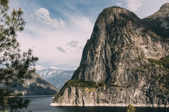
The people of California’s gold rush towns have brought new life to the area, inspite of wildfires and the pandemic. Photograph By Tanveer Badal
How California Dreaming Is Bringing New Life To Gold Rush Towns In The Sierra Nevada
In the foothills of the Sierra Nevada Mountains, Tuolumne County offers an introduction to the natural wonders of California, alongside a wealth of quirky Gold Rush towns and Hollywood film sets primed for a comeback.
— By Zoey Goto | Photographs By Tanveer Badal | August 31, 2023
At an age when most schoolkids are still learning to tie their shoelaces, Nathaniel Prebalick — AKA Gold Plate Nate — was teaching budding treasure hunters how to pan for gold. As a third-generation prospector, he was raised amid the sparkling streams of California’s Gold Country, in the foothills of the Sierra Nevada, getting to know its watery veins as well as the life lines of his own hands.
While this may sound like a sepia-tinged snapshot from another century, it’s anything but — as I discover when I meet Nate on a grassy riverbank one spring morning. He’s a thoroughly modern gold digger — a smiling twentysomething who uploads his gilded finds to Instagram — and he has a ready explanation for why Tuolumne County in eastern California is, once again, in the grip of a gold rush.
“We’ve had historic rains recently and all the gushing water has brought gold down from the hillside,” Nate says in a honeyed, Californian drawl, zipping his wetsuit up to his neck and wading into the cascading stream with a miner’s shovel in his hand. Nearby, his ponytailed father, who goes by the name of Nugget Nick, swirls a murky pan of sediment, locked into the eternal quest for a eureka moment.
Scenes like this were first witnessed in California 175 years ago, after the heady discovery of shimmering flakes attracted a stampede of 300,000 fortune-seekers who ended up reshaping the landscape of the American West. Fast forward to the present day and, once again, it seems there’s gold in them there hills. The focus for today’s prospectors are the foothills of the Sierra Nevada mountains, around two-and-a-half hours east of San Francisco. A combination of recent environmental factors, including Californian wildfires loosening the soil, coupled with pounding rains, has stirred up a bounty of precious metal in Tuolumne.

The locals are at the heart of bringing a new lease of life to these gold rush towns. Photograph By Tanveer Badal
Nate can be found most days sieving the brooks around the town of Jamestown, guiding groups of hobbyists and curious tourists as part of his family’s California Gold Panning business. In a state that’s long dangled the tantalising carrot of easy wealth — as dirt-poor miners who have struck it rich and the overnight tech billionaires of Silicon Valley will attest — Nate still holds onto a glimmer of hope each time he lays his shiny silver sluice box on the pebbled riverbed.
“I once found a nugget the size of my palm,” he enthuses, pushing ringlets of hair back from his damp forehead. He explains that only a fraction of the region’s gold was unearthed during the California Gold Rush of the mid-19th century, so there’s plenty of treasure still to be found — if you don’t mind a bit of hard physical graft. “Sure, most people aren’t getting rich doing this kind of work. But out here in nature, I’m guaranteed a lifetime of fun and a million dollars’ worth of experiences,” he says with an easy laugh and a gold-tinted glint in his eye.
Bidding Nate and his family farewell, I move on to Chinese Camp, a once-thriving stagecoach stop that was home to 5,000 Chinese miners during the Gold Rush and became a key hub for early Asian settlers in the US. Today, a handful of resilient residents remain, alongside a surreal ostentation of squawking peacocks, which parade like royalty through the near-deserted streets.
The tinkling bell above the door having announced my entry into the dinky Chinese Camp Store and Tavern, I browse shelves crammed with fizzy pop, noodles and gemstones. It’s a rare relic of a time when incense burnt outside Buddhist temples and children filed into the pagoda-roofed schoolhouse. Once the Gold Rush ended, China Camp emptied out, its buildings slowly surrendering to the creeping vines, leaving the town looking like the set of a Tim Burton gothic masterpiece.
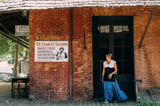
Moving with the times: St Charles Saloon in Columbia State Historic Park was originally a provisions store. Photograph By Tanveer Badal
It’s a very different vibe at my next stop, further down the snaking Route 49 highway: Columbia State Historic Park, a quirky town founded in 1850. This perfectly preserved slice of Western whimsy is home to the largest collection of Gold Rush-era brick buildings in the state. Lining the main drag are higgledy-piggledy wooden boardwalks, vintage saloon bars with swinging doors that creak in the breeze, and old-timey store fronts, the workers inside dressed in period costume like a posse of extras from a John Wayne flick.
Tuolumne is a region that’s had more scene changes than the Wild West films that were once shot here, including mid-century cult classics such as The Legend of the Lone Ranger and High Noon. Originally, this rugged scenery was home to the Me-Wuk Indians, who were pushed off their land when the gold frenzy hit. After the rush had subsided, many once-prosperous towns dwindled into rickety old ghost towns, only to be given a second act when Hollywood came calling, transforming them into sets for rootin’, tootin’ cowboy films. It’s still up for debate what the grand finale for the frontier towns that stud California’s landscape will be, but in Columbia, at least, the answer seems to swing towards a fabulously kitschy re-enactment village.
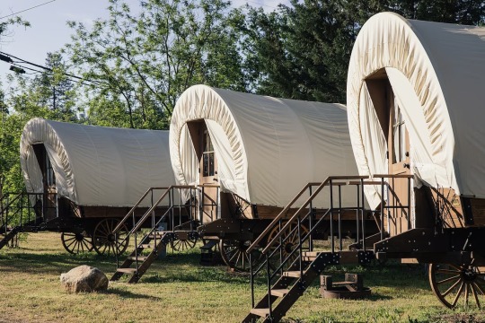
Not all traces of California’s past have been forgotten. The Yosemite Pines RV resort has nods to history everywhere, such as these Conestoga wagons. Photograph By Tanveer Badal
Following intoxicating wafts of melting caramel, I arrive at the door of Nelson’s Columbia Candy Kitchen. There to greet me is fourth-generation owner Janice Nelson, dressed in a floor-skimming floral prairie dress and standing behind glass cases stacked high with a wobble of fruit jellies, like a maternal Willy Wonka. She tells me her 100-year-old family business provides something that resonates on a far deeper level with her customers than the colourful gobstoppers and aromatic clove drops being carefully weighed out on ornate scales. “This shop is our little gold mine. But what we’re really selling is a nostalgia for the Old West,” she says, leading me past a table where women with tattooed arms are delicately hand-dipping chocolates, through to a kitchen where the walls are lined with antique copper pans. “It’s the romantic sense of freedom, discovery and adventure that attracts people to this area,” she says, as a group of children stand on tiptoes outside, eyes wide and noses pressed up against the shop window as they watch a display of hot peanut butter brittle being slathered onto a marble slab to cool.
That evening, I drive 30 miles south east to Yosemite Pines RV Resort, in the midst of the type of wilderness that’s best described as ‘wide screen’. Under an inky sky, I bed down for the night in a covered Conestoga wagon, the kind that once brought trails of hopefuls to the mother lode, so the legend goes. But appearances can be deceptive, I discover, as I ease open the door of my canvas-covered glamping wagon to find all the mod cons of a smart hotel, from a double bed and air conditioning to a coffee machine. Drifting off to sleep, I realise that Tuolumne is the kind of place where the past and present constantly overlap, creating an endlessly entertaining guessing game of ‘spot the Wild West fake’.
Getting Wild Out West
Not all windfalls in Tuolumne involve precious metal, I find out the next morning when I meet adventure guide Bryant Burnette at the entrance of Hetch Hetchy Valley, tucked into the northwest corner of Yosemite National Park. When Yosemite became a national park in 1890, Bryant tells me, it kick-started a tourism boom and luxury cabin resorts such as nearby Evergreen Lodge sprang up around the fringes of the park to accommodate holidaymakers. Nowadays, compared with other Yosemite entry points, Hetch Hetchy offers a lesser-trodden route into the fifth-most-visited national park in the country.
We head on into Yosemite, hiking through shape-shifting scenery — fields of alpine wildflowers one moment, the next, granite mountains so high I try not to fall over as I crane my neck to take them in.
Like all epic landscapes, Yosemite holds multiple meanings, which are often at odds with each other, Bryant says as we skirt our way around the edges of Hetch Hetchy Reservoir, a sheet of ruler-flat water framed by soaring peaks. America’s third national park, Yosemite helped create a blueprint for the conservation and preservation of the natural world, but it was also at the centre of a fierce environmental battle. In the 1920s, a controversial dam was built at Hetch Hetchy to provide drinking water for the residents of San Francisco, flooding the valley floor. There’s talk of draining the reservoir and reclaiming the original landscape, but, Bryant explains, the mass of water does at least mean there’s a greater diversity in the flora and fauna here than elsewhere in Yosemite.
As we pick our way along rugged boulder trails, Bryant tells me that he first came to this neck of the woods with a backpack and 100 bucks in his pocket, determined to conquer the 2,308 hair-raising metres of sheer rock face that make El Capitan Yosemite’s superstar mountain. Having reached its summit, Bryant found something about this mythical landscape that he just couldn’t shake off, so he stayed on and set up Echo Adventures Cooperative with his wife, leading outdoorsy expeditions that include rafting, snowshoeing and campouts.

The reservoir at Yosemite was created in 1923. Photograph By Tanveer Badal
“I didn’t want to spend my life dragging my knuckles into an office. I wanted to wake up each morning and feel excited about going to work,” he reflects. We turn a corner and, like the outrageous flirt that it is, Yosemite wows us with the sight of a rainbow trapped inside a spectacular, sky-high, misty waterfall. It’s a view that makes it easy to understand why Bryant chose waterfalls in the park over watercooler moments in the office.
Determined to see for myself why Yosemite’s rocks had cast their lifelong spell on Bryant, the following morning it’s a bleary-eyed start as I buckle up for a sunrise trip with Yosemite Flights. My guide for the morning is Jason Johanson, a friendly commercial pilot who recently co-founded his own outfit offering aerial tours to visitors wanting a bird’s eye view of this climber’s playground. Such is his love for aviation, Jason lives with his young family in a converted hanger at the side of the airstrip, he tells me over a crackling microphone as we whizz along the runway in his light aircraft. “There’s my home. It makes for an easy walk to work,” he says, laughing, tapping a finger against the side window as we launch into the air.
Minutes later, we’re rising above smudgy clouds to look down upon a chequered patchwork of backcountry. From this giddy vantage point, it’s easier to make sense of the ripple effect that the Gold Rush had on Tuolumne’s landscape. There are the timber mills, frontier towns and railway tracks that once serviced the mining industry, and, in contrast, Yosemite National Park, designated a protected wilderness to halt the damage being inflicted on the valley’s ecosystem by the new settlers.
We glide on over the park, circling majestic El Capitan and neighbouring Half Dome like a hawk. Gazing down at the climbers currently hiking along the valley floor, looking like a trail of ants from above, it’s hard to believe that in a couple of hours they’ll be scrambling up these snow-capped cathedrals of stone. We complete a final glory lap before heading back to Pine Mountain Lake Airport, where, still bathed in the orange glow of sunrise, Jason contentedly makes the 20-step commute back to his home.
Boom to Bust and Back Again
As I arrive in the quaint cowboy town of Sonora, west of the park, the copper gleam of an urban brewery offers up the first clue of a renaissance. But it’s the beatnik coffeehouses filled with artfully exposed brick walls and freelancers tapping away on laptops that seal the deal. As I stroll the main street of the 150-year-old settlement, originally founded by Mexican miners and overlooked by a redwood church, I’m finally getting a glimpse into the future of Tuolumne’s Gold Rush towns — and it’s looking decidedly hipster.
The latest chapter in Sonora’s bust-to-boom script occurred during the pandemic, when many of the decades-old businesses that had occupied its retro buildings folded overnight. In their place, a fresh crop of indie boutiques, florists, juice bars and poke-bowl joints set up shop, as a new generation of Tuolumne residents took a punt on their start-up dreams.
In the heart of downtown Sonora, I make a pit stop at The Armory, a courtyard bar and restaurant festooned with strings of lights. Locals mill around the recycled-barrel tables waiting for the weekly country line dancing class to kick off. Dashing past on her way to do the school run, co-owner Rebecca Barrows stops at my table for a chat. She opened the place with her husband in 2022. To cater for the younger demographic of the area, there’s a cocktail bar hidden within a bourbon-barrel doorframe, and salsa and DJ nights.
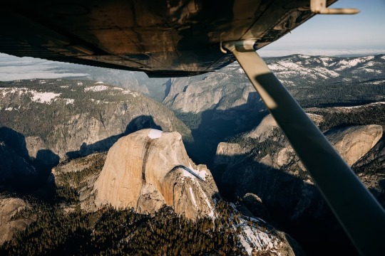
The views on a scenic light aircraft ride with Yosemite Flights include Yosemite’s Half Dome. Photograph By Tanveer Badal
“Post-Covid, there’s been a real turnover of businesses around here,” Rebecca says. “It’s the green shoots of a new scene.” Running out, she calls over her shoulder, “Be sure to try the rodeo smash burger before you leave town.” I take her advice, tucking into a hot mess of beef patties, jalapeños and pepper jack cheese — a dish that’s earned The Armory a place on the Tuolumne County Craft Burger Trail, a network of 10 eateries that take the humble burger to new heights.
Thoroughly satisfied, I leave Sonora and head back to San Francisco through the swaggering scenery of Tuolumne, a landscape that I’d seen a thousand times before on lazy Sunday afternoons spent watching Westerns on the small screen at home. I take a peek inside the shadowy doorway of California’s oldest saloon bar, the Iron Door Saloon in Groveland, where cowboys in Stetsons are propping up the bar, looking like they haven’t budged an inch since the glory days. It suddenly all feels strangely familiar — the trail of riders on horseback, the cinematic frontiers, the flutter of star-spangled banners outside honky-tonks. Long before I arrived on Californian soil, pop culture had already graciously made the intros.
A couple of hours later, I’m back in the urban swell of San Francisco and Tuolumne’s Gold Rush towns are but a dusty memory. But I know where to find them for next time — out there where the highway ends, in a place where young gold diggers still splash in rivers and tourists drift off to sleep in reimagined cowboy wagons, that’s where you’ll find the new Old West.
#Travel 🧳#California#Gold Rush#Gold Rush Town#Caligula Dreams#Sierra Nevada#Sierra Nevada Mountains ⛰️ | Tuolumne County#Zoey Goto#Nathaniel Prebalick | Gold Plate Nate#California | Gold Rush | Mid-19th Century#Chinese Camp ⛺️#Chinese Miners#Dinky | Chinese Camp Store | Tavern#Fizzy Pop | Noodles | Gemstones#Buddhist Temples#Pagoda-Roofed Schoolhouse#Tim Burton | Gothic Masterpiece.#Route 49 Highway#Columbia State Historic Park#Gold Rush-Era Brick 🧱 | Buildings#Higgledy-Piggledy| Wooden Boardwalks | Vintage Saloon Bars#John Wayne#The Legend of The Lone Ranger and High Noon#Nelson’s Columbia Candy Kitchen#Janice Nelson#Willy Wonka#Nostalgia | Old West#Yosemite Pines RV Resort#‘Spot The Wild West Fake’#Bryant Burnette
0 notes
Text

Yosemite National Park, California, United States: Yosemite National Park is a national park in California. It is bordered on the southeast by Sierra National Forest and on the northwest by Stanislaus National Forest. The park is managed by the National Park Service and covers 759,620 acres in four counties – centered in Tuolumne and Mariposa, extending north and east to Mono and south to Madera. Designated a World Heritage Site in 1984, Yosemite is internationally recognized for its granite cliffs, waterfalls, clear streams, giant sequoia groves, lakes, mountains, meadows, glaciers, and biological diversity. Wikipedia
92 notes
·
View notes
Text
Second-guessing all the work I did years ago to pinpoint where-ish Hill Valley is located.
It feels like it's meant to be somewhere in central California, and I've historically skewed a little more southern for it, given the fact that some of the scenery we see in Part III is much more desert in nature (due to them having filmed parts of the movie in Monument Valley as a nod to all the classic Westerns filmed there). But now I'm wondering if it should be a little more northerly, even if the biomes don't exactly line up -- after all, it was filmed in a number of different places, not just Arizona.
I had -- after doing loads of research -- settled on Fresno County for a number of reasons. It has several other towns of what felt like about the right size (I based population estimates for one fic off of Reedley and Sanger). Additionally, one of the important filming locations for Part III (Jamestown) is in nearby(-ish) Tuolumne County, and Route 395, which appears on a sign in downtown Hill Valley in the first film, runs through adjacent Inyo County (both of which are a little too sparsely populated to house a town Hill Valley's size themselves).
But now I'm wondering if Hill Valley is supposed to be closer to Sacramento than Fresno. I started down this rabbit hole for two reasons -- one, I was reminded recently that Doc mentions the nearby lake actually freezing over in the winter at one point, which might imply closer proximity to the mountains, and two, while playing through the game yesterday (which I consider secondary canon, but still informs my thoughts somewhat), I noted multiple references to Sacramento, as well as a character implying Placerville isn't too far away. Placerville is in El Dorado County, which borders Sacramento County. So now I'm finding myself leaning towards either there, Placer County, or Sacramento County?? Help.
(Technically, Hill Valley is located in the made-up "Hill County" but I've decided that's boring because it doesn't tell you anything about where in the state it is, so I've decided to ignore it. California is a big state with very different vibes in the different regions, I want to have some idea of what vibes are relevant!)
#californians please interact#(half joking.... but also)#this trilogy is going to make me insane. i swear#just enough real details to make the made up ones stand out glaringly when i try to do research#and god am i trying#f: your future is whatever you make it
25 notes
·
View notes
Text


Austin from Humane Society of Tuolumne County in Jamestown, California
Click here for more information about adoption and other ways to help!
Click here for a link to Humane Society of Tuolumne County's main website.
Meet Austin! He and his siblings were found as strays and brought to our local animal control, but they were never claimed. These cuties are now with us and ready for new homes! Although shy at first, it doesn't take long for them to start purring and leaning into pets, so don't let them fool you! They are often found sleeping together and would likely enjoy living with other cats in their new homes. Come by and meet them!
28 notes
·
View notes
Text
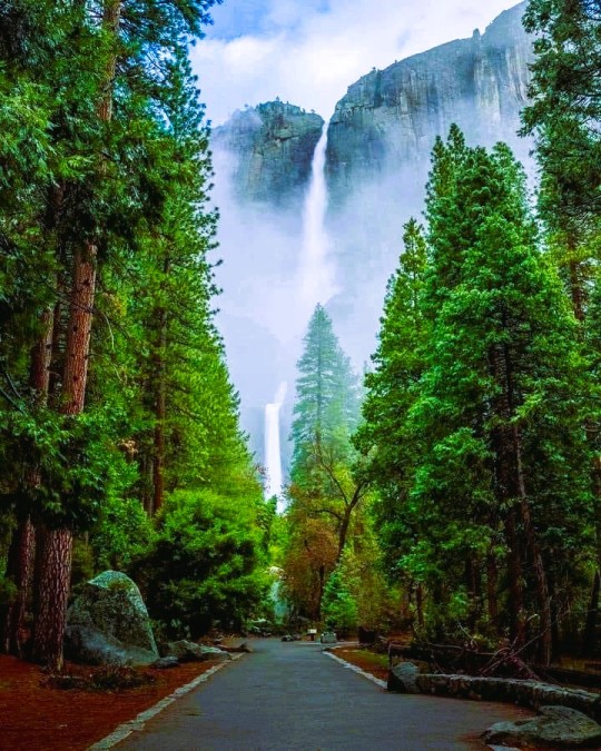
Yosemite National Park, California, United States: Yosemite National Park is a national park in California. It is bordered on the southeast by Sierra National Forest and on the northwest by Stanislaus National Forest. The park is managed by the National Park Service and covers 759,620 acres in four counties – centered in Tuolumne and Mariposa, extending north and east to Mono and south to Madera. Wikipedia
#Yosemite National Park#California#United States#world heritage site#north american continent#north america
139 notes
·
View notes
Text
THIS DAY IN GAY HISTORY
based on: The White Crane Institute's 'Gay Wisdom', Gay Birthdays, Gay For Today, Famous GLBT, glbt-Gay Encylopedia, Today in Gay History, Wikipedia, and more … December 27


c.15 AD – John the Evangelist. The Gospel of John makes several references to "the disciple Jesus loved", and to "the Beloved Disciple", including references to special priviliges that Jesus gave to this relationship, not granted to other disciples. This is taken by some Biblical scholars as evidence that Jesus had a relationship with this disciple which was at least emotionally intimate, and possibly sexual. In medieval Northern Europe, there was even a long-standing tradition that he and Christ were the bridal couple at the Cana Wedding Feast.
It is not clear whether this "Beloved Disciple" was John himself (although it could have been), or someone else possibly Lazarus.
In any event, there are suggestions from elsewhere that John may have had a same-sex relationship with another, his scribe Prochorus, after Christ's death. Prochorus later became bishop of Nicomedia, and in turn, formed a fresh relationship of his own with a younger man, Irenaeus.


1846 – Ezra Allen Miner, more popularly known as Bill Miner, was an American bandit, originally from Bowling Green, Kentucky, who served several prison terms for stagecoach robbery (d.1913). Known for his unusual politeness while committing robberies, he was widely nicknamed the Grey Fox, Gentleman Robber or the Gentleman Bandit. He is reputed to have been the originator of the phrase
"Hands up!"
Legend has it that Bill Miner admonished his cohorts to fire their guns when in danger of capture but "do not kill a man".
Miner was born Ezra Allen Miner in Vevay Township, near Onondaga, Ingham County, Michigan. He never legally changed his first name, but regarded William Allen Miner as his true name throughout most of his life. He was arrested for the first time in 1866 in San Joaquin County, California and served time there. He then formed a partnership with Bill Leroy to rob a stagecoach. Leroy was caught and lynched, but Miner escaped. He was later caught for another robbery in Tuolumne County, California and was released from San Quentin in 1901.
After his third prison term, Miner moved to British Columbia in Canada, where he adopted the pseudonym George Edwards and is believed to have staged British Columbia's first-ever train robbery on September 10, 1904 at Silverdale about 35 kilometres (22 mi) east of Vancouver, just west of Mission City.
Miner was eventually caught after a botched payroll train robbery near Kamloops at Monte Creek (then known as "Ducks"). Choosing the wrong car, they managed only to rob $15 plus a bottle of kidney pills that Miner picked up off of a shelf. Miner and his two accomplices, Tom "Shorty" Dunn and Louis Colquhoun, were located near Douglas Lake, British Columbia after an extensive manhunt. A posse surrounded them while they were lunching in the woods. Miner presented himself as George Edwards and claimed that he and his cohorts were prospectors. The officer in charge of the posse suspected he had encountered the nefarious train-robbing gang and challenged the claim, putting them under arrest.
Dunn attempted to fire at the police and was shot in the leg. He gave up quickly after being wounded. Colquhoun was disarmed by an officer standing nearby and Miner never drew his weapon. Miner's arrest and subsequent trial in Kamloops caused a media spectacle. Apparently the most damning evidence against him was the bottle of kidney pills that Miner had picked up during the Ducks robbery. Upon his conviction, he, Dunn and Colquhoun were transported by train to the provincial penitentiary in New Westminster. By that time, Miner's celebrity status had risen to the point that the tracks were reputedly lined with throngs of supporters, many of whom expressed satisfaction with the fact that someone had taken the very unpopular CPR to task.
While serving time in the B.C. Penitentiary, Miner escaped in 1907 and was never recaptured in Canada. He moved back to the United States, becoming once again involved in robberies in the South at Gainesville in 1909. There, he served more prison time, and escaped twice.
He died in the prison farm at Milledgeville, Georgia, of gastritis, contracted from drinking brackish water during his previous escape attempt.Researchers Mark Dugan and and John Boessenecker contend that Miner was the only known homosexual outlaw in the American "Wild West." In his younger days, "Miner, who had a slender, girlish figure, no doubt was a target for sex-starved older and stronger convicts." Later, they claim, he lured young men into crime and preyed on them sexually. Whatever Miner's sexual preference, the only evidence of Miner's homosexuality surfaced in 1903 when the Pinkerton Detective Agency stated that Miner "is said to be a sodomist and may have a boy with him."


1901 – Marlene Dietrich (d.1992) was a German-American actress and singer.
Dietrich remained popular throughout her long career by continually re-inventing herself, professionally and characteristically. In the Berlin of the 1920s, she acted on the stage and in silent films. Her performance as Lola-Lola in The Blue Angel, directed by Josef von Sternberg, brought her international fame and provided her a contract with Paramount Pictures in the US.
Hollywood films such as Shanghai Express and Desire capitalised on her glamour and exotic looks, cementing her stardom and making her one of the highest paid actresses of the era. Dietrich became a US citizen in 1937, and throughout World War II she was a high-profile frontline entertainer.
Although she still made occasional films in the post-war years, Dietrich spent most of the 1950s to the 1970s touring the world as a successful show performer.
Unlike her professional celebrity, which was carefully crafted and maintained, Dietrich's personal life was kept out of public view. Dietrich, who was bisexual, enjoyed the thriving gay scene of the time and drag balls of 1920s Berlin.
She married only once, to assistant director Rudolf Sieber, who later became an assistant director at Paramount Pictures in France, responsible for foreign language dubbing.
Throughout her career Dietrich had an unending string of affairs, some short-lived, some lasting decades; they often overlapped and were almost all known to her husband, to whom she was in the habit of passing the love letters of her men, sometimes with biting comments.
During the filming of Destry Rides Again, Dietrich started a love affair with co-star Jimmy Stewart, which ended after filming. In 1938, Dietrich met and began a relationship with the writer Erich Maria Remarque, and in 1941, the French actor and military hero Jean Gabin. Their relationship ended in the mid-1940s. She also had an affair with the Cuban-American writer Mercedes de Acosta, who was Greta Garbo's lover. Her last great passion, when she was in her 50s, appears to have been for the actor Yul Brynner, but her love life continued well into her 70s. She counted John Wayne, George Bernard Shaw and John F. Kennedy among her conquests. Dietrich maintained her husband and his mistress first in Europe and later on a ranch in the San Fernando Valley, California.
In 1999, the American Film Institute named Dietrich the ninth greatest female star of all time.


1932 – On this date Fritz "Fred" Klein the Austrian-born American sex researcher, psychiatrist and pioneering Bisexual rights activist was born (d.2006). He's best known as the inventor of the Klein Sexual Orientation Grid. He was also a pioneering bisexual rights activist, who was an important figure in the modern LGBT rights movement.
As a self-identified bisexual, Klein was surprised at the lack of literature on his sexuality in the New York Public Library in 1974. He was inspired to place an advertisement in a New York City alternative newspaper the Village Voice and founded a ground-breaking social and support group for the Bisexual Community called Bisexual Forum.
He devised the Klein Sexual Orientation Grid, a multi-dimensional system for describing complex sexual orientation, similar to the "zero-to-six" scale Kinsey scale used by Alfred Kinsey, but measuring seven different vectors of sexual orientation and identity (sexual attractions, sexual behavior, sexual fantasies, emotional preference, social preference, lifestyle and self-identification) separately, as they relate person's past, present and ideal future.
Klein published The Bisexual Option: A Concept of One Hundred Percent Intimacy in 1978, based on his research, the world's first real psychological study of bisexuality. He also co-authored Man, His Body, His Sex in 1978, and published Bisexualities: Theory and Research in 1986 and Bisexual and Gay Husbands: Their Stories, Their Words in 2001. He published a novel, Life, Sex and the Pursuit of Happiness in 2005.


1962 – Joseph Mantello is an American actor and director best known for his work on Broadway productions of Wicked, and Assassins, as well as earlier in his career being one of the original Broadway cast of Angels in America. Mantello directed The Ritz, his sixth production with playwright Terrence McNally, in 2007.
Joe Mantello was born the oldest son of an Italian-American family in the suburban community of Rockford, Illinois, a city some 90 miles outside of Chicago. With his parents' encouragement, he spent much of his childhood acting in community theater.
In 1984, he graduated from the North Carolina School of the Arts with a Bachelor of Fine Arts degree in acting. That same year he moved to New York to pursue a career in theater. As an actor, Mantello appeared in several Off Broadway productions.
Mantello's early acting career culminated in the original Broadway production of Tony Kushner's groundbreaking seven-hour, two-play cycle Angels in America (1993). In both of the play's two parts, Millennium Approaches and Perestroika, Mantello portrayed Louis Ironson, a liberal, self-centered Jewish New Yorker who leaves his lover Prior Walter, a gay man struggling with AIDS, and becomes involved with Joe Pitt, a Mormon Republican lawyer struggling with his sexuality.
Since his appearance in Angels in America, however, he has concentrated on his directing career. Nevertheless, in early 2011 Mantello returned to acting in a limited-run Broadway production of The Normal Heart, Larry Kramer's 1985 landmark play about the AIDS crisis.
Mantello also drew attention for his widely-chronicled romantic partnership from 1990 to 2002 with the playwright Jon Robin Baitz. In 1994, the New York Times dubbed the two men "the New York theater's couple of the moment."
They were linked professionally as well, with Mantello directing several of Baitz's plays. As the New York Times' Bruce Weber noted, their personalities and talents are "complementary," with Mantello's "warmth and humor burnishing" Baitz's "intellectual rigor and undercutting his earnestness."
When the two men separated after 12 years together, Mantello felt "completely isolated and heartbroken," but he never ascribed blame for the breakup to Baitz. "Neither of us felt wronged," Mantello later explained. "There wasn't another person. It was just a very painful, mutual acknowledgement that we had evolved from being a couple who lived together into best friends."
Indeed, Mantello and Baitz have remained friends, and in 2011 the two men reunited professionally, when Mantello directed, to critical acclaim, Baitz's new play Other Desert Cities.
Other noeworthy productions by Mantello include Terrence McNally's play Love! Valour! Compassion!, about eight gay men sharing a series of summer holidays in an upstate New York house; and Richard Greenberg's Take Me Out, which focuses on the issue of gay athletes in the straight-male-dominated world of professional sports.


1973 – Wilson Cruz (born Wilson Echevarría) is an American actor known for playing Rickie Vasquez on My So-Called Life and the recurring characters of Junito on Noah's Arcand Dr. Hugh Culber on Star Trek: Discovery. As an openly gay person of Puerto Rican ancestry, he has served as an advocate for gay youth, especially gay youth of color.
Wilson Cruz was born in Brooklyn, New York to parents of Puerto Rican descent. His family eventually moved to Rialto, California where he attended Eisenhower High School, graduating in 1991. At age 19, Cruz came out to his parents as gay, first to his mother and then his father. While his mother was initially hurt and shocked, she eventually accepted the news. His father, however, threw him out of the house, and Cruz spent the next few months living in his car and at the homes of friends. He later reconciled with his father.
After coming out to his parents, Cruz went to Hollywood to seek work as an actor, intending to be open about his sexuality from the beginning of his career. In 1994 he was cast as Enrique "Rickie" Vasquez, a troubled gay teen, in the short-lived critically acclaimed cult classic TV series My So-Called Life. In one episode (entitled "So-Called Angels") drawn from Cruz's own life, Rickie comes out to his family, who throw him out of the house.
Cruz works with and advocates on behalf of LGBT youth, especially youth of color. He has volunteered his time as host for the Youth Zone, an online community at Gay.com for LGBT youth. He was the Grand Marshal of the 1998 West Hollywood Gay Pride parade and the 2005 Chicago Pride Parade. In 2008, he was the keynote speaker at the University of Illinois at Chicago's Lavender Graduation and Rainbow Banquet honoring graduating LGBT students.
Cruz joined the board of directors of GLAAD in 1997 in order to assist the organization through a leadership transition, and joined the staff of GLAAD in 2012 as a National Spokesperson and Strategic Giving Officer.


Rowland in his army days
1990 – Died: Chuck Rowland (b.1917) was a founding member of the Mattachine Society. He was active with ONE Inc. and founded the short-lived Church of One Brotherhood. Upon retiring from twenty years of teaching in 1982, Rowland founded Celebration Theatre in Los Angeles.
Chuck Rowland was born and grew up in tiny Gary, South Dakota. He recognized he was homosexual at an early age, and after reading a sympathetic series of articles in a pulp magazine, concluded that, if millions like him existed, they could be mobilized. At the University of Minnesota in the late 1930s, he was active on campus in support of the loyalists of Spain and other causes. While in grad school during 1939–40 he returned to Gary as a substitute for the spring term. On a weekend visit to Minneapolis, he met Bob Hull, a U of M undergraduate. The two had a brief romance, lived together, and became lifelong friends.
In 1942, Rowland was drafted into the army. Due to a severe injury, he stayed stateside during the war. While enlisted, Rowland became a charter member of the American Veterans Committee, a liberal alternative to the American Legion. After discharge in March 1946, he showed his talent as an AVC organizer, but his active support for veterans’ bonus legislation, which the group disparaged as “handouts,” led to his being “canned” by the AVC by 1947.
While in the AVC, Rowland noted that those he knew to be communists were some of AVC’s best organizers. “I was just carried along with this feeling of liberalism and the horror of the [anti-communist] reaction that was setting in,” he said, “and my feeling was that we had to move farther and farther to the left, as a result of which I got into the Communist Party.” Rowland returned to Minneapolis and headed the CP’s Midwest youth division.* (His value as an organizer trumped any chance of being expelled under the party’s unwritten anti-gay policy.) Rowland recruited Hull into the party, and the two contemplated Rowland’s childhood dream of organizing homosexuals.
In 1948, he quit the CP and move to Los Angeles, followed by Hull. There, at a labor school, the two met a teacher, Harry Hay, who also had done some thinking about a homosexual organization.
Harry Hay was developing a blueprint for a homophile support group, but before he could show it to them, Rowland and Hull moved to Mexico in the summer of 1950, intending to relocate permanently to avoid anti-Communist witch-hunts. They returned by fall, however, and received Hay’s completed prospectus, which they eagerly shared with Hull’s new boyfriend, Dale Jennings. The three met with Hay and his lover Rudi Gernreich on Armistice Day 1950, and eventually formed the (necessarily) secretive Mattachine Society and its public nonprofit, Mattachine Foundation.

Mattachine members clockwise from top: Chuck Rowland, Konrad Stevens, unknown, Bob Hull, Jim Gruber
Rowland immersed himself in ONE Inc., writing for its magazine and directing its social services division. In 1954 he proposed that ONE open a guidance center staffed with gay counselors to mentor the waifs who found themselves alone in a new city. The project foundered, but Rowland nevertheless reported to ONE that in 1955 his division provided job placement and/or vocational counseling for nearly 100 people.
The early 60s saw Rowland involved in a possible FBI blacklisting (as both Red and gay), a failed business partnership, a dependence on intoxicants, mounting debt, and eviction. Finally, following the tragic suicide of his friend Bob Hull in May of 1962, Rowland returned to the Midwest. That summer he was hired as a credentialed high school teacher in Iowa. Obtaining his master’s degree in 1967, he chaired the theater arts department at a Minnesota college.
Upon retiring in 1982, Rowland returned to Los Angeles from his “exile,” as he put it, while admitting to “some worthy accomplishments” and meaningful relationships. In late 1982, with Jim Kepner and ex-Mattachino Martin Block, Rowland founded Celebration Theatre, billed as “the only theatre in Los Angeles dedicated exclusively to productions of gay and lesbian plays.” Kepner hosted its debut in the late spring of 1983, in his National Gay Archives.
Having been hospitalized in March 1090 with prostate cancer that proved to be terminal, Rowland “moved to Duluth where a former student fixed up a handsome apartment overlooking the lake,” according to a Kepner-penned obituary. “He spent five happy months among students and relatives….” Chuck Rowland died December 27, 1990.


15 notes
·
View notes
Text


Cool Plant: Monardella venosa
Windowpane Monardella
This plant is only found in Tuolumne and Butte counties of California, making it incredibly rare.
70 notes
·
View notes
Text

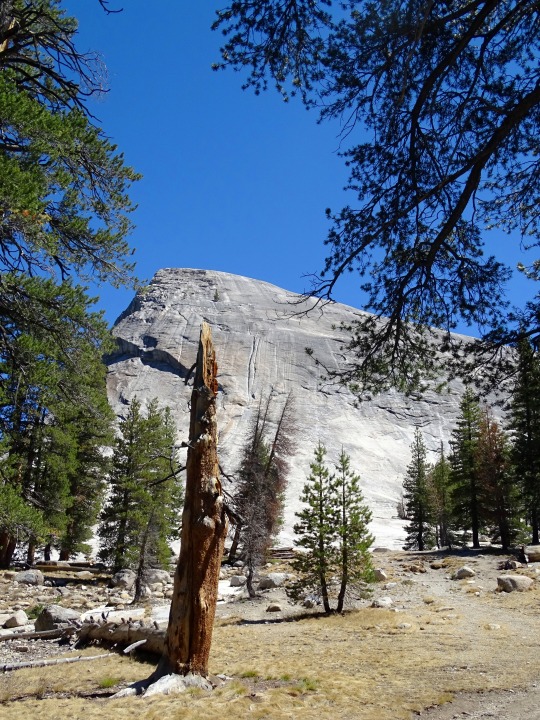
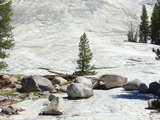

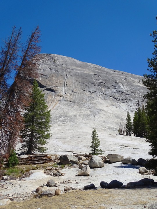
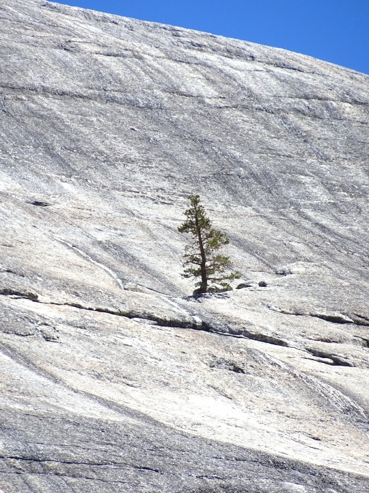


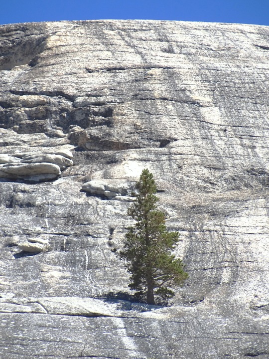
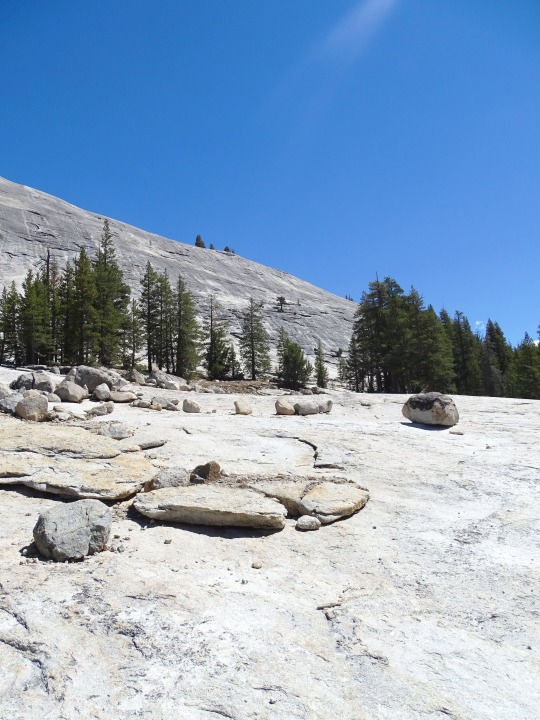
Yosemite National Park, CA (No. 3)
European American settlers first entered the valley in 1851. Other travelers entered earlier, but James D. Savage is credited with discovering the area that became Yosemite National Park. Native Americans had inhabited the region for nearly 4,000 years, although humans may have first visited as long as 8,000 to 10,000 years ago.
Yosemite was critical to the development of the concept of national parks. Galen Clark and others lobbied to protect Yosemite Valley from development, ultimately leading to President Abraham Lincoln's signing of the Yosemite Grant of 1864 that declared Yosemite as federally preserved land. In 1890, John Muir led a successful movement to motivate Congress to establish Yosemite Valley and its surrounding areas as a National Park. This helped pave the way for the National Park System. Yosemite draws about four million visitors annually. Most visitors spend the majority of their time in the valley's seven square miles (18 km2). The park set a visitation record in 2016, surpassing five million visitors for the first time.
Source: Wikipedia
#Tuolumne Meadows#Mount Dana#Mount Gibbs#Yosemite National Park#Sierra Nevada#Mono County#geology#flora#California#summer 2022#tourist attraction#landmark#landscape#countryside#USA#nature#forest#woods#fir#pine#rocks#travel#original photography#vacation#alpine meadow#creek#Lembert Dome#granite
3 notes
·
View notes
Text

➤ Yosemite National Park (/joʊˈsɛmɪti/ yoh-SEM-ih-tee) is an American national park in California, surrounded on the southeast by Sierra National Forest and on the northwest by Stanislaus National Forest. The park is managed by the National Park Service and covers an area of 759,620 acres (1,187 sq mi; 3,074 km2) in four counties – centered in Tuolumne and Mariposa, extending north and east to Mono and south to Madera County. Designated a World Heritage Site in 1984, Yosemite is internationally recognized for its cliffs, waterfalls, clear streams, giant sequoia groves, lakes, mountains, meadows, glaciers, and biological diversity. Almost 95 percent of the park is designated wilderness. Yosemite is one of the largest and least fragmented habitat blocks in the Sierra Nevada, and the park supports a diversity of plants and animals.
📷@v_outdoors
52 notes
·
View notes
Text
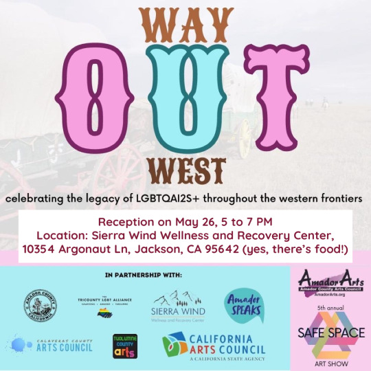
Three of my photographs from my Wilderness Domestics series are in WAY OUT WEST, celebrating the legacy of LGBTQAI2S+ history throughout the western frontiers. This art show is a part of the Safe Space annual art exhibit by Amador Arts.
Reception on May 26, 5 to 7 PM
Location: Sierra Wind Wellness and Recovery Center, 10354 Argonaut Ln, Jackson, CA 95642 (yes, there’s food!)
Calaveras and Tuolumne County timelines are to be released in the spring.
https://www.amadorarts.org/safe-space/
4 notes
·
View notes
Text

The Bennett Juniper, is the largest known juniper tree in the United States. Its height is 78 feet (24 m) feet with an average crown spread of 56 feet (17 m). The diameter at breast height (4.5 feet (1.4 m) above ground) is 12.7 feet (3.9 m). Its estimated age is over 2000 years old. Tuolumne County, California, USA.
2 notes
·
View notes


