#South Fork San Joaquin River
Explore tagged Tumblr posts
Text
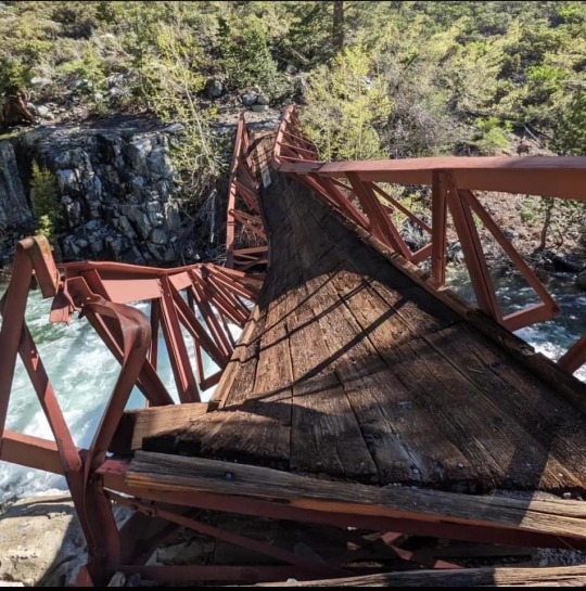
Another casualty of a tough winter and spring. This bridge crosses the South Fork of the San Joaquin River at the junction of the Piute Pass Trail and the PCT/JMT in the High Sierra.

4 notes
·
View notes
Video
Wide Open Spaces in Devils Postpile National Monument by Mark Stevens Via Flickr: While walking the Devils Postpile Trail and taking in views with some nearby forest and river with reflections. The view is looking to the south.
#Ansel Adams Wilderness#Azimuth 194#California and Oregon Road Trip#Cloudy#Day 3#Devils Postpile National Monument#Devils Postpile Trail#DxO PhotoLab 5 Edited#Forest#Forest Landscape#Hillside of Trees#Landscape#Landscape - Scenery#Looking South#Middle Fork of the San Joaquin River#Mostly Cloudy#Nature#Nikon D850#No People#Outside#Overcast#Pacific Ranges#Project365#Ridge#Ridgeline#Ridges#Ritter Range#Ritter Range-East Yosemite#River#Rolling Hillsides
0 notes
Photo

Weather: Pacific Northwest
Report generated at 2025-02-07 08:00:16.898190-08:00 using satellite imagery and alert data provided by the National Weather Service.
Winter Weather Advisory
WA:
Foothills of the Blue Mountains of Washington
Northern Blue Mountains of Oregon
Northwest Blue Mountains
OR:
Baker County
Central Oregon
Grande Ronde Valley
Harney County
John Day Basin
Lower Columbia Basin of Oregon
Lower Treasure Valley
Malheur County
North Central Oregon
Northern Blue Mountains of Oregon
Northwest Blue Mountains
Ochoco-John Day Highlands
Oregon Lower Treasure Valley
Owyhee Mountains
Southern Blue Mountains of Oregon
Upper Treasure Valley
Wallowa County
ID:
Bear River Range
Big Hole Mountains
Big Lost Highlands/Copper Basin
Boise Mountains
Camas Prairie
Caribou Range
Centennial Mountains/Island Park
Eastern Lemhi County
Frank Church Wilderness
Lewis and Southern Nez Perce Counties
Lower Clark Fork Region
Northern Clearwater Mountains
Orofino/Grangeville Region
Sawtooth/Stanley Basin
Southern Clearwater Mountains
Sun Valley Region
Teton Valley
Upper Weiser River
West Central Mountains
Wood River Foothills
CA:
Del Norte Interior
Northern Humboldt Interior
Northern Washoe County
Surprise Valley California
NV:
Greater Reno-Carson City-Minden Area
Humboldt County
Northern Washoe County
Surprise Valley California
Cold Weather Advisory
WA:
Bellevue and Vicinity
Bremerton and Vicinity
East Puget Sound Lowlands
Everett and Vicinity
Hood Canal Area
Seattle and Vicinity
Tacoma Area
Western Skagit County
Western Whatcom County
Winter Storm Warning
OR:
Foothills of the Northern Blue Mountains of Oregon
Foothills of the Southern Blue Mountains of Oregon
ID:
Lower Hells Canyon/Salmon River Region
Western Lemhi County
CA:
Eastern Sierra Slopes of Inyo County
Greater Lake Tahoe Area
Kaiser to Rodgers Ridge
Kings Canyon NP
Mono
Northern Trinity
Sequoia NP
Southern Trinity
Upper San Joaquin River
Yosemite NP outside of the valley
NV:
Greater Lake Tahoe Area
Wind Advisory
ID:
Arco/Mud Lake Desert
Eastern Magic Valley
Lower Snake River Plain
Owyhee Mountains
Raft River Region
Shoshone/Lava Beds
Southern Hills/Albion Mountains
Southern Twin Falls County
Southwest Highlands
Upper Snake River Plain
Western Magic Valley
CA:
Antelope Valley
Cuyama Valley
Death Valley National Park
Eastern Antelope Valley Foothills
Eastern San Gabriel Mountains
Interstate 5 Corridor
Mojave Desert Slopes
Owens Valley
San Luis Obispo County Interior Valleys
San Luis Obispo County Mountains
Santa Barbara County Interior Mountains
Southern Salinas Valley
Western Antelope Valley Foothills
Western Mojave Desert
Western San Gabriel Mountains and Highway 14 Corridor
White Mountains of Inyo County
NV:
Esmeralda and Central Nye County
Greater Reno-Carson City-Minden Area
Humboldt County
Lake Mead National Recreation Area
Las Vegas Valley
Mineral and Southern Lyon Counties
Northeast Clark County
Northern Elko County
Northern Lander County and Northern Eureka County
Northwestern Nye County
Ruby Mountains and East Humboldt Range
South Central Elko County
Southeastern Elko County
Southern Clark County
Southern Lander County and Southern Eureka County
Southwest Elko County
Spring Mountains-Red Rock Canyon
Western Clark and Southern Nye County
Western Nevada Basin and Range including Pyramid Lake
White Pine County
Flood Warning
CA:
Butte
Modoc
Tehama
Freeze Warning
CA:
Eastern Santa Clara Hills
Mountains Of San Benito County And Interior Monterey County Including Pinnacles National Park
North Bay Interior Valleys
Santa Lucia Mountains and Los Padres National Forest
Southern Salinas Valley/Arroyo Seco and Lake San Antonio
Frost Advisory
CA:
East Bay Hills
East Bay Interior Valleys
Marin Coastal Range
North Bay Interior Mountains
Northern Monterey Bay
Northern Salinas Valley/Hollister Valley and Carmel Valley
San Francisco Bay Shoreline
Santa Clara Valley Including San Jose
Santa Cruz Mountains
Sonoma Coastal Range
Southern Monterey Bay and Big Sur Coast
Flood Advisory
CA:
Lassen
Sonoma
0 notes
Photo
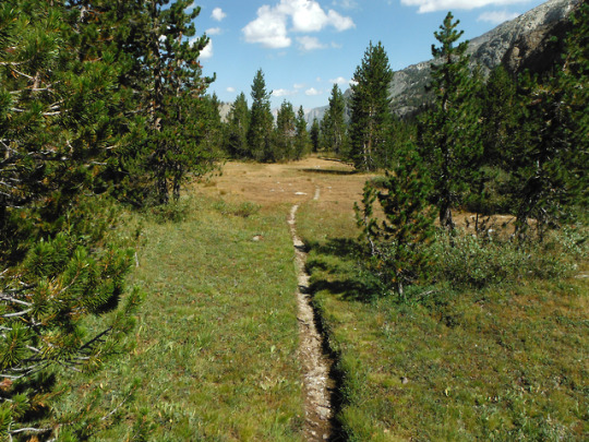
The Goddard Canyon Trail descending into the South Fork of the San Joaquin River drainage. Sequoia-Kings Canyon National Parks, SEKI, Sierra Nevada Mountains, California, USA. Photo by Van Miller
#goddard canyon#south fork of the san joaquin river#san joaquin river#Wild Rivers#rivers#sequoia-kings canyon national park#seki#Sierra Nevada Mountains#california#©Van Miller#hiking#backpacking#camping#outdoors#Wanderlust#travel#Wilderness#the wilderness journals#photography
43 notes
·
View notes
Photo

Overnight Trip in the JMT Complete An overnight adventure into the John Muir Wilderness has ended. Our destination was Blayney Meadow. Photos are uploaded and story will follow!
0 notes
Text
Mt Senger from Florence Lake, The First Sierra Hike of the Season

I had been fighting a cold over the past two weeks, and after taking the previous weekend off from hiking, I felt recovered enough to get back on the horse. I had my eyes on the Trinity Alps, but sadly could find no one who wanted to go with me. I was considering a solo trip until Rafee texted me with some ideas for western approach Sierra peaks. He mentioned Mt Senger, and I decided to join him since I was in the mood for some company. I previously thought this was more than a 30 mile effort, but that is maybe only the case when following the John Muir Trail to Sallie Keyes Lake. Secor documents a use trail, which when used would save some distance. A ferry also crosses Florence Lake, but it wouldn't start running for two more weeks, so we had no choice but to start for the northern shore of the lake. That was fine by us. Rafee would drive the morning of from his hotel in Fresno while I decided to drive in the night before and sleep at the trailhead. It was a long drive in from Shaver Lake. I arranged my sleep set up then walked out towards the lake where I meditated and watched the alpenglow. I could already feel the elevation even though I was only at 7,300 ft.

It was a rather chilly night, but I slept well enough. A mosquito had found its way into my car, and while I don’t think it managed to bite me in my sleep, the occasional buzz around my ear disturbed me from my tranquil state. I woke up before my alarm and got ready at a leisurely pace while I waited for Rafee. I invoked the luxury of turning on my car heater for warmth. Rafee pulled up next to me as I ate my breakfast, and we were on our way by 6:10am. From the day use parking lot, we passed a closed gate and followed a paved road for a short distance to the actual trailhead. The trail climbed up around the western lakeshore. Every foot of gain was all for naught as we would eventually descend back down to near lake level at the lake’s inlet. I spied Mt Darwin many miles up the canyon beyond Evolution Valley.

A lone bird flew overhead, but besides that the 4 mile walk to the other side of the lake was uneventful. The trail led us to a footbridge that crossed the mighty South Fork of the San Joaquin River.


The trail climbed away from the river and eventually met up with a dirt road. The trail and the two track would coalesce for the following few miles as they both made their way towards Muir Trail Ranch. We first passed Double Meadow, with Ward Mountain towering above us to the southeast.

In the other direction was The Tombstone, a rock feature on the way towards Chamberlain Peak and Mt Hooper.

Snow Plants were abundant in the forest following Double Meadow.

We then reached Blaney Meadows a short distance further.

Along the trail was a peculiar gate, possibly suggesting a history of grazing in the area.

North rock, a potential bonus peak, towered above us.

We were now on the lookout for the old use trail. We left the main trail as we neared Sallie Keyes Creek, prior to reaching the JMT and the MTR. We wandered somewhat aimlessly through the forest, but eventually found some large cairns and later a footpath.

We took our first break here to celebrate finding the old trail. We were already 8 miles in and hadn’t done much elevation gain. I guess there was only one way to see if my body would hold up.

The trail was very useful. It took us through sections of manzanita and simplified route finding so I could simply turn my brain off. Ward Mountain looked more impressive the higher we climbed.

The trail slowly got less and less obvious as we climbed higher, but it became less necessary as we entered a forest. We just made our way upwards, spotting a random cairn either here or there. We passed time talking about sports radio personalities. It was effective. We eventually met Sallie Keyes Creek at a wide open meadow near the outlet of the lake.

There were many large golden trout darting through the crystal clear water.


We found an old trail on the other side of the creek, and we followed this north as it paralleled the watercourse until we merged with the John Muir Trail. We reached Sallie Keyes Lakes moments later.

We somehow had completed most of the gain by now, and decided to keep our momentum by continuing up the peak. We followed the lakeshore then resumed climbing through a patch of trees towards the southern slopes of Mt Senger. We paused for a short time to observe a grouse sitting in a tree.

The climb evolved into a slog of sorts. I aimed for some large boulders to make things more fun, but I was having trouble maintaining my pace. At the 12,000 ft mark, I finally accepted that I was feeling the effects of altitude. It was a little embarrassing, but I suppose acceptable since this was my first Sierra hike of the year. I also was starting to get cold, so additional time was needed to take out my jacket and put on my gloves. Rafee ran off ahead to the summit while I labored up the final stretch. We encountered snow for the first time as we crossed the large summit plateau. The snow was consolidated and I was thankful that there were no hidden cornices along my path.

I joined Rafee at the top a couple minutes later. It took us 6 hours and 30 minutes to reach the summit, which was equivalent to Bob Burd and Mathew Holliman’s time. They admitted to feeling absolutely terrible that day, but I wasn’t feeling that much better with my altitude sickness and lingering cold.

To the northeast were Mt Hilgard, Mt Gabb, Seven Gables and Bear Creek Spire.

To the east were Mt Humphreys and Mt Emerson.

To the southeast were Charybdis and Mt Goddard.

To the south were the Kaweah Range and Mt Henry.

To the southwest was Three Sisters.

To the northwest was Mt Hooper.

RJ Secor was in the register, but I was simply disinterested in flipping through the pages. Usually I just write my name in the register, but Rafee inspired me to put my home town and a comment. I wasn’t feeling great so I didn’t have much to say.

The clear blue skies, outstanding views and a delicious homemade lunch made me feel a little better. I had barbecued tri tip a few nights ago, and was now able to consume all those protein and fat filled calories. Yum. For some reason Rafee was interested in some spot point on the topo map which we now call Peak 12068. I must have caught his interest when I suggested that there might be an obscure register on the summit, however I didn’t sincerely believe this. Anyways it seemed like an easy bonus peak so we began traversing west along the ridge. Some interesting clouds were forming to our southwest.

Even with my down puffy, I was really feeling cold and downright uncomfortable. Once at the saddle it was a quick task to reach the top, and we were rewarded with our first good views of Mt Senger.

Of course there was no summit register. There was however a better view of the Selden Pass area and Mt Hooper.

We returned back to the saddle where we spied a nice looking sand chute.

From here we made pretty quick work on our descent.

As we approached Sallie Keyes Lake, it sounded like people were shouting Rafee’s name. We thought it might be someone we knew, so we started yelling back, guessing who it might be. “AJ! Peter! Dully! Kirmse! Mihai!” Those people must have thought we were crazy. I don’t think it was anyone we knew.

We didn’t stick to the trail through the forest, finding it just as easy to traverse the forest floor in a cross country manner. We did follow the trail through the manzanita section, which proved very helpful.

Once back in the valley, we had a long 8 mile walk back to the cars. There was a lot of micro terrain that punished me. My throat had become agitated, and I most definitely regressed in terms of recovering from my cold. Doh!


I taught Rafee about nunataks as we approached Florence Lake.

We stopped at the footbridge for “dinner,” which basically consisted of the rest of the food in my pack. I strained over the last four miles back to the car, but I didn’t suffer too greatly.


I moved just fast enough to keep the mosquitos at bay. The same bird from the morning was still flying overhead. I believe it was a white-tailed kite, but I guess we will never know for sure. After reaching the cars, we had a very long drive back to Shaver Lake. All the restaurants were closed, so we had to drive an hour further to Clovis to get food. Thankfully Five Guys was open and we chowed down as we recounted the day's efforts. In the end the hike was 24.5 miles with 6,600 ft of gain, which was the perfect amount for me.
1 note
·
View note
Photo

One of the perks of hiking in the mountains near our home in Fresno, CA. Caught this image of the Milky Way over the South Fork of the San Joaquin River the first night on the way to Evolution Valley. [OC] {7952 x 5304] via /r/EarthPorn https://ift.tt/3x9qnbP
0 notes
Photo
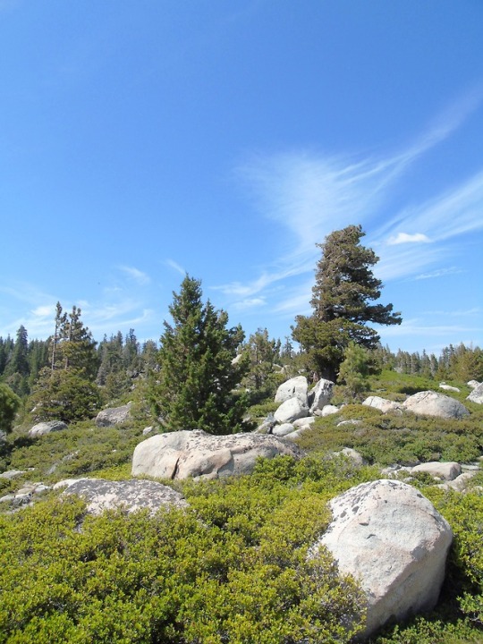
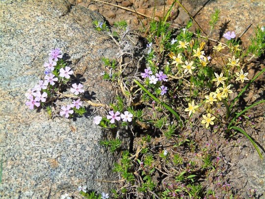
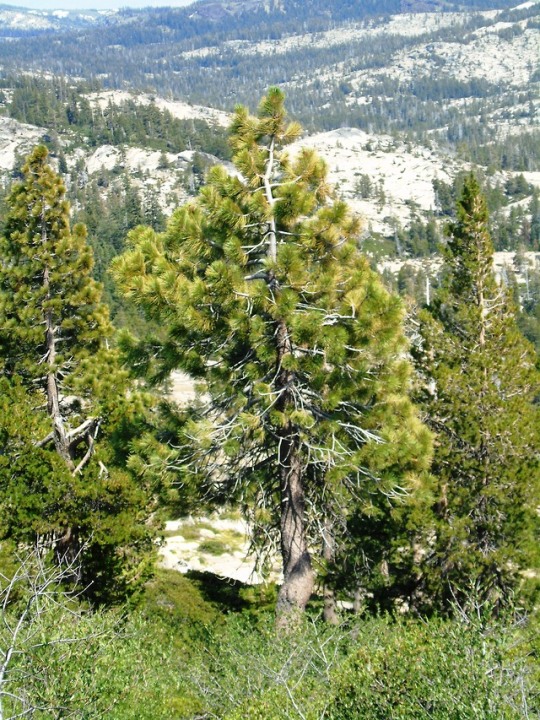
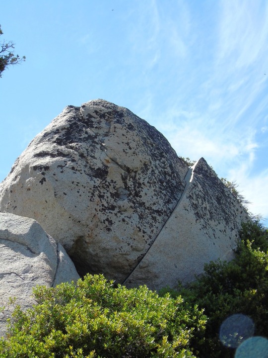
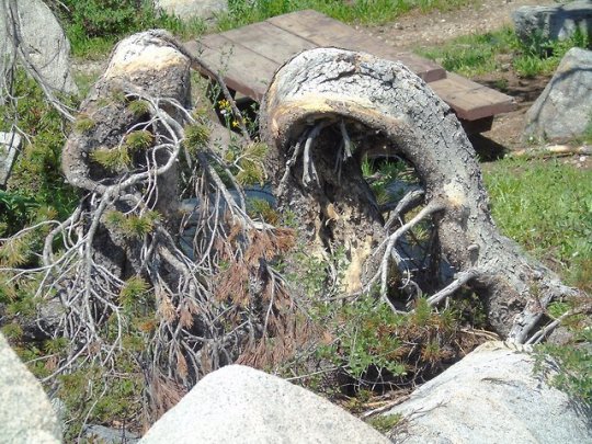
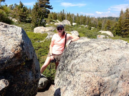
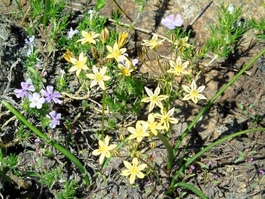
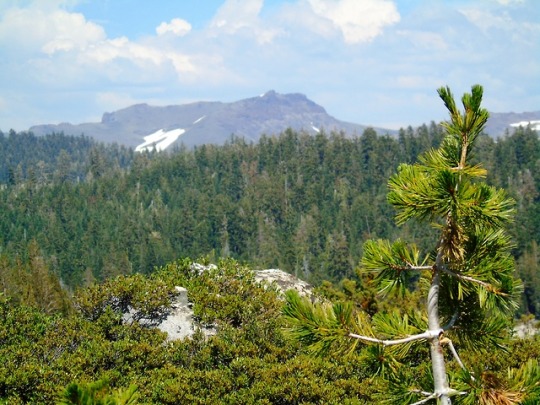
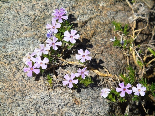
Shot Rock Vista Point, CA (No. 4)
The Sierra Nevada's irregular northern boundary stretches from the Susan River and Fredonyer Pass to the North Fork Feather River. It represents where the granitic bedrock of the Sierra Nevada dives below the southern extent of Cenozoic igneous surface rock from the Cascade Range. It is bounded on the west by California's Central Valley and on the east by the Basin and Range Province. The southern boundary is at Tehachapi Pass.
Physiographically, the Sierra is a section of the Cascade-Sierra Mountains province, which in turn is part of the larger Pacific Mountain System physiographic division. The California Geological Survey states that "the northern Sierra boundary is marked where bedrock disappears under the Cenozoic volcanic cover of the Cascade Range.
The height of the mountains in the Sierra Nevada increases gradually from north to south. Between Fredonyer Pass and Lake Tahoe, the peaks range from 5,000 feet (1,500 m) to more than 9,000 feet (2,700 m). The crest near Lake Tahoe is roughly 9,000 feet (2,700 m) high, with several peaks approaching the height of Freel Peak (10,881 ft or 3,317 m). Farther south, the highest peak in Yosemite National Park is Mount Lyell (13,120 ft or 3,999 m). The Sierra rises to almost 14,000 feet (4,300 m) with Mount Humphreys near Bishop, California. Finally, near Lone Pine, Mount Whitney is at 14,505 feet (4,421 m), the highest point in the contiguous United States.
South of Mount Whitney, the elevation of the range quickly dwindles. The crest elevation is almost 10,000 feet (3,000 m) near Lake Isabella, but south of the lake, the peaks reach to only a modest 8,000 feet (2,400 m).
There are several notable geographical features in the Sierra Nevada:
Lake Tahoe is a large, clear freshwater lake in the northern Sierra Nevada, with an elevation of 6,225 ft (1,897 m) and an area of 191 sq mi (490 km2). Lake Tahoe lies between the main Sierra and the Carson Range, a spur of the Sierra.
Hetch Hetchy Valley, Yosemite Valley, Kings Canyon, and Kern Canyon are examples of many glacially-scoured canyons on the west side of the Sierra.
Yosemite National Park is filled with notable features such as waterfalls and granite domes.
Groves of Giant Sequoias Sequoiadendron giganteum occur along a narrow band of altitude on the western side of the Sierra Nevada. Giant sequoias are the largest trees in the world.
Two of the largest rivers in California, which form the Central Valley and drain into San Francisco Bay, derive most of their flow from the western slopes of the Sierra Nevada range. The northern of the two is the Sacramento River (which also drains the adjacent Cascade Range and Klamath Range); the southern one is the San Joaquin River.
Source: Wikipedia
#Shot Rock Vista Point#view#Eldorado National Forest#Sierra Nevada#forest#woods#tree#nature#flora#mountain#i love mountains#dead tree#flower#blooming#rock#snow#landscape#countryside#off road#road trip#travel#California#usa#summer 2017#photography#photoset#higher alitude#tourism#vacation
3 notes
·
View notes
Text
JMT Day 8
9/11/17 Marie Lake to South Fork San Joaquin River The night on Marie Lake was ridiculously windy. It seemed like I rarely got more than 5 minutes of sleep at a time with how vigorously the tent was flapping. We had a long (really long) descent to Muir Trail Ranch to grab our resupply buckets. I was chanting to Craig about the bag of Terra Chips we had waiting for us. We definitely underestimated our cravings for salty snacks on this trip. We gorged on the chips and Oreos we had sent ourselves as we sorted through the resupply. We left a few things in the "hiker box" - actually an assortment of very well organized buckets - and took a few things as well. We noted that the sky had begun to darken, but decided to move on nevertheless. The rain started after about 10 minutes on trail, and lasted less than an hour. It was enough to get us soaked, but luckily the sun returned and we were at least able to dry out our clothing. After entering Kings Canyon National Park, we climbed up with the San Joaquin River on our right. It was a punishing climb with our newly reloaded packs, but the river gorge, with its countless cascades and waterfalls, proved a welcome distraction. We found a couple small campsites, set up, and cooked dinner. Craig and I each ate about two bites of our couscous before the rain started again, in big juicy drops. We covered our dinner and ran back into the tent. When the rain died down we ventured back out. We each got about four more bites of couscous before the big juicy drops returned. We ran for cover yet again! The next respite from the rain allowed us to finish dinner and clean up before calling it a night with more dark clouds on the horizon.
3 notes
·
View notes
Text
John Samuel Eastwood - Wikipedia
John Samuel Eastwood (1857, in Minnesota – 1924, in California) was an American engineer who built the world's first reinforced concrete multiple-arch dam on bedrock foundation at Hume Lake, California, in 1908. Eastwood's papers are held at the Water Resources Collections and Archives, University of California, Riverside.[1]
Early life
Born to Dutch parents in 1857 in Minnesota,[2] Eastwood attended the University of Minnesota as a civil engineering student; prior to graduation in 1880 he headed west to work on railroad construction projects in the Pacific Northwest, including on the Northern Pacific Railroad.[3] In 1883, he moved to Fresno, California and established an office as civil engineer and surveyor. He became Fresno's first City Engineer in 1885, but apparently was not well suited for office–bureaucratic life and soon resigned. For the remainder of his career he focused on work within the private sector or as a consulting engineer.
Early in 1895, he became chief engineer of the San Joaquin Electric Company, and was responsible for the design and construction of one of California's early hydroelectric plants. As described by George Low in the April 1896 Journal of Electricity, Eastwood employed the nascent technology of long-distance alternating current power transmission in creating a hydroelectric power system for the Fresno area. Unfortunately, the financial capabilities of the company proved insufficient to meet the great cost of constructing the dam in the remote reaches of the mountains, and, as a result, Eastwood was forced to rely on an undammed, natural supply of water to drive the turbines and generators. It was this inability to impound and store runoff that led to the demise of the San Joaquin Electric Company in 1899 after a long drought dried up the North Fork of the San Joaquin River and brought the company's power production to a standstill.
Big Creek Complex
Shortly thereafter, Eastwood became engaged with the Pacific Light and Power Company as engineer in charge of designing a large hydroelectric project on the South Fork of the San Joaquin River. This has since become known as the Big Creek Hydroelectric Project, presently operated by the Southern California Edison Company. The Pacific Light and Power Company was controlled by the famous financier and electric railroad magnate Henry Huntington. Eastwood had great hopes for the Big Creek project, and he planned it to include storage dams to ensure that a drought could not stop its power production.

Hume Lake
Dam, completed 1909, displaying its reinforced concrete 50-foot (15 m)-span arches resting on inclined vertical buttresses
Although Big Creek was for the most part designed prior to 1907, financial difficulties associated with the Panic of 1907 delayed Huntington's ability to initiate construction for several years. While designing the Big Creek project, Eastwood had devised an inexpensive type of reinforced concrete dam design which minimized the amount of material required and, consequently, reduced construction costs. In 1908, while waiting for work on Big Creek to begin, he designed and built the Hume Lake Dam for the Hume-Bennett Lumber Company. This structure is located in the Sierra Nevada about forty-five miles south of Big Creek. The first of its kind, its completion in 1909 demonstrated the practicality of the multiple-arch design. Shortly thereafter, Eastwood received the contract for the design of a multiple-arch dam to supersede the 1884 Big Bear Valley Arch Dam near San Bernardino in Southern California.
Eastwood envisaged the use of multiple-arch dams in the construction of the Big Creek project, but these hopes were dashed when, in November 1910, he was dismissed from all association with the project. Although he was awarded 5,400 shares of stock in the newly formed Pacific Light and Power Corporation (which was legally distinct from the earlier PL&P Company), this financial interest soon disappeared when in the summer of 1912 Huntington, as majority stockholder, assessed all owners of Pacific Light and Power Corporation stock $5 per share to help pay for the construction of Big Creek. Unable to pay the assessment ($27,000) on his stock, Eastwood was forced to relinquish his stake in the PL&P Corporation. Following this abrupt separation from the Big Creek project at the age of 53, Eastwood was left with only modest financial holdings and, as a means of survival, he began actively pursuing a career devoted to the design of multiple arch dams.
Multiple arch dams
In the early 20th century, Salt Lake City regularly experienced severe water shortages in mid-winter and late summer. To alleviate this, bonds were floated in 1914 to finance the construction of three storage dams, the largest being Mountain Dell Dam in Parley's Canyon, ten miles east of the city, that was built in two stages from 1914 to 1925.
Earlier, Eastwood had built four dams in California and his reputation as dam designer was growing. He had written several articles in Western Engineering describing his Big Bear Valley Dam, Los Verjeles Dam (in Yuba County, California) and Kennedy Dam (in Jackson, California), and had also published a four-page promotional "supplement" distribution with copies of the March 1915 Western Engineering.
Following the initial construction of Mountain Dell Dam, Eastwood continued his career in water resource development and dam design, becoming involved in projects in California, Idaho, Arizona, Mexico, and British Columbia.
He was not an armchair engineer, and he spent much of his life in the field working on practical problems of water control. He worked as a practicing engineer until the end of his life, when, in August 1924, at the age of 67, he drowned while swimming in the Kings River east of Fresno.
The Eastwood powerhouse at Shaver Lake, California was named after him. Built in 1987, the 200 MW pumped storage hydroelectric plant is located underground and was carved out of solid granite.
Eastwood designed seventeen dams in his career: one in Utah, one in Arizona, one in British Columbia, two in Idaho, and the other twelve in California. Eastwood's work includes:
Hume Lake Dam, Fresno County, California (1908)
Big Bear Lake Dam, Big Bear, California (1912)
Mountain Dell Dam, Salt Lake County, Utah (1914-1925)
Lake Hodges Dam, Escondido, California (1918)
Fish Creek Dam, Carey, Idaho (1919)
Anyox Hydroelectric Dam, Anyox, British Columbia (early 1920s)
Cave Creek Dam, Maricopa County, Arizona (1923)
Little Rock Dam, Littlerock, California (1924)
Florence Lake Dam (1926)
References
External links
0 notes
Photo

Marie Lake is another Sierra beauty located on the south side of Selden Pass as the PCT/JMT. Continuing south the trail descends to the South Fork of the San Joaquin River and Muir Trail Ranch.

4 notes
·
View notes
Video
Navigate the Waters of a Quiet Stream in Devils Postpile National Monument by Mark Stevens Via Flickr: A setting looking to the south while taking in views across still waters of the Middle Fork of the San Joaquin River. I decided to zoom in on the focal length to compose an image on this one bend in the river with the reflections of trees.
#Ansel Adams Wilderness#Azimuth 194#California and Oregon Road Trip#Cloudy#Day 3#Devils Postpile National Monument#Devils Postpile Trail#DxO PhotoLab 5 Edited#Evergreen Trees#Evergreens#Forest#Forest Landscape#Forest Reflections#Forest Reflections on Water#Glass-like Reflections#Hillside of Trees#Lake Reflections on Water#Landscape#Landscape - Scenery#Looking South#Middle Fork of the San Joaquin River#Mostly Cloudy#Nature#Nikon D850#No People#Outside#Overcast#Pacific Ranges#Project365#Reflections
0 notes
Photo

Weather: Pacific Northwest
Report generated at 2025-02-07 04:00:08.764671-08:00 using satellite imagery and alert data provided by the National Weather Service.
Winter Weather Advisory
WA:
Foothills of the Blue Mountains of Washington
Northern Blue Mountains of Oregon
Northwest Blue Mountains
Yakima Valley
OR:
Baker County
Central Douglas County
Central Siskiyou County
Eastern Curry County and Josephine County
Eastern Douglas County Foothills
Grande Ronde Valley
Harney County
Jackson County
John Day Basin
Klamath Basin
Lower Columbia Basin of Oregon
Malheur County
Modoc County
North Central Oregon
Northeast Siskiyou and Northwest Modoc Counties
Northern Blue Mountains of Oregon
Northwest Blue Mountains
Ochoco-John Day Highlands
Oregon Lower Treasure Valley
Siskiyou Mountains and Southern Oregon Cascades
South Central Oregon Cascades
Southern Blue Mountains of Oregon
Wallowa County
ID:
Bear River Range
Big Hole Mountains
Big Lost Highlands/Copper Basin
Boise Mountains
Camas Prairie
Caribou Range
Centennial Mountains/Island Park
Eastern Lemhi County
Frank Church Wilderness
Lewis and Southern Nez Perce Counties
Lower Clark Fork Region
Lower Treasure Valley
Northern Clearwater Mountains
Orofino/Grangeville Region
Owyhee Mountains
Sawtooth/Stanley Basin
Southern Clearwater Mountains
Sun Valley Region
Teton Valley
Upper Treasure Valley
Upper Weiser River
West Central Mountains
Wood River Foothills
CA:
Central Siskiyou County
Del Norte Interior
Klamath Basin
Modoc County
Northeast Siskiyou and Northwest Modoc Counties
Northern Humboldt Interior
Northern Washoe County
Surprise Valley California
Western Siskiyou County
NV:
Humboldt County
Northern Washoe County
Surprise Valley California
Cold Weather Advisory
WA:
Bellevue and Vicinity
Bremerton and Vicinity
Central Oregon Coast Range
East Central Willamette Valley
East Clark County Lowlands
East Portland Metro
East Puget Sound Lowlands
Everett and Vicinity
Hood Canal Area
Inner Portland Metro
Inner Vancouver Metro
North Oregon Coast Range
Outer Southeast Portland Metro
Seattle and Vicinity
Tacoma Area
Tualatin Valley
West Central Willamette Valley
West Hills and Chehalem Mountains
Western Skagit County
Western Whatcom County
OR:
Central Oregon Coast Range
East Central Willamette Valley
East Clark County Lowlands
East Portland Metro
Inner Portland Metro
Inner Vancouver Metro
North Oregon Coast Range
Outer Southeast Portland Metro
Tualatin Valley
West Central Willamette Valley
West Hills and Chehalem Mountains
Winter Storm Warning
OR:
Central Oregon
Central Siskiyou County
Central and Eastern Lake County
Eastern Curry County and Josephine County
Foothills of the Northern Blue Mountains of Oregon
Foothills of the Southern Blue Mountains of Oregon
Jackson County
Klamath Basin
Modoc County
North Central and Southeast Siskiyou County
Northeast Siskiyou and Northwest Modoc Counties
Northern and Eastern Klamath County and Western Lake County
South Central Siskiyou County
ID:
Lower Hells Canyon/Salmon River Region
Western Lemhi County
CA:
Burney Basin / Eastern Shasta County
Central Siskiyou County
Central and Eastern Lake County
Eastern Sierra Slopes of Inyo County
Greater Lake Tahoe Area
Kaiser to Rodgers Ridge
Kings Canyon NP
Klamath Basin
Lassen-Eastern Plumas-Eastern Sierra Counties
Modoc County
Mono
North Central and Southeast Siskiyou County
Northeast Siskiyou and Northwest Modoc Counties
Northern Trinity
Northern and Eastern Klamath County and Western Lake County
Sequoia NP
South Central Siskiyou County
Southern Trinity
Upper San Joaquin River
West Slope Northern Sierra Nevada
Western Plumas County/Lassen Park
Western Siskiyou County
Yosemite NP outside of the valley
NV:
Greater Lake Tahoe Area
Wind Advisory
ID:
Arco/Mud Lake Desert
Eastern Magic Valley
Lower Snake River Plain
Owyhee Mountains
Raft River Region
Shoshone/Lava Beds
Southern Hills/Albion Mountains
Southern Twin Falls County
Southwest Highlands
Upper Snake River Plain
Western Magic Valley
CA:
Antelope Valley
Cuyama Valley
Death Valley National Park
Eastern Antelope Valley Foothills
Eastern San Gabriel Mountains
Interstate 5 Corridor
Mojave Desert Slopes
Owens Valley
San Luis Obispo County Interior Valleys
San Luis Obispo County Mountains
Santa Barbara County Interior Mountains
Southern Salinas Valley
Western Antelope Valley Foothills
Western Mojave Desert
Western San Gabriel Mountains and Highway 14 Corridor
White Mountains of Inyo County
NV:
Esmeralda and Central Nye County
Greater Reno-Carson City-Minden Area
Humboldt County
Lake Mead National Recreation Area
Las Vegas Valley
Mineral and Southern Lyon Counties
Northeast Clark County
Northern Elko County
Northern Lander County and Northern Eureka County
Northwestern Nye County
Ruby Mountains and East Humboldt Range
South Central Elko County
Southeastern Elko County
Southern Clark County
Southern Lander County and Southern Eureka County
Southwest Elko County
Spring Mountains-Red Rock Canyon
Western Clark and Southern Nye County
Western Nevada Basin and Range including Pyramid Lake
White Pine County
Freeze Warning
CA:
Eastern Santa Clara Hills
Mountains Of San Benito County And Interior Monterey County Including Pinnacles National Park
North Bay Interior Valleys
Santa Lucia Mountains and Los Padres National Forest
Southern Salinas Valley/Arroyo Seco and Lake San Antonio
Frost Advisory
CA:
East Bay Hills
East Bay Interior Valleys
Marin Coastal Range
North Bay Interior Mountains
Northern Monterey Bay
Northern Salinas Valley/Hollister Valley and Carmel Valley
San Francisco Bay Shoreline
Santa Clara Valley Including San Jose
Santa Cruz Mountains
Sonoma Coastal Range
Southern Monterey Bay and Big Sur Coast
Flood Advisory
CA:
Lassen
Sonoma
Flood Watch
CA:
Coastal North Bay Including Point Reyes National Seashore
Marin Coastal Range
North Bay Interior Mountains
North Bay Interior Valleys
Sonoma Coastal Range
Flood Warning
CA:
Butte
Modoc
Tehama
0 notes
Photo

Lower Goddard Canyon, South Fork of the San Joaquin River, Sequoia-Kings Canyon National Parks, SEKI, Sierra Nevada Mountains, California, USA. Photo by Van Miller
#goddard canyon#south fork of the san joaquin river#Wild Rivers#san joaquin river#rivers#geology#sequoia-kings canyon national park#seki#Sierra Nevada Mountains#california#©Van Miller#hiking#backpacking#outdoors#camping#Wanderlust#travel#photography#nature#Wilderness#the wilderness journals
24 notes
·
View notes
Text
Mt Harrington via Lewis Creek Trail, Kings Canyon National Park

In my pursuit to climb 20 SPS peaks for the 2020 calendar year, I put my focus towards Mt Harrington. I had been up the Lewis Creek Trailhead the week before to climb Kennedy Mountain, and while I typically like to break up scenery, the California wildfire closures had given me slim pickings, and I had to take what I could get. I decided to make a day trip out of it. I woke up in my own bed and drove across the San Joaquin Valley to Kings Canyon. I arrived at the trailhead 40 minutes later than the previous weekend, starting off at 5:20am. The first 6 miles to Frypan Meadow was similar to the week before. There were some differences, however. I stumbled across some eye shine early on in the hike, which ended up being a couple deer grazing on the burnt slopes. Sunlight came earlier as well, which I preferred.


-Comb Spur

While I expected to be faster, I arrived at Frypan Meadow 5 minutes slower than the previous week. I was in no rush, so it wouldn't matter. I again took my obligatory rest next to the fire ring.

I didn’t even bother making my way to the unimproved trail sign, and instead walked across Frypan Meadow in the general direction of where I needed to go. I reached the King Canyon National Park boundary at a very neglected section of the park.


I expected to find a use trail here, but instead found a bunch of deadfall. I walked around for a bit and found a pink flag which was as good sign.

Whatever comfort I received from the pink flag was quickly squandered as I lost the unimproved trail shortly after. I expected that would be the end of it. I hiked cross country for a short distance and then stumbled back on the use trail. It was very well defined, and I was able to follow it with ease for the next mile.


-Hopefully not human


I lost the trail again, and I didn’t spend much time looking for it as I was not even sure this trail would lead to where I needed to go. I climbed straight up the dusty mountain slope through the forest. My topo showed the trail cutting further west, and my track climbed straight up, however the trail was further east of my position, following the East Fork of Grizzly Creek. It was a relief to get back on the trail because the off trail dusty hiking was exhausting.

Once within a quarter mile of Grizzly Lake, I left the trail again, this time intentionally, and climbed steep loose slopes up to the bench. Kennedy Mountain was visible further up the ridgeline.

A small fire was burning behind Palmer Mountain.

I made it to Grizzly Lake level after a struggle, but I never went close enough to the lake to see it. Instead I aimed for the drainage feeding the lake. Mt Harrington came into view for the first time.

I started to feel fatigued once I reached the 10k ft level. I only had a thousand feet to go, so I knew I would make it, but I was short on sleep and had a lot of things on my mind. I followed the creek through pine forests and small meadows, expecting to see a bear at some point.

I emerged onto some granite slabs. I aimed for a notch just to the right of the peak which others had reported using, however the route looked tougher than class 3.

I didn’t search thoroughly for the best route, and soon the difficulty of my climbing reflected my earlier sentiments. I would find the class 3 route upon my return, but for the time being I enjoyed the challenge of a few class 4 pitches.

Reaching the top of the ridgeline was a big milestone for me. Across Little Tehipite Valley were Spanish Mountain and Obelisk.

The remaining ridgeline looked intimidating at first, but all reports suggested moderate class 3 scrambling from my direction.


I again wasn’t actively looking for the easiest route and found myself on spicy terrain. There was no one around to help me if I had an accident, so I set myself straight and took more care the remainder of the scramble to the top.


I made it to the summit just before noon. To the southeast were Kings Canyon and Mt Brewer.

To the south were Mt Silliman and Mitchell Peak.

To the southwest were Eagle Peaks and Wren Peak. I pondered the possibility of traversing to Eagle Peaks, but I had no way of knowing what the extra effort would cost me.

To the northwest were Spanish Mountain and Obelisk. Kings Canyon and the King River emptied out into the San Joaquin Valley.

To the north was Mt Goddard.

To the east was Despair Benchmark, a possible bonus peak. Beyond that was Kennedy Mountain which I climbed a week earlier.

The summit register was rather old, dating back to 1966.

A log in the register claimed an ascent which dated back to 1953, but this was added in 1970.
-“No apparent prior ascents.”

The first legible ascent in the book came from a party joined by Andy Smatko, who has become somewhat of a Sierra peak bagging legend.

The most recent log was from a week ago. This must have been the owner of the lone car which I saw in the parking lot on my ascent of Kennedy Mountain.
-Grand Dike.

-Grizzly Lake

-Kennedy Mountain

-Mt Goddard

I had lunch on the summit. I was supposed to meet an old friend in Kings Canyon later in the day, but they hadn’t even left their home yet, so I cancelled and told Asaka that I would be back home that evening. I was relieved to simply go home post hike. The problem was that my old friend didn’t know that I had messaged him from my satellite phone, and kept responding with endless nonsense, costing me a pretty penny. I took my time scrambling down the ridge, finding a more secure route down.


I considered visiting Despair Benchmark and Hogback Peak, but I simply didn’t have the desire. I again took more care down the slab section, finding the class 3 section down. From there I meandered down the watercourse towards Grizzly Lake.


I bypassed the lake and descended down the sandy and dusty mountain slopes towards the unimproved trail.

Once on the trail, I made more of an effort not to lose it. With more care, I was able to take it all the way to the national park boundary.

I circled around Frypan Meadow and made it back to the trail. From there it would be a repeat of the previous week. I jogged a little, hiked and little, lived, laughed and loved a little.

-Mt Farquhar, North Guard & Mt Brewer

-A burnt tree barely standing

-Cougar scat

-Tarantula hole

I was pretty tired as I descended the last two miles of trail. Once at the car, I took a quick dunk in the Kings River then drove back home, completing my day trip of Mt Harrington.
1 note
·
View note
Text
New Post has been published on Car & Auto Title Loans
New Post has been published on http://getautotitleloans.com/auto-car-online-title-loans-three-rivers-ca/
Auto Car Online Title Loans Three Rivers CA
Just what is a Vehicle Title Financing?
An Auto Title Financing is a loan for a small number of funds and for a small time duration. Auto Car Online Title Loans Three Rivers CA, The Title of the Motor vehicle is kept as collateral. You get the financing and get to keep driving your motor vehicle. Get an evaluation right now, and to find out just how much your automobile is worth! Apply Immediately. Get approved Right now. Call us Now: 951-226-5874.
To obtain a Car Title Financing, you give the lending institution the title to your Motor vehicle. You pay the lender a fee to borrow the money. You usually will have to repay the car loan within the time period agreed between you and the loan company, which normally stretches to 3 to 4 years. If you can not repay the loan you owe, the lending institution can take your truck.
Most Vehicle Title Lending loan providers operate from storefronts and from online web pages. You will have to present your cars and truck, the clear title, a photo ID, and proof of insurance to finish the Car loan. Many lenders require a duplicate set of cars and truck keys. Many online loan providers have the chance to pass on the saving to the customers, as their overheads are very low. They have the ability to get you a Lower Rate Of Interest and Low monthly payments. Apply Now. Fill the app on the right.
Auto Car Online Title Loans Three Rivers CA is just one of the most reliable loan providers in the Car business. Our company has been happily providing loans to consumers for a number of years. Our Firm has helped thousands of customers get the money they require. We take honor in supporting people who might need money promptly. Our loan experts can help guide you through the process of receiving an Auto Title Financing. Apply Right now.
How Does Car Title Loan Work?
Auto Car Online Title Loans Three Rivers CA uses the equity in your car or truck as collateral. To apply for a Vehicle Title Loan, referred to as Pink Slip Loan, you need a Car or truck in functioning condition, proof of income, and a clear title. Contact today. Bad Credit rating is ok. You are just a telephone call away. Give us a call Now 951-226-5874.
The money from your Title Loan may possibly be used for just about anything including university supplies, house repairs, medical bills, or anything else. Auto Car Online Title Loans Three Rivers CA provides a Lower rate of interest and Lower Month to month Payments with manageable terms. We honor ourselves as a loan company who believes in assisting our clients. Apply Right away.
Application Procedure.
The application procedure is really simple and fast. It takes about 5 minutes to get approved. You can receive the funds with 60 minutes if you get us all the paperwork in a timely manner. Relying on just how much your automobile is actually worth, how much you need, which state you live and your ability to pay off back the loan. You could get up to $25,000.
Complete the online application on this page or call us.
A loan specialist will contact you promptly.
Send or bring in your documents and you can receive your cash fast.
Upon Approval, closing will be scheduled by the Loan Specialist.
After Signing is complete, you will get the cash.
You keep your vehicle and are free to use the Cash.
We can help you make the most suitable Decision. Get an Absolutely free Quote today. Call Now 951-226-5874.
Paperwork Needed.
You can send the Paperworks thru Email, Fax or Text.
Copy of your Vehicle Title or Pink Slip.
Copy of your ID.
Need Proof of Residence.
Income Proof.
Proof of Insurance.
Pictures of the Automobile.
Why choose Auto Car Online Title Loans Three Rivers CA for Your Loan?
Competitive rates of interest.
Any credit accepted, Bad Credit report ok.
Get funds in as little as 30 to 60 minutes.
Friendly client service.
You will get to keep driving your motor vehicle and keep the cash.
Multiple payment types accepted.
Flexible finance terms.
Quick and easy and Fast loan closing process.
We offer a variety of Services. We have Cashback program Known as a gold program. Take a look at each of these services to see how they can assist you to get more money for your next cash advance loan. Apply Right away. Fill the application on the right.
Auto Car Online Title Loans Three Rivers CA – The Title Loan Professionals.
At Auto Car Online Title Loans Three Rivers CA we are among the foremost specialists of title loan product or services, that makes us qualified to help you with a wide range of situations.
Our expertise in title loans throughout the years gave us the experience to provide loans secured against a wide variety of vehicles like Cars, Trucks, Commercial Trucks, Motorcycles, Classic Cars and also RVs. If you have the car or truck and your title, we can help. Call Today: 951-226-5874.
Contact us today to learn more about our competitive rates on Car Title Loans. You can apply online using our easy online application. If you prefer to apply by phone, call us at 951-226-5874.
Our Services in Three Rivers CA.
You will find our Automobile Title Financing specialist helping families and firms in Three Rivers CA, 93237, 93271 virtually daily. Call today at 951-226-5874 to see why our Auto Title Loan representatives are best for your Fast Cash needs. Check out our other nearby locations >> >
Our qualified professional focuses on the areas of any variety of Car Title Loans. The faster we can get your online application, the sooner we can get you approved and funded. Don’t hesitate- do the smart thing and consult with our Car Title Lending professionals today. Call Today and Get Approved 951-226-5874.
About Three Rivers, California.
Three Rivers is an unincorporated community in Tulare County, California, United States. Located in the foothills of the Sierra Nevada at the edge of the San Joaquin Valley, the town is near the entrance to Sequoia and Kings Canyon National Parks. The town’s name comes from its location near the junction of the North, Middle, and South Forks of the Kaweah River.
The population was 2,182 at the 2010 census, down from 2,248 at the 2000 census. For statistical purposes, the United States Census Bureau has defined Three Rivers as a census-designated place (CDP). The census definition of the area may not precisely correspond to local understanding of the area with the same name.
Auto Title Loans: FAQ (Frequently Asked Questions)
Just what is an Auto Title Loan?
An Auto Title Loan is a temporary credit secured against your truck.
Just why should I choose your Business?
We have just one of the lowest rates. Clients are financed in 60 minutes or less. Our application fee is very minimal. Bad Credit History is OK. Friendly customer care that will deal with you during these hard times.
What Are the Documents required for an Auto Title Loans?
a) Pink Slip/ Title to your Motor car b) Proof of Income Source c) Proof of Dwelling d) IDENTIFICATION Proof e) 5 Images of Automobile (Front, Back, Both Sides, Dashboard shows Miles). f) Insurance policy Proof.
How much Money Can I get for my Auto or truck from Title Loan?
In California, the amount we give a loan is between $2,510 to $40,000, the amount we lend is based on your vehicle’s actual wholesale value. Some of the things that define that value include the Year, Make, Model and Trim level of your jeep, and its miles and condition.
Exactly what are your Operating Hours?
Our company accept Web based Vehicle Title Loan applications 24/7/365. Our Customer support is available from 8 am to 7 pm Monday-Saturday, 9 am to 2 pm Sunday.
What is the Process for Securing an Auto Title Loans?
Step # 1 – Get a Quote and complete our on line application through our secure site or Call 951-226-5874. If you have any concerns. Step # 2 – Right after you apply on-line, a financing representative from Our Title Loan will call you to discuss your financial position and how we can support you with a Title Loan. They will discuss the Term and Conditions of the Loan. They will also give you the Check-list of Required Documentations to Fund the Loan.
Could I keep driving my Auto while I have an Auto Title Loan?
Yes, you keep the Car and the cash while making your scheduled monthly payments on your Auto Title Loan.
How long will it take me to acquire my loan?
We can get you pre-approved in 5 minutes over the Telephone. Once you provide the requested document we can fund within 60 minutes. Get in touch with us now at 951-226-584 and we can get your loan process started immediately. You can even expedite the process by filling out our on line application. Check out the on-line application.
Can I still get a Car Title Loan if I misplaced my Title?
Yes, if you’ve lost your title, our company will help you obtain a new title to get a car title loan.
Is there an early repayment charge if I decide to pay off ahead of time?
No. You can payoff your Loan at any time. There is never any early repayment penalty with your Auto Title Loan.
Do you provide Title Loans on Salvaged Automobile?
Yes, we do accept Salvaged Automobile but depends upon the value of your Vehicle. Call us to find out more.
Do I have to have the good credit rating to get a loan?
No. Bad Credit Rating or No Credit Report is Ok, it does not matter. Everyone is welcomed. Equity in your Automobile is a major Element in getting a Title Loan. We lend to people with credit report problems daily.
To Get A Title Loan Does The Vehicle Have to Be Under My Name?
To receive a title loan from our Company the registration on the vehicle must be current, must be in your name, and have full coverage insurance for loans over $2,500.
Can I settle my loan ahead of time?
Yes, when you pay an Auto Title loan off early you save much more money! If you take a loan out for 12 months, but pay it off in the 7th month, you save the interest payments for the remaining five (5) months.
Do you refinance Loans?
Yes, we refinance (buy out, pay off) Vehicle Title Loans from other providers.
Does my Car be should pay off?
No. Even if you have another Auto Title Loans on your vehicle, you may still qualify for us. Call us to check out how We Can help you.
How secure is my information?
The security of your information is also extremely important to us. We use Secure Sockets Layer (SSL) encryption to protect the transmission of your information.
Why choose an Auto Title Loans over a Bank Loan?
Most people choose Auto Title Loans because they do not get approved for traditional Bank Loans. Auto Title Loans are processed more quickly and have fewer conditions than Bank Loans.
Precisely how will I know if I am approved? When will I receive my funds?
You will be notified of the Loan decision quickly following completion of your application. If you are approved, and we get all the requested Documents we will send you the Loan Docs to Sign upon completion you will receive the Funding. Call us now to obtain the detail information 951-226-5874.
Why is Auto Title Loans Better than Payday loans?
A Payday Loan amount typically ranges from $100 to $300 in California. It is a short-term Loan and has to be completely paid in under 31 days. Payday Loans rely on specific income for their repayments (such as your next paycheck or a pending tax refund). However, an Auto Title Loans is designed to give much larger Loan amounts (thousands of dollars) and could be paid back over a longer period of time (usually 12 to 36 months). To puts it simply, a Payday Loan could be seen as a temporary fix, whereas an Auto Title Loans is designed to fulfill your longer financial needs.
0 notes

