#Ohanapecosh Falls
Explore tagged Tumblr posts
Text
Landscape Language
Punchbowl (adj) – a type of waterfall with a narrow stream channeled into a plunge pool
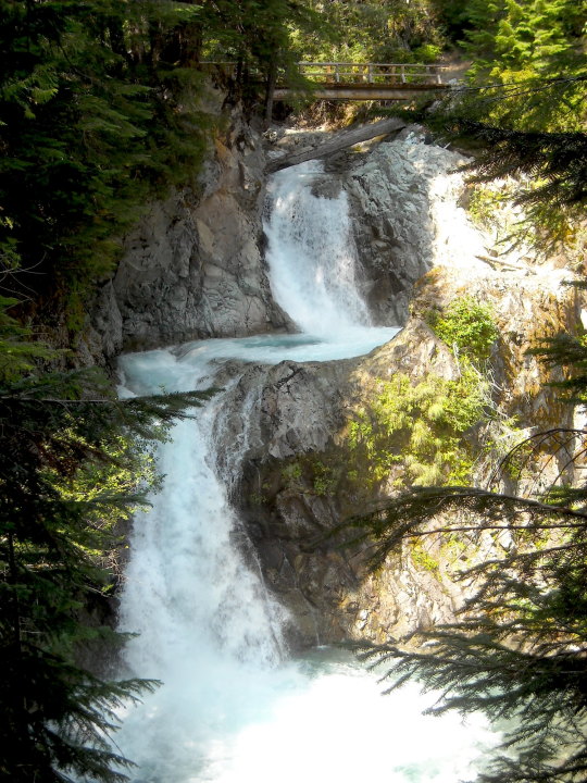
Also known as “plunge” waterfalls, a punchbowl waterfall drops into a pool shaped like a punchbowl. At Mount Rainier, an impressive two-tiered example of this is Ohanapecosh Falls, which drops nearly 70 feet in total. This waterfall can be viewed during the summer by following the Eastside Trail north of the Grove of the Patriarchs. Have you visited this waterfall in the past or have examples of other punchbowl waterfalls found in the park?
NPS/C. Roundtree Photo of Ohanapecosh Falls, 2012. ~kl
#Landscape Language#mount rainier national park#Ohanapecosh#Ohanapecosh Falls#Ohanapecosh River#Waterfall#Eastside Trail
88 notes
·
View notes
Photo
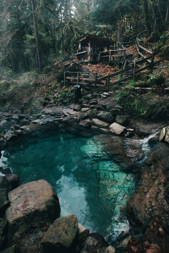
I think this is Terwilliger Hot Springs
Spring in Oregon.
I was there in the 90's. Spectacular then.
My favorite hotsprings of all time was Ohanapecosh Springs on the river of the same name. It was in My Rainier NP. A lithium salts hot spring flowed into a pool which had been created by indigenous first nation peoples and used I think for centuries by them. Two huge boulders served as dams and protection from the mid day sun though sunrise/ sunset were enjoyed and view while soaking in the Milky water feeding into the crystal clear river water with a green hue from the volcanic rocks lining the river bed. About a mile from the springs is a spectacular accessible waterfalls and hiking a couple of hours more takes you into The Grove of The Patriarchs which is/was a small stand of some of the oldest trees standing on the mountain which is still an active volcano and should it erupt Seattle will be never the same. The trees when I first met them did not have the plank walkways which when I was last there now protect the roots. Without the planks a few trees died. Last I heard the trail was closed. The hotsprings was destroyed by the National Park Service after a failed court effort to protect them. The Park Service rationale was that the hot spring pool was not a naturally occuring feature and therefore could be taken apart. If you hike just a small ways outside of the Ohanapecosh campground and veer to the river when it says not to you can still find the lithium water flowing from the hill. It is a lovely, sad spot. I have been told the soaking pool actually was actually taken apart because of nude people using drugs and being lewd in a national park. I myself had the single best and most significant mushroom experience of my life there in 1983. Hope I did not contribute to the desecration of a holy space where many a vision quest happened. I soaked the springs at sunrise, meditated in the rocks of the water falls, hiked the gentle trail along creeks and the river, swam, hung out with the big trees till dusk, hiked back down in the dark with a small set of speakers at the top of my pack and an early generation Sony walkman streaming African drumming, an owl flew with me and sang a long the way for a while, I soaked again, meandered to my tent and motorcycled up the mountain the next day.
Of the nine major rivers in this region only the Ohanapecosh and Huckleberry are non Glacial.
We miss you Ohanapecosh.
Hot Springs
30K notes
·
View notes
Photo
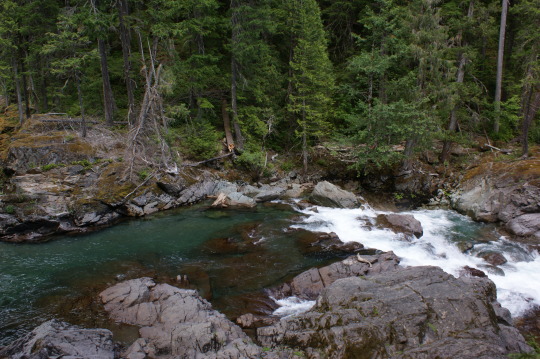
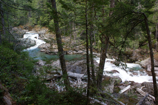
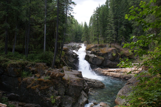
The Ohanapecosh River making it’s way through the old growth at Mount Rainier National Park.
#forest aesthetic#ohanapecosh river#mt. rainier national park#pnw#washington state#waterfalls#silver falls#national parks
2K notes
·
View notes
Photo
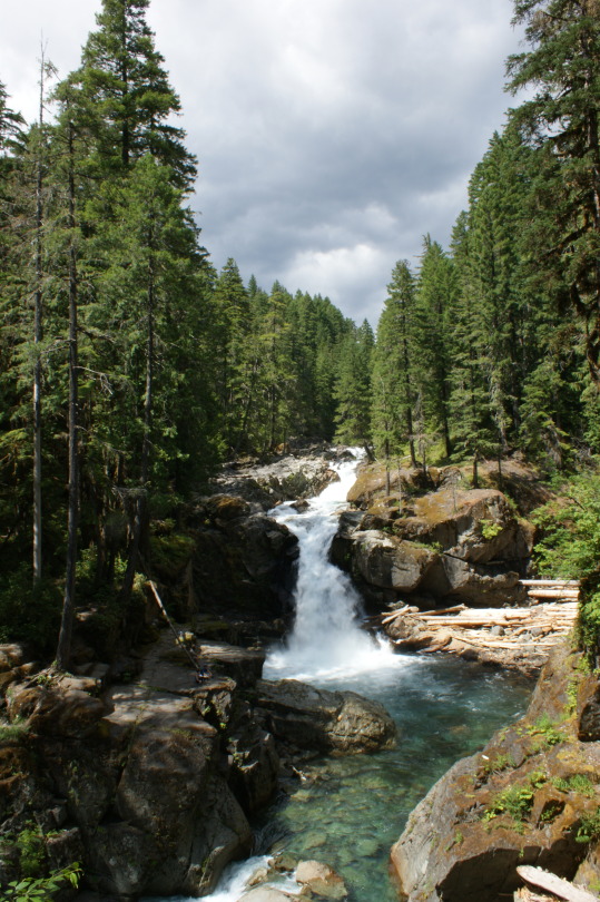
Silver Falls - M.R.N.P.
#waterfalls#waterfall wednesday#silver falls#mount rainier national park#ohanapecosh river#pacific northwest#pnw#washington state
364 notes
·
View notes
Video
From the archives Via Flickr: Silver Falls on the Ohanapecosh River at Mount Rainier National Park
2 notes
·
View notes
Video
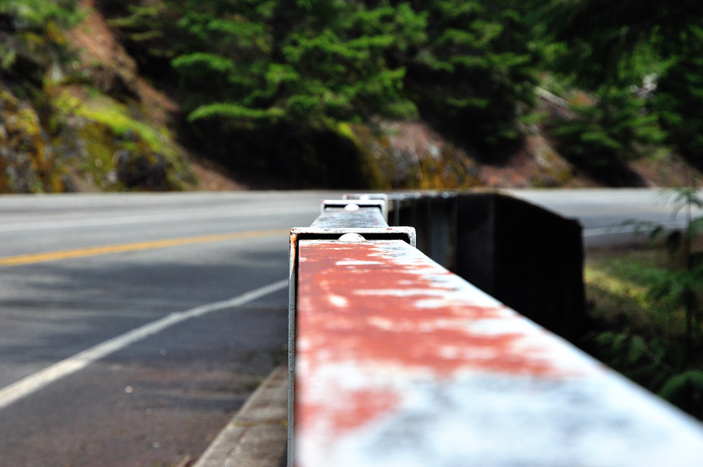
Rust on a Bridge by Mark Stevens Via Flickr: Captured while walking around over a bridge over the Ohanapecosh River in Mount Rainier National Park.
#Day 5-Mount Rainier NP#Falls Creek#Mount Rainier National Park#Nature#Nikon D90#On Bridge#project365#Rust#Silver Falls#Color Efex Pro#Bridge over Ohanapecosh River
0 notes
Photo

National park hike with all my best friends!!!! It’s been a while of planning for this nature hike!!! And we made it!! Next one is cabin camping am excited!!! Or another hike!!! #silverfalls #mtrainier #bffgoals #naturelovers (at Silver Falls, Ohanapecosh River) https://www.instagram.com/p/CCgjABJn3PAsM4s4ywEOZmDjV2Rq0pH6JuvevM0/?igshid=1e9x2uf4w4vid
21 notes
·
View notes
Photo
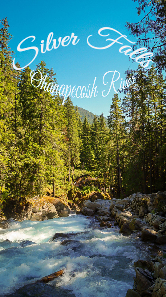
Silver Falls, Ohanapecosh River, Mount Rainier National Park, WA
#silver falls#ohanapecosh river#pnw#washington#mount rainier np#national park#washington state#pacific northwest#photography#nature#mountains#river#adventure#hiking#hike#trees#forest#stream#summer#my photos
7 notes
·
View notes
Photo

Out here right now with @selvedgeson and it's every bit as amazing as we expected. This is Silver Falls just outside of Packwood Washington. (at Ohanapecosh River) https://www.instagram.com/p/BxdiEjtlTKd/?igshid=10yybe0pj7pun
13 notes
·
View notes
Text
Weekend Trip to Mount Rainier National Park

Mount Rainier from the Skyline Trail
The Verdict:
Mount Rainier has one of our favorite hikes from any U.S. National Park -- the Skyline Trail! We highly recommend this park for this hike, and also, of course, for generally awesome views of stunning Mount Rainier.
We stayed near the southeast entrance of the Park (by Packwood), but the accommodations were overpriced for what they were. You could do the Skyline Trail and another sight or two at the park in a day trip from Seattle.
We visited in the last weekend of September and the weather was great -- if anything, a bit too hot and sunny one of the days, and pleasantly cool on the other (we managed to dodge rainy days). It seems like a generally nice time to visit.
Deciding between Mount Rainier and Olympic National Park? We loved Mount Rainier more (because of the Skyline Trail), but found accommodations more comfortable and better bang for your buck at Olympic (Port Angeles is really nice).
What to do

Ice and clouds along the Skyline Trail
The park has four main areas that, through our research, were recommended to visit: 1) Paradise, 2) Sunrise, 3) Ohanapecosh, 4) Carbon River [listed fourth because we didn't visit this one].
#1. Hike the Skyline Trail to Panorama Point (~6 miles, loop, ~1,900 ft elevation gain).
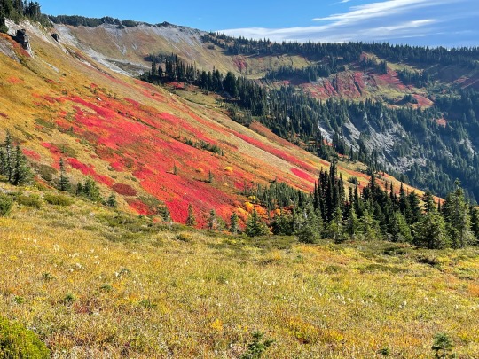
Wildflowers!
This hike starts from the Paradise area of the park and is absolutely stunning from start to finish. It is known both for its views of Mount Rainier and for the colorful wildflowers along the trail. It is the rare hike that is extraordinarily beautiful every step of the way, not just at certain points or peaks. We took a leisurely 3h 10m to complete this hike and loved every step of it. We read from AlllTrails reviews that many people saw wildlife (mountain goats, bears, marmots, pika) along the trail, but we did not see anything apart from squirrels. Still, if you can only do one thing at Mount Rainier National park, do this!!
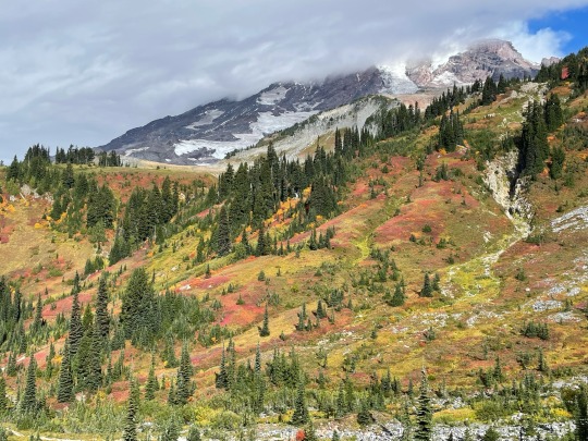
A few logistical tips:
What to wear: It was VERY windy and at times bitingly cold for much of the hike -- it was one of the rare hikes that we actually needed all of our layers (full sleeve UPF shirt + bubble jacket + windbreaker). We went on a beautiful day with a low in the mid-50s and a high of 70 degrees F.
Getting there: 1) Google mapping to "Skyline Trailhead" will cause you to overshoot the start of the hike and end up on a one-way road that will add 5-10 mins to your drive. The actual trailhead starts by a large visitor center & park lodge. 2) We drove from Packwood to the trailhead (~an hour) via Paradise Valley Road. The clouds were so low that we were literally driving through them for several miles, and visibility was terrible. We were lucky we hardly passed any other cars on the road. It was a bit of a scary drive.
Parking: The parking lot does seem to fill up. There were loads of spots when we arrived around 7:30 a.m., but it was full when we left around 11 a.m.
Toilets: There are toilets by the trailhead (plentiful, and decently clean when we visited) and by Panorama Point (we didn't check this one out, though).
Other Hikes: There are lots of hikes that start at Paradise and share parts of this trail. We didn't get a chance to try them, and we chose this hike based on Earthtrekkers' recommendation.
#2. Hike the Sourdough Ridge Trail & Fremont Fire Lookout Trail (~6 miles, out and back, ~1,200 ft elevation gain)
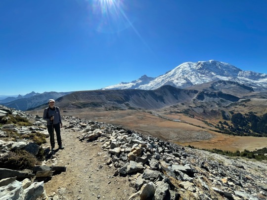
This is a highly recommended hike on many blogs and podcasts about Mount Rainier National Park. It is located in the Sunrise area (east), is considered moderately difficult, and has good views of Mount Rainier. It took us 2.5 hours in total, including a 20 minute lunch break at the top. We thought the hike was nice, but to be honest it didn't knock our socks off. Probably because we are spoiled from all of the beautiful hikes we have gotten to do this year.

#3. Hike in the forest at Grove of the Patriarchs (1.5 miles, out and back, easy) and Silver Falls (depending on where you start, 1-3.4 miles, out and back or a loop, easy to moderate)
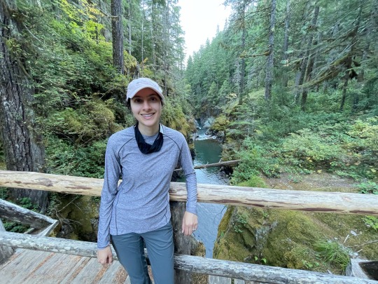
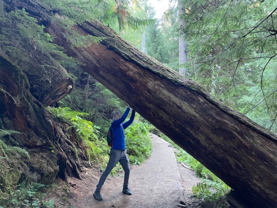
After a very hot, sunny afternoon hike to the Fremont Fire Lookout, we were glad to walk in the shaded Grove of Patriarchs in the Ohanapecosh area of the park (southeast). This is a beautiful and peaceful hike amongst massively tall trees; it reminded us a bit of walking in the Hoh Rainforest at Olympic National Park. There is a lovely swinging bridge that can be fun to walk across. However, since the hike is easy, it gets very crowded, especially with families with smal children. It does not have views of Mount Rainier, so while it is nice, we would not prioritize it if strapped for time.

Literally just across the streets from the Grove of Patriarchs trailhead, you can go to see Silver Fall, a waterfall amidst striking blue-green waters. We have a fairly high bar for waterfalls and thought this one was very pretty. If you start the trail from opposite Grove of Patriarchs, it's just a 1-mile out-and-back, fairly inclined walk to the waterfalls (0.5 mi each way). If you want a longer walk in the woods -- which we didn't, since we had just done that at Grove of Patriarchs -- it seemed like you could start the hike somewhere else and walk a ~3-mile loop with the waterfall as a stop along it.

#4. Tolmie Peak Fire Lookout (~5.6 miles, moderate)
This hike starts from a lake in the Carbon River area of the park (north). It is said to have very nice views of Mount Rainier and is highly touted by Earthtrekkers. That said, it is a pretty long drive to get there -- it would have added 2.5 hours to our drive from Paradise to south Seattle -- so we did not try it. We did read that it requires driving ~11 miles down an uncomfortable unpaved road.
Itinerary
Since we started from Seattle, we drove around the park in a clockwise loop: Seattle > Sunrise (east side of the park) > Ohanapecosh (southeast side) > Packwood [overnight by Ohanapecosh] > Paradise (south side) > Ashford [town by southwest side] > back up to Seattle along the west side of the park.
Where to stay + eat:
We stayed at the Cowlitz River Lodge in Packwood, as it was very close to Grove of Patriarchs/Silver Falls (~15 min drive) and Paradise (~50-60 min). The lodge was adequate but overpriced for what it was, and nowhere near as nice as our similarly priced hotel in Port Angeles (by Olympic National Park).
There was not a lot going on in the town: there were very few food options, but we really enjoyed White Pass Taqueria + Taproom, the Mexican restaurant in town . Their vegetarian burrito with butternut squash was amazing, and they had tons of outdoor seating.
0 notes
Text


Landscape Language
Whitewater (noun) – turbulent water
Spring is a great season for viewing whitewater. Snowmelt raises river levels and waterfalls abound. Silver Falls near Ohanapecosh is a dramatic example, with turbulent whitewater roaring over 60 feet down into a rocky amphitheater. Have you viewed this or other Mount Rainier waterfalls in spring?
NPS Photos of Silver Falls, 6/10/13. ~kl
42 notes
·
View notes
Photo
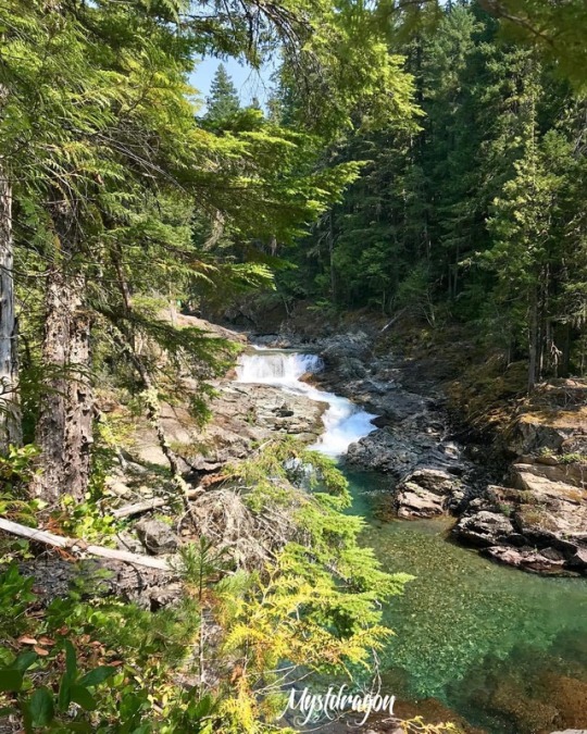
If you look closely there’s a hint of fall in this picture. #ohanapecosh #pnw #river #bluesky #getoutdoors #mtrainiernationalpark https://www.instagram.com/p/BmpbxRZn1rK/?utm_source=ig_tumblr_share&igshid=1x3ksxjm2x1os
1 note
·
View note
Photo

Silver Falls at Ohanapecosh Rainier National Park, USA
42 notes
·
View notes
Photo

Unplanned, spontaneous moments are always the best memories for me. @brian_bonham and I headed out on a little hike a few weeks ago from our campground in Mount Rainier National Park and had no idea that the new-to-us Silver Falls would be this lovely. It was the best surprise. ______________________________________________________ #nature_perfection #travelstoke #instagood #womenwhoexplore #wanderlust #pnw #vsco #travelstoke #longexposure #explore #exploremore #nikonnofilter #throughthepines #pnwonderland #pnwcollective #campingvibes #untoldvisuals #tentree #thegreat_pnw #getoutside #wanderlust #optoutside #washington #pnw_compass #wildernessculture #waterfall #pnwhikes #washingtonexplored #water_brilliance (at Silver Falls, Ohanapecosh River)
#pnwcollective#tentree#optoutside#campingvibes#water_brilliance#wildernessculture#longexposure#wanderlust#explore#exploremore#womenwhoexplore#throughthepines#getoutside#instagood#washington#pnw_compass#thegreat_pnw#nikonnofilter#pnwhikes#vsco#waterfall#travelstoke#nature_perfection#untoldvisuals#washingtonexplored#pnw#pnwonderland
2 notes
·
View notes
Photo

Along the Ohanapecosh River - Silver Falls
#watefall#silver falls#ohanapecosh#wild rivers#mt. rainier national park#washington state#pacific northwest#pnw#pnwonderland#upperleftusa#hiking life
294 notes
·
View notes
Photo

Its Visit National Park Wednesday. Today we have Mount Rainier National Park. Located in central Washington state. It has an active volcano, glaciers, meadows, six rivers and diverse wildlife. Entrance is $25 per vehicle. -Best time to visit: the park is open year round but road closures during the winter limits access. So visit during spring, summer and fall. -Best hikes: wonderland trail 83 miles, Spray park 7 miles and Naches peak loop 4 miles. -Camping: for the most part the campsites are fist come first serve. The exceptions are Cougar rock and Ohanapecosh. The average is 20$ per night. #compassandflask #thegreatoutdoors #gentlemenofadventure #vnpw #mountrenier #nationalpark #camping #hiking
1 note
·
View note

