#Navajo Loop Trail
Explore tagged Tumblr posts
Text

Fabulous Hoodoos, On The Navajo Loop Trail, Brice Canyon National Park, Dixie National Forest, Utah, USA, 31 July 2024.😎
#original photography on tumblr#utahphotographer#snapshot#phtotographers on tumblr#landscape#hiking#wanderlust#landscape photography#hikingphotography#wanderer#dramatic landscape#landscapephotography#mountainlandscape#mountainous#hikingtrails#hiking photography#hikingutah#hikingtrip#hikingtrail#backpacker#backpacking#usa#utahmountains#national forest#nationalpark#travelphotography#hikingaddict#hikingadventures#redrocks#dramaticskies
58 notes
·
View notes
Note
top 5 hiking trails !
OKAY SO
I can't rank these!! But these are maybe 5 of my most beloved.
Queen's Garden/Navajo Loop in Bryce Canyon NP
Geology 10/10. You can actually wander through the hoodoos with this trail. I recommend taking the switchbacks at the end rather than starting there because at least your ascent will be slightly more gentle and predictable that way!
Deer Mountain, Rocky Mountain NP
Probably the most rewarding hike I've done. I'm really proud of myself for it. 1400 feet of elevation on a 90ºF day was no joke, but the views were so worth it. And now I can say I've climbed a mountain :)
Nymph/Dream/Emerald/Haiyaha lakes, RMNP
Okay I've done a few iterations of these trails now over the years and frankly the way up to Dream Lake is the best. Photo under the cut. Don't do this during spring melt because it SUCKSSSSSSS but when it's either solid snow or fully melted, well, I love you trail. Take crampons.
Meadow Run/Great Gorge/GAP, Ohiopyle State Park
I can't pick just one trail here but I'm lumping them because you can hike them all sequentially. Cascades and natural water slides and waterfalls and PA's loveliest whitewater. Even better in the winter when there are almost no people around, the mountain laurels are still green, everything is covered in thick ice, and crampons let you prance around like an elf.
Moraine and Glacier Loop, Moraine State Park
Another favorite state park back home. This trail especially in the late spring is just the best. You get lakeside, you get rocky switchbacks, you get ridgeline views, you get wildflowers. Plus I saw a really cool bone here once.

hi on the way up to dream lake

icy cucumber falls ohiopyle beloved

bryce canyon bucket list hike for real!!!! would love to go back here someday

deer mountain summit !
9 notes
·
View notes
Photo

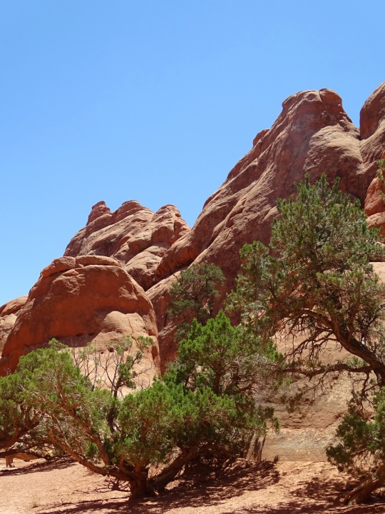

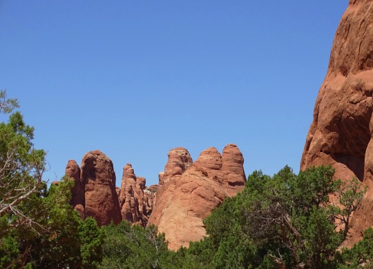
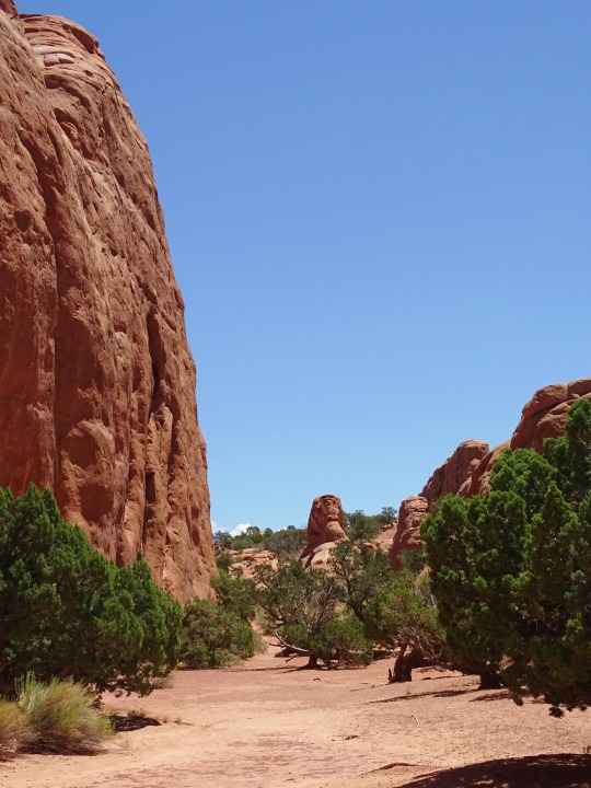

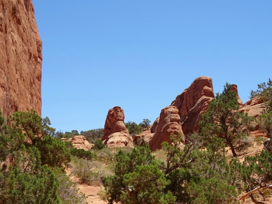
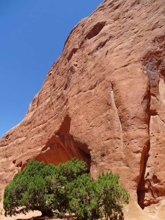
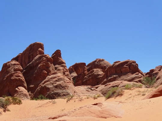

Devils Garden, Arches National Park (No. 2)
In the early 1920s, an immigrant prospector from Hungary named Alexander Ringhoffer came across the Klondike Bluffs, a similar area with fins and arches to the west of Salt Valley, which he named Devil's Garden. Ringhoffer contacted officials at the Denver and Rio Grande Western Railroad to determine whether the land could become a tourist attraction. The railroad company realized the lucrative potential of the area and contacted the National Park Service to consider making it a national monument. President Herbert Hoover signed an executive order on April 12, 1929 that created Arches National Monument. The monument originally consisted of two parts: the Windows and Devils Garden, with the latter name being taken from Ringhoffer's name for the Klondike Bluffs, an area not initially included in the park. Arches remained a national monument until 1971 when Congress passed a bill that re-designated it as a national park.
The Devils Garden trailhead and campground are located 18 mi (29 km) from the park's entrance station at the end of the main park road. The trail through the Devils Garden, including the primitive loop section and spurs, has a total length of 7.2 mi (11.6 km). The primary trail to Landscape Arch is a graded gravel path, while the primitive loop trail, which begins and ends at Landscape Arch, is more challenging with steep, sloping surfaces and close proximity to drop-offs. Landscape Arch, with the longest span of any natural arch in North America, is reached after a 0.8 mi (1.3 km) outbound hike, while Tunnel Arch and Pine Tree Arch can be seen on short spur trails located along the trail to Landscape Arch. Several other arches, including Partition, Navajo, Double O, and Private Arch, as well as the Dark Angel monolith and Fin Canyon, are accessed via the primitive loop trail and its spurs. Wall Arch, before its collapse in 2008, was also located in Devils Garden just north of Landscape Arch.
Source: Wikipedia
#Devils Garden#Arches National Park#flora#red rock#rock formation#cliff#nature#bush#original photography#summer 2022#travel#vacation#USA#Utah#Western USA#geology#desert#landscape#countryside#landmark#tourist attraction#blue skin#trail#hiking#small tree#Grand County#Colorado Plateau
10 notes
·
View notes
Text
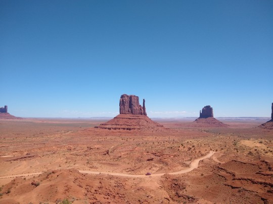
On his way to the Grand Canyon, Kermit made a small detour to Monument Valley! The valley is run by the Navajo, and while there aren't many hiking trails, there was a long scenic drive through the monuments.
Kermit did a short four mile hike around one of the monuments. Because it was going to quickly heat up in the valley, no hiking was allowed after 11 AM. Kermit was the only one out on the trail, and while it was hot, the valley had a nice breeze which kept him cool.
The trail had lots of signs identifying what different plants were. He remembered a few from his time in Canyon De Chelly--ones used as medicine, or used to make rope.
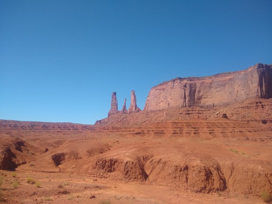
After his hike he drove the scenic loop. The road was very rough but the views were beautiful. He stopped at Code Talker point where an emaciated res dog was pitifully standing near people's cars. Kermit poured a little water into a dish for him but he didn't seem to want it. Then Kermit dug out a few scraps of food, which the dog eagerly gobbled up.

On the drive back, Kermit passed a roadside stand where some Navajo women were selling jewelry (very common in most of the areas Kermit had traveled). Kermit chatted with them a bit--all the vendors were related, each table was jewelry made my a different family member. Mother, daughter, grandmother, etc.
They asked about Kermit's travels. When he told them about what had happened to his car, the woman said someone must be wishing ill on him, and that she could sense Kermit had bad luck or bad vibes! She told him a few things he could do to try to fix his bad luck. Some involved dried herbs, but she also said arrowheads generally bring good luck.
With two separate Navajo hundreds of miles apart telling Kermit in a three day span that he was being cursed/had bad vibes, Kermit found an arrowhead he liked and hung it from his rearview mirror.
The arrowhead necklace was made by the woman's grandmother, from a rock taken from monument valley. The cord was made from deer sinew, which was waxed.
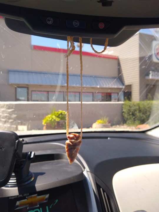
So far, Kermit is happy to report that the arrowhead seems to be working!
6 notes
·
View notes
Text
Livin’ the Lemberos Life
Day 7, Thursday - Bryce & Moab
When we woke up we threw our stuff in the car and headed back to Bryce, straight to the Queen’s/Navajo Combination Loop. It was a nice little morning hike through the canyon and helped us get some steps in before the long drive back to Moab.We had to stop and charge again at Green River but it was worth it to have a full battery for Moab.

This time, we got back to Moab early enough to find a legit campsite. First, we went to check out some campsites along the Colorado River but due to all the recent rain, those sites were closed. We ended up on a scary dirt road on the edge of a canyon before we both decided to turn around. I was very glad that Aidan was driving instead of me.
I wanted to go back to Sand Flats Recreation Area for a site but Aidan was doubtful. We were in luck! It was early enough to grab a great site. After setting up camp, we went straight into town for an early dinner. Little did Aidan know, Irene would be meeting us there!
Irene and her family were in Moab for a vacation and I decided to keep it a secret. I sent Irene my location and she tracked us down to a gift shop to reveal the surprise. The three of us caught up and ate dinner at the Food Truck Park which was right next to Irene's hotel. She told us she had a pool and said we should've brought our swimsuits. Good thing we had the car with all of our stuff in it - benefits of car camping!

The three of us went for a swim and then got to take a shower. What a treat! When Irene's family got back from their dinner, they invited us to join them on their evening of stargazing in Arches. Somehow their car was big enough to fit all 8 of us! While it was a bit cloudy for good stargazing, we had a great time joining the Lemberos family.

Day 8, Friday - Canyonlands
As usual, we started the day by going to the Visitor's Center, this time at Canyonlands. There, they recommended a bunch of shorter walks. First up was, would you believe it, another arch trail - Mesa Arch. This trail gave us an expansive view of the canyon and another quality arch pic.

Next, we did the Upheaval Dome trail which reveals a ~mysterious~ dome shape in the canyon. There are two theories about how it formed - salt and a meteor. Aidan and I are on team meteor.
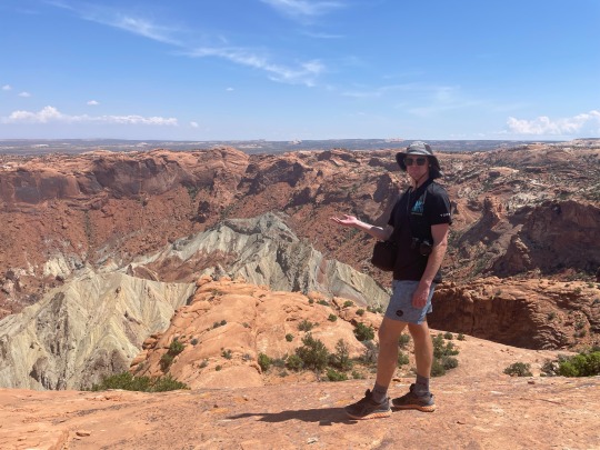
Whale Rock was next, although I don't think we followed the trail. Instead, we walked out as far as we could until we reached the edge of the canyon. There, we saw white throated swifts dive bombing the canyon. The longer we stayed, the closer they got to us. They flew so fast you could hear them soaring through the air. Something about their speed and proximity while sitting on the edge of the canyon was a little unnerving; however, it was such a special and memorable experience.
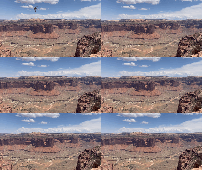
We had a picnic bench lunch and then went to the Grand View Point Overlook which gave us 360 degree views of the canyon.

We grabbed some quick tacos at the food trucks before heading back to the Lemberos' hotel for a swim - this time, with all the kids. We caught up about our days and hung out until dark. Aidan and I were looking forward to building a fire and making s'mores back at camp but unfortunately it was extremely windy so we had to take shelter in the tent and eat cold s'mores - if you can even call them that. I got a good whole body exfoliation that night from the sand whipping into our tent.

Day 9, Saturday - Arches & Drive to Denver
On Saturday morning Aidan and I went back to Arches to see the Windows. We were supposed to meet the Lemberos' there but we lost service. Aidan and I began the walk and went off to the primitive trail where Chris found us! We got to do the rest of the walk with the whole group and do a few photoshoots. Don't we blend in well with our adopted fam??
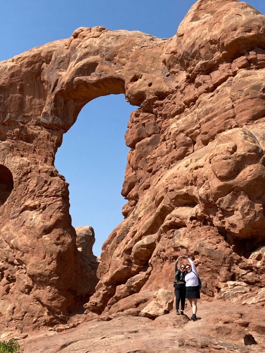

Sadly we had to head back to Denver, but at least we had a concert to look forward to on Sunday. Aidan had a great time at his first Red Rocks show! Eventually, we had to say goodbye. Stay tuned for when I go visit Aidan in London - hopefully next year and hopefully with Irene!
2 notes
·
View notes
Text
0 notes
Text
6 octobre-Bryce Canyon
Magnifique journée pour découvrir l'amphithéâtre de Bryce Canyon et ses innombrables Hoodoos.
Nous avons fait une randonnée d'une douzaine de km qui nous a fait descendre dans le canyon, un dénivelé d'environ 600 mètres. On avait envie de prendre une photo à chaque détour du sentier!
Queen's garden, Peek-a-boo-loop et Navajo Trails:


Nous sommes ressortis ce soir après le coucher du soleil pour admirer le ciel étoilé; magnifique! Il n'y a aucune grosse ville dans les environs donc pas de pollution lumineuse et une multitude d'étoiles.

1 note
·
View note
Text
Bryce Canyon National Park: Exploring the Enchanting Hoodoos and Vistas
Bryce Canyon National Park, located in southern Utah, is a mesmerizing natural wonder that showcases a unique and otherworldly landscape. With its intricate rock formations called hoodoos, vast amphitheaters, and breathtaking vistas, Bryce Canyon offers a truly unforgettable experience for visitors.
The park is renowned for its incredible hiking trails that take you through a maze of towering hoodoos and scenic viewpoints. The Rim Trail provides a leisurely walk along the edge of the canyon, offering stunning panoramic views. For a more immersive experience, the Navajo Loop Trail and Queen's Garden Trail descend into the heart of the hoodoos, allowing you to marvel at their intricate details up close.
Sunrise and sunset are particularly magical at Bryce Canyon, as the warm hues of the sun illuminate the hoodoos, creating a surreal and ethereal atmosphere. The park's stargazing opportunities are also exceptional, with minimal light pollution and clear night skies that reveal a vast array of stars.
In addition to hiking, visitors can enjoy horseback riding, camping, and scenic drives that provide access to breathtaking viewpoints such as Inspiration Point and Bryce Point. The park also hosts ranger-led programs and educational activities that provide insights into the park's geology, flora, and fauna.
Bryce Canyon National Park is a true testament to the beauty and diversity of nature. Its striking rock formations and awe-inspiring landscapes make it a must-visit destination for outdoor enthusiasts, photographers, and anyone seeking a profound connection with the natural world.
0 notes
Video
Lights and Shadows in Bryce Canyon National Park by Mark Stevens Via Flickr: While at an overlook to the switchbacks down along the Navajo Loop in Bryce Canyon National Park. The view is looking to the south and down to the Wall Street area along the trail. I captured this using the in-camera HDR setting with my Nikon D850 SLR camera. I later processed this using DxO PhotoLab 5 making adjustments to contrast, saturation and brightness for the final image.
#Aquarius Plateau#Azimuth 190#Blue Skies#Bryce Amphitheater#Bryce Canyon#Bryce Canyon National Park#Canyonlands#Claron Formation#Colorado Plateau#Day 5#Desert Landscape#Desert Mountain Landscape#DxO PhotoLab 5 Edited#Eastern Edge of the Paunsaugunt Plateau#Eroded Formations#Grottos#HDR#High Desert#Hiking Trail#Hoodoos#Horseshoe-shaped Amphitheater#In Camera HDR#Intermountain West#Landscape#Landscape - Scenery#Layers of Rock#Looking South#Nature#Nature Trail#Nikon D850
0 notes
Text
9. Samstag 18. Mai bis Montag 20. Mai 2024
Am Samstag starten wir schon in aller Frühe, um am Shuttle Parkplatz, der vor dem Eingang zum Bryce Canyon liegt, noch parken zu können. Wir sind rechtzeitig dran, der Platz ist so früh kaum belegt.
Es ist noch relativ kalt, als wir mit dem Bus zum Startpunkt des Navajo Loop and Queens Garden Trail fahren, um hier die etwas über fünf Kilometer lange Strecke zu wandern.
Auf dem Navajo steigen wir auf steilen, in den Fels gehauenen Serpentinen die Wall Street hinunter, wandern bis zu Queens Garden und dann weiter hinauf bis zum Sunset Point, an dem wir den Shuttle Bus zurück nehmen. Die Luft hat sich im Canyon sehr schnell erwärmt und auf der Höhe erwarten uns sommerliche Temperaturen. Auf der Strecke befinden sich etliche Wanderer, aber mengenmäßig überhaupt nicht zu vergleichen mit dem Gedränge im Zion.
Der Bryce Canyon übertrifft optisch alles bisher Gesehene. Hinter jeder Kurve des Wanderweges erwarten uns neue spektakuläre Aussichten, atemberaubende Felsformationen und Rottöne in allen Schattierungen. Leider können wir die sensationellen Anblicke beim Fotografieren nur bedingt einfangen.
In der Nähe des Shuttle Station gibt es BLM Plätze, die wir nach unserer Rückkehr mit Balou anfahren. Es ist erst früher Nachmittag und wir ergattern einen der schönen Übernachtungsplätze mitten im Wald.
Als wir sonntagfrüh zum Parkplatz starten, ist nach einer kalten Nacht das Dach unseres Autos gefroren. Wir kommen wieder zeitig mit dem Shuttle Bus weg und fahren bis zum Peekaboo Loop Trail, der wohl die spektakulärste Wandermöglichkeit durch den Bryce Canyon bietet.
Die atemberaubenden, majestätischen Anblicke in Kombination mit der Stille der Natur sind einfach mal wieder unfassbar.
Der Weg führt eine Meile lang stetig abwärts, dann beginnt der Loop, den man in beide Richtungen begehen kann. Die Wanderstrecke ist relativ anspruchsvoll, weil es ständig steil bergauf oder bergab geht, und die dünne Luft in über 2300 Metern Höhe zehrt zudem etwas an der Kondition. Vermutlich deshalb ist die Menge der Wanderer hier relativ überschaubar. Aber ohne Fleiß kein Bryce, zumindest keinen „Peekaboo“.
Wir begegnen einer großen Gruppe von Reitern, unterwegs gibt es eine kleine Koppel mit einer Pferdetränke. Die Reiter sind vermutlich bequemer unterwegs als wir, aber ob die Strecke hier sehr pferdefreundlich ist, wagen wir zu bezweifeln.
Zumindest ich bin ziemlich geschafft nach dieser mehr als acht Kilometer langen Wanderung und bin froh, nach der Meile des letzten Aufstiegs wieder im Shuttle zu sitzen.
Am Nachmittag fahren wir noch ca. 80 Kilometer weiter nach „Escalante“ und suchen hier in der Nähe einen Platz am „Smoky Mountain“. Aber der Wind ist hier überall so stark, dass wir in der Hitze des Nachmittags keine Fester öffnen können, ohne dass sofort alles zentimeterdick eingestaubt ist.
Deshalb fahren wir noch weiter bis zur Hole in the Rock Road, einer schlecht befahrbaren Straße, die zu weiteren Sehenswürdigkeiten führt.
Nach mehreren Versuchen finden wir hier einen etwas windgeschützten Platz zwischen Bäumen, auf dem wir die Nacht verbringen.
Am Montag entwickelt sich der starke Wind zum Orkan, sodass an irgendwelche Unternehmungen außerhalb des Autos nicht zu denken ist.

0 notes
Text

Hoodoos, Navajo Loop Trail Head, Brice Canyon National Park, Dixie National Forest, Southern Utah, USA, 31 July 2024.😎
#original photography on tumblr#utahphotographer#snapshot#phtotographers on tumblr#landscape#hiking#wanderlust#landscape photography#hikingphotography#wanderer#mountainlandscape#mountainous#mountainphotography#dramatic landscape#mountain landscape#landscapephotography#hikingadventures#hikingaddict#hiking photography#hikingtrip#hikingtrails#hiking trail#travelphotography#hikingutah#outdoorphotography#naturephotography#mountians#usa#utahphotography#skyline
33 notes
·
View notes
Note
top 5 hiking spots
💚💚 Ok in no particular order
Moraine State Park - Glacier Ridge or Moraine/Glacier Loop. Love the switchbacks, and once you finish the climb, getting to walk along the top of a ridge 🥰

Rocky Mountain National Park - Nymph, Dream, Emerald, and Haiyaha Lakes; Deer Mountain. Hoping my ankles can make it at least to Emerald this year.

Bryce Canyon NP - Queen’s Garden/Navajo Loop. Unreal place

Ohiopyle State Park, any trail, but I’m partial to the Cascades and the Great Gorge loop. So many good rocks and waterfalls and fossils and plants. One of my favorite places on earth and I miss it so much

Arches NP - Delicate Arch trail. Hands down one of the most fun hikes ever. Leaving before sunrise and getting there as the sun peeks out. Also the rock hill that kicked my ass. But goddamn

8 notes
·
View notes
Photo


Devils Garden, Arches National Park (No. 1)
Devils Garden is an area of Arches National Park, located near Moab, Utah, United States, that features a series of rock fins and arches formed by erosion.
The Devils Garden Trail, including more primitive sections and spurs, meanders through the area for 7.2 mi (11.6 km). The trailhead leads directly to Landscape Arch after a 0.8 mi (1.3 km) outbound hike, while Tunnel Arch and Pine Tree Arch can be seen on spur trails on the way to Landscape Arch.[3] Several other arches, including Partition, Navajo, Double O, and Private Arch, as well as the Dark Angel monolith and Fin Canyon, are accessed via the primitive loop trail and its spurs.
Wall Arch, before its collapse in 2008, was also located in Devils Garden just north of Landscape Arch. Black Arch is visible as a dark outline from the primitive trail and can be approached via an unmarked sidetrack.
The trailhead for Devils Garden is located at the end of the main park road. A campground and amphitheater are also available at the site.
Source: Wikipedia
#Devils Garden#Arches National Park#Hopi chipmunk#wildlife#flora#fauna#Western USA#Colorado Plateau#animal#bush#desert#original photography#landmark#tourist attraction#summer 2022#vacation#travel#landscape#countryside#red rock#rock formation#geology#hiking#blue sky#clouds#Skyline Arch Trailhead#Utah#Grand County
2 notes
·
View notes
Text
Weekend in Bryce Canyon National Park
Overview
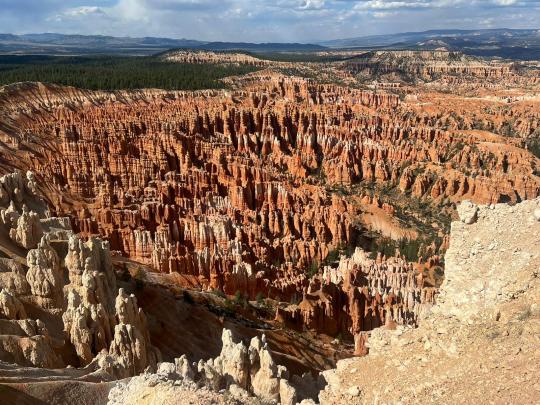
A classic view of Bryce Canyon from the Rim Trail
Bryce Canyon was epic. The main hikes descend into the canyon, which felt similar to the hikes at Grand Canyon, although the scenery looks different given Bryce’s hoodoos. I would rank this among the most stunning national parks we visited, alongside places like Grand Canyon, Grand Teton, Big Bend, and Mount Rainier. There are also some nice places to visit nearby – we enjoyed Willis Creek Slot Canyon (kind of a random hike, no official entrance or fees) and Kodachrome Basin State Park (although hiking there in the baking sun at mid-day was tough).
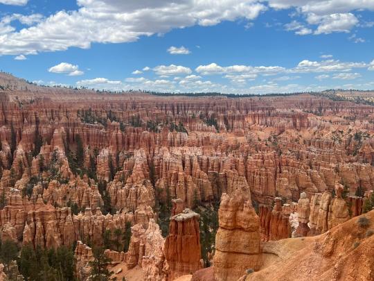
More classic views of the national park
We visited in mid-May, and it was already very hot and sunny during the daytime, though still cold at night. I think going earlier in the season would be more pleasant for hiking (though not too early, given potentially icy conditions/road closures). We booked our trip about ~6 weeks ahead of time and all of the decent-seeming hotels and nearby campgrounds were fully booked out, so we glamped at Under Canvas, which was totally fine (unique and luxurious in some ways and a downgrade from a regular hotel in others). That said, the park didn’t feel very crowded – despite getting a late start (~10am arrival), there wasn’t much of a line to get in, which we observed even around noon (when we accidentally exited the park), and we didn’t have difficulty finding parking throughout the day.
Bryce Canyon Hikes
We spent Friday visiting the national park. Bryce has quite a few options for hikes, but the big ones that caught our attention were the Queen’s Head/Navajo Loop Trail (most popular hike in the park), Peekaboo Trail (much less crowded and very nice), the Fairyland Trail (8 miles, we wanted to try it out but didn’t have time), and the Rim Trail (like Grand Canyon’s Rim Trail, this one is relatively flat and goes around the rim of the canyon). The Rim Trail connects several pretty lookout points such as Sunrise Point, Sunset Point, Bryce Point, and Inspiration Point. Most of these lookout points also have hikes that start from them.
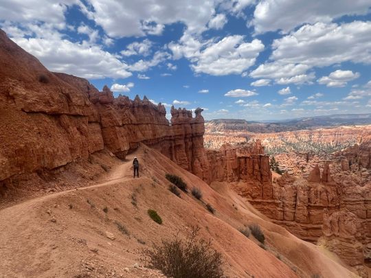
One of the trails. Probably Peekaboo given how empty it is!
For Queen’s Head/Navajo Loop, there are 2 ways to do the Navajo Loop portion – the “Wall Street” side or the “Two Bridges” side. We ended up trying both and thought the Wall Street section was much more interesting.

Navajo Loop - Two Bridges option (can you see the two rock "bridges"?)
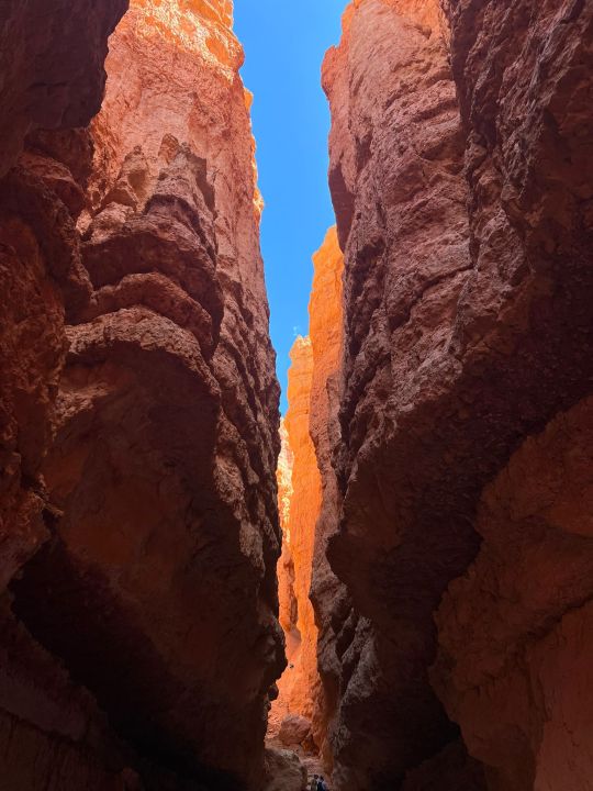
Navajo Loop - Wall Street option. The narrowness was very cool.
Other Nearby Hikes
We spent Saturday until mid-afternoon doing some nearby hikes, and then made the ~4 hour drive back to Vegas.
Willis Creek Slot Canyon was really cool. It’s about a 30 minute drive from Bryce Canyon and the walk is mostly flat with a shallow stream running through it. It seems like a fantastic option for people with kids or dogs.
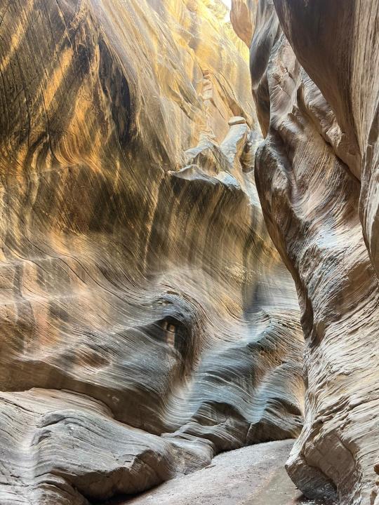
We arrived on Saturday at 9am and departed around 11am, and there was plenty of parking at both times. The last bit of the drive there was a little bumpy, but nowhere near a bad as we expected based on reading reviews. There is no fee to enter.

We managed to keep our feet mostly dry!
Kodachrome Basin State Park is also a ~30 min drive from Bryce Canyon and has several hikes, of which we tried two. We liked the relatively easy Panorama Trail (3 mile loop); it was well worth adding on the very scenic Panorama Point out-and-back (1 mile total). However, there was no shade at all and the desert sun was baking hot, even though the forecast said it was only 70 degrees out. The Grand Parade Trail, which was just across the street from the Panorama Trail and shares a parking lot, was nice but would not make the cut for me in this type of weather. The state park has a $10 daily fee per vehicle (credit cards accepted but it might be good to bring cash if you can, their card reader was temporarily down when we arrived).

View from the Panorama Trail
Food
Like most U.S. national parks, the vegetarian food options in the area were pretty sad. Subway is the best bet, and since they didn’t open on time when we were there, we picked up some basic takeaway breakfast items (yogurt, boiled eggs, a bagel) at Bryce Canyon Coffee Co. one of the days. The national park lodge seemed to have okay options (the black bean burger and quinoa salad were not terrible for lunch) and Under Canvas was also okay, though overpriced/small portions/light on vegetarian protein and potentially only available to guests (not sure about this). The best food we ate on this trip was Mixed Greens in St. George, Utah, an unexpectedly delicious and reasonably priced salads and bowls place in a strip mall about halfway between Las Vegas and Bryce Canyon. We were also happy to eat at Urth Caffe inside The Wynn/Encore in Las Vegas when we returned our Hertz car rental there.
Lodging
We stayed at Under Canvas, a luxury glamping site located a ~20 minute drive from the park entrance. It was in a very pretty area with cozy outdoor seating and many amenities (breakfast and dinner available for purchase onsite, hammocks, yoga mats, games, campfires and smores kits, etc.). The glamping tents had comfortable beds and sufficiently warm bedding for the cold nights, a shower with hot water, a sink, a normal toilet, a contraption for making a fire if desired, and Anker battery packs for charging devices overnight. There was no wifi or electricity (i.e., it wasn’t possible to use a hairdryer or laptop), and cell signal didn’t work for us onsite (so be sure to download offline maps for the park in advance!). The staff were all very nice and helpful. Apparently this is just the second season this site is open, and it generally felt pretty new and clean.
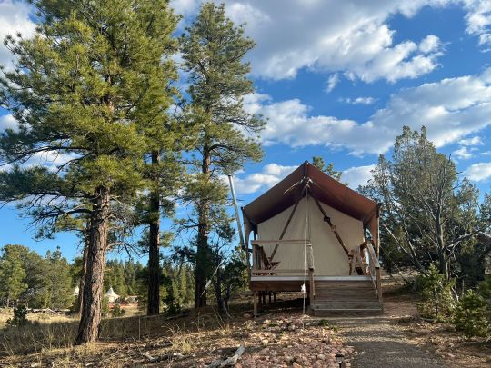
Glamping tent
Under Canvas was a unique experience, but given how expensive it was, I’d choose to stay at a regular hotel if I had the choice – it’s just a bit more convenient in terms of driving time to get to the park, electricity, staying warm overnight, etc., and likely at least a little bit less expensive. That said, if glamping were the only option, I’d totally stay here again – there were no issues and the chance to visit Bryce Canyon made it absolutely worth it.

View from the outdoor patio at Under Canvas
0 notes
Text
Sons (and Daughters) of Zion
Day 4, Monday - Zion
First thing in the morning we applied for the Angels Landing hiking permit and packed up the car to head to Zion. We hit a Walmart to charge and re-up on some groceries while Aidan made brekki in the parking lot. From there, we drove to another Walmart for more charge and a much improved trunk lunch thanks to cheese and quality tuna fish.
4+ hours later and we made it to Zion! We went straight to the Kolob Canyons visitors center where they recommended the Taylor Creek Trail which is a 4.9 mile hike with numerous river crossings.
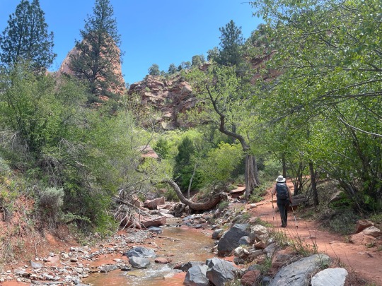
I loved the technicality of this hike and all of the flora that were thriving with the help of the creek. This is not what we expected to find in the desert. Even though Zion is an extremely popular park, we were pleasantly surprised by how quiet this gem of a trail was.
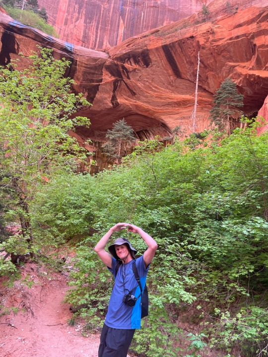
After the hike we ate a pretty disappointing dinner in town before heading to our glamping spot...or so we thought. We arrived at Zion Wildflower and the grounds were spectacular, I was eager to spend some time there. Unfortunately, our reservation was for a spot 40 minutes away, on the border of Utah and Arizona. Woops. We arrived late to our proper accommodation and went straight to sleep.
Day 5, Tuesday - Zion
On Tuesday morning we woke up early and headed to the main visitor's center at Zion. We didn't get the permit to hike Angel's Landing but we were able to hike Scout's Lookout which is the majority of the Angel's Landing hike just without the scary part. It was 1,115 ft elevation gain and 3.6 miles.
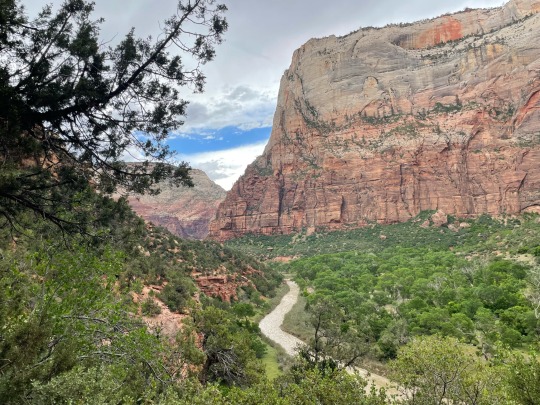
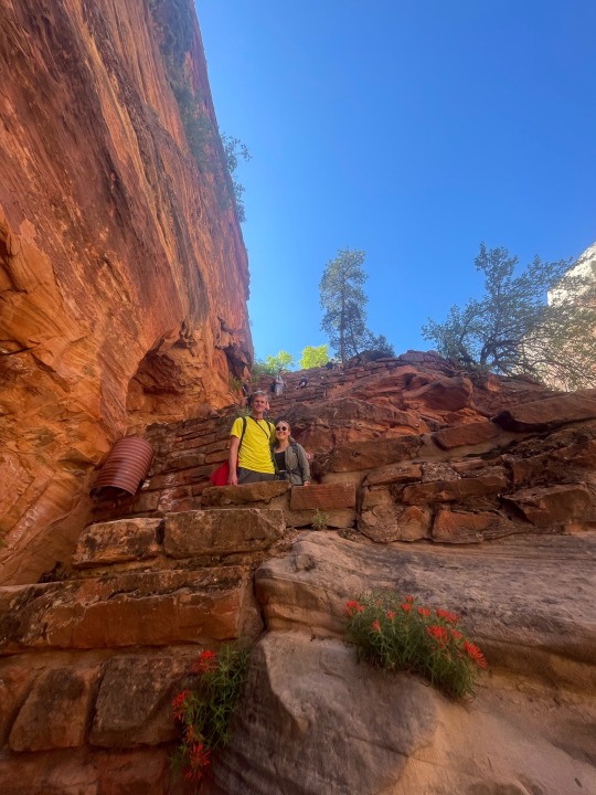
Luckily, we started the trail early enough for the majority of the ascent to be shaded. What more could I ask for? I enjoyed the climb and it was more than worth it for the panoramic views at the top. Being so high up gave me a lot of perspective on life and what’s important.
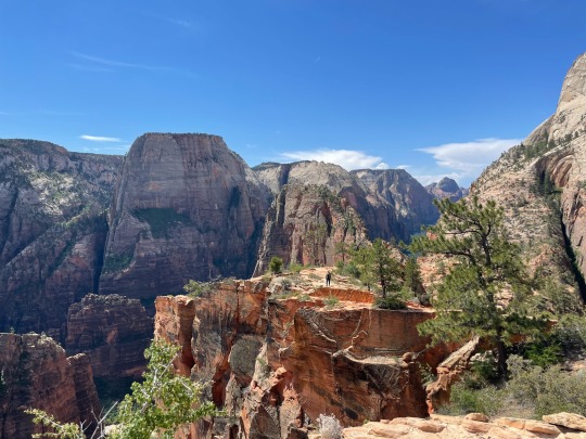
We did a bit of the West Rim Trail before heading down to eat lunch by the river. After a not long enough break, we went back up to hike the Emerald Pools Trail. The naming is iffy because I would call what I saw puddles rather than pools…
Our last hike of the day was the Riverside Walk which takes you up to the entrance of the Narrows. Unfortunately the Narrows was closed due to heavy water flow but the Riverside Walk allowed us to take a peak at the incredible views that the Narrows provides.
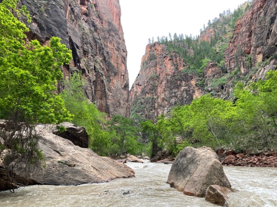
We got some Thai food on our way back to the campgrounds and actually had enough time left at camp to make a fire!

Day 6, Wednesday - Bryce
On Wednesday morning we drove straight to Bryce. At the visitors center they recommended two hikes for us to see most of the park - Queen’s/Navajo Combination Loop and the Peekaboo Loop Trail.
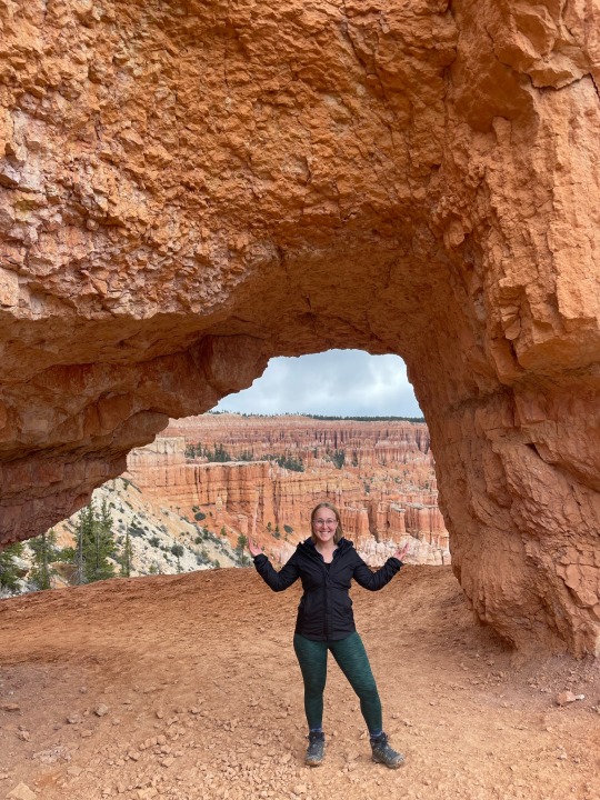
We had a quick lunch at a bench in the parking lot before getting a shuttle to the start of the Peakaboo Loop. The trail started us at the top of the canyon and then we quickly descended to the canyon floor. With the exception of all the horse poop it was a beautiful trail. I loved being able to wind my way through the hoodoos.
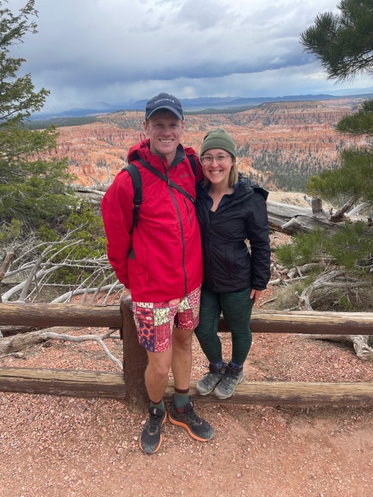
We finished the hike without getting rained on and went back to the cabin. For some reason Aidan wanted more exercise and went for a run before dinner ???
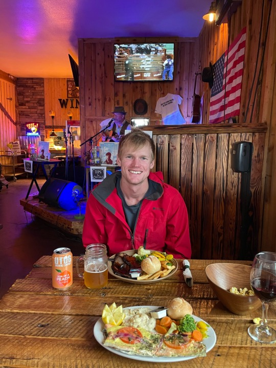
For dinner we walked about a block to Showdowns which was the perfect rustic country vibe, complete with live music! Aidan and I both had a few drinks and convinced ourselves to get last minute tickets to see Opiuo (a Kiwi!) at Red Rocks for when we got back!
2 notes
·
View notes
Text
#4 Navajo Loop and Queens Garden Trail
Location: Bryce Canyon, Utah National Park Distance: 2.9 Miles Hours of Operation: Open year round Terrain: Elevation 625 feet Fun Facts: It can be accessed from either the Sunrise or Sunset viewpoints. There is a free shuttle.
0 notes