#Montsec
Explore tagged Tumblr posts
Text

Rural street scene in Montsec, Lorraine region of France
French vintage postcard
#tarjeta#montsec#postkaart#sepia#historic#france#photo#postal#briefkaart#photography#street#vintage#ephemera#ansichtskarte#old#postcard#french#rural#postkarte#scene#carte postale
6 notes
·
View notes
Text


The natural wall of Finestres, La Franja.
These rocks are called Roques de la Vila ("the town's rocks") but many people call them "The Great Wall of Finestres". The eroded limestone is a completely natural occurrence, but it looks like a human-made or even giant-made wall. Taking advantage of it, Medieval inhabitants of the area built a little castle and a chapel dedicated to Saint Vincent between the two "walls".
Photos from Montsec de Aragón.
#finestres#viacamp i lliterà#la franja#natura#nature#geology#earth#travel#explore#wanderlust#landscape#fantasycore#geography#travel photography#europe#southern europe#medieval#middle ages
58 notes
·
View notes
Note
well, the views are definitely worth it!


What is your favorite indoors and outdoors activities during winter/holiday season? Do you have any tradition? How did it start?
i actually dont like going outside much during the winter bc of some medical problems, but we have a tradition of christmas day and/or st stephen's day (the 26th) going for a hike close to my village with my family, its one of my favorite things to do!
as for indoor activities, i cant say i have any special ones i do only in winter
#this is called the 'mar de boira' and its when youre above all the fog#its really cool bc sometimes you can see a campanario or just an entire town sticking out from it#i know i have more from other yrs but these are the ones i found from last yr. in the serra del montsec <3#(im gonna make it unrebloggable btw but u can use the replies if u want!!)
7 notes
·
View notes
Text

The Glade of the Armistice
Signs of history abound beneath the oak, beech, black cherry, and other hardwoods that blanket the Forest of Compiègne (Forêt de Compiègne) in northern France. Aerial lidar surveys have mapped hidden remnants of villas, kilns, mines, roads, and hundreds of other features of archaeological interest that date to Roman and Medieval times. More recently, the forest played a prominent role in World War I.
In November 1918, after the war had raged for four years, an increasingly exhausted and diminished German army was on the verge of collapse after being pushed back during the Meuse-Argonne offensive. At the 11th hour of the 11th day of the 11th month in 1918, German representatives crossed into Allied-held territory, traveled to the Forest of Compiègne, and signed an armistice with Allied military commanders that proved to be a crucial step in ending the war.
The meetings took place deep in the forest near the village of Rethondes in the personal railway car of Ferdinand Foch, the marshal of France and commander of Allied forces. That area, the Glade of the Armistice (Clairière de l’Armistice), is now the site of a French war memorial and museum in a clearing on the left bank of the Aisne. In the satellite image above, the clearing is visible near the confluence of the Aisne and Oise rivers near Compiégne. The image was acquired by the OLI (Operational Land Imager) on Landsat 8 on September 19, 2024.
American forces played a key role in several World War I battles in this region in 1918. The American Battle Monuments Commission maintains cemeteries and memorials honoring U.S. troops that fought at Belleau Wood, Bellicourt, Cantigny, Chatau-Thierry, Montsec, and Sommepy.
In 1919, U.S. President Woodrow Wilson declared November 11 as Armistice Day to honor World War I veterans. In 1938, an act of the U.S. Congress made Armistice Day a legal holiday. In 1954, after the conclusion of World War II and the Korean War, Congress amended the act and renamed the holiday Veterans Day to honor all military veterans of the United States Armed Forces.
NASA Earth Observatory image by Wanmei Liang, using Landsat data from the U.S. Geological Survey. Story by Adam Voiland.
0 notes
Text
Day 7 to Lunville
Yet another interesting day. The high point in and around St Mihiel salient. The Germans managed to hold a position in the woods above the town for 4 years. They were finally beaten in the fist battle of the war fought by 500,000 Americans in September 1918.
Going through the woods there are many signs of what happened over 100 years ago - trenches and bunkers. But the difference between the monuments to the fallen is stark. The German cemetery is hidden away in the forest . Each cross beats four names of Christian soldiers and each stone with a Star of David the names of four Jewish soldiers.
Meanwhile the American memorial at Montsec dominates the landscape.


0 notes
Text
Because the mention of Madrid (which is further south than me) made me go “wait what do you mean I could’ve seen it?!?”
From Catalan News:
Mountain areas such as Cerdanya county or the astronomical parks in Prades and Montsec ranges were some of the areas where some reddish lights were seen, but also near the coast, such as in Roses, or in the inland towns of Súria, Torelló or Viladrau, among others – the event was even registered in Sabadell, in the Barcelona metropolitan area, around midnight.
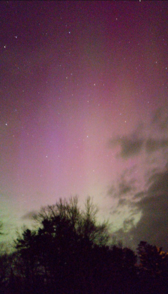
For those in the northern hemisphere, we're experiencing a solar storm right now (May 11, 2024) that's bringing auroras down into lower latitudes! If you're at or just below 40 degrees north or south (Madrid, Beijing, Boulder CO, NYC, Tasmania, the South Island, and Buenos Aires) , you have a good chance of visible auroras, especially if you don't have much light pollution in your northern or southern sky!
My area was clouded over, but I could tell something was happening for much of the night, because the thin spots in the high clouds looked significantly brighter than they should've at a moonless hour. I kept a window shade open to the north and kept things dark enough to watch the sky, and just around midnight I saw a gap in the clouds!
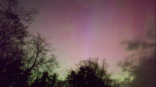
To the naked eye, this looked like a pale haze that moved and pulsed in odd ways. But with the help of my phone camera's pro mode and some ten second exposures braced against a solid surface, I managed to capture these! These are directly from the raw image files, rather than the post-processed ones phones often output by default, so this is an honest look at what the camera sensor picked up.
The solar storm is likely to continue over the weekend, so if you're at the right latitude, keep an eye out. I also recommend those without DSLR cameras getting familiar with how to take long exposures on their phone--mine has a dedicated "night mode", but that was not enough to get these pictures! If the aurora is pale, you need at least ten seconds, and ideally the raw image files, usually hidden away in some sort of pro mode. The postprocessed outputs were actually more washed out for some reason.
Keep an eye on the skies, and the US National Weather Service's Space Weather page, which includes observations and forecasts for up to 45 minutes ahead of present conditions.
61 notes
·
View notes
Text

25 notes
·
View notes
Photo

Una tranquilla passeggiata con gli anelli avvitati nel fianco della montagna su: http://www.diggita.it/v.php?id=1641235
1 note
·
View note
Photo

Do we really need a reason? :) #lake #hiking #trail #pirineu #montsec #adventure #congostdemontrebei #bridge #bridgejumping #summer Summer 2018. https://www.instagram.com/light_walking/p/Bxb_dhJltb5/?utm_source=ig_tumblr_share&igshid=f3k98dvznjo4
1 note
·
View note
Photo

Desconnexió 184/365 . . . #365dies #365days #daquiidalla #relax #montsec #instadaily #picoftheday #instamoment #moments #quotidianitat #quotidianità https://www.instagram.com/p/CRCoZZVL8HGWvGCd0O-NJhsr4HAsXN3dajeYHg0/?utm_medium=tumblr
#365dies#365days#daquiidalla#relax#montsec#instadaily#picoftheday#instamoment#moments#quotidianitat#quotidianità
0 notes
Text
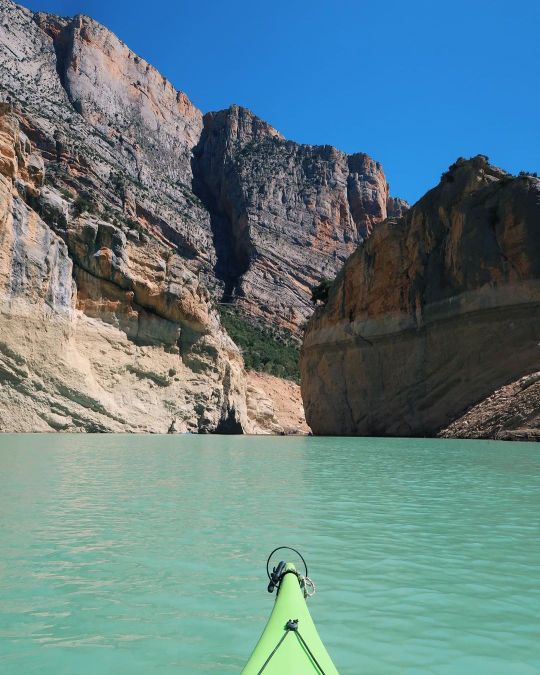
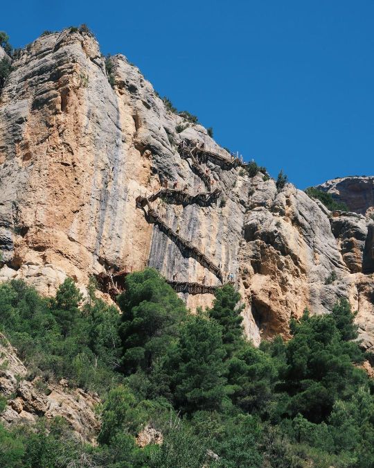


Congost de Mont-rebei (Mont-rebei canyon) is the narrowest pass of the Noguera Ribagorçana river through the Montsec mountains.
The pass of this river serves as a "border" between, on the West, La Franja (nowadays in the administrative region of Aragon) and, on the East, Catalonia.
Photos by letiziabcn on Instagram.
#congost de mont-rebei#la franja#catalunya#fotografia#natura#travel#kayak#river#canyon#nature#nature photography#landscape#landscape photography#europe#earth#travel photography
35 notes
·
View notes
Text
OOOkay here we go.
I am planning a trip to a place I know really well, where I went so many times as a kid I can tell you what you can visit xD.
But that’ll be when I get a car because mine died on me. (Rip^)
Okay so let’s talk a little about WWI and WWII for a bit shall we?
American troops came to France in 1917 to lend us a hand, to help us a great deal. No I’m not talking about WWII yet, where you totally saved our asses American folks :p.
But this is about you :D/
So. You came to help us take back from the German army what we call “Saillant de Saint Mihiel”. It is a strategic place of fortifications to protect the area.
Located in Meuse - Lorraine - Grand Est, this place was important strategically speaking.

So from september 12th to 15th and from november 9th to 11th, American soldiers protected it. And after the war, a monument was built on a hill.
And here it is. Let me introduce you the monument of Montsec, built in 1932.
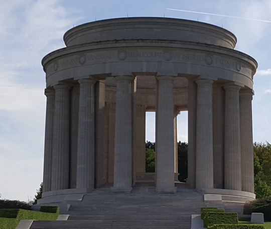
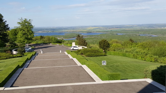
Sorry for the wonky perspective, I was trying to dodge other visitors.
Here are photos of the scenery, what we can see from this vantage point.
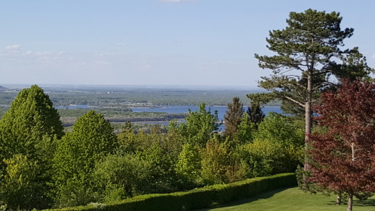
In the distance we can see the heart of Meuse, a lake we call Lac de Madine.

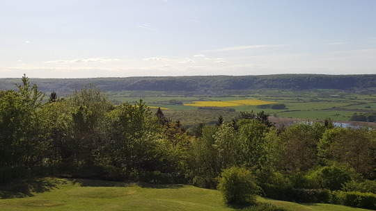


You have to imagine. This green everywhere, these fields, forests and the lake weren’t here at all in 1918. You must imagine a scenery with destroyed trees, and holes everywhere from the bombshells. Either during WWI or WWII.
In the center of the monument you can see this map. It represents the battlefield near the city called Verdun, and the “Saillant de Saint Mihiel”. From this vantage point you can see far away. And of course you are seeing what was a battlefield.


And finally, two texts in stone, which are the same texts, but one is in french and the other in English. Let me re write what’s written in French.
“Ce monument a été érigé par les Etats Unis d’Amérique
Pour commémorer la Réduction du Saillant de Saint Mihiel par les troupes de leurs premières armées, et rappeler les services des forces expéditionnaires Américains sur les champs de bataille de cette région de Lorraine et d’Alsace.
Il restera le symbole perpétuel de l’amitié et de la coopération des armées Françaises et Américaines.”


An anecdote about this place. During WWII, and the liberation of France, US soldiers where stuck where the monument stands. And they were the target of both allies and enemie’s bombshells. Not because they did anything, but both camps wanted to send bombshells in reliatation for the other’s attack.
So they were stuck here and had to survive under the rain of bombs from both camps. They had to send a pigeon to thell their allies to stop and let them come back damnit x).
This place is in the countryside. Lorraine is a mainly rural region, and the culinary specialties of this area is whatever is done with mirabelle plum. From the pie to the liqueur.
We love making liqueur of any fruits here. We don’t produce vodka, but it’s as strong xD.
I’ll tell you more next time, but here, other than WWI, it’s almost the center of the activities with mirabelle plums.
3 notes
·
View notes
Photo

Embassament de Camarasa by Hachimaki123 Montsec, Catalunya, España https://flic.kr/p/2kkigkG
0 notes
Photo

El #montsec m'enamora! #lanoguera #lleidatanament #natura #nature #cel #sky #skyhunters #nuvols #clouds #cloudscape #paisatges_de_catalunya #paisatge #landscapephotography #landscape #Catalonia #catalunya #skyhunters #celsdecatalunya #cloudy https://www.instagram.com/p/CEh2mzkIbN1/?igshid=10o5bedfp2oe6
#montsec#lanoguera#lleidatanament#natura#nature#cel#sky#skyhunters#nuvols#clouds#cloudscape#paisatges_de_catalunya#paisatge#landscapephotography#landscape#catalonia#catalunya#celsdecatalunya#cloudy
0 notes
Text
i love el montsec i think she is the most beautiful girl
1 note
·
View note
