#Moab Rim
Explore tagged Tumblr posts
Visit Tumblr Blog
Explore Tumblr blogs with no restrictions, modern design and the best experience.
Last Seen Tumblr Blogs


Fun Fact
25% of US internet users with an annual income of $80-100K use Tumblr.
Text
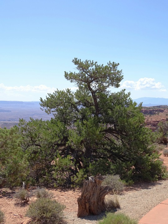
A bucket list adventure through Utah's iconic red rock landscapes, offering an unforgettable journey with breathtaking cliff-top views and endless twists and turns through the state's remarkable backcountry.
#dualsport#dual sport#adventure bike#adventurebike#adventure motorcycle#adventure touring#adventuremotorcycle#Mosko Moto#advrider#Utah#White Rim Trail#Moab
2 notes
·
View notes
Text


New Year's 2024 in Moab (2) (3) by Bryan Elias Hull
Via Flickr:
(1) Colorado River via Moab Rim (2) Top of Moab Valley and Arches in the distance (3) Marching Men along Tower Arch Trail
2 notes
·
View notes
Text
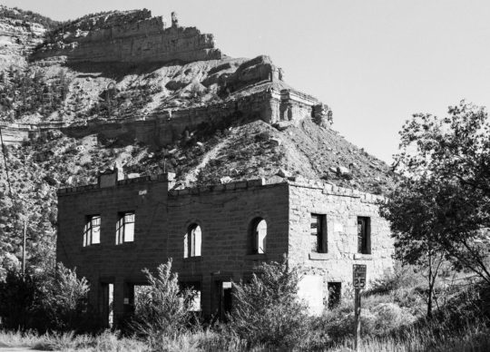
How Helper (Utah) Got Its Name, and Other Stories
Helper, Utah, and environs. (this is on the northern outskirts, and according to some maps, this was part of a hamlet, or maybe just a siding on the Denver and Rio Grande Western Railroad, called Martin at some time in the past. Maybe the locals still call it that. In October 2022, I took a driving trip that took me to Salt Lake City, Moab, and the North Rim of the Grand Canyon, among other…
View On WordPress
2 notes
·
View notes
Text
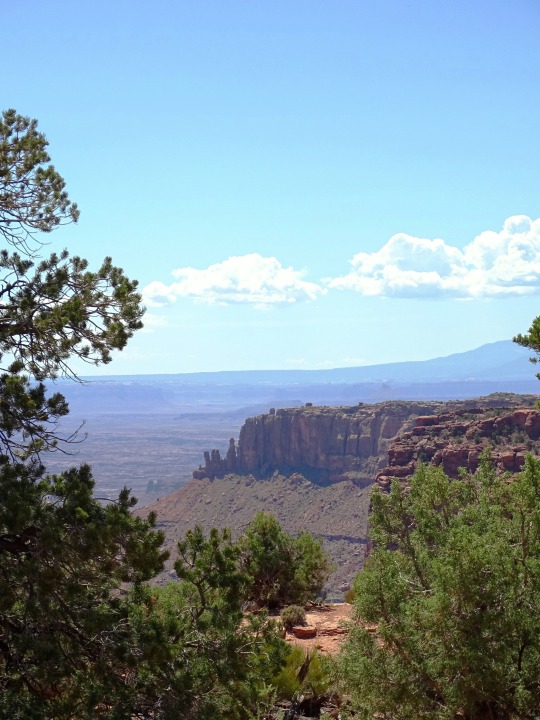
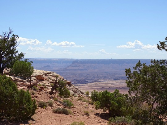
An overview: Moab pt 2
I arrived at a good time of year, as July and August are the hottest months for the area. Tourist season is known to be the months of May and October. The weather is mild then, but the crowds are plentiful. I hadn’t realized that people from all over would be visiting, considering it took me so late in life to learn about it! Parked behind my tow trailer the first night was a converted semi-truck full of about 50 people from Germany touring the U.S. The main reasons for this would be the National Parks. Southern Utah has what is known as The Big or Mighty Five: Zion and Bryce Canyon toward the west side of the state, Capitol Reef more in the center, and Moab’s own Canyonlands and Arches. Delicate Arch, found in Arches, is the image of what most people think for Utah, being on the license plate and on several versions of the Utah quarter. I visited both Canyonlands and Arches twice, and Capitol Reef once, so I can speak for those but not the others yet. Unpopular opinion, but Canyonlands, slightly southwest of Moab, is my favorite of those three. The vast sights, the deep canyons, the wildlife, the diversity in colors of the rocks, and the hikes along the rims are breathtaking. It’s a large park, which I didn’t realize before my first visit, and it is separated into districts. I have only visited the Island in the Sky district, and the White Rim Overlook trail was a fantastic choice if you can only do one there. I also hiked the Mesa Arch trail, which is another famous spot in the state, as well as Grandview Point. There are plenty of pull offs along the main drive to see the views if not hiking, and there are more difficult hikes, as well as some back country hiking, which I plan to make it back there for. While visiting I was ecstatic to just drive and see the crows, ravens, mule deer, and lizards. The most popular park, next to Zion, is Arches, named for being home of over 2,000 natural stone arches. During the busy time of year, Arches requires a timed entry reservation to enter between the hours of 7:00 am and 4:00 pm. I always made sure to get there well before 7, as the crowds have already started early to take in the phenomenal sunrise views. In addition, beating the heat was important to me. I’d make it a habit to start a hike by 5:30 am and be done for the day by 8:00 am, just to avoid the soaring temperatures. There is no shade to be found in this park. I ended up hiking to Delicate Arch twice, as I had some visitors who wanted to experience it. I think I’ve seen most of the main arches that can be accessed along the main road, and did most of the shorter hikes. Honestly, this may be controversial, but Arches NP is slightly overrated IN MY HUMBLE OPINION. Don’t get me wrong, it’s cool. Especially the first time. The rock formations are wild and most of the time it feels like you’re in Jurassic Park. I have an appreciation for it, but I won’t go out of my way to go back again. I do encourage everyone to go once and decide for yourself where it ranks! The crowds and sharing the hiking trail with so many tourists was not appealing. I’m not sure if the off season would be better, but it does get cold in that area and I’m not a cold weather hiker. Also, there is a 100 ft tall phallic-shaped rock seen from the road called “The Phallus.” If that doesn’t make you want to go, I’m not sure what will. Last, but definitely not last in ranking, was Capitol Reef. I did not have high expectations because honestly no one had given me the suggestion to go, and I didn’t hear people talk about it much. It was a bit of a drive so I stayed at a campground in Hanksville, UT. Hanksville is in the middle of nowhere, I did not have great cell service, but it was beautiful and I had a nice, refreshing time there with just myself and the dogs away from the hustle and bustle of Moab for a couple days. I was told ahead of time to make sure to get some pie while I was there, and after a bit of research I found that I needed to visit the Gifford Homestead to purchase said pie.
Go to part 3!
3 notes
·
View notes
Text
4 notes
·
View notes
Photo

Mid-day magic, White Rim Trail in Moab, UT [OC] [2050 x 700]
8 notes
·
View notes
Photo

Hayduke Day 47: Fortunately, we were not swept away in a flash flood last night. Kanab Creek has a sensor at the confluence with the Colorado River so you can check the current and historical water levels. According to the sensor, Kanab Creek flashed while we were at the South Rim. The near-daily rain hasn’t been inspiring as far as flooding goes. We find @involuted at Showerbath Spring, where we collect water since it’s dubious as to whether the water in Kanab Creek is uranium polluted (after getting reception later on and doing rudimentary internet searching, the water appears to be okay). Kanab Canyon is different than other times the Hayduke has entered or exited Grand Canyon. It’s so gradual you would never guess you’re emerging from one of the most glorious canyons on Earth. Not steep - just lots of wet feet and shrinking canyon walls. We cross the National Park boundary, depart Kanab Creek, and head up Hack Canyon. Here, the terrain changes as we walk in the creek to avoid bushwhacking along the banks. We soon reach a place where we can safely call ourselves “no longer in a canyon.” We make easy miles on grassy benches and down in the crisscrossing washes. Today’s the first day it’s looking like we’re going to have clear skies all night (as we had all day), and it’s nice to not be baking in the heat of the Hayduke’s low point. Tomorrow, there’s a chance we’ll meet friends from the South Rim, @oldmanrigney, and @kasekittykoopkat. They went to Moab to retrieve their car and are piecing together the final bits of the Hayduke. With any luck, they’ll be waiting at the trailhead for us (Hack Canyon emerges to a well-maintained dirt road) with snacks and beverages. Grand Canyon National Park - the final and one of the most daunting challenges of the Duck - is behind us; it’s a straight shot to Zion across the Arizona Strip. However, we still need to hammer out details of our route since the official Hayduke route was closed due to rockfall back in 2018/19 (and may never open again). Day: Scotty's Castle to Hack Canyon Distance: 24.02 mi / 38.66 km Elevation gain: 1,883 ft / 574 m 📷 1: @heavyteva #hayduketrail #EXTREMEWALKING
2 notes
·
View notes
Photo
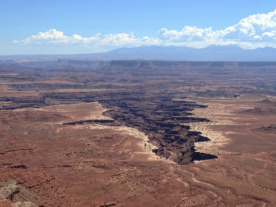
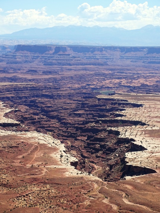
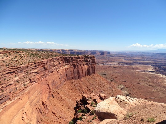
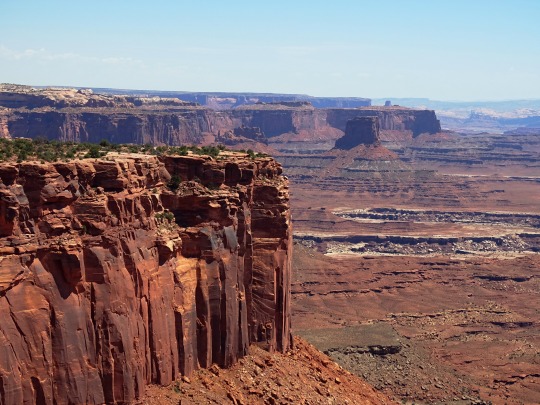
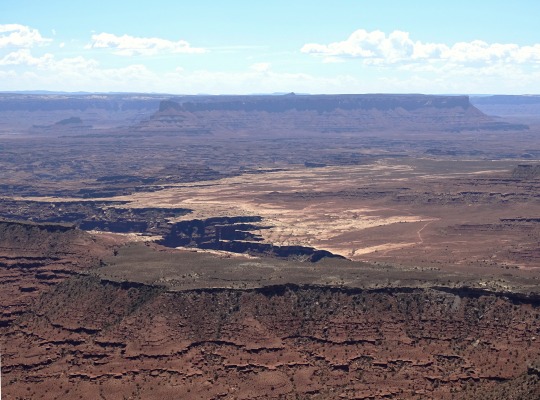
Candlestick Tower Overlook/Buck Canyon Overlook, Canyonlands National Park (No. 2)
Canyonlands is a popular recreational destination. Since 2007, more than 400,000 people have visited the park each year with a record of 776,218 visitors in 2016, representing a 22 percent increase from the prior year. The geography of the park is well suited to a number of different recreational uses. Hikers, mountain bikers, backpackers, and four-wheelers all enjoy traveling the rugged, remote trails within the Park. The White Rim Road traverses the White Rim Sandstone level of the park between the rivers and the Island in the Sky. Since 2015, day-use permits must be obtained before travelling on the White Rim Road due to the increasing popularity of driving and bicycling along it. The park service's intent is to provide a better wilderness experience for all visitors while minimizing impacts on the natural surroundings.
As of 2016, the Island in the Sky district, with its proximity to the Moab, Utah area, attracts 76.7 percent of total park visitors. The Needles district is the second most visited, drawing 20.7 percent of visitors. The remote Maze district accounts for only about 1.5 percent of visitors, while river rafters and other river users account for the remaining 1.1 percent of total park visitation.
Political compromise at the time of the park's creation limited the protected area to an arbitrary portion of the Canyonlands basin. Conservationists hope to complete the park by bringing the boundaries up to the high sandstone rims that form the natural border of the Canyonlands landscape.
Source: Wikipedia
#Buck Canyon Overlook#Candlestick Tower Overlook#original photography#USA#Canyonlands National Park#landscape#countryside#desert#flora#blue sky#Colorado Plateau#Utah#tourist attraction#landmark#nature#rock formation#Island in the Sky#White Rim Sandstone#red rock#bush#Western USA#summer 2022#hiking
2 notes
·
View notes
Text
Jeep Safari '19 Easter - Day 1 Gold Bar Rim - Trail Forged
Once reaching Moab safely on Saturday night, we immediately started to explore this stunning region. Our first trail was a group excursion that Easter Jeep Safari arranged on the Gold Bar Rim Trail. The trail has a technical rating of 5, and its primary difficulty is a waterfall. It also has dirt roads, moderate rock crawling with different sized stairs, and beautiful views.
For More info:- Gold Bar Rim Trail
0 notes
Text
White rim - Canyonlands National Park, Moab, Utah

Immerse yourself in the majestic landscapes of Canyonlands National Park in Moab, Utah, where the mesmerizing White Rim awaits to enchant your senses
0 notes
Photo

Everything is packed and ready to go for Moab. This is probably one of my favorite shots from a previous trip. When we stopped to see the Black Crack along the White Rim Trail. This was an epic adventure for all of us. (at White Rim Trail, Utah) https://www.instagram.com/p/Cpz4ubvu0D9/?igshid=NGJjMDIxMWI=
1 note
·
View note
Text
Who Is Zoe Afton McKinney Boyfriend? Utah Teen Who Fell 30 Feet To Her Death

Who Is Zoe Afton McKinney's Boyfriend? Utah Teen Who Fell 30 Feet To Her Death Here we are talking about Zoe Afton McKinney's boyfriend Lloyd Gist. Zoe Afton McKinney, 17, fell 30 feet to her death. A Utah teen who died Friday, February 10, after falling 30 feet while hiking in Cane Creek Canyon, spoke out about his relationship. As of the police investigation, While hiking with her friends on the Moab Rim Trail in eastern Utah, 17-year-old Zoe Afton McKinney tripped and fell "down a sheer cliff face." After Zoe collapses, her friends can't reach her safely. They dialed 911, which prompted police and other law enforcement agencies to arrive on site and reach Zoe using harnesses and climbing equipment. According to Police reported that they found her "dead from the fall". Zoe's boyfriend Lloyd Gist is devastated by the incident.
Who Is Zoe Afton McKinney's Boyfriend?

Zoe Afton McKinney's relationship status was committed. Her boyfriend's name is Lloyd Gist who was 18 years old. He had been dating McKinney for about a year when she died. Zoe's boyfriend Lloyd, “She had the brightest smile. She was the loveliest person; she would readily comply with any request made of her. She complimented me on my beanie, after which he remembered we began chatting in class the following day. “Then we began spending virtually every day together. She took me on a city tour and made me friends with her friends.” After dating, Zoe, a cheerleader, attended practically all of Gist’s football games. Read Also:- Laura Wolvaardt Spouse Read the full article
0 notes
Photo


Moab Rim loop
Moab, Utah 10.28.17
#Moab#Utah#trail run#trail running#runningwithdogs#traildog#trail dog#colorado river#Moab Rim#petroglyphs
8 notes
·
View notes
Text


#scenes from the white rim road#white rim road#canyonlands national park#islands in the sky#adventure#travel#my photo#desert#southwest#utah#Moab#toyota tacoma#monuments valley
25 notes
·
View notes
Photo


2020 September 11 - Moab
#travel#utah#moab#ravens rim#SalUtahZians#road trip#mighty 5 road trip#zipline#gone ziplining#selfie
6 notes
·
View notes
Photo

Downhill in Jackass Canyon, finishing the ride at Colorado River and Moab Tacos. Porcupine Rim trail. Nikon 8008, 17-35mm. Kodak Gold 200. NIK Analogue Efex Pro
2 notes
·
View notes