#Kaiser-Franz-Josefs-Höhe
Text

Kaiser-Franz-Josefs-Höhe, photographed by Kurt Hielscher, 1928
21 notes
·
View notes
Text
1 note
·
View note
Text

Old Vienna
Anno 1897
ALT - WÄHRING
Mit dem Resten des einstigen Linienwalles (L)....,
Der Bau der Stadtbahn am Währingergürtel,
Höhe Schopenhauerstraße (R),
Blickrichtung Michelbeuern.
ANMERKUNG :
Am Montag dem 9.MAI 1898 wurde die Stadtbahn in Anwesenheit von Kaiser Franz Josef,
am Bahnhof Michelbeuern feierlich eröffnet.
0 notes
Text
dailymotion
Die Großglockner Hochalpenstraße https://goo.gl/maps/vyLqW9rhQLCcAJXX6 - ein wahrlich kaiserliches Erlebnis in Österreichs Gebirge! In 36 Kehren führt die Gebirgsstraße über die österreichischen Alpen. Die Geschichte der berühmtesten Hochalpenstraße hält so einige Interessante Fakten bereit. Vor allem die Kaiser-Franz-Josefs-Höhe und ihr kaiserlicher Bezug.
Mitte des 19. Jahrhunderts besuchte dieser gemeinsam mit seiner Gemahlin Sisi das Land Kärnten. Von Heiligenblut aus unternahmen die beiden eine mehrstündige Wanderung bis an den Rand des Glocknergletschers Pasterze. Diese Stelle, von der aus seine Majestät Franz Joseph den 3.798 m hohen Großglockner bewunderte, ist nach ihm benannt.
Beitragslänge: 23.30 Minuten
Erstausstrahlung: 2016
Wiki:
https://de.wikipedia.org/wiki/Großglockner-Hochalpenstraße
https://de.wikipedia.org/wiki/Großglockner
https://de.wikipedia.org/wiki/Großglockner_Hochalpenstraßen_AG
https://de.wikipedia.org/wiki/Portal:Berge_und_Gebirge
https://de.wikipedia.org/wiki/Portal:%C3%96sterreich
PINs zur Sendung:
SHOPs:
https://www.zazzle.de/store/thejackalope/products
#austria#österreich#austrian#travel#alpen#alps#mountains#vacation#urlaub#reisen#großglockner#großglockner hochalpenstraße#hochalpenstraße#wolpertinger#jackalope
1 note
·
View note
Photo

Kaiser-Franz-Josefs-Höhe am Großglockner den größten Berg Österreichs. (hier: Großglockner) https://www.instagram.com/p/CDeYejsgOxK/?igshid=17altycmm1msz
9 notes
·
View notes
Photo

Kaiser-Franz-Josefs-Höhe
© unknown
source: flea market Berlin/Wedding
1 note
·
View note
Photo

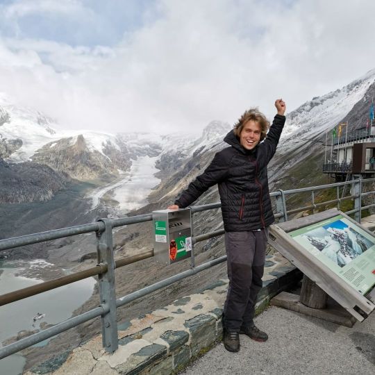
Kaiser-Franz-Josefs-Höhe (2,369 m)
National Park Hohe Tauern, Carinthia, Austria
12 notes
·
View notes
Photo
If you want to see the most beautiful places in the Austrian Alps, you must visit the Hohe Tauern National Park! Here you should visit Kaiser-Franz-Josefs-Höhe (2369 m.a.s.l.), Gamsgrubenweg, Glocknerhaus and Zentralalpenweg. The best views and experiences in Austria ever! 🤩👍🏔️🇦🇹 #austria #visitaustria #weloveaustria #mountains #mountainsview #alps #alpineascents #bealpine #easternalps #hohetauern #nationalpark #nationalparkhohetauern #gamsgrubenweg #franzjosefshöhe #glocknerhaus #zentralalpenweg #mountaineering #mountainlovers #mountainlife #mountainview #nationalpark #berge #landscape #discover #explore #lifestyle #adventures #amazinviews #whataview #hiking (v místě Hohe Tauern National Park) https://www.instagram.com/p/CTsagOKsTCG/?igshid=NGJjMDIxMWI=
#austria#visitaustria#weloveaustria#mountains#mountainsview#alps#alpineascents#bealpine#easternalps#hohetauern#nationalpark#nationalparkhohetauern#gamsgrubenweg#franzjosefshöhe#glocknerhaus#zentralalpenweg#mountaineering#mountainlovers#mountainlife#mountainview#berge#landscape#discover#explore#lifestyle#adventures#amazinviews#whataview#hiking
0 notes
Text
Murmeltiere gar nicht scheu
Murmeltiere gar nicht scheu
In meiner heutigen Story beschäftige ich mich ausschließlich mit den pfiffigen Nagern, den Murmeltieren, den "Mankeis", am Ende der Höhenstraße bei der Kaiser-Franz-Josefs-Höhe
Dieser Tage packte mich wieder einmal die Fotolust. Ziel meiner kurzen Reise war der Nationalpark Hohe Tauern mit der wunderschönen Grossglockner Hochalpenstraße, dem Alpenübergang zwischen den österreichischen Bundesländer Salzburg und Kärnten, den tollen Panoramen und den Murmeltieren!
In meiner heutigen Story beschäftige ich mich ausschließlich mit den pfiffigen Nagern, den Murmeltieren, den…

View On WordPress
0 notes
Photo

Kein Weg ist lang, mit einem Freund an der Seite! Unvergesslich das Benefizsportprojekt "Alpe Adria Trail für Vinko, 667 Kilometer für einen Sportsfreund aus Salzburg - www.alpe-adria-trail.com Am Bild gemeinsam mit Sportsfreund Günther beim Start des Benefizsportprojekt - dankend hat er uns uns unermüdlich dabei unterstützt! In dieser Zeit gewann Alex die Olympiamedaille bei den Special Olympics World Games in Amerika & empfing uns wenige Tage später in Italien mit einer großen Abordnung von unseren Familien sowie Freunden. Die Zielankunft in der Sportgemeinde Muggia bleibt in ewiger Erinnerung & der Dank gilt hierbei allen beteiligten Mitmenschen - gemeinsam wurde ein humanitäres Zeichen gesetzt! Weitere Informationen sind auch auf unserer Landessportseite: www.kaerntensport.net ersichtlich. Extrem sportliche Grüße sowie Sport bewegt & verbindet! #kelag #generali #kärntensport #sportlandkärnten #heutefürmorgen #flattach #mölltal #kärnten #österreich #benefizlauf #charity #benefiz #sport #sportler #laufsport #ausdauersport #ausdauer #running #run #runner #laufen #lauf #läufer #ausdauer #instalike #instarunners #instarun #instarunner #alpeadriatrail Eine sportliche Anzeige wegen Markennennung mit extrem sportlichen Grüßen sowie Sport bewegt & verbindet! (hier: Kaiser Franz Josef Höhe 2365m) https://www.instagram.com/p/B-M6ECVg9La/?igshid=1pvan24u5bsoc
#kelag#generali#kärntensport#sportlandkärnten#heutefürmorgen#flattach#mölltal#kärnten#österreich#benefizlauf#charity#benefiz#sport#sportler#laufsport#ausdauersport#ausdauer#running#run#runner#laufen#lauf#läufer#instalike#instarunners#instarun#instarunner#alpeadriatrail
0 notes
Photo

Die Kaiser-Franz-Josefs-Höhe in Kärnten © @snowflake.rider 🇦🇹 . . . 🔴 ⚪️ 🔴 #weloveaustria #Iloveaustria #Urlaub #Holiday #love #holidays #Vacation #Berg #Berge #Alpen #Mountain #bestview #mountainlove #awesome #amazing #Österreich #Austria #visitaustria #public #feelaustria #instagood #instadaily #destination #igersaustria #Natur #wanderlust #theplacetobe #Kärnten
#berge#visitaustria#holidays#iloveaustria#holiday#bestview#kärnten#amazing#public#igersaustria#weloveaustria#theplacetobe#vacation#wanderlust#alpen#love#awesome#destination#natur#österreich#feelaustria#mountainlove#austria#instagood#mountain#urlaub#instadaily#berg
4 notes
·
View notes
Photo

at Parkhaus Kaiser-Franz-Josefs-Höhe https://www.instagram.com/p/B21n0bRJDnm/?igshid=l1n7xdjefw1p
1 note
·
View note
Text
Die Großglockner-Hochalpenstraße verbindet als hochalpine Gebirgsstraße die beiden österreichischen Bundesländer Salzburg und Kärnten. Sie führt von Bruck an der Großglocknerstraße über die beiden Gebirgspässe Fuscher Törl und Hochtor (Tunnelportal 2504 m ü. A., historische Passhöhe 2576 m ü. A.) nach Heiligenblut am Großglockner und hat Abzweigungen zur Edelweißspitze und zur Kaiser-Franz-Josefs-Höhe. Sie ist die höchstgelegene befestigte Passstraße in Österreich.

0 notes
Photo

Gletscher Am Grossglockner... the Kaiser-Franz-Josefs-Höhe.... . #landschaft #verborgeneschätze #ourplanetdaily #bergtour #scenery #Alps #ig_countryside #zoomnl #landscapeporn #marvelshots #Austriafeature #landschappen #austriatrip #sonynederland #aussicht #landscapehunter #topaustria #landscapecaptures #tamron #austrialove #alpenland #bergwelten #austrianalps #nature_perfection #fav_squares #austrianature #Mountains #landscapestyles #awesomedreamplaces #shareyourparadise https://ift.tt/30nwZBn
0 notes
Photo

Hiking the Alpe Adria Trail section 7: from Mallnitz to Obervellach
Summer is coming, so it’s time to tell you more about my adventure on the Alpe Adria Trail. In the past year I hiked several stages in various places and I was impressed by the diversity of this long-distance walk in Europe. I did not walk the whole trail, but I enjoyed some of the highlights in Carinthia (summer) and Slovenia (autumn). The first stage I hiked was that from beautiful Kaiser-Franz-Josefs-Höhe to Heiligenblut and the second one the the section from Mallnitz to Obervellach. You’ll find my story below:
Arrival in Mallnitz and overnight
Since you are can only experience a little bit of everything during a blog trip, after section 1 it is time for me to get in the car and drive from Heiligenblut to Mallnitz. This village is located at an altitude of 1.191 meters in the middle of the Hohe Tauern National Park and is particularly known as one of the better winter sports resorts in Carinthia. However, I am here in the middle of the summer and, despite the weekend, it is relatively quiet. After arrival I check in at the beautiful Hotel Bergkristall. The hotel is just as beautiful as its name suggests. As it’s already relatively late, I freshen up and head down to their restaurant for dinner straight after my arrival. On the menu for tonight they offer Wienerschnitzel: a great bit of tradition Austrian cuisine.
After a wonderful overnight stay (because: mountain air!) and likewise amazing breakfast, I pack my backpack for the day and I agree with the owner of the hotel that I will leave Rudolph (my red Volvo) behind and pick it up at the end of the day. It’s time to go!
Hike to Stappitzer See
I pick up the trail again in the center of Mallnitz and walk on a relatively flat path to the end of the valley, to the Stappitzer See. This lake originated at the end of the last ice age when a huge rock from Mount Auernig collapsed to blocked the passage to where Mallnitz now is located. This created the Stappitzer See and the turquoise-colored Seebach (‘sea stream’).
The Stappitzer See appears to be a popular destination for families. I’m there on a Sunday and although I arrive still relatively early in the morning, the first families are already on the road. Some take the cable car here to go further up into the mountains, but I just walk to the lake and back again. It is the perfect place for a first break on today’s hike and since the sun is shining, I really have to force myself to get up and walk on. I could easily have spent all day around here!
On to the Groppensteinschlucht
The part that is to come is less interesting, I walk through the other side of the meadows back to Mallnitz and even have to walk on the paved road for a little while. Fortunately I have heard that the best is still ahead of me so I continue to move on. Today’s highlight must be the Groppensteinschlucht, but first the Rabischschlucht will appear ahead of me. This gorge is apparently regularly closed due to high water, but the Alpe Adria Trail has indicated a detour if necessary.
The possible closure also applies to the Groppensteinschlucht, in case of high water, rainfall and/or thunderstorms. For this gorge you need to buy an entrance ticket (current price in 2019: € 7 per person, only to be paid in cash when you start at the top) but you can also follow the diversion if you decide not to pay and enter the gorge. More information about the entrance fee and the exact opening times of the Groppensteinschlucht can be found here.
The walk through the Groppensteinschlucht is approx. 2.5 kilometers long and takes you over wooden walkways through a narrow gorge with numerous waterfalls. Because I’m there towards the end of the day, there is hardly anyone there and I enjoy it quite a lote. I walk from one waterfall to the other and even occasionally see a rainbow. This hike really is as good as they promised it to be! Occasionally I meet some other people (the regular route is from bottom to top) and finally I arrive at the end. At the entrance/exit I call the taxi that takes me back from Obervellach to Mallnitz. Today was again a wonderful day!
Practical tips and information about Alpe Adria Trail section 7
– The distance of this stage is 17.8 kilometers, it took me about 6 hours excluding breaks. The altitude gain is around 250 meters and you descend a total of around 750 meters.
– On the way there is limited facilities for food and drinks, as I was walking on Sunday a lot was closed. At the Stappitzer See there are some mountain huts where you can drink coffee and grab a quick bite.
– If you don’t carry cash, you can pay the entrance fee for the Groppensteinschlucht downstairs at the small information center with your bankcard.
– Buses run from Obervellach to Mallnitz, but not on Sundays. As I was walking on Sunday, I took a taxi back, a journey of about fifteen minutes.
– You do not need an official hiking map to hike this section. You can use the booklet that I describe in this article for this stage. More information about this part of the hike can be found on this page of the Alpe Adria Trail.
– Download the Alpe Adria Trail app. Each stage has its own page, so you have everything you need at hand. There is a GPS function as well as the possibility to make an emergency phone call.
– For help on the road you can call the trail angels. The number is in the hiking guide that I mentioned and if you need help on the way in any way, they will gladly help you further.
About the Alpe Adria Trail
The Alpe Adria Trail is a 750 kilometer long hike from the highest mountain in Austria (Alpe) to the Adriatic Sea (Adria) and takes you through Austria, Slovenia and Italy. The trail was developed in 2012 and has 43 stages, all about 15-25 kilometers in length. The markings are good, the trails lead you mostly through non-alpine terrain, making this walk do-able for everyone who has some experience in hiking. The Alpe Adria Trail was in Top 7 New Trails in the World by National Geographic Magazine 2016 and in 2017 about 16.000 hikers did the Alpe Adria Trail.
Kaiser Franz Josefs Höhe
Conclusion and disclaimer about this Alpe Adria Trail blog
This stage of the Alpe Adria Trail was as nice and surprising as the first one I hiked. The two highlights were the Stappitzer See with the Seebach and of course the Groppensteinschlucht. The connecting piece was not that special, but it shouldn’t be a big deal. However, I still wanted to mention it.
I made this trip by the invitation of Carinthia Marketing. All opinions given are only mine. This article contains affiliate links. When you make a purchase through one of these links, I receive a modest commission, of course without extra costs for you!
The post Hiking Alpe Adria Trail section 7: Mallnitz – Obervellach appeared first on we12travel.com.
0 notes
Photo

New on 500px : Fire and Ice by thomassattel by thomassattel Großglockner glacier is melting but still looking beautiful from 500px For download Click Here
#500px#Austria#blue#dramatic#extreme terrain#Franz-Josefs-Höhe#glacier#gletscher#global warming#Großglockner#hill#hohe#Hohe Tauern#ice#Kaiser#landscape#landschaft#Melting#mountain#mountain peak#mountain range#Pasterze#red#ridge#rock mountain#scenic#Snow#snowcapped#Tauern#valley
0 notes
Last Seen Blogs

tragicplumbob
TragicPlumbob

pratikkadbane
Untitled

valcrants
* 𝐛𝐥𝐨𝐬𝐬𝐨𝐦 !

happiighost
95% of my daily vocabulary is "what"

maxinajar
Max