#Hunga Tonga
Explore tagged Tumblr posts
Text
I said this in the comments but I think it also deserves a full reblog: in late 2021-2022 the volcano Hunga Tonga–Hunga Haʻapai erupted and blasted an unprecedented amount of water into the upper atmosphere. Water vapor is one of the strongest greenhouse gasses, and as a result we're going to be dealing with hot summers for the rest of the decade or so, but it's not humanity's fault and there's nothing we could've done to prevent it.
https://www.nasa.gov/earth/tonga-eruption-blasted-unprecedented-amount-of-water-into-stratosphere/
https://research.noaa.gov/2023/12/20/hunga-tonga-2022-eruption/

41K notes
·
View notes
Photo

Record-breaking Tonga volcano disrupted satellite signals in space | Space
The January 2022 Hunga Tonga-Hunga Ha'apai eruption continues to astound.
An underwater volcanic eruption last year was powerful enough to generate plasma bubbles that disrupted radio communications in outer space, a new study finds.
The new results could lead to ways to avoid satellite and GPS disruptions on Earth, and to learn more about volcanoes on alien worlds, scientists added.
In January 2022, the Hunga Tonga-Hunga Ha'apai submarine volcano — a large, cone-shaped mountain located near the 169 islands of the Kingdom of Tonga in the South Pacific — erupted with a violent explosion. The outburst generated the highest-ever recorded volcanic plume, one reaching 35 miles (57 kilometers) tall, and triggered tsunamis as far away as the Caribbean. All in all, the eruption was the most powerful natural explosion in more than a century...
93 notes
·
View notes
Text
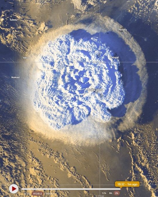
The violent eruption a few hours ago of the Hunga Tonga-Hunga Haʻapai volcano captured by satellites GOES-West and Himawari-8.
via Wonder of Science
25 notes
·
View notes
Text
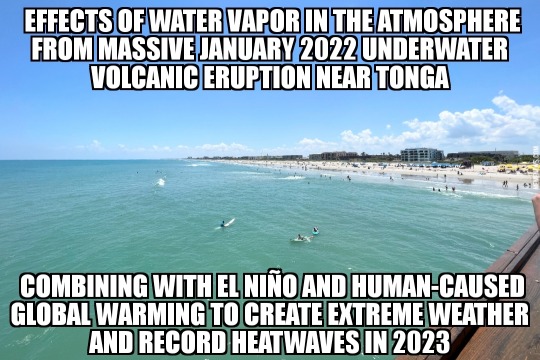
Tonga volcano eruption causing 2023 heat

View On WordPress
#climate change#earth#eruption#global warming#heat#heatwave#Hunga Tonga-Hunga Ha&039;apai#meme#memes#natural disaster#news#pacific#record#records#tonga#volcano#weather
23 notes
·
View notes
Text
Des images satellites de l' éruption du volcan Hunga-Tonga-Hunga-Ha'apai
Nouvel article publié sur https://www.2tout2rien.fr/l-eruption-du-volcan-hunga-tonga-hunga-haapai/
Des images satellites de l' éruption du volcan Hunga-Tonga-Hunga-Ha'apai

#archipel#cendre#eruption#explosion#GglNoInd#Hunga-Tonga-Hunga-Ha'apai#ile#nuage#satellite#tonga#tsunami#vague#vidéo#volcan#nature
0 notes
Text
Tonga 🇹🇴 Volcano Sparked the Most Intense Lightning Storm Ever Recorded
Last year’s eruption produced a raging storm at unprecedented altitudes, with 2,600 lightning flashes per minute at its peak
— Will Sullivan, Daily Correspondent | June 27, 2023 | Smithsonian Magazine

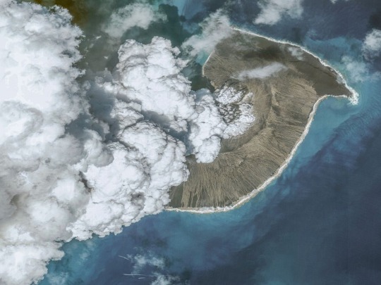
A photo of the Hunga Tonga-Hunga Ha’apai volcanic eruption taken on December 24, 2021, before the biggest eruption on January 15, 2022. Tsunamis caused by the eruption killed at six people in Tonga and Peru and displaced more than 1,500 people on Tongan islands. Maxar via Getty Images
On January 15, 2022, the underwater Hunga Tonga-Hunga Ha’apai volcano blew its top in a massive eruption, propelling a giant plume of ash and gas beyond the stratosphere. It was the largest recorded eruption since 1991, when Mount Pinatubo erupted in the Philippines.
Now, researchers say the 2022 eruption prompted the most intense lightning rates ever recorded, per a new study published last week in the journal Geophysical Research Letters. At its peak, the raging lighting storm produced 2,600 flashes per minute.
The scientists also detected lightning as high as an estimated 12 to 19 miles above sea level. Previous research elsewhere has only recorded lighting up to roughly 11 miles above sea level, according to the study.
“We’ve never seen anything like this sheer rate of lightning before—and at such high altitudes,” study co-author Alexa Van Eaton, a volcanologist at the U.S. Geological Survey, tells Space.com’s Keith Cooper.
“This is a fascinating study and shows how the Tongan eruption influenced the Earth system in ways that you might not immediately associate with a volcanic explosion,” Sam Purkis, a geologist at the University of Miami who did not contribute to the research, tells the Washington Post’s Kasha Patel.
Located near the islands of Hunga Tonga and Hunga Ha’apai in the South Pacific Ocean, the volcano started spewing ash on December 19, 2021. But its activity peaked with the cataclysmic eruption on January 15, resulting in tsunamis that caused the deaths of four people in Tonga and two people in Peru, the Guardian’s Nicola Davis wrote in April. The tsunamis also displaced more than 1,500 people on Tongan islands, and the eruption impacted over 80 percent of Tonga’s population.
The volcanic plume shot out of the ocean and reached a height of at least 36 miles above sea level. At its most intense moments, the volcano spewed out material at a rate of about 11 billion pounds per second—that’s the weight of more than 15 Empire State Buildings every second.
“It was clear right away that this was going to be a showstopping scientific event,” Van Eaton tells the Washington Post. “It’s several orders of magnitude larger than anything we’re used to looking at … This eruption clearly was going to teach us something new.”
Since last year’s eruption, scientists have been studying the event and adding to an ever-growing list of ways it made history. The volcano increased the amount of water vapor in the stratosphere by 5 percent, one study found. And that massive amount of water vapor could trap enough heat to temporarily warm Earth’s surface, according to another study.
For the new paper, the researchers examined records of the eruption from satellites and ground-based radio antennas. When viewing satellite imagery of the blast, they watched the volcanic plume rise and spread outward. Surprisingly, the lightning flashes also spread outward in four concentric rings, which matched the four phases of the eruption, writes Space.com.
Researchers had previously identified lightning in this circular pattern, but this was the first time they spotted multiple lightning rings.
Lightning, which is caused by an imbalance of electrical charges, occurs during volcanic eruptions when bits of ash brush against each other, creating charged particles, and similarly, when ice particles become charged.
“It may be that larger particles were going one direction and smaller particles were going in another, and that helped create the charge separation that leads to electrical discharges,” Van Eaton tells the Washington Post.
Researchers theorize that the lightning storm was so strong because of the eruption’s intensity, the rapid expansion of the ash plume and the large amount of vaporized seawater in the plume.
The volcanic plume may also be to blame for the high-altitude flashes: It could have raised the air pressure, leading the lightning to occur so high above sea level, Van Eaton tells Science News’ Skyler Ware. At the typical low air pressures at higher altitudes, it’s more difficult to form the channels of plasma that are necessary for lightning, according to the paper.
On top of all the existing evidence for how powerful and unusual this eruption was, the study demonstrates another way that the volcano led to unexpected events on and around the planet.
“Hunga has completely changed the way we think of how natural events can change the atmosphere and the environment where we thought lightning could exist,” Jeff Lapierre, a co-author of the study and lightning scientist at the company Advanced Environmental Monitoring, tells Science News.
#Tonga 🇹🇴 Volcano#Lightening Storm#Eruption#Hunga Tonga-Hunga Ha’apai Volcano#Tsunamis#2600 Flashes/Minute#U.S. Geological Survey
1 note
·
View note
Text
I have been waiting for Nova to cover the Hunga Tonga-Hunga Ha'apai eruption of Jan 2022.
youtube
(There was already a fascinating preliminary video from the NIWA science team last year.)
I was initially drawn to the record-setting loud bang of this eruption, which reminded me of Krakatoa's colossal 1883 explosion.
Also there's some indications that so much water blasted into the normally-dry troposphere it disrupted the southern hemisphere's climate, causing Australia's floods.
Finally, I've wondered if the c. 1620bce Thera eruption that destroyed the Minoan seaports was comparable. If so, this gives us insight into what happened. I'm especially curious whether it did the water-in-troposphere thing, because it deposited less ash across the Med than expected, just as Hunga Tonga did, so scientists had concluded that other than massive tsunamis it couldn't have affected the Minoans that much. But WAIT — now we have a new mechanism for climate disruption that leaves very little chemical footprint.
0 notes
Text
Tracking Tonga's Boom

When the Hunga Tonga-Hunga Ha’apai volcano erupted in January 2022, its effects were felt -- and heard -- thousands of kilometers away. A new study analyzes crowdsourced data (largely from Aotearoa New Zealand) to estimate the audible impact of the eruption. (Image credit: NASA; research credit: M. Clive et al.; via Gizmodo) Read the full article
56 notes
·
View notes
Text
This Island Appeared Out of Nowhere, With Life Forms Never Seen Before
A submarine volcanic eruption in the South Pacific formed Hunga Tonga-Hunga Haʻapai, a new island situated between the existing islands The eruption, which lasted several weeks, created a landmass rising over 100 meters above sea level and measuring approximately 2 kilometers wide.
47 notes
·
View notes
Text
They told us the sky was falling.
That the Earth was dying. That unless we radically altered our way of life — stopped driving cars, eating meat, flying planes, having children, or heating our homes — we would face a planetary apocalypse. They told us that climate collapse was not a possibility, but a certainty. The imagery used was catastrophic and relentless: drowning cities, burning forests, mass extinctions, and unstoppable storms. Children were told their future was bleak, their dreams imperilled by the emissions of their parents. It wasn’t just a scientific message; it was a spiritual indictment — humanity cast as the original sinner, carbon its unforgivable transgression.
“Twelve years to save the Earth!” they cried. “Eighteen months left!” King Charles warned. Alarmist prophets of climate doom, from royal bloodlines to high-school icons, beat the drum of carbon repentance. They preached austerity for the many and indulgences for the few — a kind of modern ecological priesthood who demanded sacrifice, obedience, and faith in models that changed with the political wind. The message was clear: comply or be complicit in the planet’s demise. This culture of panic and blame has grown so entrenched that even the most unrelated natural events are recast as symptoms of our ecological sins.
Just recently, one self-proclaimed climate crusader went so far as to claim that the Hunga Tonga-Hunga Ha’apai volcanic eruption was caused by “climate change” — or maybe “pollution.” The details were fuzzy, but the passion was not. With the breathless certainty of a late-night infomercial guru, he declared a direct link between human emissions and seismic activity beneath the Pacific Ocean. Of course, no scientific evidence supports this claim. Yet in today’s ideological climate, facts are optional. If something happens — anything at all — it must be our fault. The dogma demands it.
16 notes
·
View notes
Text
In December 2021, an eruption began on Hunga Tonga–Hunga Haʻapai which is classified as a submarine volcano. 🤔
#pay attention#educate yourselves#educate yourself#knowledge is power#reeducate yourself#reeducate yourselves#think for yourselves#think about it#think for yourself#do your homework#do some research#do your own research#ask yourself questions#question everything#volcano
124 notes
·
View notes
Text
An unprecedentedly violent volcanic eruption that triggered a tsunami off the Pacific island nation of Tonga in 2022 unleashed the fastest underwater currents ever recorded, according to a study published on Thursday. The submerged Hunga Tonga-Hunga Ha'apai Volcano sent rocks, ash and gas racing across the seafloor at 122 kilometers (76 miles) per hour in January last year, found the paper published in the journal Science. The eruption – the most powerful ever recorded with modern equipment – triggered a deadly tsunami and "avalanche-like flows" of material that damaged underwater telecommunications cables connecting Tonga with the rest of the world. A research team led by scientists from Britain's National Oceanography Centre (NOC) used the timings and locations of cable damage to calculate the speed of the flows. The volcano's eruption plume, up to 57 kilometers high, fell directly into the water and onto steep underwater slopes, explained Mike Clare of the NOC. The speed and power of the currents were so great that they were capable of running at least 100 kilometers across the seafloor and wrecking the cables, he said. The flows were faster than those triggered by earthquakes, floods or storms, the paper added.
Continue Reading
76 notes
·
View notes
Video
youtube
"Climate Change For Social Control" - Hunga Tonga Supervolcano CHALLENGE...
5 notes
·
View notes
Text


A Growth Spurt for Home Reef
A small island at Tonga’s Home Reef got a little roomier in recent weeks.
The underwater volcano emerged above sea level during a 2022 eruption, adding new land to the nation of islands in the South Pacific Ocean. It continued to grow during eruptions in September 2023, January 2024, and June 2024, expanding to 12.2 hectares (30.1 acres). During the most recent period of activity, from December 2024 to January 2025, the island grew another 3.7 hectares.
Landsat satellites observed the island’s recent growth spurt. The OLI-2 (Operational Land Imager-2) on Landsat 9 captured an image of the island on November 11, 2024 (top), before the latest expansion. The OLI (Operational Land Imager) on Landsat 8 imaged the same location on February 2, 2025 (lower). The new land formed as lava flowed from the volcano’s vent and solidified into rock.
The discolored water around the island is a sign of gases and magmatic fluids escaping from the volcano. “Most likely, we’re seeing a large amount of yellow sulfur mixing with the blue ocean to give the plumes a greenish hue,” said Cornel de Ronde, a geologist at GNS Science and the co-author of a study in Geochemistry, Geophysics, Geosystems about monitoring submarine volcanoes.
The impact of underwater volcanic eruptions on marine ecosystems can be mixed. Some of the substances found in underwater plumes, especially iron, can encourage the growth of phytoplankton, said Sharon Walker, a NOAA oceanographer and lead author of the study. However, the hot, acidic plumes are also known to be harmful to many species of fish and other types of marine life. Meanwhile, the new land offers more habitat for pioneer species, such as bacteria, algae, lichens, insects, and seabirds.
Prior to 2022, Home Reef had four recorded eruptions, including events in 1852 and 1857 that formed small, temporary islands. In 2006, an eruption also produced an island that had cliffs measuring up to 70 meters (230 feet) tall and survived for about nine months.
Geologists expect the current island to last longer. “Some of the previous eruptions had a more explosive character, which led to land made of a more fragmented, easily erodible material,” said Simon Plank, a researcher from the German Aerospace Center (DLR). “This one is characterized by effusive flows that form a hard material that gives the island a high chance of surviving for several years.”
Home Reef sits within the Tonga-Kermadec subduction zone, an area where three tectonic plates are colliding at the fastest converging boundary in the world. Here, the Pacific Plate is sinking beneath two other small plates, yielding one of Earth’s deepest trenches and most active volcanic arcs.
So far, Home Reef’s eruptions have had little impact on people, unlike the neighboring Hunga Tonga-Hunga Ha‘apai volcano, which erupted in 2022, triggering a tsunami, covering nearby islands with ash, and damaging crops and fisheries.
“Given what the world witnessed at Hunga, it’s certainly worth monitoring submarine volcanoes,” said de Ronde. “Satellites offer one of the best, quickest, and safest ways to do that.”
NASA Earth Observatory images by Lauren Dauphin, using Landsat data from the U.S. Geological Survey. Story by Adam Voiland.
2 notes
·
View notes
Text

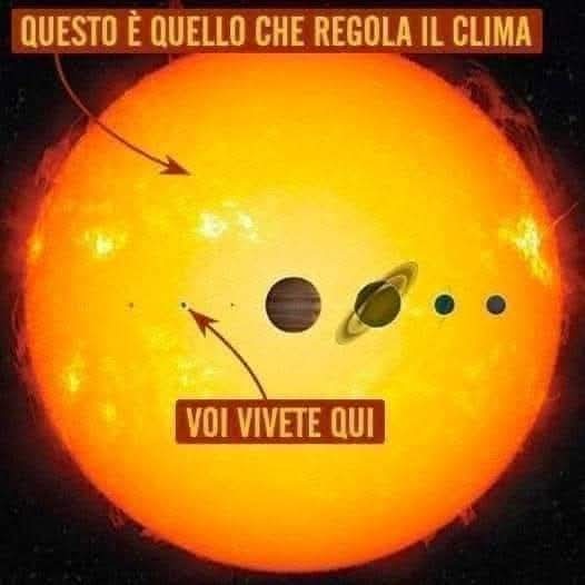
La VERA RAGIONE DEL CAMBIAMENTO CLIMATICO:
Il riscaldamento del Sole è ciclico, NON è costante. La distanza dal Sole cambia costantemente perché sia l'orbita della Terra attorno al Sole è irregolare sia il Sole stesso oscilla a causa dell'attrazione gravitazionale combinata di tutti i pianeti insieme. Guarda il ciclo solare di Schwabe di 11 anni, il ciclo solare di Jose del moto inerziale solare di 179 anni, il ciclo solare di Eddy di 1000 anni, i cicli di Bray-Halstatt di 2300-2500 anni, quindi guarda i tre cicli di Milankovitch.
Cambiamenti climatici a breve e medio termine:
Moto inerziale solare: la massa combinata dei pianeti sposta anche la posizione del Sole attraverso la loro attrazione gravitazionale combinata, il che significa che il Sole si muove seguendo il baricentro in continuo movimento del sistema solare piuttosto che trovarsi in un punto centrale fisso nel sistema solare centrale. Questa è la cosa fondamentale da capire: il Sole si muove, oscillando in un moto a spirale mentre viaggia, non è stazionario. Una volta capito che tutti i cambiamenti climatici a medio termine possono essere spiegati semplicemente a causa della distanza variabile del Sole dalla Terra.
Niente di tutto questo ha a che fare con gli ESSERI UMANI.
Niente di tutto questo ha a che fare con la CO2.
I modelli del Sistema Solare con cui sei cresciuto da bambino erano delle semplificazioni grossolane. Ti hanno condizionato a credere che il Sistema Solare abbia una posizione fissa del Sole con un'attività solare regolare con orbite regolari, di cui la Terra è una.
Eppure questa non è la realtà: non solo la Terra si inclina e oscilla mentre orbita, ma l'orbita è un'ellisse variabile e non un cerchio perfetto, il che significa che la distanza dal Sole non è costante.
Questi sono i tre cicli di Milankovitch. Anche altri pianeti hanno orbite irregolari.
L'effetto combinato di tutte queste orbite irregolari insieme tira il Sole fuori dal centro del sistema solare verso il baricentro. Un Sole che ondeggia è la vera ragione del cambiamento climatico a breve e medio termine, e un'orbita terrestre irregolare, inclinata e oscillante è la ragione del cambiamento climatico a lungo termine.
E questo è solo l'inizio della storia dell'irregolarità nell'orbita terrestre attorno al Sole, poi ci sono cicli di attività solare, che la rendono più forte o più debole a seconda di quanto è vicina al ciclo di 11 anni di inversione dei poli magnetici, il prossimo sarà nel 2024, e a quante macchie solari e brillamenti solari siamo esposti.
Poi devi considerare l'attività vulcanica. L'eruzione vulcanica sottomarina Hunga-Tonga Hunga del gennaio 2022 ha aumentato il vapore acqueo nella stratosfera del 10%, questo di per sé causerà un notevole riscaldamento del pianeta nella maggior parte delle regioni.
Non è sicuramente una semplicistica storia in bianco e nero di CO2, un gas serra minore, poiché il 95% dei gas serra della Terra è costituito da VAPORE ACQUEO.
Gli ESSERI UMANI non hanno alcun potere di determinare né l'orbita della Terra attorno al Sole né l'attività interna ed esterna del Sole, né il vapore acqueo nell'atmosfera.
La vita si adatta molto più facilmente alle temperature più elevate e agli aumenti di CO2, in particolare piante, vegetazione, alberi, plancton e fitoplancton, rispetto alle diminuzioni di CO2.
Il vero pericolo è una diminuzione di CO2 e una diminuzione della temperatura, non un aumento di entrambe.
Ancora una volta, siamo stati ingannati da un sistema di finanziamento scientifico sistematicamente corrotto legato agli interessi degli oligarchi.
La CO2 è sempre stata una manopola di controllo per la prosperità economica, non per il clima".
https://www.frontiersin.org/journals/astronomy-and-space-sciences/articles/10.3389/fspas.2022.937930/full
ROBINMG 🚀
5 notes
·
View notes