#Gifford Pinchot
Explore tagged Tumblr posts
Text


Yesterday we visited Gray Towers in Milford, PA, the summer home of Gifford Pinchot, founder and first Chief of the US Forest Service. The house and garden are spectacular, like a fairytale castle with round turrets and wondrous nooks.
Virtual Tour https://greytowers.org/greytowers_vt/html5/greytowers.html
27 notes
·
View notes
Text
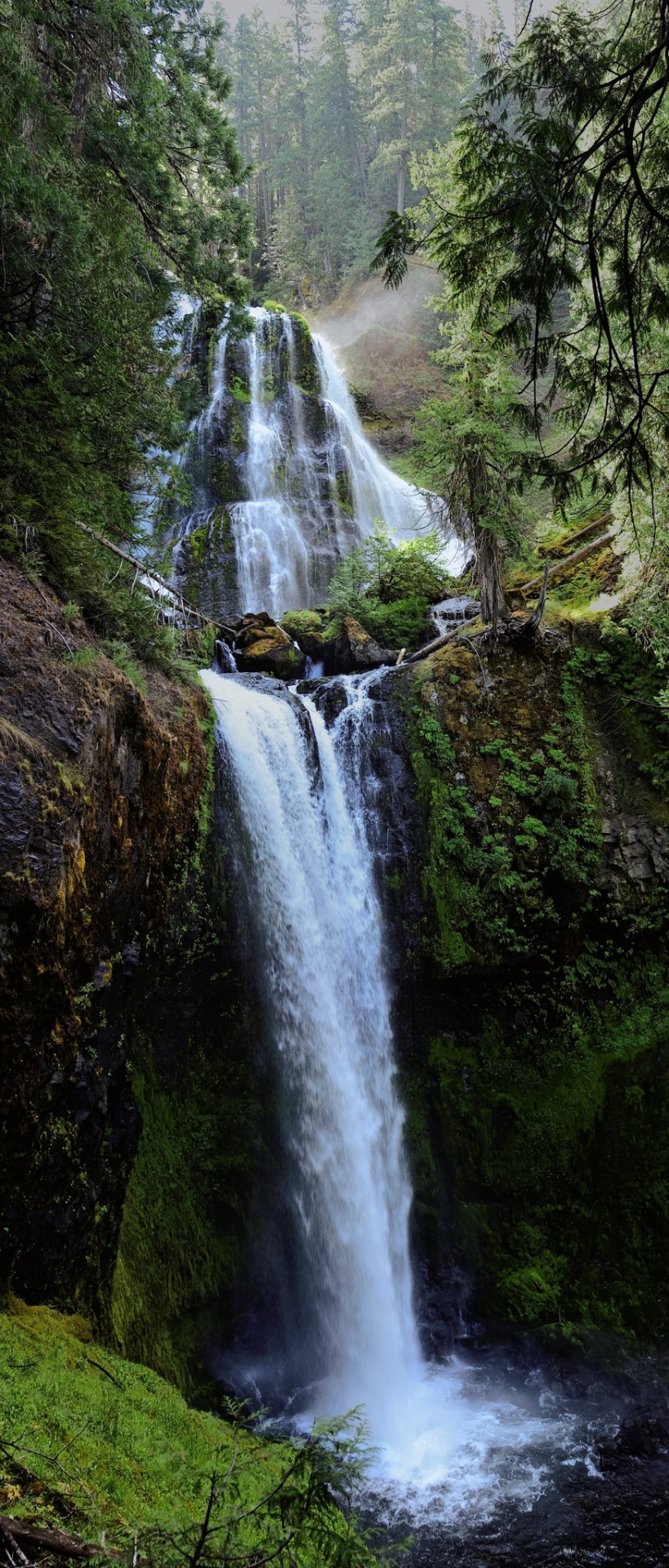
Water tumbles down basalt in the Gifford Pinchot National Forest.
18 notes
·
View notes
Text

Stumbled upon a temple the other day
10 notes
·
View notes
Text


Don't forget to look up.
Gifford Pinchot NF, Stl'pulmsh (Cowlitz) and Qwû’lh-hwai-pûm (Klickitat) territory
10 notes
·
View notes
Text
when the huckleberry fields burn, it's definitely a setback in that area for that year. but after recovering, it's the burn area with the best harvest
What I was taught growing up: Wild edible plants and animals were just so naturally abundant that the indigenous people of my area, namely western Washington state, didn't have to develop agriculture and could just easily forage/hunt for all their needs.
The first pebble in what would become a landslide: Native peoples practiced intentional fire, which kept the trees from growing over the camas praire.
The next: PNW native peoples intentionally planted and cultivated forest gardens, and we can still see the increase in biodiversity where these gardens were today.
The next: We have an oak prairie savanna ecosystem that was intentionally maintained via intentional fire (which they were banned from doing for like, 100 years and we're just now starting to do again), and this ecosystem is disappearing as Douglas firs spread, invasive species take over, and land is turned into European-style agricultural systems.
The Land Slide: Actually, the native peoples had a complex agricultural and food processing system that allowed them to meet all their needs throughout the year, including storing food for the long, wet, dark winter. They collected a wide variety of plant foods (along with the salmon, deer, and other animals they hunted), from seaweeds to roots to berries, and they also managed these food systems via not only burning, but pruning, weeding, planting, digging/tilling, selectively harvesting root crops so that smaller ones were left behind to grow and the biggest were left to reseed, and careful harvesting at particular times for each species that both ensured their perennial (!) crops would continue thriving and that harvest occurred at the best time for the best quality food. American settlers were willfully ignorant of the complex agricultural system, because being thus allowed them to claim the land wasn't being used. Native peoples were actively managing the ecosystem to produce their food, in a sustainable manner that increased biodiversity, thus benefiting not only themselves but other species as well.
So that's cool. If you want to read more, I suggest "Ancient Pathways, Ancestral Knowledge: Ethnobotany and Ecological Wisdom of Indigenous Peoples of Northwestern North America" by Nancy J. Turner
61K notes
·
View notes
Text
#hiking#huffaker mountain#bluff mountain#kraus ridge#south cascades#gifford pinchot#cispus river#cowlitz river
0 notes
Text

Panther Creek Falls, 2024
An image from my Yashica 635
38 notes
·
View notes
Text

Pacific Crest Trail, northwest corner of Mt. Adams wilderness, Washington, 2001.
#landscape#mountains#vulcanism#glaciers#hiking trail#pacific crest trail#gifford pinchot national forest#washington state#2001#photographers on tumblr#pnw#pacific northwest
7 notes
·
View notes
Text
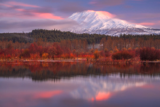
Mount Adams, Gifford Pinchot NF, Washington, USA
By Daniel Gomez
#daniel gomez#photographer#mount adams#gifford pinchot national forest#mountains#landscape#washington#united states#fall#autumn
24 notes
·
View notes
Video
Untitled by Tom Humphrey
#Boletus edulis#King Boletes#tiny chanterelees#Gifford Pinchot National Forest#Indian Heaven Wilderness#Washington#flickr
6 notes
·
View notes
Text
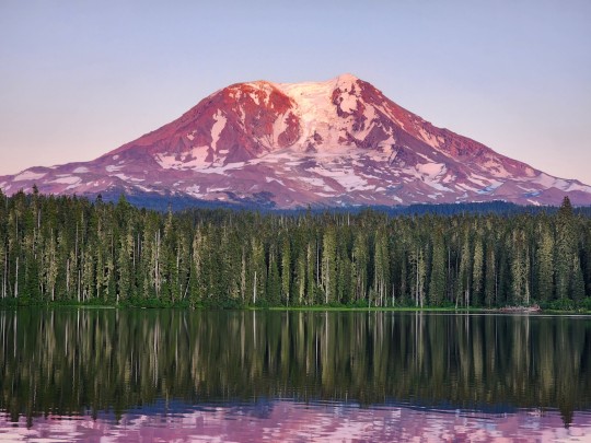
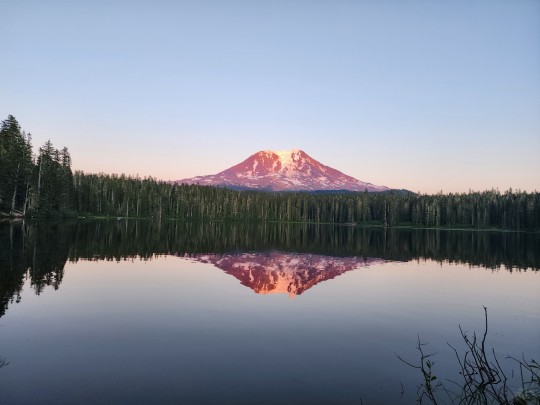
TAKHLAKH LAKE
MOUNT ADAMS
JULY 18, 2023
#washington#pnw#pacific northwest#outdoors#cascades#hiking#washington state#pnwonderland#camping#summer#mount adams#gifford pinchot national forest
5 notes
·
View notes
Text
Keeping an eye out

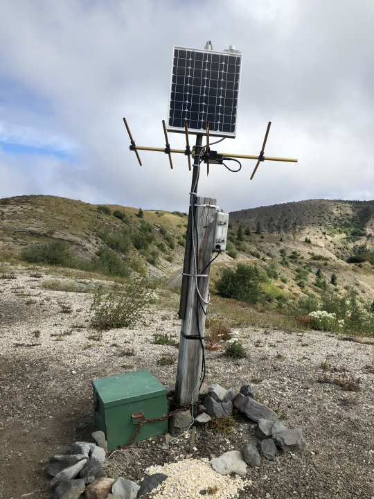
Mount St. Helens is the most active volcano in the Cascades. It's major eruption in 1980 has been succeeded by about 10 other smaller eruptions and maintains near-constant microseismicity. The first pictures show one of the close-in monitoring stations at Windy Ridge. The USGS Cascade Volcano Observatory maintains a number of large monitoring stations close to the mountain, near the vent, where they've been armored to protect from eruptive activity. These stations typically include a seismometer (seismogram here), a GPS station (the white dome), and other equipment like geophones or a webcam. Volcanoes never erupt spontaneously, they are always preceded by some kind of activity - usually small earthquakes - and let you know when they're ready to go. St. Helens hasn't done anything since about 2010, taking a well-deserved rest after the major lava dome growth in 2004-2008.
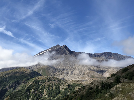

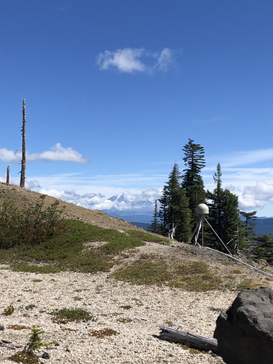
Around the mountain to the southeast, you can hike through the Plains of Abraham's pumice fields and past the slot-canyon head of Ape Canyon to the rim of the Muddy River, where another monitoring station reports seismicity and GPS data. The GPS stations observe the shape of the volcano over time. As gas, fluids, and magma move around inside the mountain, the surface deforms. Rapid or dramatic deformation is often indicative of impending eruption or other activity, and is one of the most important parameters in the volcanologists' arsenal.
#geology#pacific northwest#washington state#washington geology#mount st helens#volcano#cascade volcanoes#gifford pinchot national forest#volcanology#geohazard#loowit#bettergeology#adventures
43 notes
·
View notes
Text


Tadpoles at Pinchot, 2008.
#personal#2008#pinchot#gifford pinchot#pennsylvania#state park#tadpole#nature photography#original photographers
0 notes
Text


Peak fall colors at Indian Heaven/Gifford Pinchot NF.
Originally called Sahalee Tyee, this area has been a traditional gathering place for local indigenous people for thousands of years.
#original photography#outdoor photography#nature photography#clootie#border collie#indian heaven#sahalee tyee#gifford pinchot#pnw#blue lake
3 notes
·
View notes
Text

#pnw#pacific northwest#washington#summer#spring#miss#nature#forest#gifford pinchot national forest#trees
2 notes
·
View notes
Text
0 notes