#Fault (geology)
Explore tagged Tumblr posts
Text
Youtube post of that Myanmar quake vid shown at different speeds and zoomed to highlight changes.
youtube
This really is the first time a side-strike rupture (sideways, as opposed to a head-on collision like Japan's) has been caught on video.
I will never again be confused what they mean by "right lateral" side-strike.
(I keep yammering on about it since I live 80-100 miles from the San Andreas fault, which has and will move the same way.)
#geology#seismology#earthquake#science#to be clear i knew what side strike meant#but the ground the person is standing on may actually be moving to the left#however when you're actually experiencing it you may feel the vibration and some movement#but what you SEE is the other side of the fault appearing to scoot right
1K notes
·
View notes
Note
Silly Game Time: What was the most recent internet search you're comfortable with sharing?
Slickensides! Slickensides are rock races that are polished smooth by rubbing against another rock at a fault line (source of earthquakes). We found one on our field trip (and I looked them up online to see what other look like).
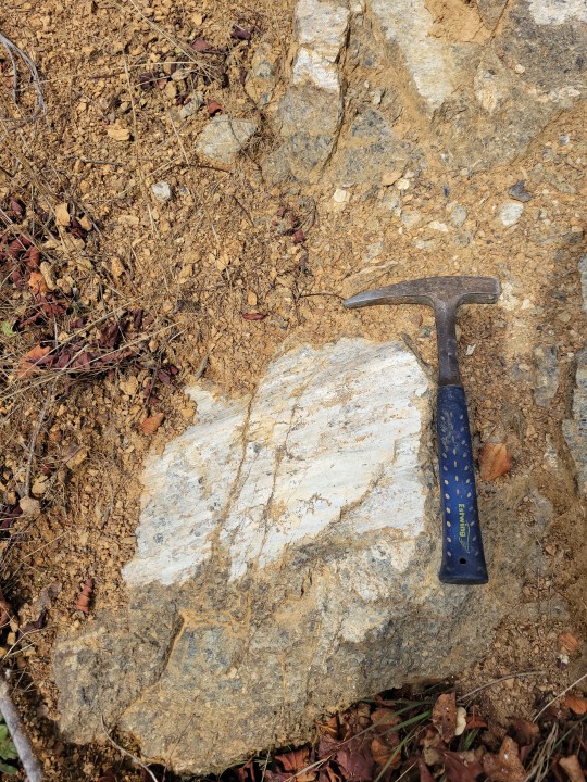
This polished surface was so smooth and hard that it felt like porcelain. It's just crazy to think that this was caused by rocks rubbing against rocks.
#this was obly half of the slickenside#an unexpected ask#jkl my beloved#geology#fault line#slickenside
150 notes
·
View notes
Text
The primary cause lies in Myanmar's complex geology: a rupture occurred along the Sagaing Fault, a massive 1,200-kilometer tectonic boundary. Here, the Indian and Eurasian plates slide horizontally past each other in a strike-slip
37 notes
·
View notes
Text


Hello fellow geology enthusiasts! I've finished my structural class and have now put some of my homework on my redbubble! link is to the socks version >:3 Enjoy!
#geology#earth science#structure#structural geology#syncline#anticline#antiform#synform#fold#fold axis#axial plane#thrust#thrust fault#normal fault#fault#graben#plate tectonics#cross section#annotated#diagram#anatomy of a fold#crenulation#slaty#pencil#anastamosing#penecontemporaneous#boudin#fracture#tectonic#gneiss
8 notes
·
View notes
Text


THE WRATH OF ENIGMA, PAGES 3 AND 4---A SLIGHT DISTURBANCE
Enigma tells San Andreas his purported backstory--he was a fault line on the ocean floor of a tectonic plate that Cascadia subducted. Fearing for his life, he dug his way through the mantle wedge and escaped out of one of Cascadia's volcanoes.
In the third panel you can see Enigma embedded in the Juan de Fuca plate slowly moving down Cascadia's gullet. There is also an unfortunate human city on top of the North American continent getting treated to a train of tsunamis thanks to Cascadia's megathrust binge eating*.
In the fourth panel you get treated to a complete view of Cascadia's "digestive tract."** So now you know that the core-mantle boundary is where Cascadia drops his poop. It's hard to see, but Enigma is in Cascadia's "stomach", which is essentially a cauldron of magma.
San Andreas takes Enigma to meet the Allies of Gaia, which are an organization of people that work with the natural disaster avatars to help protect the planet. The panel with all the people has all the main Allies of Gaia characters together, Melissa (who has appeared in both comics and my story on Wattpad), Jeremy (who I've recently posted art of), Sam (who has appeared in many comics with San Andreas), and Chastity (who primarily appears in the Wattpad story). Everyone seems to like Enigma, and things are great.
But then, while resting at his family's house in a Bay Area suburb, Sam experiences a mysterious earthquake. It's got nothing to do with San Andreas, and the aftermath is ominously quiet...
-*The Juan de Fuca plate only moves down Cascadia's throat in megathrust earthquakes, otherwise it is locked. So he pretty much has to create giant earthquakes in order to eat...which is why pretty much every other character wants him to keep starving lmao
-** I think the older slabs of the Farallon Plate would be further to the east than shown in this panel, but I ran out of room.
#webcomic#san andreas fault#cascadia subduction zone#geology#geophysics#earthquake#fault line#the wrath of enigma
6 notes
·
View notes
Text
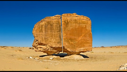
The Al Naslaa Rock Formation
#Al naslaa#saudi arabia#rock formations#rocks#petroglyphs#boulders#nature#fault lines#mystery#geology#sandstone#desert#Balance#remote#Perfect
18 notes
·
View notes
Text
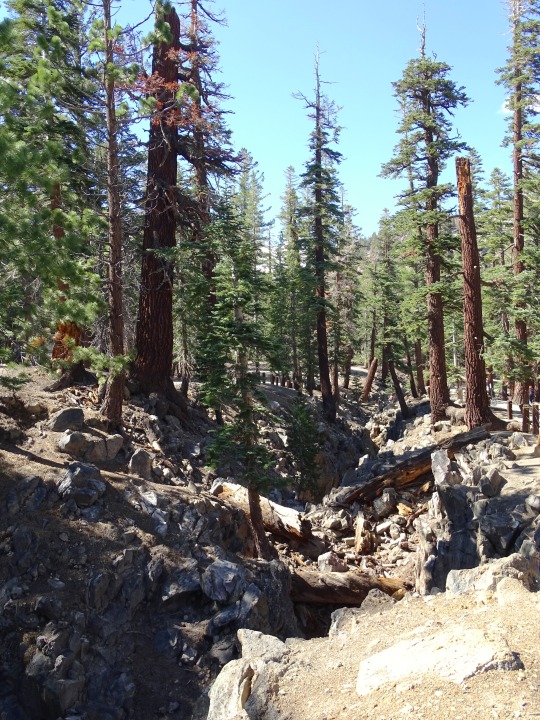
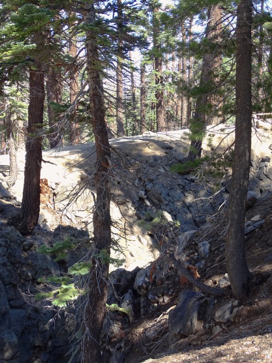
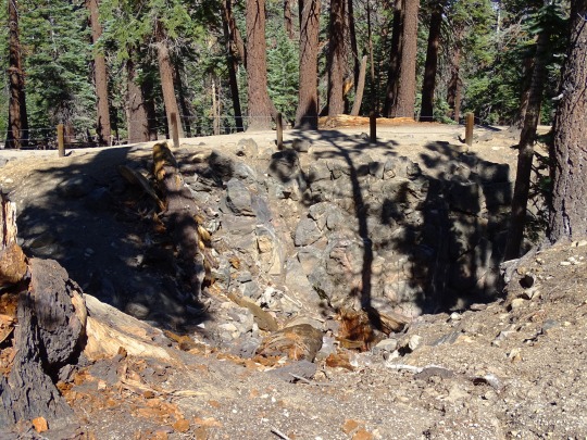
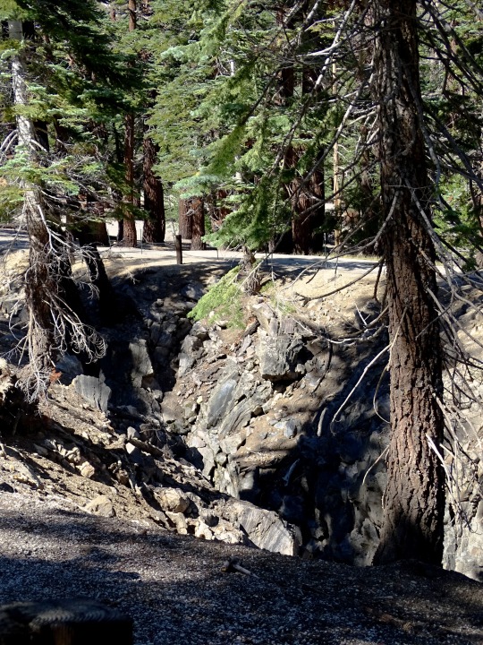
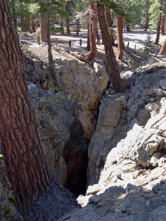
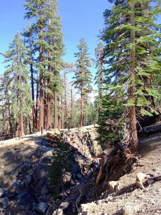
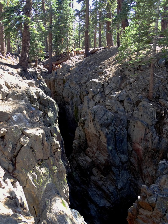

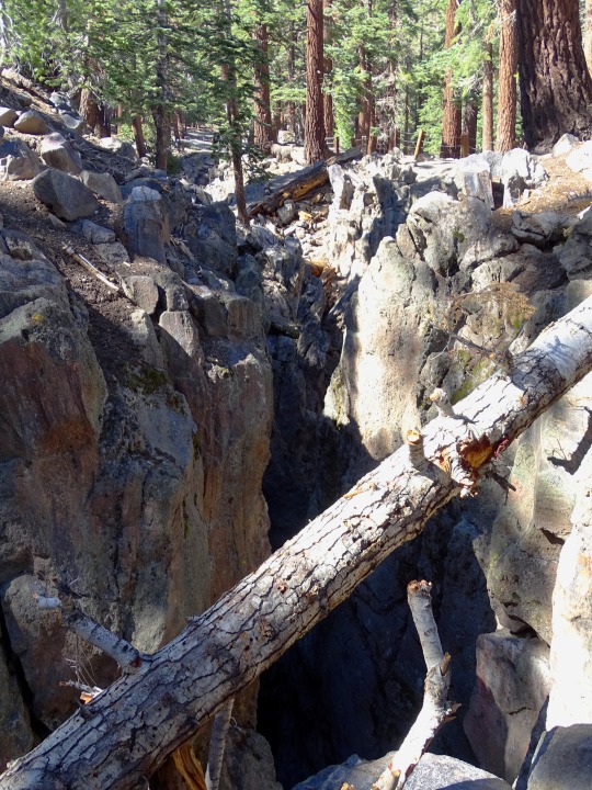
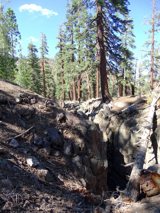
Forest (No. 87)
Earthquake Fault, Mammoth Lakes
#Earthquake Fault#Mammoth Lakes#California#Mono County#history#geology#USA#travel#original photography#vacation#tourist attraction#landmark#landscape#countryside#summer 2022#woods#flora#nature#pine#fir#free admission
17 notes
·
View notes
Text
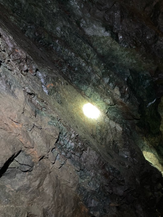
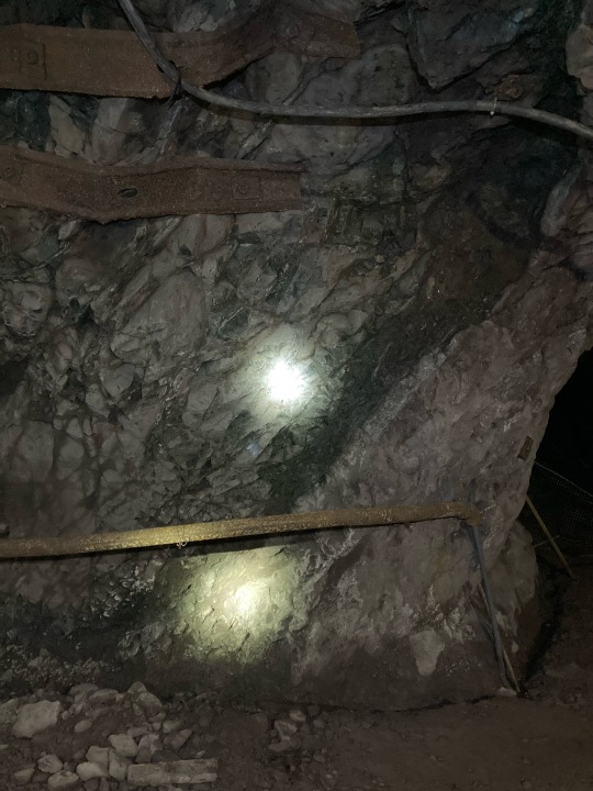
I will actually do all the geology write ups about my trips last summer eventually but here’s a reverse fault underground .
I’m a bad geologist for not putting a scale in but the fault zone is maybe a foot?
Probably wouldn’t be a great time if it reactivated while we were standing next to it but we’d learn something new!!
20 notes
·
View notes
Text
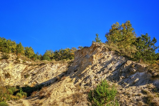
this is where i'm blogging from btw
#WOW tumblr ate the quality. horrifying. open the image to see Layers#beautiful quarry in subequana fault zone#this field trip is so beautiful and so completely useless#some of these kids know SO little about geology it's wild#however i'm staring at distant mountains so that's neat#veni veni#erasmus tag#there are many disadvantages to being a geologist#and i do mean it i'm literally blogging from here. gravity falls fanart in the lunch break etc
8 notes
·
View notes
Text

#Earthquake#natural disasters#Marmara fault#23 april#fault#strike#News#geology#tectonic plates#istanbul#turkey#magnetic field#USGS
3 notes
·
View notes
Text
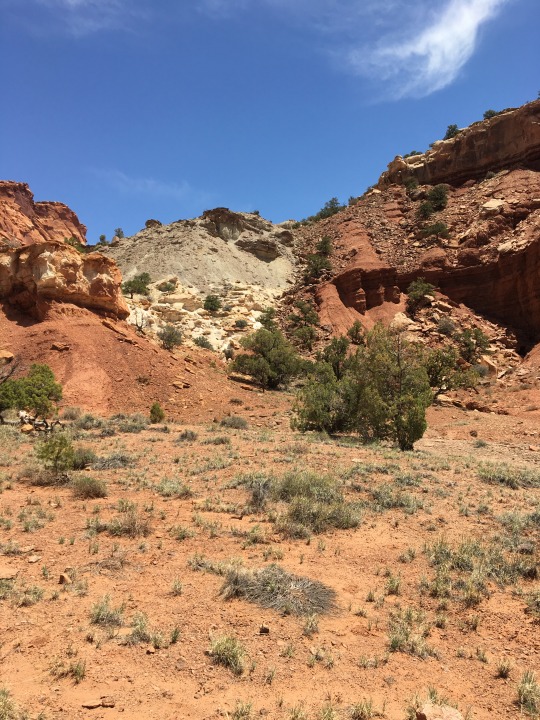
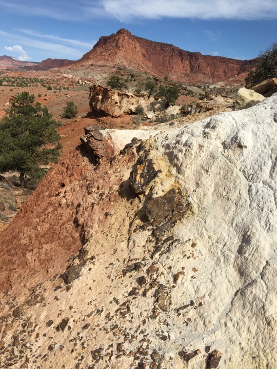
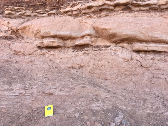
Faults in Capitol Reef National Park, UT
The first two photos are of the same near vertically-oriented fault. This is a major fault that stretches for miles across the northern portion of Capitol Reef and outside the park, towards Torrey, UT. The third photo shows two smaller parallel (synthetic) faults in the Entrada Sandstone where the top (hanging wall) layers were dropped down, indicating extension.
June 2023
#geology#faults#rocks#utah#deserts#nature#landscape#landscape photography#nature photography#photographers on tumblr#photography#original photography#lensblr#my pics
23 notes
·
View notes
Note
wait no please explain mineral processing!!!
I gasped in delight at the ask, haha. I love mineral processing.
Mineral processing is the theory of economically getting your desired element out of whatever it naturally comes in. So Li out of spodumene, or Cu out of chalcopyrite. It's usually split into hydrometallurgy and pyrometallurgy (liquid chemistry and melting the fuck out of it, respectively), and often taught as hard rock extraction, but you need it for Every Element, really. So you can also focus on extracting phosphates, or nitrates, or uranium! It's chemistry++~
Personally, I know the most about copper extraction and my focus is on hydrometallurgy/geometallurgy, although pyrometallurgy is near to my heart. Copper is coincidentally a really good example of how the two work because it comes as so many natural minerals. (Further explanations under the cut...)
So for copper minerals! You have a whole slew of oxides and sulfides. They occur in different part of your orebodies under different states of oxidation/sulfidation. Take Chrysocolla, Malachite, Chalcocite, and Chalcopyrite. (Cu-silicate)(an oxide), (Cu-carbonate)(an oxide), (Cu-Sulfide), and (Cu-Fe-Sulfide).
Mines usually use hydrometallurgy for oxides by sticking them in a leach heap and pouring sulfuric acid over the whole thing. The acid selectively picks up the Cu ion from silicates and carbonates, leaving the primary tetrahedra alone. The sulfides can work with this chemistry if the mineral's comfort zone is outside of the current conditions (Chalcocite does leach, but usually leaves a Cu ion in the structure as CuS) but minerals like Chalcopyrite are very poor leachers because the outer rim of ions are ripped away, leaving a somewhat-hypothetical "passive layer" of Fe/S that won't react with the acid. So if you have a mine with a lot of Chalcopyrite, you'll be leaving money on the table unless you do something.
So people use pyrometallurgy! Which is what we've been using since the Bronze Age, really. You crush the rock to micrometer grains, use the hydrophobic properties of sulfur to "float" the sulfides in water, then send all of it to the smelter and melt the shit out of it, while adding particular chemicals and minerals to enhance copper recovery while suppressing sulfides you don't want, like sphalerite and galena.
It's REALLY cool. I'm biased of course, but I absolutely love the whole cycle. xD Being in mineral processing also gets you on the backside of geopolitics because you're the only person who understands how to GET things and WHERE to get them and why it's not as simple as pulling Cu out of the ground.
Feel free to ask questions!! I love processing so much, and mining in general, even though I'm only a master's student.
((And NO STUPID QUESTIONS. The mining industry is a goddamn black box DO NOT feel bad if you don't know what stuff means or formulas, or processes. I swear I learn one new word a week. They also have fifty names for everything too because 50 names are always better than 1. 👍)
#Mineral processing is like- the pinnacle of geology in my opinion. I feel so biased saying this! lmfao. I love it though! It's why it#matters if you have Bornite or Chalcopyrite in the ground; or if your ore deposit is in an ophiolite or a porphyry; or if your gold is in a#quartz vein or a fault zone. If your gold is stuck as native in quartz you might not be able to get it out!#To be clear I'm a geologist too. Technically in engineering because that's where this stuff is taught but I identify as Geologist~#mining#mineral processing#geology#I hope I didn't talk too much! I tried to give a good explanation without teaching a class. It's so much info. lol
31 notes
·
View notes
Text
Calico Fault, Mojave Desert
One of the best geological anticlines (folds up) and synclines (U or V shaped) in the world, often used as the textbook example of both.
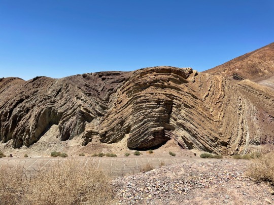
(My photo) I started camping in the adjacent campground during 2021 because SEXAY ROCKS to self-isolate on the drive to visit my parents in Utah.
But I'm not a geologist, just a rock groupie, so I'm happy to find a great short video Explaining The Thing.
youtube
Edit: I swear that's my own photo at top; if you look closely the vegetation's different. l I guess we both headed for the same corner of the parking lot for the best view!
8 notes
·
View notes
Text
Transform plate boundaries are tectonic regions where two lithospheric plates slide horizontally past each other along strike-slip faults.
Transform plate boundaries are one of the three primary types of tectonic plate interactions, alongside divergent and convergent boundaries. Transform boundaries are characterized by horizontal motion between two plates, resulting in a transform fault.
#geology#tectonic#Transform plate boundaries#divergent#convergent#resulting in a transform fault.#transform fault
6 notes
·
View notes
Text
I understand that this Superman movie was made in 1978, but this is some of the worst movie earthquake science I've ever seen, and I watched 2012
#superman 1978#i am literally studying geology and this is so painful#i was really enjoying the movie too#despite it having the longest opening credits known to man#what do you mean you're going to activate the San Andreas to make West cali fall into the ocean!?#San Andreas? the transform fault!?#what do you mean the earth just Moves Apart a Little!?#WHAT DO YOU MEAN HE FIXES IT BY PUSHING THE GROUND BACK UP!?!?
4 notes
·
View notes
Text
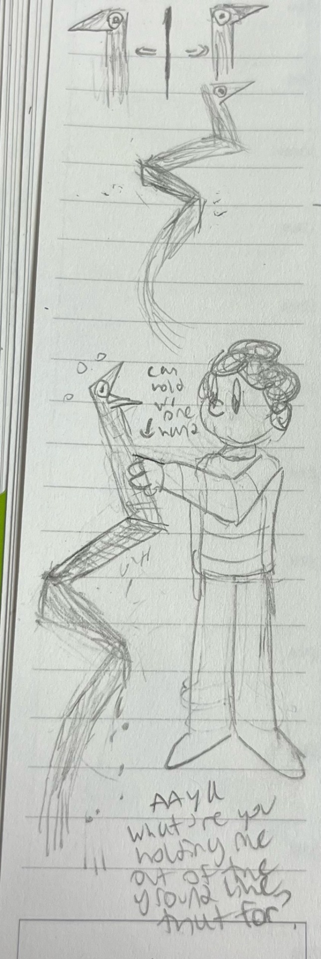
REALISTICALLY PROPORTIONED SAN ANDREAS IS SO GOOFY
If we assume that San Andreas has the same proportions in his miniature avatar form as the full size fault, he looks really ridiculous.
The inspiration for this drawing is from the paper referenced in this article:
https://www.livescience.com/18290-san-andreas-fault-propeller-shape.html
Specifically this diagram:
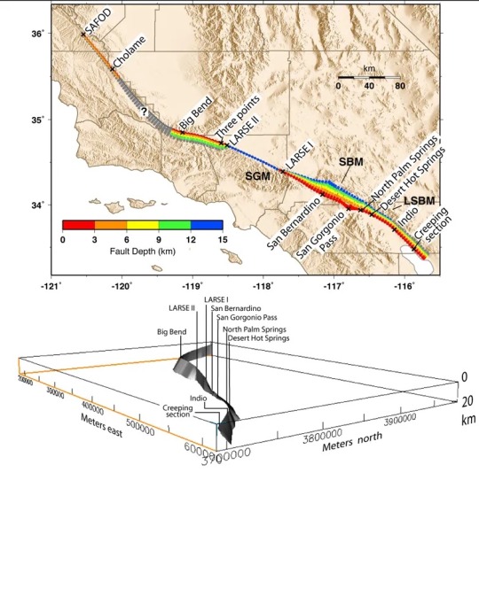
I would link the actual paper but it is behind a paywall and requires a university internet to access for free.
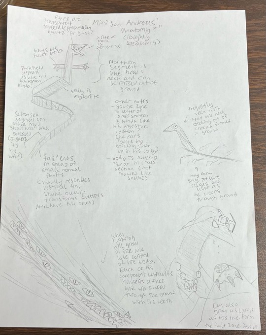
Overall notes on San Andreas’ “anatomy”
He is very flattened from side to side in cross section, but the direction of flattening changes along his length. Weird rock ribbon snake, that guy.
(It is possible to yank San Andreas’ miniature form out of the ground, upon which he loses his earthquake powers and he becomes quite helpless. This of course doesn’t work on his full size form or his true form because good luck ripping 800 miles of fault out of the ground)
#sketch#character designs#san andreas fault#geology#earthquake#so you can stop complaining about why San Andreas looks kinda like a snake#geophysics#seismology
9 notes
·
View notes