#Cloudripper
Explore tagged Tumblr posts
Video
Get Yourself to the Ancient Bristlecone Pine Forest by Mark Stevens Via Flickr: While walking the Discovery Trail and taking in views of the ancient bristlecone pines in this portion of the Schulman Grove and Inyo National Forest. The view is looking to the southwest with a distant view of the Sierra Nevada mountains.
#Ancient Bristlecone Pine Forest#Azimuth 201#Birch Mountain#Blue Skies#California and Oregon Road Trip#Central Sierra Nevada#Cloudripper#Day 2#Discovery Trail#DxO PhotoLab 5 Edited#Forest#Forest Landscape#Forest Mountain#Great Basin Bristlecone Pine#Great Basin Ranges#Hillside of Trees#Intermountain West#Inyo National Forest#Landscape#Landscape - Scenery#Looking SW#Methuselah#Methuselah Grove#Middle Palisade#Mount Agassiz#Mountain Peak#Mountains#Mountains in Distance#Mountains off in Distance#Mountainside
4 notes
·
View notes
Text

the hopeful.... (she/it)
[ID: a digital portrait of my oc Myrna. she is a brown person with a rattail hairstyle and face acne. there's a small scar on her cheek and one that goes across her neck. she wears a purple shirt. she is looking at something off-screen on the upper right. background is plain white with an orange geometric shape angled across the screen behind her. END ID.]
9 notes
·
View notes
Text
Table Mountain (N) via Tyee Lakes, 2022 Sierra Challenge Day 8
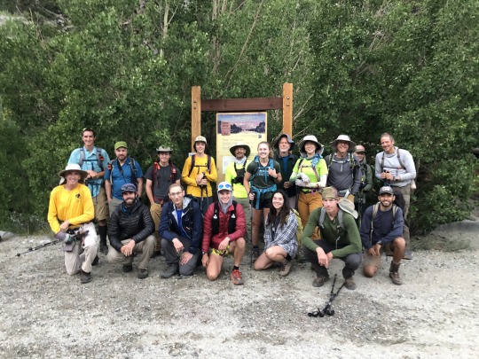
There are two Table Mountains within in the Sierra Nevada. The southern Table Mountain lies on the Great Western Divide and is a very difficult peak to day hike. The northern Table Mountain lies between South Lake and Lake Sabrina east of the Sierra Crest and relatively speaking is a very easy peak to day hike. Day 8 of the 2022 Sierra Challenge was designed to be an active rest day, sandwiched between the two toughest days of the The Citadel and Mt Torchbearer. Therefore, the northern Table Mountain seemed like a good fit. Bob surprisingly encouraged this selection, as there had never been a Sierra Challenge outing starting from Tyee Lakes Trailhead.
I woke up in my motel room somehow motivated to keep in the running for the Yellow Jersey. I drove through the darkness and arrived at the Tyee Lakes Trailhead as the dawn light began to fill the sky. As with most easy days, we had a big crowd for the day's outing. I was disorganized, rushing and awkwardly reintroduced myself to Andrew Schaper. While I had met him many times before, I had never seen him without his hat and sunglasses. I took the trailhead photo and we set off. I immediately dropped to the back of the pack and maintained a very slow pace with Mike. His Achilles was giving him trouble, but he quickly found that my pace was too slow even for him so let left me. My legs were in great pain following the previous day's outing and I suffered more than I expected. I was at least able to pass 77 year old Ron Hudson and his 68 year old girlfriend Karen Anderson, so I guess my pace could have been slower. After about two miles I reached the first of the Tyee Lakes where I caught up to Iris who was fishing and also nursing an injured knee.

We passed by four lakes that day, with each of them getting more and more beautiful as we climbed.

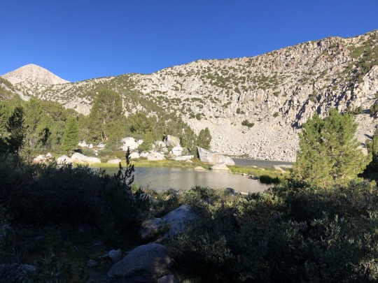
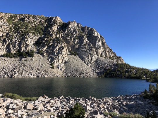
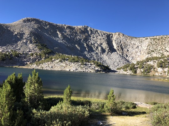
After 3 miles the trail left the lake basin and began switching back up to the plateau that was Table Mountain.


I spotted a large group on the top. I wished that I could have been part of the fun, but today was not the day.
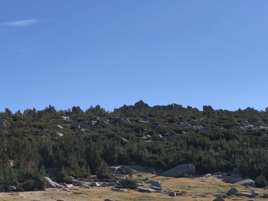
A couple large snowshoe hares darted across the barren plateau. There were humans approaching from all directions!
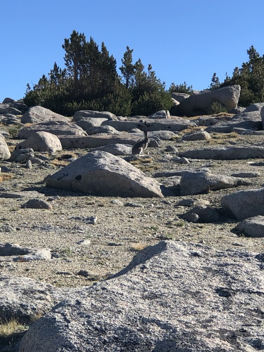
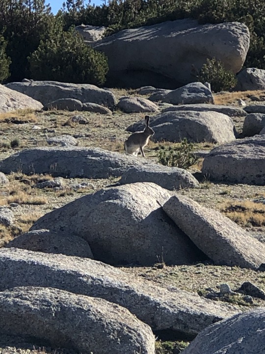
I passed some people heading down, and I watched as others made their way to other points atop the plateau. There were some pines in between me and the summit, so I took a roundabout way that lent itself to no bushwhacking.
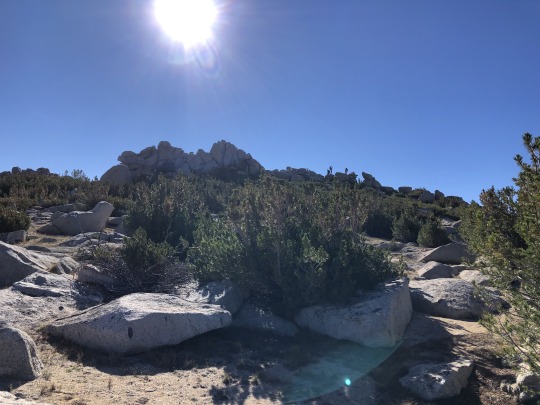
I found a surprisingly fun summit block. I took a challenging route up and sat on the summit. Emma and Megan were basking on one of the rocks below.
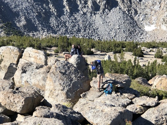
To the southwest were Mt Powell and Point Powell.

To the northwest were Mt Emerson and Mt Humphreys.

To the southeast were Cloudripper and Mt Agassiz.

There was another point to the northwest that looked nearly as tall, so I decided to go visit it. It was about three quarters of a mile away, but it looked closer. Others had already headed that way so I decided to follow. Sandy slopes took me to another interesting set of summit boulders. This peak did not qualify as a bonus peak, but it made for a worthwhile detour. Besides, I'm a purist. Looking back was the first summit.
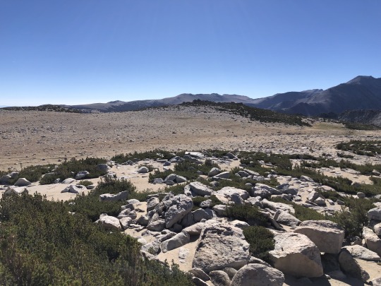
There were a couple possible high points at this location so I scrambled up both piles of rocks. Again they were fun class 3.

To the south was Thompson Ridge. Some of the more eager participants had continued towards this challenging 13er.
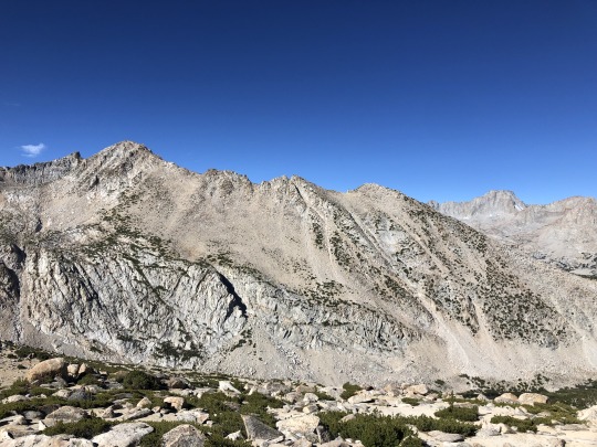
I then continued a half mile southeast to a third and final point on the plateau. Mason had mentioned finding a Smatko register on this summit previously, but not I, nor anyone else, found it.

I headed cross country down sandy slopes back to the trail where I found Zee. We chatted for a bit then I stopped at the lake for a refreshing swim. Iris was out and about fly fishing, a true outdoors woman.

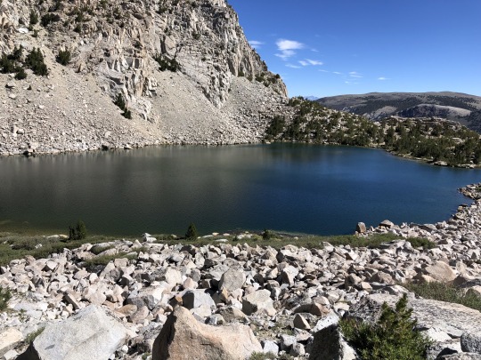
With a mile left to go, I ran into a challenge participant who was just starting. It was almost noon, but he still had plenty of time being that it was an easy day. He immediately asked me if I had any food. I said no, but this was a lie. I wasn't willing to share my dwindling snack reserves with an adult who could easily buy their own. Later that night, that same participant locked his keys in his car at Copper Top in Big Pine. Luckily, I had already left to investigate the Shepherd Pass Trailhead conditions, so I didn't have to waste my energy with that ordeal.
Official Summary:
Active rest day.
A 6am start was a little early following an arduous day 7, but many were at the trailhead on time. Today was a good day for fishermen and lake swimmers. The summit block was a fun class 3 scramble.
I went to all three points of Table Mountain that were marked on the topo. My feet are starting to hurt really bad so I'm worried about tomorrow. Let's see what my body can handle.
2 notes
·
View notes
Text


Inyo National Forest, California.
Plenty of days given over to climbing Cloudripper via Green Lake. It's rather up there. From July 2014.
#backpacking#trekking#Inyo National Forest#Cloudripper#mountains#Sierra Nevada Mountains#California#nature#hiking#landscape#travel#hike#outside#peakbagger#peak bagging#Inyo County
1 note
·
View note
Text
Google's second-generation Tensor SoC is in the works
This might power the upcoming Pixel 7 phones. #Google #GoogleTensor #everytechever
Google’s new Tensor processors made their debut today with the Pixel 6 and Pixel 6 Pro. The Google Tensor chips, which were developed with Samsung’s assistance, are tailored for Google’s significant use of machine learning, in some cases speeding up current functionality or enabling things that couldn’t previously be done on a phone. Our APK Insight team discovered references to “Cloudripper,” a…

View On WordPress
1 note
·
View note
Text
「Pixel 7/7 Pro」第2世代Tensorチップ、Samsung製モデムを搭載?
2022年のGoogleのPixel、「Pixel 7/7 Pro」。 その「Pixel 7/7 Pro」の噂が出てきています。 「Pixel 7/7 Pro」第2世代Tensorチップ、Samsung製モデムを搭載? Pixel6 9to5Google 「Pixel 7/7 Pro」 9to5Googleは、Pixel 7と7 Proについて、デバイスのコードネーム、使用されるTensorチップ、Samsung製モデムなど、最初の具体的な詳細を明らかにしたということです。 プロセッサ、モデム 第2世代のTensorは、Tensor GS201は、「Cloudripper」というコードネームということです。 GS201は、型番「g5300b」モデムを搭載するということで、これ��未発表のSamsung製Exynos Modem 5300だそうです。 「Pixel 7」「Pixel 7…

View On WordPress
0 notes
Text
Google Pixel 7 and 7 Pro are in the works with second-gen Tensor SoC and a new modem
Google Pixel 7 and 7 Pro are in the works with second-gen Tensor SoC and a new modem
Google currently has all hands in honey as it is currently working on Android 13, Pixel 6a, Pixel Notepad foldable device, along with the upcoming Pixel 7 and 7 Pro. The latest report has suggested a few information about the upcoming flagship iteration aka iPhone 7 series that will host a processor codenamed as “Cloudripper” along with a new Samsung modem. The folks at 9to5Google learned it…

View On WordPress
0 notes
Photo

We cannot deny the feeling of pure joy the mountains bestow upon us. Their invisible, magnetic attraction pulls at our hearts and gray matter and unlike actual magnets, the farther we are from the mountains, the stronger our desire to immerse ourselves in their beauty and grandeur. . This holiday weekend, Amanda, @xenome and I made our way to the Eastern Sierras for some much needed time amongst the craggy summits West of Bishop, California. . This is a photo of Pablo rocking the epic jump shot on top of Bishop Pass, with Picture Puzzle Peak behind him from our warm-up hike on Saturday. On Sunday, we attempted to climb Cloudripper, but opted to summit the slightly shorter Vagabond Peak instead, which still requires a few miles of off-trail travel and some 3rd class scrambling (using your hands but no dangerous exposure). With a little bit of assistance on the hardest parts, @royalthedoodle even made it to the top! Could that have been the first doodle (or puppy) summit of Vagabond Peak? . We took some video on Sunday and will share with y’all in the stories, so go check them out later today! What adventures or creative endeavors did you guys get into this weekend? (at California) https://www.instagram.com/p/BnUVgCNlDIq/?utm_source=ig_tumblr_share&igshid=ityqfycb2mz7
2 notes
·
View notes
Text
Google está trabajando en un Tensor SoC de segunda generación
Google está trabajando en un Tensor SoC de segunda generación
El equipo de investigación cree que Cloudripper no es en realidad el nombre del chipset ni es el nombre del Pixel 7 del próximo año. Este es probablemente el nombre en clave de la plataforma utilizada para probar el chip, que lleva el número de modelo “GS201”. Eso se compara con el nombre de modelo actual de Tensor SoC “GS101”. No es demasiado descabellado que Google ya esté trabajando en un…

View On WordPress
0 notes
Video
Get Yourself to the Ancient Bristlecone Pine Forest by Mark Stevens Via Flickr: While walking the Discovery Trail and taking in views of the ancient bristlecone pines in this portion of the Schulman Grove and Inyo National Forest. The view is looking to the southwest with a distant view of the Sierra Nevada mountains.
#Ancient Bristlecone Pine Forest#Azimuth 201#Birch Mountain#Blue Skies#California and Oregon Road Trip#Central Sierra Nevada#Cloudripper#Day 2#Discovery Trail#DxO PhotoLab 5 Edited#Forest#Forest Landscape#Forest Mountain#Great Basin Bristlecone Pine#Great Basin Ranges#Hillside of Trees#Intermountain West#Inyo National Forest#Landscape#Landscape - Scenery#Looking SW#Methuselah#Methuselah Grove#Middle Palisade#Mount Agassiz#Mountain Peak#Mountains#Mountains in Distance#Mountains off in Distance#Mountainside
4 notes
·
View notes
Photo

a sister’s sorrow (she/they)
16 notes
·
View notes
Text
Eagle Peak, Victoria Peak & Robinson Peak from Buckeye Trailhead

With the California fire wilderness closures being extended on a weekly basis, I had a limited area of accessible wilderness to access. Hoover wilderness remained open, so I planned a visit to Eagle Peak, a Sierra Nevada P2k that I first viewed on my early ascents of Matterhorn Peak. My dad was celebrating his 65th birthday at the family cabin in Twain Harte, so I decided to spend the night there and make a day trip out of it. I arrived at the trailhead around first light, then began up the road prior to sunrise. Even though it was hunting season, I didn't see another soul the whole day.

The route starts off as a road following Eagle Creek up the canyon. I reached a corral after 2 miles and the road transitioned into a dusty trail.

I was in awe of the fall colors.


The trail forked in many different places, and I tried to stay on the most defined option. Most, if not all, of these forks were cow trails. Pines began to replace the aspens as I gained elevation. After 4 miles, I reached a tributary feeding Eagle Creek. There was a well defined cow trail heading up this canyon, so I decided to follow it. This was not the standard route, but it was an alternate option that worked just as well. I aimed to climb the northeastern slopes of the peak following a gully all the way to the summit.


The trail disappeared and reappeared several times. It is probably best to stay on the right side of the creek and be patient with the gradual elevation gain. In my exploration I crossed the creek several times, one time sinking ankle deep into the mud.

The creek forks again at around 9,600 ft. I took the left fork, still finding some light use trails taking me where I needed to go.

The use trails dissipated shortly after, but terrain was easy enough. The cliffs of Eagle Peak stood in front of me. There was one steep, loose section that I had to surmount. I aimed for the lightly defined gully.

I slowly made my way up this unpleasant patch, but this section wasn't very long, and once beyond I had the worst of my day in the rearview mirror.

I snuck up on a giant snow hare. I had last seen these on a late fall climb of Cloudripper, and I was again impressed by their large size. I had enough time to snap a photo before it bolted.

Slopes became easier again. There was a light breeze and all smoke seemed to linger in the lower elevations, leaving me bluebird skies.

The summit stood dead ahead, and I felt relieved knowing that my alternate route would end up working out quite well.

The last section of the climb was a bit of a slog, but I eventually made it to the summit 4 hours after starting out. It was incredibly windy so I took shelter behind some summit rocks.

To the northwest was Walker Mountain and Hanging Valley Ridge.

To the north were Buckeye Valley and Rickey Peak. Beyond that were the Sweetwater Mountains.

To the northeast was the town of Bridgeport.

To the southeast was Dunderberg Peak.

To the south was the northern border of Yosemite.

To the southwest was Victoria Peak.

Further to the west was Tower Peak.

I had considered visiting Victoria Peak as a bonus peak, but it was so windy that I had second thoughts. I then recalled Bob Burd's trip report.
"I had plans to continue southwest to Victoria Peak, little more than a mile away, but the strong winds gave me pause. It was blowing quite strongly and I was having trouble keeping warm and I was almost ready to call it quits and head down. But something made me continue on, and I was glad of it because the winds diminished some even as I started to descend from the nearly 12,000-foot highpoint."
This was enough to convince me to go for it, and I'm glad I did because the exact same thing happened to me. The wind almost immediately vanished, and I had a pleasant walk along an easy ridge towards the next peak.

This bonus peak didn't have much prominence, meaning I didn't have to drop too far down to a saddle. It was mostly an easy ridge walk, with one obstacle along the way that I had to hike down and around.

It took me only a half hour to reach Victoria Peak from Eagle Peak.

I found the views to the northwest most impressive, however up to this point, none of those peaks were on my hiking radar.

To the west was Hunewill Peak.

To the southwest were Cirque Mountain, Crown Point, Slide Mountain and Kettle Peak.

To the southeast was the Sawtooth Ridge.

I didn't spend much time on the summit because views were more or less similar as on Eagle Peak. I turned my focus to Robinson Peak, which from this higher vantage point looked quite diminutive when compared to the perspective from Twin Lakes below.

I made my way down easy slopes and found cliffs in front of me. I followed the cliffs until reconnecting with the ridgeline that took me down towards the saddle connecting the two peaks.


I crossed some creeks and meadows, trying to find a way to the base of Robinson Peak that minimized elevation change. I then followed the western ridge to the summit, avoiding the patches of trees when necessary.

I made it to the summit at 12:30pm, just in time to have lunch. Down below was Annett's Mono Village and the Horse Creek Falls Trailhead.

To the south was Matterhorn Peak, the northernmost Sierra Emblem Peak.

Alongside Matterhorn Peak stood The Dragtooth, The Doodad, Cleaver Peak and the other teeth that make up the Sawtooth Ridge.

To the southwest was Robinson Canyon.

To the northwest were Victoria and Eagle Peaks.

To the north was my ascent canyon.

I had some service on the summit so I sent out a few texts while I ate lunch. I was ahead of schedule, and I estimated I would be back at the car by around 3. The northern slopes of Robinson Peak were wide open and easy to descend.

-Eagle Peak

-Fire Ring

Once down in the canyon, I followed a series of use trails until I was back on the main path.

Once on the "standard route", I zoned out and enjoyed the nice temperature and beautiful autumn colors.


I reached my car before 3pm, which meant I would be back in Twain Harte for dinner with my parents. After dinner, I continued my drive home, eager to see Leif and Asaka.
2 notes
·
View notes
Text
جوجل تبدأ العمل على تطوير الجيل الثاني من معالجات Tensor
جوجل تبدأ العمل على تطوير الجيل الثاني من معالجات Tensor
هذا الموضوع جوجل تبدأ العمل على تطوير الجيل الثاني من معالجات Tensor ظهر على التقنية بلا حدود. بدأت عملاق البحث في العمل على تطوير الجيل الثاني من معالجات Tensor بعد أن قدم الجيل الأول في سلسلة Pixel 6 مؤخراً. رصد موقع 9to5Google تسريبات جديدة تؤكد تطوير جوجل لإصدار جديد من معالجات Tensor والذي يظهر في التسريبات برمز “Cloudripper”. وتشير التسريبات إلى أن رقاقة جوجل القادمة التي تعرف الآن برمز…

View On WordPress
0 notes
Text
「Pixel7」のカメラは新しいレベルに?
2022年のGoogleのPixel「Pixel7」。 そのカメラの噂が出てきています。 「Pixel7」のカメラは新しいレベルに? Pixel 6、Pixel 6 Pro PhoneArena カメラ、画像表示などの人材の採用 GoogleのシニアディレクターであるMike Coulter氏が、LinkedInに、カメラISPの設計と検証のフルタイムの人材を探していると投稿しているということです。 Pixel 6のGoogle Tensor SoCをもたらしたチームの一員になるチャンスだということです。 次のGoogle Tensorチップと改良されたISPで写真が次のレベルに? Phone Arenaによると、次のGoogle Tensorチップには、 “Cloudripper “というコードネームがあるとのこと。 このチップセットは、「Pixel…

View On WordPress
0 notes
Text
Google is working on a second generation Tensor SoC
Google is working on a second generation Tensor SoC
9to5Google spotted an interesting reference within the Pixel 6 family’s source code. It mentions what appears to be a second-gen Google Tensor SoC with the codename “Cloudripper”. The research team believes that Cloudripper isn’t actually the name of the chipset nor it’s the name of the next year’s Pixel 7. This is likely the codename of the platform used to test the chip, which carries a model…

View On WordPress
0 notes
Video
If I Follow This Road, I Will Find Myself in the Mountains by Mark Stevens Via Flickr: From an overlook point along the Discovery Trail with a view looking to the southwest and more distant Sierra Nevada mountains. My thinking in composing this image was to use the down slope and then opened up mountain plane with groupings of Ancient Bristlecone Pines. The road would then be a leading line into the image with the Sierra Nevada mountains as a far off destination. The blue skies and mountains would then be that color contrast to complement the image with earth-tones present in the lower portion. I later worked with control points (line and circular) in DxO PhotoLab 5 and then made some adjustments to bring out the contrast, saturation and brightness I wanted for the final image.
#Ancient Bristlecone Pine Forest#Azimuth 201#Birch Mountain#Blue Skies#California and Oregon Road Trip#Canvas#Central Sierra Nevada#Cloudripper#Day 2#Discovery Trail#DxO PhotoLab 5 Edited#Forest#Forest Landscape#Forest Mountain#Great Basin Bristlecone Pine#Great Basin Ranges#Hillside of Trees#Intermountain West#Inyo National Forest#Landscape#Landscape - Scenery#Looking SW#Methuselah#Methuselah Grove#Middle Palisade#Mount Agassiz#Mountain Peak#Mountains#Mountains in Distance#Mountains off in Distance
0 notes