#Cassiar Highway
Explore tagged Tumblr posts
Text


Forest (No. 14)
Pinetree Lake, BC
#tourist attraction#Stewart-Cassiar Highway#British Columbia Interior#travel#original photography#vacation#landmark#landscape#Canada#summer 2023#British Columbia#forest#woods#flora#nature#mountains#countryside#clouds#Kitimat-Stikine District#the North#Three Sisters Range#fireweed#wildflower#lake shore#meadow#Skeena Region
46 notes
·
View notes
Text

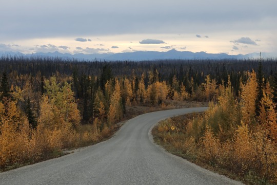
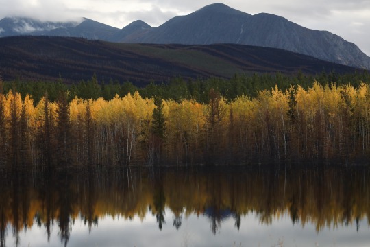

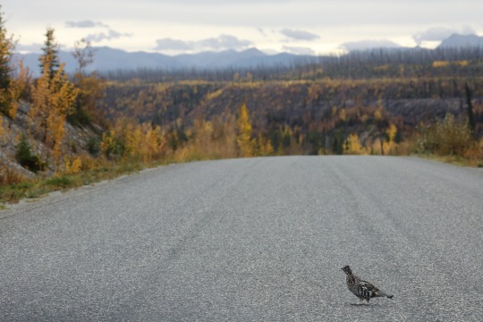
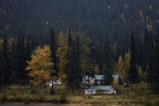
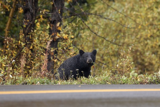
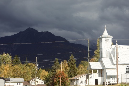
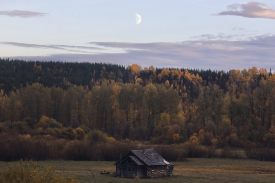
Fall on the Stewart-Cassiar Highway, through British Columbia
Taken September 2023
#autumn leaves#british columbia#canada#lonely roads#highways#churches#mountains#ruffed grouse#bears#black bear#abandoned buildings#my places#my photos#bbv
925 notes
·
View notes
Text


Aspen trees in autumn, Stewart-Cassiar Highway, British Columbia, Canada © Yva Momatiuk and John Eastcott/Minden Pictures
Today on Bing- November 21, 2024 Aspen trees, British Columbia
Fall's flaming colours | EN-CA, EN-CN, EN-GB, EN-US, ROW
0 notes
Text
May 25th, Whitehorse Yukon
Up at 5am and out at 6am from Boya Lake as we have a 310 mile drive to Whitehorse today. Once hooked up we got back on the Cassiar. Great highway for the first few miles then it degraded. Lots of burn scars and a lot of it recent, I think that messed up the road as well as it was really rough, thinking the asphalt melted. Really surreal as to how hot the fires were, some areas were completely burned and there is still no signs of life. After 53 miles, we came to the end of the Cassiar and then on to the Alcan highway.
The Alcan was in pretty good shape, with some problem areas. But unlike the Cassiar it is wider with shoulders and gives you more room to go around the bumps and heaves. Light traffic in both directions until we got closer to Whitehorse. Teslin is always a treat as you drop out of the mountains to this large river with a steel bridge. The bridge is being replaced which I guess is good but will miss the steel deck ride over the Teslin.
Got to Whitehorse before 1pm and immediately went to the park’s RV wash as both our vehicles are looking ugly. The rain yesterday made things very dirty in addition to the usual Yukon dust that you pick up. Once clean, we setup camp and then decided we were starved!
Went to Woodcutter’s Blanket Brewery. Strange name but excellent beer and food. First tasted the Raspberry Kolsch, Wheat beer, British Ale, Pilsner, and Pale Ale which all were excellent. Then we split the Smoked Hamburger….wow, that was amazing! Hard to find places that smoke hamburgers and do it well, but they know what they are doing.
We are tired and after updating the blog for the past few days, we are heading to bed. Here in Whitehorse for 7 days (we love this area).
0 notes
Text
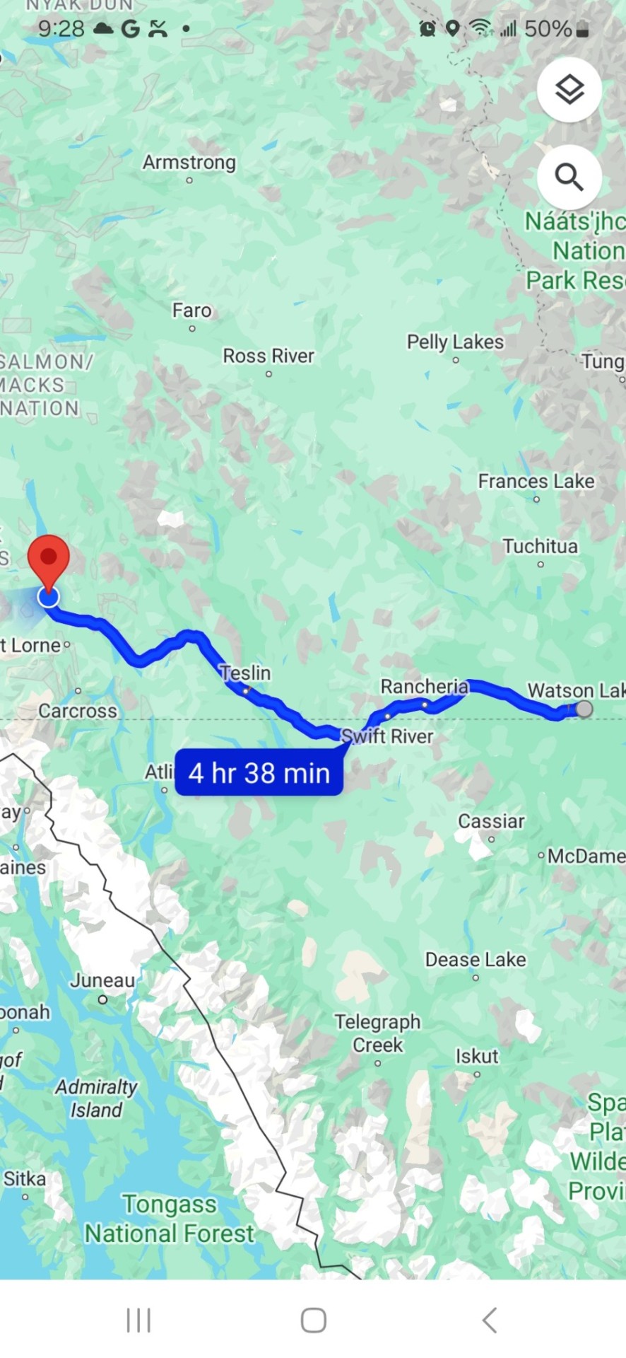
Friday, May 24, Watson Lake, Yukon to Swift River BC to Teslin, Yukon to Whitehorse, Yukon, 437 kms.
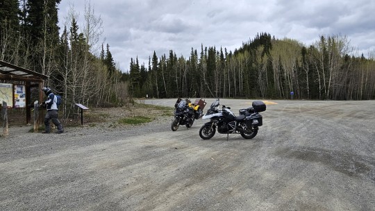
We wake up to the sound of rain. It's a sound we will be getting used to. Breakfast in the hotel to stay dry and then out in the rain to start packing our bikes. The temperature is low 40°s and will stay there most of the day, not breaking through 50° until the mid afternoon.
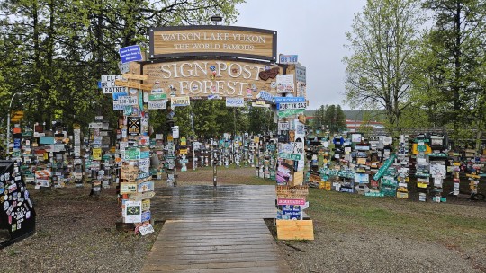
As the trip progresses, we have been bunching up less, and each finding our own riding zones. I leave early as I want to check out Watson Lakes' famous Sign Post Forest, one of the most famous of the landmarks along the Alaska Highway. It was started by a homesick GI in 1942. He was assigned light duty while recovering from an injury and erected the signpost for his hometown: Danville, Ill. 2835 miles. Visitors may add their own signs to the more than 100,000 already present.
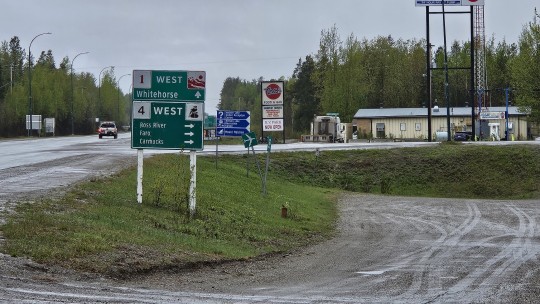
From there, we press on westward, past the Cassiar Hwy, occasionally crossing back into BC, like at our first rest stop at Swift River, and then back into the Yukon like for our lunch stop in Teslin.
It has been raining all day and hovering in the 40°s so the beef stew special at the Yukon Motel and Restaurant in Teslin really hits the spot.
As we ride through the Yukon, we gradually move from the Canadian Rockies, which stretch from New Mexico to Northern Alberta and BC, and into the Yukon Ranges which run through the south eastern part of Alaska and most of the Yukon - smaller and not necessarily snow covered but still an impressive backdrop.
Finally, around 2:30 and an hour out of Whitehorse, the rain stops, and we break into the 50°s.
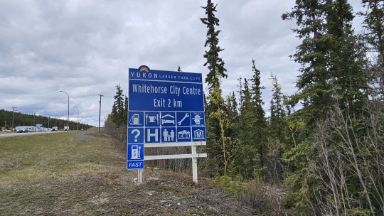
Whitehorse is the capital of Yukon, and the largest city in Northern Canada. It was incorporated in 1950 and is located at kilometre 1426 (Historic Mile 918) on the Alaska Highway in southern Yukon. Whitehorse's downtown and Riverdale areas occupy both shores of the Yukon River, which rises in British Columbia and meets the Bering Sea in Alaska. The city was named after the White Horse Rapids for their resemblance to the mane of a white horse near Miles Canyon before the river was dammed.
Interestingly enough, the population of Whitehorse is circa 30,000. The population of the entire Yukon is cica 45,000.
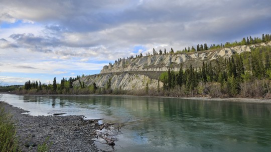
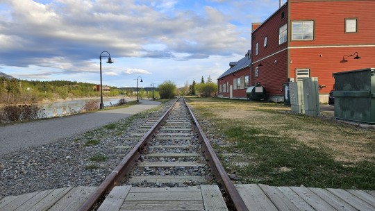
A walk around town brings you face to face with its prospecting history via the Whitepass and Yukon narrow gauge railway and monuments to the Bard of the North, Robert Service.
Tomorrow, we do Skagway and visit upon more of the Yukon's gold rush past.



0 notes
Text
To Whitehorse
Day 10 -
Pressing on to Whitehorse, we are driving W to NW thorough rolling hills with the Cassiar Mountain range in the distance. Many small lakes along the the way, in one of them was a moose and a calf grazing in the shallows.


The Highway is in very good shape and the views to the mountains are beautiful with rolling hills all the way to Whitehorse and very little traffic.


We arrived just after lunch and secured accommodations at the Eclipse Hot Springs resort, with a nice campground about 22 km north of Whitehorse.


The hot springs are absolutely beautiful and the spa is worth the money, you buy a day pass to all the pools, saunas, steam rooms, relaxation rooms and more.


The pools are lined with large field stones, 4 different pools at temperatures from 35C - 40C. Very health focused in all their offerings!
We met our young friend Willie and his wife Chanelle for dinner, homemade pizza, very delicious. After dinner we drove back to the resort and had another soak before going to bed.
0 notes
Text
Last Chance - Northland Favorites
Last Chance – Northland Favorites
When Patti announced “Last Chance”, our unpublished favorites from 2022 as last week’s Lens- Artist’s Photo Challenge, I knew I had an embarrassment of riches. Since I took a long hiatus from my blog this year, I had way too many favorites for one post. Since I spend about half the year down south housesitting and the other half home in Alaska, it seemed like an easy way to solve my dilemma…

View On WordPress
#Alaska#Alaska fall colors#Bog Bean#British Columbia#Canada#Cassiar Highway#Denali Highway#lakes#McCarthy Road#mountains#Mt. Deborah#Mt. Hayes#National Parks#pond lilies#reflections#Rivers#sunrise#sunset#Susitna River#water lilies#wildflowers#Wrangell Mountains#Wrangell-St. Elias National Park#Wrangells
0 notes
Text
Views from the Stewart- Cassiar Highway in British Columbia.


0 notes
Text
Hey travellers and (so-called) Western Canada residents of tumblr!
I’m planning a road trip with a bunch of friends throughout BC, Canada and into the NWT and Yukon…I want to be able to tell spooky stories at campfires about local legends and haunts, but LITERALLY all anyone talks about is how haunted Vancouver and Victoria are, as if that’s some kind of secret. Some places I’m totally stumped on are:
Prince George, BC (note: I do already know a fair amount about the highway of tears)
Fort St. John, BC
Dawson Creek, BC
Muncho Lake, BC
Fort Liard, NWT
Watson Lake, YK
Carcross (note: I know about the hotel and hope they’re open again when we go!), YK
Kluane National Park Reserve, YK
Atlin, BC
Anywhere along the Stewart-Cassiar Highway
The Hazeltons
Nisga’a Territory
I’d super appreciate any stories you’ve got to tell! Share your spookies!
#scary stories#haunted bc#British Columbia#northern bc#strange encounters#share stories#travel#travel stories#western Canada#Northwest Territories#Yukon territory#northern Canada#haunted Canada#ghost stories#ghostly encounters
4 notes
·
View notes
Text
Road Trip: Pacific Northwest
Road Trip: Pacific Northwest
Upon leaving Alaska, we drove some of the same stretch south along the Alaska Highway through Yukon Territory. We stayed at a couple of provincial campgrounds near beautiful lakes and hiked a few hikes. Yukon is a pretty wild province, and there is a ruggedness to it as well as a propensity towards mosquitos.
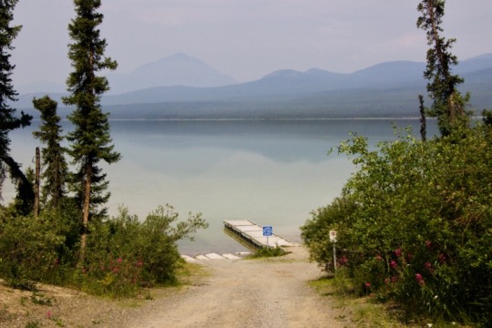
Watson Lake campground
Once we got as far south as British Columbia, we decided to take…
View On WordPress
#Alaska#bend#british columbia#canada#Columbia gorge#crater lake#Hyder#Mount St. Helens#Olympic National Park#oregon#Port Angeles#Portland#road trip#salmon glacier#Stewart Cassiar highway#Vancouver#Vancouver island#Victoria#Washington#whistler#yukon
0 notes
Text
GS Clutch Flush w/pics
By: AdvWisdom Title: GS Clutch Flush w/pics Sourced From: advwisdom.com/a/gs-clutch-flush-w-pics/ Published Date: Thu, 25 Jun 2020 19:15:54 +0000
04 R1150GS Hydraulic Clutch Flush
I thought this might be useful to some…
On the hydrolic clutch circuit, the master cylinder is located at the clutch lever and the slave cylinder is located on the transmission housing. As hose runs between the master to the slave cylinders. A bleed hose is attached to the slave cylinder and a “ball bearing type” check valve is attached to the end of the bleed hose.
This picture shows the end of the bleed hose as it is zip-tied to the frame.

This picture shows the capped end of the bleed hose and the protective sleeve.

This picture shows the check valve fitting on the end of the bleed hose.

This picture shows the cap removed and the check valve inside the fitting.

This picture shows the “bleeder” fitting (about $9) needed to attach to the end of the check valve. The bleeder fitting pushes open the check valve and allows you to easily flush the circuit.

This picture shows the two fittings assembled. Finger tight is all it takes.

This Mityvac system (about $75) makes it much easier to flush clutch and brake circuits.


This picture shows the dirty DOT4 fluid in the reservoir. Most of this was removed before I added fresh fluid.

This picture shows the assembled vacuum system. The inline needle valve is helpful.

This picture shows clean fluid in the reservoir. However, notice the grime on the walls of the reservoir. I did not see this until I looked at the picture. Looks like I have a little more work to do.

There… that’s better…

I suggest that you flush the circuit until clean fluid is continuously coming out and then remove the bleeder fitting from the check valve. Then work the clutch lever several times to pump the slave cylinder. Then flush the circuit again. I did this three times and by then end all of the fluid coming out looked clean.
My bike is an 04 R1150GS with 26k miles. I recently took a long ride (8094 miles) from Idaho Falls, ID, to Deadhorse, AK, and the only problem I had with the bike during the trip was the clutch circuit. It had never been flushed and this caught up with me on my trip when, along the Cassiar Highway, it decided to stop working. I flushed the circuit on the road by holding the check valve open with a screw driver and this brought the clutch back and I was able to finish my ride with only a few hours interruption. Today I properly flushed the circuit and now it feels 100% again.
Here is a schematic of the clutch circuit for reference. It does not appear that there is much to “rebuild”. If the master or slave cylinder goes out, you have to replace the units. The master cylinder or “clutch handlebar fitting” (#1) is about $385 and the slave cylinder or “output cylinder clutch” (#6) is about $127.

STOP THE PRESSES!!! Updated on August 8, 2009.
Thanks to the good advice from this site, I discovered the real problem.
This picture shows the slave cylinder being removed.

This picture shows the condition of the slave cylinder.

This picture shows the condition of the location occupied by the slave cylinder.

The bottom line is this, if the DOT4 fluid in the clutch system turns muddy, then the slave cylinder is shot.

I just order a new slave cylinder and gaskets. To access the slave cylinder I removed the muffler, rear tire, and rear shock.
Updated on August 17, 2009.
I installed the new slave cylinder over the weekend and this is what happened. When I finished the installation I filled and flushed the clutch system (with the new and dry slave cylinder) with DOT4 fluid using the Mityvac. However, at one point during the procedure the DOT4 fluid would no longer flow out of the check valve and into the Mityvac. I would pump the clutch lever but no more fluid would drain out through the check valve, despite the vacuum. I buttoned everything up and took the bike for a ride. I was disappointed because the clutch lever did not feel much better with the new slave cylinder than it did with the old slave cylinder. However, when I got back home I decided to flush the system again and this second time I had none of the same problems as the first time. On my next ride the clutch lever felt 100% again. It seems that I did not get all of the air out of the clutch system on my first flush after installing the new slave cylinder.
_________________

y
Read More
2 notes
·
View notes
Text


Forest (No. 11)
Gnat Pass, BC
#Gnat Pass#Stewart-Cassiar Highway#British Columbia Interior#travel#original photography#vacation#tourist attraction#landmark#landscape#Canada#summer 2023#British Columbia#forest#woods#flora#nature#mountains#countryside#clouds#Kitimat-Stikine District#the North#Three Sisters Range
26 notes
·
View notes
Text
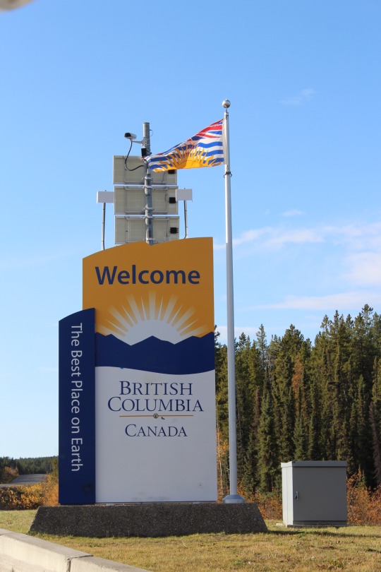
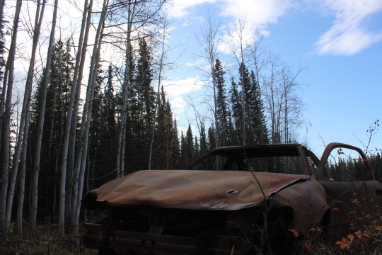
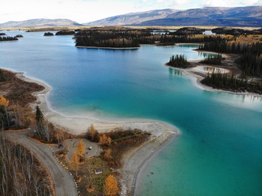
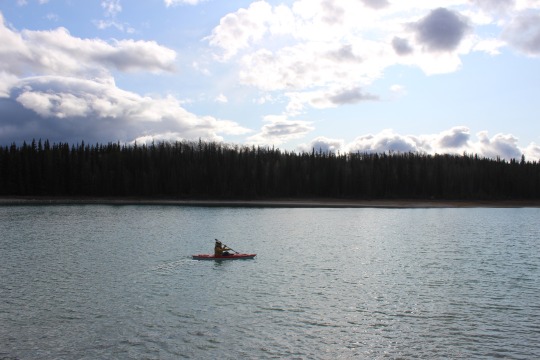
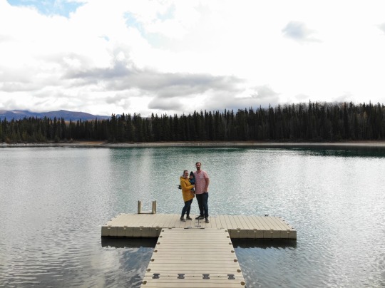
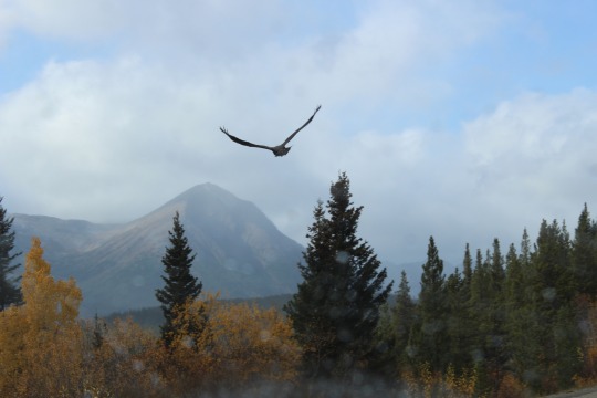
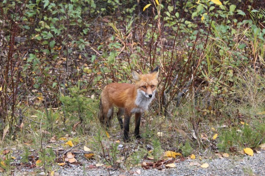
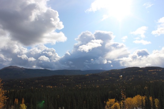
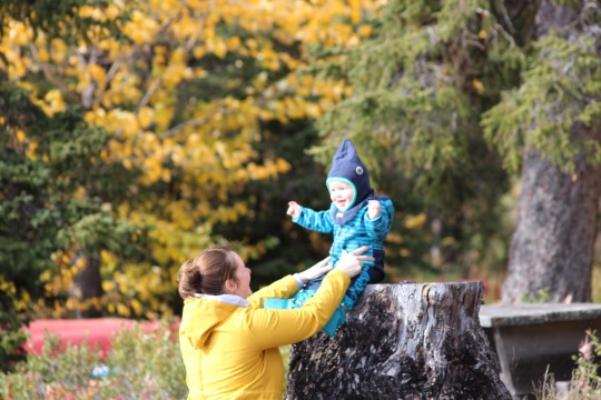
22.September 2019
Nachts prasselt der Regen aufs Wohnmobil, aber wenn man warm eingekuschelt im Bett liegt, ist das sogar ganz gemütlich. Morgens weckt uns Caspar mit einem fröhlichen „Dadada“ und „törötöt“. Wir verzichten auf die Dusche, nicht aber auf Kaffee und Frühstück, tanken am Abzweig zum Cassiar-Stewart-Highway noch einmal voll und nehmen dann genau diesen Abzweig, welcher uns fast 1000 Kilometer bis nach Prince Rupert führt.
Zunächst geht der Highway an meilenweit verbrannten Flächen entlang. Es ist erschreckend, wie lange die Natur benötigt, bis sie sich erholt hat und wie trostlos es mit den abgebrannten Fichtenstämmen aussieht.
Nach knapp 90 Kilometern nehmen wir links den Abzweig Richtung Boya Lake Provincial Park. Die Straße führt durch die Wälder und öffnet sich dann zu schönen Campingbuchten mit Blick auf den türkisblauen See. Wir bereuen etwas, dass wir die Kilometer nicht gestern noch gefahren sind und hier genächtigt haben. Es gibt einen schön angelegten Spielplatz und ein Bootshaus, an dem auf Vertrauensbasis Geld in einem Umschlag positioniert werden kann, um Kanus oder Kajaks auszuleihen. Diese liegen bereits am Seeufer.
Gunnar lässt die Drohne steigen und Cati entert mit Caspar den Spielplatz.
„Einmal muss man im Kanadaurlaub im Kajak sitzen!“ - gesagt, getan! Cati paddelt ein kurzes Stück im Kajak auf den See - mit Caspar trauen wir uns nicht - Gunnar bleibt also mit ihm an Land und macht Fotos.
Wir fahren weiter durch die herbstliche Landschaft, vorbei an tausenden großen und kleinen Seen. Plötzlich bewegt sich vor uns etwas auf der Straße. Ein Adler versucht schnell zu starten und eiert etwas hin und her - ein ganz schön großer Vogel.
Etwas später quert auf einmal ein Fuchs vor uns die Straße. Er wartet am Rand auf uns, schaut sich das Wohnmobil ganz interessiert an und lässt sich wunderbar fotografieren. Das war ein tolles Erlebnis!
Wir fahren am Dease Lake vorbei und steuern bei Iskut einen RV Park mit sämtlichen Vorzügen an - leider hat der schon geschlossen für diese Saison. Also wieder die kluge App befragen und 5 Kilometer weiter biegen wir ab zum Red Goat Campingplatz. Er hat geöffnet, aber leider gerade weder Strom noch Wasser. Da der nächste Campingplatz erst in 150 Kilometern kommt, entscheiden wir hier zu bleiben. Der Blick von unserem Stellplatz direkt am Kinaskan Lake ist atemberaubend. Wir spazieren am Ufer entlang, trinken unseren Kaffee in der Sonne und verkrümeln uns beim Hagel wieder im Wohnmobil. Am Abend kochen wir Pellkartoffeln mit Ei, sichten die Fotos und planen unsere weitere Reiseroute. Uns bleiben noch 12 Tage bis Seattle und die Tage möchten gut gefüllt sein.
3 notes
·
View notes
Text
Snowfall warnings issued as 'bitterly cold' temperatures expected across B.C. this weekend
Environment Canada issued a range of special weather statements and weather warnings across British Columbia on Saturday, warning of unseasonably cold temperatures and snowfall. A snowfall warning for Metro Vancouver and Howe Sound said up to 10 centimeters of snow could fall in the region, with up to 25 centimeters in the Fraser Valley.
The amounts were an increase from forecasts made in special weather statements earlier on Saturday.
A special weather statement issued for Whistler also warned of periods of snow throughout the weekend.
There are Arctic outflow warnings in place across the Central and North Coasts, including inland sections, with wind chill expected to make it feel like –20 C in those regions. Wind gusts could reach up to 80 km/h along the coast. In the Fraser Valley and Fraser Canyon in southwest B.C., light snow is expected to intensify later Saturday afternoon. Around 15 centimeters of snow is expected to accumulate by Sunday afternoon.
There is also a winter storm warning in place for the Coquihalla Highway between Hope and Merritt, B.C., as well as special weather statements for the Lower Mainland and across northern B.C.
"If it's outside, dress warmly in layers and stay dry." "Cover as much exposed skin as possible to avoid frostbite," reads a statement from the forecaster.
"Be prepared for unusually cold temperatures and strong winds." An Arctic front will bring unseasonably cold temperatures to the region starting Sunday. Wind chill values of -15 degrees Celsius in Metro Vancouver and -20 degrees Celsius in the Fraser Valley and Sea to Sky regions are possible.
The system will bring up to 20 centimeters of snow to the recently repaired Coquihalla Highway, according to the forecaster.
The province said drivers on the South Coast should stay off the road in poor conditions. If they must travel, they should pack an emergency kit and make sure their vehicle has proper snow tires. TransLink, the regional transit authority, stated that they were proactively de-icing SkyTrain tracks and bus trolley wires in preparation for the cold snap and that they were prepared to implement snow shuttle services if conditions became particularly bad.
A series of special weather statements on Friday said Arctic air, blasting wind, and plummeting temperatures would settle over the far north and stick around for several days. The coldest temperatures are likely to be felt Monday through Wednesday, according to meteorologist Derek Lee.
Lee said the area from Peace Region to Fort Nelson could see overnight lows below –40 C. Overnight lows of -35 C are possible in Prince George and the Cariboo. The weather statements cover Haines Road, Atlin, Teslin, Cassiar Mountains, Dease Lake, Watson Lake, Peace River, Williston, Muncho Lake Park, and Fort Nelson in the far north.
0 notes
Text
May 24th, Boya Lake
Up early for a couple of reasons. First lighter traffic, then better chance of seeing wildlife, and finally there is a ton of people all competing for the same sites as the Alcan is still closed. Rained all night and still raining, we hope to outrun it but it just kept coming.
Rode to Boya was ok, crappy, and really sh!tty. The trucks are ripping this highway apart as they detour. Plus they still do 100kph even though the road is narrow with no lines and no shoulder. Having one pass you is a hoot!
Saw some still frozen lakes which was cool. Lots of forests and river canyons which made the drive enjoyable. At 4,000ft we had snow flurries which was cool. The grade down from that summit was 8-10% and all wet gravel.
Got to Boya around 11am and found a spot, the ones we had before were all taken as well as the other pull-throughs. We found a spot with lake view/access that was decent and easy to back in to. After setting up we went for a hike around the lake to a beaver dam. The rain keeps trying but other than some drops it just cannot keep going in the afternoon.
Tomorrow we do 310 miles to Whitehorse, with only 50 of them on the Cassiar.
0 notes
Text
Thursday May 23, 2024, Bell II Lodge (Kitimat-Stikine) to Bob Quinn Lake to Dease Lake to Jade City BC to Watson Lake, Yukon, 496 kms.

Breakfast at the Lodge doesn't start until 8:30 so I get up early at 6:00 and take a run up the highway and am rewarded with some bear sightings.
After breakfast, we hit the road at 9:30 in a light rain with the temperatures in the mid-40s. The light rain continues throughout the morning, although by hour two, it has warmed into the low 50s. We stop for our first break in Bob Quinn Lake, and I acknowledge reality and put on my rain suit. It turns out to be a good decision as it pretty much rains for the rest of the day.
Visor down, rain suit on, the rain isn't really much of a factor and in reality we are more focused on watching forcwildlie (more bears) and ogling the snow capped mountains to either side of us as ride ride the Cassiar Hwy up the middle.
We stop for lunch in Dease Lake, gas up, and head back north toward the Yukon. On the way, we pass through an area recently hit by forest fires. It is impossible to envision the scale, impact, or job of trying to fight them until you have seen the aftermath. It is beyond sobering.
Beyond lies Jade City (pop 30) located on Hwy 37, west of Good Hope Lake, close to Cassiar, and just south of the Yukon border. The area around it is rich with serpentinite (a jade precursor), greenstone (jade look-a-likes), and Nephrite jade. I take lots of pictures but resist the urge to buy some jade.
After a short break, we head back north, still in the rain, for the Yukon border. It's only an hour away, and after the requisite pictures, we turn east and head for Watson Lake some 30 minutes away, where we will spend the night at Andrea's bar, lounge, restaurant, gas bar, and hotel. Watson Lake itself is located at mile 635 on the Alaska Highway close to the British Columbia border and is home to the world famous sign forest. It has a population of 790 and is named for Frank Watson, an American-born trapper and prospector, who settled in the area at the end of the 19th century.
Tailgate, dinner, shower, and bed, tomorrow we head for Whitehorse.


0 notes