#A little lake park with a river flowing through it
Explore tagged Tumblr posts
Text
I just got off work, but I’m feelin really relaxed today, since I got to spend time with family.
Popping back into my tumblr though, I just gotta say, I’m really happy with the little bubble of people I managed to find here. My mutuals are so cool and silly, the people who followed me are really kind even if sometimes you guys can get a lil goofy, this lil internet space I burrowed into is just really really cool =7=
Maybe I’m just being a bit sappy as a carry over from spending time with loved ones, but yknow, I just wanna express some appreciation for the people who floated into my bubble. Thanks for all the fun ^^ I’m glad to have met you here! :D Hope we have more good times to come!
#neil talky#I like to think of this blog as like#A little lake park with a river flowing through it#Some people float by and stay a bit#others take up temporary shack on the shore#We’re mostly just aquiantances but it doesnt mean we can’t have fun together for the time we’re here#I can’t personally really build the deep kinds of friendships I have with my irls#irl friendships work differently from online friendships for me#weird brain thing tbh#but that doesn’t mean I can’t be kind and build a different kind of good relationship#with the people I meet online#So I hope you guys are having fun with me here regardless#And I hope you’re doing well in the real world#I say this earnestly from my side of the world#take care always <3
25 notes
·
View notes
Text
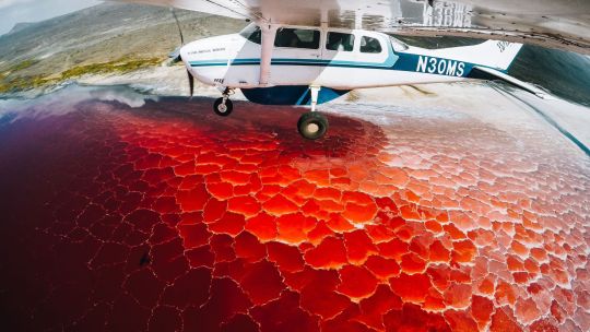
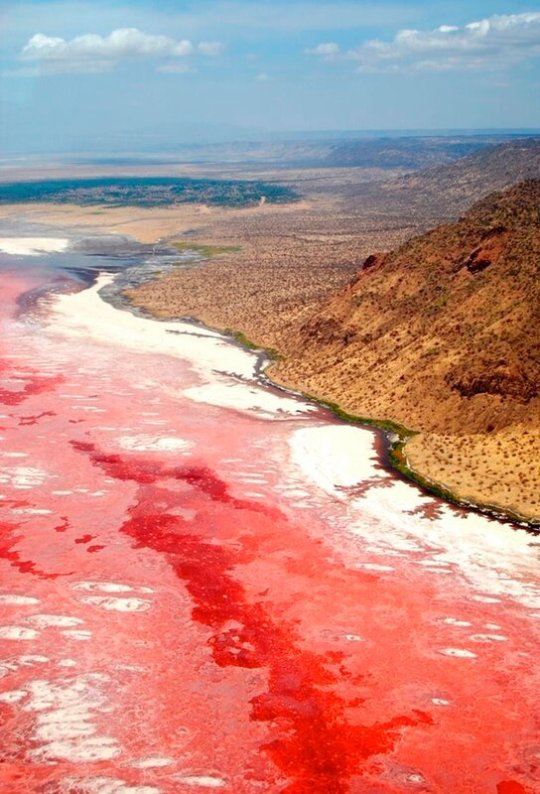
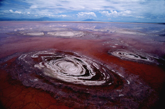
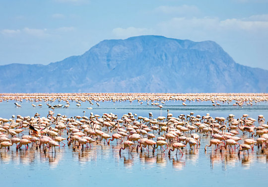
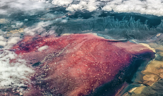
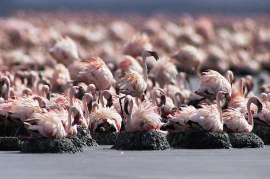

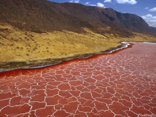
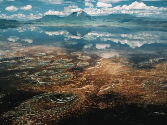

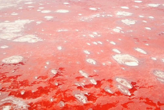
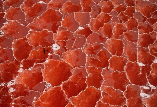
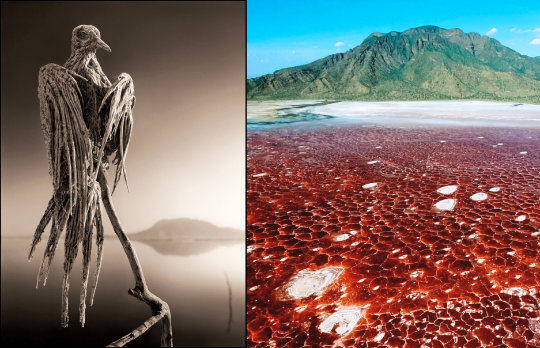
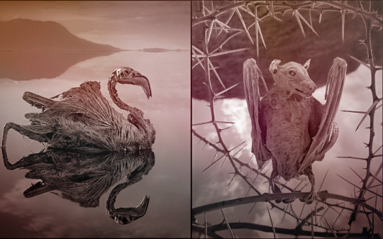
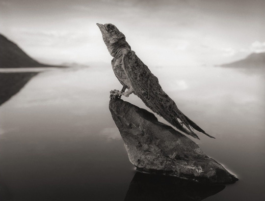

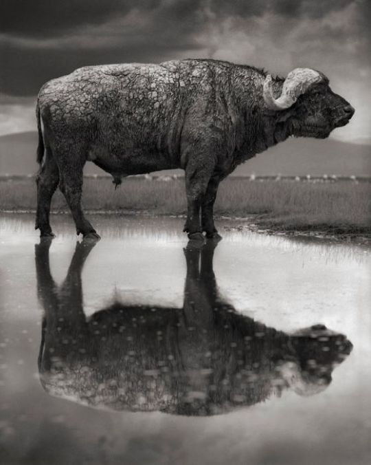
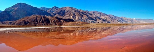
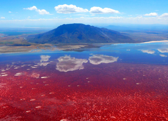
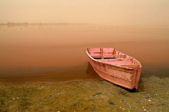
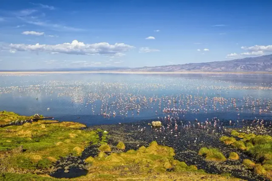
Озеро Натрон, превращающее животных в застывшие изваяния.
Озеро Натрон находится на севере Танзании, на границе с Кенией, недалеко от Национального парка Серенгети и заповедника Нгоронгоро. Озеро Натрон занимает площадь 56 км (35 миль) в длину и 24 км (15 миль) в ширину, но уровень воды меняется из-за испарения.
Вода из озера Натрон в Танзании буквально разъедает кожу, как только вы к ней прикоснетесь. Если хоть немного искупаться здесь - то кожа покроется волдырями и ожогами. Красивая корочка состоит из чрезвычайно агрессивного щелочного минерала с pH почти 12! Это почти в два раза выше здорового показателя для человека. И выше уровня аммиака, у которого pH всего 11. Мелкие животные, которые ненароком спускаются к воде, редко выживают даже после небольшого контакта с водой. Дождь, который идет в этих местах, называют призрачным. Потому что большая его часть испаряется, не долетев до поверхности.
Из озера Натрон вода не вытекает. В нее впадает одна река, а большую часть воды оно получает из родников и мелких ручейков. Однако вода просачивается через вулканическое вещество, где и обогащается щелочью. Озеро Натрон содержит очень много соли, соды и магнезита. Поверхность озера покрыта тонкой коркой соли. Вода здесь не всегда такая красная. Окрашивается она из-за деятельности микроорганизмов, которые прекрасно себя чувствуют в этой очень соленой воде. Явление это не постоянное. Происходит только когда вода испаряется и озеро становится максимально насыщенным щелочной солью - любимой средой здешних микроорганизмов.
У озера есть пресная и соленая части. Но будущая плотина может уничтожить соленую часть озера ��десь размножаются бактерии - им такой состав нипочем. Главная причина гибели здешних животных - именно бактерии, которые попадают в организм вместе с водой. Еди��ственный представитель местной фауны, кто не боится этих бактерий - фламинго. Для фламинго это идеальное место. Они питаются местными водорослями, а "красная вода" является барьером для хищников. Поэтому на фламинго здесь почти никто не охотится.
Здесь умудряются выживать даже рыбы - к этой воде приспособилось два вида тиляпий. Вода в озере очень горячая - температура иногда поднимается до 50 ° C. Всему виной горячие источники. Однако у этого уникального природного объекта есть все шансы исчезнуть с лица земли. Власти здесь планируют построить гидроэлектростанцию и плотину. Соленая часть озера может исчезнуть, так как ее зальет пресной водой. Соленую воду же хотят использовать для добычи карбонат калия и перерабатывать ее в стиральный порошок. Опасность эти инициативы представляют для малых фламинго. Оказывается, 75% этих птиц появляются на свет именно на берегах этого озера.
Lake Natron, which turns animals into frozen sculptures.
Lake Natron is located in northern Tanzania, on the border with Kenya, near the Serengeti National Park and the Ngorongoro Conservation Area. Lake Natron is 56 km (35 mi) long and 24 km (15 mi) wide, but the water level changes due to evaporation.
The water from Lake Natron in Tanzania literally corrodes the skin as soon as you touch it. If you swim here even a little, your skin will be covered in blisters and burns. The beautiful crust consists of an extremely aggressive alkaline mineral with a pH of almost 12! This is almost twice as high as the healthy level for humans. And higher than the level of ammonia, which has a pH of only 11. Small animals that inadvertently go down to the water rarely survive even a short contact with the water. The rain that falls in these places is called ghost rain. Because most of it evaporates before it reaches the surface.
There is no water flowing out of Lake Natron. One river flows into it, and it gets most of its water from springs and small streams. However, the water seeps through volcanic matter, where it is enriched with alkali. Lake Natron contains a lot of salt, soda and magnesite. The surface of the lake is covered with a thin crust of salt. The water here is not always so red. It is colored due to the activity of microorganisms that feel great in this very salty water. This phenomenon is not constant. It only occurs when the water evaporates and the lake becomes maximally saturated with alkaline salt - the favorite environment of local microorganisms.
The lake has a fresh and salty part. But the future dam can destroy the salty part of the lake. Bacteria multiply here - they do not care about such a composition. The main reason for the death of local animals is the bacteria that enter the body along with the water. The only representative of the local fauna that is not afraid of these bacteria is the flamingo. This is an ideal place for flamingos. They feed on local algae, and the "red water" is a barrier for predators. Therefore, almost no one hunts flamingos here. Even fish manage to survive here - two species of tilapia have adapted to this water. The water in the lake is very hot - the temperature sometimes rises to 50 ° C. Hot springs are to blame. However, this unique natural object has every chance of disappearing from the face of the earth. The authorities are planning to build a hydroelectric power station and a dam here. The salty part of the lake may disappear, as it will be flooded with fresh water. They want to use the salt water to extract potassium carbonate and process it into washing powder. These initiatives pose a danger to lesser flamingos. It turns out that 75% of these birds are born on the shores of this lake.
Источник://t.me/places_on_earth, //www.travel.ru/wow/natron.html, /kulturologia.ru/blogs/231022/54558/, //www.kiwoitoafricasafaris. com/ru/Танзания-направления/озеро-Натрон/, /mail.kz/ru/ news/interesting/-faktov-ob-ochen-opasnom-ozere-natron-v-tanzanii, /dzen.ru/a/ ZEKreWvVMkhyndD7, /winter-borealis. livejournal.com/103782.html.
#Tanzania#nature#nature aesthetic#landscape photography#lake#Natron#red water#fossilized skeletons#salt#alkali#flamingo#sky#clouds#naturelovers#nature video#Танзания#озеро#Натрон#природа#Пейзаж#красная вода#соль#щелочь#окаменевшие скелеты#небо#облака#фламинго#природнаякрасота#видео
124 notes
·
View notes
Text
Fun Lore Ideas for Fawcett City
I've been sitting on these concepts for ages and need to get them out of my system. For my current WIP, it was important that I have a strong concept for what kind of city Fawcett was going to be. While the plot isn't technically taking place in Fawcett, a huge amount of my lore interpretations/characterisations rely on there being a solid original setting to draw from. Also, it's super fun to extrapolate history and economy for a fictional magic city to try and make it feel as plausible as possible.
Now, to start with, I had to establish where the city would actually be located. Fawcett is typically represented and/or thought of as being in the Midwest, so I was able to whittle down my options even more. I couldn't have it too close to Central City, Keystone City, or Smallville since I wanted Fawcett to retain its isolated feel. It'd be harder for it to get away with being magic if it was a stones throw from speedster stomping grounds, for instance. In the end, I looked up old maps of America DC Comics had officially released for inspiration. What I got were these:
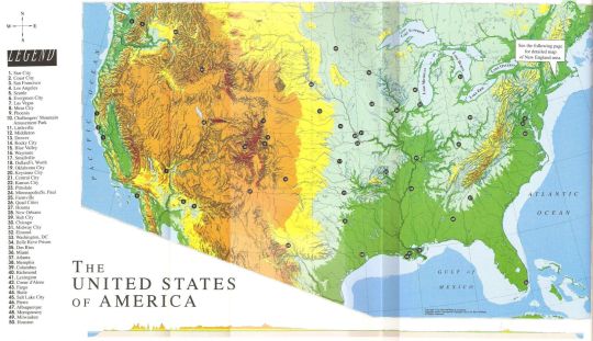
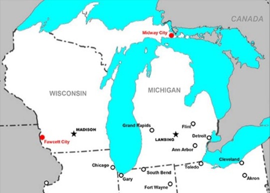
The first didn't have Fawcett at all, and the second had it placed near the border of Wisconsin. The latter was serviceable for my purposes. However, I wanted something more to draw from. I wanted to make Fawcett feel like an actual city with history before I slapped on the magic superhero. It technically was just an ordinary city until Shazam placed a portal there after all.
My second go of looking for inspiration was much more fruitful. I looked at a few fan-made maps and eventually stumbled upon this one in a reddit forum:
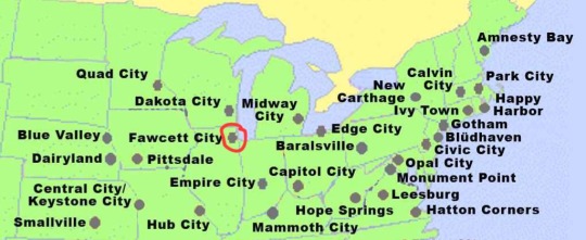
Upon closer inspection, I realised something.
That's fucking Chicago.
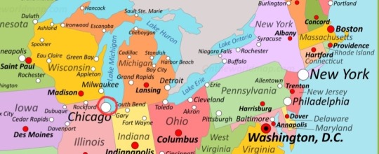
The idea that then formed was brilliant, my best one maybe ever. If I don't want to write a 2K+ document detailing an organic history of fictional Fawcett City, coupled with local industry and culture to boot, I can just STEAL a real one!
The existence of IRL Chicago is not necessary for my story, and its absence would be barely noteworthy in the grand scheme of things. Functionally, it wouldn't even be gone. Its location and major historical events would still have occurred, just under a different name. It not only saves me tons of labour as a writer, it's also fucking hilarious.
The heart of ALL of magic lies in an abdoned subway station in downtown Chicago Fawcett, the Windy city that houses pagan subcultures, talking animals, cursed objects and people who still think it's 1945.
Southern Lake Michigan has freshwater mermaids. The flat lands of the city proper are surrounded by bluffs as old as the ice age, which thrum with prehistoric magic. The sunset is always pink, and moonbeams are brighter somehow here. In the river that flows through art-nouveau styled skyscrapers swim fish with rainbow scales. The people are happy and chatty and full of little secrets, kept close and safe for rainy days. The woman who dresses in leaves and sleeps on park benches is liable to be simply human, but the jolly old milkman who visits you every morning is fae through and through. Weird is normal and normal is weird.
All while in Chicago, Illinois, one of the most populous, wealthy cities in America since the 1870s. The mechanic who enchanted your car to not break down anymore was raised by regular steel mill workers. The politician who dreams of addressing the city's entrenched class divides is stuck doing paperwork to establish legal protections for the local gnome population's tree houses. When it snows in winter, Yetis clear driveways and salt the sidewalks. No one talks about it much because what is noteworthy about public servants doing their jobs? So what if they're Yetis? You got a problem with that?
Fawcett blows Gotham out the goddamn water for weirdness, but because they're so nonchalant and humble about it, Gothamites walk around smugly assured of their tolerance for insanity, unaware of the bigger fish, which is the average Fawcett citizen. When tourists come to visit, the very genre of reality changes the second they step foot within city lines.
Fawcett solos, tbh. DC writers are weaksauce for not seeing the vision that is mystic Chicago city, home to all of magic.
#dc#dc comics#captain marvel#billy batson#shazam#fawcett#fawcett city#fawcett comics#Chicago: boring#Fawcett: better in every way#eat your heart out FLASH#the day the Justice League figures out Captains hometown is the day Batman resigns
99 notes
·
View notes
Text
Hopefully coming back to posting after being away for a bit - had a trip with Partner M to Seattle! It was very fun - Seattle is a true "water city" like I have not been to in quite a while. DC, NYC, Tokyo, etc, are all on the water in various forms, but their connection to it has withered into the purely recreational. Seattle meanwhile is built so heavily around the Puget Sound and the lakes and rivers that it feeds, defining city districts & the local "downtowns", such that you are always aware of the flows around you. We took a ferry out to Bainbridge Island - which was a huge ferry carrying hundreds of cars every half hour because that is the most efficient way to cross the Sound to the towns on the other side - and there is nothing like dozens of marinas and fleets of sailboats out on the water to make a bay feel alive:


Some of this is, of course, something of a larp - the heart of downtown Seattle (the Central Waterfront) has a million fish shacks and crab huts on the docks, with parks and walkways, because, of course you have fish restaurants on sea, right? It is where you catch the fish? But it isn't, you aren't fishing at scale right next to skyscrapers anymore - those fish are imported from distant aquaculture farms just like any meat would be, these restaurants are only here for the style points. They aren't even legacy - the central docks in Seattle began closing down in the 1960's as industrial-scale container dockyards were set up in the south with truckyards for interior shipping, and much of this area was only revitalized starting in the 2000's via a city project to build a recreational zone. The tale of every American city in the post-industrial era, right?
But not all of it is nostalgia - Seattle also boasts the Ballard Locks, the US's busiest by ship traffic, which connects the Puget Sound to the Salmon Bay & Lake Washington. Very coolly, the whole thing is an accessible park - and crossing it is a typical way a pedestrian would get from the neighborhoods of Ballard to Magnolia. We were lucky enough to arrive when a boat was passing under the paired bridge and through the locks; so we got to watch humanity's oldest technology of civilization at work, raising a boat through the magic of tight gates and buoyancy forces:


These locks also have the Salmon Ladder, so migrating salmon can swim upriver in the fall and breed without being stuck in the gates. It wasn't the season for it so no fishies for me, but it was still extremely cute.
The locks, like the rest of the city, also have a fleet of enchanted crows who watch the boats for signs of trouble - a smart use of mana by the local mage's council:

Anyway, water-nature was only half of our trip: our other focus was being Huge Nerds around the college neighborhood of the University of Washington. And I gotta say, this fucked, I was not expecting this area of town to be as cool as it was - it might be in the top 5 coolest areas in the US for this kind of vibe. An endless stretch of coffee shops, chinese noodle houses, record stores, vintage & thrift, and - critical for me - the highest density of weeb shit this side of LA's Little Tokyo. The standout was ofc Scarecrow video, though I will also highlight Neptune Records:


Partner M discussed Scarecrow in her own post, so I won't belabor it here - though look out for a later post on one of the videos we rented - but I wanted to give Neptune a shout out for being the Scarecrow Video of Music. It was floor-to-ceiling records, CDs, and cassettes stuffed into every nook and cranny that could take them; every shot shelf was so dense. As is tradition for me, whenever I visit a record store I ask after my quixotic dream of owning a Plumtree record, and typically the person goes "who is that" and opens their computer to check their inventory. At Neptune though:
"Do you have, miraculously, any Plumtree in stoc-"
"Nope"
"Oh, you know them?"
"Nope. But I know I don't got 'em"
This man has memorized his entire collection of surely >10,000 items and knew instantly Plumtree wasn't one of them. He didn't even make eye contact during this. Now that's autism, baby <3.
On the weeb side my stand-out store was Hifi Lofi, an eclectic buy-sell-trade store right by campus. Honestly when it comes to anime stores in the US, they have a huge "sameness" problem - all stocking the same Ghibli notebooks and Shounen Jump shows minifigs and the like. Hifi Lofi didn't truck in any of that, instead splicing a grunge-DJ vibe and intentional buys by the owner with whatever-the-fuck the community dumped on them. They had Pinky St figurines! I have never seen those in the US outside of cons. They had an entire collection of Neon City Records synthwave vinyl, which tells me exactly how terminally online they were in the late 2010's, mad respect (never did get one of their jackets, alas). I spoke to the owner, and they partnered with a local graphic designer to spec out their place and otherwise actually were making good money on the buy-sell margins while doing thrice yearly trips to Japan for specific merch hauls:


Here I think Seattle is reflecting its own economic demography - large Asian American population, lots of technology companies attracting a wealthy, nerdy consumer base, and most importantly a large, public university located right near the city center so the student population and the city population can intermingle. You would be surprised how uncommon that last part is! Not unique of course, but many "flagship" big universities are in their own college towns or positioned right at the edge of the city. When the University of Washington was founded in the mid 19th century, it was at said "edge" - Seattle was a tiny port town at the time, and grew far faster than anyone could have anticipated. All these demos mixing together makes for a great hub for artsy commerce. Given my fantasy dream of opening a manga cafe/anime theatre, and how difficult that would be in DC, seeing a place where it actually seemed maybe-viable was nice.
City is so nerd-friendly we saw a string of protest stickers by some strident fujoshi over the racebending casting of Severus Snape in the HBO remake:


Tumblr is truly amoung us wherever you go.
Speaking of, I was actually planning on posting to see if any mutuals in the Seattle area wanted to get coffee - but alas I had a throat issue this trip which made talking a slight struggle :/ I got through it fine but it meant I had to save my talking points for partner. Next time though!
Okay, that is my self-indulgent record-of-my-trip post done lol - may future posts be more general interest.
30 notes
·
View notes
Text
the night of the tarantula - 5

simon riley x oc
'Deep rivers run quiet.'
‘You wanna know something?’
She cleaned the corner of her mouth with a napkin. She propped her feet up on the stool, adjusting the hood of her sweater on her head. Copenhagen was incredibly cold in the winter mornings
‘What?’ She asked.
He was shirtless, leaning against the kitchen counter. He had a bowl of yogurt in his hands, spoon hanging from his mouth. He preferred anything sweet for breakfast, yogurts or any cake she baked. Fruit sometimes, frozen grapes. She had a bagel on the plate in front of her, crumbles of bread and egg on the plate and on the table, she was a messy eater.
‘Every morning, or like before lunch, I squeeze the mayo for you… I-‘, he mimicked slamming the mayo on the table to make it fall to the opening of the tube, ‘I make sure it’s all to the very end… cause it can get stuck on the sides of the bottle, you know, and I’m stronger than you…’
Her eyes lit up and she smiled. Her shoulders were shaken with a sincere laugh.
‘Really? You’re calling me a little bitch cause I can’t squeeze the mayo?’
She smiled. He scoffed and nodded, setting his empty yogurt bowl in the sink.
‘Yeah, my little bitch…’
She took another big bite or her sandwich, smearing egg yolk all over her cheeks. She grabbed the napkin again to clean herself, rubbing her feet together to feel some warmth. As she placed the half eaten bagel on the plate, Simon’s large arms wrapped around her. He scrunched down enough for his body to completely envelope hers. One arm around her neck, the other up her shirt. She felt his lips kiss her cheek, the bridge of her nose, her jaw. She was almost lifted from the chair by the force of the hug, she let her head fall back against his chest.
‘The things I do for you…’
‘Do you know what I do every day for you?’ A giggle escaped from her lips as he squeezed harder, a kiss on her neck sent tickles down her spine.
‘I know what you do for me every night…‘
She laughed out loud. His chest filled with warmth and he closed both arms around her. Still standing up behind her, he nuzzled his nose in her hair, she moved her hands on his naked arms. She squirmed in his grasp. ‘I move your blanket every day from the bed to the couch so you can have it when you nap’, she argued. She turned in the chair, freeing herself from his embrace. She cupped his cheeks with both hands, cradling his face and forcing his close to her. ‘I make sure your blanket is on the couch during the day if you wanna nap and then I take it back to bed with me so you can sleep with it.’
'The green one?'
'The green one.'
He closed his eyes, jaw unclenching, eyebrows relaxing. He felt her thumbs soothing the skin of his under eye bags, the crooked bridge of his nose, coming down to his jawline. He leaned into the chair, into her, almost wishing he could crawl inside her, he was never close enough. So soft, so tender, so indulging. When the palm of her hand caressed his cheek, he turned his head to kiss it.
‘You're saying I’m a little bitch cause I need my blanket?’
She laughed again. It felt like her chest cracked and happiness was finally flowing in her veins.
Eva was allowed to go teach ballet the next day. They escorted her car to the school, they watched her park and go up the stairs. They waited three hours for her to finish teaching a class and rehearsing with her dance partner. The same morning at 7, they has two soldiers walk ten feet behind her as she walked her dog, to the park, around the walkway of the lake and back home. Fucking terrifying. She felt imprisoned, she felt like she was gonna get shot by a sniper or some shit through the windows of the ballets school.
'Remember, arms in fifth position here…' Even teaching was harder than normal. She felt dizzy, she wasn't strong enough to lift her legs where she wanted them, the girls weren't listening today, she couldn't find the right music.
'Let's see it from the top, please…' She knew they were watching her from downstairs, the thought made her throat close up. '…and one and stay! And two, piqué! And rond de jambe…'
It was weird, knowing the fucking military was at the door, knowing her, the dance teacher, was being watched as the girls rehearsed. By authorities of the government.
After rehearsing with Blake, for both Arabian and Snow Queen, she took five minutes alone to regain her strengths. Or so she thought she was alone. She walked in circles around the room, head down, hands on her hips. She felt like a stranger in her own body, in that stupid leotard wet with sweat, feet bleeding, arms sore. But at least, alone. Away from the barking of her dog, away from Salvo, he was kind and considerate and made sure she ate and took care of herself but God, did she want to be alone… Away from that interrogation room, from the pictures, Price and… well, even him.
Ghost was standing by the door, as he did a million times before. Like a fucking dog he follower her scent and took his usual spot in the corner. Watching her, admiring her body, the way she danced. He watched her pace around, breathing still laboured from dancing for three hours, leotard slick with sweat. She went to the corner of the room where she usually had her bag and sat down. He had to slightly crane his neck to see her, risking getting caught. She had a pink bag, never seen that bag before. She took off her pointe shoes and winched in pain, he supposed she had blisters on her feet. She inspected her toes, the tape and those blue patched he saw her put on once to protect her skin. She discarded the old shoes and threw them in her bag. In the pink sack were a pair of brand new shiny pointe shoes.
She sat on her heels, got out a needle from a small flower printed box. She sawn two pink ribbons one at each side of the shoes. The ones she tied around her calves. He watched her fingers work with the fabric, brows furrowed while trying to get the ribbons symmetrical on the shoe. She cut the excess lace with her teeth. Still on the ground, she took the inside sole of the shoe, shank is what it's called and ripped it. She bent the shoe in half, pressing with both hands. He watched her biceps contract while she squeezed the shoe in half and then released it. The violence, the accurate, pondered violence she was putting in her movements made him think she was relieving some anger on the shoes. When she was done, she got up and he thought she was finally ready to leave. She wasn't.
She pressed the heel of her naked foot on the shoe, bending the shape of it and popping the toe box. A loud crack left the shoe looking lifeless. She repeated the procedure with the other shoe, putting her whole weight on it, bending and pressing. Crack. As he wondered why she was destroying the new shoes, she turned her back to him. Facing the wall, she let her fingers travel to an unspecified spot. A step back, she slammed her pointe shoe on the wall. Again, and again, and again, a rhythmic and incredibly loud bang, bang, bang, bang. He nearly flinched at sound. At the force. The front of the shoe connected with the wall several times before she was satisfied. She repeated with the other shoe. Bang, bang, bang, he stared at her back, the flower tattooed on her back distorted by her movements. He imagined the wall would dent and break and collapse and the whole building would crumble on itself. When she was done, silence filled the room again. She was panting. She put the shoes back in the pink bag, that's when he felt like he could knock. She turned in one sudden movement, frightened. By him, that is.
Her ponytail messy, her skin red from exhaustion, she looked at him betrayed. Disappointed. When he was the one who was supposed to be hurt in the situation. He knew why she was mad, don’t get me wrong. He had told the captain to contact Salvo, he gave in the only ally she had outside this situation. He had a job to do, that was the thing that she didn’t understand. So, she really had no right to look at him like that.
She stood next to her bag, jaw clenched, her eyes empty of emotion. It was the first time he was alone with her in what felt like months, he felt so detached, so disconnected. She was a stranger. And yet, there he was. Chasing her, again. Longing for time alone with her, following her, feeling privileged enough to get alone time with her out of all his colleagues. He was sitting in the car, staring through the windows of the ballet school. He would see her move around the room occasionally. He saw her students leave at 10, when the lesson was done. He saw Gemma, remember Gemma? He saw her dance partner, the guy who plays the prince, enter the school at 10.02, joining her in the rehearsals room. He found himself wondering, did she eat that morning? Was she tired, dancing for those many hours? Did she have something to drink with her? Was she busy with her patients later, how was her dog, did she need any help?
What the hell was she thinking?
He watched her from the corner of the room, she looked like she wanted to disappear into the wall behind her.
'All good?'
His voice was so low she barely understood what he said. A whisper, like he didn't even want to speak. Masked and cruel. She didn't know who that person was and the thought of having had him so close to her made her sick to her stomach. She didn't reply, she packed her bag. She put on a sweater and stripped of her skirt. He had seen her dance before, her legs in pink tights. He had seen everything, why bother to care at this point.
'What?' He asked, reacting to her silent treatment. Louder this time.
She pulled a pair of sweats on her legs and undid her ponytail, she slipped on her running shoes. She started walking towards him. She didn't look up from the ground, she knew why he was there, to collect her. To take her back home and then to work after lunch. After work, she was gonna being interrogated again. Standard procedure.
His words vane, she still wouldn’t speak. She stormed towards him like a deadly, terrific hurricane. She passed him, squeezing herself between his body and the door frame. He acted out of instinct.
His hand grabbed her wrist as she walked past him, he snatched her close to him with too much force making her nearly lose balance. She looked at him with fire in her eyes, shocked at his move.
'Lasciami stare!' She yelled, freeing her wrist from his grip.
He registered, as he didn't understand what she was saying, she spoke Italian instinctively. She took a step back and he shivered at the thought she might be fearing him. He attempted to close the distance between them with a step. He didn't have a plan after that. Yell at her, corner her against the wall, question her about her lies now that they were alone, hold her, kiss her. It was insulting to his rank, to his persona, to everything he was. This feeling, this emotion towards her. He craved her presence, he craved being close to her, physically in her space. He realised it just then, he realised that's why he was in the interrogation room, why he was escorting her to class, offering to go fetch her from the school and bring her to her car, it was to be close to her. And now that he was he didn't know what to do.
She was still looking at him baffled at him move, chest moving quickly with every breath, hand gripping the strap of her bag tightly out of anger.
'Why? He spat out, and it came out louder than he intended it to be.
'Uh?
'Why did you do that?'
'What?' She squinted her eyes at him.
'Lie.'
She scoffed, 'Oh please…', she was ready to run down the stairs.
'That's not an answer!'
She turned her back to him and the thought of her leaving made him step foreword one more time. She would not get out of that conversation.
'Oi!' He grabber her arm once more, tighter.
She tried to free herself by simply pulling in the direction of the stairs but she soon realised his hand on her forearm wasn't just lingering there. She turned back around to face him, delicately placing her small, soft hand on his, on her arm. He thought for a moment she did change her mind. This was all a big mistake. He thought they would sit on the dance room floor like they did before and talk, and she would explain everything, everything was just a big misunderstanding and maybe -
'Get the fuck away from me.'
Her eyes betrayed the harsh sound of her voice and he noticed. A shadow passed through her green irises, of fear. Of disappointment and longing. For him, maybe? He didn't move an inch despite her request. Instead, he gently pulled her closer and closer. Her running shoe squeaked on her floor, a sign she didn't want to move but she wasn't resisting either. He bent foreword to get a good look at her, trying to read her feelings through her expression. She strangely enough, didn't stop him. She looked up at him, the hand she had placed on his falling at her side. Like she wanted to see how far he would push himself. He felt like their noses were about to touch.
'You could have told me.' He said, he didn't need to raise his voice, she was close enough to hear him even whisper.
She seemed hurt by his words, her brows furrowed. She opened her mouth but no sound came out. He wouldn't understand. Never, no. His entitlement, the audacity of coming here and demanding thing he know she can't give him, after seeing her crying her eyes out during the interrogation, no. He knew too much already, he knew everything, her mom, her brother, no...
'No…'
She finally managed to speak. He sounded desperate at that point, considering they should have been back to the cars at least 10 minutes ago. He scanned her face for any sign, anything that would tell him she was being honest and open, anything to make him believe her.
'You could have told me, I-'
She shook her head, like she was getting back to her senses, like he put a spell on her. She pulled her arm back and he didn't try to stop her this time.
'No…' she mumbled, and before he knew it she was out the door.
notes: uh damn
taglist:
@random-fandom-smoothie @lucienofthelakes
@ghostlythots @sweetfemmefatal @natxpat @chavarriakeren647 @ravenmoore14 @farther-than-pleiades @internallyscreamings @hwromi @atoxicrat @cuti3maddi3 @deafeningkittenblaze @its-celeste @serene-hills @lexidoll12 @poohkie90 @lunatiquess
@warmedbythebody @katzykat @iristhemuse @azkza @keiraslayz @abbyandermine @jennyjencakes @dest-nai @corset-briefs @nutze-kekse @ilytsukiw @b3anspr0ut
@pondsblog @missyouzoe @fallenkitten @bigauthorrascalturkey @bethtay @angelynn-nicole @starluv @stargirlisworld @giyuuslittleslut @impossiblecupcakelight
@rkrivees-blog @ghosts-hoe @kam1snotverysmart @gauky76 @freyjaaasstuff @spicyspicyliving @scottpilgrimvsmyfists @courtney0-0 @shinchanboi @darling006 @my-therapist-hates-me @asteriadisera @sigynxlokiwifelover
#ghost cod#simon ghost riley#cod mw2#ghost fanfiction#call of duty#cod fic#cod modern warfare#cod 141#task force 141#tf 141#ghost simon riley#simon riley call of duty#simon riley#ghost mw2#ghost#simon riley fanfic#cod fanfic#soap cod#cod#call of duty modern warfare#modern warefare ii#cod oc x canon#cod mw3#cod ocs#oc#original character
15 notes
·
View notes
Text
Today it's sunny and warm here. I got going early on a bike ride, to beat the oncoming hot weather. For this ride I used my single-speed Surly Cross Check. This bike is decked out as a commuter machine, with fenders, rear rack, pannier bag and a center kickstand. Sheila gave it to me for Christmas about ten years ago.
I love the simplicity of a single-speed, but as I get older I start to think about getting gears added. I'm really interested in trying an internally geared hub.
Above in the video is Minnehaha Falls, flowing stronger than usual. On my route map below, the falls are in the lower right corner, a little over halfway of this 18 mile loop. There's a seafood restaurant at the park there too. Sometimes Sheila and I stop there for a beer if we're having a lackadaisical ride.
The top length on the map is the Minneapolis Greenway, a bike trail running along a former railway trench through the city. I rode the Greenway from Bde Maka Ska (pronounced bu-DAY muh-KOSS-ka, the new name of the former Lake Calhoun) to the Mississippi River.
The right side is West River Road. The bottom length is Minnehaha Parkway. To the left are lakes. This route is entirely on paved bike paths, except for a little construction detour off the Greenway this month.

After the ride I got out my bike mechanic stand. I cleaned and lubricated the drivetrains of the Surly and my e-bike. If the weather cools off a little this evening I think I'll take Sulley over to Lake Harriet (where the red marker is on the map) so he can swim a little.
36 notes
·
View notes
Text
just a little Danny imagine for Wagner Wednesday…


imagine you and danny go on a day trip to a national park together. he uses a map of the park to find a long, winding trail with lots of waterfalls and beautiful wildlife. he pulls into a spot on the edge of the trail and puts the car in park, then goes to the trunk to get all of the supplies you guys need. he has a backpack that he’ll carry with water bottles, some granola bars, and a picnic blanket. he doesn’t let you carry anything, of course, despite your protest.
he wears his hat backwards on his head, puts his sunglasses on, then starts on the path. the two do you hike for about thirty minutes before reaching a fork in the path. you take the right path, which leads you to the river inside the forest. the path follows next to the river as you walk toward a large waterfall in the distance.
walking ahead of you, he’ll sometimes turn to look at you, making sure you’re keeping up. every time he looks back, a toothy smile washes over his face, making you giggle and telling him to turn around. after a while more of walking, you finally reach the waterfall.
it’s bigger than anything you’ve ever seen, falling into a small lake with patches of greenery surrounding it. Danny sets the bag down and takes out the picnic blanket, spreading it out for you to sit on as he takes out the snacks for you both to eat while you take a rest.
“Beautiful,” you say, looking up at the flowing water, taking in the sights and sounds of nature. Danny looks at you, not the waterfall, and smiles wide. “Yeah. Beautiful.”
As you’re sitting in the ravine, Danny finds a patch of wildflowers. He walks over to it and picks one out, a small pink flower. He comes back to the blanket, reaching down and sliding the flower behind your ear and fastens it into your hair with a smile.
After your break, the two of you walk some more along the river through the deep forest. You stumble upon a natural hot spring, which you can’t possibly refuse. You’re both wearing your swimsuits underneath your clothes, so you put your clothes into the backpack and take the time to sit in the hot spring.
There were no clouds in the sky today, allowing the sun to glare through the gaps in the leaves of the trees as the two of you sit in the warm water of this chilly autumn day. The sun hits your face in just the right way, lighting up your bright-colored eyes. Danny looks at you with such deep adoration. “You’re ethereal,” he says.
As the sun starts to set, you make your way back to the end of the trail, where the car is parked. Hand in hand, you reach the car and let out a quiet yawn. “Tired?” he asks. You nod, getting into the passenger seat and lying your head on the window, shutting your eyes. Danny gets into the driver’s side and turns on the car, then looks over at you as you start to drift off to sleep. He smiles to himself, then puts the car in reverse and starts back down the road to home.
53 notes
·
View notes
Text
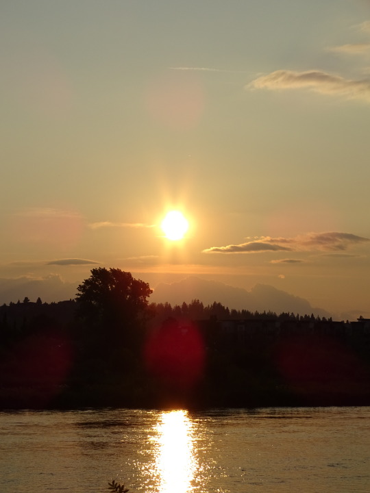
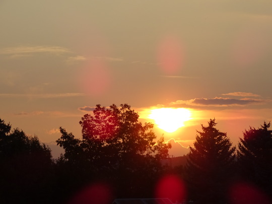

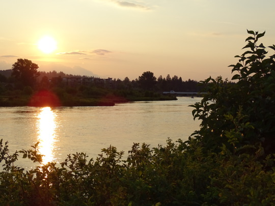
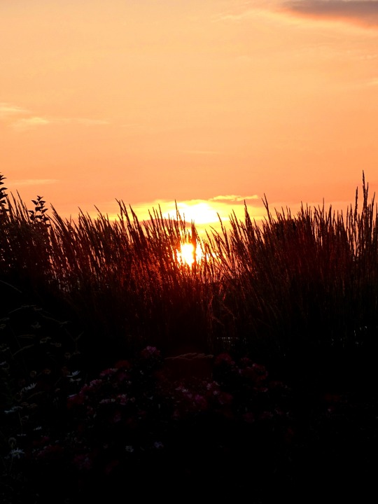
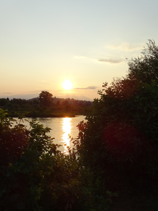
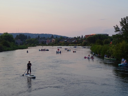
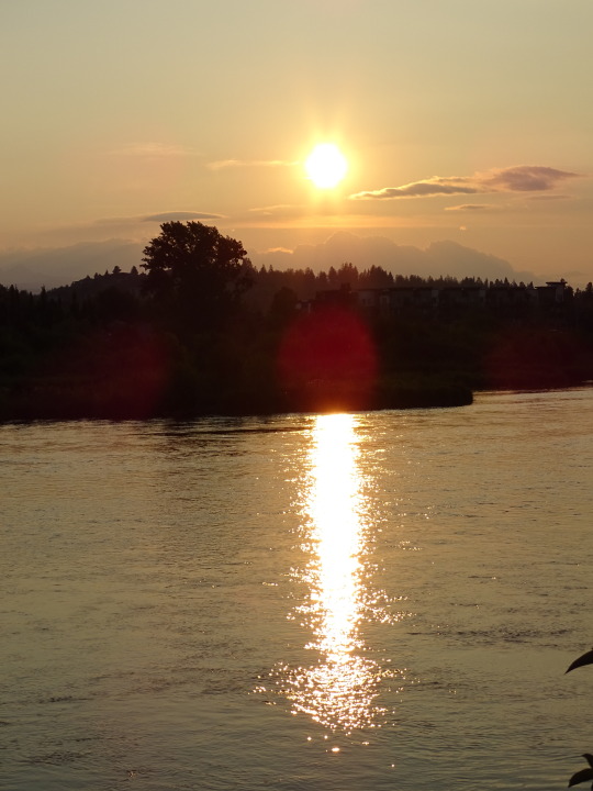
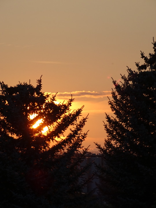
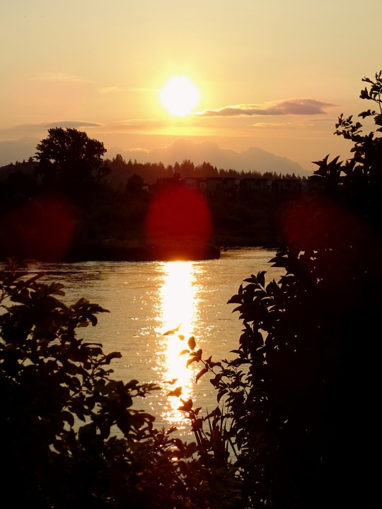
Bend, OR (No. 8)
The headwaters of the Deschutes River are at Little Lava Lake, a natural lake in the Cascade Range approximately 26 miles (42 km) northwest of the city of La Pine. The river flows south into Crane Prairie Reservoir, then into Wickiup Reservoir, from where it heads in a northeasterly direction past the resort community of Sunriver and into the city of Bend, about 170 miles (270 km) from the river mouth on the Columbia.
In central Bend, the river enters Mirror Pond, an impoundment behind Newport hydroelectric dam. The pond extends upstream to the Galveston Bridge and is a feature of Drake Park as well as Harmon, Pageant, and Brooks parks. From April through October, diversions to Central Oregon Irrigation District canals reduce the river flow between Bend and Pelton Reregulating Dam, at river mile (RM) 100 (river kilometer (RK) 160).
The river continues north from Bend, and just west of Redmond, Oregon. Here it passes by Eagle Crest Resort and Cline Falls State Scenic Viewpoint. As it heads north through the central Oregon high desert, the river carves a gorge bordered by large basalt cliffs. By the time it reaches Lake Billy Chinook, a reservoir west of Madras, the river is approximately 300 feet (91 m) below the surrounding plateau, the Little Agency Plains and Agency Plains. At Lake Billy Chinook the river is joined by the Crooked and Metolius rivers.
Beyond the dam, the river continues north in a gorge well below the surrounding countryside. It passes through the Warm Springs Indian Reservation, which includes the city of Warm Springs and the Kah-Nee-Ta resort. The river ends at its confluence with the Columbia River, 5 miles (8 km) southwest of Biggs Junction and 204 miles (328 km) from the Columbia's mouth on the Pacific Ocean.
Source: Wikipedia
#Bend#flags#Central Oregon#Deschutes County#Oregon#USA#summer 2023#Pacific Northwest#travel#original photography#vacation#tourist attraction#landscape#landmark#cityscape#architecture#Old Mill District#evening light#tree#flora#sunset#reflection
15 notes
·
View notes
Text
Excerpt from this story from Yale Environment 360:
Strong winds sweep over the Rhön, a vast region of rolling, forested hills and pastureland in central Germany. Undeterred, Stefan Zaenker, leading a group of four volunteers, runs through his checklist alongside a forest road. Are rubber boots disinfected to prevent introducing potentially harmful microorganisms into the wetland? Are the team app and GPS functioning correctly? Have enough flags been packed?
When all is in order, Zaenker, 56, leads the group into a soggy alder forest. Its mission for the day: to locate and map as-yet-undiscovered springs and document any species inhabiting them.
A senior conservation official for the state of Hesse, Zaenker considers springs so important for human life and biodiversity that he — along with volunteers from the Hesse Association for Cave and Karst Research — spends much of his spare time conducting large-scale searches for them in the Rhön, which includes the German states of Bavaria, Thuringia, and Hesse, and in a nearby national park.
Conservation strategies around the globe focus on rivers, bogs, forests, reefs, and many other habitat types. Springs rarely get any special attention. In the United States, for example, springs do “not appear to be a prominent feature on the conservation radar,” says Kirsten Work, a zoologist from Stetson University in DeLand, Florida.
But for the biosphere, these tiny spots dotted across Earth’s land surface play a powerful role: They connect reservoirs of groundwater to the outside, sunlit world. Only so-called “fossil” aquifers — ancient bodies of groundwater that do not recharge — lack a link with the surface. Without a continual connection to groundwater, which also feeds rivers, many landscapes would quickly dry up and become hotter. In addition, springs are home to a wide range of highly specialized species, some of which live outside by night and in the darkness of groundwater by day.
Far too little is known about where springs occur and what species they harbor, Zaenker says. In a country like Germany, which has no wilderness but a very efficient bureaucracy, most people assume that everything in nature has already been discovered and mapped. This is not true, he claims: “I can stand right next to an impressive spring with water flowing out, but the official topographical map shows nothing.” Official maps denote springs with a blue dot, indicating they are habitats protected by law. Yet many — if not most — springs remained undocumented. “How are we going to effectively protect these important habitats or know if they dry up,” asks Zaenker, “if we don’t even know they exist?”
Halfway around the globe, ecologist Larry Stevens is on a similar mission and is equally worried about the future of springs. In 2013, Stevens cofounded the Springs Stewardship Institute, a nonprofit science initiative linked with the Museum of Northern Arizona, and in 2023 he published Springs of the World: Distribution, Ecology, and Conservation. Stevens considers springs prime examples of “canaries in coal mines” because they act as early warning systems of water table decline and biodiversity loss.
Stevens is particularly fascinated by the large number of highly specialized and endemic species found in and around springs. He points out that with constant temperatures and high purity, spring water offers unique living conditions. Springs are often isolated from one another geographically and many have been in place for millennia, characteristics that make them hotspots for new species to arise and refuges for species that have lost their habitats elsewhere. “Although miniscule in habitat area compared to rivers, lakes, and oceans, springs support more than 10 percent of U.S. endangered species, as well as thousands of other rare and endemic biota,” he notes. For example, the so-called Comal Springs riffle beetle is limited to a few springs in Texas, while the endangered White River springfish lives only in isolated warm springs in eastern Nevada.
While there are many spectacular springs — like the white Pamukkale terraces of Turkey, Blue Spring in New Zealand, or the hot springs in Yellowstone National Park — most are rather inconspicuous. That doesn’t diminish their importance, though. Every creek, river, pond, and lake starts with at least one, and often many, springs.
13 notes
·
View notes
Text
The Music of Nature and the Nature of Music 🪕🎶🪵🌲🦦
Music and nature go hand in hand. Whether it’s the way a song reminds us of a certain place or the fact that nature itself is full of music. The two are deeply connected. If you stop and listen when you’re outdoors, you’ll hear rhythms and melodies all around you: birds singing, rivers flowing, wind whistling through the leaves in the trees. At the same time, so much of the music we create is inspired by nature too. It’s in lyrics about mountains and rivers, to actual recordings of nature sounds that are mixed into songs.
Where Is Music in Nature?
Nature has its own kind of music. Birds sing, wolves howl, whales call to each other across the ocean... Even things like rain falling, or the beat of footsteps on a trail have a natural rhythm to them. Even beyond animals, nature itself has a soundtrack. Think about the sound of a river rushing after a storm, the crackle of a campfire, or the way wind creates different whistles and tones as it moves through trees and canyons. If you pay attention, nature is constantly making music.
Where Is Nature in Music?
On the flip side, nature shows up in a lot of the music we listen to. Many songs mention the outdoors. Mountains, forests, and oceans are mentioned a lot, because those places make people feel something. Folk and country music especially love to talk about nature. Some artists take it a step further and actually use nature in their music. I can recall some folk and indie songs that literally begin with birds chirping or dogs barking (Que Poison Root by Alex G).
Indigenous music also has long used nature as both inspiration and a storytelling tool, passing down knowledge about the land through song. It’s a cool reminder that music isn’t just entertainment, it can also be a way to connect with nature and share its stories.
A Song That Brings Me Back to Nature
For me, there are so many songs that instantly take me back to a place in nature. One in particular is Suitcase Full of Sparks by Gregory Allan Isakov. This song reminds me specifically of Centennial Ridges Trail in Algonquin Provincial Park. A friend and I spontaneously drove up there a couple summers ago in the middle of the night. We slept in the back of her jeep (somewhere that we shouldn’t have been, but hey that’s the fun of it). We were able to get started on the trail before sunrise the next morning and we had a little bluetooth speaker with us. The first song we played was Suitcase Full of Sparks. The vibes were so good as the sun rose through the trees and we ate cherry tomatoes from our pockets. We put the song on loop and really took everything in. Now, every time it plays, I can picture the sun reflecting off the lake below us and illuminating the trees as we stopped to eat lunch and take in the view at one of the lookout points along the trail. The way the soft vocals and descriptive lyrics about nature matched the vibes of the hike made it feel like the song and the place belong together.

The view I’m speaking of. Taken by me on July 9, 2022. And the song:
Some other songs that bring me back to nature too:
Wild Horses by the Rolling Stones — Reminds me of driving through the mountains in spring, back when my time in Alberta was coming to a close.
Would That I by Hozier — So many references to nature, trees, willows, fire, ashes, roots, wood.
Where The Skies Are Blue by The Lumineers — Self explanatory. What a tune.
Oysters In My Pocket by Royel Otis — This song gives me deep nostalgia from early last summer when Muskoka came to life again.
Lake Shore Drive by Aliotta Haynes Jeremiah — About driving a beautiful road and taking in the scenery.
Brazil by Declan Mckenna — Rivers and grizzly bears, need I say anything else?
I Got A Name by Jim Croce — Trust me and listen.
Bobcaygeon by The Tragically Hip — Constellations and Canadian cottage towns.
Patio Lanterns by Kim Mitchell — Takes me back to warm summer nights by the fire with my dad.
Final Thoughts
Music and nature are way more connected than we might realize. Nature makes its own music, and music helps us connect with nature. Whether it’s birds in the morning, a song that reminds you of a favorite outdoor spot, or an artist blending animal sounds into their beats, the two are definitely always influencing each other. Next time you’re outside, stop and listen! Nature might just be playing a song for you ;)
2 notes
·
View notes
Text
Himachal Pradesh, nestled in the lap of the Himalayas in northern India, is renowned for its pristine landscapes, snow-capped peaks, and vibrant culture. From popular hill stations like Shimla and Manali to remote valleys and high-altitude lakes, Himachal Pradesh offers a diverse array of experiences for travelers. Beyond the well-trodden paths, there are numerous offbeat places in Himachal Pradesh waiting to be explored, each offering a unique glimpse into the state's natural beauty and cultural richness.

One of the lesser-known attractions among Himachal Pradesh offbeat places is the picturesque village of Kalpa in the Kinnaur district. Nestled at an altitude of approximately 2,960 meters, Kalpa offers breathtaking views of the Kinner Kailash range. The village is dotted with traditional wooden houses, ancient temples, and terraced apple orchards. It provides an ideal setting for travelers seeking tranquility and a glimpse into the traditional Himalayan way of life.
For those interested in spiritual exploration, offbeat places in Himachal Pradesh include the serene Tirthan Valley. Located in the district of Kullu, Tirthan Valley is named after the Tirthan River that flows through it. The valley is surrounded by dense forests, waterfalls, and snow-capped mountains, offering opportunities for trekking, birdwatching, and trout fishing. It is also home to the Great Himalayan National Park, a UNESCO World Heritage site known for its biodiversity and scenic beauty.
Another hidden gem in Himachal Pradesh offbeat places is the remote village of Malana in the Parvati Valley. Famous for its distinct cultural practices and ancient traditions, Malana is often referred to as the "Little Greece of India." The village is secluded and can only be reached by trekking through picturesque landscapes. It offers a unique cultural experience with its traditional architecture, local customs, and the revered deity Jamlu Devta.
In conclusion, Himachal Pradesh offbeat places promise travelers a chance to step off the beaten path and discover the hidden treasures of this enchanting state. Whether you're drawn to the serene mountain villages like Kalpa, the spiritual aura of Tirthan Valley, or the cultural immersion in Malana, Himachal Pradesh offers a myriad of experiences that are sure to leave a lasting impression. Embrace the adventure, immerse yourself in nature's splendor, and uncover the lesser-known wonders of Incredible India.
#clearholidays#himachal pradesh#offbeat places#offbeat tourism#himachal offbeat#india travel#india tourism#incredible india#himachal pradesh offbeat places#offbeat places in himachal pradesh
2 notes
·
View notes
Text

https://maps.app.goo.gl/PwoGuBkmRUiddMQKA?g_st=ic
Floaters who wish to fish hard without a lengthy shuttle may launch at the Kendall Recreation Area ramp, located off U.S. 127 below the dam. The takeout is the old Kendall Ferry landing located at the end of Ray Mann Road, just off the road to the recreation area. This makes for a float of approximately 1.75 miles with a shuttle of just a few minutes.
This section includes the hatchery creek outflow, a good place to fish. Boyd’s Bar, a productive wading shoal for rainbow and brown trout, lies at the end of Ray Mann Road. The next take out is a little over 4.5 miles downstream from Wolf Creek Dam at Helm’s Landing Boat Ramp, located off KY 379 via KY 55 and U.S. 127. Excellent rainbow trout fishing runs all through this stretch of the Cumberland River. Toward the end of this float you will see two rock walls on each side of the river. Legend has it that people removed rocks and piled them near the riverbank to help steamboats power over a shoal in the river. Anglers should know this shoal is one of the most productive rainbow trout fishing spots on the Cumberland River. From Helm’s Landing, it is a 5.8-mile float to the next take-out at the Rockhouse Natural Bridge, located off KY 379. In this section, the river is a series of shoals and long pools. Anglers working the rocky edge of the flowing shoals and pools score on a mixture of rainbow and brown trout. Near the end of this section, floaters will see the river take a hard left turn at a high bluff. This is the Rockhouse Hole. The Kentucky Department of Fish and Wildlife Resources recently purchased the island on the downstream left, just above the Rockhouse Hole. This island shoal is Long Bar, although some refer to the area as Snow Island. It is one of the better wading shoals on this section of the Cumberland River. Anglers may beach their boats on the island to fish this area.
The Rockhouse Natural Bridge take-out requires you to carry your boat through the arch and up a steep incline to the parking area. This take-out is not recommended for anglers in johnboats.
The Rockhouse also serves as the put-in for the next section of river. Although the float from the Rockhouse to the next take-out at Winfrey’s Ferry is 5.5 miles on the water, the shuttle is just 1.5 miles. This is because the road connects the neck of a large bend in the river. A single paddler could drop off a boat in the Rockhouse parking area, drive down KY 379 to Winfrey’s Ferry, then walk back, leaving the vehicle parked at the end of the float. Rainbow Run, one of the best fishing shoals on the river, is just downstream from the Rockhouse. A long gravel bar on your right denotes Rainbow Run. The entire length of this shoal is worth many casts. Class I rapids downstream of this area provide lively paddling. A little further along on this float is Winfrey’s Rocks at downstream left. These rocks served as signposts for boat pilots back during the steamboat era.
The rocks, located halfway through the float, mark a deep hole that holds bruiser brown trout. Striped bass also show up regularly from this section downstream. The rest of the float is a long, deep hole until Winfrey’s Ferry. Look for a cable that goes across the Cumberland River. This cable indicates the take-out downstream to the right.
The Cumberland River rises quickly when electrical generation begins from the dam. Powerful current created by more than one generator in operation makes the river unsuitable for paddlers. Log on to the U.S. Army Corps of Engineers Nashville District Web site at www.lrn.usace.army.mil/ and search for Lake Cumberland generator schedule. The daily fishing report contains the 24-hour generation schedule for Wolf Creek Dam. Boaters may also call (606) 678-8697 for current information.
4 notes
·
View notes
Text
Day One Hundred and Four
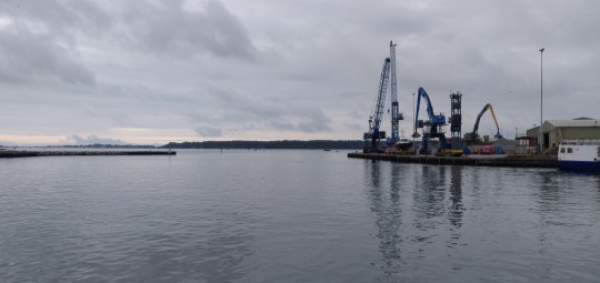
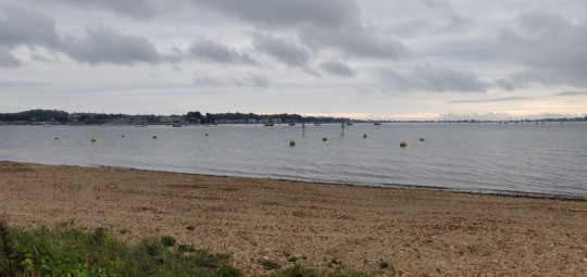
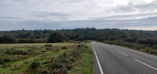
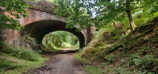
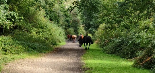

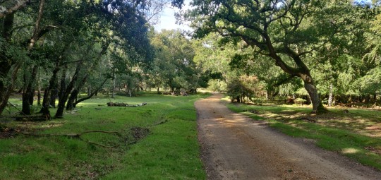
Well rested and up at 7am this morning in a pleasantly sheltered patch of trees a little outside of Wareham, it's time for another day at it!
On to the road, it's an easy start to the day with a gentle roll over the River Frome and through the nice little town of Wareham.
The place still seems to be in the process of waking up currently, and the streets are nice and quiet as I ride through and out over the River Piddle or Trent.
Rather than getting the overpriced ferry down at Shell Bay, I'm tracking around the bay and heading up the A351, which has a nice compliment of cyclable pathways running up past the busy dual carriageway junctions and into Upton.
A bice long run of road down through Hamworthy brings me back to the waterside once more to the nice quayside down at Poole.
It's now time for a stretch of riding that I've been looking forward to since seeing its potential coming up in the map, with many decent flat miles ahead of waterside riding. Let's get to it!
Around Poole Quay and past the harbourside, the trail leada on through Baiter Park with the water lapping up right next to the paving.
The path rolls past the boating lake before a short leg through some busy roads, before dropping dowj back onto the shore road.
I follow the road out for a loop around Sandbanks and past the ferry terminal, before heading back and turning off to hit the beach.
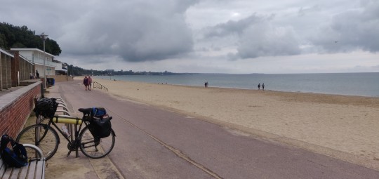
Ahead is a beautiful long run of promenade next to the lovely sandy beach, running for miles below Bournemouth's pretty cliffsides.
The day is a little grey still which is keeping tue seaside a bit quieter so far, which means fewer pedestrians to navigate around as I enjoy a nice gentle flat ride around the beach.
It's a lovely bit of riding as I roll up and around Bournemouth Pier and onwards along the full run of promenade up to the far edge of Southbourne, where I pick back up with NCN Route 2 as it heads up over the River Stour and in through Christchurch.
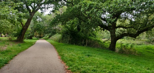
The town is quite busier than the beach today, so I keep at the trail as it heads out around some nice trails through Stanpit Marsh and then up along the side of the River Mude.
Past some busy road junctions, the route does a good job of keeping out of traffic is it twists through some back roads and out into the countryside once more.
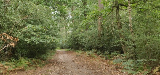
It's time for another unland diversion here with a bit that I've been looking forward to as Route 2 heads up into the beautiful woodlands and moors or the New Forest.
After meandering through the roads here, the route heads past Holmsley and hits the offroad trails through open land filled with horses and cattle roaming freely.
The terrain isn't ideal for my loaded touring bike, but I'm setting a gentle pace and ensuring the bumps and rocks aren't too much of a hazard.
The route heada down some lovely forested trails and along a lovely old rail line before swinging into Brockenhurst.
Even the more urban parts of New Forest are amazing to see, as horses and donkeys roam the streets here and do not give one single damn about the flowing traffic.
With a bemused smile on my face, I roll through and out of town and back to the trails, where I have to navigate through another herd of horses.
I also catch sight of an elusive grass snake speeding out of my way, which causes a laugh of joy. They're an animal I've loved since I was a child and seeing one is a highlight of the entire trip.
Slowly making my way along the stoney trail, the route through the forests lead out past the campsite at Denny Wood and onto the road across the wide open moors. There's a good bit of crosswind blowing along here, but the cycle route soon turns once again to set it at my back.
Past more moorlands and patches of woods, the route heads past a busy bypass and into the edges of Applemore with a convenietly placed supermarket for me to stop off at.
With the day getting in and a long urban stretch ahead, it looks like a good position to settle up for the day!
It's been a very enjoyable run today and the terrain is getting so much easier to tackle now I'm out of the real tough hills and cliffs if the West Country. A check of the map suggests that I may only be around 400 or so miles from the end of my ride now, which is a scarily short distance considering how far I've come! We'll see how the rest of the week unfurls!
TTFN!
5 notes
·
View notes
Text
BC: East Kootenay
When I left Nelson, there was no longer ash falling on the car but still a lot of smoke and the sudden 10C drop in temperature from the day before held out, so suddenly I was wearing a sweater & scarf again!
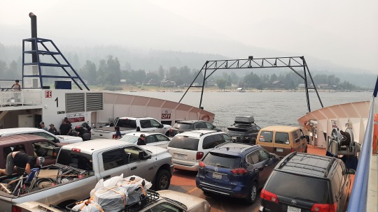
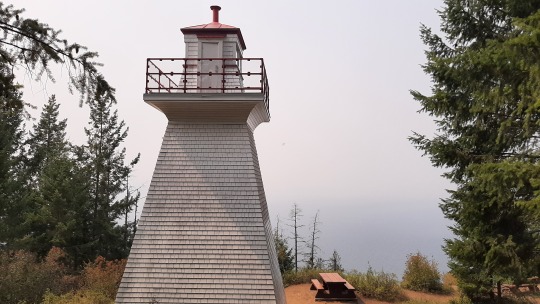
Ferries always make me think of holiday (when we were little, we would take the ferry across the Mediterranean from Tunisia to the Netherlands & France, maybe that's why?), so even with poor view I enjoyed the 35-minute (free!) crossing of Kootenay Lake. Upon landing, I visited the Pilot Bay lighthouse which was in use from 1905 to 1993 to guide ships on the long lake on days like this with poor visibility... I was able to climb tiny stairs to the top but the view remained the same; none! 😂 Somewhat further south, I walked a bit on Lockheart Beach and could only imagine the mountains surrounding it.


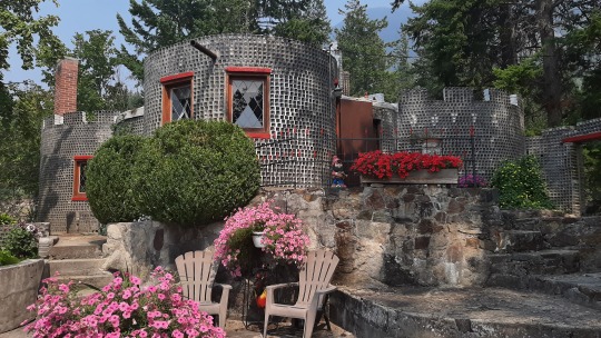
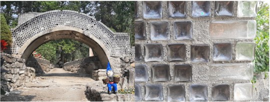
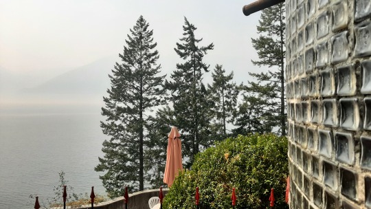
Still further south on the lake I visited the Glass House, completely made out of embalming bottles that an undertaker had collected through his job (the strangest hobbies one can have!?!😁) and which is still lived in during the winter by his descendants.
Off the lake now, the town of Creston has two grain elevators that I had wanted to take a photo of (given that we're west of the Rockies instead of on the prairies) but they were in such a bad state that I didn't even bother stopping.
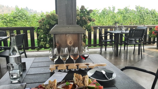
I had planned to do some wine tasting in the famous Okanagan wine valley, so instead I did one in the up & coming Creston wine valley at the Baillie-Grohman winery... out of the four that I sampled, the pinot gris was my favourite to go with the baked brie. 😊
I stayed overnight at a nearby private campground, which interestingly had simple garbage bins right next to my site instead of bear/raccoon/other wildlife-proof ones... having been conditioned to always keep food securely packed away, it was a bit unsettling but luckily the night passed uneventful. 👍

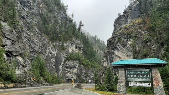
Next day, driving northeast up to Radium Hot Springs where there were another two large fires, the smoke was getting worse so I didn't feel like doing anything and cancelled all other attractions I had earmarked as potentially interesting; any viewpoints ofcourse, paddling on a pretty lake, a trout hatchery and a hike to the source of the Columbia River... With the town of Nelson having been unexpectedly the farthest west on my trip in BC, I had hoped that things would improve going back so it was disheartening that nothing changed. I had not wanted to travel to East Kootenay in the first place, and I did not like it now! 😣😅
Instead, I drove straight to my campround at Radium, set up shop and then had a soak in the nearby hot springs which improved my mood. After a tasty jambalaya dinner, I spent the evening playing solitaire and won three times in a row! 😄


In the morning, it rained but there was no smoke, and you cannot imagine how happy I was... I had not thought that I would be so glad to see proper clouds again!😂
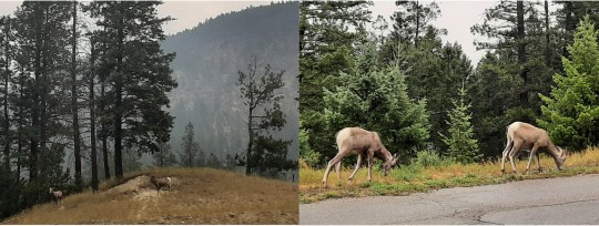
At the hot springs the previous day, I had already spotted the first few bighorn sheep (most without big horns though) and now I saw quite a few more on my way out along the canyon. Bighorn sheep don't lose their horns annually such as deer so they grow longer each year, and you can determine their age from the horn rings just like trees... roadkill is unfortunately a major issue, but this was not going to be by me (the duck was enough!!) so I slowed down properly. 👍
In Kootenay National Park, I checked out Olive Lake which is spring-fed and has pretty colours but the rain made it a brief stop.
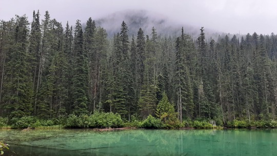
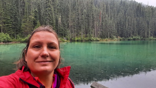
The road follows the Kootenay river, which with its light-blue glacial water was a bit monotone with the grey-white sky, but still pretty and with an impressive flow, not to swim in!
I started a hike crossing the river towards a lake but turned around at the bridge, as I didn't feel at ease. August is prime berry time for bears and as I didn't see anyone else on the trail, it felt a bad choice to continue... I'm not too concerned about black bears as they tend to flee when they see humans (unless they feel threatened), but grizzly bears are aggressive and will attack, against which my hiking poles & whistle are not really up to 😯. Lesson learnt; if I ever come back to BC and the Rockies, I would want to be in a larger group so that I can hike more!

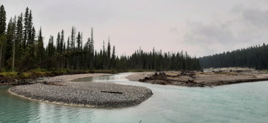
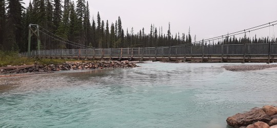
I did do a small hike in a fire restoration area as the parking lot was full and there were more people on the trail. The scenery was a bit haunting with a lot of dead trees but at the same time it had a positive feel to it as new plants were taking over. The area has had four fires in the last 20 years, some natural and some burned on purpose to create meadows, which does not only reduces the risk of devastating, out-of-control fires but also provides important habitat for wildlife who depend on the grasses & shrubs for their survival.

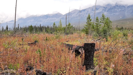
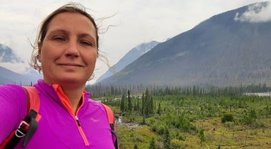
Although there was a tiny bit of blue sky during the hike, once I got to the Marble Canyon campground, it rained and rained and rained, so I sat comfortably in the car reading a magazine until there was a dry spell, set up the tent in record time and continued reading there when the rain restarted. 😁
In the morning it still rained on & off but it felt really good to breathe fresh mountain air, so I was not fed up yet. 😅 Out of the 3 Rockies canyons (Johnston in Banff & Maligne in Jasper are the other two), I found my hike at Marble Canyon to be the prettiest, as the river has carved deep into the rocks, leaving a narrow chasm with the water way down below. Impossible to photograph its full length, the waterfall plunging down into the canyon is unbelievable! 😍 As a bonus, the sun even came out!
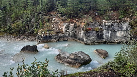

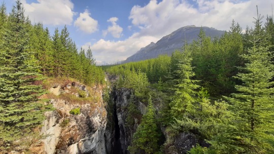

The other highlight of Kootenay park is the Paint Pots, ochre-red pools that were used by the Indigenous for e.g. body painting. I had a vague recollection that we were disappointed when we were here in 2010 and that got reconfirmed once I got to the 2-3 small pools... nothing special here but the hike to them was pretty enough not to make it a waste.
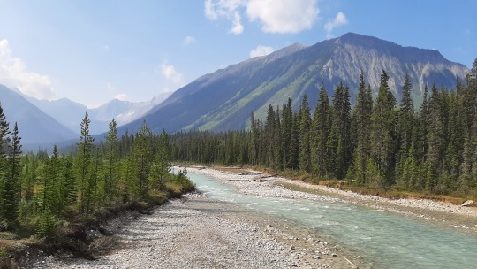
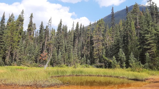

As the weather was flipflopping between rain & sunshine and I didn't want to get rained on another hike, I decided to spend the afternoon in Banff as there were still several things I was interested to explore & it would be fun to go for dinner in town... Banff was just 30 minutes away on the other side of the Continental Divide, which determines whether a rain droplet flows west to the Pacific Ocean or east to the Atlantic Ocean. Kinda cool to think how different those paths would be if you were to be a rain droplet! 😉
Am running out of my photo limit so next post will be about Banff (2nd visit) and Jasper!

Wildlife: 21 bighorn sheep (only 2 with actual big horns 😜) at Radium
SUPs: none
Hikes: 4 at Kootenay Park
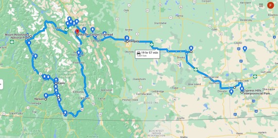
Distance driven from last map: 1,631km
2 notes
·
View notes
Text
i cling to hope like an animal.
when i wake up, i open my blinds to see how the sun is rising. i listen to my favourite songs and do my makeup in the mirror. i think about people i used to know and the versions of myself they knew. i think about how we were girls together and i will always care for them. i plan the day and daydream out the train window. i sit on a bench in the park and greet people with a good morning. i get lost in the books i read and smile at everyone i see. i smell the freshly cut grass and sweet pastries. i flick through the notebook where i sometimes sketch landscapes to capture the scenes i want to remember every detail of. i see children that remind me of a younger version of myself. i try to find heart shapes everywhere. i want to share my dreams with someone who wants to listen. i want to stop and smell the roses. i want to be sentimental and unashamed of it. i think about community and public libraries. i think about how our hands contain our humanness and how holding hands connects us. i sit by bodies of water when i don’t want to talk to anyone. i like to scribble lines of bad poetry and i try to be kind to myself. i wonder if the road ever ends. i look up at the trees and wonder if there are any that are the same age as me and have been growing with me. i think about how much history they have witnessed, the endless stories engraved into their bodies. i touch the flowers and hug my friends. i listen to birdsong and stare at art. i want to dive into the water even if it’s cold. i get into moods where i feel so much love for everyone in my life.
i try to listen to my body and work with it rather than against it. i listen to podcasts about poetry and joy and healing. i think that sharing an orange is the peak of love. i dream about all the places i can go and all the people i could be and of you. i feel grateful for bright colours and for being able to try again. i wonder if i can ever leave. i remind myself to pay attention, to listen, to stop being so sure i know anything. i think about how small flowers look like constellations. i cry about the same things. i email my friend who lives across the world every few months and wonder what it’s like to be someone else. i keep everything that people give me, especially handwritten letters and their love in my heart. i think about childhood summers and the last sunset. i think about how we can miss so much but we will never get any of it back. i bake with my friend and things feel easier. i want to be one of those old couples who hobble along the streets of foreign cities holding hands and chatting away, or sitting by the river under the shade of trees reading. i love road trips with the windows down and the soft sounds of music flowing. i think about warm light and sitting in silence by the lake. i think about basking in the comforting smells of laundry and campfire and cooking. i think about handprints in caves and the tenderness of kissing a bruise. i think about how old my grandma’s house is. i hope our kitchen tables are always full of food, people, and laughter. i find myself returning to the view from my attic bedroom window: the clouds, the hills and trees in the horizon, the occasional train passing, and all the people in their little houses living their little lives. i mostly spend my days alone. i watch comforting films and journal every so often. i write about what tugs at my heart and what i dare to wish for. memory feels like sunlight on water. i wish i can be everything like my parents and nothing like them. i want to live inside a melody. i want to be soft without turning into a beaten pulp. i light candles in the evening after showering and settle down to read. i look forward to moments in the morning when the light streaks into every crack and crevice, and the world feels quiet and bearable. i pray no one lets the loneliness consume them. i listen to the rain pat gently on the roof at night when i can’t sleep and stare at the moon in all its glory. i think about how anger unravels us and regret eats away at us and how we need tragedy. i keep my window open to hear all the soft sounds of the earth.
i cling to hope like an animal.
- Tiya
3 notes
·
View notes
Text
Waitomo and Taupō
Acquiring the vehicle and getting out of Auckland ended up being much more time consuming than we thought it would be. The streets of Auckland were very confusing - especially when driving on the other side of the road. We eventually made it out of there but not without a few wrong turns and missed exits.
We had a date to go to Waitomo for a spelunking tour, but since things took longer than expected getting out of Auckland, we had to call to move the tour down. They could only accommodate us later in the afternoon, so we ended up having some time to kill before the tour.
We decided to pop in at a place called Otorohanga Kiwi House - a native bird park with pretty good online reviews. As a bird lover, I was excited about the opportunity to see a kiwi bird and learn more about New Zealand’s amazing avian natives. The place ended up being a little sleepy and a bit run down. But we did see a kiwi bird in a darkened nighttime enclosure, which was neat! Apparently they can live to be 40-60 years old, and can be put into captivity and released again with no issues. They are often captured to ensure safe and effective breeding before being released again.
The Kiwi House may not have been a thrilling experience, but it was a nonprofit organization with all proceeds going to bird conservation, so we felt good about our patronage. I didn't get any pictures of the kiwis in the dark, but did encounter this cute little parrot.

After a quick lunch at a local cafe (“Fat Kiwi Cafe”), we headed to The Legendary Black Water Rafting Co.
We opted to do a Waitomo caving tour that was different from the one I did last time I was in New Zealand. This place had an option for a shorter, cheaper 3h tour, so we went with that.
After getting all geared up into our wetsuits and boots, we took the bus out to the caves. We were given a thick tire-sized black inner tube to take with us into the caves. Much of the cave system was traversed on foot, but in deep, cold, flowing water. The cave didn’t get overly narrow, but did have some areas with high water and low ceilings where you needed to duck under to fit.

I was surprised with how quickly my brain went from intrigued to anxious. I had a bunch of spontaneous thoughts of “what if there’s a flash flood and we drown in here”, or “what if there’s an earthquake and we get stuck, like those kids in Thailand that needed to be rescued”…. It was actually interesting to see how quickly my brain searched for the worst case scenarios. I decided to just breathe through it and enjoy - and lo, the thoughts receded. A good exercise in understanding the deceptive nature of anxious thoughts.


At one point in the cave we got to float in our tubes along the running water while looking up at a ceiling full of sparkling glow worms. This was absolutely fantastic. I’d seen the glow worms before — both last time I was here, and on our little roadside adventure in Milford sound - but this was a special way to appreciate them in all their glory. It felt like looking up at the Milky Way galaxy, but the worms have a bit more of a bluish hue than the stars typically do. It was cold, dark, and amazing all at the same time. Felt like a Disney world ride come to life.

Today happened to be Valentine’s Day, and I couldn’t think of a more romantic date than to be cruising along a river under the “stars” with my valentine.

After the caving adventure, we hit the road again and headed to Taupo. We did t see much of the town, but did get a chance to see the sunset over the lake while looking for a place to eat along the main strip. We settled on a place (Jolly Good Fellows), with a nice patio so we could see the sunset finish over the lake.

Our Airbnb that night was a lovely guesthouse in the backyard of a suburban home. It was stunning! The walls and ceilings were bare wood, but the furnishings made the space absolutely beautiful. A great inspiration for how you can take something like a simple garage/shed and make it exceptional with the right touch.

The drive from Auckland to Waitomo and down to Taupo was very beautiful. Stunning farmlands and hills that ranged from rolling to small mountains, with the road winding about in between. We commented that it was like the Caledon of New Zealand, if Caledon had mountains.

I was reminded of why NZ’s North island made such a perfect location to bring Tolkien’s Shire to life. We didn’t add the Hobbiton movie set tour to our list - too much to do already - so many I’ll hit that on my next trip to NZ. There’s already a full list of other things to come back for!

0 notes