#& the owner lives like 1.5hrs across town
Explore tagged Tumblr posts
Visit Tumblr Blog
Explore Tumblr blogs with no restrictions, modern design and the best experience.
Last Seen Tumblr Blogs


Fun Fact
In 2020, Tumblr had 29.4 million users in the US.
Text
i’ve just never understood fluid ounces or like ‘cups’ like what does that MEAN. ‘8.6oz’ bro that makes no fucking sense so i started using the other number next to it to compare bc packaging of fluids is just advertising so ive learned ml & i’ve learned how to cook in metric so i can’t even talk to my mother abt cooking bc literally we’re both googling to convert volumes
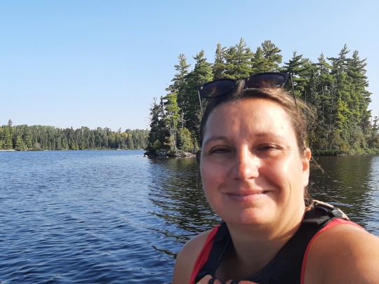
#diary#i just think that’s funny#ALSKALKSALDKLAJSALJSLAJSA#like when i worked at teahouse everything was in cc but that’s like#the same as ml so even then we were all working in ml in texas ALSKALSKALKSLAJSLAJSLAKS#LIKE IT JUST MAKES SENSE IDK#i mean ok w teahouse the owner was chinese like immigrated as an adult from china so they use metric & its his business#girl we even had to use wechat as the official scheduling & groupchat ALSKALKSLAKALAKALKSLAKSLAK#i literally remember learning abt it my sub manager was like ‘u have to download his stupid chinese app instead of text messaging’ 😭😭😭😭#that’s what happens when everyone running the restaurant is under the age of. 20.#& the owner lives like 1.5hrs across town#girl he was insane he would literally call the store & then watch the cameras & tell us what to do there was even a camera directly above#the register & he’d zoom in on the screen even 😭😭😭😭 GIRLLLLLL UNHINGEDDDDDD#DI WANG OF BELLAIRE TX DIE !!!!!!!!
6 notes
·
View notes
Text
Northwest Ontario: 2nd time's a charm
The route from Winnipeg into Ontario and eastward to Espanola is the only section of my trip that I've driven back & forth on the same road (apart from the Kenora-Thunder Bay stretch where I did take a different way back) as the rest of the 20k drive has really been one big loop across the country, hence 2nd time's a charm! 😀 Having assumed that the weather would be worse in September, I had taken my time going west, camping in beautiful provincial & national parks, so check out those earlier posts to see the full beauty of this region. Now on the way back, I tried to see a few new places and/or revisited some of my favourite spots.
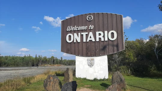
It felt really good to see the Welcome to Ontario sign, as it meant I was heading home... all provinces have their own charm, but Ontario I know best, so that will always remain "my place".
Staying in Kenora for the night, I had contemplated to go see the sunset over Lake of the Woods, but instead I just stayed at the motel trying to fix the pump hose for hopefully a few more paddles. 🤞
In the morning, I took the highway south to Fort Frances, which is an hour longer to Thunder Bay then east to Dryden but has the benefit of not having any trucks. The road is curvy & hilly so that means it's difficult to bypass slow drivers, but I had it mostly to myself to take in the beautiful Canadian Shield and all the lakes - Ontario at its best! 😍
At Sioux Narrows provincial park, I did a small hike up a viewpoint of Regina Bay, the most eastern arm of Lake of the Woods. This was one of those viewpoints where the trees are blocking most of the view 😂 but it felt good anyway to be in the fresh-smelling forest. I surprised a deer that was on the trail nibbling at tree branches so that reminded me that I needed to make some noise from time to time - I was still in bear country after all!,

A bit further south, I had a nice 1.5hr paddle at Caliper Lake provincial park along the shoreline and around a little island. I usually start paddling against the wind to make life easier on the way back, however I had misinterpreted how the wind was being deflected around a hill, so suddenly it did a 180 on me and I got the wind against me also on the way back! 😆 less relaxing than I had envisaged!

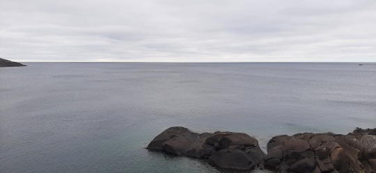
Fort Frances is the main town in this corner of Ontario, sharing a river as border with the US similar to Niagara Falls. I had thought of breaking for lunch here, but the waterfront did not really appeal to me, so I drove on and stopped instead at a viewpoint of Rainy Lake, another one of those massive lakes.
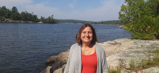
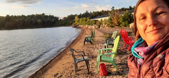
For the night, I stopped at a motel in the middle of nowhere 😁 midway to Thunder Bay, where the owner had made pretty flower gardens out of reclaimed wood. Living in Toronto, I had always thought that Kenora and Thunder Bay were kinda in the same neighbourhood "out there", whereas in reality they are over 500km apart, so I was glad to split the drive in two! As a bonus, the motel was across the road from a beautiful lake so happy to sit in a chair taking in the last sun rays of the day. 🥰


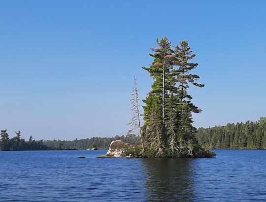
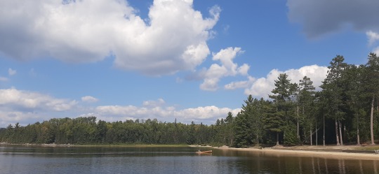
In the morning the water was still calm, so I used the motel's dock to launch my SUP and went for a great paddle around several little islands. For me, this is as close to paradise as it gets; blue water, blue sky and some little rocky islands with trees in between them 💖💖


After leaving the motel, it was only a short drive to Quetico provincial park, famed for its backcountry wilderness canoeing... something I was clearly not going to do now, but I still wanted to get a sense of what it looked like. Did a small hike around a swamp which was nothing special, so sat for a bit on a rock overlooking the lake and empty beach... travelling after Labour Day is sooo nice as the crowds disappear and calmness returns. 😍 There was a whole flock of larger brown birds walking around, which looked a bit like grouse but those tend to stay in the trees, so at the visitor centre they told me they were partridges!

After Quetico, it was another 3-hour drive to my motel in Nipigon, and adding the final hour of time difference made the day go by fast! In total, I've had eleven time-changes during this trip (+1-1+1+0.5 from Ontario via New Brunswick & Quebec to Labrador, -1.5 back to Quebec, then -1-1-1 to BC, and finally +1+1+1 to Ontario), all in the same country! 😄
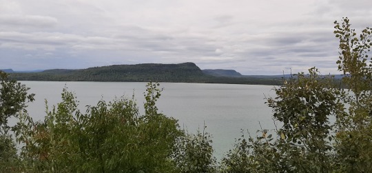
Just before getting to Nipigon, I had a quick stop at the Red Rock marina, where the view of steep hills was pretty enough, but the redness of the rock was masked by vegetation 😅. The scenery in this area is very pretty though, and the next day I really enjoyed the drive out of town - there's not many rest places along the highway to take pics from but hopefully you get the jest!

I had wanted to revisit Neys provincial park to hike up a hill to an overlook of a famous Lawren Harris painting of Pic Island, but I had been slow to leave in the morning, first sorting out things online and then waiting for my car to get an oil service. So instead, I repeated a small hike to a rocky point with a stunning view of the lake and sat there (in my coat & headband for the wind) for a while, chatting with a few friends online.
All through Canada some of my best cell phone reception was either on top of a hill or on a rocky outcrop (basically anywhere without trees) so I often would sit there to read email, research things online and chat with friends & family. 😂 It hadn't really bothered me to have poor/no reception for most of the time (sometimes for days on end), but now I was going home there was a lot to sort out, so it became more frustrating.


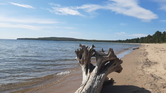
Staying that night in an airbnb without kitchen, I prepped a salad on the beach's picknick table, and then made my way over to Marathon for some cozy streaming of the Amazing Race while lying in bed 😊, a definite advantage of staying in a building rather than a tent! In the morning, I quickly checked out Marathon's Jellicoe Cove, which is undoubtedly a great place to be on the water in high summer.
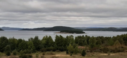
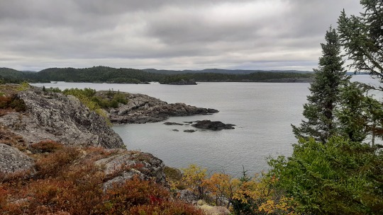
Just south of Marathon, I also revisited Pukaskwa national park, which was as stunning as on the way up. It was much greyer now though, so check out the pics from my previous post to truly appreciate its beauty. I redid the Southern Headland Trail and then added the Manito Mikana trail which I hadn't had time for previously... the little islands, the vast water expanse, the beach... all pretty and with starting fall colour changes! 😍


Temperatures were less fun; 4 degrees in the morning and only warming up to 8-12 degrees in the afternoon, so after a cold day, I got myself in Wawa a chicken noodle soup & yam fries to warm me up! Arriving early at my cabin, the same where I had stayed years ago on a Thanksgiving trip up here, I cranked up the heat and snuggled in front of the tv. 😊
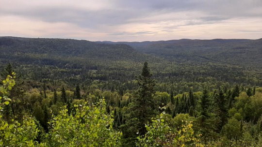
Next day, I hiked the Nokomis trail in the northern part of the Lake Superior provincial park, which has stunning views of the surrounding forest and of Old Woman Bay...which I had a harder time to see as I was stung by two wasps on the way up! 😫 Stopping to take off my sweater, they suddenly stung me on the arm and eyebrow before I even realized what happened. I picked up my stuff and ran away 😅. Not surprisingly, my entire eye got swollen so once I was back down, I took some rest on the beach before hitting the road again. Au, it hurt!! 😮


Driving went ok but it was very tiring, so I had another break at the lovely beach of Pancake Bay provincial park to eat something and soak up the sun with my eyes closed. I was surprised that Lake Superior has such large sandy beaches as most of the shoreline consists of Canadian Shield rocks... they are a bit out of the way for city folks from Toronto 😉 but great places for locals from Sault Ste Marie!
In that town, I spent some time getting ready for the next phase of leaving Canada; I washed my car so that it's a little more presentable 😅 (got also a deep-clean booked to get rid of all the sand) and spent my remaining gift cards and Shoppers points... don't want to lose any freebees! 😄
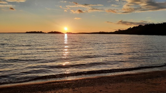
Checking in at the motel in Thessalon, I was relieved to be able to sit and not get up for a while... If we all could see such a sunset each day, the world would be a more peaceful place! 😍🥰
Wildlife: 1 deer at Sioux Narrows, 15 partridges at Quetico, 1 partridge at Pukaskwa, 2 wasps at Lake Superior
SUPs: one at Caliper Lake, one at the motel (Niobe Lake)
Hikes: one at Sioux Narrows, one at Quetico, one at Neys, one at Pukaskwa, one at Lake Superior
Distance driven since last map: 1,572km

1 note
·
View note