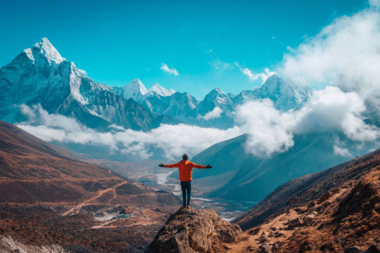
#tallest mountain in nepal
Explore tagged Tumblr posts
Visit Tumblr Blog
Explore Tumblr blogs with no restrictions, modern design and the best experience.
Last Seen Tumblr Blogs


Fun Fact
Tumblr is used by 21% of adults online aged 18-29 years.
Text

Where is Everest located in Asia? Where is Mt. Everest in the world? Where is Mount Everest located? Where is Everest located China or Nepal? Is Mount Everest located in Nepal or China?
#everest#mount everest#sagarmatha#nepal#asia#everest in asia#mount everest loation#locationa of everest#mountain everest#highest peak in the world#tallest mountain in nepal#highest mountain in asia#highest peak in nepal#highest peak in asia#nepal trekking
0 notes
Text
Evidence that Kabru from Delicious in Dungeon is Indian, a Masterpost
(EDIT: This post is an excerpt/remix of Kabru's section of my larger essay about the real world linguistic and cultural references Dungeon Meshi. You can read the essay on AO3 here. I also have another post about what part of South Asia I think Utaya is based on here.)
Since Kabru’s first appearance in the anime is upon us, I wanted to write something that compiles all the evidence we have that Kabru is meant to be a person of South or Central Asian ethnicity, or at least whatever the equivalent to that is in the Dungeon Meshi world.
Ryoko Kui can and does draw people of many different ethnicities, and the way she draws Kabru matches the way she draws other Asian characters in Dungeon Meshi. He doesn’t look Black, or Hispanic, or any other ethnicity because he isn’t supposed to. He looks like a dark-skinned South or Central Asian person, because that’s what Ryoko Kui probably intends him to be.
So let’s go through the evidence! (There are no spoilers for the plot of Dungeon Meshi below, but there ARE spoilers for Kabru's backstory as explained in the manga, and in extra materials like the Daydream Hour and Adventurer's Guide book.)
KABRU’S NAME
The Dungeon Meshi Adventurer's Bible tells us Kabru’s real name is unknown. There are other characters whose real names are only told to us in the Adventurer's Bible and were never revealed in the manga, but then Kabru, Thistle and Izutsumi’s entries simply say their real names are unknown, and though Kui could tell us their true names, she doesn’t. I assume this means that the characters themselves don’t know what their real names are, and that the names they go by are not their birth names, but this is only a supposition on my part.
KABRU THE MOUNTAIN
Kabru (काब्रु) is the name of a mountain on the border of Nepal and India, and part of the Himalayan range. It’s the 65th tallest mountain in the world and it is very snowy and icy, with frequent avalanches. Because of this, even though it’s not the tallest mountain in the world, climbing it is challenging, and is not often attempted. Those few that have managed to climb it consider it a major achievement.
“This prohibitively fearful icefall… had thwarted numerous expeditions, perhaps even the 'thought' of attempting the mountain… Unstable seracs of the icefall, a complex maze of chasms, and delicate snow bridges spanning seemingly never ending, near bottomless crevasses… Each time the members stepped into the icefall, they stood a good chance of never returning.” (Kabru - Mountain of the Gods, Major A. Abbey, Himalayan Journal 52, 1996, editor Harish Kapadia)
WHAT DOES KABRU’S NAME MEAN?
Kabru is a character that is known for being very good at charming people, but who doesn’t express himself honestly, because he’s trying to manipulate the people and situations around him in order to maintain control at all times. I think nobody really knows who Kabru is deep inside, maybe not even Kabru himself, so a remote, hostile, icy mountain that’s hard to climb seems like an extremely appropriate name.
Some of the oldest English sources I found regarding Kabru suggest that Kabru isn’t the correct local name for the mountain (a common problem in early Himalayan exploration by Europeans) and might just be a descriptor, or that it’s a misspelling.
This makes the name seem even more appropriate, since Kui’s told us Kabru’s true name is unknown. It’s possible that Kabru was a place-name or a descriptor that Milsiril (Kabru’s elven foster mother) was given when she picked up a traumatized 7 year old Kabru, and she just started using it as his name, and that even he doesn’t remember his real name thanks to his severe trauma.
The fact that people in the real world can’t seem to agree on the mountain Kabru’s name, or what it means, reminds me of the running gag of Laios repeatedly getting Kabru’s name wrong in the manga.
"All the people near the Kabru massif call it 'Kaboor'." (The Alpine Journal, 1921-22 Volume 34, Edited by George Yeld and J. P. Farrar) “It is also said that the name applies to a peak close to Kinchinjunga on the southeast, and not to the peak known to Europeans as Kabru… [The real name is] Pahung Ri [Pauhunri].” (Appendix I: Place Names in Darjeeling. The appendix says it was “compiled mainly from an article written by Colonel Waddell and published in the Journal of the Asiatic Society of Bengal (Vol. LX, part I, 1891)”) “Kangchen is a Tibetan name… the Sikkhimese use it as the name for the peak called Kabru by Europeans.” (Charles Bell, Dyhrenfurth's Himalaya (Berlin, 1931)) “...Kyabru or the horn of protection. The name is… Kabur… possibly a corruption of Kangbur or the swelling of snow; it might also mean the white swelling (kar-bur).” (Appendix I: Place Names in Darjeeling.) “Kabru literally means the 'White Avalanche' peak (Ka means 'white' and bru means 'avalanche').” (Kabru - Mountain of the Gods, Major A. Abbey, Himalayan Journal 52, 1996, editor Harish Kapadia)
I’ve seen one other mountaineering article cite the “white avalanche” meaning, and I think it’s plausible since the Appendix says it can mean “white swelling” or “swelling of snow”, which may very well be a literal translation for “white avalanche”.
WHAT ABOUT UTAYA? IS THAT INDIAN TOO?
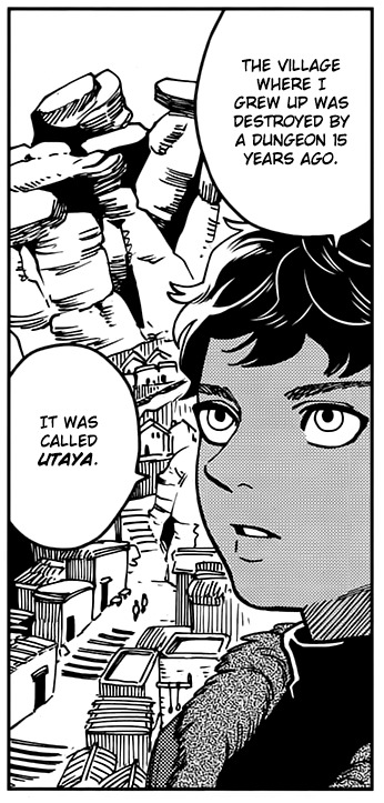
Utaya means “raised” or “uplifted” in Hindi, but it’s also a real village and a Japanese boy’s name.
Utaya (ウタヤ) is the name of the village that Kabru was raised in before his mother died and he was adopted by the elf Milsiril. Utaya is located in the southeast of the Western Continent. It’s worth noting that Kabru probably wasn’t born in Utaya, since his mother had to flee from her home to keep Kabru alive, so Utaya may be some distance away from his birth place… Not so far that a woman with a newborn baby couldn’t survive the trip, but far enough that her husband’s family gave up on chasing her. So Kabru was probably born in a close-by area.
In the real world, Utaya (Yakut: Утайа) is in an extremely rural and isolated area with a population of less than a hundred people. It’s located in the Sakha Republic, which is in the Northeastern part of Asia in the Russian Federation. The Yakut/Sakha are a Siberian Turkic people.
The Turkic peoples are a collection of diverse ethnic groups of West, Central, East, and North Asia as well as parts of Europe, who speak Turkic languages.
Early and medieval Turkic groups exhibited a wide range of both East Asian and West-Eurasian physical appearances and genetic origins, in part through long-term contact with neighboring peoples such as Iranian, Mongolic, Tocharian, Uralic/Yeniseian peoples, and others. Turkic peoples share, to varying degrees, non-linguistic characteristics like cultural traits, ancestry from a common gene pool, and historical experiences.
JAPANESE MEANINGS FOR UTAYA
Utaya can be a Japanese boy’s name with several different meanings, depending on which kanji it’s spelled with. In most of the spellings: Poetry, sing a poem, singing, compose poetry
In many of the spellings: The place where the sun shines, it's been a long time, distant, big, to shoot with a bow, to swear, affirmation, question.
The Utaya disaster happened a long time ago.
If Utaya is up in the mountains above the clouds it’s a place where the sun shines brightly.
Kabru has sworn to himself that he will prevent another Utaya tragedy from happening.
In only a few of the spellings: to mend, feathers, wings, a word for counting birds and rabbits, sort them out, washing with water to separate the good from the bad, roof, house with a roof, a world covered with a big sky, infinite space, song that praises the Buddha, Eight.
Counting birds and rabbits makes me think of divination and also that the people of Utaya were like little birds and rabbits (small prey animals) to the monsters that devoured them.
Separating the good and the bad could hint to the “judgment” of Utaya and the greed of its people that led to their downfall, also sorting through things to separate good and bad is something that’s done with food and other resources.
The Himalayan region is often referred to as the “roof of the world”, with a big open sky above it.
The infinite could refer to the dimension the demon comes from, or to the sky above the mountains.
Buddhism is a common religion in the Himalayan region, and eight has auspicious connotations in Buddhism.
With all that in mind, Utaya as a name for Kabru’s home village is an interesting choice, and adds another layer to his origins, maybe suggesting not just North Indian/Himalayan, but Central or North Asian cultural influence as well.
It is also possible that the name is just telling us that Utaya is “up” in the mountains, or that it was “uplifted” by the wealth of the dungeon, or even that Kabru was “raised” there… The Japanese name meanings are also extremely fascinating and hint at similar ideas, as well as the tragedy that happened to Utaya.
WHY ELSE DO YOU THINK KABRU AND UTAYA ARE HIMALAYAN?
In the real world, the Himalayan mountain range is an extremely popular tourist destination, and the amount of people who want to visit and attempt to climb the mountains far outpaces the local ability to support it. This makes me think of the dungeon of Utaya and how people overcrowded it in their desire to conquer and exploit it.
Dungeons as an unsustainable way for locals to make a living that leads to the destruction of their homes when the dungeon inevitably collapses is a major plot point in Dungeon Meshi, so I think the parallel is likely intentional. Characters often talk about someone “conquering” the dungeon, and “conquer” is also the terminology commonly used for climbing a mountain. This terminology obviously has a hostile, imperialist subtext in the real world, since it’s most commonly used by outsiders talking about proving their strength by climbing a mountain.
Also, there are local legends in the areas surrounding Mt. Kabru that there is a valley of immortality hidden on its slopes, which reminds me of the way that the dungeons can grant conditional immortality to the people inside of them.
This image of Utaya could be showing us a village built on a mountainside. The house shapes seem a bit more Middle Eastern than Nepali/Indian, but it’s not a detailed drawing and the roof styles are a mix of flat and peaked.
CULTURE
In the Daydream Hour sketchbook, Ryoko Kui included a small comic about characters sharing desserts from their home countries. A young Kabru is shown enthusiastically trying to share an unnamed sweet, and he is interrupted by his elven foster mother, who insists he present a type of elven cake instead. We know that Kabru hates this type of cake, and he seems disappointed to have to eat it and talk about it.

The white balls in Kabru’s dessert are very likely meant to be an Indian sweet called rasgulla (literally "syrup filled ball"). Rasgulla are a dessert popular in the eastern part of South Asia, made from ball-shaped dumplings of chhena dough, cooked in light sugar syrup. While it is near-universally agreed upon that the dessert originated in the eastern Indian subcontinent, the exact origin is disputed. Rasgulla are as culturally important to the Bengal and Odisha regions of India as Parmesan cheese is to the region of Parma in Italy.
Rasgulla are also popular in Nepal, where they are called rasbari.
KABRU’S PHYSICAL APPEARANCE

Kabru is one of several characters in Dungeon Meshi with clearly non-European features: he has brown skin and thick black/dark brown curly hair. He has almond-shaped eyes with long, dark lashes (fans like to joke that he’s wearing eyeliner). All of these are traits common to people from the Indian subcontinent. His blue eyes are not common for someone with his skin/hair color, but blue or green eyes are not unheard of in that region either.
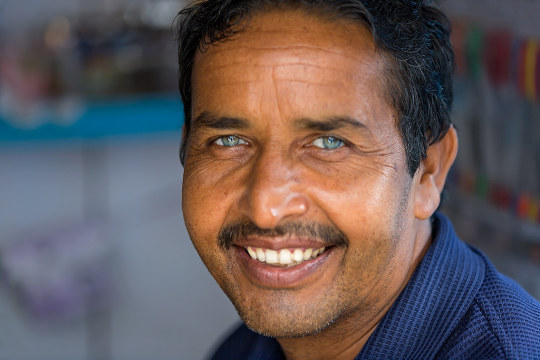
(Indian man with blue eyes)
Blue or light eyes are often a cause for discrimination, like what Kabru experienced as a child. More on this in a moment.
Kabru is 5’7” (170cm) tall, which is short for a Northern European man (180), tall for a Nepali man (162cm), but close to the average height of Indian men (177cm). He has a slender build, which is also common for Asian people in general, and South Asian men in particular.

Compared to the European-looking tall-men in Dungeon Meshi (such as Laios, Falin, Delgal, Marcille’s father), Kabru’s facial features look more like the other Asian characters, such as Toshiro and his party.
CAN DARK-SKINNED PEOPLE HAVE BLUE EYES?
Yes. Light-colored eyes are very uncommon in parts of the world where most people have dark eyes, since dark eyes are a dominant trait in real-world human beings. That means that in order for two parents with dark eyes to have a child with light eyes, both parents need to have a recessive light-eyes gene (or for there to be an illness or genetic mutation), and that’s rare in populations that don’t have a lot of light-eyed people to begin with.
THEN WHY DO SO MANY DARK-SKINNED CHARACTERS HAVE BLUE EYES?
Anime and manga often give characters with dark skin light colored eyes instead of allowing them to have brown or black eyes, which is much more common in real life. It’s a hurtful design trope that makes many readers feel that their natural dark eyes are somehow ugly or inferior to blue eyes.
This trope is used over and over again by authors who want their characters to look “cool” and “exotic”, and for their eyes to be high-contrast to make it easier to show their emotions.
I don’t think this is what Ryoko Kui is doing in Dungeon Meshi.
UNREALISTIC HAIR AND EYE COLOR COMBOS IN ANIME
In a lot of anime/manga, blue eyes (regardless of skin color) don’t actually mean anything in the narrative, in the same way characters having green or pink hair doesn’t mean anything, the colors are non-diegetic, they don’t actually exist in the world, like the music that plays in the background without an on-screen source.
It’s an artistic shorthand to make characters visually stand out, instead of giving them all black hair and eyes like most real-life Japanese people… Which is what most anime/manga characters are meant to be: Japanese people.
Dungeon Meshi has a large cast of characters that are explicitly meant to be non-Japanese. We know this because there’s a group of characters that are Japanese, and they’re drawn differently from everyone else, they wear ethnically Japanese clothing, and have ethnically Japanese names.
Unlike other series, where eye and hair color don’t mean anything, Dungeon Meshi has no unrealistic skin, hair, or eye color combinations.
(Except for the elves, who seem to have different genetics than real world-humans. I’ll get into that another time.)
Ryoko Kui must be aware of the dark skin, blue-eyes design trope, because if she gave Kabru blue eyes just because she thought it looked good, surely she would have made some of the other Asian or dark-skinned characters have light eyes. Out of 9 Asian or dark-skinned tall-man characters, Kabru is the only one with blue eyes.
Kabru having light-colored eyes is central to his story, and Kui talks about it.
KABRU’S STORY AND WHY HIS BLUE EYES MATTER
Kabru’s father and his family tried to kill Kabru when he was born because he had blue eyes. Kabru’s mother ran away, and ended up raising Kabru by herself in Utaya. She didn’t try to return home to her own birth family, but instead struggled to raise a child completely on her own with no money or support, which implies she had no other options, due to the fear people of their region have for people with blue eyes.
This is a real thing that used to happen frequently in areas where most of the population has dark eyes, and it still happens to this day.
In a realistic story, this is logically what would happen to a character with dark skin born with blue eyes in a place like the Utaya region. It’s rare for manga or anime to show dark-skinned blue-eyed characters facing this.
WHAT IS THE “EVIL EYE”?
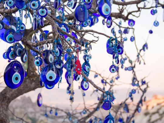
The “evil eye” is a supernatural belief in a curse brought about by a person looking at you. The belief in the evil eye has existed since prehistory, as long as 5,000 years ago. It is estimated that around 40% of the modern world's population believes in the evil eye. This concept is most common across the Mediterranean, the Balkans, the Middle East, and Central and South Asia, areas where light-colored eyes are uncommon.
In areas where light-colored eyes are rare, people with green eyes, and especially blue eyes, are thought to bestow the curse, intentionally or unintentionally. Just one look from a blue-eyed person is often considered enough to inflict a curse.
One of the most famous and widespread talismans against the evil eye is the nazar, a glass amulet featuring concentric circles in dark blue, white, light blue and black. It’s supposed to “bounce” the curse away from the wearer.
HOW DOES THIS APPLY TO KABRU?
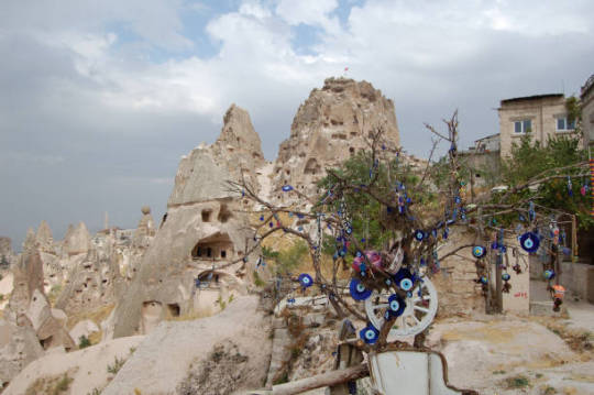
Imagine Kabru growing up in a village surrounded by people wearing and hanging talismans that look like his eyes, because the people around him think blue eyes are evil. They call his mother a witch for birthing him, and a whore because she doesn’t have a husband. Imagine parents forbidding their children from playing with or even talking to Kabru. People crossing the street to get away from him, or chasing him away by throwing rocks.
I think the reason young Kabru was able to learn how to speak some kobold is likely because he was so heavily ostracized by the other tall-men around him, the only children he could occasionally interact with in Utaya were kobolds, who might not share the same cultural superstitions that the tall-man do.
This childhood trauma, combined with Kabru’s experience of the dungeon collapse in Utaya, and being raised by an elf that treated him more like a pet than a human being, set Kabru up as a character who has never had a home where he belongs. He has been an outsider from the instant he was born, and every place he has lived treats him as an “other.”
To his father’s family, he was a curse. To his mother, although she loved him, he was a burden. To the people of Utaya, he was a monster. To the elves, he’s a tall-man baby (no matter how old he gets) with funny looking eyes, to the people on Merini Island, he’s a foreigner from the West with elven ways and education.
CONCLUSION
I wanted to write this because I know some people will see Kabru in the anime for the first time today and think "Oh, another dark skinned blue eyed character! This is a bad character design that is evidence that the author is racist at worst or ignorant at best.” And I don’t think that’s a fair assessment of Ryoko Kui’s work in Dungeon Meshi.
This isn’t to say that Ryoko Kui has never done anything wrong, or that her work couldn’t be more inclusive, or that there’s no way in which she could improve.
But there are pages and pages of artwork she’s done that shows she cares about these issues, and I think it’s worth celebrating when someone makes that kind of effort with their artwork.
ANYWAY…
If you’ve read this far, you’re very strong hahaha. I hope you enjoyed this essay. I’ll be publishing more soon when I finish my Dungeon Meshi research on the names and cultures of all the characters. Wish me luck!
#dungeon meshi#delicious in dungeon#dunmeshi#kabru#my stuff#analysis#character of color#theories#Dungeon Meshi Research
2K notes
·
View notes
Text
It's never sat right with me that mount everest is called that. why "everest"???? in NEPAL???? CHINA?? TIBET?????? hate that the worlds tallest mountain is best known by an english name. Sagarmatha. Qomolangma. no more of this "Everest" nonsense. Holy Mother. This is the Himalayas we're talking about! no more english! George Everest is nigh 160 years dead so why are we still talking about him? I never want to hear about that man again. SKY HEAD. SAGARMATHA
10 notes
·
View notes
Text
Come autumn, Nepal will deploy heavy lifter drones to transport garbage from the 6,812-metre tall Ama Dablam, south of Everest. This will be the first commercial work an unmanned aerial vehicle does in Nepal’s high-altitude zone.
The heavy lifter from China’s biggest drone maker, Da Jiang Innovations (DJI), will take on tasks traditionally handled by Sherpas. Officials believe it will help reduce casualties on Everest.
Then, in spring (March-May), DJI drones, which make sounds similar to a swarm of bees, will be put to work on Everest.
It will fly to Camp I (5,943 metres) to supply ropes and ladders to prepare routes and bring garbage to the Everest base camp at 5,364 metres.
On Sunday, a tripartite memorandum of understanding (MoU) was signed between the Sagarmatha Pollution Control Committee, the Khumbu Pasang Lhamu Rural Municipality, and the Airlift Technology Pvt Ltd for the use of advanced drone technology to efficiently manage garbage in the mountains of the Khumbu region.
In April, Chinese drone maker DJI conducted the world’s first drone delivery test on Everest.
“After a successful test in April, we plan to use drones commercially in the Everest region,” said Jagat Bhusal, chief administration officer of the rural municipality that hosts Everest.
The test result showed that the DJI FlyCart 30, the long-distance heavy lifter drone, could airlift 234 kg per hour between Camp I and Base Camp, a task usually accomplished by at least 14 porters in six hours.
Drone manufacturer DJI is under the microscope as US lawmakers push for a ban on Chinese drones, amid deteriorating relations between the US and China, the world’s largest trading nations.
Nepali officials and mountaineers, however, see the drone as a life-saving vehicle.
Traditionally, local Sherpa guides are responsible for transporting supplies and clearing trash on Everest. They may need to cross the icefall over 30 times a season to transport supplies such as oxygen bottles, gas canisters, tents, food, and ropes.
All climbers and guides must navigate the icefall on the route to the world’s tallest peak. The icefall is so notoriously dangerous that even experienced Sherpas hesitate to move when the sun shines.
The Khumbu Icefall, a river of ice a kilometre or so long, is usually crossed at night or early morning, with climbers putting headlamps on their helmets.
Normally, the route is crossed early in the morning, when the ice blocks and the hanging glaciers are stable and avalanche risks are low.
During the day, as the sun warms the mountain, the hanging glaciers melt, and ice crumbles, increasing the risk of avalanche.
“Using drones will help us avoid the dangers in the Khumbu Icefall,” said Bhusal.
On April 18, 2014, an avalanche resulting from a falling serac buried 16 Sherpa guides in the Khumbu Icefall, eventually leading to the cancellation of the season’s expeditions.
Last year, three Sherpa guides mobilised to prepare the routes were buried under the ice masses triggered by an avalanche in the Khumbu Icefall. Their bodies are yet to be recovered.
The Himalayan Database and the government records show that nearly 50 individuals died on the icefall between 1953 and 2023.
The climb from Everest Base Camp to Camp I takes six hours. Between these two camps lies the Khumbu Icefall, the most treacherous part of the route.
The most exciting and easiest part of the route is reaching Camp II (6,400 metres), which takes four hours from Camp I.
There is a set of restrictions in the mountains for carrying loads.
According to government rules, workers climbing high altitudes must not carry loads exceeding 20kg between 5,000 and 6,000 metres, 17 kg between 6,001 and 7,000 metres, 14 kg between 7,001 to 8,000 metres, and 12 kg for altitudes above 8,000 metres.
“Yes, there are concerns that the machines may actually cut jobs. But our sole purpose is to reduce potential deaths in the Khumbu Icefall, the danger zone,” said Bhusal.
“We will train Sherpas, as drone operators cannot handle tasks at the higher camps. In the future, all work will be done by Sherpas.”
In the trial phase, the drone could lift 30 kg from Camp I. However, its performance dropped to 18 kg from Camp II.
“Based on the MoU framework, we will soon sign a commercial agreement with the drone supplier,” said Bhusal. “The municipality will monitor all the activities.”
The municipality has, so far, spent Rs800,000 on the trial.
Climate change is melting snow and ice, exposing even more garbage and bodies that have been covered for decades on Everest. This waste pollutes the natural environment and poses a severe health risk to everyone who lives in the Everest watershed.
Nearly 100 tonnes of garbage were collected during this spring climbing season from Everest and Lhotse, which share the same base camp.
According to the Sagarmatha Pollution Control Committee (SPCC), 77.19 tonnes of waste was collected from the Everest base camp alone during the Spring 2024 climbing season. With 8-9 tonnes coming from the higher camps brought down by the expedition agencies, the SPCC collected 85 tonnes of waste this spring.
The breakdown of collected waste shows burnable garbage at 27.99 tonnes, recyclable garbage at 7.51 tonnes, human waste at 27.53 tonnes, and kitchen waste at 14.15 tonnes. The Nepal Army also collected over 11 tonnes of garbage.
#mount everest#trash removal#pollution#good news#science#environmentalism#nepal#environment#mountaineering#mountain climbing#climate change#climate crisis#global climate change#china#drones#unmanned drones#sherpas
9 notes
·
View notes
Text
The Nepal government-funded team of soldiers and Sherpas removed 11 tons (24,000 pounds) of garbage, four dead bodies and a skeleton from Everest during this year’s climbing season.
Ang Babu Sherpa, who led the team of Sherpas, said there could be as much as 40-50 tons (88,000-110,000 pounds) of garbage still at South Col, the last camp before climbers make their attempt on the summit.
5 notes
·
View notes
Text
Sagarmatha National Park: The No. 1 Best Destination for Trekking and Mountain Expeditions
Sagarmatha National Park is highly renowned for housing the world’s tallest mountain, Mount Everest (8,848.86 meters), and the popular trekking destination, Everest Base Camp. Sagarmatha National Park is a true ecological hotspot, with its diverse geography, native flora and fauna, breathtakingly lofty mountains, and vibrant Sherpa culture.
Background and History
The name of Sagarmatha is derived from two Nepali words: "Sagar,” meaning sky, and "Matha,” meaning forehead. So altogether, Sagarmatha means the forehead of the sky, and it is known as Chomolungma in Tibetian, which means "Goddess Mother of the Earth." Since the 1950s, tourism has taken the shape of mountaineering and trekking in the Everest Region, resulting in a positive change in the local economy as well as a change in the landscape, livelihood patterns, resource management, and infrastructure development. As a response to concerns about conservation, the Sagarmatha National Park was established on July 19, 1976 AD.
Following its establishment after three years, Sagarmatha National Park was also listed on UNESCO’s World Heritage Site List for its ecological diversity and unique culture. Furthermore, on January 1, 2002, a 275-square-kilometer buffer zone was declared, including the park's settlements. Then, on September 23, 2007, Gokyo and its surrounding lakes were recognized as Wetlands of International Importance under the Ramsar Convention.
Sagarmatha National Location, Map, and Getting There

Located in the north-eastern part of Nepal, the Sagarmatha National Park spans 1,148 square kilometers, encompassing the Himalayan ecological zone of the Khumbu Region. The protected area also adjoins the Makalu Barun National Park and Rolwaling Valley of the Gauri Sankar Conservation Area to the east and the Qomolangma Biosphere Reserve in the Tibetan Autonomous Region of China to the west.
The route to Sagarmatha National Park and also the popular trekking destinations such as the Everest Base Camp Trek, Gokyo Lakes Trek, and the Three High Pass Trek, as well as the Everest expeditions, and Kalapathar follow the same path. The distance of the SNP from Kathmandu is about 135 kilometers. So, you have the option of a flight to Lukla, which is either from Kathmandu or Manthali, Ramcehhap. The flight is about 25 minutes. Alternately, you can also catch a flight to Phaplu or Tumlingtar and trek the remaining distance, which is two days of walking. There is also the option of a direct helicopter ride to SNP.
The best route by road is to take a bus to Salleri, then, from there, another ride to Thamdada. From Thamdada, you will have to trek for another two days to reach the Sagarmatha National Park.
Flora and Fauna
The Sagarmatha National Park is one of the ecological hotspots in the Himalayan region of Nepal. The area inhabits rare and endangered species of both plants and animals, which has brought about the conservation efforts of this protected area. 69% of the total land in the protected area is barren above the altitude of 5000 meters, 28% is grazing land and the remaining 3% is covered with forests.
The park has six different types of vegetation. The lower subalpine zone is above 3,000 meters and has forests of blue pine (Pinus wallichiana), east Himalayan fir (Abies spectabilis), and drooping juniper (Juniperus recurva). The upper subalpine zone is above 3,600 meters and has a birch-rhododendron forest with Himalayan birch (Betula utilis), Rhododendron campanulatum, and R. campylocarpum. The lower alpine is above the timber line at 3,800–4,000 meters and has scrubs of Juniperus species Rhododendron anthopogon and R. lepidotum. The upper alpine zone is above 4,500 meters and has grassland and dwarf shrubs. The sub-nival zone is between 5,750 and 6,000 meters and has cushion plants.

The park also has a thriving faunal habitat with 152 high-altitude breeding species of birds, including blood pheasant (Ithaginis cruentus), robin accentor (Prunella rubeculoides), white-throated redstart (Phoenicurus schisticeps), grandala (Grandala coelicolor), and several rosefinches. There are also a total of 28 species of mammals, such as the northern plains grey langur (Semnopithecus entellus), jackal (Canis aureus), grey wolf (Canis lupus), Himalayan black bear (Ursus thibetanus) (VU), red panda (Ailurus fulgens) (VU), yellow-throated marten (Martes flavigula), Siberian weasel (Mustela sibirica), snow leopard (Panthera uncia) (EN), Himalayan musk deer (Moschus leucogaster) (EN), Himalayan tahr (Hemitragus jemlahicus) and Himalayan goral (Naemorhedus goral).
There is limited information regarding the documentation of reptiles and amphibian species. It is estimated that there are seven reptiles and six amphibians, while there have been records of 30 species of butterflies within the protected area, among them the orange and silver mountain hopper (Carterocephalus avanti), which is not recorded elsewhere in Nepal, and the rare red apollo (Parnassius epaphus).
Note: VU-Vulnerable, EN-Endangered
Mountains, Rivers, and Glaciers in the Sagarmatha National Park
The mountains of the Himalayas are considered to be geologically very young mountains, including the world’s highest Mt. Everest (8848.86 meters). Other notable peaks over 8000 meters include Cho Oyu (8,188 meters) and Lhotse (8,516 meters), along with 6000 and 7000-meter peaks such as Baruntse, Nuptse, Pumo Ri, Guachung Kang, Nangpai Gosum, Ama Dablam, Lobuche, Tabuche, Kang Tega, Thamserku, and many more.

The upper headwaters of the Bhote Kosi, Dudh Kosi, and Imja Khola rivers, which splinter beneath the Himalaya Mountains on the Tibetan border and converge close to Namche Bazar, the area's primary settlement, make up the core portion of the park. The rivers in Sagarmatha National Park are fed by glaciers at the top of each valley. Key glaciers include Imja, Nangpa, Ngozumpa, and Khumbu.

The 20-kilometer-long Ngozumpa Glacier is bordered by four Gokyo lakes. While all glaciers are retreating, Imja Dzo has expanded since the 1970s, now covering 1,200 hectares and 45 meters deep. Several new glacial lakes have also formed recently.
Communities and Culture of the Khumbu
The natives of the Khumbu region are the people of the Sherpa caste. The history of the Sherpas dates back to the late 1400s and early 1500s when the Samlo Gang in the eastern Tibetan territory was said to escape from military and political pressure. In the early 1530s, they migrated into Nepal over the Nangpa La Pass, splitting into two groups that settled in Khumbu and Solu, further south.
One of the biggest influences on the Sherpa communities has been the introduction of mountaineering in the 1950s, which revolutionized their economy. They are the followers of Tibetan Buddhism, which was founded by Guru Rinpoche. Monasteries like Tengboche and Pangboche and other smaller gompas are held in high regard, which is the prime location for their celebrations and ceremonies. The routes and trekking trails are often covered with inscriptions and flags of the Buddhist prayer Om mani padme hum, "praise to the jewel of the lotus flower."
Seasons, Weather, and Climate
The weather and temperature of SNP vary in accordance with the season and the diversity of the geographic location. Lower alpine regions such as Namche Bazaar are considerably humid with seasonal monsoons during summer, whereas the higher altitudes are very cold and dry, even dropping to a negative 25 degrees Celsius during the winter season. Autumn and spring have a more moderate temperature and a clear sky, which is the perfect time to visit SNP.
Even so, the average temperature in the Himalayas has increased by 1°C since the 1970s, nearly twice as quickly as the 0.6°C global warming that the Inter-Governmental Panel on Climate Change (IPCC) reported. This indicates that climate change is a serious problem. There have been visible impacts, such as the risk of the Glacial Lake Outburst Flood (GLOF), retreating glaciers, untimely snow and rainfall, and reduced snowlines.
Trails and Landmarks of the Sagarmatha National Park

The Sagarmatha National Park should be on your list to visit at least once in your lifetime. There are a variety of options you can choose from; from trekking to mountain expeditions to having a religious retreat, this protected area has got you covered. Here are some popular destinations within the National Park:
Everest Base Camp
The Everest Base Camp Trek is the most popular trek of Nepal. A trail within the park offers the best view of the Everest along with other majestic mountains and an immersive experience of the Sherpa culture.
Tengboche Monastery
Built in 1916, it is the largest monastery in the Khumbu region. An integral part of the Buddhist and Sherpa communities, at an elevation of 3,867 metres (12,687 feet), Tengboche Monastery is also known as the gateway to Everest.
The intricate architectural design, with the beautiful backdrop of Mount Ama Dablam, makes the monastery even more spiritual. It is a place of great importance for both the Sherpa and Buddhist communities.
Gokyo Lakes

TheGokyo Lakes Trek with ebc is another popular trekking journey among adventurers. It is a site of great importance, in terms of both natural and religious importance. Gokyo and its associated lakes are part of important wetlands around the world. Along with the lakes, the Gokyo Ri Trek also offers the best view of the Himalayan mountains.
Three High Passes trek
The Three High Passes Trek is a challenging adventure where the trails go through the famous high passes of the Everest region: Kongma La, Cho La, and Renjo La. A long and formidable trekking journey around the Sagarmatha National Park, with all-round views of Everest.
Namche Bazaar
Namche Bazaar is a bustling Sherpa town at an elevation of 3,440 metres (11,286 ft). It lies within the Sagarmatha National Park and is a trading hub for the Khumbu Region. It is the main transit for Everest treks or expeditions. Despite the lack of access to roads, Namche Bazaar has ample amenities and services that meet the demands of tourists.
Ultimately
Sagarmatha National Park is not only a significant part of the trekking and mountaineering community but also holds equal importance in regard to ecology and biodiversity. With majestic views of some of the highest mountains in the world and glimpses of rare wildlife, SNP is the best place to quench your thirst for outdoor adventure in every sense.
If you are planning a journey to Everest, allow us to guide you. From Everest Base Camp to Gokyo, you are guaranteed the best time with our experienced guides at your service, who will take you on an unforgettable adventure in the Sagarmatha National Park.
Reference
Daconto, G., & Sherpa, L. N. (2010). Applying scenario planning to park and tourism management in Sagarmatha National Park, Khumbu, Nepal. Mountain Research and Development, 30(2), 103–112. https://doi.org/10.1659/mrd-journal-d-09-00047.1
DNPWC. (n.d.). Department of National Parks and Wildlife Conservation. https://dnpwc.gov.np/en/conservation-area-detail/72/
Sagarmatha National Park. (n.d.). https://www.snp.gov.np/about-us
Unep-Wcmc. (2017, May 22). SAGARMATHA NATIONAL PARK. World Heritage Datasheet. http://world-heritage-datasheets.unep-wcmc.org/datasheet/output/site/sagarmatha-national-park/
#nepal#hiking#travel#outdoor#adventure#Nepaltreks#Trekking in Nepal#Annapurna region#everest region#everest trek
2 notes
·
View notes
Text
Blog 1: First of Many
Hello! My name is Pratik, and I am a 5th-year Zoology Major and Plant Science Minor. This is the first of hopefully many blog posts that I will be writing weekly for at least the next 3 months.
My current relationship with Nature is deeply rooted in my heritage and culture. I was born in Nepal where I spent the first 12 years of my life before immigrating to Canada with my family. Nepal is a country that focuses on agriculture and tourism and houses the tallest Mountain on Earth, Mt. Everest. Most of the people I knew grew up as farmers and villagers who deeply cared about their land and natural resources. This allowed me to grow up intertwined with nature where I both respected and feared the jungles of Nepal as they are home to Bengal tigers, Indochinese rhesus macaques, leopards, wild boars, and the Big Four snakes.
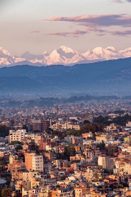
Kathmandu, Nepal where I grew up.
When I first started exploring the parks and conservation areas of Canada, I found it interesting how visitors did not fear the wildlife. This baffled me at first as I assumed Grizzly bears, cougars, and wolves roamed most of Canada and frequently clashed with the local populations like in Nepal. After doing some more research, I realized that none of the 3 animals roamed the parks near my place, and I, too, had nothing to fear like the local visitors. After 10 years in Canada, my fear of nature has eroded away, and nowadays, I frequently find myself exploring off-the-path trails and making my own path when exploring Nature. However, my respect for Nature persists as Nature, when disrespected, can be very unforgiving based on the countless tales I have heard from park naturalists, guides, and locals.
As it stands now, my relationship with Nature is built on respect and a tiny bit of fear where I plan to center my future career around Nature and Academia, hoping to make them more accessible to the public.
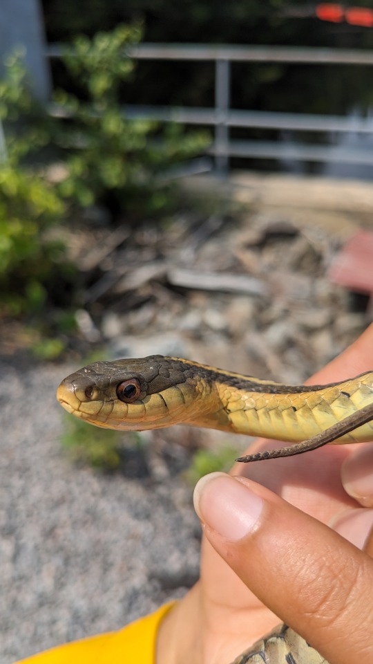
Holding a Garter Snake for my Field Course Paper in Algonquin Park
The two people that offered me a sense of place in Nature were Steve Irwin and Jeremy Wade. Steve Irwin was my introduction to wildlife outside of Nepal, and he taught me that wild animals, specifically snakes, are not evil by nature. They are, instead, misunderstood due to their appearance, causing humans to cull them from their local range. In Ontario, the Timber Rattlesnake was extirpated by hunters due to the snake being venomous even though conflicts were rarer than perceived. Steve Irwin showed me that wildlife does not like to be bothered, and their actions against humans are often justified (hunger, young protection, habitat loss).
Jeremy Wade was a professional angler who hosted the TV show known as River Monsters. He traveled the world, searching for freshwater-inhabiting creatures mentioned in local folklore. I remember vividly that his show was one of the first to showcase Nepal outside of the Himalayas. He showed me that the local population is more than often the most educated regarding wildlife inhabiting their lands. Jeremy would always listen to the stories of the local population and explore any leads they provided no matter how fictional they sounded. He taught me that working with the local population is the best way of studying Nature in a new environment and their opinions should not be ignored.
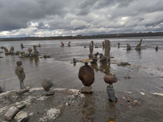
Remic Rapids Park, Oattawa
3 notes
·
View notes
Text
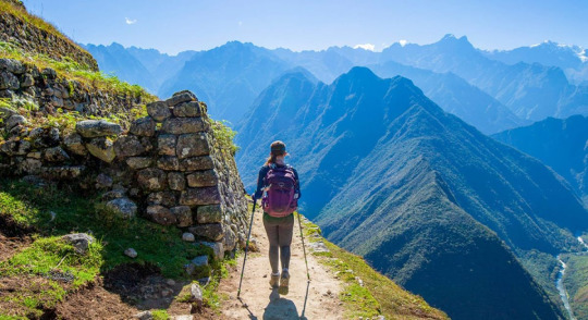
Trekking to Everest Base Camp: A Journey of Discovery
Welcome, adventurers! Today, I'm thrilled to share with you the exhilarating experience of trekking to Everest Base Camp. Join me as we venture into the heart of the Himalayas, navigating rugged trails, charming villages, and breathtaking vistas along the way.
Introduction to Everest Base Camp: The Everest Base Camp trek is an iconic journey that takes trekkers to the foot of the world's tallest mountain, Mount Everest. Located in the Khumbu region of Nepal, this legendary trail offers a once-in-a-lifetime opportunity to experience the majesty of the Himalayas up close.
Preparing for the Trek: Our journey begins with careful preparation and planning. We gather our gear, lace up our boots, and set off for the trailhead in the village of Lukla. Excitement fills the air as we take our first steps on the trail, eager for the adventure that lies ahead.
Traversing Diverse Landscapes: As we trek through the Khumbu region, the landscape transforms around us. We pass through lush forests, terraced fields, and high-altitude valleys, each offering its own unique beauty and challenges. The ever-changing scenery keeps us captivated as we make our way towards Everest Base Camp.
Encountering Local Culture: Along the way, we have the opportunity to immerse ourselves in the rich culture and hospitality of the Sherpa people. From cozy teahouses to bustling mountain villages, each stop along the trail provides insight into the daily life and traditions of the local communities.
Ascending to New Heights: As we ascend higher into the mountains, the air grows thinner, and the trail becomes steeper. We navigate rocky terrain, cross swinging suspension bridges, and climb countless stone steps, all in pursuit of our goal – reaching Everest Base Camp.
Reaching the Base Camp: Finally, after days of trekking, we catch our first glimpse of Everest Base Camp nestled amidst the Khumbu Glacier. The sight of colorful tents and fluttering prayer flags against the backdrop of towering peaks is a moment we'll never forget. We pause to soak in the achievement and reflect on the journey that brought us here.
Reflecting on the Journey: As we make our way back down the trail, we reflect on the incredible journey we've undertaken. The challenges we've faced, the friendships we've forged, and the memories we've made – each moment has been a testament to the power of adventure and perseverance.
Conclusion: Trekking to Everest Base Camp is more than just a journey – it's an experience that will stay with you for a lifetime. So lace up your boots, pack your bags, and join us on this epic adventure into the heart of the Himalayas. Until next time, happy trekking!
2 notes
·
View notes
Text
15 Toughest Treks in the World for Hiking Enthusiasts
Are you an adventurer at heart, always seeking the next thrilling journey? If the whisper of the wind through the pines, the allure of the untamed wilderness, and the exhilaration of ascending to new heights stir your soul, then this is the blog for you.
Welcome to our curated list of the 15 toughest treks in the world. These aren’t your average hikes; they’re thrilling adventures that push you to your limits, challenge your resilience, and reward you with breathtaking views and unforgettable experiences.
From the harsh arctic landscapes of Greenland to the towering peaks of the Nepalese Himalayas, each of these treks offers a unique journey that will test your endurance and ignite your adventurous spirit.
So, lace up your boots, pack your gear, and join us as we explore the thrilling world of extreme trekking. The mountains are calling – are you ready to answer?
Table Of Contents
1. Everest Base Camp Trek, Nepal 2. The Snowman Trek, Bhutan 3. The Pacific Crest Trail, USA 4. The Mount Kilimanjaro Trek, Tanzania 5. The Inca Trail to Machu Picchu, Peru 6. Mount Elbrus Trek, Russia 7. The Great Himalaya Trail, Nepal 8. Appalachian Trail, USA 9. Overland Track, Australia 10. GR20, Corsica 11. The Polar Route, Greenland 12. Routeburn Track, New Zealand 13. Larapinta Trail, Australia 14. The Long Range Traverse, Canada 15. Dientes Circuit, Chile Conclusion
1. Everest Base Camp Trek, Nepal
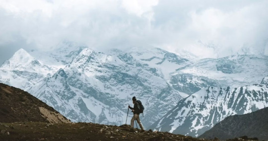
Embark on a journey to the foot of the highest peak in the world. The Everest Base Camp trek is not just a trek but a journey through the heart of the majestic Himalayas. This trek takes you through diverse landscapes, from lush valleys, glacial moraines, and terraced fields to pine forests and Sherpa villages. Along the way, you’ll encounter suspension bridges, ancient monasteries, and, of course, breathtaking views of some of the world’s tallest mountains. It’s a true test of endurance and acclimatization, but the reward is a firsthand view of Everest’s grandeur.
Altitude: 5,545 meters (18,192 ft)
Best Time to Go: March to May and September to November
Difficulty Level: Challenging
2. The Snowman Trek, Bhutan
Touted as one of the most difficult treks in the world, the Snowman Trek traverses through eleven high-altitude passes, each over 4,500 meters. The journey unfolds across the remote Lunana region, offering a deep dive into Bhutan’s rich cultural heritage and lush, untouched landscapes. Expect to encounter serene mountain lakes, majestic peaks, isolated villages, and diverse wildlife. This trek is as mentally demanding as it is physically due to its length and the isolation of the terrain.
Altitude: 5,320 meters (17,454 ft)
Best Time to Go: September to October
Difficulty Level: Very Challenging
3. The Pacific Crest Trail, USA
Spanning from the Mexican to the Canadian border, the Pacific Crest Trail offers an immersive journey through the diverse ecosystems of the American West. The trek takes hikers through scorching deserts, glaciated expanses of the Sierra Nevada, and the dense forests of Oregon and Washington. The length and varied terrain of the trek make it one of the toughest but also one of the most rewarding.
Altitude: 4,009 meters (13,153 ft)
Best Time to Go: May to November
Difficulty Level: Very Challenging
4. The Mount Kilimanjaro Trek, Tanzania
The highest peak in Africa, Mount Kilimanjaro, offers multiple routes for trekkers. Each route presents its unique set of challenges, including altitude sickness, steep inclines, and varying weather conditions. The journey unfolds through five different ecosystems, from lush rainforests and alpine deserts to the icy summit of Uhuru Peak. Despite the challenges, reaching the “Roof of Africa” is an unforgettable experience.
Altitude: 5,895 meters (19,341 ft)
Best Time to Go: January to March and June to October
Difficulty Level: Challenging
5. The Inca Trail to Machu Picchu, Peru
The Inca Trail is a rich journey through a variety of microclimates, across high mountain passes, and into lush subtropical vegetation. This trek provides glimpses into the past, with Incan paving stones, ruins, and tunnels scattered along the route. Despite the physical challenge of the high altitude and the steep ascents and descents, this trek offers an unrivaled reward: the sight of the ancient city of Machu Picchu at sunrise. The combination of natural beauty, fascinating history, and the physical challenge make this one of the most famous treks in the world.
Altitude: 4,200 meters (13,780 ft)
Best Time to Go: May to September
Difficulty Level: Moderate to Challenging
6. Mount Elbrus Trek, Russia
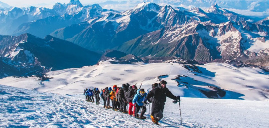
Mount Elbrus, nestled in the heart of the Caucasus Mountains, is the highest peak in Europe. The trek to its summit involves navigating through precarious glaciers and steep inclines. Despite the challenges, it offers panoramic views of the Caucasus and a unique sense of accomplishment. The trek’s difficulty is compounded by the unpredictable weather and the need for proper acclimatization, making it a must for experienced climbers.
Altitude: 5,642 meters (18,510 ft)
Best Time to Go: July to August
Difficulty Level: Very Challenging
7. The Great Himalaya Trail, Nepal
As one of the longest and highest walking trails in the world, the Great Himalaya Trail traverses the full length of the Nepalese Himalayas. This route takes trekkers through some of the wildest and most remote mountain environments on earth. The terrain is challenging and the route is remote, but the breathtaking views of high peaks, passes, and valleys make the trek an unforgettable journey. The trail is a testament to the beauty, diversity, and grandeur of the Himalayan range.
Altitude: 6,146 meters (20,160 ft)
Best Time to Go: March to May and October to November
Difficulty Level: Very Challenging
8. Appalachian Trail, USA
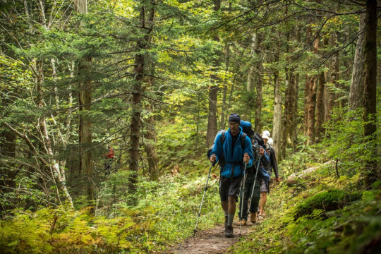
Spanning fourteen U.S. states, the Appalachian Trail is one of the longest continuously marked footpaths in the world. This journey takes hikers through wild landscapes, dense forests, and over numerous mountain peaks. Each section of the trail presents its unique set of challenges, from harsh weather conditions to physically demanding terrain. Still, the trail’s stunning beauty and the sense of accomplishment from completing sections, or the entire trail, draw hikers from around the world.
Altitude: 2,024 meters (6,643 ft)
Best Time to Go: March to September
Difficulty Level: Challenging
9. Overland Track, Australia
The Overland Track, Australia’s premier alpine walk, takes trekkers through the heart of the Cradle Mountain-Lake St Clair National Park. As part of the Tasmanian Wilderness World Heritage Area, this 65-km trail is a journey of discovery through diverse landscapes. From ancient rainforests and alpine meadows to rugged mountains and sparkling lakes, the track offers breathtaking views at every turn. The challenge of the Overland Track lies in its length and the unpredictable Tasmanian weather, but its stunning scenery and rich biodiversity make it worth the effort.
Altitude: 1,545 meters (5,069 ft)
Best Time to Go: October to May
Difficulty Level: Moderate to Challenging
10. GR20, Corsica
Considered the most challenging long-distance trail in Europe, the GR20 in Corsica stretches from the north to the south across the mountainous heart of the island. This stunning trek takes hikers through rugged peaks, beautiful glacial lakes, and dense forests. The trail’s beauty is matched by its difficulty, with steep ascents, rocky terrain, and often unpredictable weather conditions. The GR20 is a grueling trek but offers a rewarding experience that’s hard to match.
Altitude: 2,706 meters (8,878 ft)
Best Time to Go: June to September
Difficulty Level: Very Challenging
11. The Polar Route, Greenland
An arctic adventure like no other, the Polar Route in Greenland is a journey through ice fields, fjords, and remote arctic tundra. This challenging expedition tests the endurance of even the most experienced hikers, but the reward is a stunning, untouched wilderness, the chance to witness the Northern Lights, and the possibility of encountering arctic wildlife. The trek’s isolation and the harsh arctic climate add to the difficulty, making it a trek suited for the truly adventurous.
Altitude: Varies, up to 2,000 meters (6,562 ft)
Best Time to Go: April to June
Difficulty Level: Very Challenging
12. Routeburn Track, New Zealand
The Routeburn Track, located in New Zealand’s South Island, offers an incredible journey across the Southern Alps. The track winds through vast valleys, pristine alpine lakes, and verdant forests, showcasing the best of New Zealand’s diverse natural beauty. The trail is well-maintained, but the fluctuating weather conditions and the physical demands of the mountainous terrain make it a challenging trek. Regardless, the breathtaking views and the chance to explore the unique landscapes of New Zealand make the Routeburn Track a must-do for any hiking enthusiast.
Altitude: 1,255 meters (4,117 ft)
Best Time to Go: October to April
Difficulty Level: Moderate to Challenging
13. Larapinta Trail, Australia
Situated in the heart of Central Australia, the Larapinta Trail extends over 223 kilometers along the spine of the West MacDonnell Ranges. This trail brings you up close to the ancient landscape of the Northern Territory, offering stunning views of jagged ridges, weathered peaks, and the rich, red soil of the Australian Outback. Hikers will encounter a wide variety of wildlife, rare plants, and a stark, captivating beauty that’s unique to this part of the world. The route’s length, combined with the harsh, arid climate, make it a challenging trek.
Altitude: 1,380 meters (4,528 ft)
Best Time to Go: April to September
Difficulty Level: Challenging
14. The Long Range Traverse, Canada
The Long Range Traverse is an unmarked and rugged backcountry route through some of the best wilderness in Canada’s Gros Morne National Park. This challenging trek requires navigation skills as you make your way through dense forest, across bogs, and up steep scree slopes. However, the breathtaking views of fjords, glacial valleys, and the raw, untamed beauty of the Newfoundland wilderness make it worth the effort.
Altitude: 806 meters (2,644 ft)
Best Time to Go: June to September
Difficulty Level: Challenging
15. Dientes Circuit, Chile
Found on the isolated Isla Navarino in the extreme south of Chile, the Dientes Circuit is a trek like no other. This remote, rugged trail will test your trekking skills as you navigate through untouched Magellanic forests, peat bogs, and steep mountain passes. The views from the trail are unparalleled, with the jagged peaks of the Dientes de Navarino range on one side and the Beagle Channel, Cape Horn, and the snowy mountains of Tierra del Fuego on the other. This trek is not for the faint-hearted, but the stunning, end-of-the-world scenery makes it a must-do for experienced hikers.
Altitude: 800 meters (2,624 ft)
Best Time to Go: December to March
Difficulty Level: Challenging
Conclusion
Tackling these treks isn’t merely about testing your physical stamina. It’s about pushing your boundaries, exploring the unexplored, and discovering your own resilience in the face of adversity. It’s about standing on top of a peak, looking out at the panoramic vistas, and realizing that the world is as vast as it is beautiful – and you’re a part of it.
So, whether you’re a seasoned hiker or an adventurous spirit looking for your next challenge, we hope this list has ignited a spark of wanderlust. Remember, every journey begins with a single step. And who knows? Perhaps your next step will lead you on one of the toughest treks in the world.
After all, as the famous mountaineer, Sir Edmund Hillary once said, “It’s not the mountain we conquer, but ourselves.” So here’s to the treks that await us, the summits yet to be conquered, and the adventures that lie ahead. Happy trekking!
2 notes
·
View notes
Text
https://www.skylinetreks.com/package/everest-base-camp-trek
Everest Base Camp Trek, commonly referred to as the "standard route to see Mount Everest," is a fascinating journey that is one of the most popular trekking routes in Nepal and the ultimate destination for hikers who seek adventures in the Himalayas. At 8,848 meters above sea level, Mt. Everest, also known as "The Sagarmatha" natively, is the highest peak on Earth. Many of us would like to take in the breathtaking sunrise and sunset views of Nepal's tallest mountains. Around 35,000 people visit Everest Base Camp each year, and some 1000 come to climb Mount Everest, the highest mountain in the world.
#trekkers#trekking in nepal#skylinetreks#nepal#trekking#trekkinginnepal#nepal trekking#nepaltrekking#peak climbing#climbing#everestbasecamptrek#everesttrekking#everestregion
5 notes
·
View notes
Text
Pursuing MBBS in Nepal is a Cost-Effective and Viable Option for Indian Students
Pursuing MBBS in Nepal is has been emerged as a cost-effective option for Indian MBBS aspirants. Nepal is a close to India and is an ideal destination for India students. With no Visa requirement for Indian students, it proves to be cost-effective. The process of admission for MBBS in Nepal is hassle-free. The medical universities in Nepal are globally recognized; recognized by WHO and MCI. Nepal follows European standard curriculum. The curriculum is designed to provide in-depth theoretical and practical knowledge. Studying MBBS in Nepal is an excellent option for aspiring Indian physicians due to its welcoming climate, high-quality facilities, and quick adaption process.
Nepal is an Asian country nestled in the Himalayas. Nepal is a neighbouring country to India, and as a result, Indian medical students have paid close attention to medical science developments in its universities. One of its main attractions is Mount Everest, the world's tallest summit. The nation is well-known for its mountains and landscapes. Nepal is a neighbor of India and China, and its cultures are quite similar to those of both countries.
MBBS in Nepal: Key Features
Duration: 5.5 years, including a 1-year internship.
Eligibility: 10+2 with Physics, Chemistry, Biology, and English (minimum 50% marks).
Medium of Instruction: English.
Affiliation: Recognized by MCI (NMC), WHO, and Nepal Medical Council (NMC).
Tuition Fees: Relatively affordable compared to other countries.
Quality of Education: High-quality medical education with reputable institutions.
Internship Opportunities: 1-year compulsory internship in hospitals.
Accreditation: Accredited by the Nepal Medical Council (NMC).
Living Costs: Affordable living expenses for international students.
Admission Process: Based on entrance exams (NMC exam, etc.), with options for direct admission in some cases.
Cultural Diversity: Exposure to diverse cultures, with many international students.
Post-Graduation Options: Opportunities for specialization or higher education globally.
MBBS in Nepal VS MBBS in India
Course Duration
Nepal: 5.5 years (including 1-year internship).
India: 5.5 years (including 1-year internship).
Eligibility
Nepal: 50% in 12th (PCB) for General; 45% for SC/ST/OBC.
India: 50% in 12th (PCB) for General; 40% for SC/ST/OBC.
Admission Process
Nepal: Based on NEET score; direct admission possible in some universities.
India: Based on NEET score through State or National level counseling.
Language of Instruction
Nepal: English.
India: English (with regional language options in some states).
Affordability
Nepal: Relatively affordable tuition fees and living costs.
India: Tuition fees vary widely; living costs are higher in metropolitan cities.
Quality of Education
Nepal: Good quality education with Indian curriculum; many MCI-recognized universities.
India: High-quality education; leading institutions recognized by NMC (MCI).
Recognition
Nepal: Recognized by WHO, NMC, and other international bodies.
India: Recognized by WHO, NMC, and international bodies.
Internship Opportunities
Nepal: 1-year internship in hospitals after completing the course.
India: 1-year internship in hospitals after completing the course.
Student Life
Nepal: Peaceful environment with less competition compared to India.
India: Competitive atmosphere with a larger student community.
Post-Graduation Opportunities
Nepal: Options for PG in Nepal, India, or abroad; some restrictions may apply.
India: Easier to pursue PG in India or abroad with NMC approval.
English Proficiency
Nepal: English proficiency is essential for the course.
India: English proficiency is required; regional languages may be an option in some states.
Visa Requirements
Nepal: No visa required for Indian students.
India: No visa required for Indian students.
Students can enrol after completing their upper secondary education. The medical universities in Nepal need an admission exam, and students are chosen on merit. They can complete their fifth-year course requirements by interning in reputable hospitals. Some of the lecturers are experienced medical practitioners who teach practical parts of the medical profession. Once the degree is obtained, there are no limits on employment prospects. Every overseas student can practise in their home countries after passing a screening exam administered by their respective medical boards. Choosing a college, particularly to study medicine, is perplexing. Another factor to consider is your budget.
Contact Ria Overseas for more information about MBBS in Nepal.We realise the stress associated with the procedure, particularly the paperwork needed. Contact us today to begin your medical career.
Grab the opportunity! Our expert team members have specialised skills in analysing your needs and career. They would provide you with the best career option and destination to pursue an MBBS career. For the last couple of years, many Indian students have been benefitted by our agency and found the platform for studying MBBS overseas. So call us now for the best deal!
0 notes
Text
Top 10 Tips for a Successful Everest Base Camp Trek
Everest Base Camp Trek is a once-in-a-lifetime adventure in the Khumbu region of Nepal. This thrilling expedition promises breathtaking views, cultural immersion, and a sense of accomplishment. However, trekking to the foot of the world’s tallest mountain is a challenging yet rewarding experience. Therefore, trekkers require proper preparation and intelligent decision-making abilities to conquer…
0 notes
Note
what part of SA does kabru seem like he's from? i thought maybe nepal or India but idk
(To clarify for readers I think by SA they mean "South Asia." Also this post is an excerpt/remix of the information in my essay about the real world linguistic and cultural references that exist in Dungeon Meshi. You can read Kabru's section of that essay here. You can also read a tumblr version of Kabru's section here.) Kabru is the name of a mountain on the border between Nepal and India, so I agree with you, and I think he's from somewhere similar to both of those places! I don't believe any location in Dungeon Meshi is an exact copy of a place in the real world (Except Wa being Japan) so there's probably some other cultural elements mixed in there too.
I talk about this in detail in the Kabru section of my essay, in the chapter on Miscellaneous tall-men. I'll give an abridged version here, with some pictures, since this is tumblr, and I love nothing more than talking about Kabru lmao
Utaya (ウタヤ) is the name of the village that Kabru lived in until his mother’s death. It’s located in the southeastern part of the Western Continent, in an area that seems to be made up of arid mountains and cliffs, based on images in the manga, anime, and world guide.
(Utaya circled in red. As you can see it's around a mountain chain.)

Obviously the terrain information is anime-only, as Kui's map doesn't include this information... HOWEVER, Kui does give us POPULATION maps.

This is the combined population map my spouse made in 2023 to help us understand where the different races live. How does this help us?
In the real world, geographic barriers like rivers and mountains are usually what create the boundaries between different cultural groups. The person who made the anime map obviously knows this (or Kui told them) and they placed mountains and rivers based on where there are divisions between the races on Kui's map.
There's an ethnic enclave of gnomes and dwarves in the bottom east corner of the Western continent. There is most likely a serious mountain range between that population and the rest of the continent, since the World Guide says the Western Continent is dominated by elves, not dwarves or gnomes.
So, there probably ARE mountains around Utaya, in the manga, even though Kui hasn't explicitly told us so. So it's probably a region like the Himalayas, like Nepal, since those are some of the tallest mountains on earth.


These red cliffs Kabru is standing around in the first anime opening are likely meant to represent Utaya, since there is no place on the island or in the dungeon that looks like this. It's where Kabru comes from and what happened there is both vitally important to his character, and the Dungeon Meshi story as a whole, so it makes sense to foreshadow its existance in the OP.
Utaya (pronounced “uthaaya”) could be Hindi (उठाया) or Urdu (اٹھایا), but it’s also the name of a Yakut/Sakha village in Siberia (Утайа). So the village's name is either Hindi or Urdu (both Indian languages which are mutually intelligible) or Turkic. I think it's most likely the former.
The appearance of Utaya, especially the red cliffs that the anime has shown us, looks a lot like a remote part of Nepal called the Mustang District.


Mustang (मुस्ताङ) District straddles the Himalayas and extends northward onto the Tibetan Plateau. The district is one of the remotest areas in Nepal and is second in terms of the sparsity of population.
Geographically, Mustang is a cold, high-altitude steppe that is a part of the Tibetan highlands.
Upper Mustang (the northern part of the district) was once part of the Kingdom of Lo-Manthang, isolated from the rest of the world by some of the tallest peaks on earth. From the 15th to the 17th century, its strategic location granted the Kingdom of Lo-Manthang control over trade between the Himalayas and India.
We know that dungeons only grow large and dangerous if a lot of humans visit them, and dungeons that don’t have a lot of traffic tend to wither away. If Utaya was a trade hub that saw a lot of people and goods moving through it (lots of desire) like Lo-Manthang, it would make sense for a man-made dungeon to grow out of control there.
Being major trade hubs might even be something that Utaya and Merini have in common, since Merini was once the major port of entry to the Eastern Continent from the West. That may be part of why both of them grew such catastrophically dangerous dungeons.

Now obviously these houses are drawn REALLY roughly and without a lot of detail... But Kui generally doesn't seem to enjoy drawing houses so I'm not surprised. Nepal has both steepled and flat-roofed houses though, and villages that are built on the side of a steep incline aren't uncommon.


Additional reasoning:
In the Daydream Hour book, there is a comic about various characters presenting sweets from their home regions. Kabru attempts to share a dessert from Utaya that looks like white oblong balls on a plate.
These are probably an Indian sweet called rasgulla (literally "syrup filled ball"). Rasgulla are a dessert popular in the eastern part of South Asia (an area that includes the Himalayas), made from ball-shaped dumplings of chhena dough, cooked in light sugar syrup. Rasgulla are also popular in Nepal, where they are called rasbari.
The Nepal sky caves have a passing resemblance to parts of the Ancient cities that Kui shows us towards the end of the manga, where there are homes that look like they are built directly into cliff walls. Since Utaya had a man-made dungeon beneath it, there was probably an Ancient city located there... Just like these ancient ruins in Nepal.


The Ancient cities even more closely resemble Phuktal Monastery, a Buddhist monastery located in the Lungnak Valley in the Himalayan region of Ladakh, in Northern India. Phuktal is in a region very similar to Upper Mustang, on the border between North India and Tibet.


And finally, I think there's story significance to Kabru coming from a place like Nepal.
The way Kui describes dungeons and the villages that grow up around them are similar to real world gold-rush or boom towns. The ability for people to make a lot of money in a hurry, with very little initial investment, attracts poor and desperate people who use the dungeon as a way to lift themselves out of poverty. This transforms the local areas from whatever their normal lifestyle was into a service economy that is completely dependent on the unstable dungeon.
In the real world, a huge amount of Nepal’s economy depends on tourism in the Himalayan mountain range. Nepal is a very poor country, and working as a porter at Mt. Everest, a Nepali can make nearly double the nation's average wage.
The Himalayas are an extremely popular tourist destination, and the amount of people who want to visit and attempt to climb the mountains far outpaces the local ability to support it. This makes me think of the dungeon of Utaya, and the dungeon of Merini, and how people have overcrowded it in their desire to conquer and exploit it for economic gain and glory.
Dungeons as an unsustainable way for locals to make a living, that leads to the destruction of their homes when the dungeon inevitably collapses, is a major plot point in Dungeon Meshi, so I think the parallel is likely intentional. Characters often talk about someone “conquering” the dungeon, and “conquer” is also the terminology commonly used for climbing a mountain.
This phrasing obviously has a hostile, imperialist subtext in the real world, since it’s most commonly used by outsiders talking about proving their strength by climbing a mountain in some exotic, foreign place. I think it has the same subtext in Dungeon Meshi. People want to assert themselves by proving they are stronger than the dungeon.
191 notes
·
View notes
Text
Sagarmatha Mountain: Touching the Sky
Sagarmatha Mountain, known globally as Mount Everest, is the highest peak in the world. Standing at 8,848 meters (29,029 feet), it is a symbol of natural beauty and adventure. Located in Nepal, this towering mountain attracts people from all over the world.
Location and Meaning
Sagarmatha is found in the Himalayas, on the border between Nepal and Tibet. In Nepali, “Sagarmatha” means “Forehead of the Sky,” a name that matches its great height. In Tibetan, it is called “Chomolungma,” which means “Goddess Mother of the World.”
The Challenge of Climbing Sagarmatha
Climbing Sagarmatha is one of the hardest challenges in the world. Climbers face freezing temperatures, icy slopes, and strong winds. The thin air at high altitudes makes breathing very difficult. Despite these dangers, climbers from around the globe try to reach the summit every year. It takes courage, strength, and months of preparation to climb this giant mountain.
Trekking Around Sagarmatha
Not everyone can climb to the top of Sagarmatha, but trekking around it is a popular choice. The Everest Base Camp Trek is one of the most famous trails. Trekkers walk through forests, cross rivers, and pass Sherpa villages while enjoying breathtaking views of the mountains. The trek takes about two weeks and is an unforgettable experience.
Nature and Wildlife
The Sagarmatha region is part of Sagarmatha National Park, which is a UNESCO World Heritage Site. The park is home to unique animals like the red panda, snow leopard, and Himalayan tahr. It also has beautiful forests of rhododendron, pine, and juniper trees.
Fun Facts About Sagarmatha
Sagarmatha was first climbed in 1953 by Sir Edmund Hillary and Tenzing Norgay.
The mountain grows about 4 millimeters taller every year due to tectonic activity.
It is part of a mountain range that has over 100 peaks higher than 7,000 meters.
The Importance of Sagarmatha
Sagarmatha is not just a mountain; it is a cultural and natural treasure. It is sacred to the local people, who see it as a powerful and spiritual place. The mountain also plays an important role in tourism, bringing visitors to Nepal and helping the local economy.
Conclusion
Sagarmatha Mountain is more than just the tallest peak in the world. It is a place of beauty, adventure, and deep cultural importance. Whether admired from afar or explored up close, Sagarmatha inspires awe and wonder in everyone who learns about it.
0 notes
Text
Unit 9: The Most Amazing Thing about Nature!
The most amazing thing about nature are mountains for me. I developed a passion for mountains since I was a child where I went with my family to mountain ranges to explore their beautiful creation. I find their formation in of itself very interesting. This is where they are formed by either tectonic plate movements, erosion, or volcanic activities. Their size is also a key aspect to note. Mountains can range over 5000 M, which is quite huge and remarkable. As being heavy on social media, I love to post about the mountain areas I have visited alongside sharing it with my family and friends. The texbook of ENVS3000 states that many amazing personalities like Ansel Adams and Wallace Stegner loved mountains! Therefore, mountains are truly loved by amazing nature interpreters.
I really love to contemplate and interpret the mountains! When I visit mountain ranges, I always take a telescope with me so that I can look at their characteristics more closely. From there I go onto my social media and I post a story describing the area I just explored. It always lightens up my mood whenever I visit a mountain area because I just find them so fascinating. As the textbook claims that love is an essential part of interpretation, my love for the mountains made me a huge interpreter of them! One of my main goals of interpreting mountains on social media is to let the people know that we are truly blessed by having them. Whereas, the textbook alludes to interpretation as provoking people to know, understand and, appreciate a place. I personally feel that society in general takes mountains for granted and they call it useless. But I really beg to differ with them because mountains are a key factor to uplifting the natural beauty of a given place in my opinion.

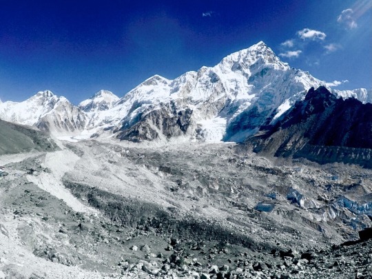
The photo above shows the tallest mountain in the world called the Mount Everest standing at 8848 M! Many people lost their lives trying to climb this mountain as they had a lifelong mission of reaching it’s peak. It is located in the Himalayas, which is an area known to be so big that it spans four countries (Pakistan, India, China, and Nepal). From looking at this mountain, I can observe how it is situated in an area which snows a lot as I see a lot of whiteness present there. I can also likewise precieve that this is a really cold area, so one would really need warm clothes in order to visit this area. It is also one of my dreams to visit this mountain as I really wanna observe how it looks when I am there spotting it live from a telescope. The textbook claims that interpreters illuminate the meanings and beauty of places. This exactly aligns with me, whereas I really want the people to feel the beauty of mountains as I describe it to them on social media.

This photo above shows a demonstration of how big the Mount Everest really is in comparsion to some of the best buildings/towers in the world! This truly makes me amazed how Burj Khalifa (tallest building in the world) is less than half as high as the Mountain Everest!
1 note
·
View note
Text
Exploring the Annapurna Sanctuary: Trekking the Heart of the Himalayas

The Annapurna trek is renowned for its accessibility and diverse range of experiences, appealing to both novice and seasoned trekkers. Unlike many high-altitude treks that require technical expertise, the Annapurna Sanctuary offers a route that’s as safe as it is scenic. The trek leads you through the heart of the Annapurna Conservation Area, allowing you to experience varied ecosystems and breathtaking landscapes with every step.
One of the most compelling reasons to choose the Annapurna Sanctuary is the opportunity to witness the magnificent Annapurna mountain range up close. The peaks that dominate this region, including Annapurna I (8,091 meters) and Machapuchare (6,993 meters), are revered by locals and have been the subject of countless mountaineering expeditions and spiritual lore. Reaching the base camp, you are welcomed by an amphitheatre of snowy peaks, giving you a panoramic view that’s unlike any other in the world.
A Journey Through Varied Terrains
Starting from subtropical forests and bamboo groves, the annapurna trek gradually transitions into alpine meadows and rocky trails, giving trekkers a taste of every natural landscape the Himalayas have to offer. The Annapurna Sanctuary trek is particularly famous for its biodiversity. Along the way, you’ll encounter lush forests filled with rhododendrons, pines, and oaks, as well as wildlife like Himalayan pheasants and langur monkeys.
Trekkers often describe the surreal feeling of hiking through lowland jungles only to emerge into alpine landscapes within a matter of days. This shifting scenery keeps the trek engaging, with each day offering new sights and sounds. From picturesque riverside villages to secluded monasteries, the Annapurna Sanctuary is full of surprises.
Highlights of the Annapurna Trek
Pokhara: The Gateway to Annapurna
Every Annapurna trek starts in Pokhara, a lakeside town known for its relaxed atmosphere and stunning views of the Annapurna range. Here, trekkers can enjoy the serene waters of Phewa Lake, explore local eateries, and get a feel for Nepali culture before heading to the trailhead.
Ghorepani and Poon Hill
One of the highlights en route to the Annapurna Sanctuary is Poon Hill, a popular viewpoint that offers mesmerizing sunrise views over the Himalayas. The climb to Poon Hill is a challenge but well worth the effort, as it provides panoramic views of peaks like Dhaulagiri and Annapurna South bathed in golden light.
Machapuchare Base Camp
The sacred peak of Machapuchare, also known as Fishtail Mountain, holds deep spiritual significance for locals and is closed to climbers. However, the trek up to Machapuchare Base Camp is open to trekkers and offers a closer look at this iconic peak. This part of the trail leads through alpine meadows and offers stunning, unobstructed views of the Himalayas.
Annapurna Base Camp
The ultimate goal of the trek, Annapurna Base Camp (ABC), is a spiritual and visual reward. Surrounded by some of the tallest mountains on Earth, this natural amphitheatre creates an awe-inspiring backdrop for trekkers. Reaching ABC is often described as an otherworldly experience, with the snow-covered peaks towering all around, creating an unmatched sense of tranquillity and achievement.
Cultural Immersion Along the Annapurna Trek
One of the most enriching aspects of the Annapurna Sanctuary trek is the chance to engage with local cultures. As you move through villages inhabited by the Gurung and Magar communities, you’ll gain insight into Nepal’s rich cultural heritage. These communities are known for their warm hospitality, and many trekkers report that the interactions with locals are among the most memorable parts of their journey.
The Annapurna region is dotted with Buddhist monasteries, prayer flags, and stupas, symbolizing the spiritual significance of the area. As you trek through these villages, you’ll hear stories of Himalayan legends, learn about local customs, and perhaps even be invited to share a meal with a local family. This cultural immersion adds depth to the experience, allowing trekkers to connect with the region on a personal level.
Trekking with OrangeDMC: A Trusted Partner
When planning a trek to a remote and challenging destination like the Annapurna Sanctuary, partnering with a reliable travel company is essential. OrangeDMC stands out as a top choice for trekkers looking to explore the Annapurna region. With knowledgeable guides, carefully planned itineraries, and a commitment to safety, OrangeDMC ensures that trekkers can enjoy a hassle-free adventure. Their guides are well-versed in the trails, and their attention to detail ensures that trekkers experience the best of what the Annapurna trek has to offer. Whether you're an experienced hiker or a first-time trekker, OrangeDMC can make your journey to the Annapurna Sanctuary safe, comfortable, and unforgettable.
For more details, visit here: https://www.orangedmc.com/annapurna-trek-blog.html
When to Embark on the Annapurna Trek
Timing your trek is crucial to fully appreciating the natural beauty of the Annapurna Sanctuary. The best seasons for this trek are spring (March to May) and autumn (September to November). During these months, the weather is relatively stable, with clear skies and mild temperatures, making the trails more enjoyable. Spring brings blooming rhododendron forests, adding a vibrant touch to the trek, while autumn offers crisp views of the snow-covered peaks.
Winter and monsoon seasons are generally less favourable due to extreme temperatures and rain, which can make the trails slippery and prone to landslides. However, for those seeking solitude, the winter season provides an opportunity to experience the Annapurna Sanctuary with fewer crowds, though it does require extra preparation for the cold.
Preparing for the Annapurna Sanctuary Trek
The Annapurna trek is moderately challenging, but with proper preparation, it’s achievable for most people with a reasonable level of fitness. Here are a few tips to help you prepare:
Physical Fitness: Begin a fitness routine that includes cardiovascular exercises, leg strengthening, and stamina-building activities. Stair climbing, cycling, and hiking are excellent for preparing your body.
Altitude Awareness: The Annapurna Sanctuary reaches heights of over 4,000 meters, so acclimatization is essential. Be mindful of altitude sickness, and give your body time to adjust by taking rest days.
Packing Essentials: Bring quality trekking gear, including layers of clothing, a good pair of trekking boots, a sturdy backpack, and essential medical supplies. A high-SPF sunscreen, sunglasses, and trekking poles are also useful on the trail.
Mental Preparation: Trekking the Annapurna Sanctuary is as much a mental challenge as it is physical. Prepare for early mornings, unpredictable weather, and long hours on your feet. Maintaining a positive attitude will go a long way in enhancing your experience.
Final Thoughts on the Annapurna Sanctuary Trek
The Annapurna Sanctuary trek offers an unparalleled adventure in the heart of the Himalayas. From the diverse landscapes to the welcoming local communities, every step of this journey provides memories that will last a lifetime. For trekkers seeking a blend of natural beauty, cultural immersion, and personal challenge, the Annapurna Sanctuary is an ideal choice. With reputable travel companies like OrangeDMC to guide you, annapurna trekking can be enjoyed safely and comfortably, allowing you to focus on the breathtaking scenery and life-changing experiences along the way.
0 notes