#sugarloaf path
Explore tagged Tumblr posts
Text
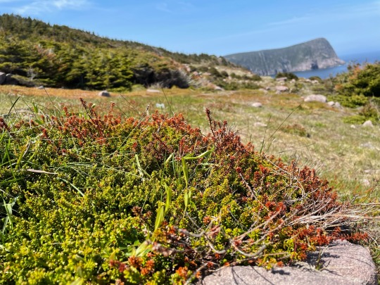
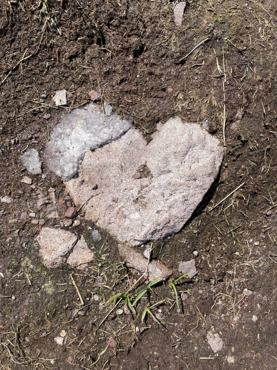
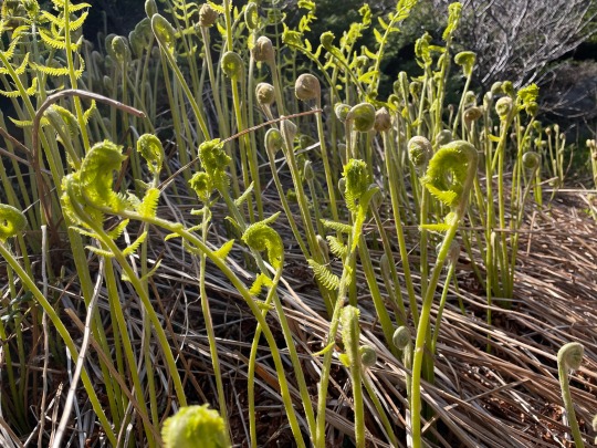
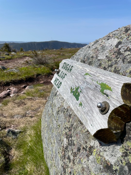
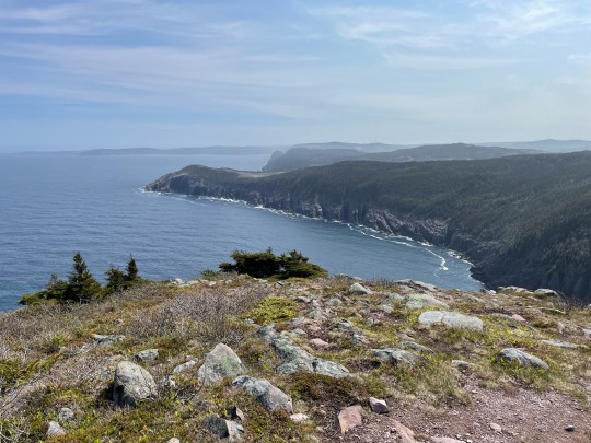
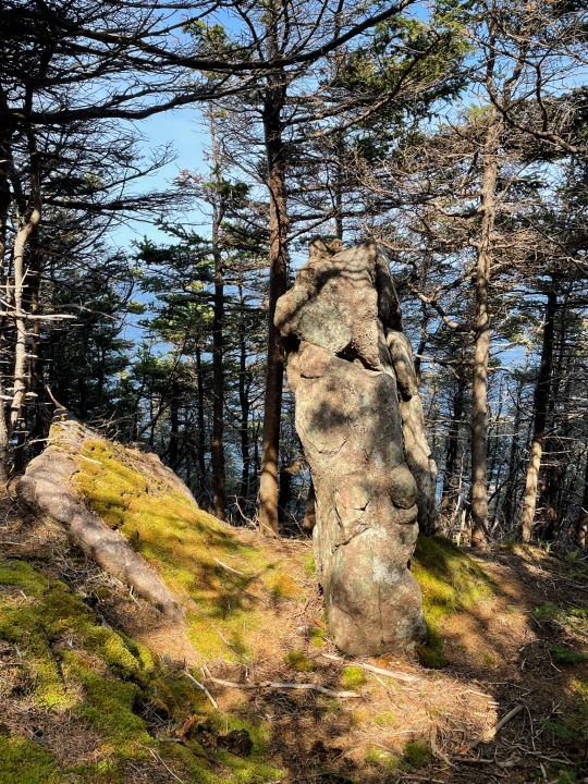


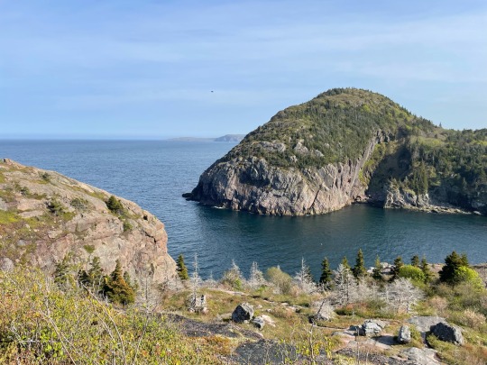
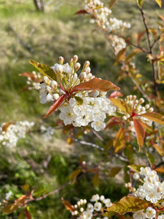
To celebrate the summer solstice I did my annual hike of Sugarloaf Path. It’s become a tradition at this point to hike the trail in its entirety at the beginning of the season. It was a bit on the cool side but still lovely to witness.
June 21st 2023.
#Sugarloaf Path#Newfoundland#Canada#Summer#summer 2023#summer solstice#east coast#hiking#explorenl#ectlove#yyt#St. John’s#east coast trail#ocean views#North Atlantic#fiddleheads#flowers#wild flowers#hillside#rock formations#rugged#sweater weather
5 notes
·
View notes
Text
° • — OPEN starter ( 0 / 3 ) ° • — sugarloaf mountain, midday

it was not healthy for her to sit around and mope, kai-ming knew that. it didn't stop her from wanting to, however. she had stayed below deck while they traveled, and the first few days back the princess had also stayed in her chambers — but no more. despite her sorrows, kai-ming realized she was only making the people who did care about her worry. she had to be brave and put on a mask, even if it was just for their sakes.
— but she did not want to wander the castle grounds, worried she'd catch sight of him at any moment. so, her mind went to the sugarloaf mountain trails. a view to enjoy, flowers to find; peace and warmth in the sun. it was exactly what kai-ming needed. halfway through the trail, though, and the little princess found herself stuck — her foot wedged between two rocks as she had attempted to climb and grab a vining flower.
she had all but given up on pulling herself free amd was about to just sit and cry when she heard footsteps up the path. " ah, excuse me! " she exclaimed, " i . . . i could use some help! " kai-ming called out nervously, hoping they could hear her.

14 notes
·
View notes
Text
Jumpstart Your Healthcare Career: Top CNA Training Programs in Atlanta
Jumpstart Your Healthcare Career: Top CNA Training Programs in Atlanta
Are you considering a career in healthcare? Becoming a Certified Nursing Assistant (CNA) is an excellent way to enter the medical field. In Atlanta, several high-quality training programs can set you on the right path. This article will guide you through some of the top CNA training programs in Atlanta, the benefits of becoming a CNA, practical tips for success, and firsthand experiences from individuals who’ve taken the plunge.
Why Become a CNA?
Before diving into the top training programs, let’s explore why becoming a CNA might be the perfect career choice for you:
High Demand: The healthcare field is booming, and CNAs are in high demand across hospitals and long-term care facilities.
Job Security: With an aging population, the need for caregiving roles is only growing, ensuring long-term job stability.
Short Training Period: CNA programs typically last 4-12 weeks, allowing you to enter the workforce quickly.
Opportunity for Advancement: Starting as a CNA can open doors to further education and career progression in healthcare.
Top CNA Training Programs in Atlanta
Here is a selection of the best CNA training programs in Atlanta that can help you kickstart your healthcare career:
Training Program
Duration
Location
Price
Atlanta Technical College
4-6 Weeks
1630 Metropolitan Pkwy SW, Atlanta
$500
Emory University
6-8 Weeks
201 Dowman Dr, Atlanta
$800
Piedmont Healthcare
5 Weeks
2001 Peachtree Rd NE, Atlanta
$600
Gwinnett Technical College
4-5 Weeks
5150 Sugarloaf Pkwy, Lawrenceville
$475
Ultimate Medical Academy
8 Weeks
Online Program
$800
1. Atlanta Technical College
Atlanta Technical College offers a comprehensive CNA program designed to provide students with a strong foundation in patient care. With experienced instructors and hands-on training, students can gain invaluable experience.
2. Emory University
Emory University is known for its advanced healthcare programs. The CNA training here focuses on developing clinical skills and understanding patient needs, preparing graduates for a variety of healthcare settings.
3. Piedmont Healthcare
Piedmont Healthcare’s CNA program combines classroom instruction with practical experience in a clinical setting. This program emphasizes effective communication and compassionate care.
4. Gwinnett Technical College
Gwinnett Technical College offers a fast-paced program that equips students with the necessary skills and knowledge to excel as CNAs. The curriculum includes both theory and practical applications.
5. Ultimate Medical Academy
This online program is an excellent choice for those with flexible schedules. Ultimate Medical Academy offers a robust curriculum that can be completed at your own pace, allowing for a convenient learning experience.
The Benefits of CNA Certification
Becoming a CNA does more than just enhance your résumé; it provides numerous benefits:
Hands-On Experience: Gain practical skills that are directly applicable to patient care.
Networking Opportunities: Connect with healthcare professionals and fellow students to expand your career opportunities.
Flexible Job Options: Work in various settings, including hospitals, nursing homes, and private residences.
Competitive Pay: CNAs earn competitive wages, with potential for overtime and benefits.
Practical Tips for Success
Here are some practical tips to ensure a successful experience in your CNA training program:
Stay Organized: Keep track of your coursework, schedules, and clinical hours.
Practice Communication Skills: Effective communication is crucial; practice both verbal and non-verbal skills.
Engage with Instructors: Don’t hesitate to ask questions. Your instructors are there to help you succeed.
Network with Peers: Build relationships with your classmates; they can offer support and job leads after graduation.
Case Studies & First-Hand Experiences
Hearing from those who have completed CNA programs can provide valuable insights. Here are a couple of testimonials:
Sara M., Atlanta Technical College Graduate
“The CNA program at Atlanta Technical College was incredibly rewarding. The hands-on training really prepared me for my role, and I felt confident starting my job at a local hospital as soon as I graduated. I love being able to make a difference in patients’ lives!”
Jason T., Emory University Graduate
“Emory University offered more than just the basics; it challenged me and pushed me to think critically about patient care. The connections I made and the skills I learned have been invaluable in my career.”
Conclusion
Embarking on a career as a Certified Nursing Assistant in Atlanta can provide a fulfilling path in the healthcare industry. With several excellent training programs available, you can find one that fits your needs and schedule. Remember the benefits of CNA certification, implement the practical tips discussed, and look into case studies that offer firsthand experiences. By investing in your education and training, you’re setting the foundation for a successful and rewarding career in healthcare.
So why wait? Jumpstart your healthcare career today by enrolling in one of these top CNA training programs in Atlanta!
youtube
https://www.cnacertificationschools.net/jumpstart-your-healthcare-career-top-cna-training-programs-in-atlanta/
0 notes
Text
Leading CNA Schools in Atlanta: Your Path to a Rewarding Healthcare Career Starts Here!
**Title: Top CNA Schools in Atlanta: Your Path to a Rewarding Healthcare Career Starts Here!**
**Introduction:** Are you looking to start a rewarding career in the healthcare industry as a Certified Nursing Assistant (CNA) in Atlanta? Finding the right CNA school is crucial to your success. With so many options available, it can be overwhelming to choose the best one for your needs. This article will guide you through the top CNA schools in Atlanta, helping you kickstart your journey to a fulfilling healthcare career.
**Benefits of Becoming a CNA:** Before we delve into the top CNA schools in Atlanta, let’s take a look at some of the benefits of pursuing a career as a Certified Nursing Assistant: – High demand for CNAs in the healthcare industry – Competitive salaries and benefits – Opportunities for career advancement – Making a positive impact on patients’ lives – Flexibility in work schedules
**Top CNA Schools in Atlanta:** 1. **Atlanta Technical College** – Location: 1560 Metropolitan Pkwy SW, Atlanta, GA 30310 – Program Length: 6-8 weeks – Accreditation: Commission on Accreditation of Allied Health Education Programs (CAAHEP)
2. **Georgia State University – Perimeter College** – Location: Multiple campuses in Atlanta area – Program Length: 11 weeks – Accreditation: Commission on Collegiate Nursing Education (CCNE)
3. **Chattahoochee Technical College** – Location: Multiple campuses in the Atlanta area – Program Length: 6-10 weeks – Accreditation: Southern Association of Colleges and Schools Commission on Colleges (SACSCOC)
4. **Gwinnett Technical College** – Location: 5150 Sugarloaf Pkwy, Lawrenceville, GA 30043 - Program Length: 8-12 weeks – Accreditation: Accrediting Commission of the American Culinary Federation (ACF)
**Practical Tips for Choosing the Right CNA School:** – Research accreditation and certification – Consider program length and schedule – Evaluate the curriculum and clinical experience opportunities – Compare costs and financial aid options – Read student reviews and testimonials
**Case Study:** Sarah, a recent high school graduate in Atlanta, decided to pursue a career as a Certified Nursing Assistant. After researching various CNA schools in the area, she chose Atlanta Technical College for its reputable program and hands-on training opportunities. Sarah completed her training in just 6 weeks and secured a job at a local hospital shortly after graduation. She credits her success to the quality education she received at Atlanta Technical College.
**Conclusion:** Choosing the right CNA school in Atlanta is the first step towards a rewarding career in the healthcare industry. By considering factors such as accreditation, program length, curriculum, and costs, you can find the perfect fit for your educational needs. Whether you decide to attend Atlanta Technical College, Georgia State University – Perimeter College, Chattahoochee Technical College, or Gwinnett Technical College, you’re on your way to a fulfilling career as a Certified Nursing Assistant. Start your journey today and make a difference in the lives of others through your work in healthcare.
youtube
https://coursescna.com/leading-cna-schools-in-atlanta-your-path-to-a-rewarding-healthcare-career-starts-here/
0 notes
Text
Morrow Mountain: Sugarloaf Trail
Morning spent in study at a museum, high noon passed amidst a meticulous recreation of the past, and now the tail end hours of the day, hours to be used for a form of contemplation arising from the feet rather than from the mind. Morrow Mountain, named after a past proprietor, only a vowel shift away from marrow, as appropriate a name, for these “mountains” are but the pith and nub of geologic bones once standing twenty thousand feet now squatting less than a thousand—in the eons it takes to make and unmake them life learns to trust land, whole seas recede, something called plants come into being as much more goes out of being, one people begin to quarry the montane remains making lithic implements, another people make it into property bearing plantations of apples and crops until at last it becomes a park.
But I want to think less of antecedents now, and instead take up my own present. I pick a route from the map—“Sugarloaf Mountain Trail, orange diamond blazes, 2.8 mile loop, strenuous”—the aptness of its sweet name to be determined by how much I sweat, for the right kind of exhaustion should make syrup of the limbs. Initially though, nothing but the taste of disappointment—the trail too close to the motor mumbling road, the elevation equivalent more to a sugar field than the ascending cone of a sugarloaf. But then the path crossed the road, and left the road, and I began to look up and only up as my legs lunged, my lungs filled and my back warmed. I rolled my pants up, came out of my shirt and took my sandals off. Something wanted daylight and wind on its chest, under its arms and between its toes. Each step further, and I began to understand that I was that something. Something happy, agile, breathing. Rock loose ascent under airy hardwoods, sharp drop descents down burn eroded faces—nothing the ground could do could stop me, but the ground did not want to stop me, nor has it ever wanted to stop the steps of the infinite others crossing here, crossing as hunters, as tribes, as soldiers, as settlers, as doctors, crossing as so many other kinds of seekers seeking the way through, over, towards, towards, towards their something, the cadence of their feet transcribing stories into soil and stone, transitory tales that have entertained these senescent mountains for a few millennia. In exchange for our “footage”, these old grounds guide, guide us through their terrain but also guide us through the terrain of ourselves; the only demand required of the guidance is attention, no step can be taken for granted, for such presumptions make bad sequences—stumble, stagger, overstep. Instead, when the path narrows, broaden your feet, at the edge of a log steady on your tip toes, up an incline flex the foot’s ball. Ground, balance, bounce—and move well up more than just the back of time laden mountains.


0 notes
Text
Acting With Unconditional Love Walk and Talk - July 16th, 2023 - 1:00 - 3:00 pm - Sugarloaf Cove Nature Center Trail - 9096 W Highway 61, Schroeder, MN - meet at the start of the trail

This is the 17th of 52 workshops being presented on the 2023 tour. Each stop on the tour will be creating a grid over the United States that will benefit our world and activate an Echoing Divine Heart energy pattern; allowing it to ripple out throughout the world and into other existences. These are going to be an exciting set of events based on the 52 key patterns of The Code Journey work. Participants will be getting their own learning experience while also contributing positive energy to the collective. The one that I will be presenting here will be focused on realizing the power of Spirit in our lives and how it will help us to overcome any of the difficulties that we face. We will look at connecting with our own Immortal Self and how it can help us to hold unconditional love in our life for ourselves and others; even those that we do not like. We will be working on opening up greater peace and love in all forms; which connects us with the Law of Unconditional Love which brings us into pure acceptance and harmonizing.
This will be a walk and talk event. It is best to leave 2-3 hours (1 1/2 - 2 hours for 1 mile trails and 2-3 for 2 mile trails - note I am a slow walker) for these events since we will be walking on easy trails for a 1-2 mile distance. We may stop along the way for conversations, or chat at a key point along the path. These are casual events, and we will talk about how things that are in the location and along the path connect with the topic. Each one is unique since each place and trail is unique. Participants do these activities at their own risk. You will want to bring water with you, and perhaps a snack if needed. It is important to have good walking/hiking shoes and comfortable clothing. There may or may not be outhouses or restrooms at the meeting point or parking area; and there will not be any along the trail. Suggested Donation $15
0 notes
Photo

Sunset on the east coast trail with the love of my life 8/15/17
#east coast trail#sunset#boyfriend#josh#hiking#newfoundland#explore nl#newfoundland and labrador#sugarloaf path#sugarloaf mountain#Canada#hike#trail#I love my life tbh#adventure#explore#ocean#views#pano#beautiful#mine#2017
7 notes
·
View notes
Photo

Devil's Path, Sugarloaf Mountain, New York
#hiking#trail#hiking trails#devil's path#sugarloaf mountain#new york#ny#new york trails#ny trails#new york hiking#ny hiking
7 notes
·
View notes
Note
How would you tickle someone who loves to be teased with a feather?
By pontificating on the potency of these lovely tickle wands~
Such a funny thing, isn't it ~ of all tickle tools the feather appears naturally and in no short supply. I'll always be able to find a feather for you. Some people doubt the power of them, even laugh that anyone thinks a feather could tickle. They just haven't felt the right feather in the right place. Why, I could lay you face down and take this stiff quill to tease at the most precise line of sensitivity behind your knee and I bet you'd make a nice squeaking case for the tickly power of this beautiful tool.
Or maybe a nice fluffy white feather for your ears? Yeahh your ear~ those brushy bushy tickles buzzing around riiight in your sound receptors, you can hear those tickles can't you? Just as much as you can hear the stiff quill brushing your leg, up to the backs of your thighs. And then we can dance them along the small of your back, oh yes we can. Yussss we can~ and you'll take all my feathery tickles because you're an adorably sensitive wiggly wormy ticklee aren't you~
Mmhmm, that's a pair of shiny black quills on your sides now. We're going up up up and tracing each rib. Hear those tickles? Mmmhmm~ that liiiight scratchy sound, it's so divine, all those fibers of the quill grazing on your ribs getting those giggles moving ~ your belly must be bouncing so much down there. But don't worry, it'll get plenty of attention soon too~
Because now we're doing the flip ~ come onnn silly pancake, flip over for me. Flip for me or I'll just keep feathering your sweet bouncy tush~ such a silly spot, no? Ahh, there we goo~ Now you get to see my little tickly friends. Such a giggly gang, huh? All these cute colors and patterns and textures ~ don't you just love the sight of a feather waving daintily between a thumb and finger like this? My nails holding it ever so lightly, just casually wielding your giggly doom ~ and you'll sit there and wiggle and melt all sweetly for me because you know it's coming, you know it's gonna get you, and it's gonna tickle, and you're gonna love it which is why you aren't trying to get away, oooh no you're not~
Let's see that hand shall we? Is your palm ticklish? Ticklish palm? I bet it isss~ This stiff white feather is so perfect for tracing those lines on your hand. Yesss wiggle those fingers. Wiggly fingers are just fine. We're gonna find your most ticklish intersections on this palm. I bet it's right on the M. Ahh yes, giggle it out now. Between each finger? You betcha ~ Up your index finger down and up the middle finger hey don't flip me offf~ I'll just tickle you more ~ and now your ring finger and your pinky and yesss let's test the tips of each finger tooo ~ did you know how much a feather can tickle your fingertip and those lil adorable rings on each finger?
And guess what? We're tickling your veins next ~ Ahh yes, the lifestream of giggles, right down your wrist while I hold your hand snugly. The path of snickers, the radiant pool of laughs right inside your elbow. It's like the kneepit of the arm. Or maybe the kneepit is the elbow of the leg? Shall we compare? Lift that leg cutie ~ this is for the science now. Feathery feathery tickly tickly in your elbow and under your knee ~ good thing I have so many feathers huh? So many feathers? Listen to those scratchies too ~ sooo pretty and tickly and I bet soo lovely in your ears~
But ooh that belly is so neglected ~ let's relax now, lean back. That's right, you can get all comfy in Tickle Mama's lap and now you get to watch my longest girliest prettiest feathers drift down and wave towards your bouncy tum tum. Twitch all you like, it's still gonna tickle. Giggle it out sugarloaf, giggle it out ~ it's like a pair of ice skaters just dancing and twirling around your sensitive skin. Does it tickle? Yeahhh? Oooh, jumping up and dancing and spinning and ooooh! Landed riiight in your navel. Awww, coochie cooo~ Did that tickle so much? What if they decide to go digging for giggles? Digging for giggles in this navel? Feathery little touches allll down in your divot, right to the bottom anddddd there~!
Awwwe~ was it so much? So many lovely feathery tickles huh? Well you just gasp it out, moaning is okay too~ I have my lil red lady for you and we'll just brushy feathery tickly your cheeks and nose while you catch up ~ oooh did your know your eyebrows were ticklish too? No one ever expects that one ~ but all it takes is the right feather and the right love ~ every part of your lovely body is feather ticklish~<3
25 notes
·
View notes
Text
Why Bristol is The Soul of Grafton County?

New Hampshire, Bristol's lovely village, is a typical hamlet in New England, surrounded by rural hills covering the southern half of Newfound Lake. The city provides all its advantages and near access to important sites and attractions just 25 miles from the capital, Concord. In the Wellington State Park and Cardigan Mountain Orchard, Bristol is an exciting site for local atmospheres, outdoor activities, and apple harvesting. Regarding accommodation book one of the best Family Vacation Cottages in Bristol for rent.
Wellington State Park is home to the finest freshwater swimming beach in the New Hampshire State Park system. Walking and picnic spots along the coastline overlook one of the deepest and cleanest lakes in the nation. A well-known path leads walkers to Mount Cardigan, Welton Falls, Bear Mountain, Sugarloaf Mountain, and Goose Pass. Wellington State Park also includes horseshoe and volleyball courts, boat rentals, kayaking rentals, a Snack Bar with souvenirs, picnic supplies, cold beverages, ice cream, and snacks. During the summer, camping with reservations is possible.
Surrounded by the mountains, water, and woods, Newfound Lake is located in Grafton County, New Hampshire, United States. It is situated in the Lakes Region of central New Hampshire. The Newfound Lake is among the cleanest lake in the country. Although it is quiet, it retains its natural purity and relaxing characteristics to give you what you want. Feel free to contact one of the professional rental management to book one of the Lakefront Vacation Cottages in Grafton County for your comfortable stay. You will be living luxuriously in it. Effortless Adventure is an all-inclusive camping outfitter for camping purposes. They provide guided personalized and personalized excursions. The powered parachute instruction is an airplane school giving flying training for powerful parachutists.
1 note
·
View note
Text


Happy Earth Day!
I’m happy to call the rugged island of Newfoundland my home on this little marble floating around in space. I honestly wouldn’t have it any other way!
#spring 2024#spring has sprung#Earth Day#Earth Day 2024#sugarloaf path#east coast trail#east coast#Newfoundland#Canada#home#big blue#hiking#explorenl#ectlove#yyt#St. John’s#explore#nature#snow#forest#spring time#coastline#rugged#atlantic ocean#ocean view#rough waters
1 note
·
View note
Text
Family Fun at Tumbling Shoals Park
Discover Family Fun at Tumbling Shoals Park
Nestled along the shores of Greers Ferry Lake, Tumbling Shoals Park is a gem for families seeking adventure and relaxation. With its picturesque landscapes, rich history, and a plethora of activities, it’s no wonder that this park has become a favorite destination for both locals and tourists. Whether you’re looking to cast a line into the Little Red River, hike up Sugarloaf Mountain, or simply enjoy a sunny day at Sandy Beach, Tumbling Shoals Park caters to all ages.
The Allure of Greers Ferry Lake and Its Surroundings
Greers Ferry Lake is not just any body of water; it's an expansive playground for nature lovers and adventure seekers alike. The lake spans over 40 miles and features numerous coves and inlets perfect for swimming, fishing, and boating. Families can rent pontoon boats from local marinas such as Heber Springs Marina or Eden Isle Marina to explore the shimmering waters.
Fishing Adventures
If your family enjoys fishing, you’re in luck! The lake is stocked with various species including bass, crappie, and catfish. Kids can learn the art of fishing with guidance from experienced anglers at the nearby Greers Ferry National Fish Hatchery. It’s an excellent opportunity for bonding while teaching kids about conservation and aquatic life.
Picnic Spots Galore
After a thrilling morning on the water, pack a picnic lunch to enjoy at one of the many picnic areas scattered around the park. With scenic views of Bridal Veil Falls in the background or while sitting under the shade of oak trees near Collins Creek Cascade, mealtime becomes an experience in itself.
Hiking Trails: Exploring Nature’s Wonders
Tumbling Shoals Park is home to several hiking trails that cater to varying skill levels. From beginners to seasoned hikers, there’s something for everyone!
Mossy Bluff National Nature Trail
This trail offers breathtaking views as it winds through lush forests filled with native plants and wildlife. Don't forget your camera; you’ll want to capture the beauty of nature along this path! As you walk this trail with your family, make sure to point out interesting flora and fauna—the kids will love it!
Sulphur Creek Trail & Buckeye Trail
For those wanting a longer trek, both Sulphur Creek Trail and Buckeye Trail provide https://501pressurewashing.com/heber-springs/ stunning views of cascading waterfalls like Cornelius Falls. These trails are ideal for family hikes where you can take breaks to enjoy nature's beauty or have fun spotting birds.
Family-Friendly Activities Beyond Hiking
While Tumbling Shoals Park offers ample opportunities for outdoor activities, there are also some hidden gems nearby that promise even more family fun.
Adventure Awaits: Loco Ropes! & Urban Air Trampoline Park
Just a stone's throw away from Tumbling Shoals Park are exciting attractions like Loco Ropes!, where families can test their balance on high ropes courses amidst towering trees. Alternatively, Urban Air Trampoline Park provides an exhilarating indoor option where kids can jump to their hearts' content—perfect for burning off energy after a day spent outdoors!
Cultural Experiences: Museums & Galleries
Don’t forget about cultural explorations! The R
0 notes
Photo


The Stink-Haver and I had a good morning in the mountains this weekend! It was a delightful 57 degrees up there. We started up the Medicine Bow Peak trail, but then tons of people and dogs were on there too. So we hoofed up a bit and turned back to the paved path. We walked across a county line. We walked to the next lake and hopped on the Sugarloaf connector trail thinger. We saw wildflowers. We saw critters (I though Marla was gonna become one with a boulder field). It was a great day that I definitely needed, and we missed the rain.
3 notes
·
View notes
Text
Day 1 - Rio
We came flying out of the blocks as the sun rose on Rio. Helped by a 4 hour time difference we were up and out of the Airbnb by 6am. We're staying in a tiny studio apartment a few roads back from Ipanema beach, a quiet spot and one that seemed slightly less like mugging territory!
At 6am it was already 22°C and we wandered to the beach and turned left. The roads strangely quiet and those that are already walking to work do so with cigarette in hand.
Further down the beach we spot some surfers and meet Felipe, a surf instructor who we'll surf with on Friday morning. Now though, we press on to Copacabana Beach. It's 7am by the time we've ambled along past the morning yoga groups, and the shirtless Brazilians delivering today's ice to the kiosks on the beachfront. There must've been 200-300kg loaded into their trolley bikes.
Lido Square, two thirds the way down the beach, is where the official buses to Christ the Redeemer leave from and we buy our tickets and only wait about 15 minutes for the next bus to leave. Screeching through the streets and the we begin winding our way up the hills behind Rio, criss-crossing with the more traditional old "cog train" bound for the same destination.
We finally reach the top around 10am and there's no queue but the crowds are beginning to build. There's a welcome breeze up here - the temperature is up around 30 now.
The views are spectacular. I fear I'll run out of superlatives on the trip so I'll leave it at that but as the mist was still burning off the mountains behind us and the sun peeped over Christ's left arm it's easy to see why they built this giant structure here, in what must have been a monumental effort in 1931.
We considered walking back down to town and sought advice on the route from the information point. The helpful girl there pointed out the start of the route, explained there was only one path so we can't get lost and then added that she felt duty bound to tell us that very few people use the route because most get robbed. This being day one, we decide to retreat to the safety of the bus. It's a long trip and we have more photos to take before our kit gets stolen!
Down into town where we meet Holly's friend Scott at a rooftop bar overlooking Copacabana beach. We dip our feet in to cool pool and catch up with Scott getting some local tips (mostly on how not to get robbed!) And enjoying a cold Corona.
Our final stop is Sugarloaf Mountain, reached by cable car. We time this to coincide with sunset (17.30ish, it's winter here remember) and settle in to watch the sun go down behind Christ and cast shadows across the various pockets of Rio. Another incredible view surrounds us.
As the sun plops over the hills we hustle for the cable car to beat the crowds, taxi back to our studio and change for dinner - steak at Garato de Ipanema, where they claim Antonio Carlos Jobim wrote "Girl from Ipanema".
Bed. Tomorrow we're being picked up early for an overnight trip to Ilha Grande.
1 note
·
View note
Text
Smoke and Strut Top 10 hikes for Cannabis Smokers on Vancouver Island
There's nothing like smoking in nature, being surrounded by trees and plants, maybe sit near a waterfall or a different body of water. Here in B.C. you can smoke in any park besides in campground common areas and within 6 meters on a playground. This is awesome since we have so much to see and do here on Vancouver Island.
There are somethings you will need to be aware of on your hikes and out in the woods.
1. Pack In What You Pack Out! Meaning please don't leave your snack wrappers or drink containers. Be sure to bring them back to your car with you or dispose of them correctly.
2. Be Fire Safe! The past few years we’ve has a lot drier conditions making it easier for forest fires to start. So I always bring a container I can fill with a bit of water and ash my joints in or my pipe bowl.
3. Don’t Get Lost! Now that everyone has a cell phone we can pre download maps and follow the map to keep on track. There is a mountain bike trail app called trailforks, it has all the trails I'm going to talk about. Trailforks allows you to follow yourself on the map and see all the trails near you as you pass them.
4. Bring Snacks! A lot of these trails take a few hours, I don’t know about you but i tend to get hungry when I smoke.
How should I consume when out and about ?
Doobie - Always a good choice besides the smell, joints get you real high and they are perfect for sharing.
Vape pen - Vape pens are perfect for these kind of trips. Just be sure to charge it up before you go out. (don’t know how many times this has happened to me get way out in the bush and have no way to get high)
Pipe - Like a joint, pipes are very good for sharing and are super portable. Pipes can give huge hoots as well it can be fun to blow smoke into the woods.
Edibles - A smaller dose can most definitely enhance your outdoor experience but a bigger does can also be fun.
Unbreakable piece - personally I have two silicone bongs one specifically for hiking and camping there's nothing quite like smoke by the river using the water from the river in the bong.
My Go To Hikes:
Seal Bay Nature Park
Seal Bay Nature Park is located northeast of Courtenay on Bates road. The road divides the park into two parts. On the east side of the road is an amazing rocky beach along the ocean. The trail down to the water is carved out of a huge lush second growth forest. There are benches on the way down to stop and take in the scenery. Seals can be heard barking in the distance. Once down on the beach you can light one up and start to explore the ocean side. There is lots of structures built from driftwood and big logs to sit and watch for whales. The west side of the road is a loop around the melda marsh the trail is called the swamp loop, don’t let that deter you though. This hike has lots of fallen trees to walk across and bridges over streams filled with frogs and otters. There are huge stumps to climb inside and look out points that overlooks the marsh.
Rosewall Creek Provincial Park
This hike is a bit south of Courtenay, only accessible by the ocean highway. After parking start walking toward the highway, be sure to cross the bridge of the highway (the trail is on the north side of the river). I usually spark up a doob at this point, there is minimal wind since you are pretty deep in the woods. The trail is partly washed away near the beginning from a flood a few years back but there is a relatively well used trail there now. There is a beautiful waterfall at the end of the trail with a rather deep swimming hole beneath the waterfall.
Willowbrae Trail / Halfmoon Bay
The Willowbrae Trail is the beginning part of the trail to Half Moon Bay. The trail is located in Ucluelet on the westside of Van Island. At the beginning of the willowbrae trail you get your first taste of the humongous trees and vegetation the island has to offer. After about a km you will come to a point where you have to either go down straight down to a beach or go left, GO LEFT. This will take you to Halfmoon Bay you will instantly be greeted with more trees, giant ferns and long stretches of boardwalks keeping you above the forest floor. There are some fallen giants along the boardwalk where you can see the network of roots that one tree has. Once you come to the stairs you are mostly there. At the bottom of the stairs you will find a seemingly deserted beach. When ever I have been here I've only seen a hand full of people. It’s the perfect beach to whip out the bong and snacks and get settled.
Hole In The Wall
This place is kind of different, park at the Coombs Country Candy store which is located to the right, as soon as you come into Port Alberni coming from the east side of the island. The trail head is across the highway, to the right of the concrete barriers. Start walking straight, soon there will be a clearing and the path goes right or left, GO RIGHT. The trail will have a few turnoff points but keep going straight. Walk for about 10 minutes and there will be a mountain bike disc brake that has been consumed by a tree turn right here. At the bottom of the hill there, you will see the hole in the wall. It’s a cool place to explore, Inuksuks have been built all around the river bed. You can also go through the hole the the river on the other side. If you turn left the trail take you down stream where you will find a waterfall that has a rope swing into the pool created by the waterfall. This is an awesome place to smoke and enjoy the water.
Englishman River Falls Provincial Park
This trail is located near Parksville closer to a town called Errington. It has a huge waterfall with a bridge that crosses over top of them. This allows you to get some awesome photos of the falls. On the other side of the falls you can turn left or right. The left turn takes you to the top of the falls there is also a picnic table beside the water it’s a nice place to have a snack. If you take a left it will take you down the river from the falls. This area is usually heavily populated, especially in the summer months so I usually use my vape and maybe and edible for this hike. There are big grand fir trees along this trail. Towards the bottom of the river there is another bridge to take you back to the parking lot. At this bridge there is a part where the river gets calm and the water is deep. It’s always a perfect place to take a dip.
Newcastle Island
Newcastle Island is located in the Nanaimo harbour. It’s a very short ferry ride that only costs $8 return. Depending on the route you take, expect to be on the island for most of the day. Be sure to bring snacks, water and weed. Cannabis is only permitted at the campsites but you can easily smoke without anyone knowing. The island is amazing with lots to see. There are many beaches, a lake and a viewpoint facing SugarLoaf Mountain, there is also a campground with fire pits. Albino Racoons can be spotted as well as seals and otters.
Cable Bay Trail
Cable Bay Trail is located south of Nanaimo near Cedar. The trail flows through the forest for 2 km, down to the ocean facing Gabriola island. This is a designated off leash area so it cool to bring your pooches while you smoke one by the water. If you keep following the trail it will take you to Dodds Narrows where Vancouver Island meets Mudge Island. Here the current flows towards Gabriola and towards Van Island. This creates a huge flow of water, if your lucky you might see seals here catching fish. This is quite a spectacle to see.
Hollands Creek Trail
This awesome trail is right in the heart of Ladysmith. My favorite way to get to this trail is from dogwood road, there is a parking lot here. This is a loop trail that takes about 2 hours. If you take the side of the trail that the parking lot is on you can go through a more forested area and it will take you to the other side eventually. On the other side you can park on the corner of 6 Ave and Methuen St. This part is wheelchair accessible. This trail has a few waterfalls and is and awesome nature walk.
Gowlland Tod Provincial Park
This hike is way down island close to Victoria and easily accessible from willis point road. This park is huge and has over 20 km of trails and amazing nature views. The ocean near the bottom is usually calm and there are many spots to hang out by the water. There are lots of old concrete structures to explore and loads of wildlife.
Mystic Beach
This magical hike is located an hour and a half north west of victoria. The trail from the parking lot to Mystic Beach is an hour hike, and is covered in big roots to climb over and huge trees to look at. The beach is down a creaky wooden stairway. Mystic Beach has such fine beautiful sand the ocean here seems clearer. It’s easy to spend the days laying on the beach here. There are often people the whole way to the beach and at the beach so discreet puffing is encouraged.
All of these hikes are awesome, whenever I am in the area I try to go and walk the trails there. I’ve always had great times here and have always left with amazing photos.
Written by Scotty Frey
References:
At the trails themselves and Google maps
#gethighandhike#smokeoutside#just blaze#ismoke#gethightogether#smokeweedeveryday#imhigh#takeahike#Hiking#Vanisland#hikevanisland
2 notes
·
View notes
Video
tumblr
The second fox we met on our journeys 8/15/17
#stop feeding dem#fox#east coast trail#newfoundland and labrador#newfoundland#explore nl#wildlife#wild animal#popcorn#sin#sugarloaf path#sugarloaf mountain#fox friend
0 notes