#semi-arid
Explore tagged Tumblr posts
Text

We had 2 months worth of rain in two days last week.
(Precipitation in inches of water.)
6 notes
·
View notes
Link
1 note
·
View note
Text
Tal Chhapar
Tal Chhapar is a semi-arid village about 225 kms and almost 4.5 hours by car from Jaipur in the Churu district of north Rajasthan. The roads aren't great and combined with the indisciplined traffic, intense heat, and the blazing sun, the 4.5 hours seem much longer than they actually are. Chhapar is home to many native and migratory birds along with the blackbucks and nilgais that form the majority of the local wildlife.
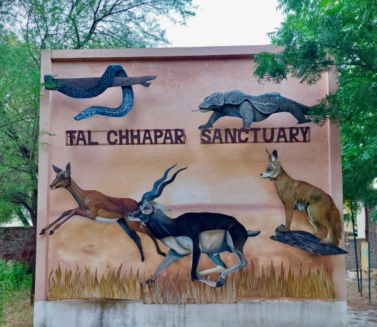
Probably the best time to visit Chhapar is in December, when one can spot many varieties of migratory birds. However, October onwards is generally considered a good time to visit for birding. Even though the number of birds is less, one can spot more variety during this time. Chhapar can get extremely hot and dusty, especially during the afternoons. In winters, the temperature also drops quite a bit. Ker and Sangri trees dot the landscape with intermittent sprinkling of stunted shrubs and bushes. Tal Chhapar in terms of birding is divided into 3 adjoining but distinct areas - the salt pans, the Tal Chhapar sanctuary, and the Gaushala lands. Each of these have their own charm and native residents. The presence of water bodies, plenty of prey, and natural cover ensure that the big birds of this area have ample reasons to stick around.
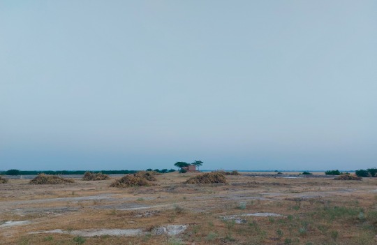
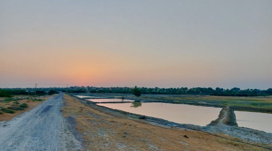
The salt pans area is adjacent to the sanctuary and has many waders (big and small) and ducks in addition to other birds. The underground brine oozes onto the surface where it's left to dry under the sun in the salt fields. The water evaporates, leaving behind the white salt. This salt is then taken to processing units where it's packed and sold. Early morning is the best to visit the pans; the forenoon and afternoon glare from the pans is blinding. This area abounds in small passerine birds and has a large number of water bodies and ponds. There are also many wells and step wells, the walls of which provide nesting space to the raptors.
The Tal Chhapar sanctuary is rather small, only about 10 sq. kms but it more than makes up for its size in terms of birding experience. It's an open grassland that offers great visibility for long distances owing to its flatness. This sanctuary used to be the royal hunting grounds of the local maharajas and boasts of a large number of blackbucks and birds, especially raptors. While the grass here isn't tall enough to hide the wildlife completely, it does provide cover to the foxes, hares, and francolins. It resembles the African savannah in terms of color and density. Early mornings and late evenings are great times of the day to see the birds in the sanctuary. Morning safaris are from 6:30 to 9 am and evening safaris are from 4 to 6:30 pm. A big prosopis tree houses spotted owlets right at the entrance of the safari. Within the sanctuary, there are many watering holes (one of which is named after Dr. Salim Ali). There are some pockets that are cordoned off to prevent overgrazing by the blackbucks. In the absence of natural predators, the blackbuck population has really taken off here. The govt. now plans to relocate some of them to a different site to prevent overcrowding. There are perches put up at regular distances to make it easier for both birds and bird watchers.
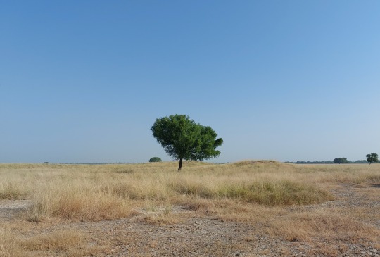
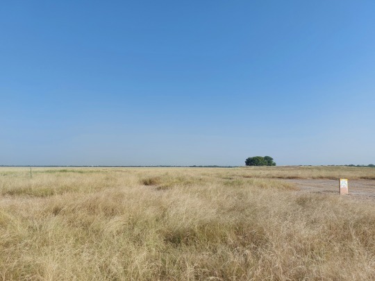
The third area in Chhapar is the Gaushala land, that's covered by thorny shrubs and stunted trees. Large tracts of this land are owned by the surrounding cow shelter homes, hence the name gaushala. Mostly you are on your own, but if you come across one of the gaushala members, you have to pay Rs. 200 as entry fee. This area again is divided into multiple sub-areas. On one side you have a zone for carcasses that abounds in carrion-eating birds such as vultures and ibises. In the middle, you have a relatively cooler area with taller trees that abounds in smaller birds such as the Indian spotted creeper, hoopoes, nilgais, and blackbucks. The last zone is a relatively hotter zone that has eagles, lizards, snakes, and foxes. It's here that you can hope to come across raptors with kills.
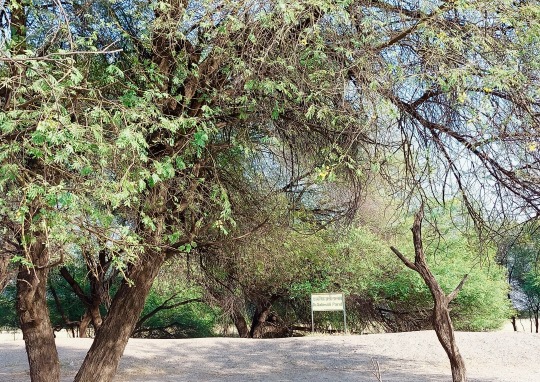
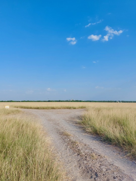
We stayed for 2 days and 2 nights at the Raptor's Inn (different from Raptor's Paradise closer to the highway) in Chhapar which is managed by Mr. Atul (+91-8826907085). It's a small place, similar to a homestay. They provide meals 3 times a day with a fixed menu. You can spend evenings catching up with guides and other birders. We met a gentleman from Gujarat who has been visiting Tal Chhapar for 17 years. The homestay folks arrange safaris in all the three areas at all times of the day, and can book your sanctuary safaris too. The safaris are usually in open Gypsy or closed cars such as Bolero. Most of the guides are locals and quite knowledgeable about the wildlife. Just as the focus in other national parks is on sighting big cats during safaris, the focus of the Tal Chhapar guides is to sight raptors and birds of prey. The Tal Chhapar sanctuary is one of the few places in India that provides a focused birding experience. It's definitely worth a visit if you are keen on spotting birds of prey.
#Chhapar#Tal Chhapar#Rajasthan#blackbuck#sanctuary#raptors#Raptor's Inn#birds of prey#big birds#birdwatching#birding#nilgai#summer#winter#wildlife#travel#Jaipur#salt pans#salt#carcass#carrion#desert#semi-arid#hot climate#Gypsy#safari
1 note
·
View note
Text

Here's a heavily improved Imperial Wardin map, with a focus on climate and geography (uses the Koppen Climate Classification). This is an attempt to infuse pre-existing lore too established to retcon with a degree of realism, but there's only so much I can do.
The majority of the climate falls under the hot mediterranean and semi-arid classification, with small pockets of warm mediterranean and arid climes. The entire region experiences a rainshadow effect from the eastern Blackmane Mountain range, which blocks northeasterly winds from the eastern ocean and starkly divides the Sub-Viper landmass between its humid east and dry west.
Most of the interior is grassland, savannah, and scrub. Savannah heavily coincides with a history of human occupation and controlled burns, and is mostly based around oak. Grassland, scrub, and semi-desert dominates the semi-arid regions. Small pockets of high desert and salt flats occur in the arid zones.
A forest originally spanned much of the north, consisting of predominantly oak. This was gradually eliminated due to multiple factors- a warming climate, low intensity human intervention (hunter-gatherers and pastoralists clearing land with controlled burns), and high intensity exploitation (deforestation for timber). Additional woodlands found along the major riverways have been wholly eliminated by logging within the past several centuries.
The largest remaining span of woodland occurs within and north of the Highlands, and in the sparsely populated northeast, where a major and mostly intact oak forest stretches to the Blackmane mountains. A smaller pocket of woodland occurs in the volcanic highlands of Lobera. Other pockets remain, but are isolated and insignificant on the map.
Most of the geography is flat, divided by a range of hills that are the heavily eroded remains of an ancient mountain range. The highest peaks of this range comprise the contemporary Highlands, which have the highest elevations and coldest climate in the region. This is the only territory that regularly receives snowfall, and is the source of several major rivers. The rest of the range is too low to drastically affect the climate, save for the Red Hills east of the Cholemdi basin, whose rain shadow effect (heavily compounded by the basin's low elevation) renders this valley the hottest and driest part of the region. This range once formed a land bridge across the Viper into Finnerich (though this was prior to anatomically modern humans Existing) with its only remnants being smatterings of islands.
The province Lobera holds a small range of volcanic highlands, composed of a network of mostly dead volcanic craters. The volcano Odatoche is the only active site in the region, though has been dormant for centuries and has not had a major eruption in millenia. The other major geological feature is the Sons of Creation, which is the fabled site of God’s self-sacrifice from which the world was made. This is the eroded range of a very large impact crater, consisting of two impact rings (visible as a circular formation of hills) a ring lake, and an elevated center.
The most fertile land is found in Ephennos, owing to the presence of the Black River and its highly fertile delta (which contains the only major semi-permanent marshes outside of Highland river valleys). This is the second largest river in the region, being a confluence of two major river systems out of the Highlands (the Urbin/Erubin and Troibad/Nedachemi rivers). Erubinnos has the largest river, the Kannethod, which originates in the Blackmane mountains.
Agriculture around some of the other river systems is mostly or entirely dependent on their post-rainy season flooding. The most prominent is the Yellowtail river (flows south past Erub). In the very distant past, this was the longest river in the region, and carved out the Cholemdi basin and reached the sea. In the contemporary, it dries out long before even approaching the sea (though occasionally still floods the basin in abnormally rainy years). The Brilla river system out of the Red Hills (flows to Wardin) reaches the sea year-round, but has been known to run dry in exceptionally severe drought, and irrigation along its length depends on its flooding.
There are very few significant lakes in the region (small lakes are unmarked). The biggest is the volcanic crater lake Aganagarre in Lobera, the Yellowtail lake north of Erub, and the ring lake within the Sons of Creation.
#The last map of the region I posted is now obsolete. Ignore it#Idk if I've given the impression that it's partly like. High desert but it's not. I based a good chunk of its climate off the north america#southwest (though much bigger chunks fall into the mediterranean climes than the SW does)#I wrote in the Highlands after climbing Wild Rose Peak in Death Valley. Just kind of inspired by the experience of being#there in February and the temps being 80-90 degrees but then climbing a few thousand feet and suddenly its way cooler and there's#cacti covered in snow.#(I live in a region that is mostly flat and at low elevations so encountering Basic Mountain Effects was mind blowing)#When I say 'based on' it's not directly based. I kind of just get a sense of each region's climate and then find as many irl analogues#as possible to get an idea of how it would work. That is the only subtropical/semi-arid mountainous region I've ever Been to though#Otherwise I've seen the Scottish and Icelandic highlands which are not even slightly analogous.#Oh and the north shore highlands which I kind of forget are a Thing and it's not just lake effect. Not even slightly analogous either.#imperial wardin
85 notes
·
View notes
Text

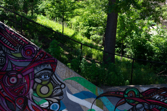

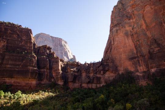
#Tropical and subtropical moist broadleaf forest 6 ft/1.8m above sea level within the American South#Temperate forest 605 ft/184.5m above sea level within the American Midwest#Semi-arid Tropical grassland 2030 ft/920m above sea level within Eastern Africa#Semi-Arid High Desert 4000 ft/1219m above sea level within the American Southwest#street photography#wildlife#landscape photography#hourbyhour#out there#outside#ishootsometimes#vvrong
23 notes
·
View notes
Text

Cute bee on a eucalypt leaf near the top of Mt Ohlssen-Bagge in Ikara Flinders Ranges
6 notes
·
View notes
Text
of all the questions i thought to trip me up with writing this story, the "did the ancient lost city of akkad probably experience much in the way of thunderstorms?" to be the one that i'd have to pay nasa for to read a paper of even passing reliability
#i figured ''okay well the generally-agreed-upon location is like. vaguely babylon-adjacent so start there''#first hurdle is that there is a babylon in new york and everyone on google dot com is dying to tell me about its weather patterns#second hurdle is the clearly-ai-generated content#third hurdle is ''semi-arid climate with hot summers“ which is like. great! we're getting somewhere#and then you run into the brick wall of ''the climate changing in the middle east probably led to the fall of the empire''#so like. what was the climate before then mister google dot com. what was the climate before.#i thought i knew what kind of climate these cities sprang up within. i thought i already had this knowledge.#i just want to know if thunderstorms were a yearly occurrence or more of a once-in-a-decade rarity! that's all!#why is this a complicated question!
24 notes
·
View notes
Text
Any of my mutuals ever been in a desert before....whats it like.........
12 notes
·
View notes
Text
found semi arid conservation park dracula

4 notes
·
View notes
Text
I got SOOOO worried there was wildfire smoke outside but uhhhhh. It was just cloudy. Fucked up to see clouds in the summer. Who let that happen. It should be three unbroken months of cloudless glare.
#it's funny living in eastern washington because everyone thinks the whole state is seattle#it's not. it's got high desert and semi arid areas#and honestly? semi arid climate fucks. it's so nice. occasionally oppressively hot but little humidity and it has real winters with snow
8 notes
·
View notes
Text
i dont like getting on the road when its raining but my town didnt get any rain for MONTHS so i hope that the rain dont go away to soon today :((
#nictxt#my region is literally turning into a semi-arid region so yeah PLEASE rain :((#← we are NOT supposed to be like that.
0 notes
Link
1 note
·
View note
Text
From Struggle to Success: Cotton Farmers in Machakos See Better Returns Amid Price Increase
“Cotton farmers in Machakos County celebrate a price increase from local textile industries, bringing hope and better returns to the semi-arid region.” “Discover how cotton farmers in Machakos are benefiting from a price boost, improving livelihoods and revitalizing the local agriculture sector.” “The price review by a local textile industry offers a lifeline to cotton farmers in Machakos, ending…
#agricultural partnerships in Kenya#cotton cooperatives in Kenya#Cotton Farmers in Machakos#cotton farming in kenya#cotton industry revival#cotton prices in Kenya#cotton seeds and inputs#cotton yield improvement#David Kitiku#government support for cotton farming#Machakos agriculture#Machakos County farming#semi-arid farming#Thika Cloths Mills#Uvouni Cotton Farmers Cooperative
1 note
·
View note
Text


What a difference 9 hours makes!
#snowmageddon#2024#springtime in colorado#semi-arid climate#snow can evaporate before it has a chance to melt
0 notes


