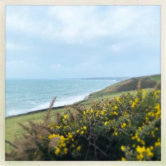
#sea view gunwalloe
Explore tagged Tumblr posts
Text

Cornish colours 💙💚💛
#cornwall#kernow#ilovecornwall#ilovekernow#west cornwall#cornish coast#cornish countryside#thecornishlife#kernowlife#cornish cliffs#coast path#gorse#gunwalloe#sea view gunwalloe
22 notes
·
View notes
Text
by the sea: photo a day challenge
by the sea: photo a day challenge
https://vimeo.com/296165822 by the sea Church Cove Gunwalloe The LIzard

by the sea photography Caryl Beach.

small abstracted mixed media on canvas. Caryl Beach. by the sea
my favourite place to be
a place of contemplation and inspiration

Looking across from St Ives Bay to Godrevy Lighthouse photo a dayhttps://citysonnet.wordpress.com/category/photography/challenges/
View On WordPress
0 notes
Text
SWCP 2017 Day 8: Porthleven to Lizard Town May 19th
It’s a Loe Bar

…But you must pass it to reach the Lizard.
As I mentioned for Day 7, we returned by bus after hiking to Porthleven, and spent the night again in Penzance. The following day we took an archaeological tour, and our guide dropped us that evening at our B&B in Porthleven. Our host thought this was very odd, and indeed I had made the plans assuming that we would take the tour between the nights in Penzance, but this worked out very well.
The morning of the 19th we had an excellent breakfast (scrambled eggs and crab cakes for me) in a sun room / dining area, chatting with the owner of the B&B and with another couple just finishing. Also met the owner’s friendly dog. We were starting a new cycle of Luggage Transfer (2 bags now, with Rob), so we left the payment with the bags and cut across a pleasant churchyard to reach a convenient road to the harbor. At the harbor, we stopped at a bakery and bought pasties for lunch, then rounded the clock tower and were on the path proper by about 10:30. The forecast had seemed iffy so we wore rain gear, but soon stripped it as it was a glorious day, partly cloudy but some blue sky almost always visible.
By 11, we had reached the Loe Bar, a sand bar at the mouth of the Cober River; what was once an estuary was drowned to form the largest freshwater lake in Cornwall. Daniel Dafoe claimed that ships could trade up the Cober to Helston, but other records make clear the bar dates at least to the 13th century, and maybe much further. One legend claims a giant, Tregeagle, was summoned from the dead in the 17th century to testify in a court case. For some reason he couldn’t be returned to this grave, so he was set to moving sand from Gunwalloe to Porthleven – and then he dropped a bag of that sand at the mouth of the Cober to form the Loe Bar. The Loe is also reputed to be the lake into which Excalibur was cast; legends need not be consistent with themselves, much less with each other.
Beyond the Loe, a long beach extends the Loe Bar. The Path climbs a low cliff and follows the edge of that for a while, then back down to its base, climbing again at the end of the beach to follow Halzephron Cliff around the cove of that name. Halzephron means “Hell’s Cliff”, apparently for the number of shipwrecks along here. Some of the mechanical debris along here may be from such wrecks, but other windlasses appear to be from fishing ramps. Around the point of the cliff, we stopped at a bench and chatted with a man walking a pair of whippets, Billie and Ruthie. I took advantage of the bench to change my socks. I kept up that part of my foot ritual despite the dearth of blisters since relearning proper boot-lacing technique; I did skip the incense burning and most of the incantations.
Billie and Ruthie smelled the pasties in our packs and were very interested.
Soon the trail dropped down to the beach at Church Cove, and Gunwalloe Church aka the Church of St. Winwalloe. I always enjoy these old country churches and their graveyards, but I was particularly drawn to the fishing floats and lobster traps behind the baptismal font, and the poignant Great War memorials including small wooden crosses and paper poppies under the next window. The 1924 transcription of a letter of thanks from King Charles I “of blessed memory”, on the other hand, was just odd.
Past the Church Cove beach the path climbs again briefly, with a view down a sheer ravine to waves crashing on rocks. Looking back from around here I could see Hazelphron Cliff in the near distance and Mount’s Bay beyond, while forward was Poldhu Point and a large retirement home, formerly a grand hotel. When we descended to Poldu Cove (oddly, the map spells the cove and the point differently, but that may have been a misprint), we found a picnic table behind a car park and had our pasties. While we ate, we watch a couple of blackbirds for 20 minutes before deciding that they were not, in fact, the famous Cornish Choughs. An ice cream assuaged our disappointment. Out in the cove, hardy surfers braved the cold water.
Climbing up to Poldhu Point then brought us to the site of Marconi’s wireless station, which I had read about in the Eric Larson book Thunderstruck. Like his Devil in the White City, this book combines history and true crime. This was the site of some of the earliest commercial radio, including the reception of the first trans-Atlantic message. An amateur radio center uses the location now, and a memorial by the trail commemorates Marconi’s work. We also spotted an apparent badger sett.
A pleasant cliff walk followed along Angrouse Cliff, descending to Pollurian Cove, then climbing again before reaching Mullion Cove with its old fishing harbor at around 3 pm. The cliffs in this area were not terribly high but were steep, sometimes with slabs of schist, other times covered in tenacious vegetation. More waves pounded on rocks at the base. We watched a variety of seabirds along the cliffs, and noted some vegetation we had not seen before, with thick leaves almost like succulents. This was the Hottentot Fig, Carpobrotus edulis, an attractive import from South Africa to British gardens that is now such a threat to native flora that the National Trust is trying to eradicate it from these cliffs.
Then more cliff walking with open grazing land inland, descending to cross ravines at Predannack and (at 5 pm) the steep valley of Gew-Graze. The landscape has changed by this point, from the flat-cleaving schist to the serpentine that the Lizard peninsula is famous for – softer, mottled greenish or sometimes red. The guidebook mentioned that the Top House where we were staying had serpentine beer-pump handles, and many shops sold small carved pieces as souvenirs.
By 6 we were approaching the prettiest spot of the day, possible of this whole 2 week hike: Kynance Cove. Several large, gorgeous rocks jutted up from the sea a short distance from Kynance cliff, with caves at their bases, and connected to the shore by a beach at low tide. In the picture at the top of this post, you can see several people on the beach, in front of the caves. The trail descended nearly to beach level, so we could have explored if we had more time, but the guide warned of the danger of getting stranded by the tide. One of the rocks is Asparagus Island, and another Gull Rock; there appeared to be thousands of gulls dotting the latter. The clifftop in this area was interesting, also; we spotted a fairy circle of mushrooms, and a stand of wild garlic.
The remaining mile or so to Lizard Point continued to be extremely scenic, if not as spectacular as Kynance Cove. Rounding the point, we had a view of the old Lizard Lifeboat station, and the lighthouse in the distance. This would be another geographical landmark: the southernmost point of England, as Land’s End was the westernmost. It was nearly 7, and we decided to take a footpath into Lizard Town rather than going the short distance further to the road above the old lifeboat station. This didn’t make much difference in distance, but it appeared to save a little up-and-down at the end of a long day (14.1 miles by guidebook, 16.9 by my GPS, and 2500 feet elevation gain). This path took us by a hillock with dozens of rabbits on it, and who knows how many more down inside the warren. We reached the Top House about 7:15, with separate rooms for the night. I had broiled sole for supper, and we shared a cheese tray.
0 notes
Text
I know, that in Malta, we have some breathtakingly gorgeous beaches, but they are crowded with Maltese and foreigners. So much so, that if you are not a proper beach-lover, you do not step foot on any of the beaches during the peak Summer months. In fact, this year, I have only been to the beach once, and this was in September, and only because it was an event which I could not miss – My father’s birthday.
When I mention my love towards the UK, I more often than not are told that in England there aren’t any attractive beaches. Today, I am going to attempt to prove you wrong. This year, in June my partner and I spent some memorable days in Cornwall. We both fell in love with this place, and one of the reasons is the gorgeous seasides.
Lands End This was quite high in our priority for the very reason that it is the southern-most part of the UK. The coastal views are spectacular and it would make a lovely day out, taking in the surroundings, the wildlife, and why not… a picnic by the sea, listening to the waves, blissfully.
Kynance Cove If white sandy beaches and turquoise coloured seas are on your list, this beach is just what you are looking for. To top it off, during our visit towards the end of June, there was almost no one around. This makes your swimming experience just a little bit more special. By the way, at low tide, you are able to explore the caves. Sadly, this was not the case when we visited!
Tintagel Beach By far my favourite – I’d say I am a bit biased by this because of the myths surrounding this place, as well as the extraordinary weather we had and the view of castle ruins on top of the cliff! I admit, this was the busiest of the beach areas we visited, but this did not stop us from capturing several photos of this very photogenic place. You be the judge!
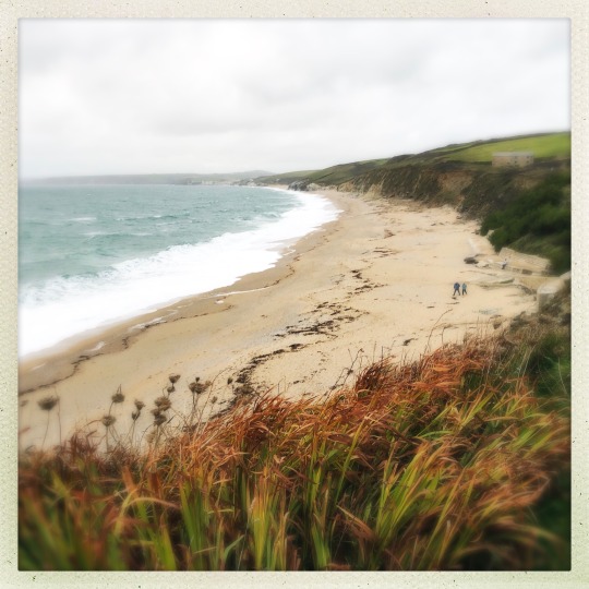
Gunwalloe Church Cove Admittedly, this bay made it into our Travel Plan because there’s a very cute church and cemetery close by. In order to get to the beach itself, there’s a rather long wobbly walk. The panoramas made it bearable as well as the serenity the place offered once we got there. We in fact, had this beach for ourselves, which was rather surprising.
Poldark fans, Kynance Cove and Church Cove are two beaches which were used as filming locations. Can you imagine walking the same steps as Aidan Turner? Now you can! 😉
Of Cornish Beaches I know, that in Malta, we have some breathtakingly gorgeous beaches, but they are crowded with Maltese and foreigners.
#adventure#architecture#bay#bbq#beach#beautiful#blue#capture#castle#cemetery#chruch#church cove#cliffs#Cornish#Cornwall#countryside#cove#crystal#destination#england#europe#exercise#filming#filmset#green#gunwalloe#gunwalloe church cove#heritage#hike#history
0 notes
Text

Gunwalloe
#west cornwall#cornwall#kernow#ilovecornwall#ilovekernow#sea view gunwalloe#gunwalloe#beachlife#cornish beach
45 notes
·
View notes
Text

Summer border
#cornwall#kernow#ilovecornwall#ilovekernow#west cornwall#cornish coast#cornish countryside#thecornishlife#gunwalloe#sea view gunwalloe#border#garden#summer flowers
116 notes
·
View notes