#redstem stork's bill
Explore tagged Tumblr posts
Text

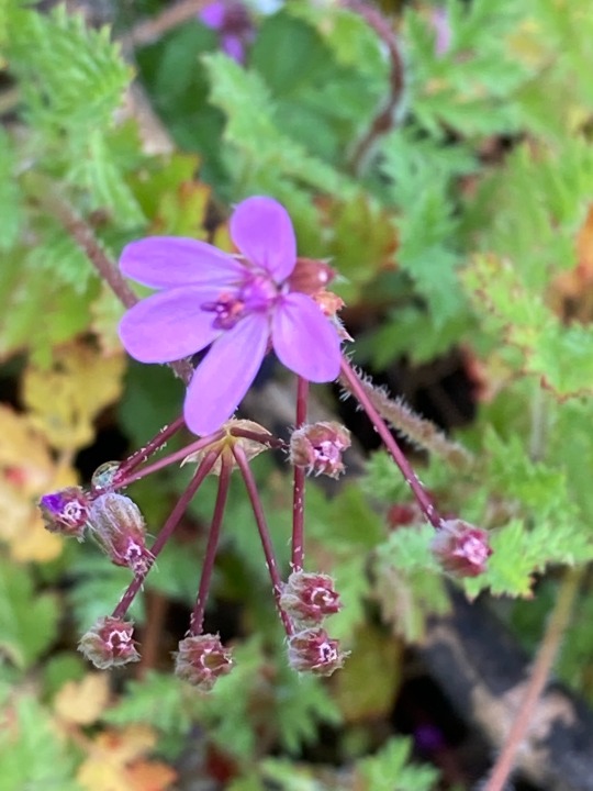

#redstem stork's bill#filaree#erodium cicutarium#flower buds#microflora#cheeseweed#malva parviflora#wildflowers#lawn weeds#encino
4 notes
·
View notes
Text

Scientific Name: Erodium cicutarium Common Name(s): Redstem stork’s bill, redstem filaree Family: Geraniaceae (geranium) Life Cycle: Annual, biennial Leaf Retention: N/A, basal rosette Habit: Forb USDA L48 Native Status: Introduced Location: Allen, Texas Season(s): Late winter
Flowers and developing fruits.
#Erodium cicutarium#redstem stork's bill#redstem filaree#Geraniaceae#annual#biennial#forb#introduced#Allen#Texas#winter#late winter#flower#fruit#pink#plantblr
1 note
·
View note
Text

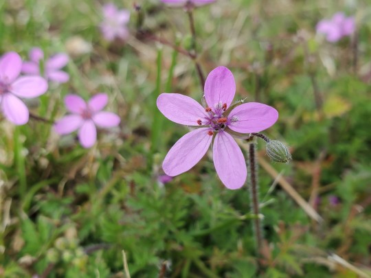

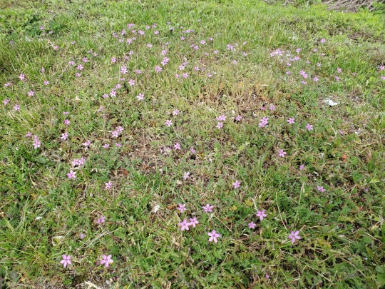
Redstem Stork's bill (flowering & fruiting), Erodium cicutarium
1 note
·
View note
Text


Erodium cicutarium L. Family: Geraniaceae
Common name: Redstem Filaree or Redstem Stork's Bill.
The name "Erodium cicutarium" comes from the Greek word "erodios" meaning "heron," due to the fruit's resemblance to a heron's beak, and "cicutarium" from the Latin "cicuta," referring to the similarity of its leaves to those of the toxic hemlock plant.
5 notes
·
View notes
Text

Redstem stork's-bill (erodium cicutarium).
3 notes
·
View notes
Text
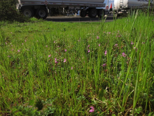
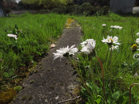


Vacant lots #1: NE Cesar E. Chavez Boulevard and Senate Street, Portland, Oregon. March 2024.
I'm pretty bad at identifying grasses, but some of the other species in the field were: redstem stork's bill (Erodium cicutarium), dovesfoot geranium (Geranium molle), hairy cat's ear (Hypochaeris radicata), narrowleaf plantain (Plantago lanceolata), common chickweed (Stellaria media), common dandelion (Taraxacum officinale), and slender speedwell (Veronica filiformis)

0 notes
Text

20230609 Green River Campground
REDSTEM STORK'S-BILL or REDSTEM FILAREE or PINWEED Erodium cicutarium
0 notes
Photo

Redstem stork’s bill (Erodium cicutarium). At the Tom Mix memorial in Pinal County, Arizona.
#photographers on tumblr#redstem stork's bill#Erodium cicutarium#Tom Mix memorial#Florence#Pinal County#Arizona
50 notes
·
View notes
Text

Geraniaceae Erodium cicutarium
Redstem Stork's Bill
Indentification via Pl@ntNet
1 note
·
View note
Photo
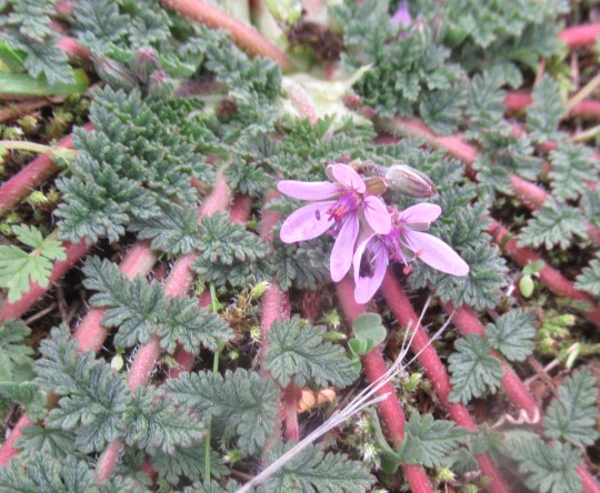
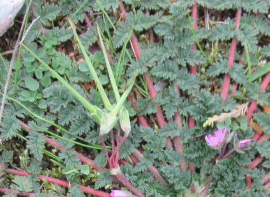
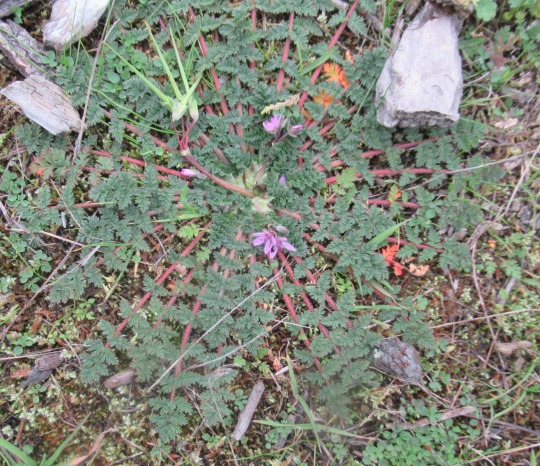
Erodium cicutarium (Common Stork’s Bill, Redstem filaree, pin weed)
A Common Stork’s Bill showing off it’s lovely radial leaf pattern down at Crescent Beach. This Mediterranean species was first brought to North America by Spanish missionaries sometime before 1769, probably by way of livestock imported from Baja California in Mexico. The common name filaree is derived from the Spanish diminutive of alfiler, a modification of the Arabic al-khilāl (the thorn, the pin). These terms refer to it’s seeds.
Thanks to it’s long-persistent styles, the fruits resemble a stork’s bill. As the fruits dry, they split lengthwise into five sharp-pointed segments. The slender style becomes spirally twisted as it dries but it straightens out again when wet. With alternate moisture and dryness this uncoiling, squirming action drives the seed into the ground. It can also disperse explosively throwing the seeds away from the mother plant.
#flowers#photographers on tumblr#Common Stork's Bill#wildflowers#invasive plants#fleurs#flores#fiori#blumen#bloemen#Vancouver
78 notes
·
View notes
Text

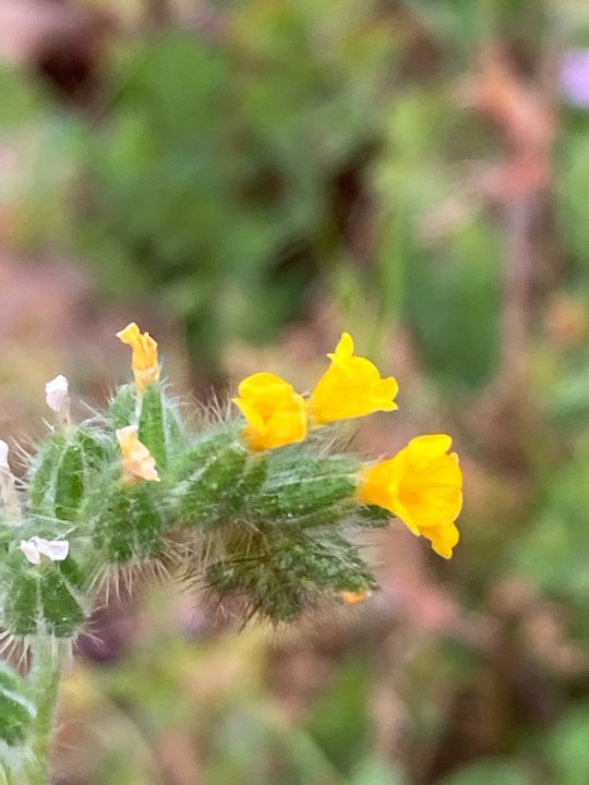

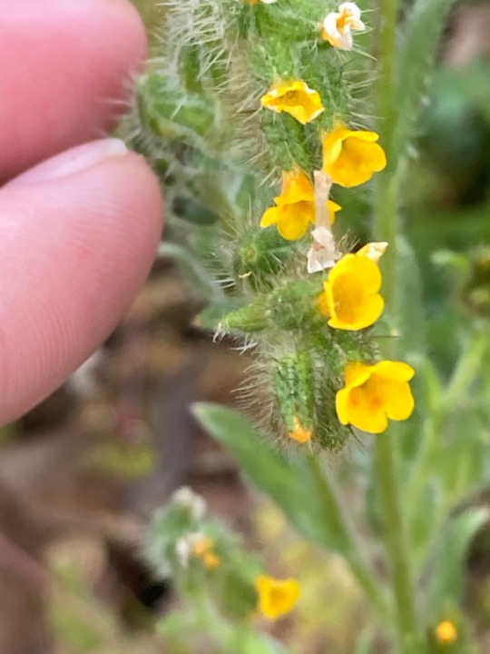
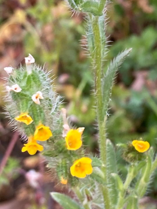
#fiddleneck#amsinckia#redstem stork's bill#erodium cicutarium#microflora#wildflowers#california native plants#encino
2 notes
·
View notes
Text
While away recently for a family funeral, spouse and I took two hours off from running errands, making calls, buying and arranging flowers, delivering food, and so on, to visit Mill Mountain Park in Roanoke, Virginia, on a chilly spring day (60F and windy!). Advertising for the park describes the trails at Mill Mountain Park as “some of the best in the area. The trails feature Roanoke’s highest point — the summit of Mill Mountain (1703 ft.) and the Roanoke Star. This area offers 900 acres of park space atop Mill Mountain, picnic areas, two scenic overlooks, access to additional trails, the Mill Mountain Zoo and the Mill Mountain Discovery Center.”


*
We first ambled through the wildflower garden, 2.5 acres of land “carefully planned, weeded, planted and maintained by [Mill Mountain Garden Club] members since 1971.” (In 2014, the club used the “lasagna method”, a version of sheet mulching, laying down newspapers and leaves to smother invasive plants and prepare the ground for planting.) Having just driven south 13 hours from northern New England, where crocuses were about all that was in bloom, the sight of spring ephemerals and other perennials already in bloom made our hearts sing.
The entrance, with white dogwoods and pink-blooming redbuds:


wildflower garden trail
First, three species of trillium:

white Trillium grandiflorum

closer view of white Trillium grandiflorum (I think … was surprised to see the pink blush)

yellow Trillium luteum in bud

close view of red Trillium sessile, I think (variegated leaves)

small colony of red Trillium sessile (I think)
Bloodroot (Sanguinaria canadensis) leaves (the flowers had already gone by):
Star of Bethlehem (Ornithogalum umbellatum) flowers; lots of people want to eradicate this little gem from their lawns and garden plots as it spreads quite rampantly:

Another ephemeral, Twin Leaf (Jeffersonia diphylla), the leaves only here; Wikipedia says they’re “uncommon spring wildflowers, which grow in limestone soils of rich deciduous forest:”

Virginia bluebells (Mertensia virginica) are also spring ephemerals; “[t]he flower buds of Virginia bluebells are pink due to a chemical called anthocyanin. When the flower is ready for pollination, it increases the alkalinity of the flower, changing the color to blue.” I guess these were almost all ready for pollination!


May Apples (Podophyllum peltatum) were colonizing and blooming. They always remind me of childhood, when I walked a mile or so to 3rd through 6th grades, mostly through a suburban neighbourhood but also through some woods, the closest of which to the elementary school was filled with these every spring. We called them Maypops, which is one of their common names. It’s said that when the May Apple leaves start to flatten, it’s morel season!


This is a plant commonly in flower early in springtime here in N.H., too, if it’s Uvularia sessilifolia (Wild Oats) as I think. But it could possibly be Uvularia puberula (Mountain Bellwort).

One non-ephemeral perennial in bloom this late April was Honesty (Lunaria annua), also known as Money Plant: “Like all members of the mustard family (Brassicaceae), the flowers have four petals. The leaves of Lunaria are roughly heart-shaped with a toothed edge. … The easiest way to identify honesty is by the unique, circular seed pods that form soon after the plant flowers. The shape of the pod calls to mind a coin, hence the name ‘money plant,’ or sometimes ‘silver dollar plant.'”


Another purple bloom, that of the dwarf crested iris (Iris cristata), I think:

This Red-Stem Stork’s Bill (Erodium cicutarium), also called Redstem Filaree, was a new one for me, even though it’s found in northern New England; it’s small, low-growing, and considered a lawn weed:

I also wasn’t previously aware of Primula elatior, oxlip, not native to the U.S.:

I think this is a wood or celandine poppy (Stylophorum diphyllum):

This is a species of Euphorbia, perhaps Euphorbia cyparissias (cypress spurge) or E. virgata (leafy spurge) — I’m inclining toward the latter:


I took this shot of a variety of blooms because I liked the way it looked, and the Plant ID group on Facebook helped me identify Packera aurea (Golden Ragwort — the orange-yellow daisylike flowers) and Geranium maculatum (Wild Geranium, the pale purple flowers) blooming.

The dogwoods were fully in bloom in Roanoke, both white and pink!

I had never seen this foliage before; it’s Arum italicum, also called Italian arum, Italian lords & ladies, and large cuckoopint. It’s not native to the U.S. but has been introduced to only seven states: Virginia, North Carolina, Illinois, Missouri, California, Oregon, and Washington. Its “[g]reenish ivory flowers resemble those of its relative, Jack-in-the-Pulpit, and appear in midsummer followed by stunning orange-red berries” (per White Flower Farm). It’s very poisonous.

We saw a bluebird while in the wildflower garden, too, but a bit far away; still, it’s recognisable.

*
After basking in the wildflowers, we just had time for a 30-minute walk on the Star Trail before prepping for the funeral visitation at 3 p.m. If I’m ever in Roanoke again, I hope to walk more of these trails; they’re not challenging, if you hike or walk much, through some can be a bit steep, and they are all short — ranging from the .22 miles of the Watchtower Trail to about 1.5 miles, the Monument Trail — but they interlock with each other and the roads up the mountain, so you can create a longer walk or hike, and they are only a few minutes from downtown, though, in fact, it felt to me like the sort of place you might run into a bear. And the views of the Roanoke Valley on a clear day — which we had — from the top of Mill Mountain (where you park), are forever.


There’s a handy sign mapping local mountains in view, with their elevation and distance away:

*
The trail map, posted on a kiosk, was useful and seemed accurate for the most part, except that we could not find the Mill Mountain Greenway (inset map) — we walked around for about 20 minutes hunting for it.

*
Some photos from the Star Trail (yellow).

Star Trail entrance (shows blue marking but it’s actually yellow)

on the trail

Star Trail with yellow trail marking

some of the trail was rock or gravel, some clay, with a bit of washout in places, but it wasn’t a wet day, so no problems walking it

I’m always happy to find Spotted Wintergreen (Chimaphila maculata), here with a trio of tuffet-shaped seedheads

more Spotted Wintergreen (Chimaphila maculata) plants — there were lots of them in multiple locations on the trail

mosses

Pearl Crescent butterfly (probably) with some damage but it was flying OK

boulder along trail

a duskywing (Erynnis sp.) butterfly

duskywing (Erynnis sp.) butterfly on blueberry buds

well-marked trails

bench near trail marker

Largus sp. (bordered plant bug) on a rock along the trail
Off the trail, we saw and moved this handsome millipede in the parking lot!

*
Thanks for taking this field trip with me!

Field Trip: Mill Mountain, Roanoke, VA While away recently for a family funeral, spouse and I took two hours off from running errands, making calls, buying and arranging flowers, delivering food, and so on, to visit Mill Mountain Park in Roanoke, Virginia, on a chilly spring day (60F and windy!).
#butterflies#Italian Arum#Lunaria annua#May Apple#Mill Mountain Park#Mill Mountain trails#Mill Mountain Wildflower Garden#Roanoke#Roanoke VA#spotted wintergreen#spring ephemerals#spring wildflowers#trillium#Twin Leaf#virginia#Virginia Bluebells#wildflowers
2 notes
·
View notes
Text
I decided to snag another plant.
This one was from my yard.
I just thought it looked cool.
I have identified it as probably Erodium Cicutarium, aka Redstem Stork's Bill. It's an annual/biannual that's edible and has been used medicinally for a variety of things. (Note: http://tropical.theferns.info/viewtropical.php?id=Erodium+cicutarium )
Guess it won't be around long. I guess they send seeds all over the place.
Guess I'll put it outside as soon as it flowers and let it seed the front yard.

#I just thought it looked cool#apparently used to stop bleeding and for joint pain#so... that's actually total win for me#I put it in the wrong soil... so I guess I might go in there and change it out#we'll see how it's feeling about it tomorrow
0 notes
Link
No side effects and contraindications are yet known. Erodium cicutarium (Redstem Stork's Bill) - 70 mg;. Geranium sanguineum (Bloody Cranesbill) - 70 mg. Astragalus glycypyhyllos (Wild liquorice) - 260 mg;.
0 notes
Photo

Erodium cicutarium
Erodium cicutarium, also known as redstem filaree, redstem stork's bill, common stork's-bill or pinweed, is a herbaceous annual – or in warm climates, biennial – member of the family Geraniaceae of flowering plants. It is native to the Mediterranean Basin and was introduced to North America in the eighteenth century, where it has since become invasive, particularly of the deserts and arid grasslands of the southwestern United States. More details Android, Windows
1 note
·
View note
Text
River Trail Loop in Deschutes River State Recreation Area
Right before spilling into the Columbia River, the Deschutes River flows down a canyon between grass and sagebrush-covered ridges with basalt outcroppings. Alongside the river, a pair of parallel trails allow hikers to enjoy a 3.1-mile loop with a variety of fine views.
The level River Trail (also known as Blackberry Trail) hugs the riverbank, while the rolling Upper Trail (also known as Riverview Trail) crosses a grassy terrace with broader vistas up and down the Deschutes. The exposed slopes of Deschutes River State Recreation Area can be a sunny change of scenery for those traveling from Portland and other forested areas to the west.
(adsbygoogle = window.adsbygoogle || []).push({});
The hike begins from the end of the road through Deschutes River State Recreation Area, which has a 63-site campground and is located 15 miles east of The Dalles. Set out south from the end of the road, crossing a field toward a pair of signs at the start of the trails.
Walk across the grass for 0.15 miles to the trailhead where the loop on single-track trails begins. To the left, a trail rises toward the Old Railbed Trail, which goes up the river for 16 miles and is popular with mountain bikers. On the way up, the trail to the left meets the Upper Trail, also referred to as Riverview Trail (and potentially also referenced as Middle Trail). To the right of the trailhead signs is the beginning of River Trail (more formally called Atiyeh Deschutes River Trail and less formally known as Blackberry Trail).
The directions for the loop described here venture out on River Trail and return via the Upper Trail, although the loop could definitely be enjoyed in the opposite direction. Upper Trail provides more overviews of the river and its surroundings while River Trail gets right up next to the water.
Begin hiking on River Trail, which offers an easy, level experience that gains 20 feet in 1.3 miles. Push through an early thicket to absorb open views over mellow rapids. Tufts of grass forms small islands in the Deschutes River.
The Deschutes River from River Trail
Proceed up the River Trail, gazing south toward grassy ridges that overlap nicely where the river weaves through the terrain. A tall grassy ridge rises above the opposite (west) side of the river canyon. The slopes above the trail are covered is sagebrush, topped by darker outcroppings of volcanic rock. Although it is quite close, the Upper Trail isn’t visible from River Trail.
After 0.4 miles, River Trail passes a gage station where the flow of the Deschutes River is measured. Just past the river gage, come to a junction with a sign displaying two arrows; River Trail is straight ahead, while Middle Trail is to the left. The sign indicates a short path that rises toward a low spot on the Upper Trail. This shortcut path can be used to form a loop of about 1 1/3 miles round trip. Unless you’re eager to cut things short, continue walking straight on River Trail.
The views change gradually as you make your way along the Deschutes River. The trail passes a bench beside a large lichen-covered boulder where you may take a break in the shade. Shortly thereafter, the trail crosses wooden bridges and boardwalks through a damp area where springs feed into the river. The end of the boardwalk has a viewing platform with another bench for resting with river views.
Hiking up River Trail
Continue on River Trail through thickets of blackberries and across a grassy area with intermittent small trees. Worried you’ll stray off course? The hillside to the left and the river to the right make the trail contained and easy to follow.
Wrapping around bends in the river, the trail offers nice views north toward grassy hills in the state of Washington. These are the Columbia Hills, which rise to Haystack Butte.
Looking down the Deschutes River and River Trail (aka Blackberry Trail)
After a little over a mile on River Trail, pass a privy-style bathroom for those who need one. In another quarter mile, the trail reaches an important unmarked junction. On the way to this junction, the trail crosses through a thicket where a stream flows across the trail. During the wet months, hikers can rock hop across. Cross a grassy area for another 0.2 miles to a point where the trail stops being level and rises up the slope to the left. On the right, a less-worn extension of River Trail continues along the riverbank. Make sure to turn left!
The trail climbs from the riverbank
Rise up from River Trail, weaving up a recess in the terrain to rapidly gain 80 feet of elevation. Arrive on the edge of a grassy terrace, a short distance up from River Trail and 1.5 miles from the start of the hike. Come to a 3-way junction. Ferry Springs Trail goes to the right, offering a longer loop. Turn left onto Upper Trail (Riverview Trail) to proceed into the second half of the River Trail – Upper Trail Loop.
The small gain in elevation has a surprisingly substantial impact on the views. The perspectives up, down, and across the river are suddenly much broader. Big views of the big landscapes remain constant as you hike north across rolling slopes spotted with sagebrush. The sun-exposed grasses host wildflowers like longleaf phlox and redstem stork’s bill.
Crossing a grassy terrace on Upper Trail
Looking north down the Deschutes River
After about a quarter mile, Upper Trail drops into a ravine, crossing a stream that is lined by blackberries. Continue through rolling grasses, past a few small green info panels describing the area’s history, animals, plants, and climate. After 0.6 miles on the Upper Trail, pass an informative panel beside a bench with excellent river views. A nearby path connects up to the Old Railbed Trail and you may spot bikers using the bigger trail. The panel reads:
The most predominant songbird in the Deschutes River Canyon is the western meadowlark. It is the Oregon state bird. Open grassland like the surrounding slopes are prime meadowlark habitat. While the meadowlark is a migratory bird, these birds can be found year round. The song of the meadowlark is particularly beautiful, as it drifts from hillside to hillside.
Upper Trail offers boasts views south up the Deschutes River
Look down over rapids in the Deschutes River as it flows around a gradual bend. Continue up the single-track trail, which dips through a rocky creek crossing. After another rise, the trail heads downhill, aligning hikers with views of the end of the Deschutes River where it joins the Columbia. In the background, the Columbia Hills rise to the north.
The Deschutes River meets the Columbia River
As Upper Trail sinks toward the river, spot the gage station along the lower trail. Pass a bench and a junction with the shortcut path coming up from River Trail. Proceed straight, hiking north into the final half mile of Upper Trail.
Rising into more sagebrush, bushes, and small basalt outcroppings, Upper Trail weaves past a few cherry trees with fragrant spring blossoms. Take a break at the last bench to soak up river views. Near the end of the trail, pass one more panel with insights into the plants that you’ve been hiking past:
This area, with an average annual precipitation of 11 inches, and extreme summer temperatures combined with drying winds, makes it intolerable for most types of vegetation. Some common plant types found in this area are sagebrush, rabbit brush, bitter brush and hackberry, as well as numerous annual and perennial plants and grasses.
(adsbygoogle = window.adsbygoogle || []).push({});
When Upper Trail ends at a T-junction, turn left and descend a hundred yards to the signs by the start of River Trail. Make the obvious right turn and walk back across the lawn toward the parking area at the end of the park road.
Dogs are allowed on River Trail Loop, but bikes and horses are not permitted. Including the grassy walk between the road and the trailhead, River Trail Loop is 3.1 miles long with 115 feet of rolling elevation change. Be on the lookout for rattlesnakes, which live in this area. No permit is needed for this hike. Deschutes River State Recreation Area does not have a day use fee and only charges for overnight parking and camping, so day hikers can enjoy the Deschutes River at no charge.
The basic directions for River Trail Loop are:
Begin by walking south from the end of the park road (0 miles)
At the trailhead signage, proceed to the right onto River Trail (0.15 miles)
Pass the gage station and a connector rising to the Upper Trail (0.6 miles)
Pass a privy along the trail (1.2 miles)
Bear left at a split to rise toward Upper Trail (1.45 miles)
Climb to a junction with Ferry Springs Trail and turn left on Upper Trail (1.5 miles)
Pass the connector trail coming up from River Trail near the gage station (2.4 miles)
At the end of Upper Trail, turn left and hike down to the trailhead (2.9 miles)
Back at the trailhead, turn right and walk across the field (2.95 miles)
Return to the parking area at the end of the park road (3.1 miles)
To get to the trailhead: From The Dalles, which is 75 miles east of Portland, travel east on Interstate 84 for 12 miles to exit 97. At the end of the offramp, turn right and make an immediate left on Route 206. Drive east for 3 miles. Just after crossing the Deschutes River, turn right into the entrance of Deschutes River State Recreation Area. Pass a trailhead on the left and drive a third of a mile through the park campground to the area at the end of the road where the hike begins.
Trailhead address: Deschutes River State Recreation Area, Wasco, OR 97065 Trailhead coordinates: 45.6293, -120.908 (45° 37′ 45.5″N 120° 54′ 28.8″W)
from hikespeak.com https://www.hikespeak.com/trails/deschutes-river-trail-loop-deschutes-river-state-oregon/
0 notes