#north south commuter rail
Explore tagged Tumblr posts
Visit Tumblr Blog
Explore Tumblr blogs with no restrictions, modern design and the best experience.
Last Seen Tumblr Blogs


Fun Fact
1,644 Tumblr posts in 1 second.
Text
North-South Commuter Railway Updates
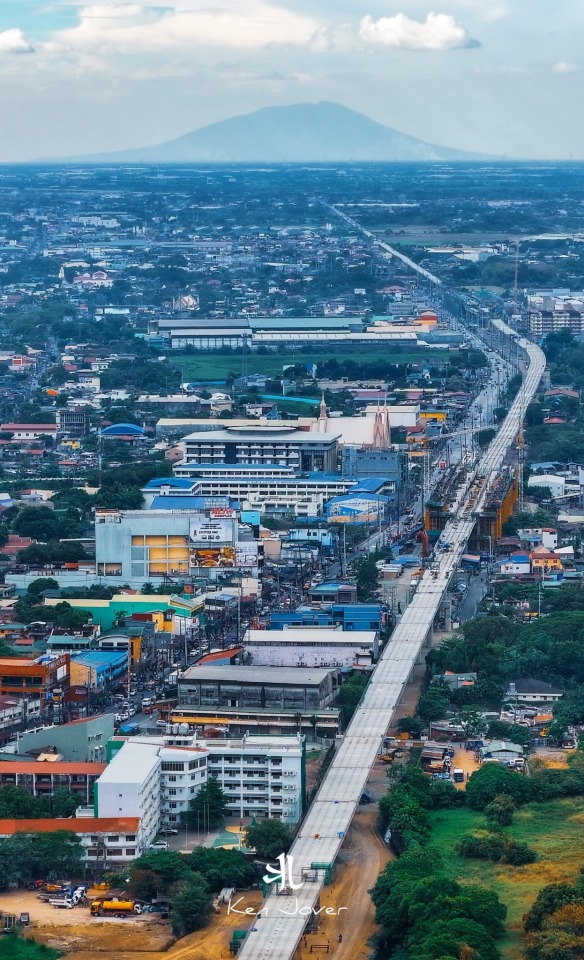
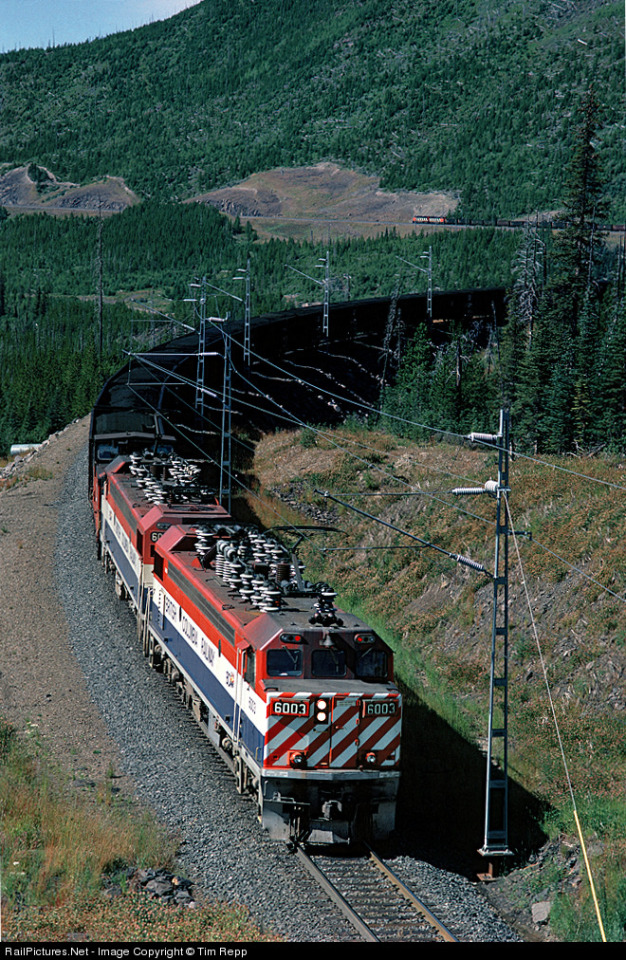
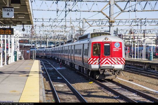
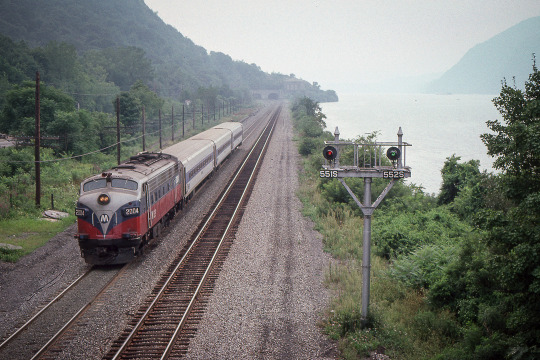
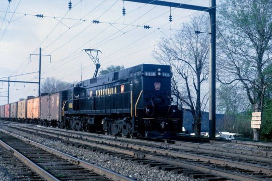
You definitely should see this 😍 Just picture yourself traveling north on the NSCR train, with the breathtaking view of Mt. Arayat 😃 📍 North-South Commuter Railway (North Bound)Meycauayan and Marilao Station Dotr #PNR #Dmci #NSCRProject #Meycauayan #MarilaoBulacan #Marilao #Bocaue #MtArayat #Pampanga credits to: Ken Jover
View On WordPress
#abs-cbn philippines#jm listings#livestream philippines#north soith commiter railway project#north south commuter rail#north south commuter railway#north south commuter railway project#north south commuter railway project phase 1#north south commuter railway update#north-south commuter railway project#philippine news#Philippines#philippines news#philippines news today#pnr north south commuter railway update#south commuter railway#south commuter railway project
1 note
·
View note
Note
Trains? >:3
TRAINS :D


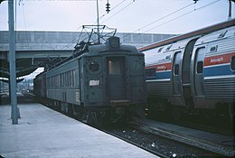
#trainposting#amtrak#electric traction#pennsylvania railroad#electrification#public transit#suburban rail#commuter rail#commuter train#bc rail#tumbler ridge#new york central#caltrain#metro trains#metro north railroad#Northeast corridor#south african railways#asks
19 notes
·
View notes
Text
when i start to feel hopeless i start naming the train lines they're building in manila just so I have smth to hope gfor
#i love you mrt 7 extension#i love you manila subway project#i love you lrt 2 extension#and most specially north south commuter rail <33#manila to laguna in 30 mins 😭🥺🥰
1 note
·
View note
Text
Me at a still-north-of-Seattle transit center, looking around and noticing a whole new fucking light link rail behind the transit center with trains coming and going on it: WAIT. THAT'S A THING NOW???? ARE THEY DONE????? CAN I USE THAT YET???????????? PLEASE...
Turned out...no, they will not be in operation until halfway through September. So I guess they're just testing the new rail and the trains. But, SIGH, it would make my travel plans so much faster and easier...
#crystal visions of lilies in the valley#but it would reeeeeeeeeeeally make my life so much easier if THE LINK RAIL JUST WENT ALL THE WAY SOUTH TO WHERE I LIVE#I mean yeah we have the commuter train and amazingly there is one that goes to and from my neighborhood SOMETIMES throughout the day#but it only goes to downtown Seattle and to go any further north (in good time) I DO have to take the link rail.#and man I still fucking wish that there were more times that the commuter train left. both trains deserve that!#but no. the one that goes from Seattle to Everett only runs four times IN THE ENTIRE FUCKING DAY. it's such bullshit.
0 notes
Text
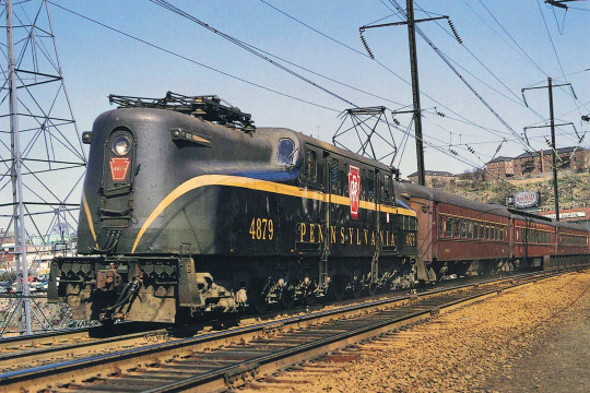
These are DC power right?
1500 Volts DC just like the South Shore Railroad rather than the 12,000 Volts AC used elsewhere
This one is the Old South Shore Railroad in Indiana and is an Essential service for getting commuters into Chicago
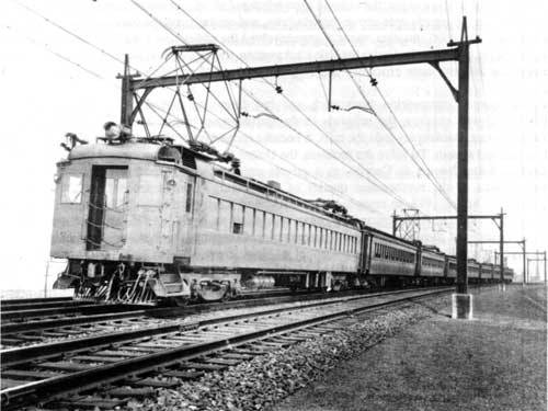
However these lower one each use a different electrical system some use the 12,000 Volts AC but others use 750 Volt third rail or 3000 Volts DC used by the Lackawanna Railroad
And also the AC lines use a mixture of 60 and 25 Hertz traction systems
And of the course the M2/M4/M6 and M8 are multi voltage and can switch between multiple different electrical systems
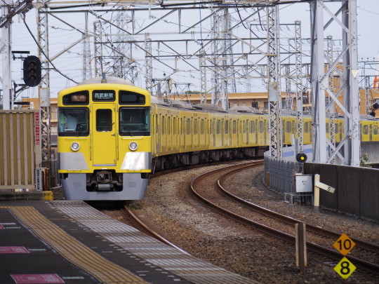
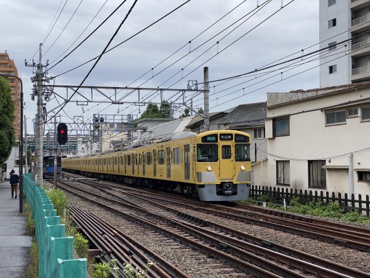
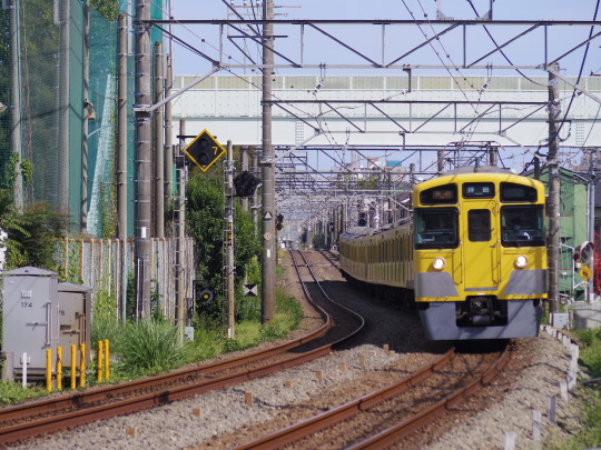
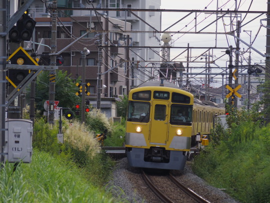
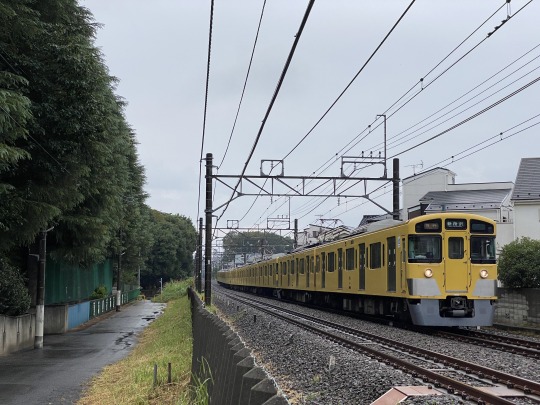
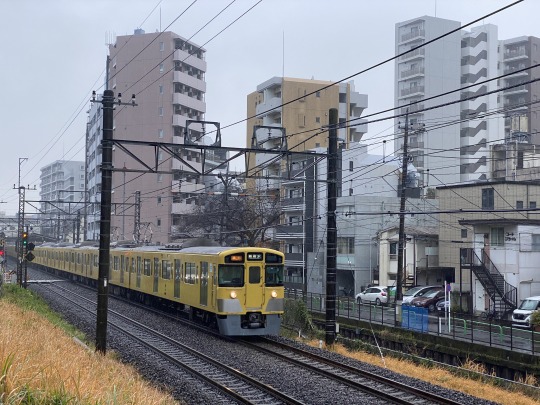
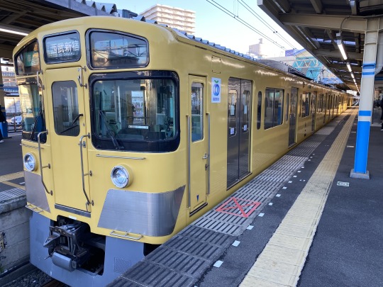
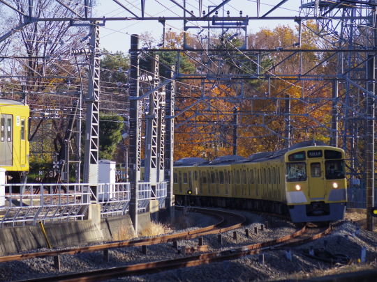
2023.5.30~12.15 東京 埼玉 西武新宿線 西武拝島線
西武新2000系 本川越・拝島側の小窓
西向きか北向きなので曇り・雨の日か、逆光が多い
#commuter train#trainposting#electric traction#electric train#mta metro north#metro north railroad#commuter rail#long island railroad#infodump#electricity#im autistic about trains#electrified railroads#south shore railroad#american railroads
47 notes
·
View notes
Text
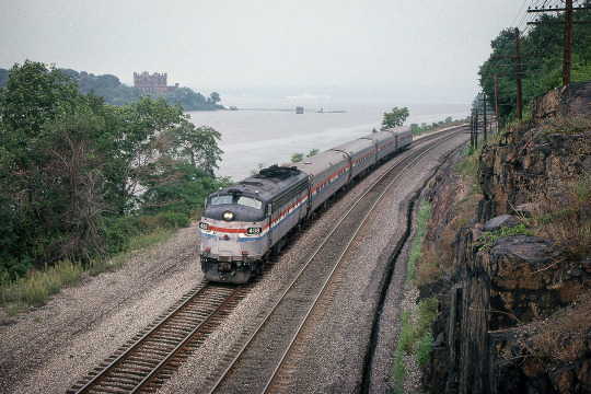
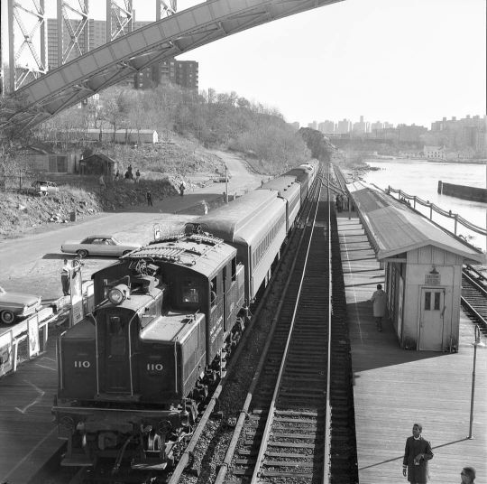
Along the Hudson River This is simply a wonderful spot on the face of the earth—we’re north of Cold Spring, New York, along the Hudson River, at Breakneck Ridge. Metro North still stops here, mainly for the benefit of hikers who want to explore the rugged landscape in this area (known as the Hudson Highlands). The “station” stop is just south of where the first photograph was taken with a few trains making stops each way, each day on the weekend. The land mass visible behind the southbound train in the first image is called Pollepel Island, and the structure thereon is called Bannerman Castle. The second photograph was taken the same afternoon at the same location—but looking south. It shows a Metro North commuter train headed north, most likely headed for Poughkeepsie. Also visible in the image, across the river, is the dramatic and massive form of Storm King Mountain. The model of locomotive, seen in both photographs, is interesting as well—the EMD FL9 was a unit designed specifically to be used for New York’s Grand Central Terminal—the destination for these trains at the time. [I believe all Amtrak trains traveling the water-level route currently end up at Penn Station now.] This unique engine is diesel-electric but also has a pick-up “shoe” for the electrified third-rail. This way the diesel prime-mover could be shut off or at least idled when in the tunnels under Madison Avenue and in the bowels of the massive terminal itself. Two images by Richard Koenig; taken in August of 1988.
#metronorthrailroad#metronorth#hudsonhighlands#hudsonriver#breakneckridge#pollepelisland#bannermancastle#amtrak#newyorkcentral#filmphotography#grainisgood
68 notes
·
View notes
Note
ok wait i am fully sold on the north station/south station connection through cambridge and i've lived in boston most of my life and have had no idea what that bridge over the charles is for...so does it connect up to the commuter rail tracks like under I-90?
It’s an old freight rail line but the right of way is intact and connects the yard at boston landing to the yard at Community College. I’d have to talk with people more knowledgeable about the property situation there to see how the land is owned but going south to north nonstop through boston would be easiest if it were refurbished.
The problem is money. Where are people going that a nonstop route through boston is so valuable? the answer is kinda just maine: Even canada is more accessible through New York because there are less mountains in the way and if it’s truly non-stop it doesn’t matter where you travel through. Conversely, if it isn’t non-stop, taking the orange line to the red line isn’t that big a deal in the grand scheme of things. Sure it’d be faster but only by 30-40minutes.
In the short term, the most valuable thing that could be done with it is non-revenue moves, where equipment and cars and such can be shuffled around more efficiently. Currently the north south connection that exists for non-revenue moves is (I think) in waltham, and a closer connection would increase speed quite a bit. However, non-revenue moves aren’t particularly good in the first place, even if they are necessary at some level, so building out infrastructure to make them easier isn’t always a winning proposition.
It’s unlikely we see any major developments here. The best thing that could happen would honestly be a circle line routed across that bridge, but no such plan exists right now. Something happening there is much more likely than a north-south connection though, which has all the same problems and is in a harder to build location.
19 notes
·
View notes
Text
this is fucking deranged
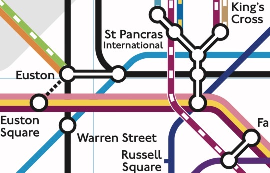
this is baso one train interchange why does it look like this
[ID: extract from National Rail's supplement to the london tube map, with commuter rail lines as well as the tube. this extract shows that map's depiction of the king's cross st pancras and euston area, large rail interchanges extremely close to each other that together become the busiest heavy rail terminus in the uk. both euston and KCSP, and the nearby farringdon, are depicted as an 'internal interchange', which means there are platforms connected by tunnels, as opposed to a regular interchange with multiple entrances on the surface. internals are depicted as circles connected solid bars, while externals are simply one circle. euston and farringdon have two connected circles, while KCSP has six. euston is also connected via a dashed line to ‘euston square’, indicating the two stations are less than ten minutes apart and foot traffic is encouraged (‘square’ is actually literally just outside the entrance of euston). the western lobe of euston is depicted as the terminus of the Lioness Line (orange) and the northwestern railway (lime with bars), which emerge from the station going northwest, depicted as being attached to each other. passing through this lobe is the western branch of the Northern Line (black). the eastern lobe of euston depicts the other branch of the Northern Line, coming from the north but turning east at euston to travel to KCSP, intersecting with the Victoria Line (azure), coming from the southeast before also turning east at euston to run parallel to the Northern Line towards KCSP, though with a gap between the two. no rail termini emerge from the western lobe of euston. the next stop on the western branch of the Northern Line after (western) euston is warren street, which also is the next stop for the Victoria Line after eastern euston, creating a right-angle triangle with the Victoria, western Northern, and the euston internal interchange. to western euston’s southwest via the ten-minute walk dashed line is euston square, which is an interchange for three tube lines, the Hammersmith City (salmon), the Circle (yellow), and the Metropolitan (dark magenta) all of which run next to each other horizontally. the three lines cross the northern-victoria-euston triangle without stopping at euston itself, towards KCSP.
KCSP is an intimidating Y shape of six lobes - three in a vertical line, then two emerging on the northwest spoke and one on the northeast. despite the name of this underground station, drawn as the internal interchange, being ‘king’s cross st pancras’, the giant Y is actually not labelled this at all - the western fork hovers near the label ‘st pancras international’ while the eastern hovers near ‘king’s cross’, and the southern fork remains unlabelled. the southernmost lobe of KCSP is for the glued-together Hammersmith, Circle and Metropolitan from euston square (not euston proper), after which the lines turn southeast to farringdon. this lobe also is for the Piccadilly line (navy), which comes from the northeast before turning south - the only Piccadilly stop in the KCSP-euston area. the middle of the three vertical lobes is for the Northern, travelling east from euston - and nothing else. the northernmost of the vertical lobes is for the Victoria - and absolutely nothing else. the Victoria crosses the Northern at euston whilst travelling diagonally, but then deliberately creates itself a gap before turning horizontal, to reach a separate lobe from the Northern due to KCSP being an internal interchange. both the Northern and Victoria politely duck under the Piccadilly after KCSP. from the Victoria lobe emerges the two spokes for king’s cross and st pancras international. King’s Cross is the terminus of the Great Northern (golden-brown, bars) and a branch of the Thameslink (maroon, bars), both heading north but separated by a tiny gap from each other. the first of the two lobes for SPI is the terminus for HS1 (blue, bars of yellow), which is absolutely not a commuter line - it goes to bloody Paris. this lobe is also bisected by a different branch of the Thameslink, going vertically, after which it sails over the Victoria, Northern and the triple glued-together lines, immediately after which it turns southeast, over the Piccadilly to farringdon. HS1 and this Thameslink out of SPI are once again separated by a tiny gap. the western lobe of SPI is the terminus of the EMR (cyan, bars), which emerges due north. the gap between the EMR and Thameslink is almost imperceptibly larger than the gap between Thameslink and HS1. after the lowest lobe of KCSP with which they intersect the Piccadilly, the triple lines (Hammer., Circle, Metro.) turn southeast to the northeasternmost of farringdon’s two lobes, with which they intersect nothing. this lobe is connected via an internal interchange to another, which is where it intersects the Thameslink coming from SPI, but also the Elizabeth Line (violet)/end ID]
34 notes
·
View notes
Text

Psst! If you live in new york, have an interest in NYC transit, are a transit enthusiast, or are any combination of those things, please speak out against Queensway! Queenslink (pictured above) is a much better project, as it:
Creates only the second north-south link across the Long Island portion of New York City, making vital connections.
Extends service to the Rockaways, shortening commute times and allowing for the reorganisation of services along the Rockaway branches, allowing service to flow better.
Creates major connection points in southeastern queens, relieving busy change points at Broadway Junction and Sutphin Blvd
Allows for the g train to potentially be reinstated along Queens Blvd due to the freed up terminal capacity at Forest Hills
Creates exactly the same thing Queensway does - Parks, grade separated biking infrastructure - all without compromising the improvement of transit in Queens
Is CHEAP NEW TRANSIT IN NEW YORK CITY!!!!! The new line runs on existing infrastructure, meaning the only major new infrastructure would be the stations.
Woodhaven Blvd on the (E) (F) (G) (M) (R) would become an express station, freeing up capacity at Jackson Heights and Forest Hills.
For more information, see
youtube
Remember: SAY "NO WAY" TO QUEENSWAY!
And if Andrew Lynch somehow finds this: Have you considered a station somewhere near Fleet St?
19 notes
·
View notes
Video

flickr
Border City por David Blazejewski Por Flickr: Inbound Keolis/MBTA shuttle train 1974 from Fall River to East Taunton with six bi levels led by Rotem cab car 1854 and shoved by MPI HSP46 2035 hustles north in this view looking south off the New Street overpass just south of the new Weaver interlocking at MP FS 9.4 on the Fall River Secondary that controls access to the new Weavers Cove layover facility. In the background rises the five story historic brick Italinate styled Border City Mill No. 2 erected in 1873. It is the largest surviving element of the once-sprawling Border City Mill complex which produced primarily shirting and sheeting fabric. Designed by Josiah Brown, is is one of the city's few brick mills, as most others were build of locally quarried granite. It operated until around 1940 and was listed on the National Register of Historic Places in 1990 and today is refurbished as residential space. This rail route into the city of Fall River opened in 1846 and saw continuous passenger service under the auspices of the Fall River Railroad and then the Old Colony system until the latter was folded into the New Haven Railroad in 1893. The NH continued daily service to Boston until September 1958 when all passenger service ended to south of Middleboro including to the famed whaling port of New Bedford. In June of 1959 Middleboro lost service along with the other former Old Colony branches to Plymouth and Greenbush. Commuter service returned to Middleboro and Plymouth in 1997 and Geeenbush a decade later but the extension south had to wait until now. Fall River, Massachusetts Friday March 28, 2025
3 notes
·
View notes
Text


Motorisation In The UK
In Britain, the road lobby is represented by the British Road Federation, founded in the 1930s to “combat the sinister and distorted propaganda of the railways to enslave British Industry”. It is a coalition of car makers such as Ford, motor organisations such as the AA and RAC, road builders, oil companies, lorry operators (e.g. the Freight Transport Association) and big business. They all believe economic growth and profit depends on having an efficient road network, a belief shared by government through the Department of Transport. It was a Labour government that started the demolition of the railway system. Some 46% of the track was torn up and much of the rest run down. The Tory Government of the 1990s continued the work. The road lobby was in the vanguard of rail privatisation, an asset-stripping bonanza to dwarf that of the buses. The strategy of the road lobby is to continually up their demands. If the road is a single lane, dual it. If dual lane already, give it three lanes or four. If somewhere doesn’t have a by-pass, give it one. If there is one to the south, give it one to the north. If it has an orbital road build another, and so on. Additionally, no road can be built without grabbing huge acreages of land alongside for “infrastructure”: hypermarkets, industrial estates, commuter housing and so on. This in turn creates loads more traffic, requiring the road built a few years ago to be expanded; and so the cycle of ‘development’ goes on.
#anarcho-communism#anarcho-primitivism#anti-capitalism#capitalism#class#class struggle#climate crisis#colonialism#deep ecology#ecology#global warming#green#Green anarchism#imperialism#industrialization#industrial revolution#industrial society#industry#mutual aid#overpopulation#poverty#social ecology#anarchism#anarchy#anarchist society#practical anarchy#practical anarchism#resistance#autonomy#revolution
3 notes
·
View notes
Text

Thursday 14 November 2024 - N453 leads retired and debranded carriage set SH31 through Newmarket bound for Seymour. Plus 92 more new photos in the V/Line - H set retirement, Commercialising commuters, Railway advertising and promotions, Southern Shorthaul Railroad Bendigo transfers, Pacific National broad gauge in Melbourne, Kinetic Melbourne, Transit Systems Victoria, Metro Tunnel portal works at South Kensington, Special trains to Flemington Racecourse and Melbourne Showgrounds , V/Line around Melbourne, Yarra Trams - Melbourne's north-western suburbs, Metro Trains Melbourne - Northern group, Track, rail and sleepers, V/Line at Southern Cross Station, Failing infrastructure at Southern Cross Station, Melbourne tram interiors, Southern Cross Station, Melbourne electric multiple unit interiors, Melbourne Airport Rail, Metro Trains Melbourne trackwork, Melbourne suburban bits and pieces and Failing rail infrastructure of Melbourne albums https://railgallery.wongm.com/page/archive/2024-11-14/
2 notes
·
View notes
Note
:3

transgender blast
:3
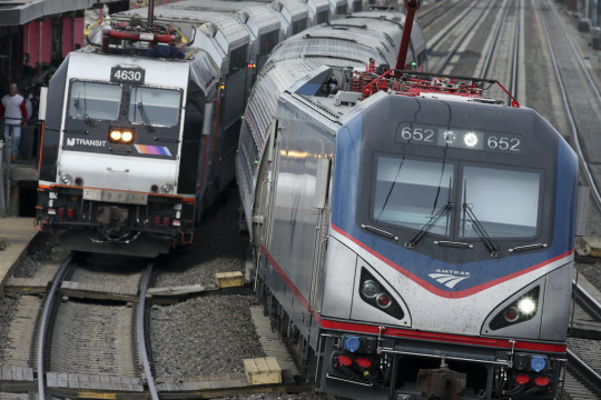
#trainposting#amtrak#electric traction#go transit#go train#new york new haven and hartford#new haven#mta metro north#metro north railroad#south African Railways#Denver rtd#commuter rail
13 notes
·
View notes
Note
Northeast corridor, what do you know of it either way I will tell you

The Northeast corridor is the longest electrified mainline in the western hemisphere it stretches from Washington DC to Boston the line is 457 miles long (735 kilometers) and is the busiest passenger rail corridor in north America it is Electrified with 3 different voltages 12kV 25Hz AC between DC union station and New Rochelle, 12.5kV 60Hz between New Rochelle and New Haven, and 25kV 60Hz between New haven and Boston South Station
These different sections all have different ownership and where Electrified at different points the New Rochelle to New Haven section is the oldest and was Electrified in 1910 by the New York New Haven & Hartford Railroad originally at 11kV 25Hz AC (however the voltage was boosted and was increased to grid frequency in the 1970s)
the line between DC union and New Rochelle was all owned by the Pennsylvania Railroad and was Electrified in Pieces starting 1912 with the Philadelphia to Paoli section and that Pennsy owned trackage was fully Electrified by 1934
However after the collapse of the Frankenstein Penn Central (the Merger of the Pennsylvania Railroad with the New Haven and New York Central Railroad's) the line was taken over by state run passenger agencies like NJ Transit, and the two new federally owned railroad's Amtrak and Conrail
Conrail ran freight on the NEC using the E33 and E44 electric Locomotives until 1981 and Amtrak took over the Northeast Regional and commuter trains were taken over by SEPTA, NJ Transit, Metro North, The Long Island Railroad, CTrail, MARC, and MBTA
That has been an infodump about The Northeast corridor
i love the northeast corridor so i did know most of this but i appreciate train
12 notes
·
View notes
Text
I am getting flak for my opposition to the north-south rail link and want to clarify: The commuter rail isn’t set up to move you from point A to point B unless point B is Boston. This is because of the economy of scale. Given the practical reality, you should probably drive most short trips in MA unless you live in Boston because very few single town pairs have sufficient gravity to warrant a mass transit solution. This isn’t to say that more or better trains aren’t an overall good, but a system that is overbuilt is going to limit its own ability to effectively serve the public, and cars are, practically speaking, a more autonomous and therefore efficient mode of transport in zones of uniform low density.
When greater Boston has trains and buses that serve significantly more demand than they do now, a north south rail link could be a logical next step, but for right now the corridors that would represent the greatest increase in T Benefit are Everett, chelsea and SoWa/Roxbury/Dorchester and it’s not close.
The tool I have to measure this is a gravity model, which doesn’t give you an absolute number of trips but can give you a comparison between two city pairs.
Population (x) x population (y)/distance^2
Let’s look at some pairs:
Boston-Hingham
Boston population (in thousands): 675
Hingham population (in thousands): 24
Distance: 17 miles
Score: 56
Boston-Concord
Concord population (in thousands): 18
Distance: 18 miles
Score: 37.5
Concord-Hingham
Distance: 31 miles
Score: 0.44
These three pairs show that while only slightly fewer people are likely to travel to boston from concord than hingham, people are 100 times less likely to make a trip from hingham to concord than boston. These are fairly characteristic of commuter rail communities, and transit should reflect that. The commuter rail is organized to get people to boston for a reason. Now, compare that to boston-cambridge or boston-brookline.
Brookline population: 63,000.
Distance: 4 miles
Score: 2,657
Cambridge population: 118,000
Distance: 3 miles
Score: 8,836
These are well connected, peer urban areas with light or heavy rail in proportion to their weight. But now look at Everett:
Population: 49,000
Distance: 4 miles.
Score: 2,064
logically, It should have nearly as much transit as Brookline, which has two and a half legs of the green line. It doesn’t, although the T is fixing this with increased bus connectivity. SoWa/Roxbury/Dorchester is the hardest one to look at here because it’s actually part of boston, meaning I have to change some assumptions about distance and population. I have been up to this point using government center as my boston location, and I’ll pick franklin park as my location for dorchester. I’ll be subtracting the dorchester and roxbury populations from the boston population to get an estimate.
Dorchester pop: 100,000
Roxbury Pop: 60,000
Adjusted Boston Pop: 515,000
Distance: 4.8miles
Score: 3,576
Now, depending on location, these residents might be served by the red or orange lines, but the scores are much higher and there is still nothing like the connectivity of brookline or cambridge. This is a major result of boston’s historic redlining, which I’ve discussed before.
These communities, with scores in the thousands, are desperate for better transit. There are ten thousand trips made on that kind of connection for each trip made between Lowell and Foxborough, and until those communities, who are disproportionately minority, have access to good transit, I won’t worry about the rail link.
There’s a reason this is called a gravity model: it’s an inverse square law, which can be generalized with calculus to cover a whole two dimensional field. Someone who is better at math than me probably already has mapped MA in this way. But the force of gravity between any two communities outside of Worcester-Boston-Springfield-Providence is probably going to be weak, or at least much weaker than the gravity pulling those commuters towards Worcester-Boston-Springfield-Providence.
So with these numbers in mind, who is the rail link for? Which communities are driving the demand for large scale movement of people not to Boston, but past it? Why should the MBTA take on the entire downtown MPA and MASSDot and the Legislature and try to build through the very land government center is on to link north station to south? Why not instead build from Fields Corner to Back Bay and give transit access to one of the most populous transit deserts in the city? Or From Maverick To Malden by way of Chelsea and Everett? It’s just such a low priority for me, and I think it should be for you too.
18 notes
·
View notes
Text
30 years ago, my parents moved us to Colorado. We flew in to Stapleton Airport and drove down to this little metropolis known as Colorado Springs. To the west of the ONLY north-south four lane (two north, two south) interstate highway was a railroad, and between the two sides, a median of nothing. And my Dad said, "they need to put a railway there now. They're going to need it 10 years from now, and in 20, they might talk about it, but they're probably going to widen the highway which won't really do anything in about 30. But there's room now, and it would be way easier and cheaper than it will be."
My Dad is from the G-D future because that is EXACTLY what happened. We have two extra lanes, that will likely become toll lanes, the median where a commuter rail between the two largest cities could have been is gone, and 10 years ago there was talk about turning the old, still in use, rail lines to the west into commuter lanes to build new ones to the west was a real thing.
I will never, in my life, understand conservatism. Just because "it works" and "it's convenient now," and "you don't want to change," and "that's just the way it's always been," does NOT mean it can be improved upon.
62K notes
·
View notes