#mweka
Explore tagged Tumblr posts
Photo

Book your Kilimanjaro climb with a reputable operator or you could chance it and come down off the mountain on one of these. #kilimanjaro #safety #safe #dailyhealthchecks #bucketlist #neverstopexploring #wanderlust #tanzania #mweka #lemosho #machame #northcircuit https://www.instagram.com/p/CnQRoBSPstg/?igshid=NGJjMDIxMWI=
#kilimanjaro#safety#safe#dailyhealthchecks#bucketlist#neverstopexploring#wanderlust#tanzania#mweka#lemosho#machame#northcircuit
0 notes
Text
8 Days Lemosho Route Kilimanjaro Climb with Spirit of Kilimanjaro: A Luxury Adventure
Climbing Mount Kilimanjaro is a bucket-list experience for many, and with Spirit of Kilimanjaro, you can take it to the next level. The Lemosho Route, often considered one of the most scenic and varied paths to the summit, offers a unique combination of natural beauty, diverse landscapes, and a luxurious adventure designed for comfort and success. Here’s what you can expect during your 8-day trek.

Day 1: Arrival in Moshi and Transfer to the Hotel
Your journey begins with a warm welcome at Kilimanjaro International Airport. Spirit of Kilimanjaro’s team will ensure you are whisked away to your luxurious hotel in Moshi, where you’ll have the chance to relax and acclimatize. Enjoy a delicious welcome dinner and a briefing about your upcoming adventure.
Day 2: Drive to Lemosho Gate & Begin the Ascent (2,100m)
After a hearty breakfast, you’ll be transferred to the Lemosho Gate, the starting point for your climb. The route is known for its stunning rainforest, filled with lush greenery and fascinating wildlife. With Spirit of Kilimanjaro’s experienced guides and porters, you’ll begin your trek at a comfortable pace. Your first camp, Big Tree Camp (2,780m), offers a perfect first night under the stars.
Day 3: Trek to Shira 1 Camp (3,500m)
Today, you’ll continue your ascent through the rainforest, emerging into the moorland zone. The vistas open up to offer panoramic views of the surrounding hills and valleys. As you approach Shira 1 Camp, situated at 3,500 meters, you’ll notice a change in the landscape—rocky terrain, vast heather, and open skies.
Day 4: Shira 1 Camp to Shira 2 Camp (3,850m)
On this day, you’ll have an easier trek, allowing your body to acclimatize and adjust to the altitude. Spirit of Kilimanjaro’s team ensures you travel at a steady pace, with breaks for hydration and rest. Shira 2 Camp is beautifully located with incredible views of the mountain, and you can enjoy a gourmet dinner as the sun sets behind Kilimanjaro.
Day 5: Shira 2 Camp to Barranco Camp (3,960m)
This day brings a dramatic change in scenery as you approach the Barranco Valley. The trail leads you through volcanic rock formations and alpine desert terrain. One of the highlights of this day is the impressive Barranco Wall—don’t worry, though; it’s not as daunting as it looks! With your experienced guides, you'll ascend this rock face safely and make your way to the Barranco Camp, nestled at 3,960 meters.
Day 6: Barranco Camp to Karanga Camp (4,035m)
Today’s trek is relatively short but still provides an excellent opportunity for acclimatization. After breakfast, you’ll hike along the Barranco Wall and into the Karanga Valley. The day’s walk includes stunning views of the glacier and the mountain’s rugged southern slopes. Karanga Camp is a serene spot to relax and enjoy a fresh, delicious meal prepared by your team.
Day 7: Karanga Camp to Barafu Camp (4,640m)
The final push towards the summit begins today as you head for Barafu Camp. At 4,640 meters, this camp is the base for your summit attempt. The terrain becomes more rocky and barren, and the air is thinner. Spirit of Kilimanjaro’s attention to detail ensures you’ll have a luxurious experience even here, with hot meals, ample hydration, and expert support. Tonight, you’ll rest early in preparation for your summit bid.
Day 8: Summit Day – Barafu to Uhuru Peak (5,895m)
The summit day starts early—usually around midnight—to give you plenty of time to reach the top. The path to the summit is challenging but rewarding, as you ascend through the harsh alpine zone. With the guidance of Spirit of Kilimanjaro’s expert guides, you’ll tackle the final stretch to Uhuru Peak, the roof of Africa, standing tall at 5,895 meters. At the summit, take in the breathtaking views and celebrate your monumental achievement.
After your summit celebration, you’ll descend to Mweka Camp (3,080m) for your final night on the mountain, where your team will prepare a delicious celebratory meal to reflect on your unforgettable journey.
Day 9: Descend to Mweka Gate and Return to Moshi
The last leg of your journey is the descent from Mweka Camp to Mweka Gate. It’s a beautiful, peaceful walk through the rainforest, allowing you to reflect on your epic adventure. Upon reaching the gate, you’ll be presented with your summit certificate, and your driver will be ready to take you back to your luxurious hotel in Moshi for a well-deserved rest and a celebratory dinner.
Why Choose Spirit of Kilimanjaro?
Luxury & Comfort: From private transfers to fine dining on the mountain, every detail is designed for your comfort and enjoyment.
Expert Guides & Support: With decades of experience, Spirit of Kilimanjaro’s team ensures a safe, enjoyable, and successful climb.
Personalized Service: Your trek is tailored to your needs, with an emphasis on acclimatization and your well-being.
Sustainability: Spirit of Kilimanjaro is committed to responsible tourism and supporting local communities.
The 8-day Lemosho route offers a perfect balance of adventure, scenic beauty, and luxury. With Spirit of Kilimanjaro, you’ll not only reach the summit of Mount Kilimanjaro but do so in a way that’s both exhilarating and indulgent. Book your climb today and embark on the adventure of a lifetime!
0 notes
Text
Conquering Kilimanjaro: The Lemosho Route
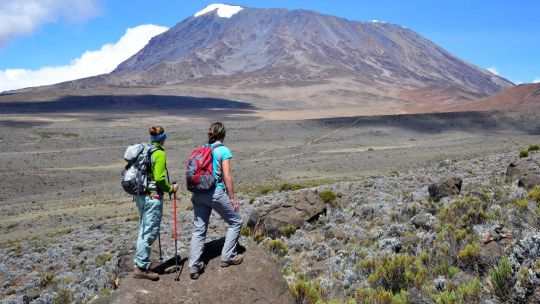
The Lemosho Route is a popular choice for those seeking a more scenic and less crowded ascent to the summit of Mount Kilimanjaro. This 8-day itinerary offers a gradual ascent, allowing for better acclimatization and a higher chance of summit success.
Overview of the Lemosho Route
Day 1: Londorossi Gate to Forest Camp
Day 2: Forest Camp to Shira Camp 1
Day 3: Shira Camp 1 to Shira 2 to Moir Hut
Day 4: Moir Hut to Lava Tower to Barranco Camp
Day 5: Barranco Camp to Karanga Camp
Day 6: Karanga Camp to Barafu CampCamp (3,100 meters)
Day 7: Barafu Camp to Summit to Mweka Hut
Day 8: Mweka Camp to Moshi
Key Features of the Lemosho Route
Scenic Beauty: The Lemosho Route offers stunning views of the Western Breach, the Great Barranco, and the Shira Plateau.
Gradual Ascent: The route provides a gradual ascent, allowing for better acclimatization.
Variety of Landscapes: Experience a diverse range of ecosystems, from rainforests to alpine deserts.
Fewer Crowds: Compared to the Marangu and Machame routes, the Lemosho Route tends to be less crowded.
Preparing for the Lemosho Route
Physical Fitness: Build a solid base of cardiovascular fitness and strength training.
Packing List: Pack warm clothing, waterproof gear, and comfortable hiking boots.
Acclimatization: Gradual ascent is crucial to prevent altitude sickness.
Hiring a Guide: A qualified guide can provide invaluable support and expertise.
Why Choose PoaPoa Tours for Your Lemosho Route Trek?
Experienced Guides: Our guides are highly trained and experienced in leading Kilimanjaro treks.
Personalized Service: We tailor our treks to meet your specific needs and preferences.
High-Quality Equipment: We provide top-quality equipment and supplies.
Commitment to Safety: Your safety is our top priority
Ready to Conquer Kilimanjaro with PoaPoa Tours?
Join us on an unforgettable journey to the summit of Africa's highest peak. Our expert guides, personalized service, and commitment to safety will ensure a successful and rewarding experience.
#LemoshoRoute#ClimbKilimanjaro#MountKilimanjaro#ExploreAfrica#TrekWithPoaPoa#KilimanjaroAdventure#AfricaHighestPeak#LessCrowdedRoutes#TanzaniaAdventure#SummitSuccess#BucketListChallenge#8DayTrek#AlpineAdventure#JourneyToTheTop#ScenicTrek#HikingGoals#KilimanjaroGuides#OutdoorChallenge#TrekkingAfrica#AdventureAwaits
0 notes
Text
Mount Kilimanjaro Machame Route: A Journey to the Roof of Africa

Mount Kilimanjaro, standing at 5,895 meters (19,341 feet), is the highest peak in Africa and one of the world’s most iconic trekking destinations. The mountain, located in Tanzania, offers several routes to the summit, with the Machame Route being one of the most popular due to its stunning landscapes and high success rate. Also known as the "Whiskey Route," the Machame Route is renowned for its scenic beauty and diverse terrain, taking trekkers through lush rainforests, moorlands, and alpine deserts, leading up to the snow-capped summit, Uhuru Peak.
At Kahlur Adventures, we offer a well-structured and guided Mount Kilimanjaro Expedition via the Machame Route, ensuring a safe and rewarding experience for all adventure enthusiasts.
Why Choose the Machame Route?
The Machame Route is one of the longer paths up Kilimanjaro, making it an excellent choice for acclimatization, increasing the chances of a successful summit. The route covers 62 km over eight days, giving trekkers enough time to adjust to the high altitude. Though more challenging than the easier Marangu Route, it rewards hikers with breathtaking panoramic views and a diverse range of ecosystems.
Kahlur Adventures Kilimanjaro Expedition Overview
Name of the Trek: Mount Kilimanjaro (5,895 M)
Duration of Expedition: 08 Nights 09 Days
Trek Distance: 62 KM
Pickup Timing: As per the flight
Drop Timing: As per the flight
Guides Services: Experienced Trekking Guides
Travel Route: Kilimanjaro Airport - Arusha - Machame Gate - Machame Camp - Shira Camp - Barranco Camp - Karanga Camp - Barafu Camp - Uhuru Peak - Mweka Camp - Mweka Gate - Kilimanjaro Airport
Pickup Point: Kilimanjaro International Airport
Drop Point: Kilimanjaro International Airport
Trek Route: Machame Route
Country: Tanzania
With Kahlur Adventures, trekkers can expect certified trekking guides, porters, and all necessary logistics to make the climb as smooth as possible. We prioritize safety and comfort, while ensuring you experience the majestic beauty of Mount Kilimanjaro in all its glory.
Why Trek with Kahlur Adventures?
At Kahlur Adventures, we provide an all-inclusive Mount Kilimanjaro Expedition experience that covers everything from trekking permits to food, accommodations, and professional guidance. Our experienced guides are well-versed in high-altitude trekking and are trained to ensure your safety and comfort throughout the expedition.
Whether you're a seasoned trekker or a first-time adventurer, our team at Kahlur Adventures will help you achieve the summit while making sure you have an unforgettable journey.
Short Itinerary of Mount Kilimanjaro Machame Route
Day 1– Arrive Kilimanjaro Airport (JRO) and drive to Arusha | Elevation: 1400 M
Day 2– Arusha to Machame Gate | Elevation: 1490 M to Machame Camp | Elevation: 2980 M
Day 3– Machame Camp | Elevation: 2980 M to Shira Camp |Elevation: 3840 M
Day 4– Shira Camp | Elevation: 3840 M to Lava Tower | Elevation: 4630 M to Barranco Camp | Elevation: 3950 M
Day 5– Barranco Camp | Elevation: 3950 M to Karanga Camp | Elevation: 4250 M
Day 6– Karanga Camp | Elevation: 4250 M to Barafu Camp | Elevation: 4600 M
Day 7- Summit Day – Barafu Camp | Elevation: 4600 M to Uhuru Peak | Elevation: 5895 M to Mweka Camp | Elevation: 3100 M
Day 8– Mweka Camp | Elevation: 3100 M to Mweka Gate | Elevation: 1980 M
Day 9– Departure from Kilimanjaro
Conclusion
Trekking Mount Kilimanjaro via the Machame Route is a once-in-a-lifetime experience that combines the thrill of adventure with the awe of nature’s beauty. As you ascend through various ecosystems, the journey to the summit of Africa's highest peak will challenge you both physically and mentally, but the reward is immeasurable.
With the expert guidance of Kahlur Adventures, you can be confident in your ability to reach the summit safely while creating unforgettable memories. Whether you're seeking a personal achievement or an adventure in nature, the Mount Kilimanjaro Expedition offers the perfect balance of challenge and reward. Let us help you conquer Africa's highest point and tick off this extraordinary feat from your bucket list.
Frequently Asked Questions
Q. How difficult is the Machame Route on Mount Kilimanjaro?The Machame Route is considered a moderate to difficult trek. It requires a good level of physical fitness due to the long trekking days and high altitude.
Q. What is the best time to trek Mount Kilimanjaro?The best time for the Mount Kilimanjaro Expedition is during the dry seasons, which are from January to March and from June to October.
Q. How long does it take to complete the Machame Route?The Machame Route typically takes 7-9 days to complete, with Kahlur Adventures offering an 8-night, 9-day package.
Q. Do I need prior trekking experience for Mount Kilimanjaro?No prior trekking experience is required, but you should be physically fit and have some experience with long hikes or outdoor activities.Q. What is the success rate of the Machame Route?The success rate for the Machame Route is relatively high due to the longer acclimatization time, with around 85% of trekkers reaching the summit.
0 notes
Text
Explore on the Kilimanjaro Northern Circuit Route: A Journey to Africa's Highest Peak

The Kilimanjaro Northern Circuit Route approaches the mountain from the west. It’s the newest and longest of the Kilimanjaro Routes and offers some of the most splendid views of the 360-degree scenery of the mountain.
This trail comes highly recommended by us at African Scenic Safaris and is also fondly known as the 360 Route or Orbit Kilimanjaro. If you want a combination of remoteness, a challenging climb, beautiful sceneries, and great acclimatization rolled into one then the Northern Circuit Route is for you. Because of the route’s great acclimatization profile with chances for climbing high and sleeping low, it has one of the best success rates. This means that with the right amount of preparation, anyone can climb Kilimanjaro via this route.
The 9 Days Northern Circuit Route begins at the Londorossi Gate and makes its way up the western side of the mountain.
The trail passes through the rainforest and climbs onto the Shira Ridge. A Typical Day on Northern Circuit Route heads north and circles clockwise from the Moir Hut to Buffalo Camp and School Hut. Climbers will summit from the east and descent will be from Stella Point via the Mweka Route. The Northern Circuit Route Cost starts from $3,300 per person and includes the fees for 9 days on the mountain. It is undoubtedly one of the best routes to Climb Mount Kilimanjaro. You too can experience a distinctive climb via the Northern Circuit Route with our selection of comprehensive Kilimanjaro Climbing Packages.
Explore on an unforgettable journey up Mount Kilimanjaro via the Northern Circuit Route. Offering breathtaking views, remote wilderness, and excellent acclimatization, this route promises a challenging yet rewarding experience for climbers of all levels. With its high success rate and comprehensive packages starting from $3,300 per person, African Scenic Safaris invites you to conquer Africa's highest peak and create lasting memories on the Northern Circuit Route.
0 notes
Text
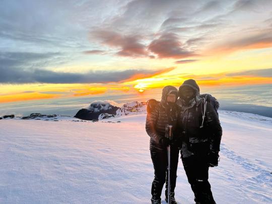
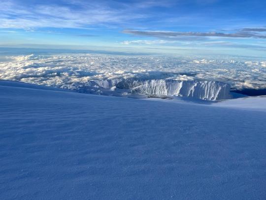
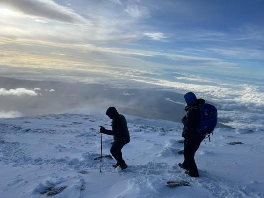
The Machame route on Kilimanjaro is a moderately difficult trail, but very doable even for first-time backpackers with little to no altitude experience. Known as the "Whiskey" route, the Machame route is now the most popular route on the mountain. Compared with Marangu, the days on Machame are longer and the walks are steeper. The Machame route is considered difficult and is best suited for those who are more adventurous and have some hiking or backpacking experience. The route begins from the south, then heads east, traversing underneath Kilimanjaro's southern ice field before summiting. The minimum number of days required for this route is six, although seven days is recommended. The Machame route is scenically beautiful and varied. However, due to the heavy crowds, it loses some of its spenders.
Day 1: Machame Gate to Machame Camp Elevation (ft): (3,000 m): 5. 6,000 ft (1,830 m) to 10,200 ft (3,100 m). Distance: 11 km. Hiking Time: 5-7 hours Habitat: montane forest. Camp: Machame Camp. The drive from Moshi to the Mount Kilimanjaro National Park gate takes about 50 minutes. The journey passes through the village of Machame, which is located on the lower slopes of the mountain. We now leave the park gate and walk through the rain forest on a winding trail up a ridge. Lower down, the trail can be muddy and slippery. Gaiters and trekking poles are a good idea here. We continue a short distance until we reach the Machame Camp.
Day 2: Machame Camp to Shira Camp
Elevation (ft): 10,200 ft (3,100 m) to 12,600 ft (3,840 m). Distance: 9 km. Walking Time: 4-6 hours Habitat: Moorland. Full-board Shira Cave Camp After breakfast, we leave the glades of the rain forest and continue on an ascending path, crossing the valley along a steep, rocky ridge. The route now turns west onto a river gorge until we arrive at the Shira campsite.
Day 3: Shira Camp to Lava Tower to Barranco Valley. Shira Camp to Barranco Camp (3,950 m.): 5-7 hours walking 12,600 ft (3,840 m) to 12,700 ft (3,860 m). Distance: 15 km. Walking Time: 5-7 hours Habitat: Semi-desert. Full Board Barranco Camp Today we walk on a gentle ascent with panoramic views. We traverse the southwest side of Kilimanjaro, passing underneath the Lava Tower and the final section of the Western Breach, and after a hot lunch at the bottom of the Lava Tower (4,600 m), we descend to the bottom of the Great Barranco Valley (3,950 m). .
Day 4: Barranco Camp to Barafu Camp Barranco Camp to Barafu Hut Camp {4600m} 6-8 hours. 4000m/13,000ft to 4700m/15,350ft Distance: 9km/ Walking Time: 6-8 hours Habitat: Alpine Desert Full Board at Barafu Camp. After breakfast, we leave Barranco and continue on a steep ridge up the Barranco Wall (elves 4250m/13,900ft), through the Karanga Valley (elves 4050m/13,250ft) to the junction which connects with the Mweka Trail. We continue up to the Barafu Camp. You have completed the South Circuit, which offers views of the summit from many different angles. Here we make camp with views of the summit in the distance.
Day 5: Barafu Camp to Summit, down to Mweka Camp Elevation (ft): 4700m (15,350ft) to 5895m (19,343ft) down to 3090m (10,150ft) Distance: 6km up; 13km down Hiking Time: 5-7 hours up; 5-6 hours down Habitat: Stone scree and ice-capped summit Very early in the morning (midnight to 2 a.m.), we continue our way to the summit between the Rebmann and Reitzel glaciers. You head in a northwesterly direction and ascend through heavy scree towards Stella Point on the crater rim. This is the most mentally and physically challenging portion of the trek. At Stella Point, you will stop for a short rest and be rewarded with the most magnificent sunrise you are ever likely to see. Faster hikers may view the sunrise from the summit. From Stella Point, you may encounter snow all the way on your 1-hour ascent to the summit. Once at Uhuru Peak, you have reached the highest point on Mount Kilimanjaro and the continent of Africa! From the summit, we begin our descent by continuing straight down to the Mweka Camp, stopping at Barafu for lunch. You may want gaiters and trekking poles for the loose gravel going down. We arrive at Mweka Camp and enjoy our last evening on the mountain.
Day 6: Mweka Camp to Mweka Gate, drive to Arusha or Moshi. Elevation (ft): 3090 m (10,150 ft) to 1680 m (5500 ft). Distance: 10km/6mi Hiking Time: 3-4 hours Habitat: Forest Meals: B After breakfast, we continue the descent down to the Mweka Park Gate to receive your summit certificates. At lower elevations, it can be wet and muddy. Gaiters and trekking poles will help. Shorts and t-shirts will probably be plenty to wear (keep rain gear and warmer clothing handy). We will be waiting for you at Mweka Gate to drive you back to your hotel in Arusha or Moshi. Included o Park fees, o Camp fees o Rescue fees o 18% VAT on tour fees & services which cost nearly 55% of the total cost charged. o Transportation to & from the mountain gate o Professional mountain guides, cooks and porters o 3 meals daily while on the mountain
Not Included o Both National and International flights o Medical insurance o Tips to mountain crew o Items of a personal nature o Laundry Services o A doctor for the group
#Kilimanjaro Machame Route#Machame Route Itinerary#6 days Kilimanjaro Trek#Kilimanjaro Summit Climb#Machame Route Highlights#Best Time to Climb Kilimanjaro#Kilimanjaro Altitude Acclimatization#Machame Route Camping#Kilimanjaro Trekking Packages#Uhuru Peak Expedition#Machame Route Difficulty#Kilimanjaro Guided Tours#Climbing Gear for Kilimanjaro#Kilimanjaro Base Camps#Machame Route Camping Sites#Kilimanjaro Flora and Fauna#Acclimatization on Kilimanjaro#Summit Success on Kilimanjaro#Machame Route Permits#Kilimanjaro Adventure Tours
1 note
·
View note
Text
#TERRITOIRE_DE_MWEKA 🇨🇩
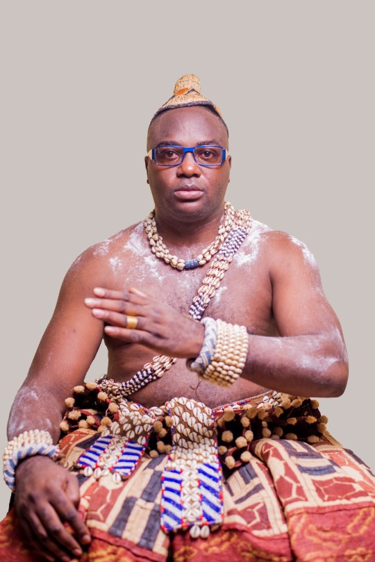
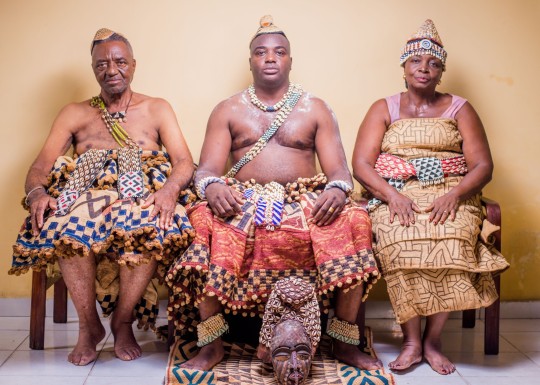
Le territoire de Mweka est une entité déconcentrée de la province du Kasaï.
Il a une seule grande tribu à savoir : le Kuba.
Les Batwa (pygmées), sont considérés comme le premier peuple à occuper le territoire de Mweka.
DONNÉES GÉOGRAPHIQUES
Le territoire de Mweka est situé dans la province du Kasaï à l’angle formé par les rivières Kasaï et Sankuru. Il est crée par décret-loi n°82/59 du 16 juillet 1959 abrogeant celui n°14/36 du 18 mai 1936.
Il est limité :
Au Nord : par le territoire de Dekese et Kole sur la rivière Sankuru,
Au Sud : par le territoire de Luebo,
À l’Est : par le territoire de Demba et celui de Dimbelenge,
À l’Ouest : par le territoire d’Ilebo
SUBDIVISION ADMINISTRATIVE
Hormis le chef-lieu, le territoire de Mweka est subdivisé en deux entités décentralisées dont la chefferie Bakuba et la commune rurale de Mweka (appelée cité). Il était composé de cinq postes d’Etat qui viennent d’être supprimés par arrêté ministériel, dont :
Kakenge
Misumba
Mushenge
Domiongo
Kampungu
Après suppression de ces derniers, il y a un vide qui ne permet pas le bon fonctionnement de certains services. Jusqu’à présent, le territoire de Mweka n’a pas de secteurs et communes rurales agréées à part les communes de Mweka et de Kakenge, qui malheureusement manquent des animateurs.
Le territoire comprend une seule chefferie appelée « chefferie Bakuba » dont le siège du grand chef se trouve à Mushenge (capitale du royaume Kuba). Avec 58 groupements au total, seuls 28 sont agrées et les autres sont des groupements des faits (donc, ne sont pas reconnus officiellement) pourtant existants.
L’attente de la population de Mweka est, vue l’étendue (la grandeur) du territoire, de voir la chefferie subdivisée en secteurs ou en communes rurales pour permettre le rapprochement de la population aux administrés ainsi que la reconnaissance de la ville de Mweka pour son épanouissement.
CLIMAT
Selon la classification de Koppen, le territoire de Mweka est couvert d’un climat tropical humide avec alternance de deux saisons : la saison des pluies et sèche.
La saison sèche : commence de mi-mai à mi-août
La saison pluvieuse : est la plus longue, elle s’étend du mois d’août au mois de mai de l’année suivante.
La saison pluvieuse connait des très fortes averses et une chaleur quasi constante. On y enregistre en effet 160 jours des pluies avec une pluviométrie annuelle de 1300 à 1500 mm d’eau.
La saison des pluies s’étend sur une période de huit mois, tandis que la saison sèche s’échelonne sur quatre mois. A savoir chaque année en janvier, on connait une petite saison sèche d’environ quatre semaines. Les précipitations atteignent leur maximum au mois d’octobre avec une pluviosité supérieure à 1500 mm.
HYDROGRAPHIE
Le territoire de Mweka est établi sur le plateau entaillé des profondes vallées situées en partie dans une partie de la forêt.
Ce plateau est chaîné par plusieurs cours d’eau de direction Sud-Est vers le Nord-Ouest, dont les plus importants sont :
Lubudi
Lutshuadi
Luekedi
Lwangala
Et d’autres qui font objet de frontière naturelle : le Sankuru (frontière avec le territoire de Dekese), le Kasaï (une partie avec le territoire de Luebo et d’Ilebo).
Ces cours d’eau forment un réseau hydrographique à pêche. Parmi eux, les plus poissonneux sont : le Sankuru et le Lubudi.
Les rivières Lutshuadi et le Sankuru se déversent dans la rivière Kasaï vers le territoire d’Ilebo.
Végétation
Le territoire de Mweka est couvert au Nord par la forêt dense sempervirente, c’est-à-dire un type de paysage de transition entre la forêt ombrophyle et les savanes guinéennes au Sud.
Sa grande partie est comprise entre l’isohyète 1800 et l’isohyète 1600.
PARTICULARITÉS ET RICHESSES DU TERRITOIRE
Le territoire de Mweka est réputé par l’agriculture et l’art Kuba.
L’art Kuba est un métier rentable mais non organisé par manque des moyens. Nous y trouvons des artistes très talentueux qui sculptent les oeuvres d’art et tissent les tapis à l’aide de fil de raphia.
Ce dernier est axé sur :
La sculpture des masques
La sculpture des statuettes
Le tissage des tapis traditionnels
Un autre élément particulier à signaler est que, c’est un territoire où existe jusqu’à ces jours le pouvoir royal.
POUVOIR TRADITIONNEL
Le pouvoir est détenu par le roi nommé grand chef, qui est assisté par sa famille, les notables et les chefs des groupements.
De son vivant, le roi gouverne la chefferie avec les notables et les chefs des groupements mais règne avec sa famille.
À son décès, il est succédé par un membre de sa famille le plus âgé de tous. Soit son petit frère, soit son neveu,… et non par ses propres enfants. C’est la famille royale qui le choisit et le peuple à son tour peut soit l’accepter ou le refuser.
Pour l’acquisition du pouvoir royal, seuls les membres de la famille du côté de la mère sont permis. Dans le royaume Kuba, le pouvoir traditionnel provient du côté de la mère car le système pratiqué dans le royaume Kuba est le matriarcat.
Signalons que la chefferie se trouve à Mushenge (capitale du royaume Kuba).
RICHESSE DU TERRITOIRE
La richesse du territoire de Mweka est basée en premier lieu sur les terres arables que possède ce dernier du point de vue agricole. C’est un territoire qui possède des potentialités agricoles par son sol très fertile et riche en humus, permettant la bonne croissance des différentes cultures vivrières tant périodiques que pérennes.
Le sous-sol aussi renferme quelques minerais. Ces derniers sont jusque là non exploités. Nous pouvons citer entre autres : or, pétrole, fer…
Seul le diamant de luxe y est exploité mais artisanalement dans quelques villages (à Benasamba, Mwanyika,…).
Signalons que Mweka est un territoire agricole et non minier.
DONNÉES CULTURELLES
Le territoire de Mweka a une seule grande tribu à savoir : le Kuba.
Cette dernière est composée des éthnies suivantes :
Kete, Bushongo, Bangende, Bapianga, Bangombe, Bashobwe, Batwa, Maluku, Bakele, Bambalaie, Lombelo, Lona, Kasuambambi, Kasua Mbengi, Bansueba, Batanda, Luembe, Mombo lona, Popolona luembe, Popolona Sud et Tshiofa.
Quelques caractéristiques pour certains peuples du territoire :
Les Batwa, sont considérés comme le premier peuple à occuper le territoire de Mweka. Ils sont spécialistes à la chasse et la cueillette. Ils n’avaient pas des lieux fixes parce qu’ils étaient nomades. On peut trouver certains le long de la rivière Lulua & Sankuru et dans d’autres villages par-ci par-là dans le territoire.
Les Kete, sont spécialistes en agriculture. On les retrouvait au Nord du territoire.
Les Showa, sont spécialistes en pêche. Ils vivent le long de la rive gauche de la rivière Sankuru.
Les Bushong, sont nombreux. Ce sont eux qui détiennent le pouvoir royal. Ils sont forts aussi en agriculture et surtout en art. On les retrouve au centre du royaume.
Les Ngende, sont spécialisés dans la culture du café.
Constat : les noms souvent dominants du territoire sont : Bope, Kwete, Mikobi, Bushabu, Minga chez le sexe masculin ; Bawota, bulape, Mantshingi, Mbokashanga chez le sexe féminin.
Proposition : les habitants des Mweka peuvent être appelés « Mwekaciens et Mwekaciennes.
SYSTÈME PARENTAL
Le système parental est le patriarcat. Seul le père est le chef de la famille. A sa mort, il est succédé par son fils.
Régime matrimonial
Dans le territoire de Mweka, c’est le régime commun des biens qui est appliqué. Tous ce que les époux possèdent avant, comme pendant le mariage, constituent un patrimoine commun. Bref, c’est le régime de la communauté universelle des biens qui est mis en place.
HABITUDES CULINAIRES
L’alimentation de base c’est la bouffe (foufou) à base du mélange de la farine de maïs et de manioc, accompagnée des feuillages de manioc (du sombé).
Cette dernière est consommée par les 3/4 de la population ; 1/4 seulement y ajoute la viande domestique (porc, chèvre, volaille), viande sauvage (singe, sanglier, antilope,…), poisson, chenille,…
HABITUDES VESTIMENTAIRES
Comme partout ailleurs actuellement, la population de Mweka s’habille en style moderne (pantalon, chemise, jupe, pagne, costume, blouse,…).
Dans le cadre de manifestation coutumière (intronisation au pouvoir coutumier, mariage, accueil des différents chefs, autres fêtes, deuil,…), il y a des tenues appropriées de la coutume.
Les hommes portent le « mapela » (jupes), avec des ceintures décorées et couvertes des perles autour de la poitrine ; des chapeaux appelés « lukete ».
Nous avons plusieurs sortes de « mapela », dont : ndona koy, ituma, matuema, shokolo,…
Chez les femmes, nous avons les « ntshek et tshiaka ». Dans le « ntshek », nous avons plusieurs sortes aussi: les »ishuep, kot,…
Les tenues de la danses sont : kambongo, bom (masque) chez les hommes, ngelemwashi, nopa,… chez les femmes.
DANSE TRADITIONNELLE
Cette dernière est pratiquée pour honorer les grands événements du territoire, tels que : intronisation du pouvoir coutumier, mariage, arrivée des autorités, naissance d’un enfant, différentes fêtes, deuil,…
Les danses les plus connues sont : les « ikese, nkan,… »
Par exemple quand il y a deuil d’un chef Kete, lors de ses obsèques, la population danse le « tshilolongo ».
LE MARIAGE
L’organisation des festivités de mariage se déroule dans le territoire de Mweka, normalement comme partout ailleurs sur toute l’étendue du pays. Sauf que la différence réside au niveau de la dot qui dépend surtout d’une coutume à une autre.
Dans le territoire de Mweka, pour prendre une fille en mariage, l’ancienne méthode consistait à donner d’abord le pré dot avant que la dot proprement dite ne puisse être remise.
La famille du garçon donnait la boisson traditionnelle (lotoko, lumayi-mayi) à la famille de la fille ; accompagnée d’autres biens comme : des chèvres (une ou deux ça dépend), costumes traditionnelles appelées « mapela » pour le père de la fille et le « tshiaka » pour la mère de la fille
La valeur de la dot ne pouvait même pas dépasser 50 000 CDF dans l’ancien temps. Parfois, on ne donnait rien pour prendre une fille en mariage dans le territoire de Mweka. Mais présentement avec la culture moderne, la famille du garçon donne comme biens, des caisses (bière & boisson gazeuse) mais aussi la boisson traditionnelle accompagnant les chèvres, bassins, pagnes, costumes, chaussures, lait en poudre (boite), sucre,… dont la valeur varie entre 100$, 300$ voire 500$ pour une famille aisée.
LANGUES PARLÉES DANS CE TERRITOIRE
Le Luba (85%)
Le Kuba (75%)
Le Lingala (50%)
Le Swahili (20%)
Mweka est un territoire dont le peuple d’origine est le Kuba. Mais avec la migration des différents peuples à la recherche toujours de l’amélioration de la vie, il y a eu arrivée massive d’autres peuples appelés « peuples flottants ».
Le Luba est le plus parlé dans le territoire. Sa fréquence est due par ce flux du peuple Luba dans cette zone et puis d’autres peuples ont emboité les pas en le parlant. Mais aussi, il est enseigné dans des écoles sur toute l’étendue du territoire comme le prévoit le programme national d’enseignement primaire, secondaire et initiation à la recherche scientifique.
En suite le Kuba, langue du peuple originaire du territoire.
Le lingala, parlé non seulement par les kinois ou les bangala mais aussi par toute personne qui en a une notion sans tenir compte des origines.
Le Swahili a pris de l’empleur petit à petit à partir des commerçants en provenance surtout de la province du katanga qui exercent leur activité commerciale à bord des trains, dont l’itinéraire est : Lubumbashi-Kananga-Mweka-Ilebo.
PRINCIPALES ACTIVITÉS
L’Agriculture (60%)
Le petit commerce (20%)
L’Elevage (15%)
L’Art de Sculpture et de tissage des tapis traditionnels (3.5%)
La pêche (1.5%)
Le territoire de Mweka contribue à l’essor économique du Kasaï grâce à son sol très riche. La production de maïs, manioc, arachide, huile de palme, café,… contribue bien à l’autoconsommation et l’autofinancement de la vie socioéconomique de la population locale. Sachant surtout que la majeure partie de la population du territoire de Mweka ne vit que de l’agriculture. Mais la population est souvent découragée parce que cette dernière ne procure pas de bénéfice à sa satisfaction, car elle produit plus mais gagne moins.
ACCESSIBILITÉ DU TERRITOIRE
Routes : Oui
Voies aériennes : Oui
Biefs navigables : Oui
Train : Oui
Le territoire de Mweka est l’un des territoires de la province du Kasaï qui a l’avantage d’être sillonné par les routes d’intérêt général et celles des dessertes agricoles.
Il va de soi qu’on énumère les routes praticables mais l’état des routes d’intérêt général demeure déplorable par manque d’entretien.
Il va de soi qu’on énumère les routes praticables, mais l’état des routes d’intérêt général demeure déplorable par manque d’entretien.
Les routes d’intérêt général partent de Kinshasa jusqu’à Lubumbashi en passant par le territoire de Mweka :
Mweka à Lodi (180Km) pour atteindre Dekese (240Km);
Mweka-Luebo (74Km) ;
Mweka-Kananga (260Km) par Demba (Nationale N°1).
Il y a deux voies pour atteindre Kananga :
Mweka-Demba-Kananga,
Mweka-Luebo-Kananga.
L’axe le plus utilisé est celui de Mweka-Demba-Kananga (Nationale N°1).
Les routes sont en mauvais états, pas d’entretien, des routes abandonnées alors que ce sont des axes très importants car ils permettent le transport des marchandises des lieux de production vers les lieux de l’acheminement (ou de la consommation finale) en ce qui concerne les produits vivriers.
ETAT DES ROUTES
Le territoire de Mweka compte 1163 Km des routes de dessertes agricoles qui continuent à se détériorer d’avantage sans entretien ni réhabilitation. Il compte 31 ponts et 4 Bacs sur différentes rivières.
Les axes routiers et là où sont coulés les ponts et bacs se présentent comme suit :
Axe Mweka-Mbelu-Misumba : 125Km
Axe Mweka-Bungaba-Lubande : 150Km
Axe Mweka-Bakwakenge : 75Km
Axe Kakenge-Misumba : 95Km
Axe Bulape-Mushenge : 35Km
Axe Domiongo-Mushenge-Lodi : 95Km
Axe Mweka-Pembeangu : 105Km
Axe Nkosi-Butala-Shongaba : 92Km.
La RN qui traverse le territoire de Mweka est en terre battue avec des amas de sable par-ci par-là et demeure en mauvais état. Cette dernière continue à se détériorer du jour le jour.
Pendant la saison des pluies c’est très catastrophique, surtout quand il vient de pleuvoir. Donc là, le tronçon routier se transforme en caniveaux de conduite des toutes les eaux des pluies et ne permettent pas aux véhicules de circuler dans cet état. Après la pluie, il y a des flaques d’eau partout sur le tronçon qui ne sèchent pas rapidement.
Pendant la saison sèche, le sol devient très sec, des amas de sable trouvés un peu partout et ne permettant pas aussi la bonne circulation des engins. Surtout les motocyclistes souffrent tellement pour parcourir ou traverser ces endroits. Avec ces derniers, trop de risque de glissade causant ainsi des accidents.
Pour son entretien, certaines petites distances de quelques mètres sont entrain d’être réhabilitées par des cantonniers manuels de l’Office de Route et que nous pouvons considérer donc comme étant en «Moyen état » mais cela est trop insignifiant.
Il est à noter que sur 100% des routes sur le territoire de Mweka, 95% sont à entretenir, 4.5% à réhabiliter et 0.5% en bon état. C’est-à-dire que les routes sont en mauvais états.
Biefs navigables
La navigabilité n’est pas trop fréquente car il n’y a pas de bateaux qui font des navettes, mais seulement les baleinières, barges ou bacs et certains sont en panne.
Voies ferrées
la voie ferrée est contrôlée par la SNCC/Mweka.
Itinéraire : Lubumbashi-Kananga-Ilebo
En ce qui concerne le territoire de Mweka, nous avons : Mweka-Kananga (250Km)
Les gares opérationnelles, sont :
Mweka-Bena Longo : 19 Km
Bena Longo-Kinda : 19 Km
Kinda-Kakenge : 21 Km
Kakenge-Bakwakenge : 23 Km
Bakwakenge-Bakwabalayi : 12 Km
Bakwabalayi-Bena Leka : 25 Km
Bena Leka-Tshimbambula : 31Km
Tshimbambula-Demba : 27 Km
Demba-Zapo Zapo : 38 Km
Zapo Zapo-Kananga : 35 Km
Pour cet Axe, la SNCC s’est fixé un point de départ à partir de Bukama (Katanga) à Ilebo (Kasai) pour une distance de 1123Km.
Le transport par voie ferrées est un moyen de transport qui permet les navettes des passagers et des marchandises. Ce dernier assure le transport des grosses charges de différents produits. Mais malheureusement il n’est pas permanent et devient difficile de faire les navettes régulièrement.
ATTRAITS TOURISTIQUES
Parcs : Non
Jardins botaniques : Non
Jardin zoologiques : Non
Chutes d’eaux : Non
Sites touristiques : Oui
Sites sacrés : Non
Le territoire de Mweka est situé dans sa grande partie dans la forêt tropophyle suivi des savanes dans le Nord-Est comme la cellule de Mushenge et celle de Misumba. L’aspect végétatif y est très varié parce qu’il est sous climat tropical humide.
Il n’y a ni parcs, ni jardins, ni chute d’eau.
ACTIVITÉS TOURISTIQUES
Le territoire de Mweka dispose des lieux touristiques qui peuvent jusqu’aujourd’hui attirer des gens pour l’une ou pour l’autre cause qui sont :
l’Ecole d’Art et la Cour Royale à Mushenge comme anciens sites
Iyoolo Imeny, là où le roi Kuba avait tiré l’origine de son pouvoir dans le village Bulumwanda
Benamakima, la première mission catholique (+100ans)
Le port de Lodi, sur lequel a été capturé Patrice Emery Lumumba
les immenses plaines de Pembeangu et de Misumba.
Espèces phares de la faune
Singes (doré, magistrat)
Antilopes (noires)
Buffle
Sanglier
Oiseaux (hibou, garde boeuf, canard à queue dressée, aigle, perroquet,….)
Espèces phares de la flore
Iroko
Tiama
Kosipo
Sapeli
Sipo
Source : Cellule d'Analyses des Indicateurs de Développement (CAID)
1 note
·
View note
Text
9 DAYS NORTHERN CIRCUIT ROUTE
9 DAYS NORTHERN CIRCUIT ROUTE
The Northern Circuit path is the newest and possibly greatest way up Mount Kilimanjaro. einsteinerupload of. This is the route to take if you want gorgeous scenery, plenty of solitude, a good challenge, and the chance to see wildlife.9 DAYS NORTHERN
There is an alternative. There is an alternative. There is an alternative. There is an alternative. There is an alternative. There is an alternative. There is an alternative.9 DAYS NORTHERN
Because this path is virtually empty of other trekkers, the campsites are quiet, tranquil, and almost deserted.
The Northern Circuit route is longer than the other trails, allowing hikers to see more of the mountain. They will not only get to hike through the breathtaking Shira Plateau, but they will also get to see Kibo Peak and Uhuru Summit along the way.
It also affords wonderful views down onto the vast plains that are found to the north of the mountain, something that is seen by only a handful of other hikers when ascending Kilimanjaro.
OVERVIEW
Our longest route, both in distance and time, 'Orbit Kilimanjaro' offers superb acclimatisation, exceptional scenery, very little traffic and some hard terrain. The Northern Circuit circles the mountain from west to north, then descends by the Mweka Route to the south. Starting on the Lemosho route, take in your first up-close look of Kibo, the imposing but manageable summit cone, from the Shira Plateau before continuing on to the magnificent Lava Tower. Part ways here and begin exploring the northern slopes, circling Kibo, which peaks far above as a continuous reminder of the work ahead. There will be few other trekkers along this route. From the high camp the trail climbs rapidly, finally scrambling over Jamaica Rocks and popping out on the rim of the crater at Gilman's Point. The likelihood of reaching Uhuru Peak is very high. Descend from Stella Point with Lemosho and Machame hikers. If you have the time and money, I highly recommend it!
Which Kilimanjaro route has the highest success rate?
Northern Circuit Route has the highest Kilimanjaro Success Rate which is 98% and approaches from south of Kilimanjaro. It is the newest and longest route, and it provides the most stunning perspective of Mount Kilimanjaro's whole 360-degree environment. einsteinerupload of.
The Northern Circuit path has the highest success percentage of any route on Mount Kilimanjaro due to its duration, much of which hovers around the same altitude for greater acclimatization.
The walk begins at the Londorossi Gate and winds its way up the western flanks of the mountain, passing through the jungle and up onto the the Shira Ridge.
From there, it travels up to the Shira Plateau itself, before proceeding north to circle in a circular path starting at the Moir Hut, then moving on to Buffalo Camp, and finally School Hut. Trekkers perform a nearly 360-degree loop around Kilimanjaro before summiting from the east.
So with everything that the Northern Circuit route has going for it, what's the downside? The only drawback to trekking this path is that it demands some extra time, which few travelers have. While most other routes may be completed in six or seven days or less, the Northern Circuit route frequently takes nine or more. This typically limits the number of people who can fit this trail into their schedule, but those who do will find it well worth it.
How difficult is the Northern Circuit Route?
The Northern Circuit is the most challenging of the Kilimanjaro Routes. Despite being the longest route, the lengthier itinerary implies that it has the best acclimatization profile, making the trek easier. The nine-day physical journey is ideal for altitude acclimation and is generally gentle on the feet. A good level of fitness is strongly advised.
What is the distance of the Northern Circuit Route and how many days does it take?
The Northern Circuit Route is 88 kilometers (53 miles) in length. The Northern Circuit Route can be completed in 8 days. Shorter ascents are possible, but need some difficult hiking days. When you factor in arrival and departure days, it comes to 10 or 12. The term "responsibility" refers to the act of determining whether or not a person is responsible for his or her own actions.
What is the Northern Circuit Route Summit Success Rate?
The Northern Circuit is the most direct route up Kilimanjaro and provides the best opportunity for acclimatization. While no official figures are available, the average success rate for all operators is 90%. The Northern Circuit Route, on the other hand, has a summit success rate of over 98%!
What is the Scenery like on the Northern Circuit Route?
The primary approach will take you through the magnificent Lemosho forest and across the Shira Plateau. The terrain grows increasingly arid and austere as the climber circles around to the isolated and rarely visited north side of Kilimanjaro. Because it is so remote, shy eland and the rare buffalo that come to suck minerals from the natural caves on Kilimanjaro's high slopes are frequently spotted.
When is the best time to Trek Northern Circuit Route?
The Northern Circuit Route is best hiked between July and September, when the weather is most consistent and rain is less likely. That so, since it is close to the equator it is possible to climb the peak at any time of the year. April and May are wet months, so stay away from them.
0 notes
Photo

#KILIMANJARO #CLIMB #Group #Join #2020 Make your Dream comes true,Trekking Mount Kilimanjaro with Signature Safari,#mchame #route #lemosho #route #shira #route #rongai #route #marangu #route #cocacola #umbwe #mweka # #worldheritagesite , #freestandinghighestmountainintheworld the highest mountain in Africa Continent 5895mil booking us #kilimajaro #climb #luxury #adventure #safari #meru #treking #chrismass #offer #discount #signatire #safari https://signaturesafari.com/kilimanjaro-climb-group-join-2020-2021/ [email protected] www.signaturesafari.com +255755880881 (at Signature safari) https://www.instagram.com/p/B9gzpvcJJQ6/?igshid=169u6ghldbv9g
#kilimanjaro#climb#group#join#2020#mchame#route#lemosho#shira#rongai#marangu#cocacola#umbwe#mweka#worldheritagesite#freestandinghighestmountainintheworld#kilimajaro#luxury#adventure#safari#meru#treking#chrismass#offer#discount#signatire
0 notes
Text
Dalitso BM - Nimwebofye Mweka Mp3
Dalitso BM – Nimwebofye Mweka Mp3
Dalitso BM – Nimwebofye Mweka Mp3 Talented gospel hit singer Dalitso BM has released a Brand New Banger tagged Nimwebofye Mweka. A Hit single that happens to be the 3rd track off his Album titled Nimwebofye Mweka. Related: Dalitso BM – “Ifyo Mwachita” Mp3 Check it out Below and share the Love. Enjoy. DOWNLOAD Mp3

View On WordPress
0 notes
Text
MOUNT KILIMANJARO CLIMBING, MACHAME ROUTE 6DAYS 5NIGHT.
DAY 01: ARUSHA TO MACHAME GATE
Morning after breakfast drive from your hotel to Machame gate, where you begin your trek through a spectacular forest area reaching Machame camp after 6 or 8 hours. There you will have dinner and overnight (3000meter). Meal plan L,D
DAY 02: MACHAME CAMP TO SHIRA CAVE
After a short descent, you will begin your trek toward Shira cathedral. Continue on you will pass by superb bivi cave just before arriving at Shira camp at 3840 meters where you'll have dinner and overnight. Today's climb is about 5 - 6 hours. Meals plan B, L, D
DAY 03: SHIRA CAVE TO BARANCO VIA LAVAR TOWER.
Trek from Shira Cave to Baranco camp. You'll have dinner and overnight at Baranco camp is (3950 metres about 11800 ft) meal plan B, L, D.
DAY 04: BARANCO TO BARAFU.
Trek from Baranco camp to Barafu camp (4600 metres) but its trek ascend to the top from near and requires and experience climber and good equipment. Meal plan B, L, D.
DAY O5: SUMMIT TO MWEKA CAMP
Short after mid night arise and begin the final ascent to the Uhuru peak (5895 metres) you'll then begin your decent to the Mweka camp (3100 metres) stopping at Barafu camp for lunch in one hour, where you'll have dinner and overnight. Meal plan B, L, D.
DAY 06: MWEKA CAMP TO GATE.
After completing your descent to Mweka gate, you'll receive your summit certificate and transfer back to your hotel. Meal plan B, L, D.
PRICE INCLUDED
1: Guide and assistant guide
2: Potters
3: Transport
4: Food
5: Salary for guide and potters.
6: Water for starting and other days the staff will boiling and filling in empty bottles.
7: Camping equipment.
WHAT IS NOT INCLUSIVE
1: Item things.
2: Soft drinks.
3: Tip
4: Cigarette.
4 notes
·
View notes
Photo

#kinotasontravel (at Mweka Gate) https://www.instagram.com/p/B1Ku7ttn6nQ/?igshid=1dw80r23709bq
2 notes
·
View notes
Text
非洲最高峰吉力馬扎羅山Kilimanjaro

最終下定決心要爬吉利馬扎羅山之後就開始研究上山的各條路線,雖然號稱是不用特殊技能就可以登頂的世界高峰,但畢竟是將近六千米的高海拔山,還是仔細衡量評估了每條路線每天的上升高度、路線長度和攀登天數後,最後決定在Machame和Lemosho兩條中間選一條。
聯絡了幾家登山公司,詢問了價格、配備和一些上山的問題,最後是篩選出Pamoja Kilimanjaro和Kessy Brother's兩家公司,這兩家的風評都算好,報價都合理,也都會攜帶備用氧氣瓶上山不另外加價。我抵達山腳下的Moshi小鎮後,一邊注意天氣,一邊也分別和兩家約見面細談。

因為已經是要接近雨季的三月登山淡季,所以一個人自己爬和跟人拼團的價錢差不多,而且我知道我自己上山的速度很慢,自己一人不拼團走起來比較沒壓力。
最後,根據自己過去寥寥可數的幾次高山經驗,想想原本擔心的Machame第一天一千米的上升應該還吃得消,最後還是選擇了比Lemosho便宜一些的七天Machame路線,畢竟也是一大筆錢啊!
在Moshi混了快十天,總算和Pamoja Kilimanjaro講定了13號星期五上山。

03-13第一天,Machame Gate(1640m) to Machame Camp(2850m),11Km/6hrs
當天早上8:45車子來接我,算是很準時了,然後我們直接去裝備店把需要的裝備借好。重點是要有暖和的睡袋和外套,嚮導有幫我挑選比較好的裝備,所以式樣和顏色無法搭配也是沒辦法的事了。
等一些挑夫來集合後,9點半多車子開去拿午餐盒,沿路上買肉再順路接一兩個挑夫,這次一共是六個人跟我上山,一個嚮導、一個廚師、四個挑夫。
11點半抵達Machame公園入口,我辦理完簽到手續後就去吃午餐盒,挑夫們把帳篷食物等背去秤重,這里的規定很嚴格,每個挑夫最多只能背20公斤,廚師和嚮導都只能背自己的行李,如果被���到偷背會被處罰的。
12:30正要踏進出發門時下起雨了,也好,直接把雨衣雨褲就穿身上了。路上嚮導說需要照相我都可以幫你,但我說我現在��級醜的,哈哈!
雨大概兩個小時就停了,走在雨林裡其實很喜歡的,但我也不曉得為什麼,走到最後好累,也不過就11公里的路。我快6點才抵達營地,是最後一個簽到的,我真的差點快要走不動了。
今晚Machame營地有點冷清,只有三團包含我共五個遊客。晚上被嚮導訓斥了,他說要多喝水,多吃才會有力氣,不然之後只會食慾越來越差。然後明天要提早出發,因為我想今天他有發現我實在走得很慢吧!

03-14第二天,Machame Camp(2850m) to Shira Cave Camp(3750m),5Km/4.5hrs
昨天半夜起來尿尿後就睡睡醒醒,早上五點半乾脆就起來整理行李了,肚子有覺得餓了,哈哈!六點多早餐送來,慢慢吃完後嚮導來測量今天狀況,心跳降低了一點,其餘正常。
7:20我就比所有人都先出發了,今天是一路的陡升坡,我一開始也不敢走太快,因為早上去上廁所都還會喘,而且上陡坡是我的最弱項啊!沒走多久嚮導就說話了,他說你走的得實在太慢了,要打開嘴巴喘氣,來登山就是要讓心跳快的。我每次爬山前都會先跟嚮導說我上坡會很慢,但都沒有人相信會有多慢。他說不是很慢,是太慢、是嬰兒慢,依照這種速度,我們可能走六個小時走一整天也走不到。
後來我調整了呼吸和自己的速度,漸漸進入佳境,配速還不錯,最後到今天最高點時,還有挑夫經過我們身旁時說,你們速度蠻快的嘛!我的嚮導老實回答,是我們出發的早,慢慢走。
中午12點就抵達Shira Cave營地,很開心。吃了中飯後就在自己的帳篷休息,但是其實日頭照到帳篷立刻變超級悶熱的,還真有點擔心中暑頭痛。一整個下午大概去尿了四趟,丹木斯的利尿副作用啊!
晚上食慾還可以,一切似乎正常。

03-15第三天,Shira Camp(3750m) to Lava Tower(4600m) back to Barranco Camp(3960m),10Km/7.5hrs
昨天晚上睡覺會冷,得穿著薄羽絨鑽進睡袋。早上要出去尿尿還加了大羽絨外套又多套牢一件褲子才出帳篷,回來又氣喘吁吁了。早上收完行李和睡袋,我就已經感覺沒力氣了。
7:40出發,今天的路線雖然沒有昨天陡,但今天有太陽又沒有什麼遮蔭物,越走頭越痛,越沒力氣。原本預計四個小時要到達四千六百米的Lava Tower做高度適應,我走了五個半小時才到,力氣都要用盡了。
13:30在Lava Tower吃完攜帶的簡易午餐包,看看四週開始起霧,還是趕緊下山。又走了兩小時約15:30才抵達Barranco營地。但剛剛山上沒事,一到營地自己的帳篷換了衣服後頭就開始爆炸痛!趕緊吃一顆止痛藥,然後坐也不是,躺也不是,整個開始懷疑自己還能不能撐到山頂。等止痛藥的作用開始了才比較舒服,然後晚上就沒什麼食慾,但還是認真的吃了一些。
晚上嚮導來問我要不要明天一路衝去Barafu,然後隔天可以睡到清晨四點,不用半夜登頂,嚮導說半夜攻頂是真的超級冷 。我之前也在網路上看過人家說他們的嚮導也是有這樣問,但我今天狀況真的很不好,我很擔心明天沒法又是走七個小時的一路衝去四千六的Barafu營地,可我又覺得我似乎應該相信我的嚮導。討論到最後,決定明天先到了Karanga營地看狀況再決定要不要衝。
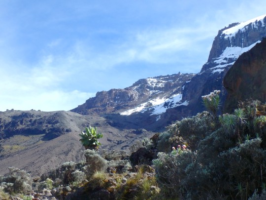
03-16第四天,Barranco Camp(3960m) to Karanga Camp(3995m),5Km/4.5hrs
半夜沒睡好,一直到早上四點才舒服的入睡,早上六點該起床我也不管了,一直睡到有人來送熱水。然後嚮導過來跟我說,他聽到我還在咳嗽,今天還是照行程只要走到Karanga就好,我可以不用急的慢慢來。於是回頭再躺了一會才爬起來整理行李。
昨天才在想或許稀飯可以引起我的食慾,結果今天早餐真的就是稀飯了耶!早上8:30出發,相信嚮導的配速,一路就緊跟在他的後面,他說休息才休息,最後下午1:00抵達Karanga營地。
下午還有很多時間,午後小睡了一會,感覺自己狀況還不錯,對登頂比較有信心了。

03-17第五天,Karanga Camp(3995m) to Barafu Camp(4673m),4Km/4hrs
早上8:30出發,12點半抵達Barafu營地,護唇膏都凍到擠不出來,嘴唇好乾(其實應該是有一點發疳的前兆)。今天狀況似乎還不錯,希望可以繼續保持到晚上攻頂。
下午想睡一下沒睡好,因為日頭很曬就開著帳篷睡覺,沒想到老鼠就跑進來啦!第一次聽到聲音轉頭一看,看到一隻老鼠嚇跑出去,已為沒事就把帳篷紗窗關上,躺下來繼續睡。沒想到過沒多久又聽到聲音,起身一看原來帳篷裡還有一隻啊!這隻被我嚇到亂跑,卻笨到跑不出帳篷,我也只好喊人來幫我抓老鼠了。
六點吃完晚餐,等嚮導來做說明,然後就要準備半夜11點攻頂了。
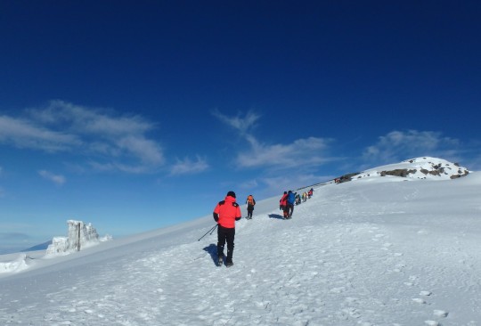
03-18第六天,Barafu Camp(4673m) to Uhuru Peak (5980m) back to Millennium Camp(3950m),14Km/14hrs
半夜11點出發,我應該是整個營地第一組出發的人,摸黑慢慢走,天上還是有星光的。第一次休息是大約快一點,出發兩小時了,抵達五千五的高度,據嚮導說目前速度還不錯。
但後面接下來就有點亂了腳步,一度慢了下來,開始有人超越我們,我不緊張的慢慢走,但是實在很想休息卻一直不見嚮導停下來,我想我要���合跟上他的腳步,但實在是越來越慢了。
中間停下來喝水,嚮導說要Push啊!我想每個嚮導有自己的一套,上次雪山的嚮導說呼吸不能急促,現在這個嚮導卻說爬山就是要喘氣,好吧!既然要相信嚮導,我就努力用盡最後力氣往上吧!沒走多久我就覺得力氣用盡了,開始很緩慢的上山,然後發現日出快要出來了,我還差一點點路就抵達火山頂的Stella Point,我其實很想坐下來看日出,但嚮導鼓勵我快到頂了,上去再看。
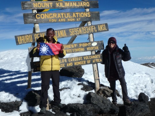
最後一段上去之後,大開心了,很漂亮,好像忘記疲累的一直很想拍景色,然後嚮導說還有最後一點點路去最高峰Uhuru Peak,我們先去登頂回來再慢慢拍。
這裡已經是火山口,都是積雪了,不過路面平緩,可我也走不快,到後來是嚮導牽著我的手,拉著我走完最後一百米,我嘔了眼淚鼻涕直流的總算走到頂。
請人拍了些登頂照,然後我也不知道為甚麼,就突然跟嚮導說,我們早點下去吧!我好像有點不是很舒服,然後他點頭背起背包,就那一瞬間,我倒了,自己突然知道自己不行了,眼睛都要睜不開了!
嚮導趕緊抓著我就往回衝,一路叫我的名字,還跟我說你會沒事的。我根本沒想這麼多,只是很痛苦很喘沒有力氣自己走,很想有人來抬我下山。其他人看了也沒人伸手援助,大家都要顧自己的客人,我只能盡力跟著撐著我的嚮導移動腳步,太想停下來休息了。
嚮導說不行,我們要一直下,一路不停的往下降低高度,一直到我可以睜開眼睛時,大概是五千五吧!我站著就喘,硬是要坐下,一坐下來,身體就整個軟下來的往下倒,嚮導不讓我躺,硬是讓我靠著他坐著。
然後我好一點了,可以用屁股慢慢往下滑,但一站起來就喘得沒力氣。看到大本營還很遠,我心想我走不到的,讓嚮導叫人上來幫忙,他打了電話,說要挑夫上山。我就一直盼趕快有人,但是我們真的還很高,還是得自己走,我也不是愛耍賴的人,但是真的走不動,喘起了好難受…
我知道我的嚮導肯定也累了,他也背不動我,只能好不容易看到第一個挑夫上來了,是年輕的Lamek,也是邊喝水邊喘,然後上來的是Karister,他們試著兩人架我下山,但我還是走兩步就喘,就想停下來休息。嚮導說這樣也不是辦法,你讓他們背吧!
Karister先背我一段路,再換Lamek背一段,就這樣兩人輪流一直把我背到快到營地的陡坡。這裡路不好走了,我就說讓我下來吧!我可以慢慢走。Karister仍舊緊握住我的手扶著我慢慢下山。最後好不容易回到營地,立刻讓嚮導量了血氧,還好還有八十,看起來應該不用後送,就先休息吧!
晚一點嚮導過來說,我們今天改下撤到比較近的Millenium營地就好。下午三點出發,應該只有1.5小時的路程,我走了三小時才到營地。
03-19第七天,Millennium Camp(3950m) to Mweka Gate(1640m),13.5Km/5hrs
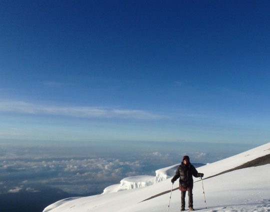
因為我們昨天沒有在預定的Mweka紮營,所以今天回去的路程會比較長,於是我們就提早點出發,六點出發時天都還有點黑,處於日出之前的景色。
不過我的體力似乎恢復了,抵達原本預計的昨晚紮營的Mweka營地時也才7:45,在這個營地的大部分團隊都還在吃早餐呢!
接下來一路上也一直���順的下山,一直到最後膝蓋開始有點不舒服了,才走得比較慢一點。 最後在11點前抵達大門完成最後的簽到,算是挑戰成功了!

每個公司的小費制度不一樣,Pamoja Kilimanjaro是讓客人回來到旅館後,才填寫要給每個人多少的小費表單,並同時將小費總數的現金和表單放入信封袋密封交給嚮導。好處是客人不用帶錢上山,然後每個人也可以清楚知道自己分到多少小費。
1 note
·
View note
Video
instagram
LEMOSHO ROUTE The Lemosho route is considered the most scenic trail on Kilimanjaro, granting panoramic vistas on various sides of the mountain. As one of the newer routes, Lemosho is a superb choice for your climb. It is our preferred route due to its ideal balance of low crowds, beautiful scenery and a high summit success rate. Ultimate Kilimanjaro® specializes in guiding on the Lemosho route. Most of our clients climb Kilimanjaro using this route and they consistently report that they loved it. Thus, Lemosho is highly recommended. The route approaches Mount Kilimanjaro from the west, beginning with a long drive from Moshi to Londorossi Gate. From there, the first two days are spent trekking through the rain forest to Shira Ridge. The Lemosho route crosses the entire Shira Plateau from west to east in a pleasant, relatively flat hike. Crowds are low until the route joins the Machame route near Lava Tower. Then the route traverses underneath Kilimanjaro's Southern Ice Field on a path known as the Southern Circuit before summiting from Barafu. The descent is made via the Mweka route. Our 8 days ethical Kilimanjaro climb via Lemosho costs the US 2950 per person and 7 days ethical Kilimanjaro climb via Lemosho costs the US 2750 per person. For more details about the #Kilimanjaro route and itineraries, Don't hesitate to reach us. #climber #mountaineers #mountain #photooftheday #travel #mountains #Hiking #travelmore #bucketlist #adventuretravel #adventures #adventure #nature #snow #rockclimbing #photo #pic #landscape #climb #naturelovers #nature_shooters #eachyfeet #thegoldlist #instapassport #travelpics #traveldeeper https://www.instagram.com/p/B1b06nRAn8L/?igshid=ucnuwudis660
#kilimanjaro#climber#mountaineers#mountain#photooftheday#travel#mountains#hiking#travelmore#bucketlist#adventuretravel#adventures#adventure#nature#snow#rockclimbing#photo#pic#landscape#climb#naturelovers#nature_shooters#eachyfeet#thegoldlist#instapassport#travelpics#traveldeeper
6 notes
·
View notes
Text
Make the Most Out of Your Kilimanjaro Mountain Holidays
Kilimanjaro is one of the most visited beauties of Tanzania in Africa. We hope you know that it’s the world’s highest free-standing mountain that is trekked by more than 28,000 people every year. Of the world’s seven summits, Mount Kilimanjaro is one of them. Besides, it is the easiest to climb Kilimanjaro as compared to other mountains. It’s a non-technical hike and doesn’t require any previous mountaineering experience.
Apart from this, there are some interesting facts about Mount Kilimanjaro that you must know in order to make your Kilimanjaro mountain holidays amazing.
What’s Interesting about Kilimanjaro Mountain Holidays in Tanzania?
Kilimanjaro rises majestically above the African plains to the 20,000-foot and has invited climbers since its first recorded summit in 1889. Here are a few interesting facts to help motivate your future summit:
1. The very first interesting fact about Mount Kilimanjaro is that it is the highest peak of the African continent and the world’s highest free-standing mountain. One most important thing you should ensure is that don’t go alone. Get any of Africa mountain tour packages so that you can feel quite familiar and comfortable during the trek.

2.The mountain consists of three volcanic cones- Mawenzi, Kibo, and Shira. Shira and Mawenzi have almost extinct; however, the highest peak- Kibo is dormant and may erupt again. The most recent and the last eruption was about 200 years ago; whereas the major eruption is estimated to be 360,000 years ago.
3. Another most interesting thing about Kilimanjaro is that it has a diverse ecological system. You can get to see rain forest, moorland, cultivated land, alpine desert, heath, and an arctic summit. In short, it’s a package full of distinct and beautiful ecology. Besides, if you move away a little from the mountain, you will find Zanzibar- an amazing archipelago in Africa. Get Zanzibar beach holiday packages and enjoy your vacation to the fullest.

4.The mountain gives you seven options to choose from. It has seven routes out of which six routes namely- Umbwe, Machame, Shira, Rongai, Marangu, and Lemosho are used for ascent and one that is Mweka is used for descent. Marangu Route is the easiest and most popular one used by the tourists as it offers sleeping huts along the way. However, Machame is the most difficult and second most popular route used by tourists. Also, it doesn’t have sleeping huts for accommodations.
5. One of the most interesting facts about Mount Kilimanjaro is that South African Bernard Goosen scaled twice on the mountain that too in a wheelchair. This means that hiking to this mountain isn’t that difficult and it surely gives many of us a climbing goal. Going into deep, Goosen took nine days to complete his first summit in 2003. However, after four years, he made his second summit and finished it in only six days. Therefore, if any of you finds yourself disabled due to any reason, this doesn’t mean you can’t enjoy your life, it’s all about thinking and executing.
6. An average of approximately 25,000 people attempt to summit Mount Kilimanjaro every year. Among this, two-thirds of the population completes the trekking successfully. The most popular reason for people giving up to the summit is the altitude sickness due to which they get dizziness, vomiting, and become seriously ill. However, if you climb with proper care and preparation, you can avoid it. We would suggest you not to go too far in a single day. Keep some time gaps and relax yourself.
Besides Mount Kilimanjaro, there are many other beautiful attractions in Tanzania. You can see Wildebeest Migration, Mount Meru, Arusha National Park, Zanzibar, and more. You can enjoy wildlife safari in Tanzania if you love the wildlife.
1 note
·
View note


