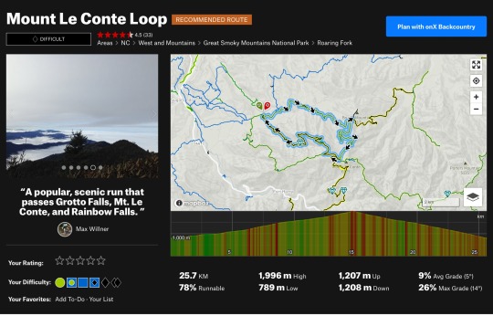
#mount Leconte
Explore tagged Tumblr posts
Text

Covered in a blanket of silence.
The Boulevard Trail on Mount Leconte never looked better than this magical morning as the sun illuminated all the work the storm had left overnight.
Look closely and you can see the small wooden sign pointing to “Clifftops” in the clearing.
“💡 YES!! I know that spot!!”
More evidence proving the Smokies are “always never the same”
7 notes
·
View notes
Text
i have this tendency to associate locations with books because of idk how my brain works i guess. and by locations i don't mean like, i think of ann patchett's the patron saint of liars every time my mom mentions mount leconte because that's what i was reading when we hiked it. i mean this incredibly specific stretch of pothole-ridden road i take to dogwalk always makes me think of five kingdoms by brandon mull. i mean this one neighborhood on the way to a church i don't attend is inextricably connected to the alex rider series and also angels & airwaves a little. i mean i can't drive to sonic without thinking about wings of fire in the parking lot.
there's something weirdly lovely about that, i think. mundane places will forever remind me of things that brought me joy there once.
7 notes
·
View notes
Text


Mount LeConte was so pretty
2 notes
·
View notes
Text
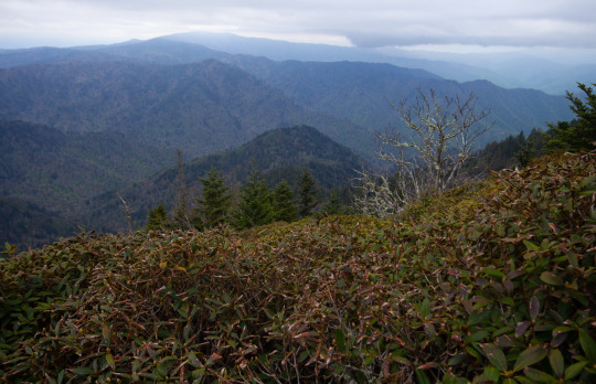
On top of Mount LeConte, Great Smoky Mountains National Park
3 notes
·
View notes
Text
0 notes
Text
Theodore Solomons – A Father of the JMT (Part 2)
Excerpted from Michael Hoberman, “Jews in the Wilderness”
This post follows the January 27 post that focused on the role that Theodore Solomons played in the shaping of the nation’s best-loved and most spectacular long-distance footpath, the John Muir Trail. The Pacific Crest Trailside Reader: California (2011) includes Solomons own account of the origins of the JMT, “The Beginnings of the John Muir Trail.” This particular story talks about Solommons and Bonner and their naming and exploration of the Evolution Valley and Lakes and the pass that would eventually be named for John Muir.
What Theodore Solomons experienced and found in 1895, besides eventually yielding the information that enabled Joe LeConte to find Muir Pass in 1908, merits retelling and commemoration. Well ahead of the freak July snowstorm that drove them off the side of Mount Goddard, he and his companion had already become the first recorded Sierra travelers to enter an area that, in an expression of his enthusiasm for the scientific developments of the day, Solomons decided to call the Evolution Basin. Two days out from Jackass Meadows, they found themselves ascending a steep tributary gorge of the South Fork San Joaquin that, as Solomons would write in his trail report of 1896, contained more water than its narrow volume seemed capable of holding. “Swelled by the fast-melting snows of its high sources,” Solomons explained, “the stream hurled itself with torrential force over a series of falls and cascades the most striking and magnificent I have yet encountered in the Sierra.” At the top of the thousand-foot climb along the waterfalls lay a several-mile-long stretch of pristine and forest-fringed meadow whose beauty rivaled that of Yosemite’s famous Tuolumne Valley. Solomons called it “one of the fairest paradises of the nowhere unlovely western slope of the Sierra.” He marveled at the fact that its “difficulty of approach” had kept it from being overrun by the hundreds of thousands of grazing sheep that John Muir, a decade earlier, had famously referred to as “hoofed locusts.”
At the southeastern edge of what we now know as Evolution Meadow, Solomons and Bonner encountered and ascended another gorge. As he first described it in his 1896 report, Solomons referred to it generically as the Middle Fork of the San Joaquin; later, he named it Evolution Creek. As the two men continued to climb the gorge in a southeasterly direction, they saw a “peaked and pinnacled wall” to their immediate south whose looming elevation above them (they were already well above 10,000 feet) ranged between 1,500 and 3,000 feet. Those imposing summits, he wrote, deserved to be thought of as “beautiful monuments rather than mountain peaks.” In the days following his and Bonner’s failed attempt to surmount the Goddard Divide, Solomons named each of them after his scientific and scholarly heroes: Charles Darwin, Thomas Huxley, Herbert Spencer, Alfred Wallace, Ernst Haeckel, and the philosopher John Fiske. These men, as Solomons wrote in his 1940 retrospective (included in the 2011 Pacific Crest Trailside Reader: California), had been so “at-one in their devotion to the sublime in Nature” that only these massive rock towers could suffice to monumentalize their legacy.
I sat on my unsaddled bronco facing east and gazing in utter fascination at the most beautiful and the most mysterious sight I had ever seen.
At the base of these heights lay an additional, albeit less intimidating wonder. Hikers all up and down the John Muir Trail still speak of this “fine sheet of water,” as Solomons described it, in reverential tones, whether or not they have heard of the explorer who named it Evolution Lake. These days, every evening from late June to early September its northern end is dotted with multicolored tents. As many as two dozen backpackers bask on its rocky shore, hydrating their meals with water that they’ve fetched out of its frigid depth.
Solomons knew that Evolution Lake was a place of signal importance and also of contradictory implications. “Nowhere more generous is the recompense that awaits the wearied traveler” to its shores, he wrote, highlighting its refugelike qualities. At the same time, he also intuited a profound connection between its apparent isolation and the extreme density that characterized the population centers of his home state of California. “Such is the birthplace of the San Joaquin,” he wrote, “the origin of that river which turns a hundred mills, irrigates a million acres of grain, fruit, and vine, and which imparts fertility and beauty to the largest and richest of California’s valleys.”

Snow Tunnel, Enchanted Gorge, Sierra Nevada photographs / Taken by Theodore Seixas Solomons
At the end of the day on which they’d visited Evolution Lake, Solomons and Bonner camped at the foot of the peak that he’d just named Mount Huxley. They didn’t realize it at the time, but this particular campsite lay within 2 miles of the pass they were seeking. Indeed, as Solomons slept, he dreamed that his “task was fully done.”
Was he also imagining the backpackers who would eventually converge there? In his dream, “A well-marked trail led from the distant Yosemite past the long lake, up the snow-basin, and over the divide to the King’s River.” It was one thing to have been a teenager fantasizing from the lowland safety of his uncle’s pasture about an imaginary trail passing along the crest of the Sierras’ “flashing teeth.” It was another to picture the future trail at a moment when he was several days into a journey along the mountains’ spine, at such an enormous remove from the slightest reminder of civilization. Solomons “hope[d] that his dream was prophetic.” He knew that “the way was clear” and that “only the trail wait[ed] to be built.”
The snowstorm came the following day, as Solomons and Bonner climbed and then descended Mount Goddard in their attempt to locate the pass he’d just dreamed about. The gorge in which they sought and found shelter and warmth over the course of the next several days would prove to be a dead end of sorts, but few dead ends in the world can possibly have been so densely packed with scenic features. Traveling headlong down the south side of the mountain, they entered an area that remains trailless to this day. Solomons called it the Enchanted Gorge. In the words of a hiker who visited it in 1996, it still qualifies as “one of the most remote canyons in the Sierra Nevada.”
The Enchanted Gorge, as Solomons first described it, “was guarded by a nearly frozen lake, whose sheer ice-smoothed walls arose on either side, up and up, seemingly into the very sky, their crowns two sharp black peaks of most majestic form.” He called the peaks Scylla and Charybdis. After gingerly making their way around the edge of the lake, the travelers followed a snow-choked “road” through the gorge, descending “as though into the bowels of the earth,” all the while glancing upward at “black, glinting, [and] weird” walls whose 2,000-foot summits they could barely see. Solomons captured the otherworldliness of the gorge in the photographs he took while there. Two of his most striking images, “Rotunda in the Enchanted Gorge” and “Snow Tunnel in the Enchanted Gorge,” relay the beauty and desolation of the place in stark detail—the thick cover of snow, the jagged rocks, the indifferent sky, and nary a sign of vegetation even in the far distance, let alone of animal or human presence of any kind.
For all of its wonders, the journey into the Enchanted Gorge was not bringing them any closer to a crossing of the Goddard Divide, but they weren’t aware of that fact yet. On their southwestern trajectory out of the wilderness, Solomons and Bonner entered another deep valley formed by the Middle Fork of the Kings River called the Tehipite (fittingly, today’s Theodore Solomons Trail passes through that area). They exited the wilderness at Simpson Meadow on July 28, having logged 200 miles of hiking through places that very few, if any, other human beings, had ever seen.

The Rotunda, Enchanted Gorge, Sierra Nevada photographs / Taken by Theodore Seixas Solomons
In 1896 Solomons made two trips in the region north of the Goddard Divide. The second of the two, during which he successfully led an official Geological Survey party through the territory around mounts Lyell and Ritter and the Minarets that he had first visited and mapped in 1892, would prove to be his final outing in the Sierras for several decades to come, and also the last time he would be either making or following his own path through the mountains.
The most rugged phase of his mountaineering and exploration career lay behind him, however, and his active contributions to the development of the John Muir Trail had come to an end. In the deliberations that took place between its official commissioning in 1915 and the completion of its final portion in 1938, Solomons weighed in freely but commanded little authority.
Epilogue
John Muir’s reputation has come under renewed scrutiny owing to his alleged ties to a prominent eugenicist and his numerous disparaging comments regarding Chinese immigrants and American Indians. It is an appropriate time to revisit the mountains’ cultural significance and the trail’s namesake’s history. In 2018 a movement to rename the John Muir Trail the Nüümü Poyo, or “People’s Road,” arose among certain advocates for tribal rights who wished to draw attention to the Sierras’ Native American heritage. The Kern Kaweah chapter of the Sierra Club drafted a refutation of this proposal, albeit in as culturally sensitive a manner as they could muster. The report gave perfunctory attention to Solomons’ and other Sierra explorers’ roles in helping to create the trail in order to make its wider case in favor of honoring precedent. Why rename the trail, the authors of the report asked, when it was already, by definition, a memorial—“a human-constructed asset”—and not a natural feature like a mountain or a lake?
#Theodore Solomons#John Muir Trail Evolution Valley#Evoluntion Lake#Muir Pass#Enchanted Gorge#Mt. Huxley#Mt. Darwin#Goddard Divide#Mt. Spencer#Mt. Wallace#Mt. Fiske#Mt. Haeckel
0 notes
Text


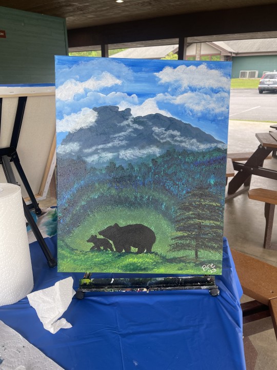


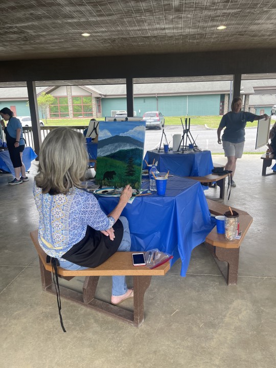
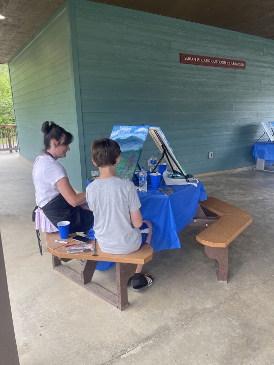

Teacher Appreciation Painting Party with the staff of Pittman Center Elementary...plein aire painting their beautiful view of Mount LeConte and enjoying the Spring breeze. Thanks to Maggie Edwards for setting this up and honoring our dedicated teachers!
#teacherappreciationweek #pleinairepainting #mountleconte #staffappreciation #artclass #paintparty #paintingpartygatlinburg #thingstodointhesmokies @visitgatlinburg-blog @visitmysmokies #seviercountyschools
Artstudioofthesmokies.com
#artstudioofthesmokies
#gatlinburg#sevierville#pigeonforge#artstudioofthesmokies#smokymountains#artlesson#art#painting#paintparty#pigeonforgetn
0 notes
Photo

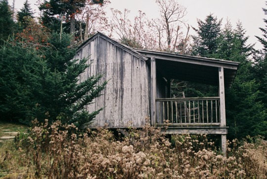
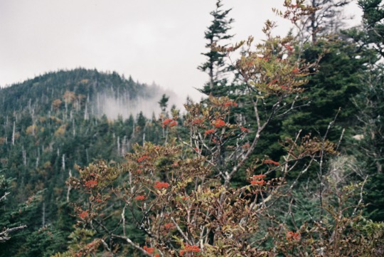
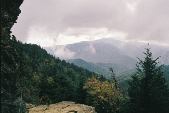
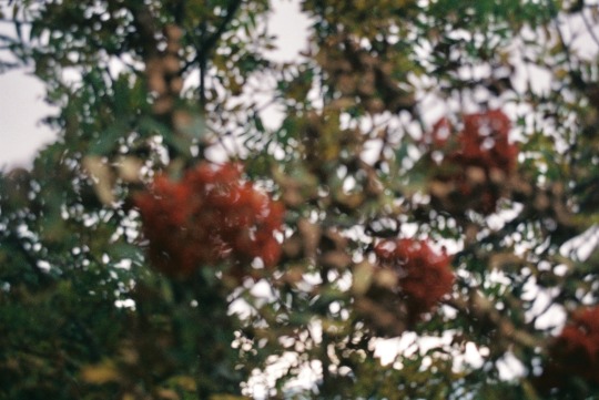
LeConte Lodge
Great Smoky Mountains National Park, Tennessee
#Tennessee#analogue#35mm#film photography#analog#original photography#photographers on tumblr#nature#nature photography#mountains#hiking#the great outdoors#appalachia#Blue Ridge Mountains#Great Smoky Mountains National Park#the great smoky mountains#Mount LeConte#Lodge#Cabin
151 notes
·
View notes
Text


Take me back 🥺
#Tennessee#gatlinburg#pigeon forge#mount leconte#i really miss tennessee 🥺#hike#hiking#nature#black bears#take me back#alum cave trail
4 notes
·
View notes
Text

Mount LeConte in GSMNP, Tn 11-01-20
@kimzplace
0 notes
Text

Mt LeConte with Jake Ortega and David Strickland in 1992
1 note
·
View note
Text
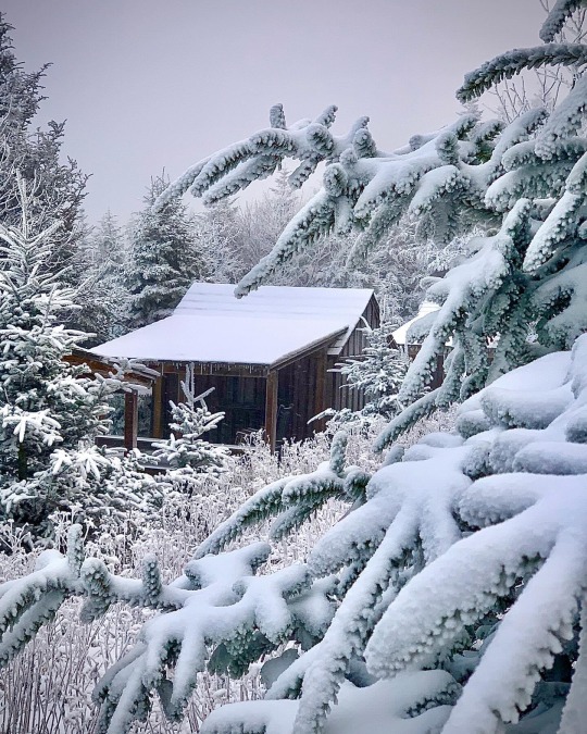
Just a cozy little cabin, nestled in the woods.
Actually, at the Leconte Lodge, on top of Mount Leconte in the Great Smoky Mountains National Park there are several cabins for guests and staff.
“That’s different” is just the beginning …. Consider that the only way to get there is at least a 5 mile hike up mountain, you can begin to appreciate how truly unique a stay at this National Park Lodge really is.
6 notes
·
View notes
Photo

Mount LeConte, Great Smoky Mountains [OC][6000x4000] via /r/EarthPorn https://ift.tt/2Mqmd8Y
0 notes
Text
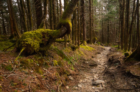
This interesting tree on a trail headed to Mount LeConte looked like it tied itself into a knot
2 notes
·
View notes
Note
venture: name 3 new things you tried this year.
i was going to say blankets but actually i started the l'blanket last year didn't i...hm. let's see.
going through a drive thru. this does not sound like a big deal but i've gone over two decades of my life without ever driving through a drive through myself because they give me the WORST anxiety. however my friend wanted to go to starbucks and got a mobile order and i said okay, i'll go through the drive thru for it. and i did it! and now i've done drive thrus twice! big deal for me.
making applesauce!! i've alwayssss wanted to make applesauce because years ago i had homemade applesauce and it ruined storebought forever. finally learned how this year (i've actually been doing a lot of trying to learn how to cook and it's been um...challenging but pretty good so far!!) and we've had applesauce like six times.
it's a little bit of a cheat to put hiking because i've been hiking all my life but like. i've never hiked more than maybe 5 miles round trip total. this fall i went on a 15-ish mile round trip hike with my parents up mount leconte in tennessee and spent the night on top and came back down the next day and it was something i have never done before and never intend to do again christ alive. but hey mark that off my bucket list i guess??
end of year asks!
2 notes
·
View notes
