#i should prolly edit it and polish it eventually
Explore tagged Tumblr posts
Visit Tumblr Blog
Explore Tumblr blogs with no restrictions, modern design and the best experience.
Last Seen Tumblr Blogs


Fun Fact
Tumblr was attacked by a cross-site scripting worm deployed by the Internet troll group GNAA on Dec 3, 2012.
Text
‘I think I’d like to die.’
Chapter 10: The End
#annnnnddd we're done#the old guard AU#jegulus#is it my best writing? no#but did I have all the fun? yes.#i should prolly edit it and polish it eventually#but today is not that day#enjoy my trash fire <3
9 notes
·
View notes
Photo
Turns out “memory lane” for me is basically I-5 going north from Seattle to Vancouver. It’s a drive that’s filled with overlays from the past and, as the missus ‘n I drove to Bellingham on Monday, a lot of those memories were brought front and center once again.
We didn’t even have to get out of the drive before a memory poked its head out.
For example, and for starters, we already live a few miles north of what I used to think of as Canada. I mean, not literally Canada, but soooooooo far north that it might as well be.
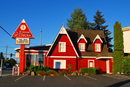
The place I’m thinking about was actually a kennel to which my dad and I were taking our beagle, Rusty, back when I was a kid. This would be the northiest north part of Lynnwood. And however we reached this remote area from Magnolia, the last bit was done on 99, take a right at the red clock building, take the very next right after that, then drive down to the end.
So we’re on the road now, up I-5 passed Everett. Coming down into the valley after downtown, Dagmar’s Landing is always a memory. An olfactory memory. Because this whole area used to stink. Really it did.
That was also back when I was a kid... paper mills, I think.
Whatever it was... it. was. nasty.
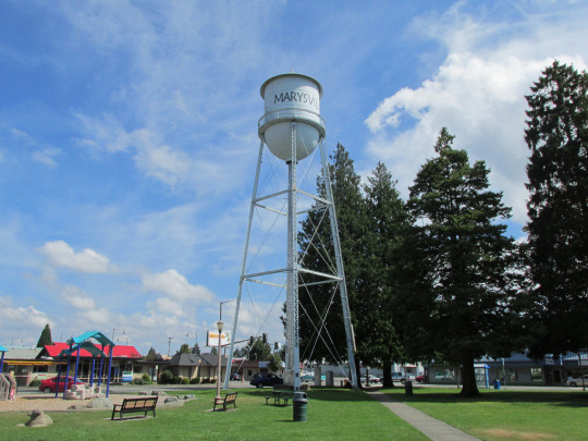
Keep driving and, of course, Marysville. Where our dear friends, the Ramos family, lives. We always give a wave of the hand as we pass by.
Mostly a mental wave of the hand.
But you get the idea.
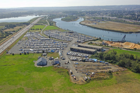
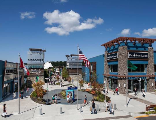
After the casino, it’s Seattle Premium Outlets. I especially remember this place ‘cause the last time we were here... my hands were literally freezing.
Not a great memory. But it sure sticks with you.
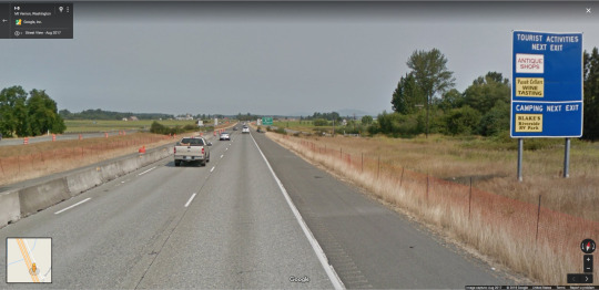
Next up, 172nd Street NE. Smokey Point. An area that itself has no particular significance other than it’s where we’ve exited to reach three destinations west of I-5.
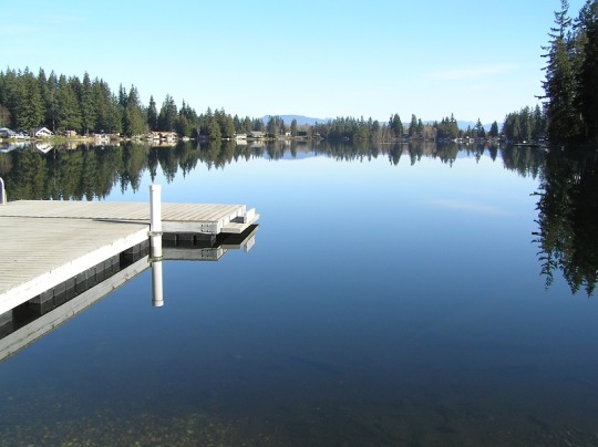
The first is Lake Ki. When she was in grade school, Linzy ‘n I and her uncle and cousin came out here disturbingly early one morning to fish.
So yeah.
We did that.
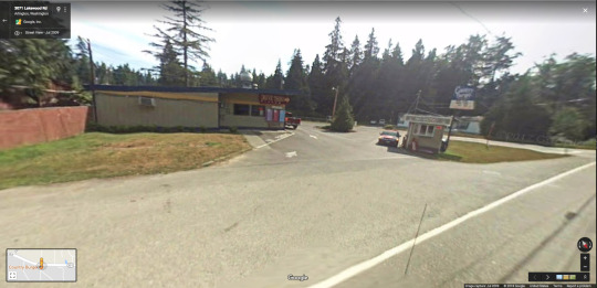
Not too far after Lake Ki, Country Burger. And I love this place. Looooooooove it. It’s on the way to Warm Beach... but we’ve actually driven all the way out here just to eat here.
No kidding.
You should definitely check it out yourself.
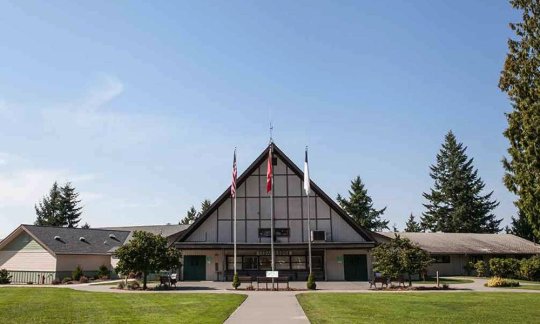
Almost all the way to the water, Warm Beach Camp. We spent time up here with family as well as called it home for a few days of Winter Camp for Kids during a week that included Valentine’s Day.
And yes... Kimmer did her camp medical provider thing and I helped.
What was nice... was that we were set up in our own cabin.
:-)
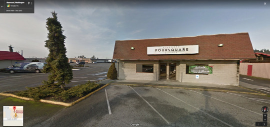
Back on I-5, coming up on highway 532, the Stanwood exit, I’m always reminded of Stanwood Foursquare Church because my very first Kid’s Camp gig was accomplished without my own computer. I had my own consumer-grade video camera, sure, but as for a Mac...
I used theirs.
Drove up here to borrow it. Drove back here a week later to return it.
It was an awful lot of driving, but worth it as the church was gracious enough to loan me the use of their own Mac.
La Conner’s never been that big a deal for us, but every time we come up on Conway, WA, not even a proper town but a Census Designated Place, I’m reminded of a wedding we attended out here. Somewhere.
I know it was a classic white-painted church. I think a steeple, definitely two stories. Barely on the west side of I-5.
I also know the reception was in La Conner and driving between the two was pretty straightforward. Conceptually, anyway. There were actually a lot of turns and curves and unlit roads involved.
Can’t actually find it on Google Maps where I figured it would be... but I still always think of it around these parts.

North, still, there’s an area where you kind of descend a little into another valley. It’s not super dramatic or anything, but you notice it.
And every time I do... I think:
Arlington.
Of course, were I to print that in the paper or broadcast it on TV, you could definitely call that Fake News.
Remember that exit for Warm Beach?
Arlington’s on the east side of I-5 at that point.
Still... this is where I always think Arlington.
And probably always will.
As you pass through the area, eventually a county road parallels the freeway. Somewhere along here, back when I was a kid driving this way with my parents, was a little stand where they sold honey. I remember we stopped there once to buy some. Don’t know if it’s still there. I didn’t see it this trip.
I just think honey along this stretch of road.

Okay so the area I think of as Arlington is basically the outskirts of Mount Vernon. The overpass you see below is, for me, the sign that we’ve entered the town proper.
Is that true?
No idea. I’ve always just thought that when I was a kid. Pass under the road and BAM.
Mount Vernon.

Couple things about Mount Vernon is that there used to be a 2-3 story brick building here that was a bookstore. Kimmer ‘n I actually stopped in town once to check it out. Nowadays, I don’t think it’s there anymore. Not in the brick building, anyway.
The other thing is that one year a bunch of college friends and I did a Skagit Valley bike ride. A totally doable thing ‘cause it’s all flat in the valley.
I think we parked in town and rode our bikes across that bridge below toward wide open spaces.
That’s what I remember, anyway.
Burlington and Highway 20 is another major crossroads in my life.
For one, I remember going on the Skagit Tour when I was a kid. You basically drive I-5 from Seattle to Burlington, head east about 60 miles on the North Cascade Highway and...
There you are.
I caught this description in the June 16, 1977 edition of the Centralia Daily Chronical. It matches what’s still rolling around inside my head.
“The regular tour is generally available by prepaid advance reservation only. This fully-guided four-hour visit begins with a complete orientation at the Diablo Tour Center and includes a ride on the incline lift, a boat cruise to Ross Dam, a tour of the Ross Powerhouse and an all-you-can-eat family-style meal.”
https://newspaperarchive.com/centralia-daily-chronicle-jun-16-1977-p-7/
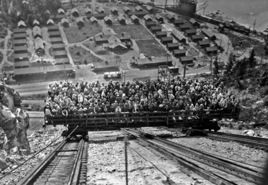
The thing I have an actual visual memory of, though, is this.

https://commons.wikimedia.org/wiki/File:Lift_at_Diablo_Dam,_1954_(40496828082).jpg
It’s the incline lift near Diablo Dam.
They don’t use it anymore on the tours, but when they did, it had this kind of capacity.
And I loved riding it as a kid.
Prolly still would.
http://www.funimag.com/photoblog/index.php/articles/us-the-great-era-of-lost-american-funiculars/seattle-diablo-skagit-4/
I’m actually thinking about redoing that tour someday. But I am bummed about the incline lift.
Here are a few more details about the tour...
https://www.goskagit.com/funicular-lift/image_4d742320-f3c8-11e2-8e32-001a4bcf887a.html
Okay so say dams, tours, and hydroelectric power isn’t your thing. About 60 miles further east on the North Cascade Highway you’ll find a town pulled from the old west.
At least it’s got that vibe.
We actually drove out here once to hang out in a nearby cabin with friends.
We got a late start on the evening we were supposed to catch up with them and, by the time we hit Burlington, it was super dark. And we had no appetite for driving Highway 20 that way. So we figured a hotel for the night. Only, there was some kind of sports tournament going on at the time and all the hotels were booked.
As were all the hotels in Mount Vernon.
We basically had to backtrack about 20 miles to find a room at the inn.
Yeah.
Winthrop was cool, though. The next day.
Okay. We’re back at Burlington and Highway 20. We’re not any further north, but west of here I remember a great country breakfast kind of place painted red from top to bottom with white trim. It’s a place I’m pretty sure we must’ve spotted from either I-5 or on our way to Deception Pass. Certainly there wasn’t a way for us to just know about it.
Of course, like that little church I mentioned earlier... I can’t find it where I was pretty sure it would be on Google Maps.
UPDATE (11/10/2018) Found it! It’s called the Skagit Valley’s Farmhouse Restaurant. And my memory was completely off as to its location. Turns out, we never spotted it from I-5. Not even once. Kimmer ‘n I spotted it from Highway 20 on our way to Whidbey Island one time. It’s also not “painted red from top to bottom with white trim”. So I don’t know what that’s about. All I know is... it’s still here. :-)
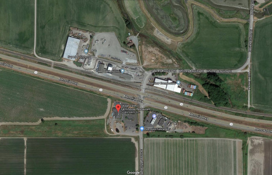
Kimmer ‘n I managed to eat there once and it. was. delicious.
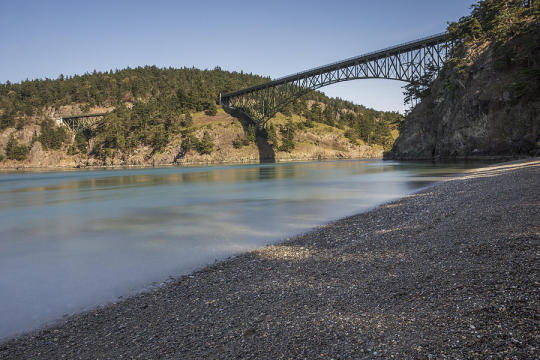
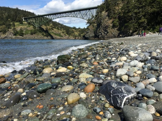
Back on Highway 20, drive another 20 miles across the valley, then across Fidalgo Island, then across a pair of iron bridges onto the northern tip of Whidbey Island.
Right down below is where my family spent a lot of picnic time when I was growing up.
We even came here once with my Aunt Esther and her family. She had a 16mm film camera with her and managed to capture the most embarrassing moment of my grade school self ever.
To this day, it’s the most embarassing moment of my life.
And I’m pretty sure she still has that film.
My dad liked to gather a lot of the naturally polished rocks here which, I’m pretty sure, gave him the idea to buy a rotary rock tumbler that he set up in our garage. It always seemed to be running.
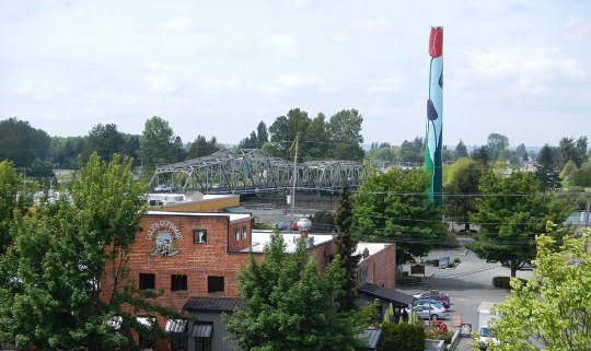
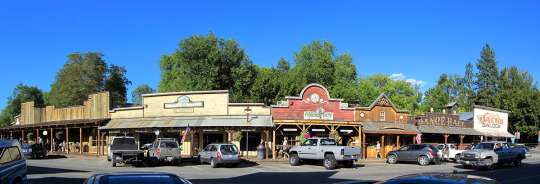
From Burlington north... next stop’s Bellingham which I always thought was this.
It’s actually Fairhaven, one very Instagram-friendly neighborhood of Bellingham. Calling Fairhaven Bellingham is like calling Pioneer Square Seattle.
But this is where I always ended up on those few occasions in my life I found myself in Bellingham so...
I thought this was Bellingham.
Yeah.
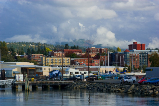
Bellingham, of course, is much more. And last Monday we had an opportunity to explore it just a touch more thoroughly. Enough to finally understand that Bellingham isn’t what I thought it was.
And this:
The photograph below is Haggens, up the hill from Bellingham Marina. Broadway, take a left on Meridien. You’ll find it by the time you hit Illinois Street.
Anyway.
The thing about Haggens is this is the grocery store Kimmer’s talking about whenever she talks about the grocery store at which she worked when she went to Western Washington University. The one she rode her bike down to from her dorm. And then back up again.
The one she worked at that one time when she fell asleep in her dorm and woke up thinking it was the next morning when it was actually evening of the same day.
Thought she missed her shift, you see.
That Haggens.
This one here.
And there you have it. My trip up Memory Lane. North Edmonds to Bellingham. It’s a fast drive getting there, a little over an hour (which surprised both of us).
But it covers decades of pretty awesome memories.
:-)
#memory lane#memories#places#Bellingham#Burlington#Smokey Point#growing up#adulting#empty nesting#road trip#a sunny day
0 notes