#hikingapp
Explore tagged Tumblr posts
Visit Tumblr Blog
Explore Tumblr blogs with no restrictions, modern design and the best experience.
Last Seen Tumblr Blogs


Fun Fact
Celebrities use Tumblr as well.
Photo

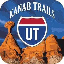
New Post has been published on https://vacationsoup.com/youve-gotta-check-out-this-hiking-app-for-the-kanab-utah-area/
You've gotta' check out this Hiking App for the Kanab, Utah Area!
Get Off The Beaten Path!
The National Parks are Stunning, no doubt about it. But what do you do when you want to get off the beaten path? The Kanab area is full of amazing trails in beautiful Red Rock Country, without all the crowds.
Kane County tourism now offers the amazing “Kanab Trails App”. This app can help you plan and navigate your outdoor adventures in Kanab and the surrounding area. It has an incredible array of red rock trails, slot canyons, and high mountain forest. You are sure to find just the right trail you have been looking for. Whether you are on foot, horse or Atv's.
youtube
The Kanab area of Utah has some of the most unique terrain in the world and the Kanab Trails App makes it easy for you to enjoy it.
By using this mobile guide, even those who are unfamiliar with the area can feel confident to venture out in this beautiful environment! Whether you’re out on the road looking for adventure, or planning a trip from home, the Kanab Trails App invites you to discover and explore these hidden gems! Enjoy the picturesque scenery, breath-taking trails, spectacular slot canyons, and places you never knew existed.
You can view the app and download their information PDF (click on the Kanab Trails Overview info) here: http://www.mapntour.com/viewer/?c=534
Here is info directly from the app-
The roads and trails displayed in the App are available for public access and can serve as guides for your Kane County Trail adventure.
You may view the roads in map or satellite view. Pinch and zoom the map to see all the roads in the county. If you enter an area with no cell coverage, essential elements of the road paths and points of interest are still available offline.
Offline capabilities:
The road and trail paths visible - if app downloaded to your device.
My location GPS tracking - if enable in device and app settings
The text descriptions and photos
Topographic map overlays if they are available for the area you are visiting.
App features: Benefits for you:
Selecting road from the navigation list or search result we'll fly you to the map where that road is centered in the screen and highlighted so the path is wider.
The roads name will be displayed on the title bar at the bottom of the screen.
You may slide the title bar to get mileage information about that road if there is any available.
If you see signage on the road- or trail you can search for that number in the app. Or select from the list in the navigation list.
Touch a path and its name will display on the information drawer title bar at the bottom of the screen.
You should be able to view your location with or without cell service:
Topographic Map layer:
An example of the topographic maps is shown here. You may pinch and zoom into the area of your location. Touch the arrow pointing in the left-hand side of the map to show your location.
Notifications:
You may get alerts when you come within an established distance of a trailhead, point of interest or destination depending on you're app settings.
The in-app information has a whole lot more! Great reminders like:
Using other sources of info
Be mindful of weather, especially when entering Slot Canyons
Map based apps use a lot of battery power. Have extra charging options with you
Check road conditions prior to travel
Bring extra water! It is hotter and drier than you think
Very limited Cell phone service in this area
Talk about adventure! The Kanab Trails app makes trails easy to find, simple to follow, and enjoyable to experience. Be spontaneous! The geo-alerts let you know what outdoor adventures are nearby. Discovering this magically unspoiled area requires offline access – and we have you covered.
Roads, trails, GPS tracking, and trail information is all available without wi-fi or cellular service.
Now for what you really want - The Kanab Trails App download - Head over to https://www.visitsouthernutah.com/ click on the Kanab Trails icon, there ya go!
All in all, you are going to have a great time exploring and you are going to see things like you have never seen before!
If you are digging this idea and this app, and want even more info, here is a copy of the in-app Tips
Mobile App Tips
Mobile App Tips for Adventure Hiking Trails
Adventure Hiking Trails may parallel roads in some cases. The Adventure Trail Paths are shown in ORANGE.
“This map and directions are intended for general reference use only. Always check local road and weather conditions. Stay on designated roads. Dirt roads are impassable when wet. Please respect Private Property. Be prepared for a wilderness experience: Always bring extra water, food, sunscreen, and supplies. Do not remove artifacts or deface the ‘rock art’. Leave no trace of your visit so others may enjoy.”
Cell phone service is non-existent in most areas. Essential information is available offline for the Adventure Trails and Outdoor Recreational Opportunities on this app. In areas without cellular service map tiles may not be displayed. You can go to "Settings" and toggle on topographic maps to assist with navigation.
Safety: Enjoy your trip –by being prepared. Due to cell phone battery limitations, we always advise visitors to bring charging cords or battery packs and have access to hard copy maps as a backup.
About Adventure Trail Featured Paths & Content: The Kane County Commission invites you to use the Kanab Trails App. You can plan your excursions and follow the route on your mobile device while on location.
These trails are meant to serve as guides for your Kane County Adventure with both map and satellite view options. Each Adventure Trail is its own category that lists the trail path(s) its trailhead and destination. Some Trails show highway access points. If you have downloaded the app to your device and then enter an area with no cell coverage, the essential paths, and points of interest are still available offline.
Adventure Hiking Trail Experience: Many of the Adventure Trails follow roads for a portion of the way. You will see which type of road is running alongside, and when the road ends the hiking routes begins.
#hikers#Hiking#hikingapp#hikingmaps#hikingsouthernutah#hikingutah#HolidayInKanabUtah#KanabUtah#SouthWestUtah#UtahUSA#VacationInKanabUtah#VacationSoup
1 note
·
View note
Photo

Hiking app designed to help the user find the best trails in the world. Easy to use resources. #barskydesignart #barskydesign #appdesigner #hikingapp #hiking #outdoors #landingpage #designconcept #uxui #designinspiration #design #designforhire #designs #ux #ui #productdesign #clean #outdoordesign #marketing #art #instagramart #artistsoninstagram @uxlinks @ux_trends @ux_trends @uiuxmobile @uxbrainy https://www.instagram.com/p/CAMRA9ZJ9Y7/?igshid=vb69cv15155m
#barskydesignart#barskydesign#appdesigner#hikingapp#hiking#outdoors#landingpage#designconcept#uxui#designinspiration#design#designforhire#designs#ux#ui#productdesign#clean#outdoordesign#marketing#art#instagramart#artistsoninstagram
0 notes
Text
Tweeted
Participants needed for online survey! Topic: "Impact of hiking apps" https://t.co/6j6OV7sJBc via @SurveyCircle #hiking #walking #exercise #HikingApps #mountain #hill #travel #trail #survey #surveycircle https://t.co/PzPoYYfDHu
— Daily Research @SurveyCircle (@daily_research) Oct 27, 2022
0 notes
Photo

Yunque App
2 notes
·
View notes
Text
Because you asked, the app I use for hiking is komoot, which helps me plan my routes and also track distance, hight and speed...


Hiking today was lovely with a sad finish.
Found a weak buzzard and brought him to the wildlife Center, but he didn’t make it.
The vet told us he was far too light. He was probably hit by a car and couldn’t hunt anymore.
Buzzards are endangered so I hoped they could have done something, but she said with so little weight he wouldn’t have made it even if we had found him yesterday.
Still a shame.
#nature#hikingtrip#hiking#trail#trail running#training#outdoor#outdoors#walking#buzzard#app#komoot#hikingapp
10 notes
·
View notes