#funningur
Explore tagged Tumblr posts
Text

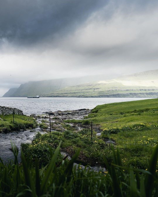
Funningur, Eysturoy Island, Faroe Islands
Maria Teneva
0 notes
Text

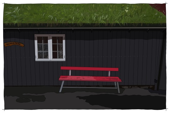
"One-eyed damsel". The outside of a small cottage in the village of Funningur, Faroe Islands. Drawn from a photograph in Adobe Fresco.
0 notes
Text


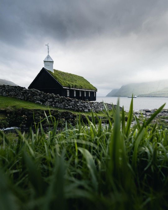
Funningur Church 1847 in the Faroe Islands 🇫🇴
📸 by Daryl Walker
13 notes
·
View notes
Text

View of the Cliffs of Funningur In Faroe Islands
📷 pietroienca
89 notes
·
View notes
Text


Faroe islands land of maybe (2) (3) (4) by Rainer Ralph
Via Flickr:
(1) Gasadalur with mulafossur waterfall. (2) Puffin - a hole-nesting seabird of northern and Arctic waters, with a large head and a massive, brightly colored triangular bill. (3) Funningur church. (4) View of Gasadalur from a boat.
4 notes
·
View notes
Text
Day 4


Funningur


13 notes
·
View notes
Text
Mapy / górskie szczyty
Między osadami #Eiði i #Funningur na wysokość 880 metrów wznosi się najwyższy farerski szczyt #Slættaratindur. To jedna z dziesięciu gór, które sięgają na wysokość ponad 800 metrów. Dziś zapraszam na #kartograficzne spojrzenie na #farerskie szczyty.
Między osadami Eiði i Funningur na wysokość 880 metrów wznosi się najwyższy farerski szczyt Slættaratindur. To jedna z dziesięciu gór na Wyspach Owczych, które sięgają na wysokość ponad 800 metrów. Najwyższą wyspą archipelagu jest Kunoy – aż sześć z pierwszej dziesiątki najwyższych wzniesień położonych jest właśnie tam. W sumie farerskie mapy upstrzone są około 340 górskimi szczytami o…
0 notes
Video
Driving the Faroes by Zeb Andrews Via Flickr: I really cannot adequately describe how much I enjoyed driving in the Faroe Islands. While there I did both a ton of hiking and a ton of driving and enjoyed both almost equally. There are many factors that make driving around these islands so enjoyable. The most obvious is the landscape. It seems like every bend in the road brings some heart-stopping vista. I was glad the traffic was so light because I barely wanted to go the speed limit, preferring to take my time and marvel at the scenery around each corner. The land itself is amazing but thanks to the geography of these islands you constantly find yourself in different light or weather. The islands are shaped like giant fins coming out of the Atlantic, with the roads mostly circumnavigating these islands. But quite frequently you have tunnels that bore straight from one side of an island to the other. In a couple of kilometers you can go from heavy cloud cover to bright sun, or from drizzly rain to sunset skies. Of course those aforementioned tunnels are an experience themselves. Many of the tunnels are one lane, dark, thoroughfares that cut right through the mountains. But the Faroe Islands are home to three subsea (soon to be four) tunnels that connect various islands. These tunnels are multiple lanes, bright, and dive deep down under the surface of the sea with their lowest points usually lit up by colored lights painting the tunnel walls red or blue or green while you whisk along at 80kmh under the surface of the sea. And they are long, at least the newest one is which takes over six minutes to drive through (I timed it) and has a roundabout two-thirds of the way along it. But then other tunnels are rocky and narrow with the frequent pullout for oncoming traffic that has you anxiously peering to the tunnel's end for oncoming headlights while minding the narrow clearance to either side of your rental car. In short, the tunnels themselves are one of the more memorable aspects of the drive here. Then there is the open, empty nature of many of the roads. Other cars are not uncommon, but driving for kilometers without seeing another vehicle is also not uncommon, at least during the time of year I was there. I could pull over, get out, and it would be quiet - at least of traffic. I felt nicely alone, even standing alongside a major road like in this image. I guess last, and I have mentioned this in a previous post, is the proximity of everywhere. No drive was over two hours, and most were well under an hour. It was fast to get everywhere, even if you were going slow. Or at least the drives themselves were so beautiful they never felt long. I have kept a mental list of some of the most beautiful drives I have done in the US. The Going To The Sun Road, or the Road to Hana, or the Beartooth Hwy, or even the stretch of US 395 that runs from Burns to Lakeview here in my home state of Oregon. These have all stood out to me as exceptional. They stood out. None of the drives in the Faroes really stood out because they are all pretty exceptional. I suppose if I had to choose though I would point to the Oyggjarvegur scenic route that runs through the mountains above Tórshavn and the scenic route that also winds through the mountains between Eiði and Funningur (that as far as I can tell doesn't even have a name). Anyway, that is my recollections and impressions from driving the Faroes. Some of them, at least. Pentax 67 Cinestill 400D
0 notes
Photo

Funningur, Faroe Islands. photo by Prieto Ienca
1K notes
·
View notes
Photo

Only one way to get to Kalsoy ⚓ . . . . . #faroeislands #visitfaroeislands #faroe #funningur #Kalsoy #gjógv #earthfocus #roamthefaroeislands #faroese #roamtheplanet #torshavn #moodygrams #stayandwander #tjørnuvík #wildernessculture #welcometonature #agameoftones #nature #faroeisland #denmark #atlanticairways #map_of_europe #visualsoflife #visualsofearth #visualmobs #travel #mykines (à Mikladalur, Kalsoy, Faroe Islands) https://www.instagram.com/p/CRbnUvTHBDA/?utm_medium=tumblr
#faroeislands#visitfaroeislands#faroe#funningur#kalsoy#gjógv#earthfocus#roamthefaroeislands#faroese#roamtheplanet#torshavn#moodygrams#stayandwander#tjørnuvík#wildernessculture#welcometonature#agameoftones#nature#faroeisland#denmark#atlanticairways#map_of_europe#visualsoflife#visualsofearth#visualmobs#travel#mykines
2 notes
·
View notes
Photo


eysturoy, faroe islands
#photographers on tumblr#original photographers#lensblr#landscape#nature#birds#eysturoy#faroe islands#funningur#summer#2018#bright#f
5K notes
·
View notes
Photo

Slættaratindur (Faroe Islands).
At 880m above sea level, Slættaratindur is the highest mountain in the Faroe Islands. It is situated in the north of the Esturoy region. The village Funningur lies at the foot of the mountain, but the summit is not visible from the village. Its name means “flat summit”, and in clear weather, the entire archipelago can be seen from the top.


Slættaratindur from the streets of Funningur.
26 notes
·
View notes
Photo

On the edge, Faroe Islands by jamiecurrie84
3 notes
·
View notes
Photo

Funningur, Faroe Islands - Tom Archer
88 notes
·
View notes
Photo

Gjáarskarð Epic Sunset
#magical#landscape#epic#dramatic#sky#faroe#island#islands#eysturoy#funningur#gjáarskarð#Slættaratindu
3 notes
·
View notes
Text


Faroe islands land of maybe (2) (3) (4) by Rainer Ralph
Via Flickr:
(1) the road to Funningur (2) Gasadalur seen from sea side (3) Mykines (4) Mikladalur
3 notes
·
View notes