#foothill penstemon
Explore tagged Tumblr posts
Video
n296_w1150 by Biodiversity Heritage Library Via Flickr: Le Jardin.. Paris :Librairie horticole du Jardin,1887-1921.. biodiversitylibrary.org/page/8941433
#Gardening#Horticulture#Periodicals#Mertz Library#The New York Botanical Garden#bhl:page=8941433#dc:identifier=http://biodiversitylibrary.org/page/8941433#taxonomy:common=Penstemons#PENTSTEMONS#PENSTEMONS#Beardtongues Plant#Penstemon murrayanus#penstemon gentianoides#penstemon puniceus#penstemon heterophyllus#bunchleaf penstemon#foothill penstemon#foothill beardtongue#scarlet beardtongue#Gentian Beardtongue#Penstemon superbus#Superb Beardtongue#flickr#botanical illustration#scientific illustration
2 notes
·
View notes
Text
Super Bloom 2023?
Here is the Wildflower Update from the US Forest Service dated January 27,2023 in response to the above question.
Will there be a superbloom this year? The short answer- maybe. It is still too early to predict if the storms from the summer 2022 monsoon season will lead to a showy 2023 spring bloom. Generally, superblooms are preceeded by fall/winter rains, which we did not receive. Sprouts of many wildflower species have been seen popping up on alluvial fans, in washes and around Furnace Creek Visitor Center but whether they survive will depend on many factors including wind, additional precipitation and temperature. Right now we are anticipating an average to above average bloom this year, but it remains to be seen if there will be a full superbloom. See "Predicting a Good Bloom Year" below to learn more.
Predicting a Good Bloom Year
A good wildflower year depends on at least three things:
Well-spaced rainfall throughout the winter and spring
Sufficient warmth from the sun
Lack of drying winds
Rain is Key
Gentle rain that soaks deeply into the soil is essential for a desert floral display. To begin, a rainstorm of a half inch or more is needed to wash the protective coating off wildflower seeds and allow them to sprout. For plants to continue growing, rainstorms must come at evenly-spaced intervals throughout the winter and spring. The best blooms are triggered by an early, winter-type rainstorm in September or October, followed by an El Niño weather pattern that brings above average rainfall to the Desert Southwest.
Warming Things Up
Wildflower seeds that sprout with cool winter storms often remain small and low to the ground until the springtime sun starts to warm the soil. They may not look like they are growing, but a strong root system is developing below the surface. As the temperatures get warmer, the well established plants then put on a growth spurt and start to bloom.
Harsh Desert Wind
Frequent springtime windstorms without additional rain can bring about a quick end to the spring bloom or even prevent it from happening by killing off delicate sprouts. Dry, moving air dehydrates exposed surfaces of all living things, including human beings. Desert plants often have waxy, hairy, or spiny leaves to baffle the wind and retain precious moisture. Humans can carry and drink water as needed, but the wildflowers must grow and bloom before they dry out, or late-spring heat arrives, in order to leave seeds scattered on the desert floor to produce the next generation.
When Wildflowers Typically Bloom
Mid February to Mid April
Where: Lower elevations on alluvial fans and foothills.
Wildflowers: Desert Gold (Geraea canescens), Notch-leaf Phacelia (Phacelia crenulata), Caltha-leaf Phacelia (Phacelia calthifolia), Golden Evening Primrose (Camissonia brevipes), Gravel Ghost (Atrichoseris platyphylla), Bigelow Monkeyflower (Mimulus bigelovii), Desert Five-spot (Eremalche rotundifolia)
Early April to Early May
Where: 3000 to 5000 feet elevations, upper desert slopes, canyons, higher valleys
Wildflowers: Desert Dandelion (Malacothrix glabrata), Brittlebush (Encelia farinosa), Princesplume (Stanleya pinnata), Desert Paintbrush (Castilleja chromosa), Fremont Phacelia (Phacelia fremontii), Mojave Aster (Xyloriza tortifolia), Bigelow's Coreopsis (Coreopsis bigelovii), Indigo Bush (Psorothamnus arborescens), Desert Globemallow (Sphaeralcea ambigua)
Early May to Mid July
Where: 5000 to 11,000 feet elevation on mountain slopes, pinyon pine/juniper woodlands
Wildflowers: Desert Mariposa (Calochortus kennedyi), Purple Sage (Salvia dorrii), Rose Sage (Salvia pachyphylla), Panamint Penstemon (Penstemon floridus austinii), Magnificent Lupine (Lupinus magnificus), Inyo Lupine (Lupinus excubitus)
Fleeting Beauty

NPS / E. Hoerner
Past Wildflower Seasons
2022
Although we received rain in July, it came too early; rain is usually required in the fall to produce a large bloom. This fall was not only dry, but also hot, with above average temperatures in November. However, several rain events in December thoroughly wet the soil, which was good news for wildflowers, leading to an average bloom (not a super bloom) this spring.
3 notes
·
View notes
Photo

Penstemon
Foothill penstemon is a native herb found up and down California. Also called Beardtongue.
3 notes
·
View notes
Text

@bleuwalk asked: A rather small bushel, just enough stalks to be a handful; soft purples that fade to blue leaping from green stems in a beautiful drop. There's a smile on his face as he offers the bundle to her. "For you, Ikkaku-chan, though I'm afraid no flower will ever truly match your beauty." // foothill penstemon !
Unprompted


Ikkaku didn’t even try to keep the flattered grin off her face, nor the pleased gasp when she was presented with the bouquet. While there were many who might assume that, as an engineer, she was only interested in machines and had no interest in nature, but in reality she had a major weak spot for flowers. Especially when given to her by such a gentleman.
“Sanji, this is so sweet!” she exclaimed, carefully taking the delicate blooms. She didn’t want to accidentally crush them. It wouldn’t be easy, what with living in a submarine, but she was determined to keep them alive as best she could. There were some sun lamps she could use and there had to be something she could add to the water to keep them healthy.
She took a careful sniff, deciding that the scent was as pretty as the colors. It was especially nice that he got her something purple and blue - yellow was of course her favorite color, but everyone got her yellow stuff. It was a welcome change of pace, and surprisingly thoughtful. Then again, that was Sanji in a nutshell, wasn’t it?
Beaconing him closer, Ikkaku pressed an appreciative kiss to his cheek. “Thanks. I absolutely love them. I basically never get flowers from the boys, so you just made my whole damn month.”
#bleuwalk#The Engine is the Heart of the Ship (canon)#Straw-Heart Alliance#Princely Chef (Sanji)#(dawwww this was super sweet and those flowers are so pretty!)#(Ikkaku is over the moon with this bouquet!)
2 notes
·
View notes
Text


Mountain Blue Penstemon (P. laetus) A Sierra foothill native- I grew this from locally collected seed. To watch it sprout, grow, and finally have it bloom for me feels incredible. Native plants really are such treasures and more people should propagate them
#my plants#native plants#wildflowers#california wildflowers#native plant gardening#california native plants#penstemon#perrenials#native plant propagation#native plant garden#habitat garden#habitat gardening#penstemon laetus#mountain blue penstemon#sierra nevada native plants#sierra nevada wildflowers#purple flowers#blue flowers#june#2021#june 2021
8 notes
·
View notes
Photo

Hillside in Bloom Wentworth and Foothill Sticky Monkeyflower, mustard, penstemon Sunland, Californa 2019 #flowers #monkeyflower #mustard #penstemon #sunlandtujunga #california #travelphotography #travel #usa #colorful #©lauraquick https://www.instagram.com/p/BxWGsFlnPuO/?utm_source=ig_tumblr_share&igshid=w1ogfr1z0zke
#flowers#monkeyflower#mustard#penstemon#sunlandtujunga#california#travelphotography#travel#usa#colorful#©lauraquick
5 notes
·
View notes
Text
Understanding Elk
Social Construction
Elk often group along with the cows and calves in 1 herd, the elderly bulls in a different herd, along with also the younger bulls remains a different herd, though old and young bulls might be seen together. Throughout the summer and spring, cow elk traveling in massive herds with their own calves. These herds are usually composed of an elderly dominant bunny, her sisters, and their wives and their kid's favorites. The bulls frequently remain beside the cows before the start of the rut in late August/early September and remain together till November. However, I've found bulls with cattle since early as July. Following the joys, the bulls normally form loose groups and then proceed independently. Elk of both genders and all ages might be seen together in winter, particularly when food resources are limited.
Habitat
Elk is all grazing animals; hence they're mostly a species of plains, open woods, and subtropical mountains. But they're extremely adaptable and flourish from the densely populated regions of the badlands of the Dakota's, and also the semi-desert regions of New Mexico, Arizona and Oregon. Back in Minnesota and Michigan elk occupy mixed hardwood forests nearby agricultural lands at the proximity of people.
In mountainous areas, elk use open coniferous woods in foothills or mountains nearby creek and river drainages. These regions offer a combination of distinct habitats assembly in borders where many forage species happen and in which there's fresh water for everyday usage. Studies indicate that elk like to remain inside 1/2 mile of free-flowing water. Preferred advantages include drainages in which evergreens fulfill aspen, alder, willow and footprints, and in which these species match meadows or wetlands. Scientific studies demonstrate that the borders between two distinct forms of habitat supply double the number of species and volume of food compared to fifty meters into the habitat. As a result of this elk usage declines after 100 meters into particular habitats. Habitats covering 30 to 80 yards meet the typical biological demands of elk for cover or feeding.
Meadows
Elk favors feeding regions ranging from 0 to 25 percent protect and 20 to 45 yards in size. They generally cross openings of 490 ft. When openings reach 985 ft elk would rather journey around instead of round the opening. Elk utilizes open mountain high meadows adjoining woods on a couple of those hills since these meadows provide forage, pay and accessibility to distinct microclimates within a comparatively little space. Meadows supply the grasses, sedges, and Forbes (wildflowers and weeds) which elk would rather feed.
Slopes and Drainages
The angle of the incline has an obvious impact on elk usage in mountainous areas due to plant growth and microcline (fever ). Elk uses increases together with the steepness of this incline to a max of 30 to 40 percent, using favored slopes between 15 and 30 percent. There's a noticeable decrease in elk usage when incline angles exceed 40 percent. Upper slopes are favored over lower and middle slopes in the winter and summer. River drainages and shore are utilized widely in the summertime since they supply thermal refuge and late summer meals, and they're usually employed as travel lanes. Northeast slopes are greatly utilized in summer months and early autumn since they keep more moisture and supply succulent forage for the animals to consume. South facing slopes have been utilized twice as great in winter as north facing slopes, and likely due to solar power, which causes snow melting down and exposes accessible forage. The steep, rocky terrain of mountain slopes provides escape paths and supplies succulent forage in the summertime.
Coniferous Forest; Thermal and Safety Cover, Bedding Areas
Coniferous (evergreen) forests provide escape and safety protection for elk by giving protection against heat through color, protection against the chilly by holding in warmth, protection against the wind along with windchill variables by lowering wind speed by 50-70 %, and protection against precipitation. The favorite coniferous woods for thermal cover (color in the summertime, wind security in autumn and winter) is either ponderosa pine/Douglas fir or alternative mixed conifer forms. The thermal cover should be 30 yards or more in size so as to cut down wind speeds. Ponderosa pines 40 ft or more in height, with no lower limbs and lean ground cover, are all employed in warm weather since they supply shade and permit cooling breezes to happen.
When safety pay is used for concealing, the forest overstory is typical of moderate elevation using downed woody material and plentiful surf, with roughly 200 trees per acre. The preferred safety cap is 600 feet broad. The exact identical sort of cover is utilized by elk in chilly weather to decrease heat loss. Elk usage of safety cap declines between 450 and 600 foot to the pay; elk do not frequently go deeper to hefty cover than 600 ft. When fleeing risk, elk transfer an average of 375 feet to cover before feeling protected.
Preferred bedding pay for elk is usually 75 to 100 percent shut, along with 30 to 60 yards in size. During hot intervals elk daybeds have been usually found on north-facing slopes; nighttime beds are usually located on south-facing slopes, and frequently in open locations. During cold intervals day beds are seen on south-facing slopes; nighttime beds are often around the side of mountains. Most bedding websites are observed near wood clumps, with the exclusion of hot weather nighttime beds, which can be usually in open locations.
Forage
An analysis of Roosevelt Elk revealed that by June through August their forage consisted of roughly 20 percent Forbes, 20 percentage navigate along with 60% kinds of grass and sedges. Their diet altered in September through November, when 20 percent had been navigating, and 75 percent had been sedges. This shift could result from the deficiency of succulent Forbes after in year. Preferred Forbes of Rocky Mountain elk throughout the fall contain Frequent commander, Slimpod shooting star, American Roast, Dotted Grayfeather, Alfalfa, Yellow sweet clover, Mountain bluebells, Cord-leaved Montia, Siberian Montia, Alpine forget-me-not, Wilcox penstemon, Columbian groundsel, Sitka valerian, Wyethia, and Frequent beargrass; favored fall blossoms and grass-like plants comprise Bluestem wheatgrass, Bearded blue bunch wheatgrass, Blue wildrye, Idaho fescue, Sheep fescue, Pary Rush, Millet woodrush, Timothy, Bluegrass, and Needle-and-thread; favored fall shrubs and trees comprise Curlleaf mountain mahogany, Quaking aspen, Bitter cherry, Antelope bitterbrush, Prickly climbed, Willow, Blueberry older, Blackbeard American and elder mountain ash. Elk is opportunistic feeders and also love the top boughs and fibers of recently dropped spruce and walnut the bark of recently dropped aspen, and acorns in which accessible.
Bulls and cows frequently use different quantities of the exact identical food resources. In 1 research bulls utilized 10 percent more bud cows and cattle 10 percent greater Salmonberry in September than they did in August. There has been a noticeable difference in the sum of food consumption between bulls and cows from mid-November, following the rut. In general cow, intake has been decreased from September to October, whilst bull consumption was greatest following the rut. This is most likely because of the simple fact that bulls will need to place on fat for them during the rut, as well as the cows consume less since the Warriors have started to forage more and consume less milk. Elk consumes between 1.7 and 2.9 lbs of dry meadow bud a hundred lbs of body fat; big bulls can consume from 12 to 18 lbs each day.
2 notes
·
View notes
Photo

Scenes From My Walk - Bunchleaf Penstemon also called foothill penstemon, and foothill beardtongue #ScenesFromMyWalk #BunchleafPenstemon #FoothillPenstemon #FoothillBeardtongue #Flowers #Flower (at Agua Fria, New Mexico) https://www.instagram.com/p/Cj8ElXSONXa/?igshid=NGJjMDIxMWI=
1 note
·
View note
Photo
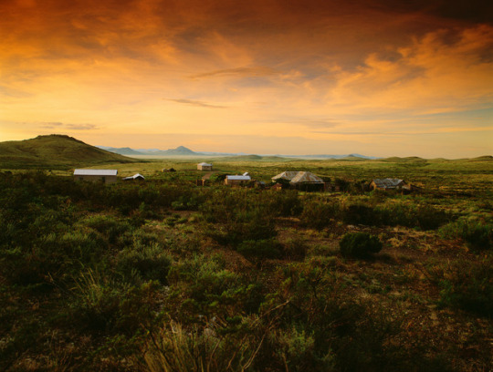
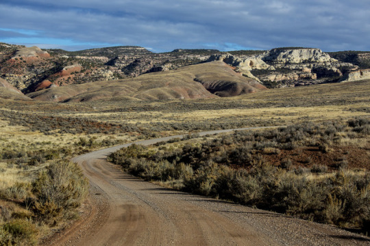

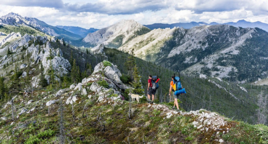

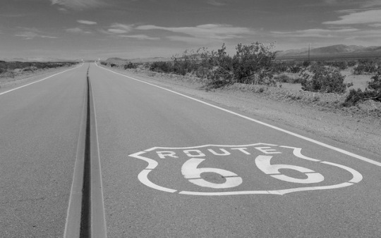
#NewYearNewAdventures: Our favorite road trips/byways
We’re continuing to share some of the top spots on #yourpubliclands to start the New Year off right. Explore the outdoors with these road trips and byways this year to BLM-managed public lands.

Dalton Highway, Alaska
The Dalton Highway stretches 414 miles across northern Alaska from Livengood (84 miles north of Fairbanks) to Deadhorse and the oilfields of Prudhoe Bay. Built during construction of the trans-Alaska oil pipeline in the 1970s, this mostly gravel highway travels through rolling, forested hills, across the Yukon River and Arctic Circle, through the rugged Brooks Range, and over the North Slope to the Arctic Ocean. Along most of its length, you'll see no strip malls, no gift shops, no service stations, just forest, tundra, and mountains, crossed by a ribbon of road and pipe.The BLM manages a swath of public lands along the highway from the Yukon River to the north side of the Brooks Range. Within the Dalton corridor, the BLM maintains campgrounds, rest areas, interpretive panels and the award-winning Arctic Interagency Visitor Center in Coldfoot.This is no ordinary road -- it pays to be prepared. There is no cell phone service or public Internet connection along the Dalton Highway.
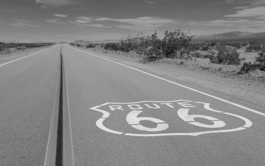
Route 66 Historic Backcountry Byway, Arizona
This 42-mile stretch of two-lane blacktop is one of the last and best-preserved segments of the original Route 66, one of America's first transcontinental highways. This portion of the highway once included one of the most fearsome obstacles for "flatland" travelers in the 1930's: the hairpin curves and steep grades of Sitgreaves Pass, which characterize Old Route 66 as it makes its way over the Black Mountains of western Arizona.
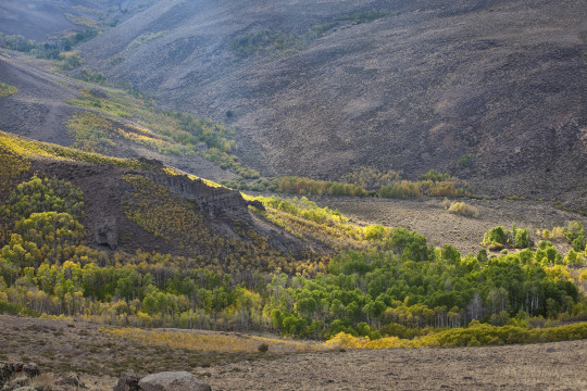
Bodie Hills, California
Always on our #roadtrip #bucketlist! California’s Eastern Sierra region is a dramatic transition zone between the snow-capped granite spires of the Sierra Nevada and the endless sagebrush covered uplands of the Great Basin. A trip at the right time of year will reward visitors with a diversity of wildflowers.
One great wildflower viewing area is just north of Mono Lake and east of Yosemite National Park in the rolling Bodie Hills – hills being an understatement since they top out at over 10,000 feet! Because of their high elevation, wildflower blooms are later here than much of California – typically arriving in May-June on the lower slopes and into July on the highest peaks. Several back roads traverse the area and offer access to view the displays of phlox, penstemon and paintbrush to name a few of the many wildflower species. More than 100,000 acres of BLM lands cover most of the Bodie Hills and include several wilderness study areas.
Bodie State Historic Park is the best-preserved ghost town in California, and arguably in the United States. Wildlife viewers can see antelope, mule deer, and if lucky, get a glimpse of a sage grouse. If you visit later, around early October, crisp clear nights will turn the scattered aspen stands to gold, giving a second opportunity to see Bodie Hills in color.
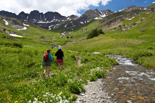
Alpine Loop National Backcountry Byway, Colorado
A #roadtrip to the #AlpineLoop should be on your #bucketlist for 2018! Located northeast of Silverton, Colorado in San Juan and Hinsdale counties, the Alpine Loop Back Country Byway is a premiere visitor destination. The epic scenery draws off-highway-vehicle enthusiasts across the country who are treated with a network of roads that climb above the timberline, accessing unparalleled vistas in an alpine environment. The hiking, biking and camping in the area is also fantastic. Scattered along the Alpine loop are remnants of our nation’s frontier history, where visitors can learn about the bustling mining towns that once thrived here.
While many roads are accessible by regular, two-wheel drive vehicles, getting into the alpine areas require high-clearance, four wheel drive vehicles. Plan your trip accordingly.
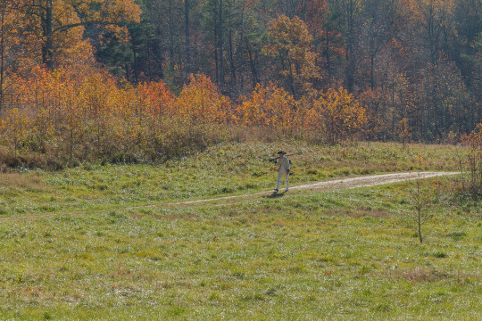
Washington-Rochambeau Revolutionary Route National Historic Trail, Virginia
Journey through early American history and walk in the footsteps of our nation’s founding fathers as you explore the Washington-Rochambeau Revolutionary Route. This National Historic Trail commemorates over 680 miles of land and water trails followed by the allied armies of General George Washington and the French Lieutenant General Comte Jean de Rochambeau. During their 1781 march from Newport, Rhode Island to Yorktown, Virginia, the French army established an encampment on what is now the Meadowood Special Recreation Management Area (SRMA). A segment of this trail connects with a BLM system of trails crossing the SRMA on the historic Mason Neck Peninsula, just a short drive from the nation’s capital. At Meadowood, the trail transects open meadows, enters into mature hardwood forests, and crosses riparian wetlands. While in the area, visit Gunston Hall, the home of Founding Father George Mason, a strong supporter of individual liberties and the author of the Virginia Declaration of Rights. Many of the concepts in that document found embodiment in the first ten amendments to the U.S. Constitution, the Bill of Rights.
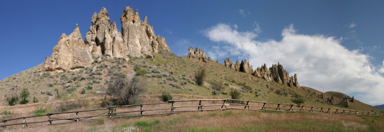
Lewis and Clark Backcountry Byway, Idaho
The Lewis and Clark Backcountry Byway and Adventure Road is a 36-mile loop drive through a beautiful and historic landscape following the Lewis and Clark National Historic Trail and the Continental Divide National Scenic Trail. Experience incredible views of the Lemhi Valley and the surrounding mountain ranges; truly some of the finest scenery in America!
The mountains, evergreen forests, high desert canyons and grassy foothills look much the same today as when the Lewis and Clark Expedition passed through in 1805. Take a slow and meandering journey along this drive with time to stop along the way for hiking, fishing, mountain biking and exploration. With a 4,000 foot gain and loss in elevation, expect some steep grades too.
Lemhi Pass is well-known for its wildflower displays in the spring and summer. Captain Lewis collected three new plant species in this area: mountain maple, common snowberry and Lewis’s monkey flower. You might see elk, mule and whitetail deer, black bear, moose, pronghorn antelope, coyotes and many smaller mammal species. Early mornings and evenings are the times to look for wildlife, particularly where the forest and meadow meet.
By late September, shorter days and cooler temperatures release hues of red, yellow, and gold in aspens, cottonwoods, willows and shrubs. Don’t miss Agency Creek in October – it’s beautiful! Download a visitor guide for your roadtrip from our website.
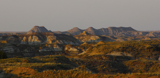
Big Sky Byway, Montana
The 105-mile Big Sky Back Country Byway begins in Terry, MT, and travels north and south covering badlands and rolling prairies. The byway ends in Wolf Point, MT, on the beautiful Missouri River, part of the Lewis and Clark National Historic Trail. The route is part of the National Scenic Byways Program, linking Terry with Wolf Point. Taking 2 hours one way, you can stop to take a look at the information kiosks in Terry, Circle, and Wolf Point, which describe byway attributes, local history, and culture. Visitors can enjoy the scenic badlands of eastern Montana year round from this all-weather road.
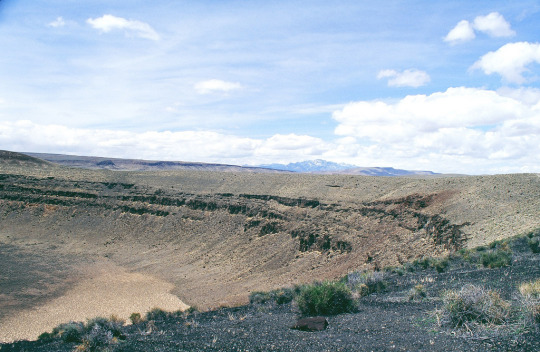
Lunar Crater Backcountry Byway, Nevada
The scenic loop (the Lunar Crater Back Country Byway) passes by the crater with a stopping point near the crater where visitors can get out to view the impressive volcanic feature. Vehicles are limited to existing roads and trails.
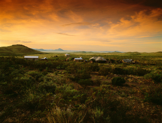
Lake Valley Backcountry Byway, New Mexico
A meandering 48-mile drive on paved roads takes visitors through ranching and mining country and past the ruins of the 1880s mining town of Lake Valley. The Lake Valley Backcountry Byway is nestled between the Mimbres and Caballo Mountains and the Cooke's Range in southwestern New Mexico and offers spectacular scenic views. Rich in history and scenery, the Byway offers an outstanding trip for travelers with an hour to spare.
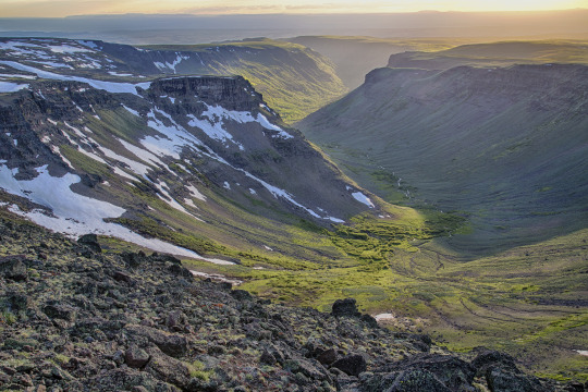
Steens Mountain, Oregon
How about this for a scenic byway: Glacier-carved gorges, pristine alpine lakes and wild and scenic rivers, all accessible via the highest elevation road in Oregon!
Come take a drive on the 52-mile-long Steens Mountain Backcountry Byway! There are four campgrounds along the byway for those wanting to stay a little bit longer in one of the most remote places in the U.S.!
Photo/video: https://goo.gl/VOkTFg
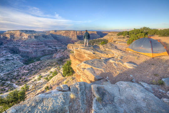
San Rafael Swell, Utah
Make the most of your road-trip to Moab or the Skyline Drive! Take the scenic route through the San Rafael Swell. Emery County Road 332 is a gravel road that connects approximately 45 miles between Huntington, Utah to Interstate 70 in the heart of the San Rafael Swell. Enjoy the amazing desert scenery, stop at the wedge overlook for a view of the “Little Grand Canyon,” view the ancient rock art of the Buckhorn Draw Panel, and maybe even take a side trip to the Cleveland-Lloyd Dinosaur Quarry. While there is primitive-style camping in the area, there are no other services. Come prepared with everything you need, and take home everything you bring. Flat tires are common.
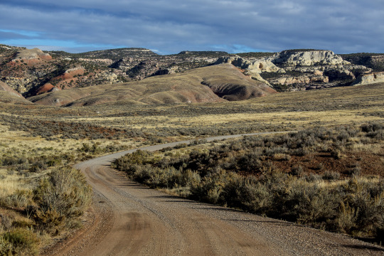
Red Gulch/Alkali National Backcountry Byway, Wyoming
The Red Gulch/Alkali National Backcountry Byway is a 32-mile scenic drive on improved gravel and dirt roads through the foothills of the Bighorn Mountains. Near each of the two entrances to this historic route you will see a National Backcountry Byway kiosk which provides historical information about the byway as well as road conditions. The steep, rugged canyons cut into the mountains along the byway and offer many challenging and interesting hiking opportunities. Among the wondrous sights you may see are hoodoos. These strange, artistic rock formations were carved over the centuries by Wyoming’s wind.
#bureau of land management#explore#yourpubliclands#recreation#roadtrip#byway#outdoors#getoutdoors#outside#newyearnewadventures#newyear#2018#solitude#nature#photography#wilderness#alaska#arizona#california#colorado#virginia#idaho#montana#nevada#newmexico#oregon#utah#wyoming
42 notes
·
View notes
Text
Hyperallergic: The Histories Erased by a Monument to the Los Angeles Aqueduct
The back of the Los Angeles Aqueduct Monument (all photos by the author for Hyperallergic unless indicated otherwise)
LOS ANGELES — Like an empty bucket it sits on the south side of Los Angeles City Hall. The Los Angeles Aqueduct Monument is a white marble fountain beneath large rubber trees. No water flows here. Instead, the stained basins hold shredded plastic, cracked bottles, broken as the fountain.
The rounded lawn of City Hall is a democratic haven amid the increasingly privatized public space of Los Angeles. Shade and grass are abundant. Traffic thins out. Bathrooms are available. You will see a true sampling of society resting, walking, working, talking, looking, biking, photographing, leering, policing, and surviving all in this one spot, with the fountain as its dried up watering hole.
The front of the Los Angeles Aqueduct Monument
On the summer afternoon I visit, Mardi Gras beads sparkle softly from the edge of the middle basin. I see just above them another basin, and there in the upper center of the monument is a bas-relief bust of Frank Putnam Flint (1862–1929), the senator who devised the Los Angeles Aqueduct. Accompanying plaques explain how Flint was aided in his efforts by Theodore Roosevelt. This portrait of the mustachioed senator and its duplicate mounted on the other façade of the fountain were created in 1933 by Julia Bracken Wendt. The medallions replicate originals, which were stolen in the 1990s. (The fountain was restored in 2006.)
For the last 114 years, Flint’s aqueduct has brought water from Owens Valley in central California to LA. The same system of canals, waterways, and pipes conveys billions of gallons of water to southern California. It might as well come from another planet; with the twist of a wrist, Angelenos can readily relieve their unquenchable thirst.
Invisibly embedded in this monument and others like it is the goal of making us forget Indigenous people. Through this homage to modernity and amenity, we lose touch with what came before. We forget that water is life and can’t be owned. The dry fountain commemorates the journey of water brought to a near-desert where it almost never rains.
In order to consume aqueduct water with a sense of innocence, we have to ignore how it became “ours.” The real history of the Los Angeles Aqueduct is obfuscated by the fountain. And that truth deals more in colonization — land grabs, duplicity, violence, oppression, and starvation — than in legislation and engineering.
The plaque on the Los Angeles Aqueduct Monument
Although City Council recently voted to designate the second Monday in October as Indigenous Peoples Day, no mention of Indigenous people is found on the grounds of City Hall. This designed landscape suggests the city’s history only goes back to the 18th century. The fountain invokes a tranquility that may never have existed. It was installed in the time of segregated drinking fountains and redlining, the same Jim Crow era when many Confederate monuments went up. Without a discourse that can critique Confederate monuments and others, we forget Indigenous people, like the Paiute in Owens Valley. We forget their fight for freedom and struggle against white supremacy.
I come to this fountain the day after the solar eclipse to reinvestigate a place where I remembered resting after the Women’s March. That January evening, I had hopeful conversations with younger, wiser people. I walked around City Hall and finally sat on a ledge. My attention was drawn to signs left behind by protesters: “Asians for Black Lives Matter”; “Jesus was a Middle Eastern refugee”; “Pussy grabs back.” The sheer number of discarded protest signs — all that waste — left me slightly discouraged because these sentiments are not trash, they are recyclable. I turned and realized I was sitting on a monument. There was something quietly dignified about it. I noted the place, recorded a minute-long voice memo, and vaguely plotted to return. Over the ensuing months, the examination of monuments as sites of history exploded into public discourse.
Detail of the Los Angeles Aqueduct Monument
Monuments are memories by their very nature; they cannot be innocuous. This is evident even on the surface level, even in the absence of water in the Los Angeles Aqueduct Monument. In 1967 a drunk man drowned in the monument’s shallow pool , and it has remained empty ever since. Looking beyond the symbolism of the fountain, the aqueduct’s history spills into more tragedy.
Forty-three people died building the Los Angeles aqueduct. The labor force included Indigenous and immigrant workers. They endured extreme weather, grueling conditions, and disease. Largely untold, the story of their plight is absent from the sanitized narrative of individualistic triumph represented in bas relief on the monument. Fortunately, the project’s labor history has been brought to light in recent projects like a series of fictional journal entries written by UCLA students from the workers’ perspective, and Lauren Bon and the Metabolic Studio’s public art project One Hundred Mules Walking the Los Angeles Aqueduct.
Any honest monument to the aqueduct would have to represent not only the workers, but also the Indigenous people who were displaced in order for construction to take place. The monument excludes the Paiute people, the original inhabitants of Owens Valley — where the city’s water comes from — just as the aqueduct itself excludes them from their water supply.
Settler diaries describe discrimination blocking the Paiute from the economy that they developed in the Valley. Beginning in 1859, settlers came to mine, farm, and graze cattle there. These new white immigrants refused multiculturalism through exclusion and violence. In response to this dehumanizing treatment, Indigenous armed resistance movements began around the same time. By 1862, white people were engaging in wars of attrition, destroying Indigenous crops and food storage just as volunteer militias carried out murders of Natives. They were fulfilling the genocidal proposals of California’s first governor, Peter Burnett, who in 1851 said: “That a war of extermination will continue to be waged between the races until the Indian race becomes extinct must be expected.”
In March of 1863, in hopes of avoiding forced relocation, several Paiute people fled by swimming into Owens Lake. A few Natives avoided getting shot by US soldiers, but between 30 and 40 drowned in that lake in what would become one of numerous massacres in the era. Regardless, in July of that same year, hundreds of Paiute people were forced into a makeshift reservation at Fort Tejon. Owens Lake has been dry since 1924, but these scars remain.
In the Paiute realm, water geography holds memory. Oral narratives align each of the lakes in the Sierras to a particular sacred component of the world. Even their name for themselves derives from their word for water, “Pai.” Paiute people are still fighting for water sovereignty in 2017. The construction of the aqueduct threw both their cultural and natural landscapes into disarray, and that process continues today.
In 1939, Congress brokered an agreement whereby Los Angeles forced Native people still in Owens Valley to sell their land or they would be unable to join the federally recognized tribes at the Big Pine, Lone Pine, and Bishop reservations. According to the terms of agreement, water would be provided to the reservations, but water rights were left to-be-determined and never finalized.
Prior to being dispossessed, Paiute communities used sustainable, life-giving water engineering that predates the Los Angeles Aqueduct by thousands of years. The original irrigation builders spent generations maintaining shallow trenches off of rivers that would restore groundwater and quench crops like piñon trees, edible grass, and tubers. The aquifers also served as incubation ponds for brine shrimp, a staple. Centuries before it became a trend, the Paiute were practicing sustainable agriculture.
What would happen if this Los Angeles Aqueduct Monument honored the Paiute Nation instead of one upper-class white man? What would happen if a different monument took shape, a monument in the form of land returned? A monument to freedom that consisted of territory, like Jorge Luis Borges’s story of a map whose scale is exactly to real-world size. The people of the Paiute Nation deserve recognition for their struggle, their resilience, and their aqueducts.
Since the Los Angeles Aqueduct Monument was made, there has been progress in memorial making. The idea of a monument protecting sacred land is not hypothetical; in fact, the best example of this is Bears Ears National Monument. As I write this, Secretary of the Interior Ryan Zinke is proposing to cut down the size of National Monument lands, including swaths of land preserved after decades-long Indigenous efforts, including Bears Ears. The cuts would shrink protected land and make way for mining and oil drilling. President Obama designated Bears Ears to have the first of its kind tribal commission, a panel that provides federal managers with Indigenous expertise and historical knowledge. The recent push to exploit and extract value from Native land is predictable — Indigenous nations have always been targets of conquest.
Back at Los Angeles City Hall, though there is no mention of the Paiute, one can find memorials to native living beings: plants. Outside the building walls live various palms, birds of paradise, blue chalk sticks, foothill penstemon, century plants, agave, and grass, all labeled and called by name, and marked “California Native ” where applicable.
A dead Coast Redwood near the Los Angeles Aqueduct Monument
A dead Coast Redwood stood until recently on the lawn beside the Los Angeles Aqueduct Monument. The tree, which attained an even fiercer red in death, has vanished since my second visit to the grounds, but the stump still resonates. Redwoods can survive climate carnage that humans cannot — they have already done so for millennia. Dead trees speak through their future form — smoldering embers. With more than 100 million dead trees in California waiting to ignite in wildfire, City Hall’s dead redwood was a reminder that danger is close. Even in controlled urban environments, oases are precarious. Appropriately, a monolithic monument to firefighters stands near where that redwood used to.
We know that the climate changes, and such change in the Sierras is well documented. But there are also less predictable changes: the landslide that cut off the Pacific Coast Highway; the near-collapse of the Oroville Dam; the stress on the watersheds feeding the aqueduct. Such infrastructure has been exposed as fallible. Century-old concrete gray-scapes are still trusted out of convenience, a nonchalant wager that they will endure forever. Even the Los Angeles Aqueduct will stall someday if Sierra snowpack continues to dwindle.
And yet, all is not bleak. While the western world drags its feet to address climate disasters, Indigenous people continue to be the world’s defenders of biodiversity. Consider this interview with elders from the Paiute Nation, Alan Bacock and Harry Williams. The story they envision begins with invasive destruction and plunder, as is contextually necessary, yet concludes with a planted seed. “You can change the world through a garden,” they say.
In the growth of those seeds, a different landscape of monuments and markers is possible. Projects like the Equal Justice Initiative provide a roadmap to that end. Or artists’ projects like Ken Gonzales-Day’s mapped walking tour of lynching sites in Los Angeles, which reveals the city’s hidden history. Lynchings of Black, Indigenous, Chicano, and Asian people were happening in Los Angeles in the 1850s, just as white settlers invaded the Sierras and the Paiute people waged resistance.
A more complete history of Indigenous people is attainable. But standing face-to-face with the Frank Putnam Flint fountain, this struggle evaporates and white supremacy is made to appear neutral. Undoing that process means reading past the face value of our monuments and seeking meaning in the mundane.
The Los Angeles Aqueduct Monument in 1959 (courtesy the Los Angeles Public Library)
I round the corner from the fountain and remember the day that made the journey possible. I would not have learned this history without getting involved, would not have a nation I could connect to the water that flows from my taps. That movement was the Divest LA campaign — a broad movement, led by Native people. Our goal was to end LA’s municipal investments with Wells Fargo, thus divesting the funds from the Dakota Access Pipeline. Ultimately, the campaign was successful, and the city now has to consider alternatives and specific criteria for responsible banking. During the campaign we held marches, collected thousands of petition signatures at other marches, and went to City Hall budget meetings.
When the main Divest LA march concluded on the steps of City Hall in March, Native people bore witness to their struggle. On those steps, I heard children speak Nahuatl. In their words and in their survival they overcome colonization. Such nonviolent social movements for environmental justice connect everyone, from all walks of life and every generation — from the urban and upstream to the rural.
The current of Divest LA and other movements like it around the country, their energy, is decolonization. To decolonize public space is to continue a process that liberates the individual and the community. This dialogue may lead to removing or replacing more monuments honoring Confederate war generals. But truly redressing past injustice means also challenging peacetime monuments, like the Los Angeles Aqueduct Monument. Perhaps on Indigenous Peoples Day we can rededicate Frank Putnam Flint’s fountain to the Paiute people whose water we have been drinking for 114 years. This would be a swell in the vast flow of decolonizing.
The post The Histories Erased by a Monument to the Los Angeles Aqueduct appeared first on Hyperallergic.
from Hyperallergic http://ift.tt/2fVPfRs via IFTTT
0 notes
Photo

Foothills evening and penstemon. May 2017, near Golden, CO. . #may #getoutside #springflowers #penstemon #beardtongue
0 notes
Text
Penstemon Heterophyllus

Common name: Penstemon, Foothills
Water requirements: Low
Height: 1′- 3′
How to care for: Likes sun, prefers loam and rocky soils
Where did this information come from?: link
For more plant information: link
0 notes
