#donegal bay
Explore tagged Tumblr posts
Text
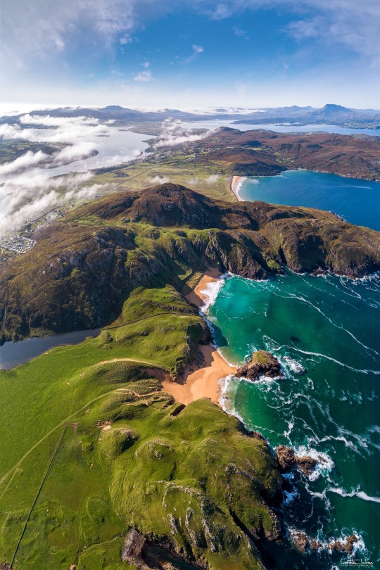
Boyeeghter Bay | Murder Hole Beach
One of Ireland’s most beautiful and pristine bays is on the Rosguill Peninsula – Boyeeghter Bay. At high tide you will find two sandy beaches, which grow together to one big beach when the tide is out. The roaring Atlantic Ocean has gnawed bizarre cuts and a cave into the cliff faces along the bay. The wild waters may also be responsible for the bay’s nickname – ‘The Murder Hole’. The beach may…
View On WordPress
#Boyeeghter Bay#Donegal#Downings#History of Ireland#Ireland#Irish History#Melmore Head#Murder Hole Beach#Rosguill Peninsula#Tra Na Rossan Bay
11 notes
·
View notes
Text
Shannen's Native American Descent
We all know Shannen Doherty was of Irish descent through the paternal side of her family.
The Doherty / O’Doherty family is an Irish clan based in County Donegal. The O’Dohertys are named after Dochartach (c. 10th century), a member of the Cenél Conaill dynasty which in medieval Irish genealogy traced itself to Niall of the Nine Hostages. The O’Doherty clan and family name is one of the most ancient in Europe. The clan traces its pedigree through history, pre-history, and mythology to 2BC. (Source)
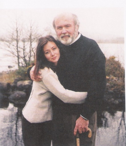
Shannen and her dad, John Thomas Doherty, in Ireland ca. 1996/97.
Shannen was also from English and Scottish descent through her mother Rosa Elizabeth née Wright. The red-haired Southern belle also has Native American ancestry, most concretley the Chumash people (Source), and thus has Shannen (Source).
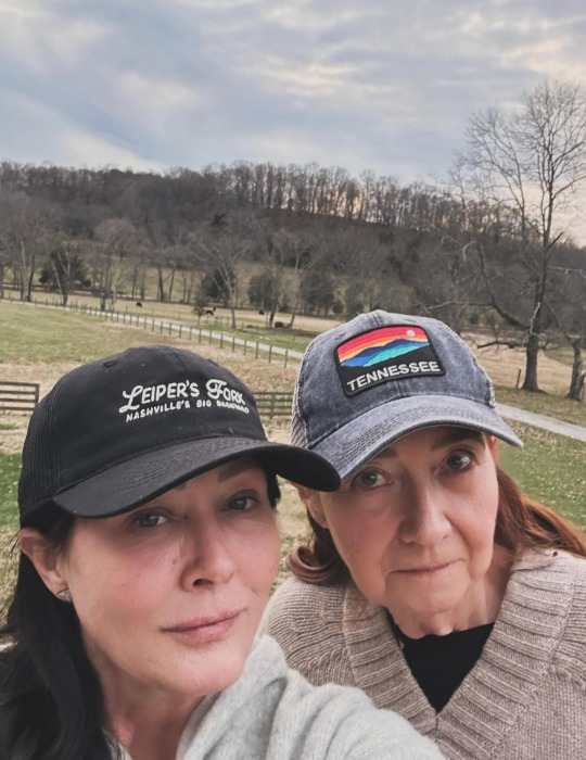
Shannen and her mum spending time in nature, ca.2024.
Shannen explained that she wasn't able to be with her dad when he passed away on the 4th of November of 2010. Her best friend Chris Cortazzo told her to spend some quality time with her mother and him at his ranch in Tennesse, which is surrounded by Native American ground. When she was there suddenly the wind shaked the plants and trees and she felt her father’s arms go around her and say “It’s ok baby, I love you. I’m here" (Source) (Source).
Her mother Rosa said that one of her great-great-grandmothers (she doesn't know the grade) was forced to move in the called "Trail of Tears", the forced displacement of approximately 60,000 people of the "Five Civilized Tribes" [Cherokee, Chickasaw, Choctaw, Muscogee (Creek), and Seminoles] between 1830 and 1850, and the additional thousands of Native Americans within that were ethnically cleansed by the United States government (Wiki). Furthermore, she said her ancestor was from the Chumash people and was forced to move from Mississipi to Oklahoma (Source).
Rosa also said about Shannen's Native American's heritage:
"The whole Indian heritage to Shannen was very, very important ... Shannen swore when she bought this property [a ranch in Malibu to live with her mum, her friends, and to do a shelter for horses]… she says, I just feel it. She says, I know that this is where I'm supposed to be. And she just felt that whole Indian."
Also she was proud of having directed "Charmed"'s episode "The Good, The Bad and The Cursed" that features a storyline involving American's First Nations people's and Native actors Kimberly Guerrero (from Colville and Salish-Kootenai native peoples from Alaska) and Michael Greyeyes (Nêhiyaw (Plains Cree) from Muskeg Lake Cree Nation in Saskatchewan, Canada).
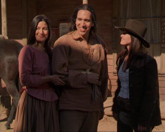
Shannen Doherty (R) with First Nations' actors Kimberley Guerrero and Michael Greyeyes.
The Chumash are a Native American people of the central and southern coastal regions of California (Wiki), in portions of what is now Kern, San Luis Obispo, Santa Barbara, Ventura and Los Angeles counties, extending from Morro Bay in the north to Malibu in the south to Mt Pinos in the east. Their territory includes three of the Channel Islands: Santa Cruz, Santa Rosa, and San Miguel; the smaller island of Anacapa was likely inhabited seasonally due to the lack of a consistent water source.
Modern place names with Chumash origins include Malibu, Nipomo, Lompoc, Ojai, Pismo Beach, Point Mugu, Port Hueneme, Piru, Lake Castaic, Saticoy, Simi Valley and Somis. Archaeological research demonstrates that the Chumash people have deep roots in the Santa Barbara Channel area and lived along the southern California coast for millennia.
The Chumash lived in over 150 independent villages, speaking variations of the same language. Much of their culture consisted of basketry, bead manufacturing and trading, cuisine of local abalone and clam, herbalism which consisted of using local herbs to produce teas and medical reliefs, rock art, and the scorpion tree. The scorpion tree was significant to the Chumash as shown in its arborglyph: a carving depicting a six-legged creature with a headdress including a crown and two spheres. The shamans participated in the carving which was used in observations of the stars and in part of the Chumash calendar. The Chumash resided between the Santa Ynez Mountains and the California coasts where a bounty of resources could be found. The tribe lived in an area of three environments: the interior, the coast, and the Northern Channel Islands. Some researchers believe that the Chumash may have been visited by Polynesians between AD 400 and 800, nearly 1,000 years before Christopher Columbus reached the Americas.
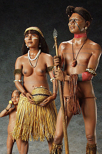
Chumash Family by American sculptor George S. Stuart
The maritime explorer Juan Cabrillo was the first European to make contact with the coastal Alta Californian tribes in the year 1542. Spain claimed what is now California from that time forward, but did not return to settle until 1769, when the first Spanish soldiers and missionaries arrived with the double purpose of Christianizing the Native Americans and facilitating Spanish colonization. The Chumash people moved from their villages to the Franciscan missions between 1772 and 1817.
Mexico seized control of the missions in 1834. Tribespeople either fled into the interior, attempted farming for themselves and were driven off the land, or were enslaved by the new administrators. After 1849 most Chumash land was lost due to theft by Americans and a declining population, due to the effects of violence and disease. The remaining Chumash began to lose their cohesive identity. In 1855, a small piece of land (120 acres) was set aside for just over 100 remaining Chumash Indians near Santa Ynez mission. This land ultimately became the only Chumash reservation, although Chumash individuals and families also continued to live throughout their former territory in southern California.
No native Chumash speak their own language since Mary Yee, the last Barbareño speaker, died in 1965. Today, the Chumash are estimated to have a population of 5,000 members.
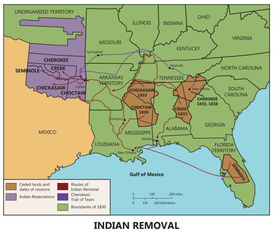
Map of the Trail of Tears
Chumash worldview is centered on the belief "that considers all things to be, in varying measure, alive, intelligent, dangerous, and sacred." "They assume that the universe with its three, or in some versions five, layers has always been here."
Human beings occupy the Middle Region, which rests upon two giant snakes. Chronological time is unimportant, though the past is divided into two sections: the universal flood that caused the First People to become the natural world and, thereafter the creation of human beings, the arrival of the Europeans, and the devastating consequences that followed."
The middle region (sometimes referred to as 'antap), where humans and spirits of this world live and where shamans could travel in vision quests, is interconnected with the lower world (C'oyinahsup) through the springs and marsh areas and is connected to the upper world through the mountains. In the lower world live snakes, frogs, salamanders. The world trembles or has earthquakes when the snakes which support the world writhe.
Water creatures are also in contact with the powers of the lower world and "were often depicted in rock art perhaps to bring more water to the Chumash or to appease underworld spirits' at times of hunger or disease." Itiashap is the home of the First People. Alapay is the upper world in Chumash cosmology where the "sky people" lived, who play an important role in the health of the people. Principle figures of the sky world include the Sun, the Moon, Lizard, Sky Coyote, and Eagle. The Sun is the source of life and is also "a source of disease and death." The Sky Coyote, also known as the Great Coyote of the Sky or Shnilemun, is considered to be a protector and according to Inseño Chumash lore, “looks out for the welfare of all in the world below him”. During the creation of mankind, the Sky Coyote was present among the other important cosmological figures. The Eagle, also known as Slo’w, is the force that maintains momentum and order among the other stars so that they do not fall down on and destroy earth.
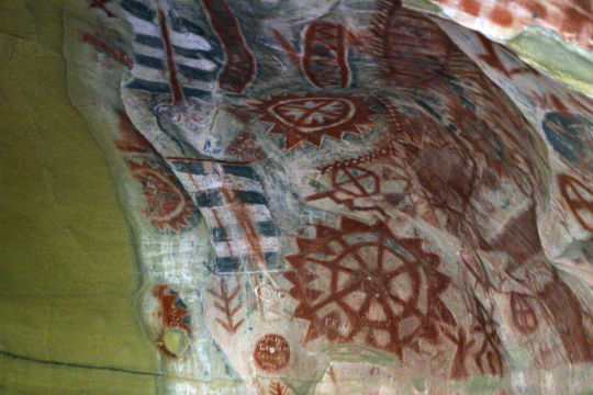
Chumash pictographs.
The Chumash cosmology is also centered around astronomy. Rock art and arborglyphs that have been found within Chumash sites are thought to have depicted Polaris (the North Star) and Ursa Major (the Big Dipper). These two astrological entities were paramount to the Chumash belief system as well as their perception of time. It is believed that the Chumash used these constellations to determine what time of the year it was depending on the position of Ursa Major around Polaris.
***
I love that Shannen showed her respect to her ancestry in some "Charmed" episodes, like in 2x10 "Heartbreak City" (click to see if bigger):

Charmed 3x01 "The Honeymoon is Over" (click to see bigger):

And the already mentioned 3x14 "The Good, The Bad and The Cursed" (click to see bigger). Her love for horses also comes from that connection:

#shannen doherty#ancestry#irish ancestry#native american ancestry#first nations ancestry#chumash#chumash people#family#trail of tears#heritage#indian heritage#charmed 3x14#charmed 2x10#charmed 3x01#charmed#director#shannen doherty director#shannen director#1990s shannen doherty#2000s shannen doherty#2020s shannen doherty#rosa doherty#malibu#chris cortazzo#tennesse
21 notes
·
View notes
Text

MR FAME (Fame VF+ x Swana++) 1989 Polish/CMK/Egyptian bay gelding bred by Marv and Christine Miller. Tail female to the Crabbet import RODANIA through the US bred DONEGAL.
1996 US National Reserve Champion Dressage Second Level 1996 US National TT Dressage Third Level
Brittany N Thompson
22 notes
·
View notes
Text
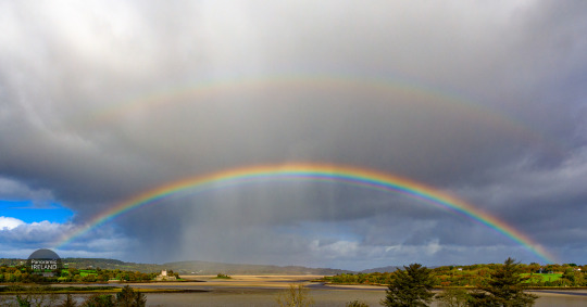
Intense double rainbow in a stormy, rain-filled sky over Doe Castle and Sheephaven Bay in Donegal, Ireland.

The tower was built in the 1420s and the outer walls in the 1620s. Doe Castle was home to the McSweeneys for most of this period.
#ireland#vsco#landscape#vscocam#irish#photographers on tumblr#photography#travel#nature#rainbow#scenery#panoramic ireland#donegal#irish castles#castle#wild atlantic way#sea and sky
24 notes
·
View notes
Text

Hai mai sentito parlare dello spettacolare Gleniff Horseshoe?
Questo percorso di 10 km nella Contea di Sligo regala viste spettacolari delle Dartry Mountains e di Donegal Bay. La valle glaciale dell'Horseshoe sul lato nord della montagna si formò durante l'ultima glaciazione, quando il paesaggio era coperto da ghiacciai spessi più di 1 km.
Oltre allo splendido scenario, ci sono monumenti megalitici, un tumulo di corte e una grande grotta sulla scogliera.
© Turismo Irlandese
foto © 𝗥𝗮𝘀𝗵𝗲𝗱 𝗛𝗲𝗻𝗱𝗲𝗿𝘀𝗼𝗻
26 notes
·
View notes
Text
Arthur, very drunk: Sing us a song, Mr. Macguire!
Sean: Which one?
Arthur: I dunno, one of those Irish songs about cliffs and a girl with golden black hair. And the English all being bad.
Sean: M'too tired, sing it yourself.
Arthur: Alright...
Arthur: *stands on a box, wobbly*
Arthur: Oh Eamonn, Danny dear, I miss the Galway Bay, And I'll sing for all I got! With a riddle-diddle Dublin, And a riddle-diddle Donegal, The English are all bollocks!
Sean: *applauds*
78 notes
·
View notes
Text
The House on the Hill
Salthill is well-named as it sits on high ground overlooking the harbour at Mountcharles, County Donegal. Of two storeys over raised basement and five bays, the house has a central pedimented breakfront with Diocletian window. The building is thought to date from the 1770s and may have been designed by Dublin-based architect Thomas Ivory, commissioned by the Conyngham family who owned a large…

View On WordPress
#Architectural History#County Donegal#Georgian Architecture#Irish Country House#Salthill#The Big House
3 notes
·
View notes
Photo

Boyeeghter Bay, Donegal. [OC] [1160 x 870]
11 notes
·
View notes
Text
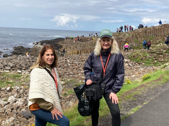
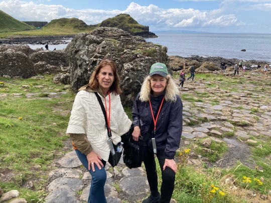
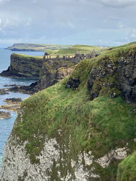
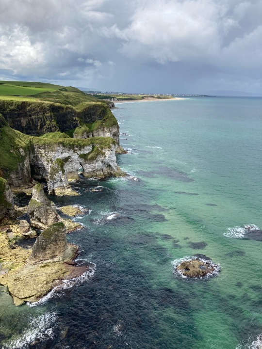
Day 8 Sligo to Belfast stop off Derry-Giants Causeway
Drive along Donegal Bay with its small fishing ports and hidden beaches to Derry, the walled city banks of the Foyle River. Continue onto awe-inspiring Giants Causeway, a UNESCO World Heritage site. Millions of years ago, the more than 40,000 interlocking basalt columns were formed. Overnight stay in Belfast.



2 notes
·
View notes
Photo

Boyeeghter Bay, Donegal. [OC] [1160 x 870] https://ift.tt/aJ4ic9R
1 note
·
View note
Text
Capturing Your Special Moments: Wedding Photographer Donegal
Why Donegal is Perfect for Wedding Photography
Donegal is a hidden gem for couples looking to tie the knot amidst nature's grandeur. From the stunning beaches at Ballymastocker Bay to the iconic cliffs of Slieve League, the region boasts a range of picturesque locations. Imagine exchanging vows under the soft hues of a Donegal sunset or posing against the mystical ruins of Glenveagh Castle. A professional wedding photographer in Donegal understands how to utilize these enchanting settings to create captivating photos.
Donegal’s unpredictable weather can be a challenge, but a seasoned photographer knows how to adapt, making rain or shine work in your favor. Whether it’s capturing the soft light of a misty morning or the vibrant colors of a sunny afternoon, their expertise ensures every shot is picture-perfect.
The Importance of a Skilled Wedding Photographer
Wedding photography isn’t just about pointing a camera and clicking. It’s an art that requires a blend of creativity, technical skill, and an eye for detail. Your wedding photographer plays a crucial role in documenting the candid laughter, emotional exchanges, and tiny details that make your day unique.
A Wedding Photographer Donegal who is familiar with the local terrain brings additional value to the table. They know the best spots for romantic shots, how to work with the natural light, and how to frame you against Donegal's breathtaking landscapes. Their experience ensures that every image tells a story, reflecting your personalities and the joy of your special day.
What to Expect from a Professional Wedding Photographer in Donegal
When you choose a professional photographer, you’re investing in a service that goes beyond the wedding day. From pre-wedding consultations to post-production editing, their role involves meticulous planning and attention to detail.
Pre-Wedding Consultation: A professional wedding photographer will take time to understand your vision, style preferences, and must-have shots. This ensures that the final album aligns with your expectations.
On-the-Day Coverage: Their experience allows them to seamlessly blend into your wedding day, capturing candid moments without intruding. Whether it’s the bride’s final preparations, the groom’s nervous anticipation, or the heartfelt speeches, every moment is preserved authentically.
Post-Production Excellence: After the big day, the photographer carefully selects and edits the images, enhancing colors, balancing lighting, and ensuring every photo is polished and perfect.
Finding the Right Photographer
Donegal has a vibrant community of photographers, each with a unique style and approach. Look for someone whose portfolio resonates with your vision. Check reviews, ask for recommendations, and have open conversations to gauge their compatibility with your requirements.
One excellent choice for couples is Jay Doherty Photography. Known for capturing the natural beauty of Donegal and the emotional essence of weddings, Jay brings professionalism and passion to every project.
A Timeless Investment
Your wedding photos are a lasting keepsake, a way to relive your special day for years to come. They’ll become part of your family’s legacy, shared with future generations. That’s why choosing the right wedding photographer in Donegal is a decision that should not be rushed.
0 notes
Text
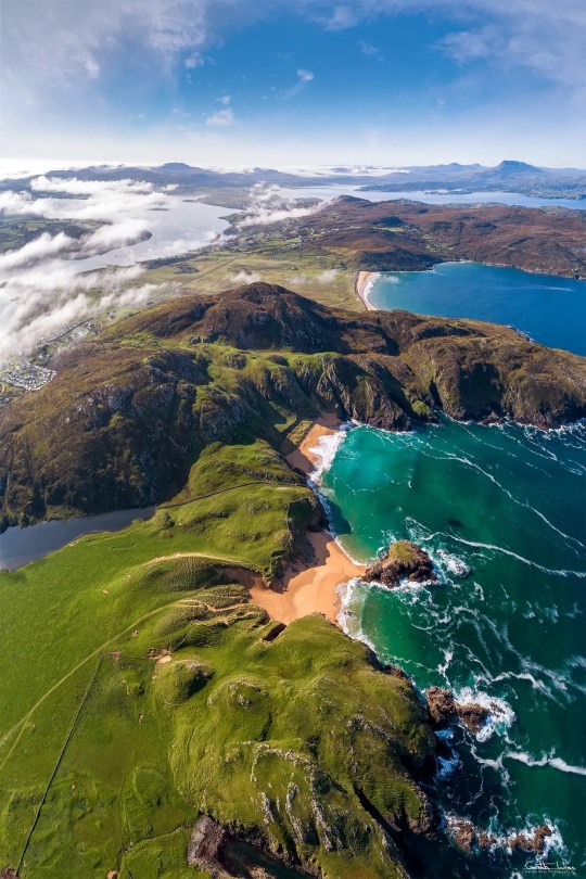
Boyeeghter Bay | Murder Hole Beach
One of Ireland’s most beautiful and pristine bays is on the Rosguill Peninsula – Boyeeghter Bay. At high tide you will find two sandy beaches, which grow together to one big beach when the tide is out. The roaring Atlantic Ocean has gnawed bizarre cuts and a cave into the cliff faces along the bay. The wild waters may also be responsible for the bay’s nickname – ‘The Murder Hole’. The beach may…
View On WordPress
#Boyeeghter Bay#Donegal#Downings#History of Ireland#Ireland#Irish History#Melmore Head#Murder Hole Beach#Rosguill Peninsula#Tra Na Rossan Bay
11 notes
·
View notes
Link
Check out this listing I just added to my Poshmark closet: St. John’s Bay | Cowl Neck Chunky Sweater Poncho Shrug Light Pink Plus 1X NWT.
0 notes
Text
Discover Ireland's Hidden Gems Guide to Must-Visit Spots in 2024!

Dreaming of exploring the Emerald Isle beyond the usual tourist hotspots? 🌿✨ Ireland is bursting with hidden gems that promise unforgettable experiences away from the crowds. If you’re planning a European adventure in 2024, be sure to include these lesser-known treasures in your itinerary.
1. Achill Island, County Mayo Discover breathtaking cliffs, pristine beaches, and serene hiking trails on Achill Island. Keem Bay’s crystal-clear waters and stunning views are perfect for a tranquil escape. 🏖️🌊
2. Glenveagh National Park, County Donegal Immerse yourself in nature at Glenveagh National Park, where a picturesque castle, lush gardens, and miles of walking trails await. 🏰🌲
3. The Burren, County Clare Explore the unique karst landscape of The Burren, with its ancient megalithic tombs, caves, and diverse flora. A truly intriguing natural wonder! 🌿🗺️
4. Dingle Peninsula, County Kerry Venture off the beaten path to the Dingle Peninsula for rugged coastlines, charming villages, and the scenic Slea Head Drive. Don’t miss the vibrant town of Dingle! 🚗🌅
5. Hook Peninsula, County Wexford Experience maritime history and coastal beauty at Hook Peninsula. Visit the historic Hook Lighthouse and enjoy peaceful coastal trails. 🌊⛵
6. Connemara, County Galway Discover the rugged beauty of Connemara with its stunning landscapes, traditional culture, and the picturesque Kylemore Abbey. 🌄🏞️
7. Aran Islands, County Galway Step back in time on the Aran Islands. Explore ancient forts, and rugged landscapes, and experience traditional Irish culture. Inishmore’s Dun Aonghasa Fort is a must-see! 🏛️⛰️
8. Lough Tay, County Wicklow Marvel at the “Guinness Lake” with its dark waters and sandy beach. Lough Tay offers breathtaking views and a serene setting perfect for relaxation. 🌅🏞️
9. Carlingford, County Louth Wander through the medieval charm of Carlingford, nestled between the Cooley Mountains and Carlingford Lough. Enjoy hiking, water sports, and the town’s rich history. 🏰🚶♂️
10. Copper Coast, County Waterford Explore the UNESCO Global Geopark of the Copper Coast, with its dramatic cliffs, secluded coves, and geological wonders. It’s a paradise for hikers and explorers! 🌍🗺️
0 notes
Text

Sheephaven Bay - Donegal
0 notes
Photo

"Ineuran Bay," from the Nordic/Irish meaning small, sheltered harbour. The house pictured, built circa 1860, is only one of three listed buildings in Malin Head, Co. Donegal (789��403))
0 notes