#clear creek canyon climbing
Explore tagged Tumblr posts
Text
Clear Creek Canyon Climbing: Best Routes to Explore
Clear Creek Canyon offers some of the best routes for climbers of all levels. Clear Creek Canyon climbing provides a variety of terrains, from easy slabs to challenging overhangs. Whether you're just starting out or you're an experienced climber, you'll find plenty of exciting routes to explore. Enjoy the stunning views and a memorable climbing adventure in the canyon.
0 notes
Text

I spent 55 days climbing outside in 2023 and really couldn’t have asked for a better year ♥️
Oak Flat: 22 days
Priest Draw: 14 days
Groom Creek: 7 days
Clear Creek: 4 days
Cherry Canyon: 3 days
Beardsley: 2 days
Sierra de la Laguna: 1 day
Blue Ridge: 1 day
Kelly Canyon: 1 day
Photo: Instagram.com/queencreekbouldering
75 notes
·
View notes
Text
Hiking Journal: Waterton Lakes NP,
Bauerman/Blakiston Valleys Loop Part I, July 21
On the first day of the backpack we set out from the busy parking lot at Red Rocks Canyon, an interpretive site where families like to splash in the tumbling pools of the scarlet argillite creek bed. The Kenow Fire swept through this valley and many others in the park in 2017. In the lower Bauerman, undergrowth has thickened greenly around the bases of what once was the forest — now a seemingly infinite array of white heartwood posts with blackened patches of bark still clinging in spots. Thick waist-high salmonberry bushes shared the ground floor with sapling lodgepole pines. The serotinous cones of the elder lodgepoles, it was clear, had burst open in the heat of Kenow, spreading the seeds of a new generation. Where not shaded by the young pines, still-blooming wildflowers grew along the path: scarlet paintbrushes fading pink in the drought, pale violet asters, and wild roses. The impression in the distance was of a zebra-striped cloud over green carpet. To the south, our left, the pyramid spire of Anderson Peak pierced the sky.

Little wildlife but birds seen out in the valley heat of midday (and it was hot, over thirty degrees!) but here’s a mother grouse we saw stalking us a bit in brave defence of her three chicks.

There was no water anywhere near the trail until we reached the junction up to Goat Lake. Here we climbed steeply — and hotly! — up the sun-blasted south aspect slope, where a thin waterfall (Goat Creek, I suppose) trickled out of a narrow notch in the cliff band.

From the heights, the end of the burn zone could be seen ahead, an abrupt transition to proper, needled trees. I’d almost forgotten what they looked like.

Here’s the beautiful outhouse at Goat Lake, the first campsite of the loop. The plan for the next day was to do as the sign suggested and follow Avion Ridge to Snowshoe campground. Stay tuned. This first day already took longer to write about than I expected so we’ll see how long the whole thing takes.

3 notes
·
View notes
Text
Lines Written in Oregon
Vladimir Nabokov
Esmeralda! now we rest
Here, in the bewitched and blest
Mountain forests of the West.
Here the very air is stranger.
Damzel, anchoret, and ranger
Share the woodland’s dream and danger
And to think I deemed you dead!
(In a dungeon, it was said;
Tortured, strangled); but instead –
Blue birds from the bluest fable,
Bear and hare in coats of sable,
Peacock moth on picnic table.
Huddled roadsigns softly speak
Of Lake Merlin, Castle Creek,
And (obliterated) Peak.
Do you recognize that clover?
Dandelions, l’or du pauvre?
(Europe, nonetheless, is over).
Up the turf, along the burn
Latin lilies climb and turn
Into Gothic fir and fern.
Cornfields have befouled the prairies
But these canyons laugh! And there is
Still the forest with its fairies.
And I rest where I awoke
In the sea shade – l’ombre glauque –
Of a legendary oak;
Where the woods get ever dimmer,
Where the Phantom Orchids glimmer –
Esmeralda, immer, immer.
Annotations
Title. In Oregon. VN rented an apartment in Mount Ashland in the summer of 1953, where he wrote Lolita and hunted butterflies in the local woods.
1. Esmeralda. A butterfly or moth. Several species of moth or butterfly share the species name esmeralda/-us, or are commonly called “emerald”, but it seems clear to me that this is a mythical green butterfly that reminds Nabokov of one he found during his boyhood. Cf Speak Memory, Ch. 6, in which a butterfly flew (in VN’s imagination) from Russia to North America, “and southward along the Rocky Mountains- to be finally overtaken and captured, after a forty-year race, on an immigrant dandelion under an endemic aspen near Boulder.” “Esmeralda” recalls Victor Hugo’s gypsy, Lucette, called "our Esmeralda and mermaid" in Ada, Esmeralda and Her Parandrus from Look at the Harlequins, and Gerald Emerald from Pale Fire.
3. … West. Cf LATH, Part 4.1 on rediscovering Russian landscapes in the Rocky Mountains: “I spent what remained of the summer exploring the incredibly lyrical Rocky Mountain states, getting drunk on whiffs of Oriental Russia in the sagebrush zone and on the North Russian fragrances so faithfully reproduced above timberline by certain small bogs along trickles of sky between the snowbank and the orchid.”
5. Damzel, anchoret. Damzel, Cf The Blessed Damozel by Dante Gabriel Rossetti. An anchoret is a religious recluse.
11. coats of sable. Other examples of heraldic language in Nabokov include the obvious Bend, Sinister; in Pale Fire, the crest of King Charles and the multiple appearances of a “heraldic butterfly, volant in arrière, sable, a bend gules”; Nabokov’s family crest in Speak Memory; The Blazon, a poem from Poems and Problems, in which: “I adopted the blazon of exile: on a field of sable a starry sword.”
12. Peacock moth. The Great Peacock Moth Saturnia pyri is the largest moth in Europe.
17. L’or du pauvre. French, poor man’s gold.
20-21. Latin lilies… Gothic fir. Metonyms for the southern France and Russia of VN’s youth, respectively. Lilies are the symbol of France. Cf VN’s poem Provence, a Russian poet in a French setting: “What bliss it is, in this world full of song,/ to brush against the chalk of walls, what bliss/ to be a Russian poet lost among/ cicadas trilling with a Latin lisp.” Also parallels the European languages used herein, ie French and German. Russian is notable in its absence.
26. L’ombre glauque. French, pale green shade.
29. Phantom Orchid. Endemic to the Pacific Northwest, the Phantom Orchid Cephalanthera austiniae is a species of orchid whose entire body is white.
30. Immer, immer. German, always.
5 notes
·
View notes
Text
Exploring Nature's Masterpieces: The Best Hikes in Oregon

Oregon, known for its breathtaking landscapes and diverse terrain, offers some of the most spectacular hiking experiences in the United States. From coastal cliffs and cascading waterfalls to towering mountains and ancient forests, the Beaver State boasts a wealth of natural beauty waiting to be explored. Here are some of the best hikes in Oregon that promise unforgettable adventures for outdoor enthusiasts of all levels.
Multnomah Falls Loop Trail: Located in the Columbia River Gorge National Scenic Area, the Multnomah Falls Loop Trail is one of Oregon's most iconic hikes. This easy-to-moderate trail takes hikers on a scenic journey through lush forestland to the base of the stunning Multnomah Falls, the second-highest waterfall in the United States. With its picturesque views and accessibility, the Multnomah Falls Loop Trail is a must-visit for nature lovers and photographers alike.
Smith Rock State Park: Situated in central Oregon near the town of Bend, Smith Rock State Park offers some of the best hiking and rock climbing opportunities in the Pacific Northwest. The park's network of trails ranges from easy strolls along the Crooked River to challenging hikes that lead to panoramic viewpoints overlooking the rugged terrain. Highlights include the Misery Ridge Trail, which offers stunning views of the Cascade Mountains, and the Canyon Trail, which meanders along the scenic Crooked River.
Columbia River Gorge: Eagle Creek Trail: For a more challenging adventure, the Eagle Creek Trail in the Columbia River Gorge is a must-visit. This moderate-to-difficult hike takes hikers on a journey through lush old-growth forest, past towering cliffs, and alongside sparkling waterfalls. Highlights include Punch Bowl Falls, a picturesque waterfall surrounded by moss-covered rocks, and Tunnel Falls, where hikers can walk behind the cascading water for a truly immersive experience.
Cape Lookout Trail: Located on the scenic Oregon Coast, the Cape Lookout Trail offers breathtaking views of the Pacific Ocean and the rugged coastline below. This moderate hike takes hikers through dense coastal forest to the edge of a dramatic cliff, where they can spot whales, seabirds, and other marine life. With its stunning vistas and proximity to the beach, the Cape Lookout Trail is a favorite among hikers and nature enthusiasts.
Mount Hood: Timberline Trail: For experienced hikers seeking a challenge, the Timberline Trail around Mount Hood is a bucket-list adventure. This strenuous, multi-day hike circumnavigates Oregon's tallest peak, offering unparalleled views of glaciers, alpine meadows, and volcanic landscapes along the way. Highlights include the iconic Timberline Lodge, the shimmering waters of Mirror Lake, and the majestic beauty of the Sandy River Canyon.
Opal Creek Wilderness: Opal Pool Trail: Tucked away in the lush forests of the Opal Creek Wilderness, the Opal Pool Trail is a hidden gem waiting to be discovered. This moderate hike follows the crystal-clear waters of Opal Creek through ancient groves of Douglas fir and hemlock trees, leading hikers to a pristine swimming hole surrounded by towering cliffs and lush vegetation. With its serene beauty and tranquil atmosphere, the Opal Pool Trail is a peaceful retreat from the hustle and bustle of everyday life.
In conclusion, Oregon offers some of the most spectacular hiking experiences in the United States, from cascading waterfalls and rugged coastlines to towering mountains and ancient forests. Whether you're seeking an easy stroll or a challenging adventure, the Beaver State has something to offer for hikers of all levels and interests. So lace up your boots, hit the trail, and prepare to be amazed by the natural beauty of Oregon's great outdoors
0 notes
Text
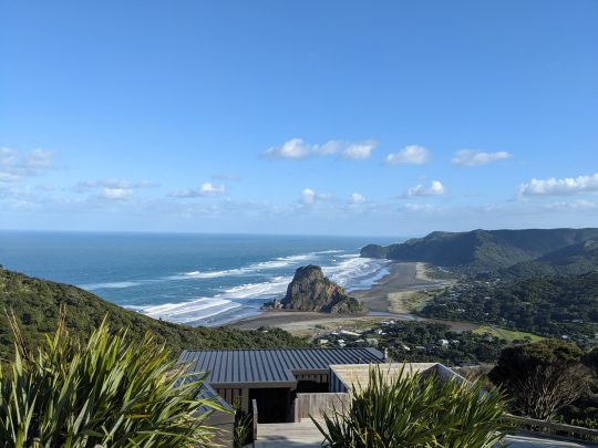
16 March 2024 - Woke up at 6:45 am and dragged myself out of bed. I got on the motorbike and rode to Cam's house. Cam offered me some toast with cheese and tomatoes for breakfast. I ate my toast, grabbed the keys to the van, and drove to Auckland. I got to the sky tower and found my clients, three college-aged kids from Utah, Zach, Cora, and Shennai. When I found out that they were from Utah, we bonded over that! They'd heard of Lambs Knoll and Yankee Doodle Canyon! Zach had climbed in and around Zion, and Cora mountain biked all over Moab. In the car ride, we sang along to the "Hercules" soundtrack playing on my ipod from 2007. We stopped at the top of Piha for a quick photo of the beautiful beach and Lion Rock with a clear blue sky above.

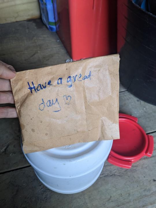
When I opened up the AWOL shed in Piha, I found the afghan that Elise had left for me! Agh, she's so sweet!
They were all capable and fit clients. We crushed the hike up to the top of Kitekite in like 10 minutes or something like that. The whole day was cruisy and easy. When we got to the final abseil of the canyon, the marker rock was submerged. Uh-oh.
Some background - Piha Canyon is safe to do at low flows. When there's a lot of rain, the flows will increase. Descending Piha Canyon at higher flows is still very safe for the first three abseils, but the fourth abseil (the one that goes right down the center of the full flow of the waterfall) can be questionable at higher flows. The guides have a marker rock that we use to determine if the flow is at a safe level or not. When the marker rock is out of the water, we continue descending down the fourth abseil. But when the marker rock is submerged, we bail out of the canyon before the fourth abseil because the flow is higher than normal.
Today, the marker rock was just barely submerged. Like, the top of the marker rock was less than a centimeter below the surface of the creek. I looked at the marker rock, and I said to the clients, "I've got bad news, you guys. The marker rock is submerged, so we can't continue down the canyon. We're going to have to hike down to the bottom." We all looked down the waterfall at the heavy flow of the waterfall hammering down the fourth abseil. The clients were bummed. I debated with myself about whether this was an appropriate time to break the rules. "These clients are capable," I said to myself. "Do you guys feel comfortable doing this?" All three of them nodded their heads yes. "Okay, let's do it!"
I gave them the talk about the fourth abseil, stressing that it's important to stay calm and not panic if water is hammering them in the face. I also told them that I was going to lower them, and that they wouldn't be in control of their own descent. They all agreed that that made sense. One-by-one, I lowered them down the abseil, and they were whooping and woohoo-ing the whole way down! They LOVED it! I LOVED it! It felt pretty badass to abseil down the waterfall, just getting smacked by the water, the force of the waterfall pushing down on you, beating down on your head, shoulders, arms, and legs. Everyone did so well, and I felt really good about my decision to continue down the fourth abseil instead of bailing out of the canyon before the fourth abseil. We finished out the canyon, and the clients said that this was one of their favorite guided trips ever! I drove the clients to Piha Beach, and while they were walking on the beach, I picked up a sleeping bag, a sleeping pad, and a tent at Elise's house. I drove the clients back towards Auckland, stopping at my house to drop off some wetsuits and harnesses and gear. I dropped them off at their hotel in Auckland, then returned the van to Cam's house.
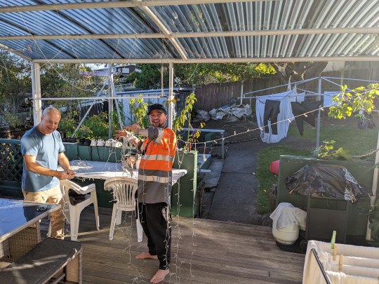
I drove the motorbike home to Henderson, and Jimmy and I loaded up his car with all the canyoning gear and camping gear. Jimmy and Arnie were detangling the lights that Jimmy had bought for our upcoming barbeque. Jimmy said, "I look like a bloody Christmas tree, and it's not even Christmastime, mate!"
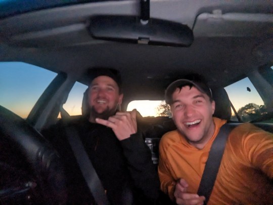
Jimmy and I drove to Coromandel! We saw the beautiful sunset as we drove towards Sleeping God Canyon.
We stopped in Bombay for some kebabs for dinner; we ate on the road. We arrived at Trestle View Campsite at the Kauaerunga Valley road end. We ate our kebabs in the warmth of Jimmy's car while waiting for Jordan and Wilson to show up.
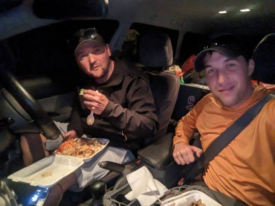
When Jordan and Wilson arrived in Wilson's van, they invited us to come hang out in their van. We all four of us hung out in the back of Wilson's van, chatting and talking about canyoning, hearing about Jordan's and Wilson's day through Bull's Run/Rangihau Canyon today. We hung out in their van for over an hour, just hanging out and enjoying each other's company. It was super fun; I wish I had a photo capturing that. At a certain point, sometime around 11 pm, Wilson gave us a subtle New Zealander hint to GTFO of his van. Jimmy said that he "couldn't be bothered to set up the tent tonight," so he planned to just sleep in his car. That did NOT sound comfortable to me, so I set off looking around the campsite for two suitable trees. I set up my hammock! I slept in my hammock for the first time in a LONG time! I can't even remember the last time I slept in my hammock. I think it might have been March of 2022 during my WFR course in Kanab, UT. Anyway, I LOVED sleeping in my hammock. I was so warm and cozy, snuggled in my sleeping bag in my cocoon of a hammock.
I'm thankful for capable and fun clients. I'm grateful for a wonderful and fun day in Piha Canyon. I'm grateful that the clients I had today were the right clients for descending the fourth abseil at a higher-than-normal flow. I'm grateful for Jimmy and for our roadtrip down to Coromandel. I'm grateful to Wilson and Jordan for sharing their van space with us and hanging out with us before bedtime.
0 notes
Text
The Amnesiac : ep39
Trees of Mystery - One Month Ago
She’s right, best to turn back now so that I don’t have to spend the next two days on my motorcycle in cold, wet boots and soggy, stinky socks. I turn around and begin the delicate rock dance back down stream and out of the canyon, but by the time I reach the parking lot the strawberry blonde is long gone. Her complete disregard for dry feet means that she was able to stomp down the middle of the creek at a jogger’s pace. Like a pair of wet socks hanging on the line, my opportunity to pour on the charm in the parking lot has … evaporated.
I mount up on the Ducati and begin the hour-long backtrack along the beach and through the Jurassic forest to the highway, and then onward north until I reach the gas station in Klamath where I top up the tank with fuel. A couple of Harley riders are filling up with gas at the pump next to me and point out the Country Club Bar & Grill across the street from the gas station.
“Son, if you ain’t afraid of the occasional fist fight, that there place has the coldest beer and greasiest burgers in a hunert-miles” he tells me. “Course I’m not sure if you fellers riding them fancy Italian sissy-cycles er cut out for fist fights.”
You’d think that all motorcyclists would stick together as a tribe, but the Harley guys are a faction unto themselves. It’s clear they’re looking for trouble, but predators are always looking for prey, never another predator. So I put my hand into my pocket and pretend I’m reaching for my knife as I tell them “Well you know those Italians like a good knife fight, and I already left a blade in the ribcage of some smart-ass in Reno, so you’d better just mosey along.” It’s a fight-fire-with-fire response that’s just unhinged enough that they decide to leave me alone.
Close call.
They fire up their big obnoxious Harleys and blaze off down the highway, thankfully heading south. I notice my hand trembling a little from the adrenaline as I pull my helmet visor closed. “Plus I’m still full from the waffles” I joke to myself nervously inside the helmet. With the tank full, I pull my fancy Italian sissy-cycle onto the highway, point it northbound and disappear over the horizon at light-speed before they decide to turn around and call my bluff.
Residual adrenaline, a motorcycle, and a twisty road are the perfect bedfellows. “Fleeing from a biker gang” is also the perfect excuse to give a highway patrolman, so I speed northbound without fear of consequence. North of Klamath the highway twists and turns as it climbs into a canopy of Redwood forest. The bark of the exhaust echoes off of the great trees as I wrestle with the handlebars to drag the motorcycle from corner apex to corner apex. I’m pushing the motorcycle to the absolute limit, at speeds where the tiniest lapse in concentration could be fatal when a fifty foot tall wooden statue of Paul Bunyan and Babe the Blue Ox appears on the horizon and nearly startles me to death. I clamp the Ducati brakes and slow the bike like a junkyard dog finding the end of his chain, decelerating just enough to swoop into the parking lot without crashing.
I shove the kickstand to the ground and rev the bike good and hard one time before shutting off engine. The sound rips through the sky, shattering the serenity of this majestic forest. The revving and posturing is all for naught. There’s only one car in the parking lot, an empty SUV. There’s a little gift shop building to my left with a sign on the roof that says “Trees of Mystery.” Clearly it’s a redwood forest tourist attraction and the gigantic lumberjack is just to attract passersby.
I’m standing marveling at the statues when I hear a faint click behind me. I turn around and standing about 15 feet behind me is the strawberry blonde with Leica camera up to her face. As I’m looking at her, she click off a second photo, and then without saying a word just turns and walks away.
She crosses the parking lot to the only car here, the little white SUV, opens the rear tailgate, crawls inside, kicks off her wet boots, and hangs her soggy, porcelain-white feet out over the rear bumper to evaporate away the wrinkles in the warm pacific sun.
I’m intrigued now more than ever. Intoxicated on a cocktail of moxie and machismo from having fended off the Harley idiots, I march right across the parking lot to the back of the SUV and grab her big toe between my thumb and finger and give it a friendly wiggle.
“Should’ve kept those feet dry.”
“Great advice.”
“Do you always take people’s picture without their permission?”
“I’m a journalist. It’s in my DNA.”
“Seems as though you and I are following the same path today.”
“There’s only one road through here amigo.”
“Yeah, but this is the third time we’ve crossed paths today. Twice is a coincidence, three times is …”
“Three times?”
“The diner this morning … you were sitting behind me.”
“Oh Jesus, that was you? Every time you shifted your weight that stupid booth was bouncing me up and down like wump wump wump!”
“Oh no, every time YOU shifted YOUR weight my seat was bouncing up and down like wump wump wump!”
We both have a good laugh, then she tosses a pair of flip-flops on the ground under the bumper and motions with her hand for me to pull her to her feet. Her toes slip into the sandals as I gently take her hand and pull her up to standing. We’re face to face now.
“I’m Autumn” she tells me.
“Hi. David.”
I have to resist the urge to shake hands, because we’re already holding hands, so I just give her fingers a little squeeze of acknowledgement and let go. The sun is warm, so I unzip my motorcycle jacket and take it off. I’m wearing a blood red t-shirt with an art-deco Ducati logo emblazoned across the chest.
“Cool shirt” she says.
“Oh thanks.”
“Ducati, they’re like the Ferrari of motorcycles, right?”
“Ahh yes, the Ferrari of motorcycles … I use that line to impress all the ladies” I joke.
“Ha! You’re so full of shit.”
“True. Girls have zero interest in what kind of motorcycle you ride”
“Only that you ride …”
“Bingo.”
I glance up at the big lumberjack statue, then look around the empty parking lot, and then back to Autumn.
“What’s newsworthy enough to bring you all the way out here?”
“I’m driving up the coast and writing a travel piece for Westways Magazine, mostly photography with some lite storytelling.”
“You’re getting paid to take my vacation.”
“It’s work!” she protests.
“Now you’re full of shit.”
“It’s a complete boondoggle” she admits while wiping tears of laughter out of her eyes. “But there is one downside, sometimes I have to visit these cheesy tourist traps all by myself” she tells me suggestively.
“Oh no! No no no no. Do I look like the kind of guy you’d find strolling through the Trees of Mystery?”
“Oh come on, what’s the worst thing that could happen? You just might make a new friend.”
0 notes
Text
Three Sisters and Broken Top Circumnavigation (1/5)
I got back to Klamath Falls from my week-long trip to the Wallowas and Strawberry Mountain on September 12th. As I already wrote about a little bit in that trip report, mid-September is typically the end of the backpacking season for me (because of work obligations that start in mid-September), and, "traditionally" (i.e. "before COVID") at least, Lindsey and I had ended a number of summers in a row by hiking in the Wallowas. So, coming home from there naturally felt a bit like being done with big adventures for the year.
Two things made the summer of 2023 a little different, though. First off, I was going to be on sabbatical from the university from the fall of 2023 until the fall of 2024, which meant that while I had a lot of work to do on my sabbatical project throughout the fall, I could continue backpacking as long as the weather would allow, provided that I kept working in-between trips.
Second, because August had been such a bad month for wildfires, I'd already spent much of that month indoors, working on my sabbatical project during my summer break, which meant that, theoretically, I had a big block of free "summer break" time open in October. I'd never been able to plan a big backpacking trip in October before because I've lived most of my adult life on an academic calendar. Where would I go?! What would I do?!
Well, my first thought was to just return to the Wallowas. I love the area so much and had had so much fun there in September it almost made sense to just drive back and do another loop in a different part of the wilderness. In the end, though, my natural inclination toward novelty won out and I ruled out this option.
Second, I hadn't been to the Trinity Alps since Lindsey and I's trip to Canyon Creek at the beginning of the summer...but that whole area was still, unfortunately, aflame in October and many of the trails were closed for safety reasons even when under clear skies.
Third, I toyed with the idea of returning to Desolation Wilderness and doing that loop again to redeem the memory of Lindsey and I's disastrous trip there last summer, during what ended up being a massive and dangerous wildfire right outside of Tahoe...but right as I started planning a potential return trip, the air quality started to turn. And I just couldn't deal with the idea of a repeat of last year's trip, so I bailed on the idea.
Finally, I had planned and committed pretty hard to a long loop through the Emigrant Wilderness in central California, a place I'd never been but that looked incredible and was far enough south and high enough up that fires seemed, historically, to burn there in the middle-to-late fall instead of during early October. I wasn't super-keen on driving the ten hours one-way to get there right after finishing a massive (non-hiking-based) road trip in late September, but it looked like an incredible place to hike...until a big fire started two miles west of the wilderness boundary two days before I was going to drive down.
A bit at my wit's end, but intent on getting in one more big trip before the snow fell, to take advantage of my sabbatical year and to "make up" for the rough August I'd spent mostly indoors and fretting, I came up with a last minute idea: I'd loved hiking the Three Sisters Loop with Lindsey back in 2018 and the Broken Top Loop had blown my mind in 2022. Was it possible to combine those routes and hike both together?
I got out my Green Trails map and skimmed it. It was indeed possible.
So, I was going to hike seventy-something miles and climb over ten thousand feet in five days, encircling Broken Top, all three Sisters, and some of the most beautiful disaster country I've ever had the privilege to hike through. I was going to start from the Three Creek Meadow Trailhead northeast of Broken Top, and hike the loop clockwise, because that was the only trailhead I could get a permit for on short notice. I had to start on October third and finish by the eighth because a huge winter storm was supposed to hit the Cascades the night of the eighth. But I had time. I could make it.
Then, out of nowhere, a snowstorm dumped at high elevations right before I left. I left anyway.
Driving out of Sisters (the town) and toward Sisters (the mountains), the road and the surrounding environs were dry, but it was clear even from fifty miles away that the mountains themselves had gotten a fair amount of snow during the storm.
My concern wasn't necessarily hiking or camping on snow: I've soloed a bunch of 14ers, camped on glaciers, scrambled up ice chutes, and navigated through whiteouts before, and am pretty confident about handling inclement weather at this point in my hiking career.
What I was worried about was a small section of trail on both sides of a particular high point, called Broken Hand, that you have to pass just east of Broken Top to complete the Broken Top Loop. When I'd done that loop the previous summer, the entire hike had been phenomenal and phenomenally straightforward except for this small, quarter-mile section of trail, which had still been iced over from the previous winter. I'd had to cross it without crampons or an ice ax (because who carries those things at 8,000 feet in August?!) and as a result at multiple points had very nearly ended up rocketing down the ice slope, backpack and all, to crash into the huge lava rocks at the bottom of a two-hundred-plus-foot slide.
I imagined it was probably worse in October, right after a snowstorm, but I also hadn't wanted to carry a lot of heavy winter climbing gear for seventy-plus miles for a quarter-mile of scrambling and had banked on that section of trail being clear of ice before I hiked it.
The view from my car made it clear that that section of trail was not, in fact, going to be clear of ice before I hiked it. So, improvising again based on conditions, I decided to hike the whole loop counterclockwise instead of clockwise. That would give Broken Hand four relatively warm days to melt out as I circled around the mountains to the north and then to the south before ending up on Broken Top proper instead of, as I'd planned, passing over the high point on the first day.
I was nervous about this change of plans as I loaded up at the car, but as soon as I walked two miles down the broad double-track of the Metolius-Windigo Trail and turned west onto the Park Meadow Trail, I was so happy to be back in the Three Sisters Wilderness that it suddenly felt entirely possible that nothing would ever go wrong again.
Sometimes it seems weird to me how much I love this place, considering how much of the forest around the mountains has been burnt out in the last twenty years. A significant amount of the hiking you do on both or either of these loops looks a lot like the first picture I took on the first day of this hike.

I have hiked this trail on a ninety-degree day. It is not fun. But it is beautiful, at least to me. And, in October, it was more like fifty degrees than ninety degrees, which I'm sure helped my mood this time around. It was both exciting and a little daunting being able to see all Three Sisters at the onset of the hike knowing that I'd be solo hiking all the way to and then around "the back" of them before I'd be back to civilization.
It's only a three-hour drive to the Three Creek area from my house, so even with the short October day in mind, I'd gotten started early enough to cover some decent distance. In the counterclockwise plan I'd improvised in the trailhead parking lot, it made sense to me to try to get to Golden Lake to camp for the first night. It was a bit out of my way for doing the loop proper, but it was a gorgeous lake with good camping spots and a wonderful view of Broken Top that I'd scouted when doing the shorter loop in 2022 but had passed on at the time in favor of Green Lakes because I'd had a long summer day ahead of me and had wanted to cover some more distance.
Much of the seven-ish miles to Golden Lake looks a lot like that first picture, so I didn't take many more photos while on foot for the first day. At one point, I "crossed" Snow Creek, which had been a serious flow during last year's August hike: now it was a barely-audible and nearly-invisible dribble. Shortly after, Whycus Creek, which had been a raging torrent that had flooded out the trail at knee height and almost turned me back completely in the summer, was barely deep enough to draw water from in October. I hadn't been worried about finding water sources between the big lakes on this hike before, but I made a mental note at this point to remember that it was possible that all the creeks and streams would be dried up and only the lakes themselves might be reliable sources of water going forward.
Along the banks of each creek, below and among the burnt-out remains of what used to be mature forest, I saw piles of fluff from what, a month or so before, would have been vibrant pink stands of fireweed. Fireweed is my favorite flower, but I hadn't expected to see any growing this late in the season. It was nice to be able to at least recognize their remains. They'll be back next year. I probably will be, too.

Before too long, Park Meadow sprawled open before me, to my left (south). It certainly looked different than it had in the summer, but no less beautiful...just more gold than green. Broken Top loomed over the meadow, snow-covered and forbidding (at least for a guy who didn't have snow climbing gear). I could see the ridge I would have to navigate in four days from where I was standing. It didn't look great, yet.

There are actually some very good campsites right off the trail in Park Meadow proper, and the East Fork Park Creek isn't far away, but I was covering ground faster than I'd expected and wanted to continue on to Golden Lake, so I did. It's about another mile from the meadow on the main trail and then a bit less than that on the spur trail that leads to the lake. I'd have to double back on the spur trail in the morning to get back on track, but I didn't regret my decision at all once the lake and the mountain came into view.

This area had wowed me last summer, but at that point in the season the mountain had been more or less dry, and there's just something about a rugged mountain wreathed in snow that makes it seem much more awesome than the same mountain wearing only bare rock.
There are a lot of solid campsites just north of and up the hill from Golden Lake, among the boulders, but I'd remembered from my previous visit that there was one fantastic site further downhill and closer to the lake in a tree stand to the west, and I wanted that one in particular if it wasn't already taken (it wasn't, and in fact I hadn't seen a single person on the trail all day and wouldn't see anyone at all until tomorrow afternoon).
First, though, being me, I had to fully case the joint before settling in for the night. I'd noticed last summer that there was a thin, narrow trail leading around the lake and toward the mountain to the south, and indeed my topo showed this trail continuing another six hundred feet up the mountain's flank to a flat spot containing two unnamed lakes. I was already a little worried about how cold it was going to get later that night, but in the battle between curiosity and the fear of it being even colder higher up, curiosity won. I kept hiking.
Out and around the lake to the east, all Three Sisters came into view for the first time since I'd left the burn area.

Once around the lake, the trail was a little difficult to follow because of deadfall, running water, and, in a few spots, snow, but as I climbed higher and higher the views got bigger and bigger.

A very small amount of scrambling was required to get up and over the final rock wall between me and the lakes, then I pushed up and over the top to find...nothing.
Well, not nothing. There was a great view of Broken Top, including a ridge to the right of the summit that looked climbable from where I was currently standing. I had no time or desire to climb the mountain proper, and besides I knew from previous research that the last bit of the summit scramble is technical and well beyond my risk tolerance...but it was still neat to see. The summit, only eighteen hundred feet above me, seemed close enough to touch.

I was a little confused, though, by the absence of the two unnamed lakes: certainly, it was late in the season, but there had been so much water flowing down the hill into Golden Lake during my hike up it seemed impossible that there was no sign of any larger body of water higher up.
I briefly toyed with the idea of setting up camp in the high basin anyway, and just walking a bit to get to running water, but the spots with the best views and the spots with access to water were far enough apart that I finally decided I'd be happier at Golden Lake proper. So, I climbed right back down what I had just climbed up and set up my tent right at the edge of the uninhabited tree stand.

I still had a bit more time before sunset, so after getting set up and replenishing my water stores, I wandered around the lake one more time and took photos of all the mountains reflected by its surface: all four of the "main" mountains I'd be circumnavigating over the next four days.


It got dark early, being October, and while I would normally have spent some time sitting outside in the dark watching the stars and/or taking night photos, it also got really cold as soon as the sun went down, so I pretty much immediately retreated into the tent. I was hoping to oversleep instead of undersleep anyway, because my goal for the next day was to make it all the way to South Matthieu Lake, underneath the north face of North Sister. Lindsey and I had done part of this hike in 2018, and I remembered it being relatively physically easy, but a mentally challenging trip through a long, monotonous burn area. It would be at least a fifteen mile hike during a short October day, so I'd want to make sure I had hoarded my energy...
#camping#hiking#backpacking#writing#traveling#mountains#photos#three sisters#broken top#south sister#north sister#middle sister#central oregon
1 note
·
View note
Text
The Fifth Season
Last fall I went to my hometown of Yreka and stayed at the Miner’s Inn. The parking lot filled up on Sunday evening with various utility trucks as the road repair and firefighter crews came in for the week. They were mopping up the huge McKinney fire, California’s biggest fire all year. It had burned for weeks through the Klamath wilderness: 60,000 acres, four deaths, at least 118 homes.
The workers were all on their way before eight the next morning, boots pounding up and down the staircases, leaving the breakfast buffet in shambles. My brother picked me up in his old Suburban and we headed into the Shasta River canyons on 263, a twisting terror high above the river, no guard rails, the beautiful river far below the rocky, arid slopes. We turned onto 96, the Klamath River Highway, which runs along the great river. The water had turned foamy and dark. In a while patches of blackened ground appeared. Then whole hillsides, charred and torn. Piles of rubble. A broken chimney, twisted cars, grey ground. One of our old family cabins was destroyed, the foundation barely visible in a stand of dead ponderosa pine. Most of a small town was gone. A school left untouched. Distant moonscapes into the hills.
We stopped at the turn to Seiad Valley, where there’s a river flat of big eroded stones beside a pretty swimming hole under the bridge. Here the river rests, quiet and deep and cool, and today the pool is thick with dozens of King salmon. From the bridge, we turned off 96 and climbed up a narrow, sharply winding road above the wide Scott River. Houses were visible here and there through the thick green trees, and we couldn’t see fire damage at all. I know it is there, just over a steep hill, miles of it. But here it is clear and green and smells of blackberries.
Our other family cabin is several miles on. It is owned by a friend of my sister now, and they both met us on the road’s narrow shoulder. We looked around the little place, remembering, and then trotted down the path that is so much shorter now than when I was young, down to the river. The water is wide, deep, and slow here, with a rough stony cliff across the water. The huge rocks have barely moved: the one for sunbathing and the one for sliding off and the one for jumping off. So we did, my brother and me; we jumped off. It was very cold; we didn’t swim long.
A month ago, my cousin lost everything he had in the fire of Lahaina. Everything he had turned to ash. Three weeks ago, a fire ran over the rivers again. It was centered this time on the quiet pool of salmon. It still burns, burns in all directions, up against last year’s scar, into the high hills, across the roads, across the scattered cabins. Across the creeks that feed the deep, cold river. Into the tiny hamlet of Scott Bar, where one man dies. It burns in the cliffs across the river from our old cabin. It jumped the river once, hit the rocks, couldn’t get a purchase. The cabin still stands. And the fire still burns.
Fire has become our fifth season.
1 note
·
View note
Text
Sonoma’s Sugarloaf Mountain Range is it a local Yosemite?
Traversing up Adobe Canyon Road in Kenwood, just north of the town of Sonoma, a person seeking an exhilarating experience of nature and bucolic adventure will be breathtakingly taken aback by the rustic beauty of Sugarloaf Ridge State Park.
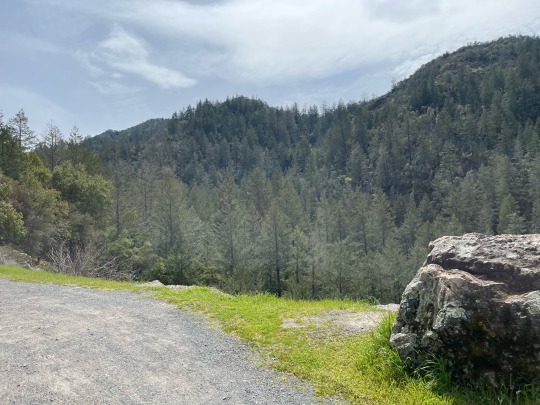
Some visitors have commented It’s Sonoma’s Yosemite. “I am not one of them,” said longtime Sonoma resident Mary Oswald.
Her reason for not comparing it to Yosemite is simple. “Sugarloaf is unique and it’s a part of Sonoma. It’s one of those special places that few people know about,” said Oswald.
As someone who has volunteered as a docent and visitor’s center guide, she explained why the 4,900-acre mountain range is called sugarloaf. “Sugar wasn’t always sold in the neat paper packages that we buy at the supermarket these days,” said Oswald.
“Before the 20th Century, said Oswald, sugar came in loaves that looked something like oversized, upside-down ice cream cones. The grocer just broke off pieces for his customers,” she said. To the pioneers who settled in the Sonoma Valley, “it reminded them of a piece of a loaf of sugar; hence the name Sugarloaf,” Oswald added.
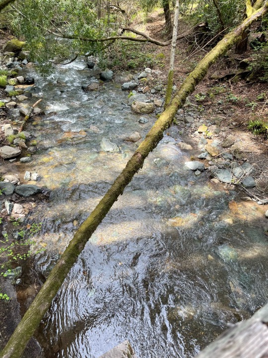
A 25-foot waterfall flows after the winter rains. And now that spring has arrived it’s an ideal time to make the trek to the 200 to 2729 feet elevations of Sugarloaf.
There is a self-guided nature trail along Sonoma Creek that starts near the picnic area. Sugarloaf Ridge State Park contains the headwaters of Sonoma Creek. It runs through gorge and canyon, across the meadow floor, beneath scenic rock outcroppings, and is surrounded at times by redwoods and ferns.
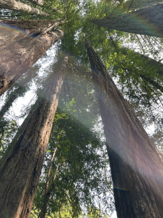
Views are spectacular as far as the human eye can see in just about every direction.
Trees of many varieties are abundant. Within the oak woodland and chaparral, the park has 25 miles of trails for hiking and horseback riding. But amid the abundance of arbor expansion Redwoods are the ancient gem of this hill and mountains retreat.
Simply stand beneath one and look up. The sounds of birds and of babbling creek waters are soothing as well as enticing.
The eagerness to explore and meander is encouraging. Yet it’s advised to do so with caution as trails can be narrow. Twigs, branches, rocks and other obstacles can make for a slow climb or descending path.

With daylight hours increasing, this is an on-foot excursion that should be savored and not rushed.
On a clear day, visitors can see views of the Sierra Nevada and the Golden Gate bridge from the 2729-foot summit of Bald Mountain.
Deer, gray foxes, the occasional bobcat and coyote can be seen in the park. In spring, wildflowers provide a colorful palette across the green hills.
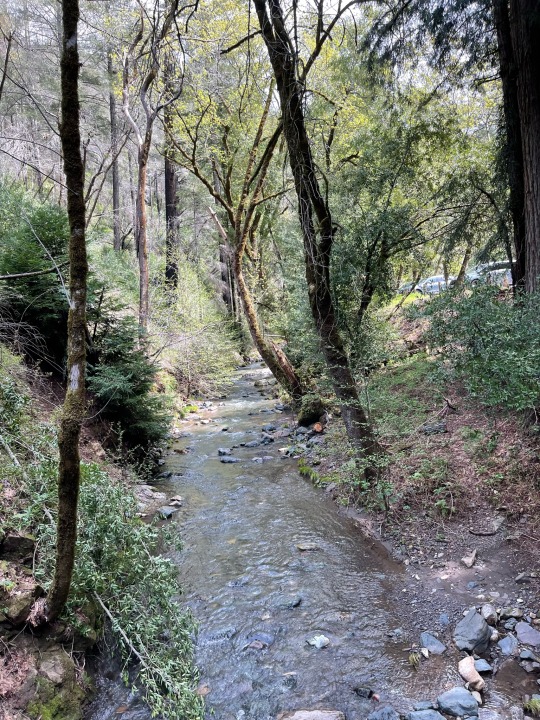
Lower portions of Sugarloaf is free for visitors to park and walk. Other higher portions and sections, especially campsites require an admission fee.
Note that all plants and wildlife within the park are protected. Collecting or destroying anything in the park, including mushrooms, is prohibited.
Dogs must be on a leash under your control at all times. Dogs are not allowed on trails.
Camping is permitted in designated areas. Dogs must be in a tent, camper or enclosed vehicle during the night.
The non-profit Valley of the Moon Observatory Association provides year-round astronomy education and interpretation programs at the Robert Ferguson Observatory within Sugarloaf Ridge State Park. Program fees vary, some are free with the payment of the park's Day Use Fee.
There are three telescopes and the New Generation 40-inch Telescope Project at the Ferguson Observatory which will be one of the largest telescopes dedicated for public viewing. For more information and public viewing schedules, visit the Sugarloaf State Park website.

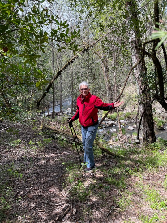
1 note
·
View note
Text
Clear Creek Canyon Climbing: Best Trails and Tips
Clear Creek Canyon climbing offers a variety of trails and routes for climbers of all levels. From beginner-friendly options to more advanced challenges, Clear Creek Canyon climbing provides an exciting adventure with stunning views. The canyon’s diverse terrain ensures a rewarding experience, making it a perfect spot for climbers to enjoy nature and improve their skills.
0 notes
Text
5 Best Things to Do In Denver, Colorado#Denver #Colorado
THE MILE HIGH City elevates every adventure, from limit-pushing climbs to quad-torching rides (and a cocktail or two afterward). Set out on these five expeditions—which include physical and mental challenges (and, okay, a bar crawl)—guaranteed to help you satisfy your sense of adventure. Denver, ho! 1. Rock Out Head to Clear Creek Canyon Park for 1,000-plus rock-climbing routes and nearly six…

View On WordPress
0 notes
Text


Hanging out on ‘Slammer’ 5.12b at Clear Creek Canyon, Colorado
#me#climbing#climb on#rock climbing#climber#mine#climb#sport climbing#sport climb#clear creek canyon#lead climb#lead climbing#colorado#photography
11 notes
·
View notes
Text
Ride Report - Big Tujunga - Angeles Forest Hwy
Ride Report – Big Tujunga – Angeles Forest Hwy
43.18 miles, 3:55 time, 4,774 ft elevation. On a cold sunny morning, the Club met at La Canada Starbucks for a big climb up Big Tujunga Canyon and Angeles Forest Highway. Low 40s F at the start. Brrr. But, we were all bundled up and ready for the mountain cold. Hats, Gloves, Shoe covers, wool socks, layers. We rode west out on Foothill through La Canada, Montrose and Sunland. Philip started at…

View On WordPress
#angeles crest highway#angeles forest highway#big tujunga canyon#Clear Creek#climbing#mountain#red box
1 note
·
View note
Photo


there’s some great reception up here
19 notes
·
View notes
Text
Modern 1BR close to trails, NREL + breweries Check Availability: https://www.airbnb.com/rooms/54221720?source_impression_id=p3_1649298494_8sEKCj%2FpKsKvnvG7 About this space Come fall in love with Golden! Nestled in the foothills and home to some of the world's best mountain biking, and breakfast burritos. Walk to South Table Mountain trailheads, CODA Brewing, or King Soopers Grocery in ten minutes. Spend the summer tubing down Clear Creek or climbing Clear Creek Canyon. Or simply enjoy your coffee from the deck with views of Lookout Mountain. The space Booking this room will reserve one of the four newly-renovated private rooms available in the house. Your private room will include a queen bed, desk and desk chair, nightstand, and lamp. Each room also has its own heat and air-conditioning so you'll have full control over your room's temperature. The house is a split level, with the lower level partially below grade (garden level). On the upper level are two bedrooms, one full bathroom (shower stall only-- no tub), one living room with a 55" TV, a full kitchen, and a dining area. On the lower level are two additional bedrooms, a full bath with shower/tub combo (completely remodeled in 2021), living room with a second 55" TV, washer, and dryer. Other than your private room, you will share access to all living areas with other guests. There is a garage that can be used to store gear, bikes, etc but vehicular parking is driveway only. There is a spacious backyard/garden and deck. All utilities including high-speed internet are included. Guest access Your room comes with one parking spot in the driveway.
#NREL#staycation#stayconnected#colorado#goldencolorado#airbnb#airbnbhost#airbnbexperience#TheAllium#airbnblistings#comfortstay#affordablestay#goldenco#cleanroom#covidsafe#amenities#freeinternet#longtermstay#safestay#nature#travel#camping#photography#vacation#food#road trip
7 notes
·
View notes