#cerro santa lucia
Text


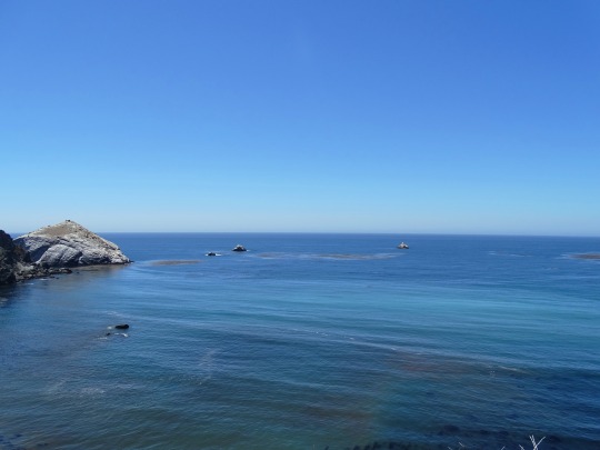
Cerro Santa Lucia. Santiago, Chile
#chile#chile tumblr#original photogrpahy#original photographers#cieloazul#santiago#Cerro Santa Lucia
40 notes
·
View notes
Text


Subiendo el cerro santa Lucia uvu , modelando porque me sentia lindis uvu
#Cute#Chile#santiago#pretty#Linda#Tierna#Contenta#Happy girl#Girl#Yo#Me#so cute#My photos#my phoyography#Cerro santa lucia#Cerro#Paseando#Travel#Model#Feliz#Soleado#Curly hair#Morado#Cabello morado
40 notes
·
View notes
Text


☆*・゜゚・* 𝕮𝖊𝖗𝖗𝖔 𝕾𝖆𝖓𝖙𝖆 𝕷𝖚𝖈𝖎𝖆 <Յ *・゜゚・*☆
1 note
·
View note
Video
youtube
Cerro Santa Lucia Hill remnant of a volcano 15 million years old Santiag...
0 notes
Text
Great 8: Santiago Sights
Santiago, Chile‘s vibrant capital, is a city that beautifully blends modernity with historical charm. From its bustling markets to its serene parks, Santiago offers a diverse range of sights. It exemplifies the perfect mix of culture and leisure, so whether you’re travelling solo or with family, this fantastic destination will keep your days filled with adventure.
Here are my 8 must-see sights…

View On WordPress
#Cerro San Cristóbal#Chile#erro Santa Lucia#Mercado Central#Plaza de Armas#Santiago#Santiago de Chile#Sky Costanera#Solo Travel#South America
0 notes
Text
Monterrey, un encuentro con la Energía Norteña.
View On WordPress
#barrio antiguo#cabrito#cerro de la silla#experiencias locales en monterrey#Monterrey#nuevo leon#parque fundidora#paseo santa lucia#Restaurantes en Monterrey
0 notes
Text


0 notes
Photo
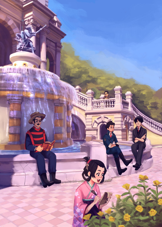
My drawing for @/dgstravelzine
Some of the DGS folks in the Neptuno fountan in Cerro Santa Lucia, Chile
Thank you for having me!
#dgs#tgaa#the great ace attorney#dai gyakuten saiban#ryunosuke naruhodo#kazuma asougi#susato mikotoba#yujin mikotoba#soseki natsume#here's there just very tiny#fanart#i never visited this fountiain till i went to take pics for reference!! it's bigger than i thought
311 notes
·
View notes
Text

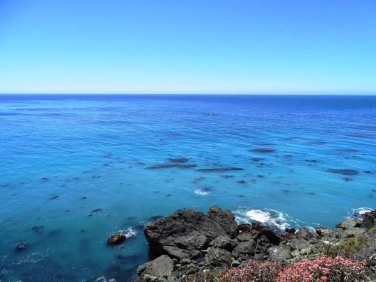
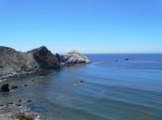
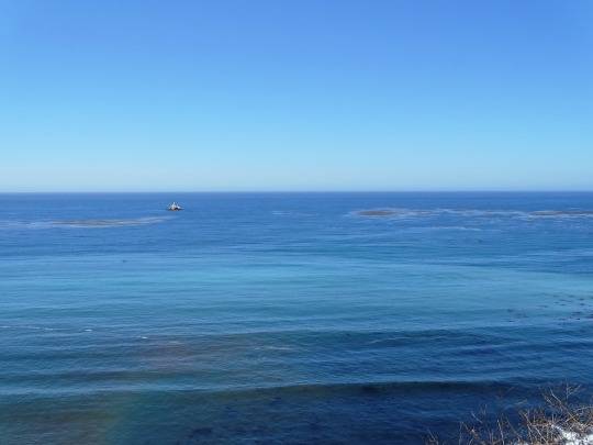
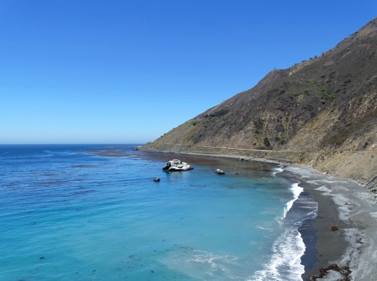
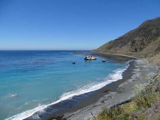
Black Sand Shores, CA (No. 5)
In 1909, an advertisement for the Idlewild Hotel on the Little Sur River stated that the camp would be accessible by auto as soon as the "Cerro Grade", the stretch of road from the coast to the Little Sur River near Cerro Hill, was completed. In 1910, the Monterey Daily Cypress reported that Mr. and Mrs. A.E. Cooper "motored down to Mrs. Martha M. Cooper ranch at Sur, leaving Monterey at 12 midnight and arriving there at 2 a.m." But the road was still very rough, and most goods including cheese produced on the Cooper Ranch was still shipped by boat to Monterey. The Idlewild competed with the Pfeiffer Resort for guests through about 1920, when the Idlewild was forced out of business by Martha Cooper, who acquired the land. In 1904, residents extended the unpaved road from the Pfeiffer Resort to the Post Ranch, and then it was extended another 2.5 miles (4.0 km) south to Castro Canyon, near the present-day location of Deetjen's Big Sur Inn.
As late as the 1920s, only two homes in the entire region had electricity, locally generated by water wheels and windmills. Most of the population lived without power until connections to the California electric grid were established in the early 1950s. The region has always been relatively difficult to access and only the sturdiest and most self-sufficient settlers stayed.
In July 1937, the California Highways and Public Works department described the journey, "There was a narrow, winding, steep road from Carmel south ... approximately 35 miles to the Big Sur River. From that point south to San Simeon, it could only be traveled by horseback or on foot."The southern portion, which was for many years merely a foot and horse trail, became known as the "Coast Ridge Road". It used to begin near the Old Post Ranch. It is currently only accessible on foot from near the Ventana Inn. It passes through private land and connects with the Nacimiento-Fergusson Road. It follows the crest of the coastal ridge south about 34 miles (55 km) to within a couple of miles of Cone Peak. Both the Old Coast Road and the Coast Ridge Road are often unusable during and after winter storms.
The southern region of Monterey County coast was isolated from the few settlements in the north by the steep terrain. The southern homesteaders were more closely tied to the people in the interior San Antonio Valley including the Jolon and Lockwood areas than to coastal communities to the north. Those who lived in the vicinity of the Big Sur River were connected with Monterey to the north.
A horse trail connected Jolon through present-day Fort Hunter Liggett to Wagon Caves, and from there over the Santa Lucia range, from which two trails split to the coast or to the Los Burros Mining District.
The horse trail across the mountains was widened and improved into a road beginning in 1931, and completed in 1937. The road was constructed by crews composed of men from the Civilian Conservation Corp, U.S. Forest Service, and state and county relief agencies.
Source: Wikipedia
#Black Sand Shores#California State Route 1#Highway 1#Pacific Coast Highway#National Scenic Byway#Big Sur#Pacific Ocean#travel#original photography#vacation#tourist attraction#landmark#landscape#seascape#countryside#street scene#road trip#summer 2022#California#West Coast#Big Sur Coast Highway#nature#flora#grass#tree#USA#blue sky#blue sea#beach#waves
2 notes
·
View notes
Text
Découverte de Santiago-jour 2
Très belle journée! Température idéale assez fraîche le matin, mais qui se réchauffe jusqu’à 29 degrés en plein après-midi. Aucune humidité, et… aucun maringouin…
Ça a été une journée musées aujourd’hui. C’est vraiment incroyable. Ici, pour inciter les gens à fréquenter les musées, tout est gratuit. On devrait faire ça au Québec.
On remarque que les femmes d’ici ressemblent vraiment à des amérindiennes. Elles sont petites, cheveux et teints foncés, et elles sont pas mal toutes grassouillettes. Ce ne sont pas les belles Espagnoles ou les belles Italiennes…
En revenant de souper ce soir, nous avons assisté en direct à une manifestation. On s’en revenait vers notre hôtel, et au loin, on voyait des feux et de la fumée. Un cycliste nous a dit en espagnol de ne pas continuer sur le trottoir où nous marchions, car des manifestants lançaient des pierres et que ça pouvait être dangereux pour nous. On a donc rebroussé chemin et sommes revenus à l’appartement. Directement devant notre hôtel, des manifestants avaient allumé un feu dans les poubelles. Ce dont les gens de l’hôtel qui les éteignaient avec des boyaux d’arrosage et non la police. Présentement, on entend des cris et des sirènes de police. Je vais chercher sur Internet pour tenter de voir pourquoi ces gens manifestent. Pas trop sécuritaire et plusieurs locaux nous ont dit de faire attention à nos sacs à main et cellulaires.
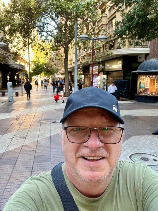
Dans une rue piétonne ce matin à 10 h. Ça ressemble à l’Espagne.
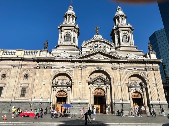
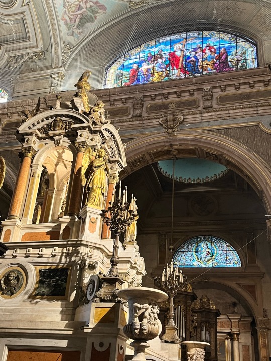
Place d’Armes. Église et intérieur.

Musée de l’histoire du Chili. Très intéressant, mais tout est en espagnol.
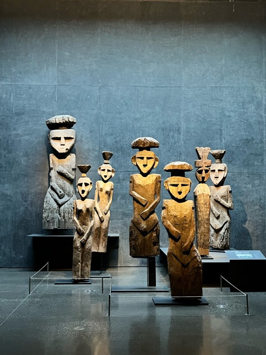

Musée d’art pré-colombien. Le seul qui soit payant ici. J’aurais pu y passer la journée.

Pizza italienne à deux ce midi avec bières chiliennes.
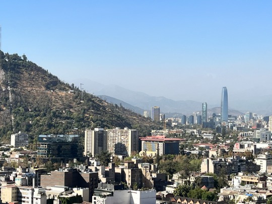
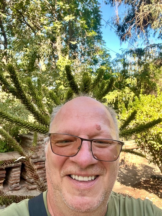
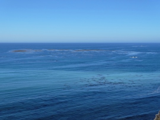
Du haut du Cerro Santa Lucia vers 17 h. On voit les Andes en arrière plan. Robert s’amuse à se faire un panache avec un arbre typique du coin.
2 notes
·
View notes
Text

Fotito de hoy en el cerro santa lucia, lindo dia, lo pase muy bien uvu
#Cute#Linda#Tierna#Curly hair#Chile#Santiago#Cerro santa lucia#yo#cute girl#girl#me#Selfie#Mirador#Pretty eyes#Pretty#Morado#Pelo morado
52 notes
·
View notes
Text


holaa turistas
¿Estas buscando un lugar para turistear?
Te mostramos nuestras mejores recomendaciones para pasar el rato en Monterrey con tus amigos o familia.
Monterrey cuenta con varias de las zonas más hermosas de México por ser de los lugares con mas inversión economica.
Algunas de las zonas más populares son
La huasteca ubicada en Santa Catarina NL Parque La Huasteca es un parque ecológico ubicado en el municipio de Santa Catarina en el estado de Nuevo León. Se encuentra junto al cauce del Río Santa Catarina, entre el Cerro de Chipinque y el Cerro de Santa Catarina, que forman parte del parque nacional Cumbres de Monterrey.,
La Huasteca tiene muchos lugares por visitar. Uno de ellos se llama Cañón las Guitarritas, puedes llegar en auto hasta el sitio y también disfrutar de una caminata tranquila, tanto con niños y personas de la 3 edad. Acampar incluso si te gusta. Solo recoge tu basura y no dañes el entorno .
Paseo Santa Lucia en Centro, 64000 Monterrey , agradable paseo familiar o con la pareja, puedes rentar lancha particular o pagar el boleto $120 adulto el cual te incluye dos boletos (ida y regreso) iniciando o finalizando enLos visitantes se embarcan en un recorrido guiado por el canal desde el Parque Fundidora hasta el Museo de Historia Mexicana.En un trayecto de 2.5 kms. disfrutan de un hermoso paisaje con 24 fuentes, murales de artistas regiomontanos, gran extensión de áreas verdes y explanadas,que crean perfectos paisajes y escenarios para eventos deportivos y de esparcimiento. el museo de historia o parque fundidora.
Parque fiestas de aventuras en Agrícola, 64590 Monterrey, N.L.
Ya no es plaza Sésamo, es fiesta aventura ya no están los personajes , hay otros muñe hos es bonito la pasas bien , pro si ibas con la ilusión de ver los personajes y tomarte fotos NOT . Si vas pensando en ir a un parque acuático pues súper
En caso de haber visitado a nuestra comunidad de monterrey, dejanos tu opinión y recomendaciones para inspirar a más turistas a ir :)
1 note
·
View note

Text

Jardín japonés - cerro Santa Lucia
Sony a37 18-55mm
1 note
·
View note
Text

Cerro Santa Lucia -
It was originally called Huelito o heutrecan by the pre-colonization inhabitants. However, the current name comes from the day in which Pedro de Valdivia conquered the hill, on December 13, 1540. That day celebrates "Santa Lucía."
0 notes
Text
Ðimanche 12 février : Barrio Italia, Santiago de Chile, Region Metropolitana
Ce matin visite de la Cathédrale Metropolitaine de Santiago, puis Fontaine Neptuno de l’autre côté du Cerro Santa Lucia puis le quartier Lastarria. Je m’arrête pour prendre un cheesecake puis visite le Barrio Italia, fais les courses puis rentre à Puente Alto. Aujourd’hui Nataly est restée chez elle. On se rend à la toute petite piscine de sa résidence, envahie par les enfants. Je décide de…

View On WordPress
0 notes
Last Seen Blogs

freshmilkshakenerd
このブログはフィクションです

poemsformom
Poems for Mom

eleftraa
ikay

po-tae-hoe-blog
Po-Tae-Hoe

mayorofcattown
Not a euphemism