#WetterhornPeak
Explore tagged Tumblr posts
Photo

Unc from Watterson. #adventureneers #wetterhornpeak #uncompahgrepeak #14ersofcolorado #14erinitiative #14er #14ers #hikingcolorado #landscapephotography #getoutside #getupearly #coloradolife #sanjuanmountains #lakecitycolorado https://www.instagram.com/p/CG6SjttMHmq/?igshid=581w493rr6hf
#adventureneers#wetterhornpeak#uncompahgrepeak#14ersofcolorado#14erinitiative#14er#14ers#hikingcolorado#landscapephotography#getoutside#getupearly#coloradolife#sanjuanmountains#lakecitycolorado
0 notes
Photo

Today's #sunrise #colorado #wetterhornpeak
2 notes
·
View notes
Text
#33 – Wetterhorn Peak 14,015 and Matterhorn Peak 13,590
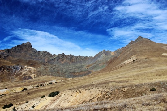
The weather today for just about every 14er in Colorado was the same: Windy. I’m not a fan of wind gusts of 45+ mph (which usually end up being around 85mph up on the peaks if we’re honest) but they’re manageable if it’s a warm day. I ruled out any peak with snow on it because wind and snow don’t mix (as I learned last week). That left me with Wetterhorn Peak for today’s 14er. I checked the weather: 20% chance of snow and 100% chance of 25mph+ winds with gusts of 43mph. Hmmmm. That didn’t sound too promising. Not bad, but not great. I knew there wasn’t any snow on Wetterhorn, so that was a plus. I was just worried it would get snow during the night/day and ruin the trip. I didn’t want to drive 6 hours out there to turn around.
I was musing all this to my kids when my youngest said “Mom, you should just go. You’ll never really know the weather or if you can make it or not unless you try.” She’s a smart 14 year old. (She must have an amazing mom…). I told her she was right, and set my alarm for midnight. Besides, this would be my 33rd 14er and my 3rd class 3. Lots of 3’s mean it’s meant to be, right?
The trailhead is easy to find/follow. From this sign it’s really a 4WD road.
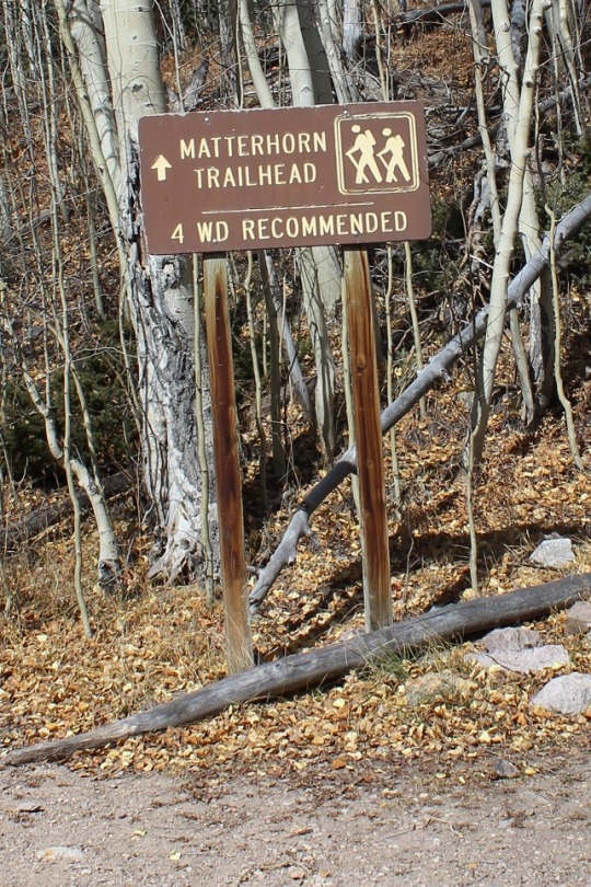
I know others have posted it’s manageable in a 2WD, and I’m sure it is for those amazing 2WD gods out there, but if you value your 2WD vehicle, do NOT take it on this road. However, if you’re looking for a reason to get a new vehicle, by all means proceed. Here are a few pics:
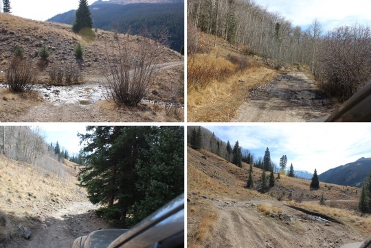
I made it to the trailhead at 5:30am and was on the trail by 5:45 (I drive fast). There were 2 other vehicles in the lot (I parked lower down). There’s probably room for 15 vehicles total at the upper trailhead, including parking about 10 yards below the lot. Here’s what the trailhead looks like in the daytime. The trail starts to the left of the trail signs.

Note: Most of these pictures were taken on the way down because my fingers were too frozen to take pictures on the way up.
The beginning of the hike was pretty uneventful. (Another Note: The summit ledger is full and the pen provided doesn’t have any ink left. Maybe a hiker could bring new supplies with them?) It was just me hiking in the dark. The trail was wide, clear of snow, with just a few muddy spots in areas. It was about 37 degrees, and there wasn’t any wind. Yet.
As soon as I hit treeline the wind began to blow, but it wasn’t too powerful and it wasn’t cold outside, so it was bearable. As the sun began to rise I noticed what looked suspiciously like snow clouds on the mountains next to where I was hiking. Luckily the wind was blowing them away from me. It seemed like the sun took an awful long time to rise this morning. I passed a boulder field that was easy to navigate but didn’t have any cairns? This could be a problem in the winter.
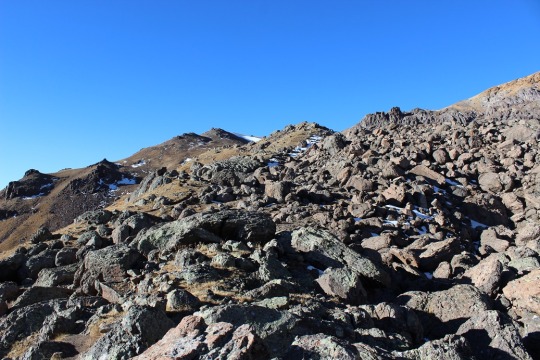
The entire trail was very well maintained, all the way to the ridge
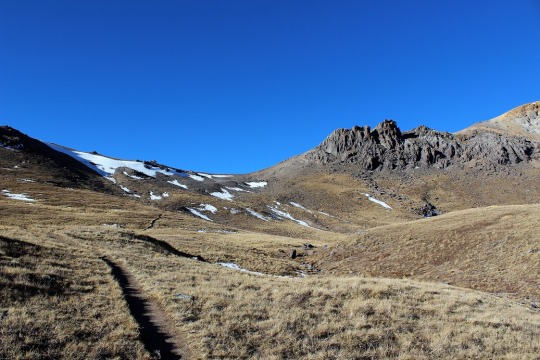
I looked for the turnoff to Matterhorn Peak but never saw it? I did see this sign, which, despite it’s name, does not go to Matterhorn Peak.

I could see a few hikers in front of me by their flashlights. They seemed far away, but I quickly caught up with them. They looked really cold in their hoodies. I was cold in my snow clothes.
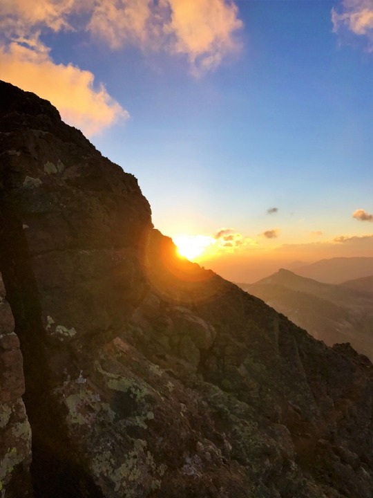
At this time the sun began to rise and the temperature began to drop as I hit the ridge and the wind picked up. I still think Colorado Flag sunrises are cool!
At the top of the ridge I could see most of the route left. This scree hill was insanely slippery! I could tell a lot of people had chosen to just walk on the tundra. I put on my microspikes and braved the scree.
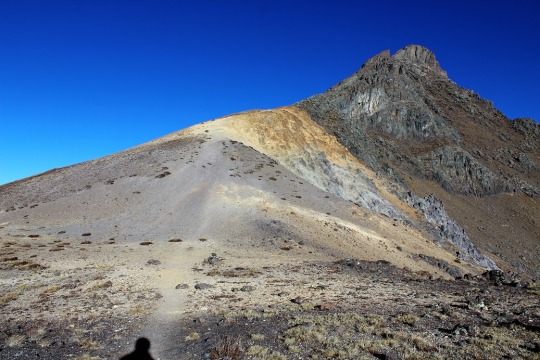
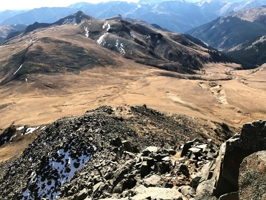
At the top of the scree hill I could see the path to the summit (or part of it).
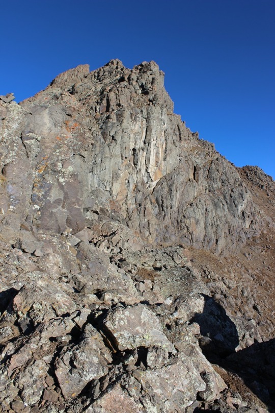
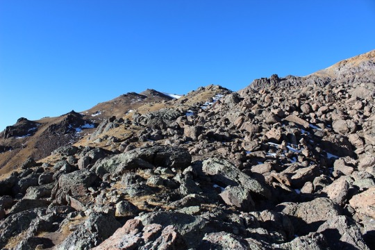
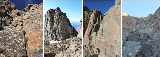
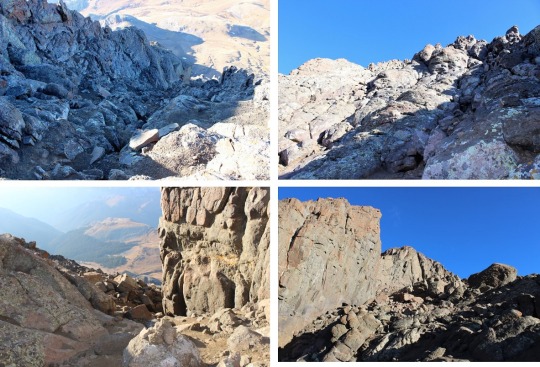
It included a LOT of scrambling over a lot of rock walls/large gullies/insanely tall boulders. These pictures just do not do them justice!
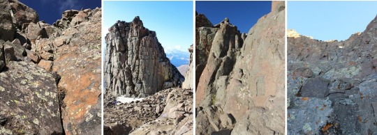
This part should have been fun for me (I love scrambling) but the weather made it really difficult to find my way. The wind was cold and intense. I had to find a cave to shelter in to get out my map, and taking my gloves off made my fingers freeze instantly. I’d look at my map, put it away, put on my gloves, head out to hike, and the terrain kept changing on me. I even brought up the pictures on my phone. Nothing up close looked like the pictures I had? Well, every once in a while they did, but not on a consistent basis. I gave up and just followed the cairns. Luckily there were a lot of them.
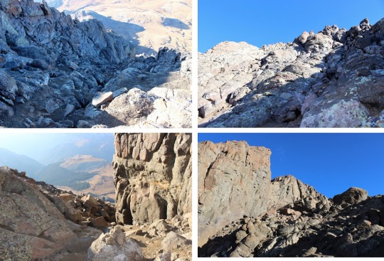
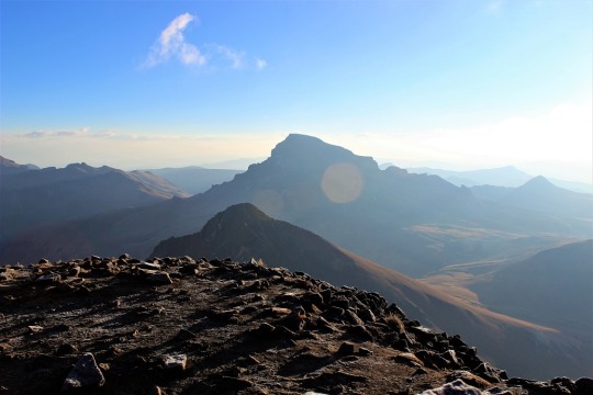
Did I mention the boulders were COLD? My hands were frozen! And it was pretty windy, so I didn’t want to rest too long to appreciate the view. I just wanted to summit, and was thrilled when I did!
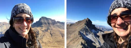
I could see Matterhorn Peak and Uncompaghre Peak in the distance.
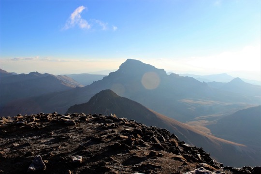
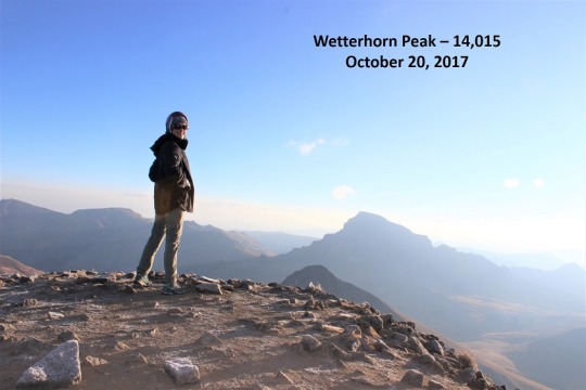
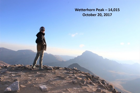
I took a selfie to prove I’d summited
And a quick 360 degree video
youtube
And headed back down. I needed to get warm again. Soon. I was seriously worried about two fingers on my left hand at this point that were solid and starting to burn. I kept trying to flex them to keep the blood pumping but they wouldn’t move. (No, not frostbite, I have Raynaud’s, so I’m overly susceptible to cold temperatures).
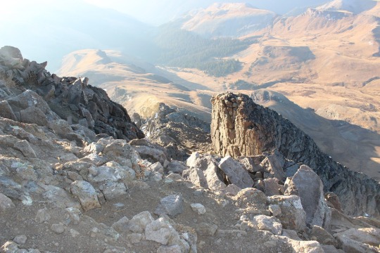
Climbing down is different than climbing up, as your center of gravity is off and you can see more of the exposure so it’s more mental. I took my time, even though my fingers were frozen. I didn’t want to slip.
Just as I was finishing the climbing part of this hike I ran into the three hikers again, getting ready to cross over the first obstacle.
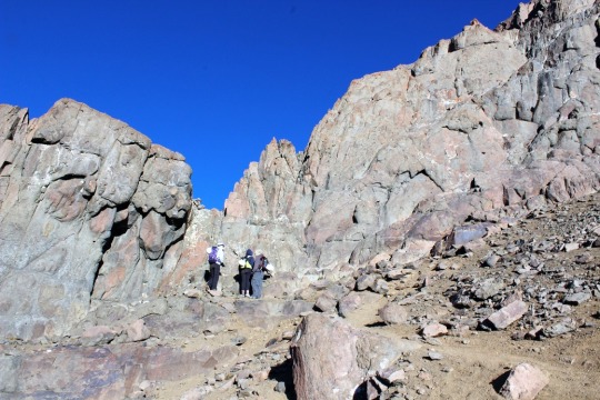
OK, time to book it back down in elevation to warm up these fingers! Luckily the sun was coming out and the clouds all seemed to gravitate towards other peaks. It was still windy though. As I hiked back down I contemplated Wetterhorn. She was beautiful!
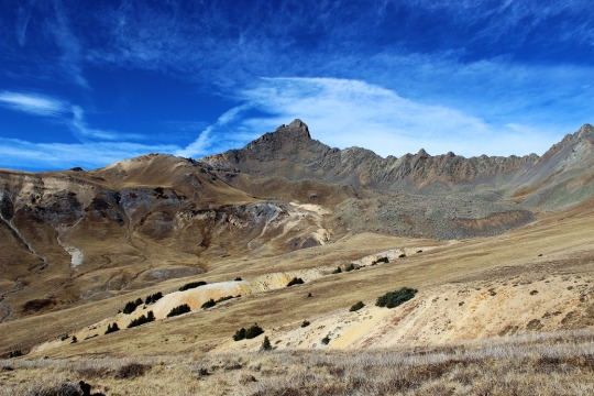
Summiting had been really anti-climactic and I was trying to figure out why? I should have LOVED that climb! It must have been the cold/wind. I mentally tried to decide if I was even up for hiking Matterhorn Peak today? I went back and forth in my mind a few times, and told myself the decision hinged on actually finding the trailhead and my fingers defrosting. Oh, and warmer weather and less wind wouldn’t hurt…
As I descended into the basin and passed through the boulder field there was a brief period where all wind stopped. The silence was deafening. I didn’t hear a bird, marmot, pika, airplane, wind, etc. Nothing. I grew up in Southern California, and directly before and after earthquakes everything becomes still (for different reasons). That’s what this felt like: The still before the chaos. I hoped that wasn’t foreshadowing for the hike ahead.
I kept debating the whole Matterhorn Peak thing. My fingers had finally defrosted, the wind had died down a bit (but don’t let those photos fool you: the wind was intense!) and I didn’t really want to drive all the way back here to hike Matterhorn at a different time. But I was tired, and I still wasn’t sure where that trailhead was? As I was hiking I had a thought: Could it be here? At the Ridgestock Driveway and Wetterhorn Peak junction?
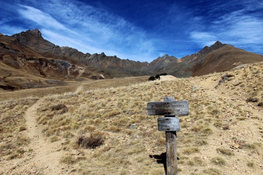
That wasn’t in any of my notes, and didn’t really make sense (shouldn’t it be at the Matterhorn trail junction where it wasn’t?). But in the daylight it looked right. I got out my altimeter. Ugh! I was at 12,500’. If I was going to do this hike I was going to have to gain another 2000’ in elevation, after already doing 3300’ this morning. I was tired. Did I REALLY want to do this? I heard my daughter’s voice in my head again: “Mom, you should just go. You’ll never really know if you can make it or not unless you try.”
Before making the decision to hike Matterhorn Peak I decided to see if this was actually the correct junction to take. Then if it was I could either continue hiking, or know for next time when I’d most likely be hiking in the dark. I started up this hill. It really did seem to go on a lot longer than it looked like it should, and more than once I thought about stopping this nonsense and heading back down the trail. But I’m stubborn, so I continued on.
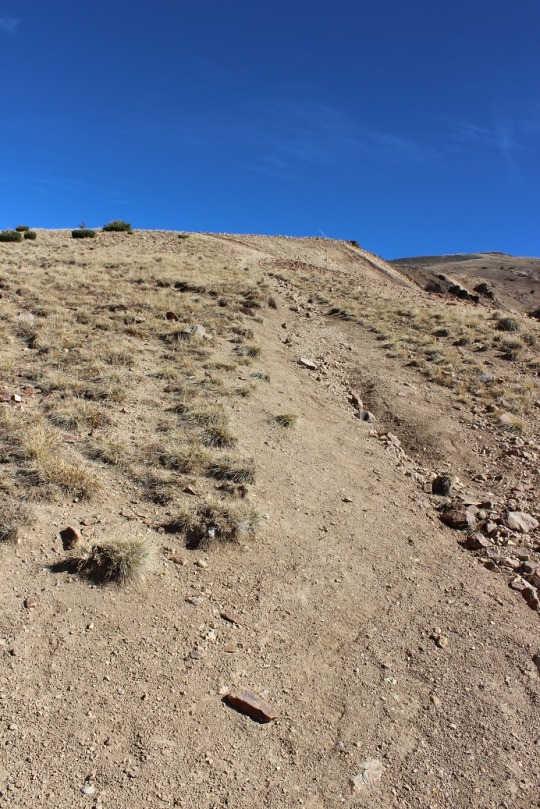
At the top of the hill the trail kind of split in two. Left is the correct way to go
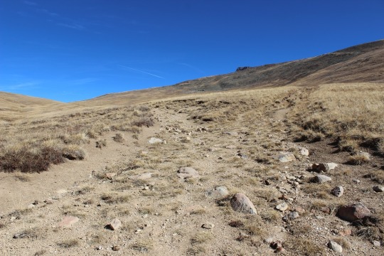
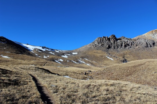
This is what I saw:
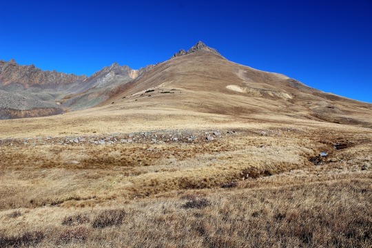
I was intrigued. What I saw before me truly looked like fun. Sure, I was tired, but this looked like FUN! There was no trail, I’d get to make a trail for the first time, and this looked totally doable! I just needed to cross the stream and head up! I was in a basin, so it would be difficult to get lost.
I was in. Since there was no established trail I designed a plan: I’d leave the trail, cross that little creek and hike straight up the mountain (no sissy switchbacks for me, I wanted that elevation gain). I looked at the entire mountain and visually picked cues (rocks) to aim towards. Here’s the route I took:
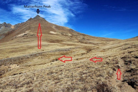
Before heading out I turned around to get a good visual of where I’d started from so I could return to the same spot. I snapped a picture with my camera just in case I forgot, and was off!
I told myself no looking back/down. The elevation gain was indeed intense because I just went straight up, but I kept making small goals and taking breaks when I met them. I took a lot more breaks than I normally do. As I got further up the mountain I could see the rocky ridge above me, and made out two figures in the center that looked to me like rabbits (think Easter Bunny Chocolate Candy). They were right in the middle of the ridge, so that’s where I aimed.
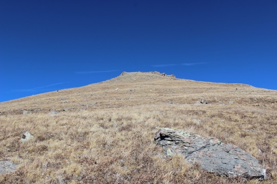
As I got closer they looked more and more like rabbits.
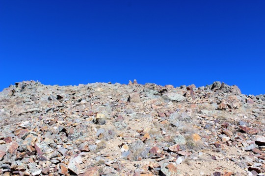
I reached the rabbits and gave them my trekking pole for safe keeping. I trudged on. I could see the summit in front of me.
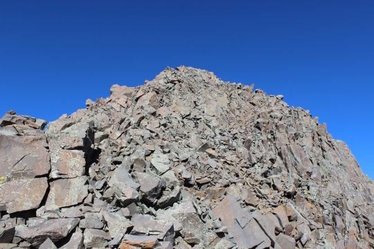
There was no clear path to the top, but I could clearly see the peak and several routes I could take to summit. There was a lot of easy scrambling (compared to Wetterhorn this was a piece of cake!) and a very small summit. So small I couldn’t get a summit selfie. I straddled the summit and just sat there, thinking about what I’d just done. I’d rocked that climb! And check out my view!
youtube
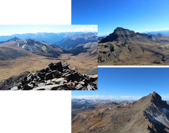
I was surrounded by Uncompaghre, Wetterhorn, and the entire mountain range. I was in the middle of it all, sitting on a peak, completely enjoying the experience. I the sun and a huge smile on my face. This was awesome! This is why I’d come to hike today! And guess what? For the 15 minutes I was on Matterhorn Peak the wind completely stopped. I was warm, could take off my gloves, and took a few pictures.
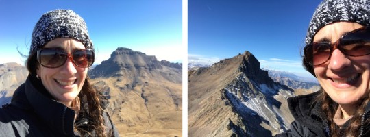
I was happy. I was thrilled. I felt accomplished and my self esteem soared. I love solo hiking!!! I spent about 15 minutes on the summit, which is unheard of from me. I usually summit, take pictures, and head back down to a lower elevation to warm up. However, it was now time to head back. I still had a 6 hour drive home ahead of me. I revisited the rabbits, thanked them for watching my pole, looked for my point of reference and headed back down the mountain.
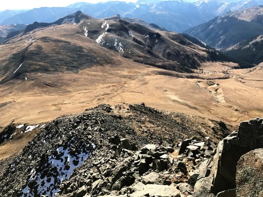
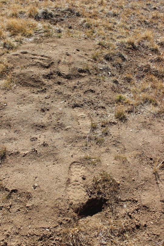
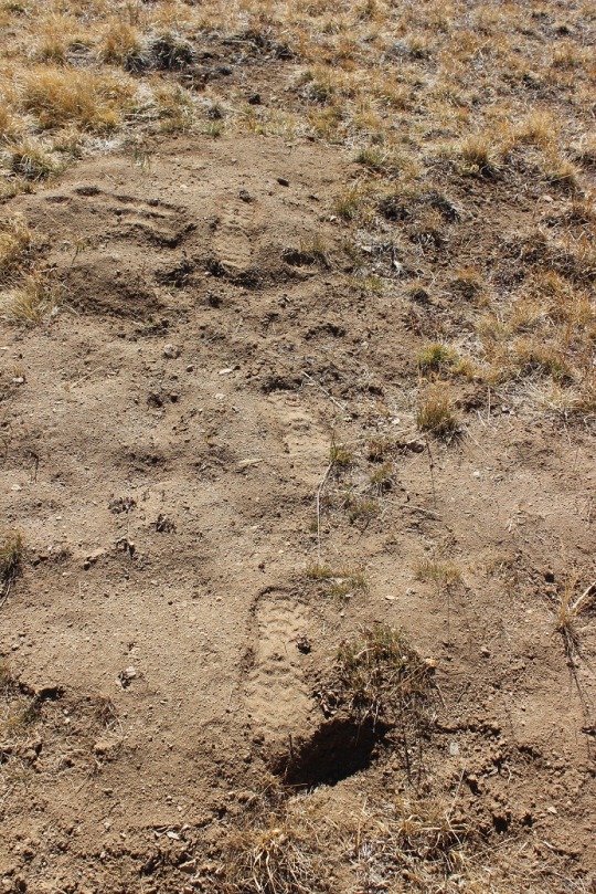
I kept looking for and finding my past reference points and headed towards where I’d initially gone off the trail. I must have done a really good job, because about three quarters of the way back I started walking over the tracks I’d initially made! How crazy is that? All those years of practicing orienteering paid off!
I made it back across the creek, found the trail, and headed back down the mountain. I was in a much better mood than when I’d started today! I was so glad I’d decided to come hiking. Matterhorn Peak is my new favorite 13er!
#WetterhornPeak#MatterhornPeak#14015#13590#hiking#climbing#summit#14er#14erchallenge#13er#14erchallenge33#wildwanderer#sunrise#colorado
1 note
·
View note
Photo

See forever on Uncle Unc. #14ersofcolorado #14er #uncompahgrepeak #uncompahgre #wetterhornpeak #adventureneers #hikingcolorado #hikingadventures #lakecitycolorado #lakecitybrewing (at Uncompahgre Peak) https://www.instagram.com/p/CFYB1jZlzVl/?igshid=2jmzpv2r2jin
#14ersofcolorado#14er#uncompahgrepeak#uncompahgre#wetterhornpeak#adventureneers#hikingcolorado#hikingadventures#lakecitycolorado#lakecitybrewing
0 notes
Text
#33 – Wetterhorn Peak 14,015 and Matterhorn Peak 13,590
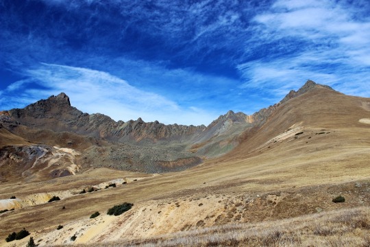
The weather today for just about every 14er in Colorado was the same: Windy. I’m not a fan of wind gusts of 45+ mph (which usually end up being around 85mph up on the peaks if we’re honest) but they’re manageable if it’s a warm day. I ruled out any peak with snow on it because wind and snow don’t mix (as I learned last week). That left me with Wetterhorn Peak for today’s 14er. I checked the weather: 20% chance of snow and 100% chance of 25mph+ winds with gusts of 43mph. Hmmmm. That didn’t sound too promising. Not bad, but not great. I knew there wasn’t any snow on Wetterhorn, so that was a plus. I was just worried it would get snow during the night/day and ruin the trip. I didn’t want to drive 6 hours out there to turn around.
I was musing all this to my kids when my youngest said “Mom, you should just go. You’ll never really know the weather or if you can make it or not unless you try.” She’s a smart 14 year old. (She must have an amazing mom…). I told her she was right, and set my alarm for midnight. Besides, this would be my 33rd 14er and my 3rd class 3. Lots of 3’s mean it’s meant to be, right?
The trailhead is easy to find/follow. From this sign it’s really a 4WD road.
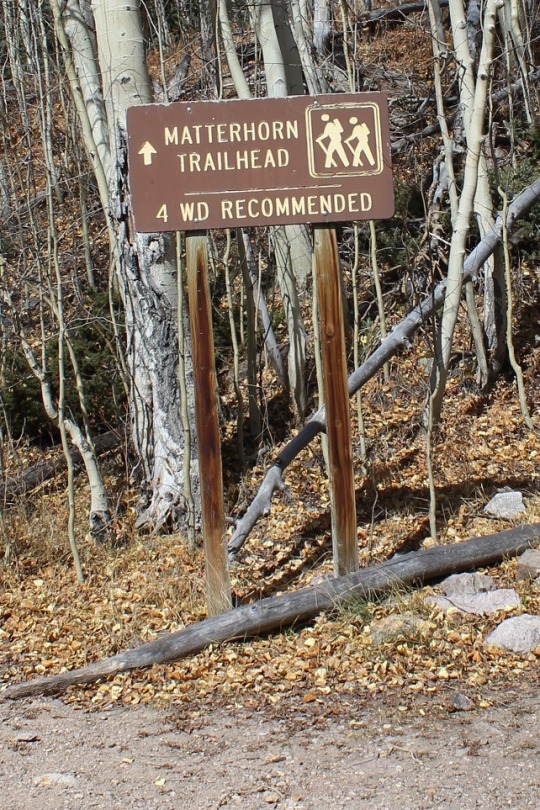
I know others have posted it’s manageable in a 2WD, and I’m sure it is for those amazing 2WD gods out there, but if you value your 2WD vehicle, do NOT take it on this road. However, if you’re looking for a reason to get a new vehicle, by all means proceed. Here are a few pics:
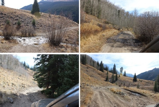
I made it to the trailhead at 5:30am and was on the trail by 5:45 (I drive fast). There were 2 other vehicles in the lot (I parked lower down). There’s probably room for 15 vehicles total at the upper trailhead, including parking about 10 yards below the lot. Here’s what the trailhead looks like in the daytime. The trail starts to the left of the trail signs.

Note: Most of these pictures were taken on the way down because my fingers were too frozen to take pictures on the way up.
The beginning of the hike was pretty uneventful. (Another Note: The summit ledger is full and the pen provided doesn’t have any ink left. Maybe a hiker could bring new supplies with them?) It was just me hiking in the dark. The trail was wide, clear of snow, with just a few muddy spots in areas. It was about 37 degrees, and there wasn’t any wind. Yet.
As soon as I hit treeline the wind began to blow, but it wasn’t too powerful and it wasn’t cold outside, so it was bearable. As the sun began to rise I noticed what looked suspiciously like snow clouds on the mountains next to where I was hiking. Luckily the wind was blowing them away from me. It seemed like the sun took an awful long time to rise this morning. I passed a boulder field that was easy to navigate but didn’t have any cairns? This could be a problem in the winter.
The entire trail was very well maintained, all the way to the ridge
I looked for the turnoff to Matterhorn Peak but never saw it? I did see this sign, which, despite it’s name, does not go to Matterhorn Peak.
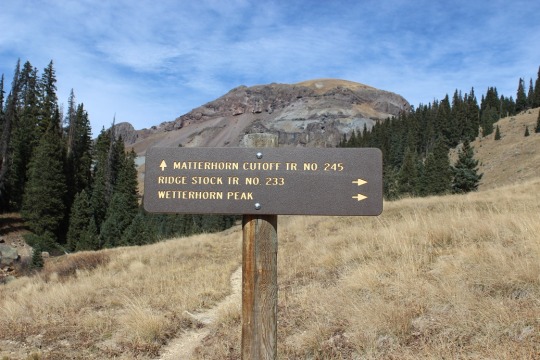
I could see a few hikers in front of me by their flashlights. They seemed far away, but I quickly caught up with them. They looked really cold in their hoodies. I was cold in my snow clothes.
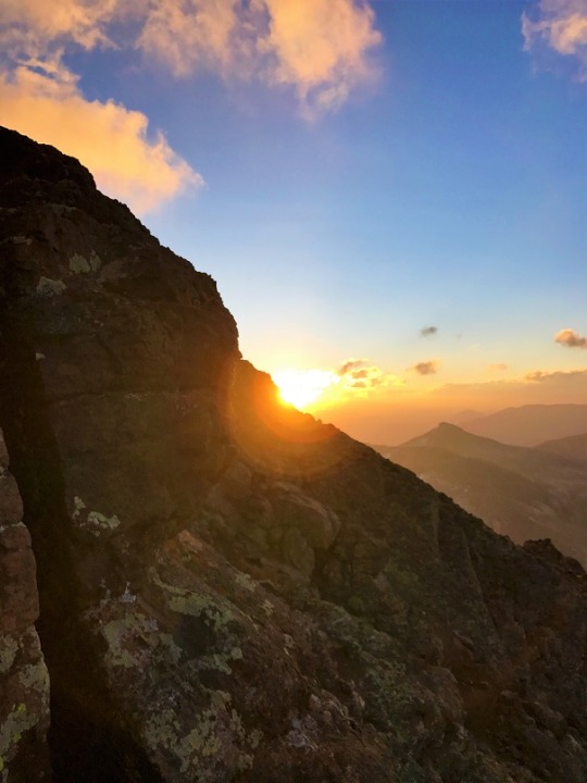
At this time the sun began to rise and the temperature began to drop as I hit the ridge and the wind picked up. I still think Colorado Flag sunrises are cool!
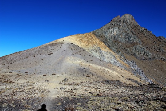
At the top of the ridge I could see most of the route left. This scree hill was insanely slippery! I could tell a lot of people had chosen to just walk on the tundra. I put on my microspikes and braved the scree.
At the top of the scree hill I could see the path to the summit (or part of it).
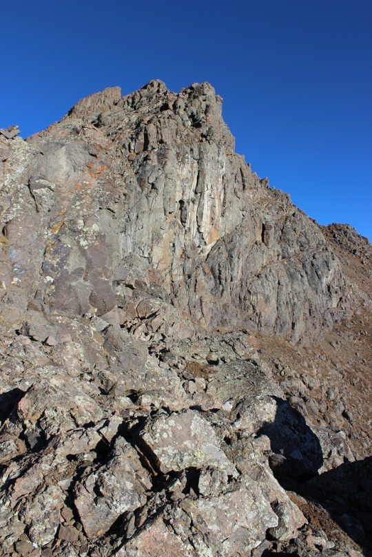
It included a LOT of scrambling over a lot of rock walls/large gullies/insanely tall boulders. These pictures just do not do them justice!
This part should have been fun for me (I love scrambling) but the weather made it really difficult to find my way. The wind was cold and intense. I had to find a cave to shelter in to get out my map, and taking my gloves off made my fingers freeze instantly. I’d look at my map, put it away, put on my gloves, head out to hike, and the terrain kept changing on me. I even brought up the pictures on my phone. Nothing up close looked like the pictures I had? Well, every once in a while they did, but not on a consistent basis. I gave up and just followed the cairns. Luckily there were a lot of them.
Did I mention the boulders were COLD? My hands were frozen! And it was pretty windy, so I didn’t want to rest too long to appreciate the view. I just wanted to summit, and was thrilled when I did!
I could see Matterhorn Peak and Uncompaghre Peak in the distance.
I took a selfie to prove I’d summited
And a quick 360 degree video
youtube
And headed back down. I needed to get warm again. Soon. I was seriously worried about two fingers on my left hand at this point that were solid and starting to burn. I kept trying to flex them to keep the blood pumping but they wouldn’t move. (No, not frostbite, I have Raynaud’s, so I’m overly susceptible to cold temperatures).
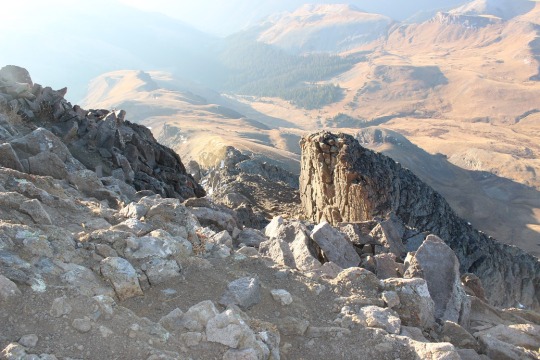
Climbing down is different than climbing up, as your center of gravity is off and you can see more of the exposure so it’s more mental. I took my time, even though my fingers were frozen. I didn’t want to slip.
Just as I was finishing the climbing part of this hike I ran into the three hikers again, getting ready to cross over the first obstacle.
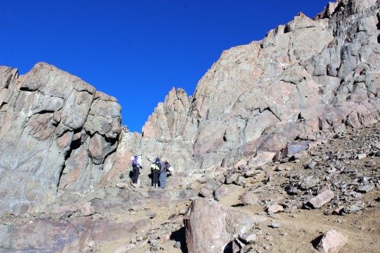
OK, time to book it back down in elevation to warm up these fingers! Luckily the sun was coming out and the clouds all seemed to gravitate towards other peaks. It was still windy though. As I hiked back down I contemplated Wetterhorn. She was beautiful!

Summiting had been really anti-climactic and I was trying to figure out why? I should have LOVED that climb! It must have been the cold/wind. I mentally tried to decide if I was even up for hiking Matterhorn Peak today? I went back and forth in my mind a few times, and told myself the decision hinged on actually finding the trailhead and my fingers defrosting. Oh, and warmer weather and less wind wouldn’t hurt…
As I descended into the basin and passed through the boulder field there was a brief period where all wind stopped. The silence was deafening. I didn’t hear a bird, marmot, pika, airplane, wind, etc. Nothing. I grew up in Southern California, and directly before and after earthquakes everything becomes still (for different reasons). That’s what this felt like: The still before the chaos. I hoped that wasn’t foreshadowing for the hike ahead.
I kept debating the whole Matterhorn Peak thing. My fingers had finally defrosted, the wind had died down a bit (but don’t let those photos fool you: the wind was intense!) and I didn’t really want to drive all the way back here to hike Matterhorn at a different time. But I was tired, and I still wasn’t sure where that trailhead was? As I was hiking I had a thought: Could it be here? At the Ridgestock Driveway and Wetterhorn Peak junction?
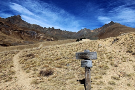
That wasn’t in any of my notes, and didn’t really make sense (shouldn’t it be at the Matterhorn trail junction where it wasn’t?). But in the daylight it looked right. I got out my altimeter. Ugh! I was at 12,500’. If I was going to do this hike I was going to have to gain another 2000’ in elevation, after already doing 3300’ this morning. I was tired. Did I REALLY want to do this? I heard my daughter’s voice in my head again: “Mom, you should just go. You’ll never really know if you can make it or not unless you try.”
Before making the decision to hike Matterhorn Peak I decided to see if this was actually the correct junction to take. Then if it was I could either continue hiking, or know for next time when I’d most likely be hiking in the dark. I started up this hill. It really did seem to go on a lot longer than it looked like it should, and more than once I thought about stopping this nonsense and heading back down the trail. But I’m stubborn, so I continued on.
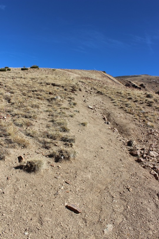
At the top of the hill the trail kind of split in two. Left is the correct way to go

This is what I saw:
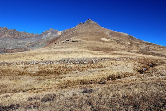
I was intrigued. What I saw before me truly looked like fun. Sure, I was tired, but this looked like FUN! There was no trail, I’d get to make a trail for the first time, and this looked totally doable! I just needed to cross the stream and head up! I was in a basin, so it would be difficult to get lost.
I was in. Since there was no established trail I designed a plan: I’d leave the trail, cross that little creek and hike straight up the mountain (no sissy switchbacks for me, I wanted that elevation gain). I looked at the entire mountain and visually picked cues (rocks) to aim towards. Here’s the route I took:
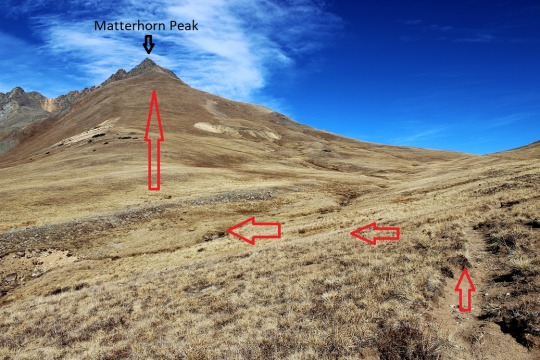
Before heading out I turned around to get a good visual of where I’d started from so I could return to the same spot. I snapped a picture with my camera just in case I forgot, and was off!
I told myself no looking back/down. The elevation gain was indeed intense because I just went straight up, but I kept making small goals and taking breaks when I met them. I took a lot more breaks than I normally do. As I got further up the mountain I could see the rocky ridge above me, and made out two figures in the center that looked to me like rabbits (think Easter Bunny Chocolate Candy). They were right in the middle of the ridge, so that’s where I aimed.

As I got closer they looked more and more like rabbits.
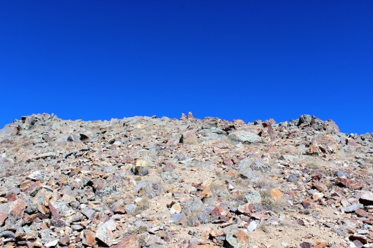
I reached the rabbits and gave them my trekking pole for safe keeping. I trudged on. I could see the summit in front of me.

There was no clear path to the top, but I could clearly see the peak and several routes I could take to summit. There was a lot of easy scrambling (compared to Wetterhorn this was a piece of cake!) and a very small summit. So small I couldn’t get a summit selfie. I straddled the summit and just sat there, thinking about what I’d just done. I’d rocked that climb! And check out my view!
youtube
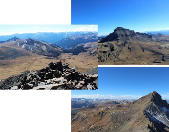
I was surrounded by Uncompaghre, Wetterhorn, and the entire mountain range. I was in the middle of it all, sitting on a peak, completely enjoying the experience. I the sun and a huge smile on my face. This was awesome! This is why I’d come to hike today! And guess what? For the 15 minutes I was on Matterhorn Peak the wind completely stopped. I was warm, could take off my gloves, and took a few pictures.
I was happy. I was thrilled. I felt accomplished and my self esteem soared. I love solo hiking!!! I spent about 15 minutes on the summit, which is unheard of from me. I usually summit, take pictures, and head back down to a lower elevation to warm up. However, it was now time to head back. I still had a 6 hour drive home ahead of me. I revisited the rabbits, thanked them for watching my pole, looked for my point of reference and headed back down the mountain.
I kept looking for and finding my past reference points and headed towards where I’d initially gone off the trail. I must have done a really good job, because about three quarters of the way back I started walking over the tracks I’d initially made! How crazy is that? All those years of practicing orienteering paid off!
I made it back across the creek, found the trail, and headed back down the mountain. I was in a much better mood than when I’d started today! I was so glad I’d decided to come hiking. Matterhorn Peak is my new favorite 13er!
Total Miles: 10
Total Elevation Gain: 5300’
Total Time: 6 hours
#wildwanderer#14er#14erchallenge#13er#14erchallenge33#WetterhornPeak#MatterhornPeak#14015#13590#hiking#summit#climbing#colorado#sunrise
2 notes
·
View notes
Photo

Heading up #climbing #wetterhornpeak #14er #colorado #noropes #wildwanderer
0 notes