#Vilhelmina Municipality
Explore tagged Tumblr posts
Text

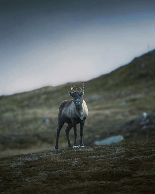
Stekenjokk, Klimpfjäll, Vilhelmina Municipality, Sweden
Christoph Nolte
1 note
·
View note
Photo


Ångermanälven, Sweden (No. 3)
Ångermanälven is a river that flows through central Norrland,is 463 km long and whose catchment area covers 31,860 km². It is one of Sweden's most water-rich rivers, with an average water flow of 500 m³/s at the mouth. [1] Ångermanälven has its springs in southern Lapland and flows through Vilhelmina and Åsele municipalities and down through Ångermanland and flows into the Bothnian Sea.
The river has many large power plants and the main rapids are Nämforsen, Moforsen, Forsmoforsen, Nässundforsen and Granvågsforsen. The main tributaries are Vojmån, Fjällsjöälven and Faxälven.
The valley of the Ångerman river downstream of Junsele (and down to the Bothnian Sea) is called Ådalen. Below Uusimaa in Kramfors municipality, ångermanälven forms a long, wide estuary bay with the two famous bridges Sandöbron and Högakustenbron. The distance between Hammarsbron-Uusimaa and Svanö-Sandö can be described as a threshold fjord, with depths down to 100 meters between Kramfors and Bjärtrå and the threshold at Svanö-Sandö at a depth of 10 meters. Larger ships can go up to Uusimaa, and smaller boats (which can go under low bridges) to Sollefteå.
In the Middle Ages, the river was in some contexts called Styrån, as Styresholm Castle was located at the river's lower end. The whole of upper Norrland was ruled from that castle.
Source: Wikipedia
#Ångermanälven#Rastplats Vojmån#Meselefors Rasteplass#summer 2020#Vilhelmina Municipality#Västerbotten County#Swedish Lapland#Ångerman#Angerman#river#river bank#rapids#European grayling#fishing rod#travel#roadside attraction#woods#forest#nature#meadow#clouds#blue sky#tourist attraction#landmark#Sweden#Sverige#Scandinavia#Northern Europe#fireweed#wildflower
0 notes
Text
Crown Princess Victoria and Prince Daniel's call to Vilhelmina municipality on 31st March was unexpectedly interrupted by their dog Rio who decided to play with a noisy toy while his owners were working. It seems home working with pets is the same whether you're royal or not!
30 notes
·
View notes
Photo


trip to the Alsberget nature reserve by the municipal border with Vualtjere/Vilhelmina
10 notes
·
View notes
Text
Three Swedish neighbouring municipalities chooses Digpro for better cooperation in their fiber networks
Digpro, the major innovator in the field of Geographic IT and Network Lifecycle Management, has been selected to provide the three Swedish neighbouring municipalities Dorotea, Åsele and Vilhelmina with the geographic information system dpCom for thei https://www.environmentguru.com/pages/elements/element.aspx?utm_source=dlvr.it&utm_medium=tumblr&id=5510237
0 notes
Photo


Ångermanälven, Sweden (No. 2)
Vilhelmina Municipality (Swedish: Vilhelmina kommun; Southern Sami: Vualtjeren tjïelte) is a municipality in Västerbotten County in northern Sweden. Its seat is located in Vilhelmina.
In 1804 the parish of Volgsjö was renamed Vilhelmina in honour of Queen Frederica Dorothea Wilhelmina of Sweden.
In 1947 the locality Vilhelmina was detached from the rural municipality with the same name, forming the market town (köping) of Vilhelmina. The two entities were reunited in 1965.
Like the northern parts of Sweden (colloquial Norrland), it is scarcely populated due to its inhospitable conditions and cold climate, but is superb for those who like wildlife and untouched nature.
The village of Malgovik, about 20 km north of Vilhelmina, holds the record for the lowest temperature ever recorded in Sweden. It was set on December 13, 1941, when the temperature dropped down to -53 °C.
Every July the town of Vilhelmina holds a festival called Hembygdsdagarna Vilhelmina. In addition to popular and folk music performances, tradition holds that a local engaged couple is selected each year to get married during the festival. The bride and groom lead a parade of fiddlers and other traditionally dressed Swedes through town to the church where the marriage is performed in front of all who wish to attend. They are not always able to find a couple willing to get married, however, so some years they hold the parade without an engaged couple, and hold a public church service instead of a wedding.
Source: Wikipedia
#Ångermanälven#Vilhelmina Municipality#Västerbotten County#Lapland#Sweden#river#nature#landscape#Ångerman#Angerman#river bank#flora#woods#forest#pines#water#European grayling#rastp#Rastplats Vojmån#clouds#rapids#tourist attraction#landmark#sculpture#summer 2020#Swedish Lapland#Sverige#Scandinavia#Northern Europe#rest area
0 notes
Text
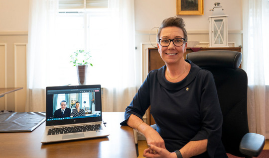

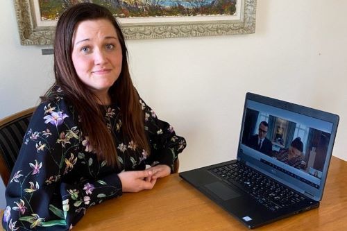
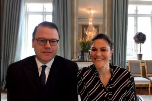
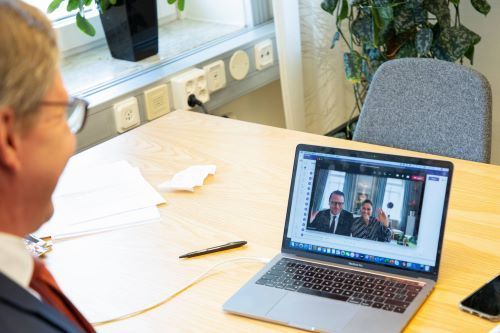
31st March 2021 // Crown Princess Victoria and Prince Daniel continued their digital meetings with representatives of the Executive Committees of various municipalities - this time Eksjö and Lomma in the south, Dals-Ed in the West, Vilhelmina in the North, Salem, Älvkarleby in the East, and Vingåker in Central Sweden - where they received an update on the local response to the pandemic. Since the start of the year they have made these unofficial calls to at least 90 municipalities, representing over 25% of Swedish residents
15 notes
·
View notes
Photo


Överuman/Uman, Swedish Lapland (No. 13)
Storuman Municipality is a municipality in Västerbotten County, Sweden. In Sweden, the municipality in the north is bordered by Sorsele,in the south by Vilhelmina and to the east by Lycksele. West; in Norway it borders the municipalities of Hattfjelldal, Hemnes and Rana. The central town is Storuman with 2,030 inhabitants, which is the municipality's largest urban area where 36.8% of the municipality's inhabitants lived in 2015. In the same year, 57.9% of the municipality's population lived in the four urban areas of Storuman, Stensele, Tärnaby and Hemavan.
The municipality is one of Sweden's largest by area, and it is a Sami administrative municipality since 1 January 2010.
Source: Wikipedia
#Lake Överuman#Lake Uman#Swedish Lapland#Lappland#landscape#beach#Storuman Municipality#Västerbotten County#forest#snow#flora#nature#countryside#summer 2020#original photography#vacation#travel#moutains#woods#pines#tourist attraction#landmark#waves#blue sky#clouds#Scandinavia#Northern Europe#Sweden#Sverige#reflection
1 note
·
View note
Photo


Dorotea, Sweden
Dorotea (Southern Sami: Kraapohke) is an urban area in Lapland and the capital of Dorotea Municipality in Västerbotten County and a church village in dorotea parish.
The town is located on the E45 And Inland Railway,about 170 kilometres northeast of Östersund. Highway 92 connects Dorotea with Umeå, where the distance is around 210 kilometers.
The village was originally called Bergvattnet (Southern Sami: Kraapohke or Kraaponjaevrie and was located in åsele parish. On May 7, 1799, Bergvattnet's chapel day was given to form its own pastorate and parish named Dorotea after Gustav IV Adolf's wife Queen Fredrika Dorotea Vilhelmina of Baden. The church was almost completely built at the time. The village was later renamed Dorotea after the parish/church/parish.
After the 1862 municipal reform was implemented in Lapland in 1874, the town was part of the Dorotea municipality. It was established on 30 October 1936 by the Dorotea Municipal Society, which was dissolved at the end of 1957. Between 1974 and 1980, the town was part of Åsele municipality, when Dorotea municipality was reconstituted.
On June 16, 2016, Dorotea's Sami name was changed to Kraapohke after the municipality appealed against lantmäteriet's decision in 2013 to name the municipality Döörte.
Source: Wikipedia
#Bergvattensjön#lake#reflection#I really love the first pic#Swedish Lapland#summer 2020#original photography#landscape#countryside#architecture#cityscape#small town#village#woods#forest#flora#nature#blue sky#clouds#Sweden#Västerbotten County#dark water#pixel#Sverige#Lapland#Scandinavia#Northern Europe#tourist attraction#landmark
0 notes