#Ventana Canyon
Explore tagged Tumblr posts
Visit Tumblr Blog
Explore Tumblr blogs with no restrictions, modern design and the best experience.
Last Seen Tumblr Blogs


Fun Fact
Tumblr was created by web developers David Karp and Marco Arment.
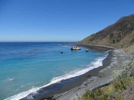
Photo

The sun kisses the rugged peaks of Ventana Canyon, casting a warm glow over the sprawling Tucson landscape below. Majestic saguaros stand tall, guardians of the serene Arizona wilderness.
#Ventana Canyon#Tucson#Arizona#sunset#mountain peaks#saguaro cacti#desert landscape#wilderness#natural beauty#warm glow#rugged terrain#outdoor photography#Southwestern United States#desert sunset#Arizona wilderness
2 notes
·
View notes
Text

Eric Kroll - Helena in Ventana Canyon, from The New Erotic Photography by Dian Hanson (2009)
380 notes
·
View notes
Text
Fresh from the Deep: MBARI scientists film an elusive dreamer anglerfish in 4K!
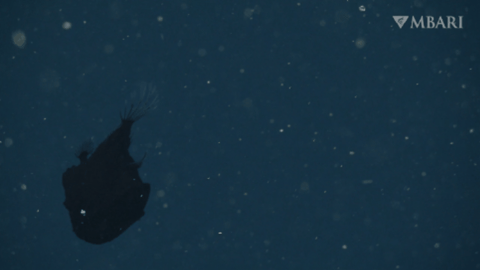
Recently, MBARI researchers happened upon the elusive dreamer anglerfish (Oneirodes sp.). It was filmed with MBARI’s ROV Ventana, 781 meters deep in Monterey Canyon.
youtube
In 35 years of deep-sea exploration, MBARI’s ROVs have completed more than 7,300 successful dives and recorded more than 28,400 hours of video, yet we have only encountered the dreamer anglerfish 9 times.
501 notes
·
View notes
Text


Hike #5 of 2024
Maiden Pools via Ventana Trail
5.6 miles, 1354 ft elevation gain
Pretty canyon hike. Super bright and sunny so none of the pictures really captured how pretty it was.
Idk why but I felt like I was dying the whole way up. It was awful. I was out of breath from the beginning and my muscles got tired really fast.
Tomorrow we’re hiking another tough one and I’m super nervous. I don’t want to let my hiking partners down so hopefully I can keep up.
Lots of beautiful purple buckhorn cholla. Interesting striations on the rocks. And lots of water! Very hot and not much shade.
17 notes
·
View notes
Text
youtube
Fresh from the Deep: Ocean scientists film elusive dreamer anglerfish
During a deep-sea expedition this fall, MBARI researchers happened upon the elusive dreamer anglerfish (Oneirodes sp.). This fascinating fish was filmed with MBARI’s remotely operated vehicle (ROV) Ventana, 781 meters (2,562 feet) deep in Monterey Canyon. In 35 years of deep-sea exploration, MBARI’s ROVs have completed more than 7,300 successful dives and recorded more than 28,400 hours of video, yet we have only encountered the dreamer anglerfish nine times. MBARI’s last observation of Oneirodes was in 2016. This encounter marked MBARI’s first opportunity to film a deep-sea anglerfish in 4K. The unusual appearance of Oneirodes—ultra-black skin, a luminous lure, and sharp teeth—ensures survival in one of the most challenging environments on Earth. Anglerfishes have bioluminescent lures to attract a meal. Their ultra-black skin absorbs the lure’s light concealing their giant mouth just beyond the lure. In fact, the dreamer anglerfishes are the blackest of black fishes known in the ocean. This “invisibility cloak” also keeps them hidden from predators. The ROV Ventana recently completed its 4,500th research dive. This is the most science dives logged by a single ROV to date. The trove of deep-sea video filmed by the entire fleet of MBARI’s robots helps scientists document the diversity of life that dwells in the ocean’s depths and better understand humanity’s connection to the deep sea. Read more: Fresh from the Deep:MBARI scientists film elusive dreamer anglerfish in 4K • MBARI
via: MBARI (Monterey Bay Aquarium Research Institute)
15 notes
·
View notes
Text
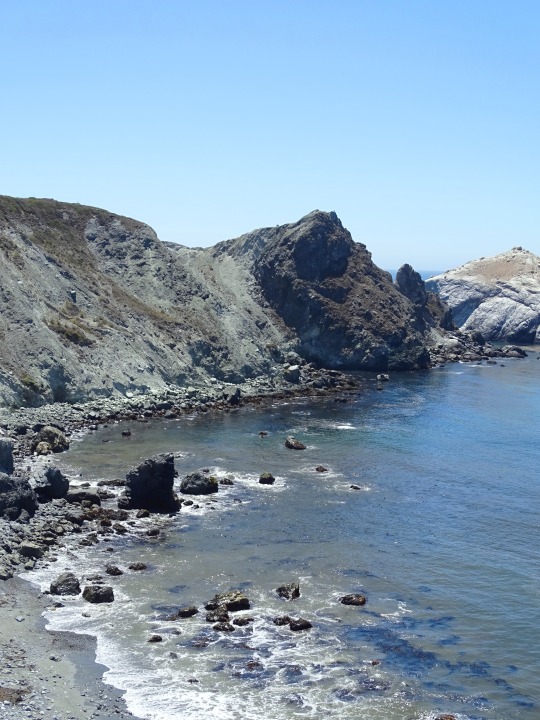
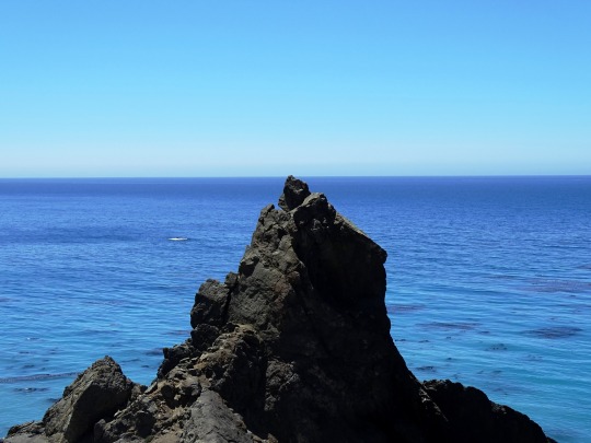

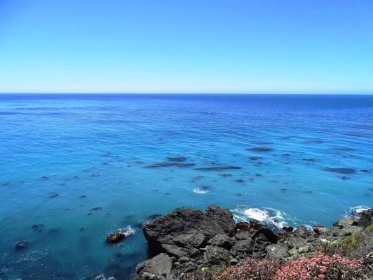
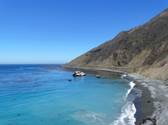
Black Sand Shores, CA (No. 5)
In 1909, an advertisement for the Idlewild Hotel on the Little Sur River stated that the camp would be accessible by auto as soon as the "Cerro Grade", the stretch of road from the coast to the Little Sur River near Cerro Hill, was completed. In 1910, the Monterey Daily Cypress reported that Mr. and Mrs. A.E. Cooper "motored down to Mrs. Martha M. Cooper ranch at Sur, leaving Monterey at 12 midnight and arriving there at 2 a.m." But the road was still very rough, and most goods including cheese produced on the Cooper Ranch was still shipped by boat to Monterey. The Idlewild competed with the Pfeiffer Resort for guests through about 1920, when the Idlewild was forced out of business by Martha Cooper, who acquired the land. In 1904, residents extended the unpaved road from the Pfeiffer Resort to the Post Ranch, and then it was extended another 2.5 miles (4.0 km) south to Castro Canyon, near the present-day location of Deetjen's Big Sur Inn.
As late as the 1920s, only two homes in the entire region had electricity, locally generated by water wheels and windmills. Most of the population lived without power until connections to the California electric grid were established in the early 1950s. The region has always been relatively difficult to access and only the sturdiest and most self-sufficient settlers stayed.
In July 1937, the California Highways and Public Works department described the journey, "There was a narrow, winding, steep road from Carmel south ... approximately 35 miles to the Big Sur River. From that point south to San Simeon, it could only be traveled by horseback or on foot."The southern portion, which was for many years merely a foot and horse trail, became known as the "Coast Ridge Road". It used to begin near the Old Post Ranch. It is currently only accessible on foot from near the Ventana Inn. It passes through private land and connects with the Nacimiento-Fergusson Road. It follows the crest of the coastal ridge south about 34 miles (55 km) to within a couple of miles of Cone Peak. Both the Old Coast Road and the Coast Ridge Road are often unusable during and after winter storms.
The southern region of Monterey County coast was isolated from the few settlements in the north by the steep terrain. The southern homesteaders were more closely tied to the people in the interior San Antonio Valley including the Jolon and Lockwood areas than to coastal communities to the north. Those who lived in the vicinity of the Big Sur River were connected with Monterey to the north.
A horse trail connected Jolon through present-day Fort Hunter Liggett to Wagon Caves, and from there over the Santa Lucia range, from which two trails split to the coast or to the Los Burros Mining District.
The horse trail across the mountains was widened and improved into a road beginning in 1931, and completed in 1937. The road was constructed by crews composed of men from the Civilian Conservation Corp, U.S. Forest Service, and state and county relief agencies.
Source: Wikipedia
#Black Sand Shores#California State Route 1#Highway 1#Pacific Coast Highway#National Scenic Byway#Big Sur#Pacific Ocean#travel#original photography#vacation#tourist attraction#landmark#landscape#seascape#countryside#street scene#road trip#summer 2022#California#West Coast#Big Sur Coast Highway#nature#flora#grass#tree#USA#blue sky#blue sea#beach#waves
2 notes
·
View notes
Text
"Me preguntan" de Jorie Graham
“Me preguntan”
por qué los nuevos
pájaros sin defecto
programados con precisión
hermoso
canto que vuela sube
planea calma
sin diferenciar
de los que no regresan
no son los mismos
puntas de alas
brillando
como a la luz
del sol de antes,
alas moteadas
salpicando aún más
una mancha umbría perfecta
cuellos que
mueven dulces preocupados
arriba y abajo
garganta
que palpita tan leve
como cuando
se expulsa
el canto por
qué no nos son
suficiente, por
qué sólo
al cerrar los ojos
la emoción
–puedes elegir
la especie de ave– es
real, vienen
a las ventanas, se van
inesperadamente al
movernos…Cómo su
parvada atravesó nuestros
campos. Cómo
esa última mañana,
en aquel mundo de niebla
levantándose, al sofoco de
la última evaporación al salir
aquel sol extraño, con brazos
alzados &
riendo, sin
aliento, corrimos detrás de ellos
hasta que des-
aparecieron.
Jorie Graham. 2023. “They Ask Me”, To 2040. Copper Canyon Press. e-book pp. 24-25.
3 notes
·
View notes
Text
0 notes
Text
In the early days of Cuba, New Mexico, the transportation infrastructure was limited, but as the area developed and the need for reliable routes grew, roads gradually began to take shape. As early as 1879, a wagon road emerged, following the east bank of the Río Puerco from points south of La Ventana to Cuba. However, this road presented its own challenges. It lacked bridges, forcing travelers to navigate numerous arroyos that would periodically flood. Crossing these arroyos was a laborious and time-consuming process.
The 1880s marked a significant period of growth in the region, as copper and coal deposits were discovered and exploited in various communities along the west side of the Nacimiento Mountains. To facilitate transportation and connect these mining communities with Cuba, a dirt road was established, stretching from La Ventana to San Miguel, San Pablo, and Señorito. This road became a vital lifeline, aiding the movement of people, goods, and supplies.
However, as the mines eventually became abandoned and the communities dwindled, the road fell into disrepair. It became a mere remnant of its former importance, no longer serving as a bustling artery for commerce and travel.
Yet, even in this state of disrepair, individuals like Diego C de Baca and his son Ciriaco recognized the importance of maintaining some form of connectivity in the area. They took it upon themselves to maintain a road from San Ysidro to Cuba, ensuring that at least a portion of the route remained passable for those relying on it.
Years later, in 1929, a significant development occurred when Highway 55 was constructed north from Cuba. Upon reaching Counselor, the highway forked. The main section of Highway 55 continued to extend north, leading to Bloomfield. Meanwhile, the right fork of this road was the original Highway 44, covering a distance of approximately 50 miles, followed the picturesque Largo Canyon until it reached the San Juan River.
This newly constructed highway marked a significant improvement in transportation infrastructure, offering a more direct and efficient route for travelers. It allowed for increased accessibility to and from Cuba, further connecting the area to neighboring communities and regions.
As Highway 55 became a mainstay in the region, it ushered in a new era for Cuba and nearby towns. It brought increased opportunities for trade and commerce, as well as enhanced connectivity for residents, ultimately contributing to the growth and development of the area.
Today, the roads in the Cuba, New Mexico, area serve as a testament to the perseverance and determination of the early settlers. The wagon road along the Río Puerco, the dirt road linking mining communities, and later the construction of Highway 55 all played a crucial role in shaping the growth and connectivity of the region. The roads continue to serve as essential conduits for transportation, connecting communities and facilitating the exchange of goods and ideas.
0 notes
Text
I Look Beyond Flowers
I Look Beyond Flowers
Desert Rosemallow — Image by kenne As I looked beyond the flowers in the canyon curvature of the desert basin begins, rolling across dried river beds to the west where the sun sets each day beyond the Tucson Mountains starting a new day somewhere in the east. — kenne

View On WordPress
1 note
·
View note
Photo

Caught in the golden hour, this serene snapshot captures the rugged beauty of Ventana Canyon in Tucson, Arizona. The towering saguaro and sun-kissed rocks create a perfect desert escape.
#golden hour#Ventana Canyon#Tucson Arizona#desert beauty#rugged landscape#saguaro cactus#nature photography#outdoor adventure#desert rocks#sun-kissed#Arizona desert#hiking trails#wilderness#scenic view#tranquil scene
3 notes
·
View notes
Photo

A window in a red rock wall deep within Ventana Mesa opens the canyon beyond to sunlight, Navajo, Arizona. Photo by Adriel Heisey. National Geographic, September 1996
via @geoarchive_
https://www.instagram.com/likalinea/
377 notes
·
View notes
Text
Charge of the saguaros! (Ventana Canyon Trail)

3 notes
·
View notes
Text
Hi guys so we’ve had a few room inquiries over the past few months, and we’ve pretty much declined them. We have right at 70 rooms and the only rooms we see being utilized consistently are homes. So here’s what we want from you. Check the list below, to see what rooms you might want to keep or which ones you might want to see gone. Once the list is finalized based off what YOU as a community vote for we will then consider letting individuals start business rooms again. However with that means that you have to keep said room active. If your room goes more than 2 months inactive it will be removed and may get another chance to reopen your business at a much later date. If you have suggestions of new rooms you’d like to see please let us know those as well.
To vote on rooms, simply post in the comments the rooms you’d like to see stay. Any rooms that do not make the cut will be removed from cliq immediately.
7 Eleven
71 above
BOA steak house
Beverly Center
Big bear mountain
Border Grill
Bossa Nova
Breakfast Bitch
Bxr Gym & Boxing
Catch LA
Cobb Estate/ Haunted Forrest
Disney Land
Firefly
Florida
Gizmo’s Cereal Bar
Griffith Park
Hollywood Sign & Hollywood Boulevard
In-N-Out
Johnny Rockets
Katana Sushi
L.A Police department
LA zoo
Los Angeles County Museum of Art
Los Angeles Gun Club
Los Angeles Mission
Luckie’s Cabaret
Lucky Strike
Mildred E Mathis Botanical Garden
Monty Good Burger
Moonlight rollerway
Nobu
Oc Fair
Ocean Prime
Olive Garden
Overland Veterinary Clinic
Perch
Perfect Sound Studios
Providence
RH rooftop Bar and Restaurant
Red Lobster
Regal Cinemas L.A.
Reign of Terror haunted house
Rodeo Drive
Roscoes House of Chicken and Waffles
Runyon Canyon
Sage Vegan Bistro
Santa Monica Pier
Six Flags hurricane harbor
Six Flags Magic Mountain
Sky zone
Star Hookah Lounge
Starbucks
Studio City Tattoo & Piercing
Sugar Factory
Sunset strip
TAO
Target
The Abbey
The Beverly Hills Hotel
The Dolly Llama
The Ritz-Carlton
The nice guy
The ventana Rooftop Pool
Tinfoil liquor & Grocery
Top Golf
Trejos tacos
Venice Beach
Walmart
Westside Pavilion
Whole foods
Whyte Diamonds
6 notes
·
View notes
Text
I was tagged by dear @uneorchide 💜
I tag (if you want to or haven’t done it yet): @xluenae, @isterofimia, @rruslana, @aroseofanyothername, @amadryades, @sanftmuetig, @rhymes-of-an-hour, @laplagesauvage, @filledesun, @frenchsiren
Rules are simple, choose 50 songs you want to recommend to tagged people and see what they prepare for you (if you decide to do it). You can choose only one song by certain artist!
In no particular order:
1. Elo Hi by Ofra Haza
2. Haenim by Kim Jung Mi
3. Northern Sky by Nick Drake
4. Guilty by Al Bowlly
5. Everything I Cannot See by Charlotte Gainsbourg
6. Cheshme Man by Dariush
7. Saraabe Toe by Kourosh Yaghmaei
8. Ahwak by Abdel Halim Hafez
9. Till forever by Labi Siffre
10. Лето by Zoopark
11. Can’t find my way home by Blind Faith
12. Ladies of the Canyon Joni Mitchell
13. Perdido de Amor by Luiz Bonfá
14. Amores Hallaras by Inti-Illimani
15. Huos haenuy bong by Poev Vanary
16. Let the music play by The Drifters
17. Sing Nachtigall Sing by Evelyn Künneke
18. Denise by Randy & the Rainbows
19. Goniac Kormorany by Piotr Szczepanik
20. Abre la Ventana by Victor Jara
21. Blue Hotel by Chris Isaak
22. Blue Moon Revisited (Song For Elvis) by Cowboy Junkies
23. Feels Just Fine by The Handmaiden Soundtrack
24. Will The Orange Blossom Smile? by Rebecca Pan
25. Dolerme by Rosalia
26. Her Summer by Vu.
27. Natsuno Klaxon by Junichi Inagaki
28. This Never Happened Before by Paul McCartney
29. Sick Child by Siouxsie and the Banshees
30. How to bring a blush to the snow by the Cocteau Twins
31. Pavanne by David Motion
32. Perfume: The story of a murderer: Distilling Roses by Johnny Klimek
33. To the Ball by Adrian Johnston
34. Orchard House by Thomas Newman
35. Deep Water by Strawberry Switchblade
36. Faded Streets, Windy Weather by Gary Shearston
37. I Like It by DeBarge
38. Derniers baisers by Les Chats Sauvages
39. Il cielo in una stanza by Gino Paoli
40. Valerie a tyden divu by Luboš Fišer
41. Espejismo by Juanello
42. A hunting accident (waltz) by Eugen Doga
43. Oye Como Va by Santana
44. Trooping with crows by Abel Korzeniowski
45. Этот мир by Alla Pugacheva
46. Колыбельная by Anna German
47. Snow by Loreena McKennitt
48. Lullaby by Goran Bregović
49. Daisy by You Young Suk
50. Epilogue by Lee Byung Woo
20 notes
·
View notes
Text
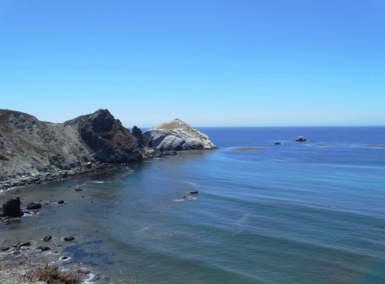
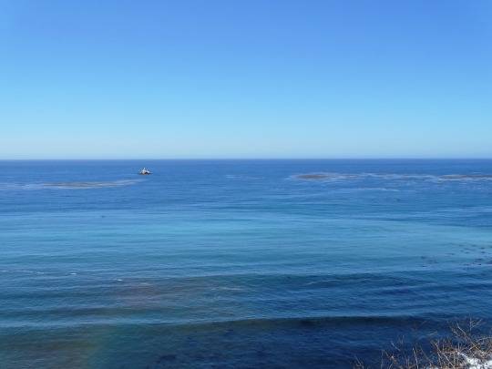
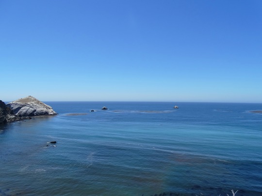
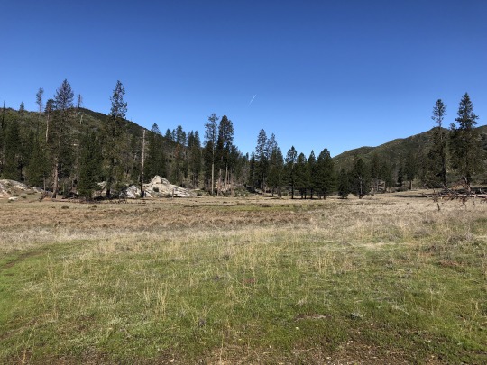
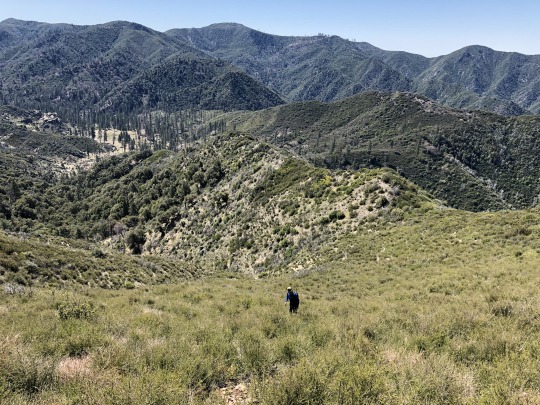
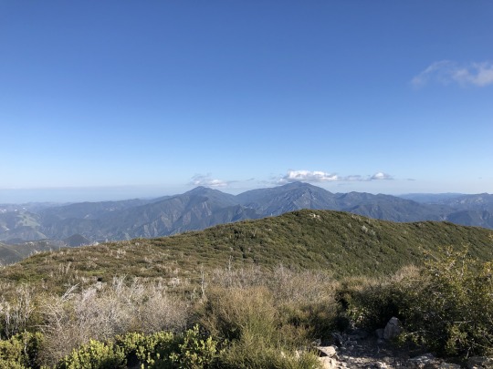
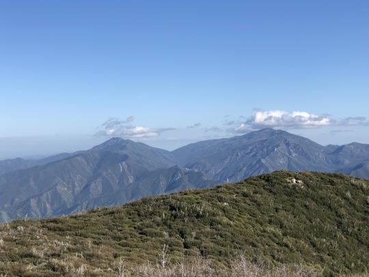
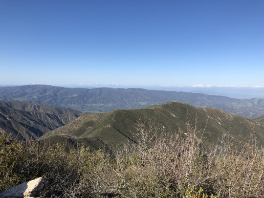
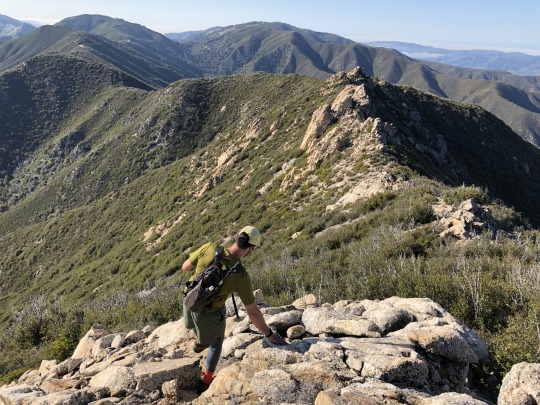
Miller Mountain & Black Butte from Tassajara Road, Ventana Wilderness

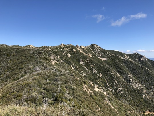
It was my third consecutive weekend heading to China Camp Trailhead in the Ventana Wilderness. I had climbed South Ventana Cone, Chews Ridge and Ventana Cone over the previous two weeks, so it made sense to "finish off" the area and climb Miller Mountain as well. This was all part of my plan to climb the Ventana 15, and the relatively short drive to the trailhead was also part of the allure. Asaka was 8 months pregnant, so I didn't want to go too far away from home in case the time finally came. Surprisingly both Daryn and Colin were willing to join me again, chalking it up to quarantine restlessness. I knew the truth was really that they both greatly enjoy my company. There were no surprises as we followed the Pine Ridge Trail 3.5 miles to the Church Creek Divide. By this time we were experts on this section of trail.

Behind Pine Valley were Ventana Double Cone, Uncle Sam Mountain and Miller Mountain.

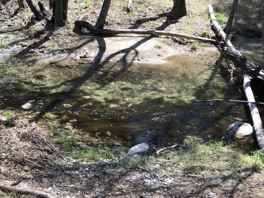
Once at the saddle, we took a right down into Pine Valley. This was new experience for all of us. The saddle was dry, but spring water started to emerge as we descended down the canyon. After a little more than 5 miles we reached the historic cabin built by Jack English. It was a beautiful area.

We picked up the Carmel River Trail here, but it was hard to follow initially as it crossed through a marshy meadow.
We left the trail at a creek flowing down the southeastern slopes of Miller Mountain and followed this up the rarely traveled canyon.

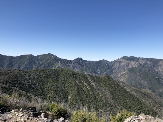
I planned to follow the canyon further, but found it easier to climb up the ridge to the south of the peak. Once atop the ridge, we had great views of the summit (minus the bug in the photo).

Back to the west were Ventana Cone and Double Ventana Cone.
There was some easy bushwhacking along the ridge. The vegetation had burned in a fire, but it was steadily growing back. It looked worse than it ended up being.
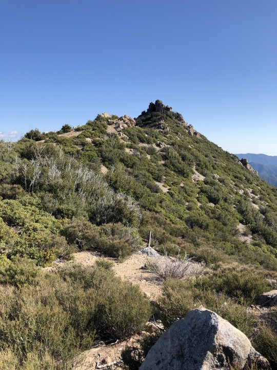
I was happy to reach the summit, considering I was not sure that we would make it at all. To the northeast was the Salinas Range.
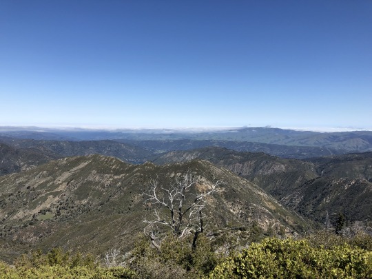
To the northwest were Uncle Sam Mountain and Elephant Mountain.
To the west were Ventana Cone and Double Ventana Cone.

To the southwest were Junipero Serra Peak and South Ventana Cone.

To the southeast was Chews Ridge. We considered following the ridgeline back to China Camp but it looked brushy and difficult.

-Bug!

It was still early so we decided to eat lunch later. We followed a similar route down, this time staying more on top of the ridge. As we dropped into one of the gullies, we found a deer carcass laying in the creek. Earlier on I was about to fill up in the creek downstream and I'm very thankful that I didn't.
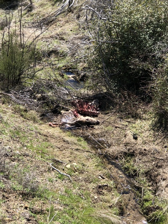
We wondered what killed the deer. My money was on a mountain lion. We followed the creek out until we intersected the trail once again.

We stopped for lunch at the cabin. There were some nice benches to sit on here.
Colin walked over to the Carmel River and saw a fish. We had considered bringing our fishing gear, but I was skeptical that they would live so close to the headwaters.


-Carmel River
The remaining journey to the car was a dull march uphill. I had a lot of time to think about bonus peaks. We had enough daylight to climb Black Butte which stood just down the road from the car, but the question was if we would have enough energy. I started my pitch as we hiked the last couple miles. Both Daryn and Colin were still uncommitted by the time we reached the car, so I suggested we just drive down the road to check it out. Once at the trailhead, I pointed at the peak, pretending to be surprised with regards to how close we were to the summit. This tactic worked on Colin surprisingly; Daryn was too experienced to fall for the oldest trick in the book. With Colin now in, Daryn also agreed to come. Off we went down the dirt road.

The dirt road ended and the bushwhacking began. This was the part that was not visible from earlier. Luckily, there was a clipped trail through the brush.
There was a lot of ducking and pushing away branches, but we got through the worst of it to some open terrain.
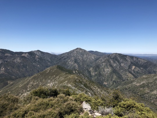
It was now just a matter of running the ridge. We scrambled around a false summit. The true summit stood just a short distance further.

We all made the summit, happy that we went through with it in the first place.

To the southeast were Pinyon Peak and Junipero Serra Peak.
Pinyon Peak on the left is still my hardest hike to date.
To the south were Cone Peak and Twin Peak.

To the southwest were Black Cone and White Cone.

To the northwest were South Ventana Cone, Ventana Double Cone and Uncle Sam Mountain.
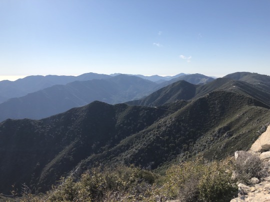
To the northeast was Palo Escrito. The Sierra Nevada was even visible across the San Joaquin Valley.
I was very happy with our extra credit. I felt very accomplished and I think the others were too.
We retraced our steps back along the ridge and drove back home that afternoon.
2 notes
·
View notes