#Lamoille Creek
Explore tagged Tumblr posts
Text
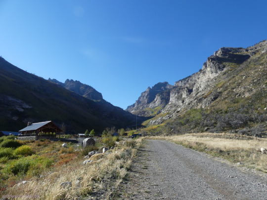

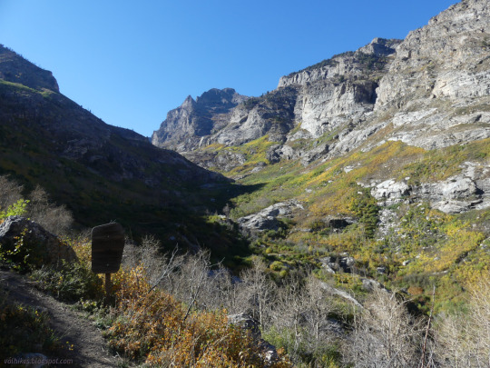
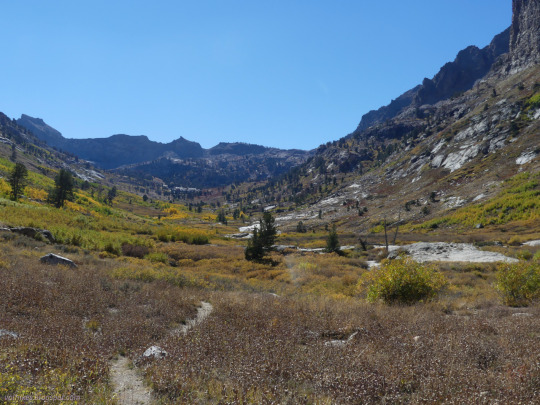

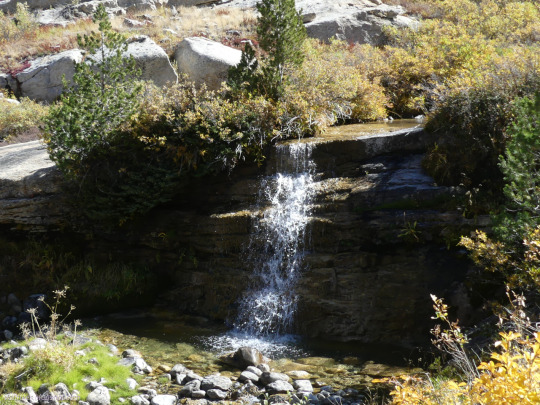
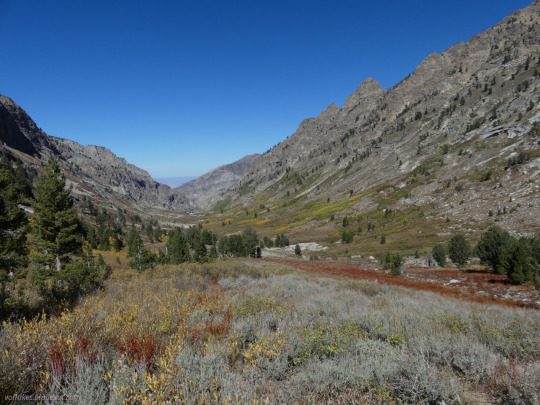

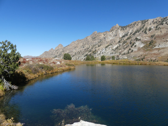

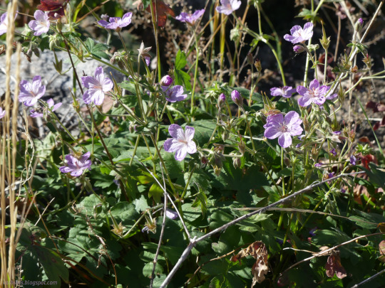
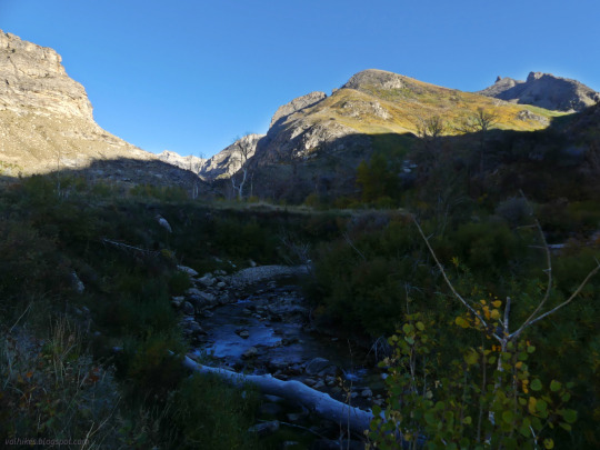
Humboldt-Toiyabe National Forest, Nevada
A little more time spent on Lamoille Creek, but this time along the right fork. I hiked from Camp Lamoille to Goat Lake.
#hiking#Nevada#Humboldt-Toiyabe National Forest#nature#landscape#travel#hike#outside#day hike#mountains#canyon#Lamoille Creek#Lamoille Canyon#Right Fork#Humboldt National Forest#Goat Lake#glacial valley#glacier carved
4 notes
·
View notes
Text
Lamoille County, Vermont, is home to 26,000 people living in small towns nestled among the woods and mountains. It’s known for two ski resorts—Stowe and Smugglers’ Notch—and a winding river where locals and tourists fly-fish and canoe. In 2020, a ProPublica analysis identified Lamoille as the one county, across the entire United States, that could be most protected from the combined effects of climate change, including sea-level rise, wildfires, crop damage, and economic impact. But that was before the floods.
Earlier this month, five to 10 inches of rain fell in Morrisville, near the center of the county. Roads were destroyed in nearby Wolcott. Thirty people were evacuated as floodwaters from the Lamoille River swirled around Cambridge. Entire harvests were wiped out, and major roads became impassable. Jennifer Morrison, Vermont’s public-safety commissioner, called Lamoille County “the hardest-hit area” in the state.
July’s flood is just the latest in a string of extreme weather events in Vermont this year. After a historically warm January, a late-May frost may have destroyed more than half of the state’s commercial apple crop. By summer, smoke from Canadian wildfires choked the once-clean air. Then, during the week of July 10, heavy rains flooded the state capital, Montpelier, and washed out homes and businesses across the state. It was the worst flooding since Hurricane Irene, a “100-year” storm that struck only 12 years ago.
Vermont is no longer the haven many believed it to be. And if this tiny, bucolic state isn’t safe, far from the ocean in one of the coolest parts of the country, it’s hard to imagine a place that is.
Academics have long had an interest in identifying “climate havens”—regions that may be less likely to suffer extreme heat, sea-level rise, and inland flooding as the global temperature continues to climb, and that may have the capacity to accommodate climate refugees. Vermont towns are often on these lists. One, compiled by the Tulane University real-estate professor Jesse Keenan just last year, included Burlington, Vermont, along with cities such as Pittsburgh, Pennsylvania, and Asheville, North Carolina. And yet, 100-year storms could hit Pittsburgh as frequently as every two decades, according to a recent analysis by the climate nonprofit First Street Foundation; in the coming decades, Asheville is predicted to be prone to drought, extreme heat, and extreme precipitation. If conditions look this bad in the so-called havens, we’re in for a much-needed awakening.
When you live in a supposed climate haven, it’s easy to get complacent—to think of the climate crisis as something that happens in other parts of the nation. I’ve covered climate change for a decade, almost as long as I’ve lived in Vermont. I knew the science and the predictions: stronger storms and more extreme precipitation events. I shouldn’t have been shocked when the Battenkill River flooded its banks eight miles north of me and angry waters rushed into my friends’ homes and businesses—but I was.
That perception of safety is widespread. According to local news, a recent survey found that one-third of Vermont’s new residents moved here for climate-related reasons. My friend Joe Dickson is one of them. He and his husband used to have a farm in Bastrop County, Texas, an area that was witnessing more wildfires and flash flooding every year. In 2017, Hurricane Harvey washed out a bridge and stranded their community. They moved to Peru, Vermont, only a year ago. After the flooding last week, Joe told me, he felt a “deep and anxious vigilance”—staying up all night to check the forecast, despite the fact that his house is on high ground. It was just like when he’d wake up every hour or two during storms back in Texas, going out to check the rain gauge and look at the creek, waiting for the moment it would overflow.
Longtime Vermonters have been similarly shocked by the floods. On Saturday, I ran into my friend Brad Peacock, who has lived in Shaftsbury for decades, at our local organic farm. “I don’t think I’m the only farmer who thought Vermont was better prepared for climate change,” he told me. We’re used to living in a northern, nature-forward state with progressive climate policies. We don’t expect to be caught unprepared, as we were during Hurricane Irene and again last week.
My daughters have lived in Vermont their entire lives. On the day Hurricane Irene flooded the state, my oldest, Frasier, was 2 years old, dancing in the rain at a friend’s wedding while I held her infant sister. We had no idea that soon entire towns would be cut off from the world as highways washed out. But last week’s storm was different. My daughters, now 14 and 12, got flood alerts on their phones; their friends sent videos of water rushing through their houses. After the initial rainfall, we drove north on Route 7A to survey the damage. Our tires splashed through several inches of standing water on the highway. The contents of basements were dumped into front yards for emergency safekeeping. The local park and putting green were completely submerged, and the Battenkill River—typically clear—was brown with runoff, and so high it was licking a local bridge as it roared underneath.
After we got home, our collective mood was somber. “I can feel myself anticipating something bad,” Frasier told me. Later, as we watched news footage of the flooding on the living-room couch, Zephyr was melancholy. “I feel scared that I have to grow up in a ruined version of Vermont,” she said.
Vermonters, like other rural Americans, tend to feel a deep bond with the earth around them. My farmer friend, Brad, was devastated for the locals whose fields were flooded. Some “may never get back on the land they so lovingly tended, and that truly hurts my heart,” he wrote to me. “I know what it is like to be connected to the land, and the thought of having it taken away in the blink of an eye is heartbreaking.”
Around the country, in climate havens and known risk zones, families are terrified of losing that tie to home. Farmers in Georgia are grieving the lost peach crop. Homeowners in Florida are eyeing the 90-degree sea, waiting for the day it laps their front lawn. Folks in Louisiana are watching the ocean rush underneath the stilts of a family cottage, coming ever closer to carrying it away.
In Vermont, we are fixing flooded tractors and raising money for lost crops, donating to farmers and flooded bookstores. But we know that this heartbreak is everywhere, and only poised to increase. We will find new ways to love the land and grow food. We will help our neighbors reap their harvests before the next flood. But after this summer, I suspect we will never again believe ourselves to be out of harm’s way.
0 notes
Video
vimeo
Original caption:
The Ruby Mountains rise above northeast Nevada near the city of Elko, and nearest the Spring Creek community where my folks built the family getaway. Inside Humboldt-Toiyabe National Forest, Lamoille Canyon cuts through the range with dramatic peaks and rivers, ornamented with "quaking aspen" trees named for how their leaves flutter in the wind. This short lyrical landscape film was an excuse to set one of my longtime favorite musical works (the sunrise passage from Ravel's "Daphnis et Chloé") to aerial cinematography, of my favorite place on Earth. Drones aren't permitted in national parks, but under the jurisdiction of the USDA, National Forests do embrace them, and Lamoille Canyon is that rare example of a National Forest crowned with high peaks, jagged terrain, and diverse landscapes rivaling any National Park in the United States.
Besides the musical reason, this worked out to be my first full drone run, testing the new DJI Phantom 4 Pro V2.0, while also something to give my Dad on Father's Day, adding location footage to our westdocumentary.com. The style is really over-the-top (often, literally) Disney drama, but this place is so beautiful, it begs for indulgence. Filmed on May 26 & 28, edited on June 11-12, 2018, in UHD-4k resolution.
#National forest#canyon#elko#nevada#spring creek#geology#nature#travel#video#vimeo#lamoille canyon#the earth story#landscape
73 notes
·
View notes
Text
Elko County, Nevada (particularly the town of Spring Creek) is on my list of places I want to visit. The Ruby Mountains look magnificent in these pictures and I can only imagine how gorgeous they are in person...
The last picture is in the town of Lamoille, which is in Elko County too. I just love this type of scenery so much.


7 notes
·
View notes
Link

In this 2012 file photo, stunning views can be seen from the Lamoille Canyon Scenic Byway in the Ruby Mountains just east of Elko. Deborah Wall Special to View
Excerpt:
The U.S. Forest Service is prepared to open almost 54,000 acres in the Ruby Mountains to new oil and gas exploration, according to a document obtained by an environmental group fighting the plan.
In its draft environmental assessment, the forest service is proposing to allow fossil fuel leases on all of the land requested by and oil and gas developer in the Rubies but with restrictions that would prevent any surface disturbances.
The developers would have place their wells and other equipment on neighboring Bureau of Land Management property and use horizontal drilling or hydraulic fracturing to reach any deposits beneath the requested forest lands in the iconic Nevada mountain range about 370 miles north of Las Vegas.
Patrick Donnelly, Nevada state director for the [Center for Biological Diversity], said the service’s plan to restrict surface activity on the land does offer some protection, but water resources and wildlife habitat are still at risk.
“They could conceivably frack directly under a creek that’s filled with Lahontan cutthroat trout,” Donnelly said, referring to Nevada’s official — and federally protected — state fish.
Conservationists, American Indian tribes and hunting groups are also concerned about the proximity of the proposed oil and gas development to the wintering ground for the state’s largest herd of mule deer and prime habitat for sage grouse.
11 notes
·
View notes
Video
youtube
The Ruby Mountains rise above northeast Nevada near the city of Elko, and nearest the Spring Creek community where my folks built the family getaway. Inside Humboldt-Toiyabe National Forest, Lamoille Canyon cuts through the range with dramatic peaks and rivers, ornamented with "quaking aspen" trees named for how their leaves flutter in the wind. This short lyrical landscape film was an excuse to set one of my longtime favorite musical works (the sunrise passage from Ravel's "Daphnis et Chloé") to aerial cinematography, at my favorite place on Earth. Drones aren't permitted in National Parks, but under the jurisdiction of the USDA, National Forests do embrace them, and Lamoille Canyon is that rare example of a National Forest crowned with high peaks, jagged terrain, and diverse landscapes rivaling any National Park in the United States.
This update to my original film adds an epilogue shot three years later, set to a movement from Bach's Goldberg Variations. Starting from 06:12, you'll see the result of a reckless accident that happened just four months after all the preceding footage of Lamoille Canyon: a once-paradise that will take decades to recover how it looked in this film's first half.
Also at: http://vimeo.com/hpmoon/ruby
Filmed and edited by H. Paul Moon on May 26 & 28, 2018 (w/epilogue in May & December 2021)
0 notes
Text
Hookup Spring Creek Nevada

Hookup Spring Creek Nevada Real Estate
Spring Creek Nevada High School
Spring Creek Campground (5,800 feet) is just minutes away from the clear waters of the Frenchman Lake. The landscape provides a magnificent backdrop for a variety of recreational activities. The campground offers 35 camp sites with 12 sites available for reservation.
Zillow has 62 homes for sale in Spring Creek NV. View listing photos, review sales history, and use our detailed real estate filters to find the perfect place. There are 124 real estate listings found in Spring Creek, NV.View our Spring Creek real estate area information to learn about the weather, local school districts, demographic data, and general information about Spring Creek, NV.
The campground offers single-family campsites for tent and RV camping, including one accessible site (#23). The campground has paved roads and paved parking pads. Host, water and garbage service are provided during peak camping season. Two group campsites are available. All campsites are equipped with tables and campfire rings with grills. Bear resistant lockers are not provided. Campground host, paved roads Vault toilets and drinking water are provided.
Need to Know
Generally, campsites will accommodate 2 vehicles. Free online dating az. The first vehicle is included in the site fee, the second vehicle fee will be collected onsite at the daily rate posted on the fee sign.
Electric hookups are not available.
Bears frequent the area; all food must be kept in approved containers.
Click here to learn more about the Plumas National Forest
A variety of wildlife live in this area, including black bears. Before making a reservation, become aware of bear safety.
Please go to the following link for more information:http://www.centerforwildlifeinformation.org/BeBearAware/Hiking_and_Camping/hiking_and_camping.html
Don't Move Firewood: Protect California's forests from tree-killing pests by buying your firewood locally and burning it on-site. For more information visit firewood.ca.gov.
Firewood Bundles are available for purchased from the campground host. Firewood collection is allowed.
Off road vehicles are not allowed on campground road
Bear resistant lockers are not provided

Natural Features


This campground is at the interface between mountains and high desert and between the Sierra Nevada and Cascade mountain ranges. Ancient lava that flowed across the land has been eroded by creeks forming interesting landscapes.
Nearby Attractions
Plantation my speed dating. Little Last Chance Canyon Scenic Area
Sierra Valley - Largest valley in the Sierra Nevada

Stores and services in the towns of Chilcoot and Loyalton
Recreation
During summer, the campground offers a variety of outdoor experiences including hiking, biking, picnicking and hunting. The nearby lake provides ample opportunities for swimming, boating, water skiing and jet skiing. The expansive road system in Plumas National Forest is a great location for exploration and sightseeing.
Contact Information
Default
PLUMAS NATIONAL FOREST - BECKWOURTH RANGER DISTRICT PO BOX 7 BLAIRSDEN CA 96103
Phone Number
For campground inquiries, please call: 530-836-2575
Hookup Spring Creek Nevada Real Estate
Rental Options
Driving Directions
From Reno, travel north on Highway 395. Turn west on Highway 70 and travel 5 miles to Chilcoot. Turn north on Highway 284, travel 8 miles to the Frenchman Lake Reservoir, turn right, cross the dam, and travel 2 miles to the Spring Creek Campground.
Available Campsites
Spring Creek Nevada High School
Photo Gallery
Camp, RV, and Explore Outdoors
Recreation.gov is your gateway to explore America's outdoor and cultural destinations in your zip code and across the country. We provide tools and tips to discover new adventures through a one-stop shop for inspiration and ideation, trip planning, information sharing, and reservations. Find incredible places and experiences that help you bring home a story through Recreation.gov!
Get to Know Us
Plan with Us
Let Us Help You

Spring Creek is a census-designated place (CDP) in central Elko County, in northeastern Nevada in the western United States. It mainly serves as a bedroom community for the businesses and industries in and around the nearby city of Elko. It is part of the Elko Micropolitan Statistical Area. The population was 12,361 at the 2010 census. Spring Creek is located in a large valley between the Elko Hills to the northwest, and the Ruby Mountains to the southeast. To the southwest is Huntington Valley and the South Fork of the Humboldt River, while to the north is the main branch of the Humboldt. The city of Elko is approximately 6 miles (10 km) to the northwest, while Lamoille is just to the east. According to the United States Census Bureau, the CDP has a total area of 58.7 square miles (152.0 km²). The community was developed in the 1970s by Robert P. McCulloch as three large housing sections. The western section, at the base of the Elko Hills, is located near the post office (zip 89815), a shopping center, and a supermarket. About 1 mile to the east is the main school campus for grades 1-12. The central section of the community, another mile to the east, includes a park and lake ('The Marina'), and an 18-hole golf course and clubhouse. Nearby are an outdoor sports complex and a second elementary school. The southern section of the community surrounds an indoor sports arena ('The Horse Palace'), and is adjacent to the Ruby Mountains and a community-owned campground. All three sections are connected by the 4-lane Lamoille Highway, which also crosses 5765-foot (1757 m) Lamoille Summit to connect with Elko.

0 notes
Photo

Going to be in spring creek NV am hrs .free estimates. Concrete removed.for a job well done. Tom inker (at Lamoille Canyon) https://www.instagram.com/p/B1H6h_1gpp7/?igshid=4o5ofn06kkbe
0 notes
Video
404 Parkchester Dr, Spring Creek, NV 89815 from iQ Visual Tours on Vimeo.
For more information: cbelko.com/listing/94-120843/404-parkchester-dr-spring-creek-nv-89815
Model - The Lamoille. Standard features: Granite counter tops, soft close cabinets and drawers, tile floors in the kitchen, laundry and baths, vaulted ceiling, central air, all stainless steel appliances including: microwave, electric smooth top range, and refrigerator. Builder to pay up to $4000 toward buyers closing costs. Up to $1000 to be paid in closing costs by preferred lender. Photos are for illustration purposes only.
Contact: Victoria Blair (775) 753-2898 [email protected]
0 notes
Text
Rapid snowmelt triggers flood warnings across N. Nevada
Rapid snowmelt triggers flood warnings across N. Nevada
MSN– ELKO, Nev. (AP) ? The National Weather Service has issued a flood warning for urban areas and small streams in parts of northeast Nevada’s Elko County through 1:30 p.m. Saturday. The service says Lamoille Creek was beginning to rise Wednesday afternoon south of Elko due to accelerated snow melt in the mountains. It says the creek should reach flood stage Wednesday night and continue to flow…
View On WordPress
0 notes
Photo

Visiting Lamoille Lake with these super heroes in training! #elevation9747 #lamoillecanyon #distadfamilyadventures (at Spring Creek, Nevada)
0 notes
Text
Adobe Range High Point from Coal Mine Canyon

We were planning to have a rest day, but I wanted to climb one easy peak in the Elko area. The majority of the group was out climbing Beaver Creek for someone’s Nevada P2k list finish, but this seemed like a long and hot hike. We were worn out from Ibapah Peak the day before, and wanted something light. Dean was also in Elko, and agreed to join us on an alternate hike. We perused the local P2ks, and decided to climb Adobe Range High Point. The track we intended to follow was only 3.5 miles round trip, so we expected the hike to only take about 2 hours. We met Dean at his hotel and we all piled into his Range Rover. We followed highway 80 north to Old Devils Gate Road and followed this to Coal Mine Canyon Road. Dean’s research found us a jeep road which we followed to a saddle, then up to Point 7206 on the topo map. The drive was not trivial, and Dean was having trouble with the big rocks on some of the steeper sections. The summit was only 8,135 ft tall, so I was worried that the hike might be too easy. We got out of the car and started following the ridgeline southwest towards the range high point.


I didn’t account for the heat. Over the past week, every peak we climbed was taller than 9,500 ft. This lower elevation peak was really hot and dry, and the lack of a trail across rocky terrain made for a more difficult walk than expected.

As I turned a bend, a bobcat took off in the other direction and ran over the hill. I somehow was able to get a photo of the cat as it sprinted over the horizon. What a lucky shot.

As we continued, I kept a lookout for the bobcat, but it wouldn’t show itself again. We dropped down to a small saddle where we stared at the false summit.

Rather than climb over the top, we hiked to the left of the false summit. There was thick brush and loose rock along the way. This is not what I would call enjoyable hiking.


I could tell Asaka wasn’t having fun. Heck, I wasn’t having fun either. But the summit was now in sight. Dean ran ahead and claimed the summit.

We all joined him shortly after. To the east was Hole in the Mountain Peak.

To the southeast were the Ruby Mountains.

To the southwest the Adobe Range continued.

To the northwest was Wieland Flat.

The views were not very memorable, and it was hotter than we would have liked, so much so that Guillermo had to go into rolled up sleeve mode.

We left the true summit and walked over to the false summit where there was a tall cairn. We didn’t know why the cairn was built on the lower summit, but my guess is that it was a mining claim. Looking back to the southwest was the slightly taller true summit.

From the false summit, we dropped back down to the saddle and retraced our previous steps. Along the way, Dean and Guillermo found a small snake in a bush. The poor snake was more scared of us than we were of it.

Judging by the pattern on its back, it looked like a rattlesnake, but we didn’t want to stick our hand in there and find out. We let it be and continued along the ridge. As we closed in on the final half mile of the hike, I heard a “polite” rattle. By polite, I mean that the rattle didn’t sound threatening, but was more of a “hey guys I’m here”. I checked underneath a nearby rock and there was a huge rattlesnake shading itself from the sun.

That was the second snake in the last 15 minutes, and I knew there were probably many more basking nearby. We carefully watched each step until we made it back to the Range Rover.

On the drive out, Dean tried to follow the jeep track in the northern direction, hoping the road would be better. While it was less steep and there were less rocks, the brush was heavier and Dean’s paint job got some desert stripes. The road dead ended in a field, and while we were only a few more meters from the road, we were stopped by a creek with steep banks and a fence. It was impossible for a vehicle to exit here, so we had to drive all the way back up to the saddle, and drive out the way we came in. The combination of heat and rough terrain made the hike harder than we all anticipated. Asaka was checked out, and was ready to go home. I did not accept this, since we planned to climb Ruby Dome the following day, and this was the primary objective of the trip. No matter what I said, she refused to hike anymore. It was time to get creative. We stopped at the Boot Barn in downtown Elko and I let Asaka look around the store. She eventually found a very nice pair of cowgirl boots, but as expected they were a bit expensive. I offered to buy Asaka the boots if she climbed Ruby Dome the following day. A deal was struck, and Ruby Dome was back on the agenda. While at the store, I got a call from Laura Newman and she offered to let us stay at her mom’s place in Lamoille. The house in Lamoille was only 10 minutes from the Ruby Dome trailhead, and they had the rancher’s key which would allow us to drive in an extra mile to the official trailhead, saving us a total of 2 extra miles and 400 vertical feet of hiking. This was an offer I couldn’t refuse. We pitched a tent in their back yard and spent the rest of the night hanging out with Lisa Barbosa, Laura and her family.
0 notes
Photo

Just keep walking. #county #border #lamoille #chittenden #cambridge #hike #vermont #vt #outside #spring #betterthanacarshow #sorry #water #settlement #creek #stream #brook #backyard #seevt #seevermont https://ift.tt/2jyFEy7
0 notes
Text
Skiing Terminal Cancer Couloir In Nevada’s Ruby Mountains
Location: Terminal Cancer Couloir, Ruby Mountains, Nevada Starting Point: Lamoille Canyon FS Road 660 (7400′) Aspect: Northwest Distance: 2.15 miles Time: 2-5 hours Top Elevation: 9,400′ at top of couloir Vertical: 2100′ USGS Maps: Lamoille
As the resorts closed up shop for the season, it was time to hit the road and go on a van based skiing road trip. With all they news about California’s epic snowpack, the obvious destination of choice was the Eastern Sierra. About halfway between Montana and California lies the Ruby Mountains and one of the 50 Classic Ski Descents In North America: the Terminal Cancer Couloir. Definitely worth stopping in for a ski!
Terminal Cancer Couloir
Skiing Terminal Cancer seems to be on everyone’s ski mountaineering bucket list. It’s a classic, walled couloir in a remote mountain range. People travel from all over to ski this line. It’s proximity to I-80, access via Lamoille Canyon FS Road 660, and the fact that it’s a classic helps to attract skiers and riders. Plus it’s darn fun.
Finding Terminal Cancer
After craning our necks out of the window looking up at potential ski lines. We spotted the northwest facing line in the evening light, we quickly scouted around and found numerous pullouts to park. FYI – the road turned to snow about a mile pass the ski line. As we peered up at our ski line, we noticed that numerous other vehicles were doing the same thing. This is not unusual during the spring ski season. We soon made friends with two skiers from Utah and two from Colorado who had similar plans to boot the couloir in the early morning light. We agreed to climb together as this was the safest option.
The next morning one group bailed on the line, which left 4 of us. Donning shoes we waded across Lamoille Creek. Drying off our feet as best we could, we then slipped on ski boots and began to boot it. We wallowed through snow and bushwhacked through a gnarly section of alders before hitting the snowy apron. From there, it was steady uphill walking.
Looking up at the line
Hitting snow on the apron
Avalanche debris filled the first small choke that sits below a large snowfield. Soon we entered the beginning of the walled couloir. After a few hundred feet the couloir opens up for a good stretch. Then it closes in tightly up to the final col.
J. Wood at the apron of TC
Booting up in the early morning light
Exploring the Ruby Mountains
After a windy night, we were definitely dealing with a questionably spooky snowpack. This required a bit of extra snow assessment and safe travel techniques as this was not a place to get avalanched. Finally we reached the col at 9400′ with a little help from our friends who set the booter.
Climbing
Bootpacking Up TC
From the top you look up at a nice face that goes to around 10100′. It also appears that you can climb/skin a more mellow route starting from near the Thomas Canyon Campground and access the top of Terminal Cancer from the back. Due to the short distance and ability to assess snow, I’d prefer to boot the thing.
Behind TC
Looking Down Terminal Cancer Couloir
We transitioned on a decently sized rocky ledge. Soon we were skiing Terminal Cancer couloir. It was jump turns at the top and then opened up into nice snow. The lower chokes were filled with avalanche debris which was essentially unskiable. As we popped out of the walled couloir, we were greeted by another group who was having a leisurely and late start.
Transition Zone at top of TC
Dropping Into Top Of TC
Decent Turns
Jeremy Wood Making Turns IN TC
Soon we were navigating back through the trees and crossing Lamoille Creek. Once back at the car, we dried out, ate some food, and got ready to head to the Eastern Sierra. Our adventure to ski Terminal Cancer took around 3 hours. We covered just over 2 miles and booted 2100′. Not a bad way to spend the morning.
Starting and ending with a bushwhack through thick alders and wallowy snow
Lamoille Creek
See our route for skiing Terminal Cancer Couloir in the Ruby Mountains of Nevada:
Here are additional photos from skiing Terminal Cancer Couloir in the Ruby Mountains of Nevada:
#gallery-0-5 { margin: auto; } #gallery-0-5 .gallery-item { float: left; margin-top: 10px; text-align: center; width: 33%; } #gallery-0-5 img { border: 2px solid #cfcfcf; } #gallery-0-5 .gallery-caption { margin-left: 0; } /* see gallery_shortcode() in wp-includes/media.php */
Finding Terminal Cancer
TC from our dirt pullout
Looking up at the line
Crossing Lamoille Creek
Hitting snow on the apron
Booting up in the early morning light
Terminal Cancer Couloir as seen from road
Exploring the Ruby Mountains
Bootpacking Up TC
Bottom of TC
Looking down toward Lamoille Canyon Road
Climbing
Almost up there.
Transition Zone at top of TC
Looking Down Terminal Cancer Couloir
Dropping Into Top Of TC
Jeremy Wood Making Turns IN TC
Decent Turns despite a spooky snowpack
J. Wood at the apron of TC
Starting and ending with a bushwhack through thick alders and wallowy snow
Lamoille Creek
Terminal Cancer Couloir
This trip report from skiing Terminal Cancer Couloir in the Ruby Mountains of Nevada is from April 21, 2017.
TR: Terminal Cancer Couloir Skiing Terminal Cancer Couloir In Nevada's Ruby Mountains Location: Terminal Cancer Couloir, Ruby Mountains, Nevada Starting Point:
0 notes
Text
Spring Flowers 2017
It’s been a long winter.
For me, the final stretch of the season was spent in Vermont, where I worked on my book about Pine Mountain. Why Vermont? Because the Vermont Studio Center accepted my application to come write there for a month. It was fantastic, true, but I also waded through a nor’easter that dropped two feet of snow, and probably more, in the course of two days. It never stopped snowing for those forty-eight hours.
Granted, it was lovely and, let’s face it, nostalgic to see such powdery snow and even, on occasion, to shovel it. Walking along the Lamoille River on snowmobile trails to waterfalls and outcrops of schist and looking at hooded mergansers was a beautiful way to spend an afternoon. In the end, I got stir crazy. It did, after all, drop to around -8 degrees. I looked forward to coming home to see the wildflowers.
On my first Sunday back, Kate and I went to the Bernheim Forest. The Elm Lick Trail, to be exact. I’d been there last year to find fawn lilies (also known as “trout lilies” or, unexplainably, “dogtooth violets”), bloodroot, and several species of violets. Despite the fact that most trees were without color--the redbuds were the notable exception--the flowers were blooming heavily in the valley of Elm Lick Creek. Up on the ridges, bluets were blooming, sometimes in tufts--they are so small, however, that it is difficult to photograph them.
Here’s some pictures Kate took:

Rue anemone (Thalictrum thalictroides)

Star chickweed (Stellaria pubera)

Downy yellow violet (Viola pubescens, and there were also purple and white violets)

Dogtooth violet (Erythronium americanum)

Bloodroot (Sanguinaria canadensis)

Bloodroot, again.
Today I hiked Scott’s Gap in the Jefferson Memorial Forest (I’ll do my best to cover these; you may know how finicky iPhone’s are at flower shots, which is to say, close-up’s). In addition to redbuds, the dogwoods were blooming. Along the creek, and on the ridges, flowers flourished. Here’s a few more that I shot:

Paw-paw (a tree, actually, Asimina triloba)

Fire pink (Silene virginica)

Dutchman’s breeches (Dicentra cucullaria)

Spring beauty (Claytonia virginica)

Celandine (Chelidonium majus)

Blue cohosh (Caulophyllum thalictroides)

Trillium (the dwarf wake robin, I believe, Trillium pusillum)

Toadshade (Trillium sessile)

Carolina larkspur (Delphinium carolinianum)

Mayapple, which is thriving in large colonies (Podophyllum peltatum)

A bit blurry, but you get the point: Jack-in-the-pulpit (Arisaema triphyllum)
Though it wasn't yet flowering, I believe I also saw wild ginger (Asarum canadense). There were also geraniums (Geranium maculatum), and, as mentioned, the bluets (Houstonia caerulea).
Now is the time, especially in The Knobs (which both Bernheim Forest and Jefferson Memorial Forest are a part of), to see the flowers. Many trails are easily hiked after work, as much as of a Sunday afternoon.
0 notes