#Jobo Bay
Explore tagged Tumblr posts
Photo
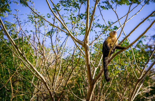
A wild capuchin monkey found along the shore in Jobo Bay. Northwest Costa Rica.
5 notes
·
View notes
Text
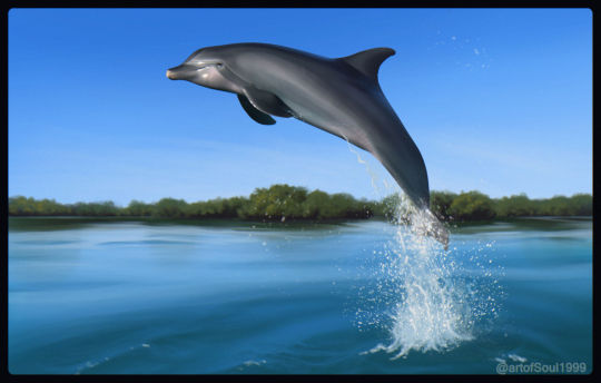
Here's an painting of a bottlenose dolphin from Jobos Bay in Guayama Puerto Rico. I've been obsessed with these animals ever since I found out about them, and while I haven't been lucky enough to spot them, they are always on my mind any time I get a view of the area. There's sadly not that many good reference pics of them, but I tried my best to capture that Puerto Rican bottlenose dolphin charm.
#bottlenose dolphin#atlantic bottlenose dolphin#cetaceans#dolphins#whales#illustration#wildlife art#krita
30 notes
·
View notes
Note
recommendations for “local” spots in PR? im going over springbreak and im so excited!!! (anything fun do/ explore besides el yunque and san juan?)
omg i love this questionnnn!!!!
so if you get the chance: RENT. A. CAR. There are so many amazing spots in PR but because the public transportation system here might as well be nonexistent, you need a car to get to most of them. so here is the list of my personal fave spots that you need a car for: (dw i will include another list of things that are more local to san juan and also one more thing)
- Playa Sucia, Cabo Rojo: gorgeous beach, i spent a lot of time there in college. you have to walk a bit to get to the actual beach but it’s so worth it. you can also hike up the cliffs surrounding the beach which is so fun and beautiful. and you can go up to the lighthouse which has the most amazing view.
- Crash Boat beach, Aguadilla: another beach, another college me spot. it’s just really cool, people are always playing music, there’s a big ol pier. just very awesome.
- Toro Verde Adventure Park: ZIPLINE. VERY BIG ZIPLINE THAT TAKES YOU 95 MPH. I believe it’s the longest in the US and the third longest in the entire world. the view while you’re on it is unlike anything i have ever seen before 10/10, taking my bf there this weekend.
- Surfing: my fave surf spots are Domes Beach in Rincon. Jobos Beach in Isabela. and La Punta in San Juan. You can search up surf lessons in these beaches and you’ll get a bunch of instructors.
-La Parguera: Bioluminescent bay. It’s so gorgeous and so worth it
- Piñones: Long strip of road with different spots you can get out in and go to the beach in. It’s littered with a bunch of typical puertorican food stands like fried shit that we love. if you want the real PR experience, go on a weekend
Now for some more local San Juan area things to do:
- Again, Surfing: literally just google surf lessons in san juan and a bunch will pop up
- Distrito T-Mobile: Has a bunch of restaurants and live music, definitely a good spot to just kinda hang out in. There’s a huge arcade there as well as one of my fav restaurants: La Central by Mario Pagan (get the truffle butter on the steak)
-La Placita: Drinks. Legal age is 18 here so if you want to PARTY, go here.
-Calle Loiza: same as la placita but more locals go here methinks
-The Place: my fav burger place ever, it’s in Condado. Build your own burger w really good ingredients 10/10
-Pirilo: amazing pizza place. it’s in old san juan so this might be a bit of a cop out but it’s really good regardless.
-Casa Bacardi: Rum factory, you can take a tour and it’s pretty cool
-Paddle Boarding: you can go paddle boarding in Condado Lagoon, if you’re lucky you might even get to see manatees or turtles!!!
- Metropol: my favorite restaurant. they have a bunch of locations but you can’t go wrong with any of them. typical puertorican and cuban food. fucking delicious i can never get enough. (get the sorullitos you won’t regret it.)
Now for the something extra:
-Culebra and Vieques: You can either take a plane or a ferry to either of these islands. They are the most beautiful islands i have ever seen. Very remote so little to no cell service but genuinely so so so worth it because the stars look so amazing at night it’s like nothing i have ever seen before. also Vieques has a bioluminescent beach as well :)
ik some of these are kind of touristy things and not necessarily local but they are genuinely some of my favorite things to do and i will always always always recommend to do at least one of them.
If you google Discover Puerto Rico, that website is amazing and gives you like a million things to do 10/10
here’s a link to my fav youtuber’s vlog where she went to PR and imo she did an amazing job of immersing herself in the culture i adore her: https://youtu.be/KPzqRP0T3ew?si=_sFNg_5kg6N5SGQg
youtube
7 notes
·
View notes
Text
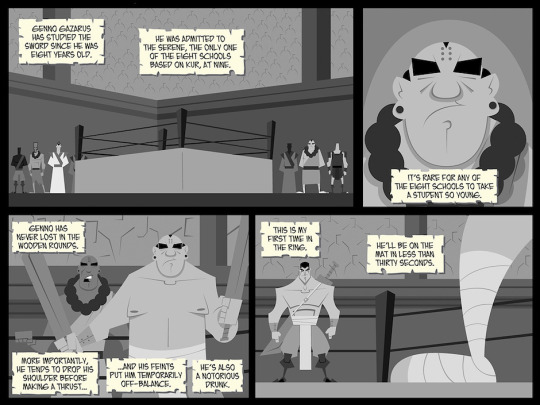
Hunter Black Page 152 - In Less That Thirty Seconds
What I Said Then: "The last line, 'He’ll be on the mat in less than thirty seconds,' is an homage of sorts, to a scene in Beowulf’s Children, the sequel to my favorite novel, The Legacy of Heorot. There is something similar in that book, although the scenes themselves are not all that alike. Also, they’re hardly of equal importance. That pair of books has influenced the series before; Weyland’s Bay is named for the main character of the series, Cadmann Weyland. The Serene is a school of swordsmanship, inspired by kung fu movies and Buddhist caricature."
What I'm Saying Now: On the current pages that we're working on, I'm using a lot more caption boxes that are NOT from Hunter's POV. This segment reads kind of like those, but here, I wanted to demonstrate what Hunter had picked up from Jobo. This was exposition -- and not exposition about Genno Gazarus and The Serene.
#fantasy#comics#noir#independent comics#amwriting#webcomic#hardboiled#revenge#magic#swordsmen#samurai#warriors#killer#The Great and Grand Tourney
1 note
·
View note
Photo
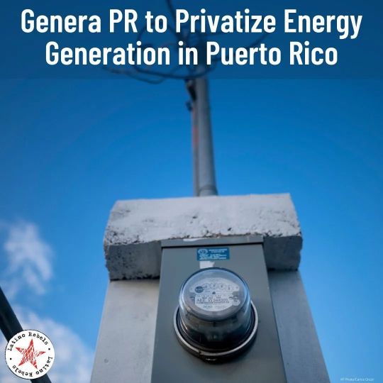
When you have Vultures running the Asylum! Make it make sense. Reposted from @latinorebels On Wednesday Gov. Pedro Pierluisi announced that Genera PR will officially take over the remains of the Puerto Rico Electric Power Authority and finish privatizing electrical generation on the archipelago. (Reporting by @carlosberriospolanco) Read at @LatinoRebels 📸: An electricity meter shortly after it was installed at the Jobos Bay National Research Reserve in Salinas, Puerto Rico, May 3, 2022. (AP Photo/Carlos Giusti ) #PuertoRico #energy #business #prflagsup #puertoricanflagsup https://www.instagram.com/p/Cn5GWxDpvt3/?igshid=NGJjMDIxMWI=
0 notes
Text
Cuba
Capitale : La Havane
Langue officielle : Espagnol
Population : 11 163 934
Hymne National : La Bayamesa
Monnaie : Peso Cubain (CUP)
Fête nationale : 1er janvier
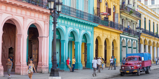
GÉOGRAPHIE
L’archipel cubain est situé dans la partie plus occidentale des Caraïbes insulaire. Il groupe à l'île de la Cuba, l'île de la Jeunesse et plus de 4 mille îlots et des îlots rocheux. Le territoire émergé est d'environ 111 mille kilomètres carrés avec une longueur approximative de 1 200 km de cela à l'ouest. Cuba possède plus de six mille kilomètres de côtes, avec plus de 600 plages et diversité naturelle qu'il caractérise à la destination il est manifeste dans différents écosystèmes qui composent ses diverses régions.
Cuba compte avec des abondants et excellents ports naturels dans des baies comme La Havane, Cárdenas, Matanzas et Nuevitas, sur la côte le nord, et Guantánamo, Santiago de Cuba et Cienfuegos sur la côte le sud.
Dans le relief se détachent 3 chaînes montagneuses : la Cordillère Guaniguanico dans l'occident, le Massif de Guamuhaya au centre et la Sierra Maestra (Chaîne montagneuse Maestra) dans l'orient, où se trouve la plus grande hauteur du pays : le PicoTurquino (Pic Turquino) avec 1 974 mètres. Les plaines occupent le 60 pourcent de l'aire du pays. Plus de 60 pourcent des roches du pays sont calcaires qui est à l'origine à plus de 20 000 grottes qui conforment un monde souterrain intéressant. En Cuba, est remarquable, la présence de réservoirs naturels et artificiels. Il possède un réseau fluvial avec de courtes rivières et en général de peu caudal et peu de longueur ; les principaux sont : Cauto, Zaza et Sagua la Grande.
Le 25 pourcent du territoire sont des bois, fondamentalement de mangrove. Le 23 pourcent de l'aire ont un quelque degré de protection de sa nature, en se détachant ses 14 parcs nationaux.
Les sols sont moyennement fertiles dédiés à la culture de la canne à sucre, de cultures différentes et l’élevage. Le fuseau horaire de la République de Cuba est GMT - 5, par ce qu'il partage la zone horaire avec Colombie, l'Équateur, le Panama, le Pérou ; Mexique heure centre (heure d'été), entre autres pays.

Nature de Cuba
La nature de l'archipel se montre riche et curieuse dans toute son extension. La caractéristique plus éminente de la flore cubaine est son haut degré d'endémisme qui situe à Cuba comme l'un des centres principaux d'évolution d'espèces des Antilles et comme l'une des plus intéressantes entre les îles du monde, par sa richesse et grande diversité de communautés végétales. Se détache le Palmier Corcho* (espèce de palmier) d'une période géologique très antique comme le carbonifère, qui se trouve dans la province de Pinar del Río.
Riche et variée, est aussi la faune terrestre. Il est remarquable, le fait d'avoir des espèces reconnues internationalement pour son nanisme entre lesquelles se fait remarquer l'oiseau le plus minuscule du monde : la petite Émeraude de Cuba ou oiseau mouche, un vrai bijou ailé, espèce de colibri de seulement 63 mms de longueur.
Aussi Il faut mentionner la petite grenouille cubaine avec 12 mms de longueur ; une minuscule chauve - souris, appelée papillon de 2 à 3 grammes de poids et un scorpion nain avec 10 mms de longueur ; De plus, sont nombreuses, les espèces de mollusques, certains de beauté inégalée comme les polymitas, dont les coquilles sont considérées entre les escargots terrestres les plus beaux.
L'avifaune, hétérogène et attractive, aussi bien terrestre et marine, est représentée par plus de 350 espèces reportées, plusieurs endémiques et autres qui migrent par l'île, dans une époque hivernale. La situation géographique privilégiée, à demi chemin entre la deux Amériques, fait de Cuba un endroit de séjour obligé pour une grande quantité d'oiseaux. Par cela ils existent des zones reconnues au niveau international, comme : Marécage de Zapata (Ciénaga de Zapata).
L'observation d'oiseaux, la randonnée, la plongée, la pêche sportive, les cavalcades en plein air, l'espeleotourisme, le cyclotourisme ou le tourisme rural, ce sont certains des options multiples que les destinations touristiques en Cuba, en dépendant de ses potentialités, offrent au visiteur qu'il cherche le contact direct avec la nature.
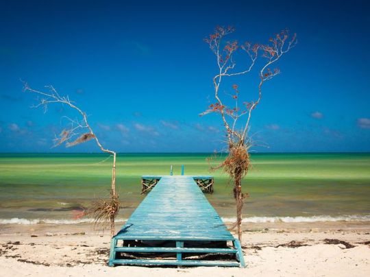
Cuba a 6 Réserves de la Biosphère déclarées par l'UNESCO : Réserves de la Biosphère ″Guanahacabibes″, ″La Scie du Rosario″, ″Cienaga de Zapata″ (le Marécage de Zapata), ″Buenavista″, ″Baconao″ et ″Lames de la riviere du Toa″ (Cuchillas del Toa) ; également la destination compte actuellement avec 6 sites Ramsar, bien qu’on travaille dans deux nouvelles propositions, La Péninsule de Guanahacabibes et la Zone humide Sud de ″Los Palacios*″ (*Nom d’une municipalité), les deux dans la province de Pinar del Río. Ils complètent la liste, 14 Parcs Nationaux, 2 sites Patrimoines Mondial Naturel et 28 IBAs (aires importantes pour la conservation d'oiseaux).
Aires protégées en Cuba
La Région Occidentale :
· Parc National Guanahacabibes
· Parc National Viñales
· Aire Protégée de Ressources gérées Mil Cumbres
· Réserve de la Biosphère Scie du Rosario
· Les Terrasses (Las Terrazas)
· Soroa.
· Réserve de la Biosphère Péninsule de Zapata (Site Ramsar 2001 – La Plus grande zone humide de la Caraïbes insulaires)
· Paysage Naturel Protégé la Vallée de la rivière Canímar.
Autres aires d'intérêt touristique :
· Sud de l'Île de la Jeunesse (Site Ramsar 2002, de plus Aire Protégée de Ressources gérées qui comprend les terrains du Marécage de Lanier).
Région Centrale :
-Refuge de Faune Guanaroca - Pointe d'Épervier (Gavilán).
·Paysage Naturel Protégé Hanabanilla.
· Refuge de Faune Cayo Santo-María.
· Refuge de Faune Las Loras.
· Parc National Caguanes.
· Paysage Naturel Protégé Topes de Collantes.
· Réserve Écologique les Collines de Banao.
· Aire Protégée de Ressources gérées Jobo Rosado.
- Aire Protégée de Ressources gérées Scie du Chorrillo.
·Réserve Écologique les Limones-Tuabaquey.
· Refuge de Faune Riviere Maximo (Site Ramsar 2002).
Autres aires d'intérêt touristique :
· Paysage Naturel Protégé Yaguanabo
·Le Nicho.
· Réserve de la Biosphère Buenavista (Site Ramsar 2002) (Il Contient dans son intérieur le Parc National Caguanes).
· Zones humides du nord de la province Ciego de Avila (Site Ramsar 2002).
Région Orientale :
· Parc National le Débarquement du Granma (Site Patrimoine de l'Humanité).
·Parc National Turquino.
· Réserve de la Biosphère Baconao.
· Paysage Naturel Protégé La Grande Pierre (La Gran Piedra).
· Réserve Écologique Hatibonico.
-Parc National Alejandro de Humboldt (Site Patrimoine de l'Humanité) ·
-Élément Naturel Remarquable l'Enclume de Baracoa (El Yunque de Baracoa).
Autres des aires d'intérêt touristique :
· Delta de la rivière Cauto (Site Ramsar 2002, le plus grand système deltaïque des Caraïbes).
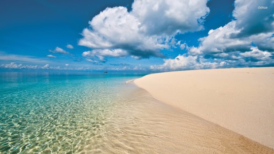
Le climat de Cuba:
Le climat de Cuba est tropical, saisonnièrement humide, avec influence maritime et ragues de semi-continentales ; Cependant, coexistent d'autres temps climatiques situés dans les systèmes montagneux et côtiers. Il est défini dans deux périodes : peu pluvieux et pluvieux.
Peu pluvieux (Novembre à Avril) :
Connu comme hiver, des variations du temps et le climat deviennent plus perceptibles, avec des changements brusques dans le temps quotidien, associés au pas des systèmes frontaux. Il est plus appréciable dans la moitié ouest que dans l'est.
Pluvieux (Mai à Octobre) :
Connu comme l'été, il y a peu des variations dans le temps, en étant les changements les plus importants en raison du pas des ondes de l’est et les cyclones tropicaux.
Culture
Cultures multiples donné naissance à une nouvelle culture à Cuba. Des courses et des fusions coutumes, dans un processus de plusieurs siècles, a donné naissance à une culture unique africaine, autochtone, chinoise, cours de français et l'espagnol, le tout dans une sorte de mélange unique de la richesse énorme à la fois.
Parmi les premiers colons ont survécu expressions et noms autochtones; l'injuste traite des esclaves et de l'esclavage Cuba doit la forte présence africaine a contribué, ainsi que les Espagnols, forment la vision du monde et l'imagination populaire. Encore une fois et l'influence a mis sa musique de timbre, la danse, les rituels, les traditions, les coutumes et les célébrations des Cubains. Comme le sucre est blanc, brun et brun, comme l'a dit le poète Pablo Armando Fernández, la culture cubaine est influencée par un mélange de plusieurs nationalités a été et est le plus grand port des Antilles. Un ajiaco de transculturate, selon don Fernando Ortiz se compose d'un peuple métis qui héritèrent et détient tous les composants sans être déjà l'un ni l'autre, mais, en plus de l'hétérogénéité, unique cubaine.

2 notes
·
View notes
Photo
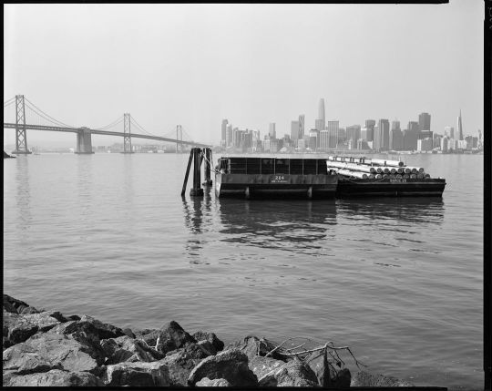
Barges. San Francisco, CA. The detail that can be seen in an 8x10 negative is astounding. Swipe for some detail crops (you can read the clock on the Ferry Building rom across the bay!) and a behind the scenes shot by @adventures_with_a_historian. I am starting to love the process of this large format and can’t wait to shoot some portraits soon. #8x10film #kodak #kodaktmax400 #kodakhc110 #jobo2830 #jobo #hobojobo #homeprocessing #largeformatfilm #largeformatfilmphotography #sanfrancisco #treasureisland #sanfranciscobay #baybridge (at Treasure Island San Fransisco Ca) https://www.instagram.com/p/CE8InU-nrIJ/?igshid=1fyfbu7pgw12u
#8x10film#kodak#kodaktmax400#kodakhc110#jobo2830#jobo#hobojobo#homeprocessing#largeformatfilm#largeformatfilmphotography#sanfrancisco#treasureisland#sanfranciscobay#baybridge
0 notes
Text
Puerto Rico Could Be A Solar Pioneer, But The GOP Wants A Fossil Fuel Theme Park
To the west of Jobos Bay, the Aguirre Power Station burned oil. To the east, the AES Power Plant burned coal. For 3 months after Hurricane Maria, the cities that surround the bay in southeastern Puerto Rico suffered in darkness. The filthy and suspicious electrical power issue preceded the Category 5 tempest that eliminated Puerto […]
The post Puerto Rico Could Be A Solar Pioneer, But The GOP Wants A Fossil Fuel Theme Park appeared first on ThinkAlong.net.
from Puerto Rico Could Be A Solar Pioneer, But The GOP Wants A Fossil Fuel Theme Park
0 notes
Photo
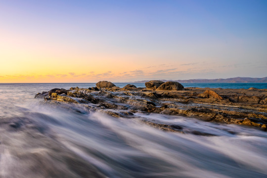
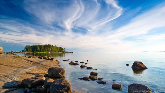
Rocks on the shore of Jobo Bay in Costa Rica. Such a beautiful area that's so easy to photograph.
0 notes
Text
Visit to Aguadilla
Friends,
I recently traveled back to the house I grew up in on M street in Ramey. I have followed the state of the island since Maria hit almost 8 weeks ago, and had lots of questions going down, so I thought I’d share my notes…
Travel by air: I was not able to book in or out of BQN airport… Jetblue flights that run overnight from the states were all cancelled. So I booked AA through San Juan. Prices were reasonable on AA, but Jetblue is still the best if you can get a flight. Easy to find flights down to the island… harder to find them back. SJU airport was full, but operating normally. AC was on, and I had no trouble transiting and picking up my rental car. BQN currently only has had a regular service from Spirit Airlines from FLL. In theory, service from Jetblue and United will return to BQN before the holidays, but we’ll only know for sure once its happened. One new feature of BQN - the old ready area where the bombers used to park has been taken over by the US military, and is now a small city of lights with lots of army trucks exiting and entering near the golf course. Now that the Army’s mission is complete, this may return to its normal empty state.
Connectivity: much better than expected. I have a Verizon contract and was connected to Claro the moment I powered up at SJU and it remained so all over the North side of the island. Near Ramey, the connection is actually LTE, which means its been good enough to use my phone as a hotspot for email, research, e-commerce. I believe that this is partially a result of more than 40 high efficiency solar powered cell stations that were brought to the island by Vanu inc. (Vanu Bose, the founder of Vanu and the driver of this humanitarian contribution, was the son of Amar Bose of the eponymous corporation. He passed away last week.) People on AT&T were also on Claro. I had coverage from San Juan to Mayaguez continuously on Route 2 without interruption. I wouldn’t count on this to watch netflix, but it was strong and reliable for phone, text, and email. All of Ramey had coverage. At this point there is no value in pursuing satellite, but there are various expensive Satellite systems, like this one from Garmin, that keep you in basic communication when you're off the cell grid, but they don't actually replace Internet connection. There's a great review in there that goes on for pages - its a complicated device.
Travel around the island - Driving from San Juan to Ramey was almost completely normal except for the visuals. You notice right away that all the outdoor advertising and large signage is gone, and pretty much anything involving wood, corrugated roofing, or poles for any use. Traditional construction of concrete with metal ventanas is pretty much untouched. The impact is notable in San Juan, but becomes much more dramatic from Arecibo on. A kinda weird visual - you could tell the worst sections because the buildings looked sandblasted. Many businesses along #2 were open with generators, or occasionally, a section that had power. I took the same route to Ramey as I have done, without detours. Some traffic lights are out, but none of the really important ones where big routes cross. If you have to turn left at a busted light on rt. 2, just don’t…. turn right and figure it out later.
Water… is flowing in Ramey and many places around the island, and did not drop out when I was there. There’s still a boiling order, and when you take a shower you come out smelling like you exited a heavily chlorinated pool. But regardless, having water is great. I brought two different filtration systems, one that is gravity based (Lifestraw) and one that you pump. I bought 4 coleman solar showers, which are basically 5 gallon black plastic bags with nozzles. Down the road, I’ll try to purchase some water storage, a big cisterns for flushing, and something else for long term storage of potable water, but right now this was not as urgent.
Fuel: I had no problems getting gas, there were no lines and most gas stations were open.
Groceries: The Econo is open, and even takes credit cards. As always, its a social center, so budget 3 minutes for talking for every minute of shopping. The coolers were full and prices are about as I remember them. I bought a fresh salad that was good!
Restaurants: many are open, though some with a smaller menu or shorter hours.
Open out gate 5:
Levain (daily coffee here was sent from heaven)
Debut
Cofos Pizza
Martin’s BBQ
Cinco
Country Pizza
110 thai
Palmas
Open down the Hill:
eclipse (dinner only, no breakfast or lunch)
The frituras place at the S on the way down to Jobos
Ocean Front and lots of places near Jobos
Julios and lots of the other frituras places on the beach near Isabella
Open out Gate 1:
El Meson
Sasones
Desecheo
Lots of fast food out near #2
Closed:
Umas
Ramey Bakery
Airport cafe
Marriott (they have a small thing set up just for guests)
Beaches: After seeing pics of crashboat online I was concerned that all the beaches were just as hollowed out… not so:
Crash boat: every bit as dramatic as the pics. Right side is now tiny and not terribly safe, lots of exposed rock under the surf near the jetty. It seems that a lot of the missing beach was thrown onto the space that was the parking lot… which is now 3-4 feet deep with sand. I hold out hope that this sand can be pushed back out to re-create some of the old the beach. The left side you can still park and swim; its smaller but not that different from how it was.
Malecon Aguadilla: The brand new oceanfront walk seems to have come through entirely unharmed and looks great.
Borinquen beach: Much as beautiful as it always has been. Only new feature: a military unit desalinating water in the parking lot… impressive operation.
Survival / Martinica / Bajuras / Shacks: the Sand road down the cliff is still intact, though the left turn to go to Survival is completely blocked. You can go straight across, although its still rainy season and with all the recent dumping its turned into a bit more of a cesspool of garbage and shit than I remember. It appears that despite the violence of the storm, the waves did not break through the dunes and flood the old sand excavation area - a concern I’d long held. Once across, you can walk the strand to either survival or Shacks without impediment. I saw many hoof prints as well, so it looks like people are riding this stretch. The lawns next to the Eclipse took a beating, but the restaurant was hardly touched… hopefully people will be able to breakfast and lunch their soon.
Jobos: is in mid-construction down near the beach access, so I didn’t see that much, but did not seem too undermined. None of the oceanfront places fell in, and many were open and totally full on a Friday night.
Surfers: the road down has a couple trees propped across the roadway, but not so low you can’t pass. The parking lot structure is a bit undermined, but it was before. Waves are the same.
Spot/Middles/Isabela: I was down that way at Julios in lower Isabela on Sunday and the place was as full as I can remember, complete with the parade of Jeeps and music. The beach roads are intact and the north shore seems largely as it was.
Money / ATMs, Banks, Credit Cards: this is not quite back to normal, cash is still the only currency in a lot of smaller businesses, but I didn’t have trouble getting cash out of ATMs, and used credit cards for large purchases at Home Depot and Econo.
Electricity - This is really the biggest story that remains. The grid is a string and tinkertoy tangle that will be an enormous labor to sort out. Just to restore 30 houses on our street is a project that will require clearing/cutting dozens of fallen trees to create backyard access, and then every pole, wire and transformer is down (and will have been for months), and most connections to the individual houses are impaired as well. And the whole island is like that. Right now, the focus is on the easiest and most critical places. The most recent estimate that I think is credible is 70% of meters connected by the end of February. This leaves the 30% that pay the smallest bills and are the hardest to reach, and I could see it being another year before its 95%. While I was there, none of the housing areas in Ramey had power, but there were a few areas outside Gate 1 and Gate 5 that had been restored. Lots of people run generators - our neighborhood sounds like lawn mowers going 24 hours a day. The Solar folks, particularly Maximo Solar near us, are crazy busy. He’s signed contracts for more than 1,000 off-grid systems… only about a million more to go!
Until power is restored - There is a lot that can be done to improve quality of life even if you do not have grid power. Its hard to know how much to spend because you don’t know when you might be lucky enough to get your power back on. My view - think of your spending as one part now, one part preparation for the next Irma/Maria. But with the money thing in mind, I’ll go in order from cheapest to most expensive. I brought two checked bags of 50 lbs each, so my experience was limited to what I could brink and what i could buy on the island.
— My very favorite thing is the OPolar USB fan. This 9 inch fan doesn’t replace a ceiling fan, but it runs all night, blows enough to keep me cool and keep the bugs at bay, and uses just a part of my laptop battery, and it was cheap. We still had our mosquito nets, but the mosquitoes were actually not bad in Ramey, so I did not re-hang them. This fan actually had a review from someone in PR who used it after Maria using her laptop battery. I also found these little fans that are used to cool electronics and blow 50 CFMs each and are powered by USB ports out of the batteries. I bought two sets of two... These worked and drew very little, but the Opolar was a much better solution for cooling down and sleeping.
— I bought 4 LED solar lights that you leave outside during the day and stay on all night... they have motion detectors and you can leave them in three modes: full on, night light, or motion detecting that goes from night light to full. My next favorite thing. charge up during the day, take them inside and light your evening hours no problem. Then leave them in night-light mode so you don’t stub your toe on the way to the bathroom.
— a Two burner grill and a propane cylinder. I bought these on the island for $89 and $49 at the Home Depot in Hatillo, and now I can boil water and cook stuff.
— portable fold up solar panels (36 watts) - this is perfect for charging cell phones and kindles, but not for laptop or fan. I’d skip this, and instead, the next two are useful individually, but if you’re willing to drop the dough, they are perfect together:
—185 watt-hour battery that output USB and, with separate inverters, 110 volt AC which runs laptops, charges phones, anything up to 100 watts draw, including the USB fans (see above), but also the smaller of the standard 120 volt rotating fans.
— 80 watt fold up panel to charge the battery. These connect to each other via a 5.5 outside diameter * 2.5mm inside diameter DC cable that is female on both ends, but is fairly short, so I bought 3 12 foot male to female extenders. This combo worked great, but you really do need 8 hours of sun to recharge the battery if you’ve drawn it all the way down. It weighs 4 lbs, folds to the size of a fat laptop, and if you have a reasonably sunny day, will power up the battery I listed above. While I don’t recommend it, I did leave this unit out in some pretty heavy rain several times, and it continued working.
— One of the things that I hungered for as I tried to mete out my meager trickle of electricity was the ability to know how many watts a thing used… what would burn down my battery faster, this fan or that fan? This watt meter would have been super useful, so I’ve bought three and they’ll go back down with me in December.
— A 1000 watt honda generator. This is 26 lbs and can be brought in checked luggage as long as you never open the box. It is the quietest, lightest, smallest generator on the planet, and runs longer on less fuel than anything out there. Two trade-offs: you can only power 900 watts of stuff with it, and its pricier than many bigger, noisier, heavier generators. This will let you run things like a (modern) fridge, almost any household item that doesn’t have a heating element including all your fans to keep you cool, and you can charge your batteries in the rain. Generators could not be had at any store I visited on the island, nor could you buy a jerry can, and I looked. If you bring a generator to the island, bring a jerry can or you’ll not get much use of it.
— Cool trick: turn off every single breaker in the house. Turn everything off. Cut off the female end of an extension cord, and splice on a male end. Plug one end into your generator, and the other into a wall socket. Now all the things that are on that circuit are powered by the generator. In my case, that enabled things like ceiling fans and the lights attached to them. Warning: do not back-power the grid, make sure that the circuit you plug into is -not- open. If this sounds confusing, just think of it like water. If your neighbor has well water and your city water is out, they can run a hose to your outdoor spigot and turn both ends on, and you’ve got water in your house… now you just need to make sure that your neighbors well isn’t running through your house back out into the city water system full of broken pipes or whatever.
— Refrigeration -- Our house fridge ran brilliantly on the Honda genset… it cooled right down, and stayed pretty cool when the generator wasn’t running. Alternatively, there are some really fantastic new compressors in a 40 quart fridge/freezer (about 1.33 cubic ft) that draw just 30 watts (about 10% of the power of a normal fridge) and can run for a week on the charge in a 12 volt car battery. I'm not going to jump on this, but it may be the best way forward for folks that are trying to run a minimalist electrical footprint on portable solar panels.
— Cleanup & Tools -- Chainsaws could not be had at any store on the island. Dewalt has a new 'flexvolt' battery system with 60 volt tools. For example this chainsaw or this fan. If you buy 4 batteries, you can power an inverter power station that with the power stored in all 4 batteries is a little like the jobsite version of the Tesla Powerwall, which can power a house fridge or other normal things that need house current. I didn’t purchase / test this.
Laundry -- This becomes a top issue once you’re in week 4 and you have water and generators. The motors in older washers draw 1,000 to 2,000 watts, so you need a bigger generator than the one I brought. Modern energy star washers draw more like 500 watts. Dryers - Just no… I’ll put up a clothes line for the back porch.
Bigger Batteries, Inverters, bigger portable solar — We have had folks from RAM staying in the house, and they were kind enough to put another portable solar solution on the house. It was a pair of Centech 750 watt inverters, a Solar charge controller model cm-30a, two Uni-Solar PVL-136 roll-out solar panels, and a 935 CCA 12 volt lead acid truck battery that I bought at the local auto parts place. This system worked, but was not able to run stuff that drew more than 100-200 watts. I think part of this was just my ignorance of how to optimize the utilization of this rig.
Bigger Generators - Generators are everywhere, so the whole island is like Saturday morning with lawn mowers running. The inexpensive gas generators work great but they are -very- noisy. After waking up to the sound of a generator for the Xth time, quiet is important and merciful. With that in mind, the Honda 2,000 watt generators can be put in tandem, they have an ‘eco’ mode that throttles up and down as energy is drawn, they are efficient, and as quiet as its possible to make a generator that makes this much power. 4 kilowatts peak service will allow most houses to do most things, with thoughtfulness about what gets turned on. A dual rig with parallel cables, security attachments and extended run fuel system can be had for under $2,500.
Permanent Solar - This is the long term solution. I’ve gone ahead and committed to 21 240 volt panels and a Tesla powerwall, to be installed by Maximo Solar. This, combined with a moderation of electrical consumption, will permanently address electrical power. Two neighbors had rooftop solar arrays that survived the winds of the storm completely intact. Another neighbor out on the cliff was a bit more exposed, and their array tangled with a solar water heater tank, and was a total loss.
A couple concluding topics:
Law & Order: My experience was really very much like life on the island at any other time. Across more than 4 decades there’s been lots of petty larceny, and perhaps I’ve just been lucky, but I’ve experienced just one face to face larceny (in high school on the track bus) and zero violent crimes. While there are stories (as ever) and people should take proper precautions, I found the island as peaceful (and chaotic) as ever it has been. The mood and tone were warm, and I felt at every moment surrounded by commiseration and a willingness to help. I felt totally secure at gas stations, banks, supermarkets and airports.
The big work: I saw electrical crews out at all hours of day and night, in all weathers. Debris removal crews had started to come through our neighborhood. Its an extraordinary undertaking, with no drive-in assistance, but I think the agree with others that amidst the huge challenges and overwhelming scale of work, the key words are resilience, optimism, and heartwarming positive vibes.
How to help?
The first way to help is simply to think about this as you read the news, and as you advocate and you vote. The future of the island is absolutely in the hands of our federal government, everything from the amount of assistance supplied to the diaspora of Boricuas that are arriving in the 10s of thousands, to the way that PREPA will pay the billions required to rebuild 50 years of electrical power infrastructure. This stands on top of the basic questions that predate Maria: a decade of economic and population shrinkage, and a death spiral of debt burden.
There are many charities doing extraordinary work on the island. Global Disaster Immediate Recovery Team worked with the Vanu team to restore cell communications on the island. There is still a lot of work especially up in the mountains, so you can volunteer through the coordination site Volunteer Organizations Active in Disasters. If you’re on the island and unemployed, FEMA is hiring.
At a more personal level, I’ve followed through on gofundme campaigns of friends and colleagues, and tried to work the connections I know and contribute what I can to the upward spiral. I’ve diverted resources from stateside projects to cleaning and rebuilding on the island, and tried to support others as they’ve done so as well.
0 notes
Text
You may have missed the main article leading up to this one called Click link〉〉Rincon, Puerto Rico: Exploring the Area, this article is about day trips I took just outside of Rincon. After covering the best parts of town, I had to share the surrounding attractions in another travel piece. I will also remind anyone starting with this story that the trip was taken shortly after Thanksgiving, the peak season was over, and the weather hovering in the mid-80s…
Boating, Fishing, and Snorkeling in La Parguera
La Parguera, Gina @ Johnny’s Boat Rentals
We headed out to La Parguera, about an hour away, to Gina @ Johnny’s boat rentals, where we rented two small open skiffs to ride to a nearby cove and snorkel and fish with friends who had done the same.
On the way, we passed small painted cottages on stilts with covered boat slips and grabbed our cameras. We passed a dock where iguanas came to beg for food from tourists, providing another photo opportunity.
After spending the day in water so clear you could see the color of the sand at your feet and the fish swimming by, we reluctantly left, but detoured through the mangrove forest over the water, in and out of other secluded fishing spots, through tropical tunnels of bird inhabited greenery and twisted tree limbs. If you book a tour in the evening, you can visit one of the islands bioluminescent bays. The best time to go is when there is a new moon for greater visibility.
Cottages on the Water at La Parguera
Mangroves in La Parguera
Begging Iguanas at La Parguera
Jobos Beach in Isabela
Another day was spent about a half hour north of Rincon at Jobos Beach to see the crashing waves on the rocks of a popular surfing beach in Isabela. Once a beach primarily accessible to those living in the area, it is now under construction, with new hotels and restaurants making parking a bit of a struggle. Park along the main road or pay $5 in a local resident’s lot.
Waves crashing into rocks at Jobos Beach in Isabela, PR
You can trek the volcanic and plutonic rock to the top of a cliff and watch the ocean waves make contact and spray seafoam in the air. You are safe in a pair of flip flops, but bare feet would be ill-advised and seriously slow you down. The beach is the typically soft sand found on most of the area beaches and the water is easily accessed for swimming.
There are Spanish style eateries to visit along the beachfront here serving local fare. The construction will likely end up commercializing the area and taking some of the native feel away. New hotels mean new restaurants and activities, but there is a cost. Puerto Rico’s economy is not the best and additional tourism dollars can help. Keep an eye on this transitioning area and see what unfolds.
Underwater at Jobos Beach in Isabela
Shallow reef area for snorkeling
Jobos Beach in Isabela
Playa Sucia in Cabo Rojo
Playa Sucia Beach and Salt Flats in Cabo Rojo, PR
Puerto Rico has salt flats near the beach in an 1800-acre reserve in Playa Sucia – La Playuela – in Cabo Rojo. The name means “dirty beach” but it is anything but unkempt. Heading south, it takes a little over an hour to get there. Then you will drive on a white sand and salt road riddled with potholes and pools of water through indigenous trees and brush for about a mile to reach a secluded beach area perfect for picnicking. The low-lying trees create a canopy to find shade from the sun. The sand is soft and white and the water is clear blue for miles.
This is where the Caribbean Sea meets the Atlantic Ocean. On one end of the beach are trails to take you along the ridgeline of limestone cliffs until you reach a jetty of rock and natural bridges for some excellent views of the entire area including the lighthouse and observatory. You will see lizards on the path and big blue crabs climbing the rock formations near the water; a spectacular site as waves crash into the cliffs are viewed from above. An unusual number of butterflies gather here that are attracted by the salt and natural plant life.
Los Morillos Lighthouse on the other side of the beach is accessible by walking up the long gravel drive to the top of the cliffs or by shuttle bus. There is a tourist center where you can get water, read about the history of the reserve, salt crystals, and the lighthouse, and purchase local crafts made as you watch; items like jewelry, hammocks, and artwork. Outside, get as close as you dare to the edge of the cliffs to capture this dramatic view. There are no safety barriers. You would not be the first person to fall, be wary.
White and Yellow butterflies everywhere in Playa Sucia
Los Morillos Lighthouse in Playa Sucia, Cabo Rojo, PR
Gozalandia Falls in San Sebastian
Side view of Gozalandia Falls
With all the cliffs around the island of Puerto Rico, it makes sense to search for waterfalls like the Gozalandia Falls in San Sebastian about 45 minutes away. Be prepared, you will find steep dirt road access to the parking area and it gets even steeper when hiking on foot to the waterfall area. It used to be downright dangerous, but the park added cement steps with railings and walkways to viewing areas in 2010. Wear comfortable shoes and prepare to get wet. Hiking-style sandals with straps would be recommended for traction, to protect your feet, and dry quickly.
Gozalandia Falls, San Sebastian, PR
The falls empty into a swimming hole before continuing down the rocky river bed. A recent rain will make the 50’ falls even more amazing. The water in November, after some pretty heavy rains, was still comfortable for swimming. Even though the weather was mid-80s, it was a little cooler in the shade of the trees. We spotted a drone or two taking photos above our heads to get some crazy angles.
Crash Boat Beach in Aguadilla
We just had to see what the fuss was about at Crash Boat Beach in Aguadilla. A half hour north of Rincon, local fishermen paint their boats in bright colors, load up their gear, push their boats off the beach and into the ocean to fish for the day. On their return, there is no dock to tie up to so they get a running start and head full tilt to crash onto the beach as far as they can go before dragging the boat onto rollers and hauling it up further to unload their catch.
Crash Boats Beach Fishing Boats
There is a long cement pier on one end with a strange bright yellow metal doorway to nowhere. You can walk through it and continue down the pier. You may see a man surrounded by pelicans. Some train them for taking pictures with tourists and it is probably the closest look you can get to a wild pelican.
Look for a rock wall with the national flag painted on it near a path up the rock face that has crumbled from weather. A vendor style food stand is located just off the parking lot. This is a watersport beach and considered a great spot for Scuba diving. The beach is wide for sunbathing, but not for swimming.
Door to Nowhere in Crash Boats Beach in Aguadillla, PR
Crash Boats Beach artwork
Crash Boats Beach Flag on the rocks
Each of these sites is a personal experience I will treasure. Puerto Rico is loaded with other activities, beaches, restaurants, shopping, and historical sites. They provided countless opportunities for extreme picture taking.
I have one more location to share that had so many things to see and explore, I put a third article together titled, Aricebo, Puerto Rico: The Caves of La Cuerva del Indio.〈〈Click link.
La Cueva del Indio is a hiking excursion through caves to see views of rock bridges and arches and find isolated beaches with incredible scenery. The tallest statue in the US is visible as you approach the town of Arecibo.
Dreamtrips Travel Club has encouraged me to plan more travel. I am expanding my mind, experiences, and culture everywhere I go; I am determined to work on my bucket list of destinations now, while I’m healthy. I would be happy to share information about it with you. Leave your contact information on the site or contact me by email at [email protected].
[contact-form]
Side Trips from the Town of Rincon, Puerto Rico You may have missed the main article leading up to this one called Click link〉〉Rincon, Puerto Rico: Exploring the Area…
0 notes
Text
If you somehow missed the main article on my seven-day vacation called Click link〉〉Rincon, Puerto Rico, and Surrounding Treasures, this article is about side trips I took within a short driving distance of Rincon. There was so much to see and do in Rincon that I couldn’t contain it in one article. I will also remind anyone starting with this piece that the trip was taken at the end of November, the weather was mid-80s, and it was not at peak season…
Boating, Fishing, and Snorkeling in La Parguera
La Parguera, Gina @ Johnny’s Boat Rentals
We headed out to La Parguera, about an hour away, to Gina @ Johnny’s boat rentals, where we rented two small open skiffs to ride to a nearby cove and snorkel and fish with friends who had done the same.
On the way, we passed small painted cottages on stilts with covered boat slips and grabbed our cameras. We passed a dock where iguanas came to beg for food from tourists, providing another photo opportunity.
After spending the day in water so clear you could see the color of the sand at your feet and the fish swimming by, we reluctantly left, but detoured through the mangrove forest over the water, in and out of other secluded fishing spots, through tropical tunnels of bird inhabited greenery and twisted tree limbs. If you book a tour in the evening, you can visit one of the islands bioluminescent bays. The best time to go is when there is a new moon for greater visibility.
Jobos Beach in Isabela
Another day was spent about a half hour north of Rincon at Jobos Beach to see the crashing waves on the rocks of a popular surfing beach in Isabela. Once a beach primarily accessible to those living in the area, it is now under construction, with new hotels and restaurants making parking a bit of a struggle. Park along the main road or pay $5 in a local resident’s lot.
Waves crashing into rocks at Jobos Beach in Isabela, PR
You can trek the volcanic and plutonic rock to the top of a cliff and watch the ocean waves make contact and spray seafoam in the air. You are safe in a pair of flip flops, but bare feet would be ill-advised and seriously slow you down. The beach is the typically soft sand found on most of the area beaches and the water is easily accessed for swimming.
There are Spanish style eateries to visit along the beachfront here serving local fare. The construction will likely end up commercializing the area and taking some of the native feel away. New hotels mean new restaurants and activities, but there is a cost. Puerto Rico’s economy is not the best and additional tourism dollars can help. Keep an eye on this transitioning area and see what unfolds.
Playa Sucia in Cabo Rojo
Playa Sucia Beach and Salt Flats in Cabo Rojo, PR
Puerto Rico has salt flats near the beach in an 1800-acre reserve in Playa Sucia – La Playuela – in Cabo Rojo. The name means “dirty beach” but it is anything but unkempt. Heading south, it takes a little over an hour to get there. Then you will drive on a white sand and salt road riddled with potholes and pools of water through indigenous trees and brush for about a mile to reach a secluded beach area perfect for picnicking. The low-lying trees create a canopy to find shade from the sun. The sand is soft and white and the water is clear blue for miles.
This is where the Caribbean Sea meets the Atlantic Ocean. On one end of the beach are trails to take you along the ridgeline of limestone cliffs until you reach a jetty of rock and natural bridges for some excellent views of the entire area including the lighthouse and observatory. You will see lizards on the path and big blue crabs climbing the rock formations near the water; a spectacular site as waves crash into the cliffs are viewed from above. An unusual number of butterflies gather here that are attracted by the salt and natural plant life.
Los Morillos Lighthouse on the other side of the beach is accessible by walking up the long gravel drive to the top of the cliffs or by shuttle bus. There is a tourist center where you can get water, read about the history of the reserve, salt crystals, and the lighthouse, and purchase local crafts made as you watch; items like jewelry, hammocks, and artwork. Outside, get as close as you dare to the edge of the cliffs to capture this dramatic view. There are no safety barriers. You would not be the first person to fall, be wary.
Gozalandia Falls in San Sebastian
Side view of Gozalandia Falls
With all the cliffs around the island of Puerto Rico, it makes sense to search for waterfalls like the Gozalandia Falls in San Sebastian about 45 minutes away. Be prepared, you will find steep dirt road access to the parking area and it gets even steeper when hiking on foot to the waterfall area. It used to be downright dangerous, but the park added cement steps with railings and walkways to viewing areas in 2010. Wear comfortable shoes and prepare to get wet. Hiking-style sandals with straps would be recommended for traction, to protect your feet, and dry quickly.
Gozalandia Falls, San Sebastian, PR
The falls empty into a swimming hole before continuing down the rocky river bed. A recent rain will make the 50’ falls even more amazing. The water in November, after some pretty heavy rains, was still comfortable for swimming. Even though the weather was mid-80s, it was a little cooler in the shade of the trees. We spotted a drone or two taking photos above our heads to get some crazy angles.
Crash Boat Beach in Aguadilla
We just had to see what the fuss was about at Crash Boat Beach in Aguadilla. A half hour north of Rincon, local fishermen paint their boats in bright colors, load up their gear, push their boats off the beach and into the ocean to fish for the day. On their return, there is no dock to tie up to so they get a running start and head full tilt to crash onto the beach as far as they can go before dragging the boat onto rollers and hauling it up further to unload their catch.
Crash Boats Beach Fishing Boats
There is a long cement pier on one end with a strange bright yellow metal doorway to nowhere. You can walk through it and continue down the pier. You may see a man surrounded by pelicans. Some train them for taking pictures with tourists and it is probably the closest look you can get to a wild pelican.
Look for a rock wall with the national flag painted on it near a path up the rock face that has crumbled from weather. A vendor style food stand is located just off the parking lot. This is a watersport beach and considered a great spot for Scuba diving. The beach is wide for sunbathing, but not for swimming.
Each of these sites is a personal experience I will treasure. Puerto Rico is loaded with other activities, beaches, restaurants, shopping, and historical sites. They provided countless opportunities for extreme picture taking.
I have one more location to share that had so many things to see and explore, I put a third article together titled, La Cueva del Indio in Aricebo.〈〈Click link.
La Cueva del Indio is a hiking excursion through caves to see views of rock bridges and arches and find isolated beaches with incredible scenery. The tallest statue in the US is visible as you approach the town of Arecibo.
Dreamtrips Travel Club has encouraged me to plan more travel. I am expanding my mind, experiences, and culture everywhere I go; I am determined to work on my bucket list of destinations now, while I’m healthy. I would be happy to share information about it with you. Leave your contact information on the site or contact me by email at [email protected].
[contact-form] Day Trips from Rincon, Puerto Rico If you somehow missed the main article on my seven-day vacation called Click link〉〉Rincon, Puerto Rico, and Surrounding Treasures…
0 notes
Photo
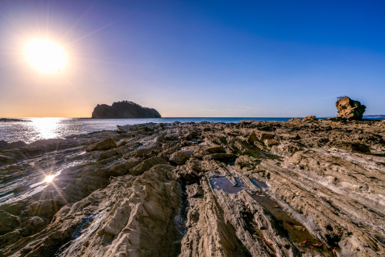
Sun shining over Jobo Bay in Guantacaste Costa Rica.
0 notes
Photo
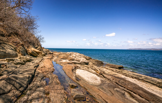
The shore of Jobo Bay in Costa Rica on a beautiful sunny morning.
0 notes
Photo
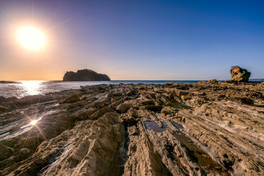
Jobo Bay, in El Jobo Costa Rica
0 notes
