#Headwater Exploration
Explore tagged Tumblr posts
Visit Tumblr Blog
Explore Tumblr blogs with no restrictions, modern design and the best experience.
Last Seen Tumblr Blogs


Fun Fact
130K people were victims of a chain letter scam that affected Tumblr in May 2011.
Text

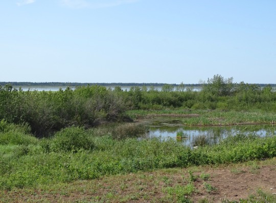
#country#nature#outdoors#hiking#travel#western#peace#treescape#explore#minnesota#itasca state park#state park#mississippi#mississippi headwaters#lakeside#lake
8 notes
·
View notes
Text
For the first time in 100 years, Atlantic salmon are once again spawning in the upper waters of the River Derwent.
The return of spawning salmon to the rivers of Derbyshire is a real conservation success story. After centuries of intensive river management by the county’s burgeoning factories, the fish were driven extinct in many of its waterways.
Since then, the health of some of the rivers have improved to an extent that salmon can once again spawn. But the routes for the fish to return are still blocked by the remnants of the industrial boom, with numerous dams and weirs still blocking the migratory route of salmon attempting to swim upstream.
Dr Tim Jacklin is a Conservation Officer for the Wild Trout Trust who has worked on river restoration projects that encourage and helps the migration of fish such as the Atlantic salmon. He was involved with the removal of a weir at Snake Lane, Derbyshire, which allowed the salmon to recolonise the headwaters of the River Derwent.
The catalyst for this work was seeing salmon making it all the way up the River Derwent, but then being stopped from exploring the upper reaches where the river becomes the Ecclesbourne.
“We’d started to see large salmon turning up in the Derwent in winter,” explains Tim. “They became sort of local celebrities really. People were going out with their head torches at night and looking into the river, because it’s not a particularly large watercourse and these fish were quite literally as long as your arm, without it being an angler’s tale.”
“So they attracted quite a lot of attention. But it also highlighted the fact that Snake Lane Weir, which was a concrete structure that had been built in the 1970s to replace an old mill, was a complete barrier to fish getting upstream.”
This prompted the work to remove the Snake Lane Weir and replace it with a boulder rapid that the fish would, once again, navigate over and continue on their journey.
“It’s very rewarding,” says Tim. “We opened up a good ten kilometres of spawning habitat upstream, so that translates into hundreds more juvenile salmon that make their way downstream and hopefully to come back and spawn.”
Putting the river bends back in
A little further upstream on the Ecclesbourne River, the Derbyshire Wildlife Trust is working to continue the work started at Snake Lane. At the edge of a farmer’s field a deep, straight channel rushes along under the trees. This was created by diverting the river to increase its flow to power a mill using a weir. This has formed yet another barrier for the migrating salmon.
But not even 20 metres away the ghost of the river’s original route perseveres. Nothing more than a shallow, muddy ditch with a few scraggly trees overgrowing it, the bends and curves of the river’s natural path can still be seen forming the boundary of a field.
The wildlife charity is now trying to undo the centuries of harm that bypassing the river’s natural route has done, with the hope that the salmon will travel even further up into the headwaters and spawn once more in the gravel of the restored river.
“A lot of our rivers across the whole country have been straightened,” explains Jenny Kril from the Derbyshire Wildlife Trust. “Unfortunately, what that does is remove any sort of natural habitat that we would expect to see in a healthy river.”
“What we’re doing is re-wiggling or re-meandering the Ecclesbourne, which is essentially just putting the bends back into it. What that does is change the speed and flow of the water. It creates nice beaches and different habitats for a whole host of different species and just making the river more natural.”
It is hoped that this work will create a greater variety of habitats, which in turn will encourage a greater variety of plants and invertebrates, and so boosting the overall biodiversity seen in this section of the river. But the cherry on the cake would be if the salmon start nesting.
“Over the next few years, we’re going to see this whole area just continue to develop naturally,” says Jenny. “We’ll get some sediment being deposited on some of the beaches creating more habitats, and we’re going to do tree planting to further increase the biodiversity of the area.”
“We’re just going to hopefully watch it become the brand-new river and as it should be again.”
There is a long way to go to safeguard the future of the UK’s rivers, but the work on the Ecclesbourne is showing that with the resources and right interventions change can happen and improvements made.
“I think we’ve got some huge challenges ahead of us, but you know, they’re not making rivers anymore,” says Tim. “So we’ve got to look after the ones that we’ve got.”
-via UK Natural History Museum, April 8, 2024
668 notes
·
View notes
Text


Gap Lake, AB (No. 2)
Mount McGillivray was named for Duncan McGillivray (1770–1808), one of the first white men along with David Thompson to see the Bow Valley. In November 1800, McGillivray and Thompson rode south on a trip from the newly established fort at Rocky Mountain House and explored west into the Bow Valley as far as what is now Mount McGillivray in search of the headwaters of the Columbia River. The mountain's toponym was officially adopted in 1957 by the Geographical Names Board of Canada.
During the Cold War, tunnels and vaults were constructed under the north slope of the mountain as part of a plan to safely store government documents, however the project was never completed.
On July 28, 2023, a small single-engine plane crashed on Mt. McGillivray, killing all six occupants from Calgary.
Source: Wikipedia
#Gap Lake#Mount McGillivray#Bow Valley#Kananaskis Country#travel#original photography#vacation#tourist attraction#landmark#landscape#countryside#Rocky Mountains#Canada#summer 2024#Alberta's Rockies#Canadian Rockies#flora#nature#forest#woods
17 notes
·
View notes
Text
Milestone Monday


On June 17, 1673, French explorers Jacques Marquette (1637-1675) and Louis Jolliet (1645-1700) reach the Mississippi River through Prairie du Chien Wisconsin and continued downstream for thirty days mapping the river's course and interacting with Indigenous communities. Marquette and Jolliet’s legacy would forever be marked as the first Europeans to map the Upper Mississippi and record its local flora and fauna.
Commemorating the day, we’re sharing Minn of the Mississippi written and illustrated by Holling Clancy Holling and published by Houghton Mifflin Company in 1951. Holland’s story follows the journey of a three-legged snapping turtle from its hatching at the Mississippi headwaters to the Gulf of Mexico. Along the way, Minn encounters a variety of animals, people, and manmade and natural environments. Holling utilizes Minn’s expedition to discuss the ecology, geology, and history of the river through elaborately illustrative marginal content.
Adding to Holling’s notable publications, Minn of the Mississippi received a Newberry Honor in 1952 and was generally met with positive reviews including accolades for Holling and his contribution to the “art of digression” method of writing and illustrating. This book is part of our extensive Historical Curriculum Collection that can be explored online here.
Read other Milestone Monday posts here
– Jenna, Special Collections Graduate Intern
#milestone monday#minn of mississippi#mississippi river#holling clancy holling#newberry honor#houghton mifflin company#jacques marquette#louis jolliet#historical curriculum collection#snapping turtle#children's books#Newberry Honor Book
30 notes
·
View notes
Text
[Sediment/Sentiment] Fluxes
The Yukon River exports sixty megatons of sediment per year away into the Bering Sea, the majority of it silt and clay derived from the glaciers carving stone at its headwaters. We call this measurement, movement quantified over time, a flux.
I kissed them the night before they left the hemisphere on an exploration geology contract, a two year visa. They study ores, hard rock, mapping what has sat solid in earth for an age, waiting. Their hands were callused already from the heft of samples.
They study ores, and I study fluxes -- water, sediment, salt, ice. My hands are finicky, shaky things, carved for the precision of catching a change in the act. You cannot hold a flux, only bear witness.
I kissed them in a liminal bedroom, half-boxed, walls bared. I took off my binder and we laughed -- oh, fluxes -- at how when they return, we will be changed, both, irrevocably and unavoidably, sure as every river I've known rises each spring and reworks the geometry of its own banks.
To live is to be in flux. It is my honour and joy, queer geologist I am, to bear witness.
We kiss, forehead to forehead, eyes open. Their hand presses into mine, chipped nail polish, calluses blooming. Sixty megatons of sediment, passing through my spread fingers --
They study what stays. I study what leaves.
#creative writing#queer#geology#rocks#writing#sedimentology I suppose?#the inherent joy of sprinkling gender metaphors into geology
5 notes
·
View notes
Text

Dear Reader,
There is a boy sitting in the woods. His chin is cocked up, eyes closed, mouth open with his tongue sticking out like a frog trying to catch a bug. There is a picture of this boy, taken almost a hundred years later, hand in the pocket of his three-piece suit, clutching the waist of his second wife, Shirley.
Reader, there is a talking house in the woods there, whose windows will at times belch open and sing the chorus of a pageant written for a thousand performers. There is a house of shimmering blue outlines puffing smoke from the chimney and darkening the air with song, I am the smoke king, hail to the Black! The house is a part of a city shaped like a river, snaking up and down the coast and the boy, he flew there to cast his tongue out into the woods and catch everything in his mouth. Like a fisherman, he will spend his life on the edge of things, easing his dropper into blue and purple swirls of salt and particles of life. In his last message he’ll tell us he loved his people and his play. “Time is long,” he’ll say. “Live and believe in life.”
This latest dispatch of Black Interior Magazine is about Du Bois, it takes up his charge. It is the blue-heeled little girl taking your black hand. It says, let us play.
Up ahead, several resident artists illuminate the shimmering outlines of singing trees, ancient domes for melodious language along the Minnesota River Valley. A woman, who has gotten tired of her ex-boyfriend’s shit because he didn’t ever buy her nothin', treks from the Mississippi headwaters to its Atlantic mouth. Finally, we will explore the latest youth sensation, Black Reconstruction, a first person POV-IRL game guided by abstract rules that confound even our reporter, who attempts participation. There is an exploration of wind as it relates to tone and, as ever, our How To offers a guide for writing land acknowledgements that don’t make you want to rob the white person reading it. This, among other dispatches from the Interior.
Yours,
The Editor
3 notes
·
View notes
Text
Montana Fly Fishing Trips: Reel in Memories with Fishtales Outfitting
Montana's crystal-clear rivers and thriving trout populations beckon. Embark on unforgettable Montana fly fishing trips tailored to your skill level. From serene headwaters to adrenaline-pumping rapids, explore Big Sky Country's aquatic jewels with Fishtales Outfitting. Land trophy trout, soak in breathtaking scenery, and create memories that reel you back year after year. Book your Montana fly fishing trips today!
2 notes
·
View notes
Text
NAME: Ben Prestor
AGE: 34
DO YOU LIKE TO CUDDLE?: He does. Permission helps.
CAN WE MAKE-OUT?: …Yes.
A NIGHT IN OR DINNER OUT?: Out is okay. Easy on the surprises.
WHIP CREAM OR CHOCOLATE SYRUP?: *frown deepens as he realizes he and Beth apply different meanings to these… things… and none involve sundaes* Syrup?
CHOCOLATES AND ROSES?: Nah. He’d rather do something for you.
WHAT MAKES YOU A GOOD VALENTINE?: He didn’t say that.
WOULD YOU COOK FOR ME?: Beth… *thinks* All right.
WOULD YOU LET ME COOK FOR YOU?: *clears throat* That’s okay.
WHERE WOULD YOU TAKE ME ON A DATE? Somewhere natural so he doesn’t have to think about tablecloths.
WHO’S PAYING?: *flustered silence*
WHAT DID YOU GET ME FOR VALENTINE’S DAY?: He made you something, naturally. A lovely thing carved in bone with a fine skill he may take a little for granted. He’s sorry about that. You have to kiss him first, though, because ^this was hell.

Better Together || -
Beth's fingertip traces from the natural part in his hair down the slope of his nose, pausing at the very tip, before continuing on over his lips ~she takes care to neither be kissed nor nipped on the journey~ and on down to his chin. From there she travels on an itinerant journey to explore the parts between. The sweep of his jaw, the arch of his cheek. A scattering of freckles here, a mole there. The shell of his ear, the etched lines of his brow. But specifically not the scar. He has trouble enough with that, and she only needs to drown in the turbid headwaters of his eyes to see the way he turns from stray ideas of touch. They are the same in that regard; his is kapu from pain and misery, hers is kapu for its host of other reasons. Even now as they make themselves into living nesting dolls ~she being the holder of the others, Ben tucked up and around her as if with enough determination he can fit into the space between her ribs and disappear, and D.O rested her head on his thigh, where Ben could pet her and she was part of this cozy circle. She doesn't know when she abandoned the quiz, having used it as a buffer to broach things she's too uptight to just bring up like an adult. Some questions don't need to be asked. She knows his name. Has heard everything whispered and shouted about it. From himself, from others. She trusts D.O. as the best judge of character. Beth knows they are of the same age, though it's funny that they should both be water and she's the elder by four-ish months. "I'm not much f' goin' out dese days." He doesn't know how close Mos Espa has come to having a new ever flowing river running red through town like an ancient apocalyptic sign. But she remembers every flinch, every inward curl of shoulder and shuffle-drag of foot. She remembers every time he doesn't lift his gaze and every nasty thing still muttered behind his broad back. Some day she will make them all regret every slight cast his way. She won't shed a tear over it. He ghosts the single word against her ribs and sends a rush of goose bumps rushing from the curve of her hips to the nape of her neck. Ben doesn't always need words; expressions, a flick of his wrist, the tectonic shift of his shoulders is enough to make an elegant counterpoint. She's grateful he doesn't gravitate toward roses, and in turn rewards him with the brush of lips across his brow, the shift of pose allowing him to burrow just that much deeper into her. Ben is a sensitive soul. Maybe because it's so big in him it pushes at his skin and threaten to spill out of his nicks and scars like spring sap. Her fingers tangle themselves in the thick ink of his hair. Lets it stain her skin the way he stains wood; with patience and care, the mark of hesitance. "We don' have to, ya know. Can jus' order some kine jalike. Somet'ing dat totally break da mout'. I could go get it. We could go togeddah." She can't cook, and it seems unfair to force such a thing on him if he's not feeling quite up to it. Sometimes she wonders if he resents food as a necessary evil, the way she does her meds. Therapy. Things she's forced to do in order to simply maintain survival level existence. She doesn't know how to carefully pry at that without letting the worms of argument escape the can. "Or mebbe, jus' could consume each oddah. Live off of..." She trails off, the word sticking in her throat. She shifts again and D.O huffs a little sigh before grudgingly removing her head from Ben's leg, the C of her back now pushing against him as she rests her muzzle on her paws. It's not an indictment of Ben and Beth's relationship but rather being disgruntled by all the moving around. For her part, Beth shimmies down just a little and the bed-frame creaks mournfully. Ben needs a better bed, especially if Beth is going to take up her own negligible space. Her hand slides up the rungs of his ribs. Swerves toward his back. The hand in his hair tightens only enough to tip his face upward. Her lips grace his, a half breath caught between their mouths. "I wanna kiss you. Gonna do it now, okay?" It seems weird to announce her intent; not as a warning, not as a demand ~she has few of those and never with him~ but maybe she's looking for permission, for an acceptance. A substitute for the things that she can't quite get out of her own head.
#submission#Stardust|Ben Solo#Parallel Lines|Ben and Beth#Rusty Cage|ExCon verse#Cruisin' Mos Espa|A Place Called Tatooine
2 notes
·
View notes
Text

Personal treasure. I’m sure most of us have something deeply meaningful that, while precious to us, may not have much monetary value. This one is mine.
In the early 80s, when I was somewhere between 9 and 12, my family took one of our many outings. This time we went with close family friends to the Mississippi headwaters.

Here, you can wade across the Mississippi as it is both shallow and narrow- almost impossible to believe the roaring juggernaut it turns into.
All of us played in the water and explored the woods around lake Itasca. After a while it was time to head back to our campsite. However, not without a stop at the gift shop.
While wandering the aisles, I happened upon a shelf with a collection of tiny brass horses in various poses. I was smitten and desperately wanted one. My mother tried to talk me out of it as apparently they were somewhat pricy (to this day I don’t know the actual cost but I can guess it was around $20). However, dad rapidly folded under my pleading and got it for me - with the promise I wouldn’t let the other kids know I got a gift that cost more than the agreed budget.
I’ve had this with me ever since. It has traveled during several moves and even to Alaska. I value it more than any other trinket or valuable I own. Whenever I look at it I remember that day in the gift shop. I remember wading in ice cold waters. And I remember my dad, who did all he could to give his kids whatever they wanted - even when money was tight.
2 notes
·
View notes
Photo


Book Recommendations: New Nonfiction eAudiobooks on Libby
Looking for free access to eBooks or eAudiobooks? Check out Libby, a service from the Rock Island Public Library (RIPL) that can be accessed with your RIPL card number! You can log in to Libby through our website or download it as an app from the Apple Store or Google Play Store.
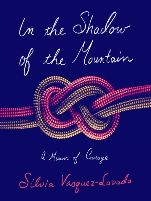
In the Shadow of the Mountain by Silvia Vasquez-Lavado
Endless ice. Thin air. The threat of dropping into nothingness thousands of feet below. This is the climb Silvia Vasquez-Lavado braves in her page-turning, pulse-raising memoir following her journey to Mount Everest.
A Latina hero in the elite macho tech world of Silicon Valley, privately, she was hanging by a thread. Deep in the throes of alcoholism, hiding her sexuality from her family, and repressing the abuse she'd suffered as a child, she started climbing. Something about the brute force required for the ascent—the risk and spirit and sheer size of the mountains and death's close proximity—woke her up. She then took her biggest pain as a survivor to the biggest mountain: Everest.
"The Mother of the World," as it's known in Nepal, allows few to reach her summit, but Silvia didn't go alone. She gathered a group of young female survivors and led them to base camp alongside her. It was never easy. At times hair-raising, nerve-racking, and always challenging, Silvia remembers the acute anxiety of leading a group of novice climbers to Everest's base, all the while coping with her own nerves of summiting. But, there were also moments of peace, joy, and healing with the strength of her fellow survivors and community propelling her forward.
Under the Skin by Linda Villarosa
In 2018, Linda Villarosa's New York Times Magazine article on maternal and infant mortality among black mothers and babies in America caused an awakening. Hundreds of studies had previously established a link between racial discrimination and the health of Black Americans, with little progress toward solutions. But Villarosa's article exposing that a Black woman with a college education is as likely to die or nearly die in childbirth as a white woman with an eighth grade education made racial disparities in health care impossible to ignore.
Now, in Under the Skin, Linda Villarosa lays bare the forces in the American health-care system and in American society that cause Black people to “live sicker and die quicker” compared to their white counterparts. Today's medical texts and instruments still carry fallacious slavery-era assumptions that Black bodies are fundamentally different from white bodies. Study after study of medical settings show worse treatment and outcomes for Black patients. Black people live in dirtier, more polluted communities due to environmental racism and neglect from all levels of government. And, most powerfully, Villarosa describes the new understanding that coping with the daily scourge of racism ages Black people prematurely. Anchored by unforgettable human stories and offering incontrovertible proof, Under the Skin is dramatic, tragic, and necessary reading.
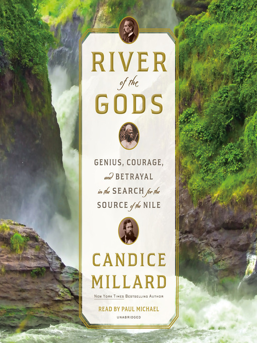
River of the Gods by Candice Millard
For millennia the location of the Nile River’s headwaters was shrouded in mystery. In the 19th century, there was a frenzy of interest in ancient Egypt. At the same time, European powers sent off waves of explorations intended to map the unknown corners of the globe – and extend their colonial empires.
Richard Burton and John Hanning Speke were sent by the Royal Geographical Society to claim the prize for England. Burton spoke twenty-nine languages, and was a decorated soldier. He was also mercurial, subtle, and an iconoclastic atheist. Speke was a young aristocrat and Army officer determined to make his mark, passionate about hunting, Burton’s opposite in temperament and beliefs.
From the start the two men clashed. They would endure tremendous hardships, illness, and constant setbacks. Two years in, deep in the African interior, Burton became too sick to press on, but Speke did, and claimed he found the source in a great lake that he christened Lake Victoria. When they returned to England, Speke rushed to take credit, disparaging Burton. Burton disputed his claim, and Speke launched another expedition to Africa to prove it. The two became venomous enemies, with the public siding with the more charismatic Burton, to Speke’s great envy. The day before they were to publicly debate,Speke shot himself.
Yet there was a third man on both expeditions, his name obscured by imperial annals, whose exploits were even more extraordinary. This was Sidi Mubarak Bombay, who was enslaved and shipped from his home village in East Africa to India. When the man who purchased him died, he made his way into the local Sultan’s army, and eventually traveled back to Africa, where he used his resourcefulness, linguistic prowess and raw courage to forge a living as a guide. Without Bombay and men like him, who led, carried, and protected the expedition, neither Englishman would have come close to the headwaters of the Nile, or perhaps even survived.
And Finally by Henry Marsh
As a retired brain surgeon, Henry Marsh thought he understood illness, but he was unprepared for the impact of his diagnosis of advanced cancer. And Finally explores what happens when someone who has spent a lifetime on the frontline of life and death finds himself contemplating what might be his own death sentence.
As he navigates the bewildering transition from doctor to patient, he is haunted by past failures and projects yet to be completed, and frustrated by the inconveniences of illness and old age. But he is also more entranced than ever by the mysteries of science and the brain, the beauty of the natural world and his love for his family. Elegiac, candid, luminous and poignant, And Finally is ultimately not so much an audiobook about death, but an audiobook about life and what matters in the end.
#nonfiction#history#biography#memoir#audiobooks#ebooks#Libby#Library Books#Book Recommendations#book recs#Reading Recs#reading recommendations#TBR pile#tbrpile#to read#Want To Read#Booklr#book tumblr#book blog#library blog#new library books
3 notes
·
View notes
Text
Sheep River Provincial Park: A Natural Gem in Kananaskis Country, Okotoks, Canada
Nestled in the heart of Kananaskis Country near Okotoks, Alberta, Sheep River Provincial Park is a serene haven for nature lovers, outdoor enthusiasts, and history buffs. This picturesque park is renowned for its stunning landscapes, abundant wildlife, and recreational opportunities. Whether you're seeking adventure or tranquility, Sheep River Provincial Park offers an unforgettable experience that connects visitors to the natural beauty and heritage of Alberta.
Historical Significance
Sheep River Provincial Park has a rich history tied to the early exploration and settlement of the region. The Sheep River, which flows through the park, was a vital resource for Indigenous communities and early settlers, providing water and sustenance. These groups relied on the land for hunting, fishing, and gathering, and their presence left an indelible mark on the area’s cultural heritage.
The park’s establishment as part of Kananaskis Country highlights Alberta’s commitment to preserving its natural landscapes. Created to protect the unique ecosystems and species within its boundaries, Sheep River Provincial Park plays a key role in conserving the headwaters of the Sheep River, ensuring that it remains a pristine environment for future generations.
Why It Is Famous
Sheep River Provincial Park is famous for its breathtaking scenery, which includes rolling foothills, dense forests, and rugged mountain vistas. The park is particularly noted for:
Sheep River Falls: A stunning natural waterfall that serves as a focal point for visitors. Its beauty and accessibility make it one of the most photographed spots in the park.
Wildlife Viewing: The park is home to a diverse array of wildlife, including elk, deer, moose, and bighorn sheep. It’s also a critical habitat for grizzly bears and cougars. Birdwatchers can spot a variety of species, including golden eagles and hawks.
Outdoor Activities: From hiking and cycling to fishing and picnicking, the park offers numerous recreational opportunities that attract visitors year-round.
Connection to Kananaskis Country: As part of the larger Kananaskis region, Sheep River Provincial Park benefits from the area’s reputation as a premier destination for outdoor adventure and natural beauty.
When to Visit
Sheep River Provincial Park is open year-round, with each season offering unique experiences:
Spring: The park comes alive with blooming wildflowers and flowing rivers, making it an excellent time for nature walks and photography.
Summer: Warm weather and long days make summer ideal for hiking, picnicking, and camping. The trails are at their most accessible during this season.
Fall: The park is a spectacle of vibrant autumn colors, offering stunning views and cooler temperatures for hiking and cycling. Wildlife activity is often heightened during this season.
Winter: For those who embrace cold-weather activities, the park offers opportunities for snowshoeing, cross-country skiing, and wildlife tracking.
What to Do There
Visit Sheep River Falls: No trip to the park is complete without a visit to its iconic waterfall. A short, family-friendly trail leads to the falls, offering excellent photo opportunities and a chance to enjoy the sound of cascading water.
Hiking and Walking Trails: Explore the park’s network of trails, ranging from easy strolls to more challenging hikes. Popular trails include the Sandy McNabb area and Junction Creek.
Wildlife Viewing: Bring your binoculars and keep an eye out for the park’s diverse wildlife. Early mornings and late afternoons are the best times for sightings.
Fishing: The Sheep River is a popular spot for anglers, offering the chance to catch trout and other fish species.
Picnicking: Several designated picnic areas provide scenic spots to relax and enjoy a meal surrounded by nature.
Cycling: The paved and gravel roads within the park are great for cycling, offering scenic views along the way.
How to Plan a Visit
Check Park Regulations: Before visiting, familiarize yourself with park rules, seasonal restrictions, and any wildlife advisories. This information can be found on the official Alberta Parks website.
Plan Your Activities: Decide which activities you want to prioritize, such as hiking, fishing, or photography. Ensure you have the necessary permits for activities like fishing.
Pack Appropriately: Bring essentials such as water, snacks, comfortable footwear, sunscreen, and layers for varying weather conditions. If visiting in winter, pack appropriate gear for snow and ice.
Travel Arrangements: The park is about an hour’s drive from Calgary and is easily accessible by car. Parking is available at various trailheads and picnic areas.
Accommodations: If you plan to stay overnight, consider camping at one of the designated campgrounds or booking accommodations in nearby Okotoks or Turner Valley.
Safety Precautions: Sheep River Provincial Park is a wilderness area, so be prepared for encounters with wildlife. Carry bear spray, make noise on trails, and follow Leave No Trace principles to minimize your impact on the environment.
Why You Should Visit
Sheep River Provincial Park offers an idyllic escape from the hustle and bustle of everyday life. Whether you’re marveling at the beauty of Sheep River Falls, spotting wildlife in their natural habitat, or simply soaking in the tranquil surroundings, the park provides a rejuvenating experience for visitors of all ages.
The park’s combination of natural beauty, recreational opportunities, and historical significance makes it a must-visit destination for those exploring Kananaskis Country. By visiting Sheep River Provincial Park, you not only connect with nature but also contribute to the ongoing preservation of Alberta’s precious landscapes.
So pack your gear, grab your camera, and prepare for an adventure that will leave you with memories to cherish. Sheep River Provincial Park awaits, ready to inspire and delight.
0 notes
Text
Exploring Okefenokee National Wildlife Refuge
Folkston, Georgia All it takes is a ruffle of the leaves or a splash of water to become jittery real fast. Playing in the swamp brings one face to face with nature, but be prepared for what you can stumble upon. Alligators and the Okefenokee Swamp The Okefenokee National Wildlife Refuge is at the headwaters of the Suwannee and St. Mary’s Rivers. It is world renowned for its amphibian…
#adventurewalk#Alligators#folkstongeorgia#jittery#nationalwildliferefuge#Okefenokee#RDP#swamp#wildlifeRefuge#worldrenownedswamp
0 notes
Text

A sharp cry echoed across the grasslands, then another, as a bald eagle alighted on top of a cabbage palm. The top of the tree’s leafy head had been twisted off during a hurricane, leaving a bare perch for the bird of prey, and a clear view of the glistening deep blue water of the river. The eagle cried again and scanned the landscape. Looking for family or a tasty blue crab floating through the water towards the Gulf? Unsatisfied, he rose into the blue sky with a powerful flap of wings and soared away over a sea of yellow grasses. Vultures swept overhead, swooping and circling, intrigued by the smell of old bait, before leaving for more suitable feeding grounds. A white heron waded along the muddy riverbank, pitted with crab holes, waiting for the fish of the day and a Great Blue Heron alighted on a fallen tree above, to watch with curiosity. Time stands still along the winding and wild Waccasassa River. You can travel the waterway without passing a single soul, but if you choose to stop, nature soon forgets you are even there. Bald eagle on a cabbage palm overlooking the Waccasassa River by Sally White Where there are Cows The Seminoles dubbed the river “Waccasassa”, or “(where) there are cows”, after the grazing cows the pioneer settlers kept in the area. But today the only cows you will see in the lower Waccasassa are the occasional sea cow, the huge, torpedo-shaped grey manatee. The Waccasassa River runs 29 miles from the headwaters, fed by Blue Spring, near Bronson and Wekiva Spring, along with several other groundwater sources on its journey to the Gulf of Mexico. Fresh water is vital to maintain a healthy wetland ecosystem. Designated a National Natural Landmark in 1976, theWaccasassa River, a slice of old Florida, does not disappoint. Old Growth Hydric Hammock Fallen logs and protruding rocks are a common sight along the Waccasassa River. Photo by Sally White It’s 4-miles from the Waccasassa River boat ramp to the mouth of the river in Waccasassa Bay, and a trip that takes you from freshwater and the lush vegetation of a hydric hammock through the brackish waters of the swamp and the rushes and wiregrass wetlands of the saltmarshes. Remnants of what was once 100,000 acres of old-growth, the hydric hammock once stretched between Cedar Key and Yankee Town. 80% of it was lost in the 1970s-1980s to commercial logging activities when the land was cleared to create loblolly pine plantations to yield fast-growing timber. The remainder nowprovides a wild refuge for wading birds, black bears, deer, raccoons, and the endangered Florida Salt Marsh Vole. Wetland grasses receive the brunt of the storms on the Waccasassa. Photo by Sally White Waccasassa Bay Preserve State Park is a Very Wet State Park Unique in location, the 30,784-acre Waccasassa Bay Preserve State Park can only be reached by water. There are no boardwalks, hiking trails, or observation platforms. The only signage is a ‘beware of rocks in the waterway’ sign. Paddlers and boaters can explore and fish the river and tidal creeks and the 20-miles of coastline in this Florida water-based state park. Influenced by the tides, the limestone rocks and fallen trees in the river reveal themselves during low tide. Mud slicks the embankments where alligators slide into the dark water. Bird and otter tracks dot across the dark muck. But the land is deceptively not land, and should a two-legged human attempt to stand there, they would sink into the mud. Hurricanes and the Waccasassa River The Waccasassa River has seen 6 hurricanes since 2014. Fallen trees and twisted palms are a common sight along the river. Photo by Sally White This region of Florida’s Nature Coast takes the brunt of many strong storms. Six named storms have struck the area since 2014. The landscape here has been shaped by the weather. Near the mouth of the Waccasassa, fields of yellow marsh grasses bend to the fierce winds, their tangled roots capturing debris in the saltwater storm surges. Then cabbage palms rise, tall and slender. Many with their tops torn off from hurricanes. Red cedars join next, sturdy sentinels with a shallow yet fibrous root system that spreads out to prevent erosion. Some of the cedars have been recently uprooted by Hurricane Helene, and now their vibrant greens have turnedto autumn browns. Their needle-like leaves will fall and the trunks and roots will face the sun and salt washes, bleaching with time and elements to the color that even Sherwin Williams paint can never truly recreate. Trees have fallen, bushes blown away, but a marker warning in the river still stands. Photo by Sally White No Gulf Channel Markers Wildlife is not always welcoming, and the quiet along the river tells tales of a post-storm aftermath. Trees and logs jut out of the river, and branches float by or catch on other debris, shifting the current. Although the rock warning sign is still standing, all but two coastal markers remain in the Gulf Channel. In an area of oyster beds and shallows, unless you have the old channel marked on your boat's GPS navigation system, the Gulf of Mexico remains unnavigable, in this modern world. If you do venture out with a motorboat, use caution, a depth finder, and reduced speed. Bugs, Bugs, Bugs There are tidal creeks to be explored by boaters in the water-based Waccasassa Bay Preserve State Park on the Waccasassa River. Photo by Sally White The no-see-ums and mosquitoes vie for attention once the sun begins its descent. With wilderness comes wild things of all sizes, and beastly bugs become a painful nuisance on the river. Between you and the native animals, you are the sweet treat for them. Should you decide to explore this wild slice of Florida, be warned, there are no facilities, just you and the wild elements. Arm yourself with bug spray. You will use it. Bring sun protection & keep hydrated. The sky may look more crisp and bluer, but the sun is brighter, especially once you leave the protection of thehammock. Make note of the tides and the weather and let someone know where you are going. The Waccasassa River Boat Ramp is located on SE County Rd 326, Inglis, Florida by the Gulf Hammock Fishing Club. There are toilet facilities and a floating dock at the boat ramp for mooring. Sources:https://www.floridastateparks.org/parks-and-trails/waccasassa-bay-preserve-state-parkhttps://floridadep.gov/https://myfwc.com/ Read the full article
0 notes
Text
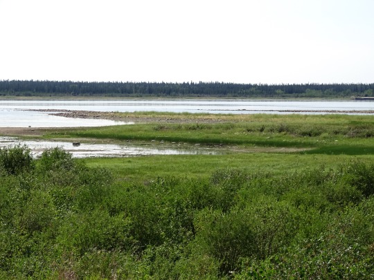
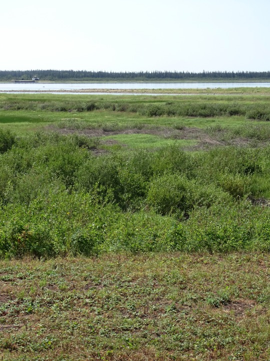
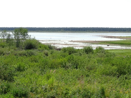
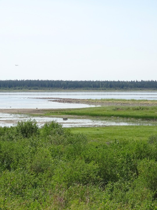
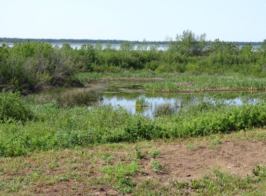

Mackenzie River, NWT
The Mackenzie River (French: Fleuve (de) Mackenzie; Slavey: Deh-Cho [tèh tʃʰò], literally big river; Inuvialuktun: Kuukpak [kuːkpɑk], literally great river) is a river in the Canadian boreal forest. It forms, along with the Slave, Peace, and Finlay, the longest river system in Canada, and includes the second largest drainage basin of any North American river after the Mississippi.
The Mackenzie River flows through a vast, thinly populated region of forest and tundra entirely within the Northwest Territories in Canada, although its many tributaries reach into five other Canadian provinces and territories. The river's main stem is 1,738 kilometres (1,080 mi) long, flowing north-northwest from Great Slave Lake into the Arctic Ocean, where it forms a large delta at its mouth. Its extensive watershed drains about 20 percent of Canada. It is the largest river flowing into the Arctic from North America, and including its tributaries has a total length of 4,241 kilometres (2,635 mi), making it the thirteenth longest river system in the world.
The ultimate source of the Mackenzie River is Thutade Lake, in the Northern Interior of British Columbia. The Mackenzie valley is believed to have been the path taken by prehistoric peoples during the initial human migration from Asia to North America over 10,000 years ago, despite sparse evidence.
The Inuvialuit, Gwich'in and other Indigenous peoples lived along the river for thousands of years. The river provided the major route into Canada's northern interior for early European explorers.
Economic development remains limited along the river. During the 19th century, fur trading became a lucrative business, but this was affected by harsh weather conditions. The discovery of oil at Norman Wells in the 1920s began a period of industrialization in the Mackenzie valley. Metallic minerals have been found along the eastern and southern edges of the basin; these include uranium, gold, lead, and zinc. Agriculture remains prevalent along the south, particularly in the Peace River area. Various tributaries and headwaters of the river have been developed for hydroelectricity production, flood control and irrigation.
Source: Wikipedia
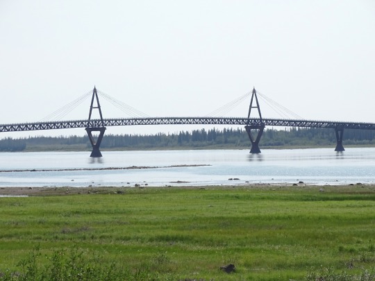
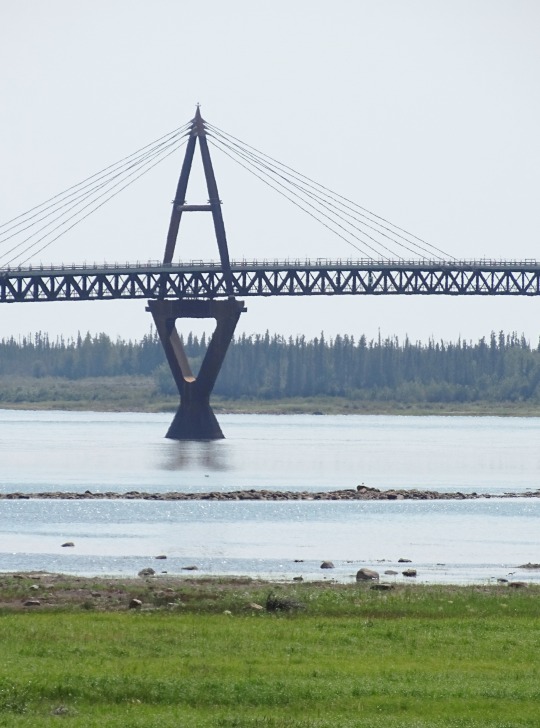
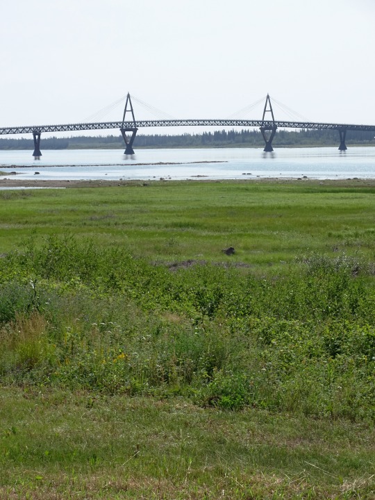
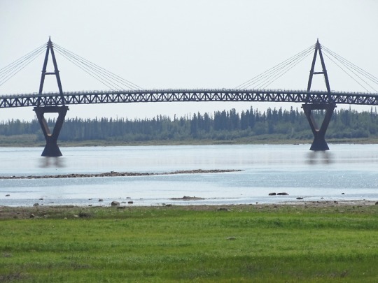
The Deh Cho Bridge is a 1.1 km-long (0.68 mi) cable-stayed bridge across a 1.6 km (0.99 mi) span of the Mackenzie River on the Yellowknife Highway (Highway 3) near Fort Providence, Northwest Territories. Construction began in 2008 and was expected to be completed in 2010 but faced delays due to technical and financial difficulties. The bridge officially opened to traffic on November 30, 2012. The bridge replaced the MV Merv Hardie, the ferry in operation at the time of opening, and ice bridge combination used for river crossing.
Deh Cho (lit. "Big River") is the Slavey language name for the Mackenzie River.
Source: Wikipedia
#Mackenzie River Access Point#Mackenzie River#Deh Cho Bridge by JR Spronken and Associates Ltd#engineering#Northwest Territories#nature#travel#original photography#vacation#tourist attraction#landmark#landscape#Canada#summer 2024#river bank#the North#Fort Providence#South Slave Region#flora#meadow#forest#woods
13 notes
·
View notes
Text
Exploring Farther
Stephen Harriman Long, early American explorer of present-day Oklahoma. Stephen Long Explores Oklahoma Region Neither cold nor heat, drought nor flood, dangerous Indians nor hostile Spaniards could stem the surge of American merchants, scientists, adventurers, missionaries, and soldiers who persevered across the rivers, then the lands of present-day Oklahoma. While the imperial powers of Europe drained each other’s blood and treasure, or sank into non-productive lassitude, the young American nation born of them vibrated with energy and ambition. Indeed, many people would have many ideas for Indian Territory. Scores of daring American entrepreneurs yearned to reach the bountiful trading hub of Santa Fe to the west of Texas, but well-armed Spanish troops under orders from their distant government prevented that, at the point of the bayonet when necessary. It was no place for the faint of heart or the uncertain of aim. Many of the keenest observations and most notable discoveries by Americans were accomplished by private citizens such as scientists or merchants, rather than those in government service. One of the most intrepid American explorers of early Oklahoma, though, was U.S. Army Engineer Stephen Long. As the Osage-Cherokee war raged in 1817, the War Department commissioned him to choose a location on the Arkansas River for a fort to help calm that vicious feud, as well as to protect the American settlers beginning to enter the area. Long established Fort Smith, later one of the largest cities in Arkansas. Then, encouraged by the Adams-Onis Treaty signed between the United States and Spain, a series of important American explorations trekked through present-day Oklahoma in the late 1810s and early 1820s. Natural and manmade dangers alike lurked in every direction throughout the rough country. Long’s Epic Journey Two years after his first Oklahoma adventure, esteeming his toughness and coolness of mind in dangerous situations, the War Department sent Long west on an even more daunting mission: finding the elusive headwaters of the Arkansas and Red Rivers. Numerous previous American expeditions had failed to do so. Also plagued throughout the expedition by supply shortages due to the financial Panic of 1819, Long trekked across the Great Plains to the Rocky Mountains, then in the summer of 1820 detached Captain John H. Bell and a dozen men to follow the Arkansas back to Fort Smith. This group, which included the father of American zoology, Thomas Say, faced its own desperate odyssey, braving thirst and scorching heat before reaching their destination. Say suffered additional heartache as deserting soldiers stole five journals in which he had painstakingly compiled vast amounts of eyewitness data about newly christened Indian Territory’s people, plants, animals, geography, and minerals. Forging on from memory and the remnants of his expedition writings, he managed to publish a book chronicling the Bell expedition. Stephen Long’s great 1820 expedition through present-day Oklahoma continued his preceding year’s exploration of the Missouri River. The remarkable pathfinder seemed to find a way to answer every one of the many formidable challenges that arose with ingenuity and resourcefulness. Read the entire Oklahoma story in John J. Dwyer’s The Oklahomans: The Story of Oklahoma and Its People volume 1 of a 2-part series on the 46th state and the people who make this state very special.
#oklahoma#history#john dwyer#the oklahomans#chocktaw#cherokee#seminole#chickasaw#sooners#boomers#89ers#land run#okies
0 notes
Text
Metallic Tiles Market Demand Driven by Aesthetic Appeal and Durability

Metallic Tiles Market Growth Strategic Market Overview and Growth Projections
The global metallic tiles market size was valued at USD 1.50 billion in 2022. It is estimated to reach USD 2.58 billion by 2031, growing at a CAGR of 6.25% during the forecast period (2023–2031).
The latest Global Metallic Tiles Market by straits research provides an in-depth analysis of the Metallic Tiles Market, including its future growth potential and key factors influencing its trajectory. This comprehensive report explores crucial elements driving market expansion, current challenges, competitive landscapes, and emerging opportunities. It delves into significant trends, competitive strategies, and the role of key industry players shaping the global Metallic Tiles Market. Additionally, it provides insight into the regulatory environment, market dynamics, and regional performance, offering a holistic view of the global market’s landscape through 2032.
Competitive Landscape
Some of the prominent key players operating in the Metallic Tiles Market are
Metrotile (Ross Roof Group)
Roser Co., Ltd.
Tilcor Roofing Systems (Ross Roof Group)
Gerard Roofs
Headwaters, Inc.
Fortiza Roofing Systems (Fletcher Building)
Decra Roof Systems
Kingspan
Interlock Roofing
Apex Tiles
Met-Tile
ATAS International
VANAEL
Get Free Request Sample Report @ https://straitsresearch.com/report/metallic-tiles-market/request-sample
The Metallic Tiles Market Research report delivers comprehensive annual revenue forecasts alongside detailed analysis of sales growth within the market. These projections, developed by seasoned analysts, are grounded in a deep exploration of the latest industry trends. The forecasts offer valuable insights for investors, highlighting key growth opportunities and industry potential. Additionally, the report provides a concise dashboard overview of leading organizations, showcasing their effective marketing strategies, market share, and the most recent advancements in both historical and current market landscapes.Global Metallic Tiles Market: Segmentation
The Metallic Tiles Market segmentation divides the market into multiple sub-segments based on product type, application, and geographical region. This segmentation approach enables more precise regional and country-level forecasts, providing deeper insights into market dynamics and potential growth opportunities within each segment.
By Type
Shake Type
Modena Type
Shingle Type
Classical Type
Others
By Applications
Residential
Commercial
Others
Stay ahead of the competition with our in-depth analysis of the market trends!
Buy Now @ https://straitsresearch.com/buy-now/metallic-tiles-market
Market Highlights:
A company's revenue and the applications market are used by market analysts, data analysts, and others in connected industries to assess product values and regional markets.
But not limited to: reports from corporations, international Organization, and governments; market surveys; relevant industry news.
Examining historical market patterns, making predictions for the year 2022, as well as looking forward to 2032, using CAGRs (compound annual growth rates)
Historical and anticipated data on demand, application, pricing, and market share by country are all included in the study, which focuses on major markets such the United States, Europe, and China.
Apart from that, it sheds light on the primary market forces at work as well as the obstacles, opportunities, and threats that suppliers face. In addition, the worldwide market's leading players are profiled, together with their respective market shares.
Goals of the Study
What is the overall size and scope of the Metallic Tiles Market market?
What are the key trends currently influencing the market landscape?
Who are the primary competitors operating within the Metallic Tiles Market market?
What are the potential growth opportunities for companies in this market?
What are the major challenges or obstacles the market is currently facing?
What demographic segments are primarily targeted in the Metallic Tiles Market market?
What are the prevailing consumer preferences and behaviors within this market?
What are the key market segments, and how do they contribute to the overall market share?
What are the future growth projections for the Metallic Tiles Market market over the next several years?
How do regulatory and legal frameworks influence the market?
About Straits Research
Straits Research is dedicated to providing businesses with the highest quality market research services. With a team of experienced researchers and analysts, we strive to deliver insightful and actionable data that helps our clients make informed decisions about their industry and market. Our customized approach allows us to tailor our research to each client's specific needs and goals, ensuring that they receive the most relevant and valuable insights.
Contact Us
Email: [email protected]
Tel: UK: +44 203 695 0070, USA: +1 646 905 0080
#Metallic Tiles Market Market#Metallic Tiles Market Market Share#Metallic Tiles Market Market Size#Metallic Tiles Market Market Research#Metallic Tiles Market Industry#What is Metallic Tiles Market?
0 notes