#Halfwayanywhere
Explore tagged Tumblr posts
Visit Tumblr Blog
Explore Tumblr blogs with no restrictions, modern design and the best experience.
Last Seen Tumblr Blogs


Fun Fact
Tumblr has been providing a Korean-language service since 2013.
Photo
GIVEAWAY | While doing trail magic on the Pacific Crest Trail (PCT) last year, what may be the filthiest thru-hiker I've ever seen wandered out of the woods and sat with us briefly while we fed him pizza and Capri Suns. Little did we know that this man, @nick.fowler.says.hi, would go on to set the self-supported PCT Fastest Known Time (FKT)—probably because of the Capri Suns we blessed him with. Nick has recently released a book, Itch: A Pacific Northwest Trail Story, chronicling his 2021 Pacific Northwest Trail FKT across Montana, Idaho, and Washington. I’ve got a copy to give away, so if you want a free copy, do the following: -Be following @halfwayanywhere and @nick.fowler.says.hi -Tag a friend in the comments who you would want to support you on an FKT attempt (supported, obviously) Winner will be selected at 22:00 Pacific Time on Friday, March 29, 2024. Open to anyone with a US shipping address. #pacificnorthwesttrail #fkt
0 notes
Photo


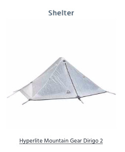
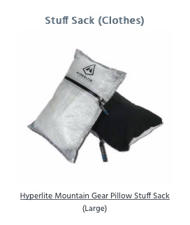
Hyperlite Mountain Gear featured on Halfway Anywhere
0 notes
Photo
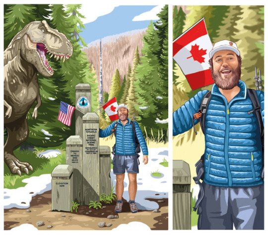
Mac the Wizard @halfwayanywhere wished for a dinosaur in his illustration. Well I thought a trex might fulfill his idea? 😁 If you also want a terminus illustration check out my website (link in my bio) and go to “PCT/AT illustrations” - you find all information about how to order there 😃 - don’t hesitate if you are a southbounder or if you hiked the CDT or AT- I also draw these!
0 notes
Photo
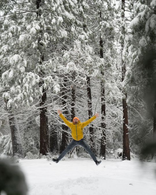
I've spent a lot of time in Yosemite, but a few months back I realized that I had never spent any time there during the winter. So I booked myself a campsite in the Valley (another thing I've never done as I typically stay at the backpackers' camp or Camp 4) and hoped for snow. I was not disappointed. If you get the chance, I highly recommend just hanging in the Valley for a few days in winter sometime to decompress and chill. Whether that means reading a book by the campfire in freezing temperatures, driving around (slowly and carefully ) to take in the sights, or playing cribbage in Degnan's. #YosemiteNationalPark #SierraNevada #California
8 notes
·
View notes
Photo
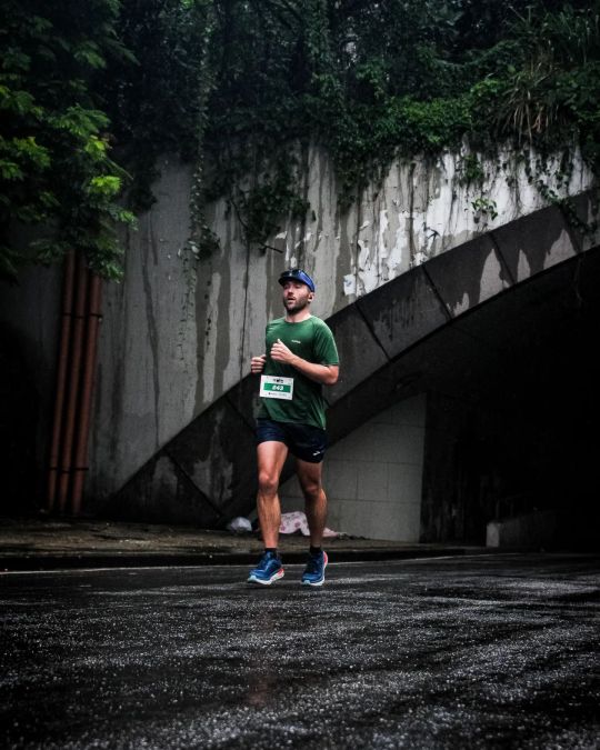
The Rio de Janeiro Marathon, my first official marathon (i.e. a marathon distance ran instead of hiked as part of an event) is officially behind me. TL;DR: went about as well as I expected it would. 🏁 Finished, which was the primary objective (also didn't end up in medical tent at the finish which I suppose was a side quest) 🏃♂️ Managed to run the entire time which was secondary objective (the word run here used liberally to describe anything greater than a walk) 🌧 It rained literally the entire time (and around mile 17 / km 27 it started POURING for around 30 minutes) 🇧🇷 Ran with one friend made the day before the race and one made within the first 20 minutes of the start for the first 18.6 mi / 30 km (then my legs decided they had had enough of their pace) 👟 My chip time has yet to come through and despite having emailed support, I haven't heard anything back, but my time was 4:05:17 according to my watch (which also reported a distance of 26.52 mi / 42.68 km) 😖 The race overall was not well organized - particularly at the start and end (which were at the same place). Paying for a "VIP" entry was a complete waste of money (fortunately, not much) 🌚 The race started at 5 in the morning with little supplemental lighting through some pitch black stretches (particularly near the Museu do Amanhã) - sunrise was ~6:30 Overall? Was fantastic, would do again. Now just need to figure out how to run 73.8 mi / 118.8 km further in September. #riodejaneiro #maratonadorio
2 notes
·
View notes
Photo
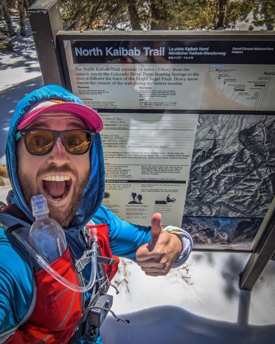
Rim to Rim to Rim in the Grand Canyon - I can't say I'm a huge fan of day hikes, but I am a fan of day-long endurance challenges. Traversing the Grand Canyon twice in a single day? Sounds pretty fun. I think? After parking my car at Bright Angel Trailhead (where I plan to finish), I walk 2.3 mi / 3.7 km to the shuttle stop in Grand Canyon Village where I catch the first shuttle to South Kaibab Trailhead - where I'm beginning my hike. It's dark (and freezing) when I reach the trailhead. I run all the way down to the river and make it to the flushing toilets in Bright Angel Campground just in time (to poop). I'm feeling good, and that's good, because that was the easy part. It's only 6 mi / 9.7 km and change down to the river from South Kaibab Trailhead. It's almost 15 mi / 24 km more to reach the North Rim via the North Kaibab Trail. I'm still feeling good as I begin to climb, but the amount of time I'm spending running, or even jogging, is slowly drawing to a close. It's a slog up to the North Rim, but I make it. I should definitely be eating more. But now it's all downhill again - huzzah! I try to stay inspired and maintain a pace that falls somewhere above my quickest hiking speed and my slowest running speed. Back at Phantom Ranch (at the river), I psyche myself up on some snacks and prepare for the day's final challenge - the climb up the Bright Angel Trail to Bright Angel Trailhead. I climb as the sun slowly, then quickly, dips below the rim. Intent on making it back to the car before it's big dark (not just little dark), I try my hand (legs) at running instead taking it slow. Bad idea; I bonk hard. The final couple thousand feet of climbing take far longer than I had hoped, but eventually (and in the darkness) I make it back to where I began this adventure this morning. I'm now incredibly pleased with my decision to have parked my car and walked the extra miles this morning. Day: South Kaibab Trailhead to North Kaibab Trailhead to Bright Angel Trailhead Distance: 44.19 mi / 71.12 km Elevation gain: 11,234 ft / 3,424 m #GrandCanyonNationalPark #Arizona
1 note
·
View note
Photo
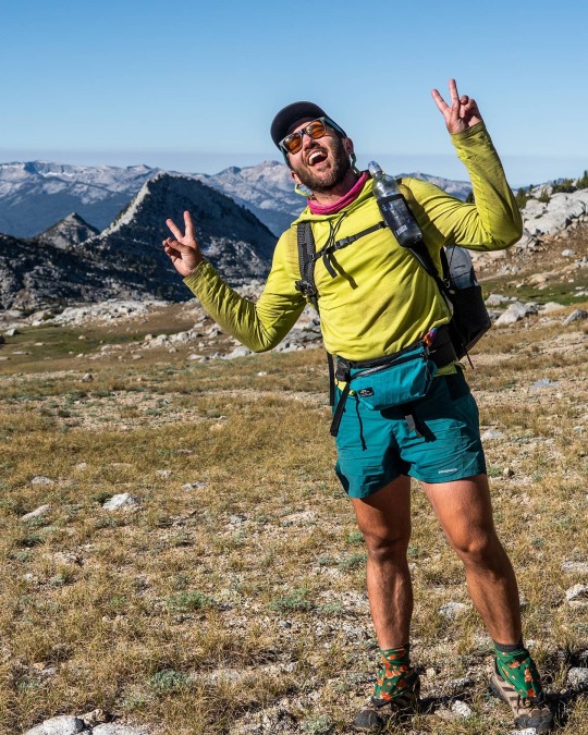
Kings Canyon High Basin Route Day 8: Our last morning on the route begins early and without many bugs - I guess they're all down feasting further west on Pacific Crest Trail and John Muir Trail hikers. I've already hiked this section of the route, but in the opposite direction; it's the same between camp (State Lakes) and Road's End (where we'll finish and, hopefully, find the car @simajohnr and I left there a week ago). It's another cold morning and we're hiking in our jackets and gloves until we begin the final climb up to Goat Crest Saddle at around 4.5 mi / 7.2 km in. From this vantage point (and our high point of the day), we can see our next destination, and final pass on the route, Grouse Lake Pass. The hiking is easy over to the pass, and after a short descent and a little more cross-country travel, we're on the Copper Creek Trail. This trail leads us all the way down, another 5,000+ / 1,524+ m, to Road's End. The hike up this trail was a beast, and I'm expecting it to take a while to get down. However, the time flies and we make excellent time down to the car. We made the mistake of not leaving ourselves any rewards at the trailhead (we don't even have water in the car) and it's over an hour drive back to my car at Lodgepole. Fortunately, when we make it there, Lodgepole has a small store open with everything we're looking for (mostly beer and Cheetos). Overall, Kings Canyon High Basin Route, great success. Now it's time to go rehab my lips. Day: State Lakes to Road's End Distance: 16.01 mi / 25.77 km Elevation Gain: 1,872 ft / 571 m #kingscanyonhighbasinroute #kchbr #kingscanyonnationalpark
1 note
·
View note
Photo
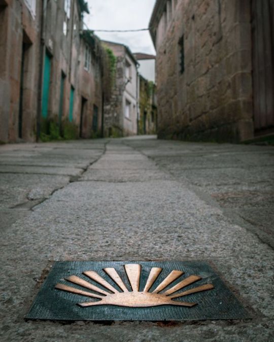
[𝗠𝗮𝗰'𝘀 𝗦𝘁𝗼𝗿𝘆 - 𝗣𝗮𝗿𝘁 𝗫𝗩] At the end of 2018 I was bumming around Europe from friend's couch to friend's couch. Most of the mountains I would have liked to explore were covered in snow and I needed to walk somewhere so I decided to walk the Camino de Santiago from Porto, Portugal to Santiago de Compostella in Spain. I did this walk during the low season and met just four other people walking the Camino during my seven-day journey. It definitely wasn't your typical pilgrim experience. I enjoyed practicing my Portuguese and it was fun seeing the small villages dotting the Portuguese and Spanish countryside. I also enjoyed staying (usually alone) in the albergues and monasteries along the way, but the trip was 90% road walking and it rained nearly every day. I can't say I would recommend it (at least not doing it the way I did). I didn't have any opportunities to camp which was sad, but I also didn't have to carry any food or water for the entirety of the trip since I was constantly passing through towns and villages. There are a lot of different routes available to those wanting to hike the Camino de Santiago, but I don't know if I will be embarking upon another one. Right now, the European route that I'm most interested in is the Pyrenees High Route (Pyrenean Haute Route) and some yet undiscovered trail in Eastern Europe somewhere (and possibly the GR20). But to really get into what Europe has to offer, I'm probably going to need to get more into mountaineering. Friends?
#trilha#saintjamesway#portugal_em_fotos#halfwayanywhere#letsgoplaces#portugalcamino#caminhodesantiago#macinspain#buencaminoperegrino#pilgrim#extremewalking#overland#bomcaminho#stjamesway#caminodesantiago#macinportugal#caminhodesantiagodecompostela#caminosantiagodecompostela#adventuring#wayofsaintjames#roadwalking#oporto#porto#overlanding#igersportugal#santiagodecompostella#caminoportugues#portugal#buencamino#pelegrino
1 note
·
View note
Photo
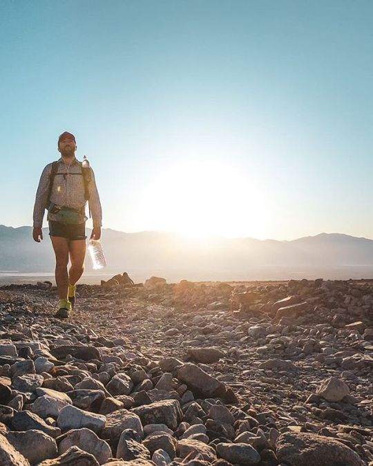
Lowest to Highest Day 2: I had a terrible night’s sleep last night; it turns out there are still plenty of insects active at night this low in the desert (I didn’t set up my shelter). . I begin the morning in the dark with already-warm temperatures. I’m not using trekking poles and so with my free hands I’ve decided to carry my water (instead of carrying it in my pack). I quickly discover that carrying a water bottle with an attached plastic handle is superior to carrying one with a paper handle attached via stickiness (I hope this description makes sense). The attached-plactic-handle bottle is also more structurally sound (this becomes important later in the day as I’m falling on my water bottle attempting to scramble up scree). . I follow a jeep road up Hanaupah Canyon until I find Hanaupah Spring. There’s a ton of water here and it’s more like a stream than a spring, but I’ll take it. There are signs warning that the water here might be contaminated from runoff from illegal cannabis grows in the area, but I’ve yet to hear from any hikers becoming sick from it. Regardless of the water’s status, I still have plenty of water from my first cache. Still, I fill up a gallon (this turns ou to be way too much) in a bottle just in case I need it. . From the spring the route cuts steeply up to a ridge as it climbs toward Telescope Peak. The climb is steep and I can’t find much in the way of use trails and so most of the climb involves trying to find the least-bad way up the mountain. Many hours of scrambling later, the sun is setting and I’ve yet to reach the top. I can still see where I began my hike last night which is a little sad, but eventually I make it to the ridge below Telescope Peak and collapse in the first sheltered campsite I find (it’s very windy). A full day hiking and just 16.72 mi / 26.91 km to show for it - this route is certainly a challenge (that said, there was 10,548 ft / 3,215 m of mostly off-trail elevation gain). . Day: West Side Road to ridge below Telescope Peak Day’s distance: 16.72 mi / 26.91 km Day’s elevation gain: 10,548 ft / 3,215 m . #LowToHighRoute #DeathValleyNationalPark
#deathvalley#l2h#hiking#californiadesert#natureza#lowtohighroute#l2hroute#backpacking#telescopepeak#halfwayanywhere#californiahiking#macincalifornia#socalhiking#extremewalking#mountains#badwaterbasin#lowesttohighest#deathvalleyhiking#hikertrash#hanaupahspring#lowesttohighestroute#deathvalleynp#deathvalleynationalpark#deserthiking#getoutside#desert#hanaupahcanyon#leavenotrace#lowtohigh
4 notes
·
View notes
Photo
I'm not a big fan of holidays (and today, in the United States, for all those unaware, is Valentine's Day - a D-list "holiday" if there ever was one), but I am a huge fan of this girl. Thanks, @paulinadao for pushing me outside my comfort zone, baking me all the breads, showing me how to grow as a person (and a climber), reminding me that worth can't always be measured in miles, and giving me a reason to call somewhere home. And now back to your regularly scheduled programming. ❤
#windriver#hikelife#trilhas#wyominghikes#hiking#montanhas#mountainworld#hikingadventures#hikewyoming#halfwayanywhere#hikers#cirqueofthetowers#mountainliving#trilha#mountainview#macinwyoming#mountainlife#wyoming#outdooradventurephotos#hiker#takeahike#mountainlove#natureza#trek#windriverrange#outdoorlife#jackasspass#登山#hikingtrail
1 note
·
View note
Photo
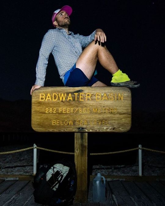
Lowest to Highest Route Day (Night) 1: I've been interested in the Lowest to Highest Route for a while now. It's a route that combines established trails, jeep roads, and off-trail navigation to link Badwater Basin (-278.9 ft / -85 m below sea level) to Mount Whitney (14,505 ft / 4,4𝟐𝟏 m above sea level) - the lowest place in the United States to the highest place in the (Continental) United States. Get it? Lowest to highest. After caching water for myself along the trail (because it turns out that Death Valley doesn't have many natural water sources), @paulinadao drops me off at Badwater Basin - well after dark. I would have preferred to begin hiking during the day, but I am grateful to have gotten a ride all the way out here into what's essentially the middle of nowhere. My hike this first night is short - just 6.91mi / 11.12 km - and takes me across the salt flats and to my first water cache. The days are short, so it will be an early morning tomorrow to head up what I have heard is a long and challenging climb up to the ridge below Telescope Peak. Hopefully, the water source at the end of this canyon is flowing tomorrow (the internets tell me it should be). Day: Badwater Basin to West Side Road Distance: 6.91mi / 11.12 km Elevation gain: 280 ft / 85 m #EXTREMEWALKING #badwater #badwaterbasin #l2h #deathvalley #deathvalleynationalpark #badwaterbasindeathvalley #deathvalleynp #belowsealevel #backpacking #hiking #hikertrash #trekking #deserthiking #california #nighthiking #deathvalleyhiking #ltohroute #outdoorlife #hikes #hiker #lowest2highest #adventuring #lowesttohighest #l2hroute #lowesttohighestroute #packitout #leavenotrace #halfwayanywhere #macincalifornia
#lowesttohighestroute#backpacking#badwaterbasindeathvalley#hikertrash#deathvalleyhiking#adventuring#l2h#outdoorlife#packitout#leavenotrace#hikes#halfwayanywhere#ltohroute#deathvalley#deserthiking#hiking#deathvalleynationalpark#badwaterbasin#lowesttohighest#nighthiking#hiker#extremewalking#lowest2highest#california#belowsealevel#l2hroute#deathvalleynp#trekking#badwater#macincalifornia
2 notes
·
View notes
Photo
I go to the hills when my heart is lonely I know I will hear what I've heard before My heart will be blessed with the sound of music And I'll sing once more . …or something like that. . Photo: @paulinadao . #HolyCrossWilderness #Colorado
#backpacking#coloradolove#summit#macincolorado#getoutside#thegreatoutdoors#coloradotography#halfwayanywhere#choosemountains#wilderness#trekking#optoutside#naturelover#holycross#missourilakes#mountains#hike#colorado#sunset#trail#missourilakestrailhead#visitcolorado#holycrosswilderness#natureza#hiking#coloradohiking#camping#nature#outdoors#coloradogram
4 notes
·
View notes
Photo
Wonderland Trail Day 2: I wake up and get moving before the sun is up after having been reminded yesterday how short the days are becoming (and how scary night hiking is - especially in Sasquatch territory). . There are flushing toilets at Cougar Rock Campground where I camped, but my body (unfortunately?) has never quite gotten onboard the poop-as-soon-as-you-wake-up train. However, my missed flushing-toilet opportunity turns out to be a blessing in disguise as by the time my body’s flipped switch number two, I find an outdoor box toilet (is that what we call these things?) - literally just a raised wooden platform with a toilet seat built into the top of it (see the second photo for details). When’s the last time you got to poop, sitting on what could essentially be described as a toilet, in the middle of the woods, in the rain, without pesky walls imposing their privacy on you? . Today was far more exciting than yesterday as I passed a bunch of vertical rivers (aka waterfalls), got above the tree line, and even got my first glimpses of Mount Rainier (aka the big mountain this entire trail is literally built around). . Despite my early-morning start, I still end up having to night hike. Why don’t I just stop before it gets dark and not complain about having to night hike? Because I don’t have a permit for camping in the backcountry and need to make it to a frontcountry campground to camp legally. That, and I don’t have enough food to extend this trip beyond my planned three days and so I can’t afford to extend this trip. . Day’s distance: 32.71 mi / 52.64 km Day’s elevation gain: 8,784 ft / 2,677 m Day: Cougar Rock Campground to White River Campground . #WonderlandTrail #Washignton
#mountains#getoutside#wonderlandtrail#washingtonstate#pnw#hikewashington#optoutside#halfwayanywhere#visitwashington#trekking#outdoors#trail#macinwashington#washingtonhiking#hike#washingtongram#backpacking#extremewalking#hiking#nationalpark#pacificnorthwest#choosemountains#naturelover#nature#mountrainiernationalpark#washignton#natureza#mountrainier
1 note
·
View note
Photo
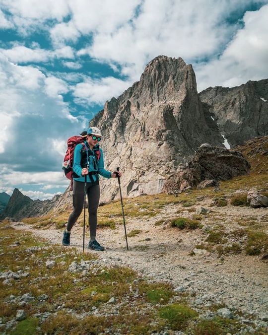
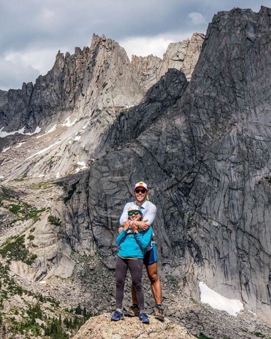
The fact that we needed to drive down nearly 50 mi / 80 km of unpaved roads to get to our trailhead (and the fact that on a greater scale this place is in the middle of nowhere) is probably a good thing. . #WindRiverRange #Wyoming
#bridgertetonnationalforest#hiking#macinwyoming#wyoming#naturelover#halfwayanywhere#camping#hike#outdoors#hikewyoming#getoutside#thegreatoutdoors#windriverrange#wyominghiking#trekking#wyominggram#nature#bridgerteton#windriver#backpacking#trail#natureza#mountains#extremewalking#choosemountains#optoutside#wilderness#nationalforest#visitwyoming
1 note
·
View note
Photo
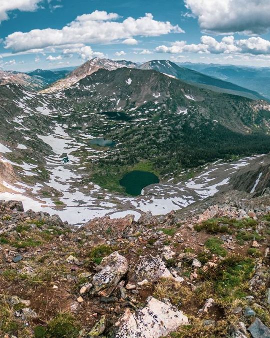
Thru-hiking has been trying to destroy my hiking/camping style by convincing me that a day’s success can be measured only in miles. Fortunately, I made it out into the Holy Cross Wilderness of Colorado with a crew that has shown me that there are other ways to enjoy the outdoors. . The last time I camped in the same spot two nights in a row was on a hike in New Zealand two years ago. Setting up a basecamp and exploring/hiking/climbing all the things might be the way of the future for me. . Can you see my camp? Probably not. Can you guess where it is? Also, probably not. Here’s a hint, @dylan.h.brown told me it would take five hours to get to the summit this photo was taken from. It took 1.5 hours. Love you, DY-LAN! . #HolyCrossWilderness #Colorado
#camping#hiking#macincolorado#backpacking#choosemountains#trail#coloradohiking#naturelover#missourilakestrailhead#nature#visitcolorado#halfwayanywhere#natureza#optoutside#summit#missourilakes#trekking#coloradolove#savagepeak#hike#holycrosswilderness#mountains#thegreatoutdoors#holycross#outdoors#coloradotography#coloradogram#wilderness#getoutside#colorado
1 note
·
View note
Photo
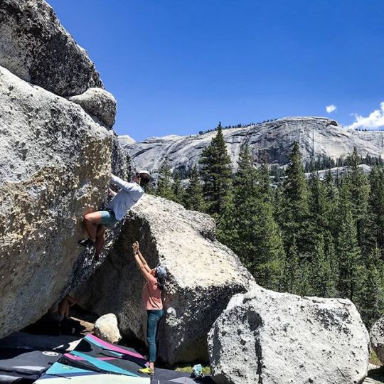
Pacific Crest Trail Day 53: Before heading south back to Los Angeles where I intend on sorting out my life post-PCT, I got up to climbing some rocks in Tuolumne with @paulinadao who yells at me to try hard and makes sure I don't fall and break myself. Climbing more things is high on the list for the months to come (need to get myself ready for Ama Dablam with @teehandles). . I hitch out of Yosemite early in the morning and it takes me three rides to make it 140 mi / 225 km to Lone Pine east of the Sierra along Highway 395. From here, the road splits and the first two cars who stop are heading toward San Diego instead of Los Angeles. I hate turning down rides while hitchhiking as usually things seem to work themselves out no matter whom I take rides with, but these rides seemed to be much too far out of the way. It’s blazing hot and by the time a third car stops, I’m ready to escape the heat no matter where they’re going. . I get into the car and can tell by the gear strewn about the back seat that two two guys in the front are my people. We get talking and I realize that I briefly met them one night a couple weeks ago after heading over Mather Pass. My new friends, Airborne (@jonschwarze) and Legend (@thefreeoutside - who just set a new FKT on the Long Trail), are heading to Kennedy Meadows tonight to stay in a friend’s house. Airborne tells me that tomorrow morning he is heading literally right past where I’m wanting to be dropped off in LA, and that I’m welcome to stay the night with them in Kennedy Meadows. How could I say no? . We make it to Kennedy Meadows and after some beer, some swimming, and some sun, I pass out and sleep through dinner, the night, and into the next morning. A fitting end to this PCT adventure. . Photo: @ceatran . #Sierra #PCT
#hiking#pct2019#backpacking#pcthikers#natureza#tuolumnebourdering#pcta#guthookguides#pacificcresttrail#halfwayanywhere#thruhiking#sierra#extremewalking#pctnobo#tuolumnemeadows#hikertrash#pct#bouldering#trilhas#withguthook#pctig#optoutside#thruhike#sierraneveda#yosemite#pctclassof2019#pacificcresttrail2019#sierrahiking#maconthepct
1 note
·
View note