#Garmin GPS maps GPS devices
Explore tagged Tumblr posts
Visit Tumblr Blog
Explore Tumblr blogs with no restrictions, modern design and the best experience.
Last Seen Tumblr Blogs


Fun Fact
Tumblr was created by web developers David Karp and Marco Arment.
Text
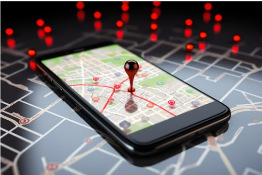
Get Your GPS Update Today - Hassle-Free GPS Update Services
Keep your GPS up-to-date for accurate navigation and stress-free travel, Our GPS update services ensures you always have the latest maps, software, and features. We cater to all major GPS brands like Garmin, TomTom, Magellan, and more.

#GPS update services#how to update GPS devices#Garmin map update#Latest GPS & Maps update services#how to renew gps tracker#how to update garmin gps device#how to update tomtom navigation device#how do I udapte my garmin gps device#how can i update my gps for free
0 notes
Text
Does The Garmin 67i Come With Maps?
Does the Garmin 67i Come With Maps? Have you been eyeing the Garmin 67i and wondering if it includes maps? You’re not alone. Many people considering investing in this highly lauded GPS device are curious about what it comes pre-loaded with. Let’s get into the details and find out everything you need to know about the Garmin 67i and its mapping capabilities. What Is the Garmin 67i? Before we get…
0 notes
Text
What to Do If You Get Lost in the Wild
Even in the age of smartphones and GPS, stories of hikers getting lost in the wilderness still regularly appear in the news. How do people get lost even when carrying their devices, and what should you do if you ever find yourself in that situation? To answer those questions, I called up Creek Stewart, a wilderness survival expert and instructor and a longtime friend of AoM. Creek is the author of numerous books on wilderness survival and has been the host of several Weather Channel shows on the subject, including S.O.S.: How to Survive. Besides his over two decades of survival experience, Creek told me that hosting S.O.S. gave him a unique perspective on how people get lost in the wilderness and what separates those who survive and get rescued quickly from those who flounder. When he hosted the show, he interviewed dozens of folks who had gotten lost in the wild, often in popular national parks filled with other people. Below Creek shares his insights on how anyone can become disoriented when traversing the great outdoors and, more importantly, how to stay safe if it happens to you. Pre-Trip Preparation: How to Ensure Your Quick Rescue in the Event You Get Lost Creek says there are three things you can do before your trip that, should you manage to get lost during it, will dramatically increase your chances of a quick rescue and a safe return: 1. Tell people where you’re going and when to expect you back. Do this even if you’re going on a simple day hike near your home. 2. Ensure your phone is fully charged and bring a power bank. If you plan on using a digital app/map to guide your hike, you’ll of course want to make sure your phone is fully charged and has a backup power source as well. A phone is of no use if it doesn’t have power. People get lost, their phones die, and they can’t figure out where they are and how to get back on track. A dead phone not only contributes to getting lost, but prevents a quick rescue as well. Creek told me the one thing that all the people who had a slow rescue had in common was that they went out into the wild without a fully charged phone and without a way to power it back up. “The people who got found quickly typically had a fully charged phone, so when they got lost, they could make a call or at least put out a distress signal with GPS,” he told me. If you’re looking for a power bank for outdoor excursions, I like and use the S.A.B.A.N.I. Portable Charger 35000mAh Power Bank. You can charge your iPhone up to five times with this power bank. 3. Consider carrying a Personal Locator Beacon (PLB). Creek recommends buying a PLB or satellite communicator. While they’re pricey and require a subscription, they will allow you to send a distress signal and share your GPS location even when you don’t have cell service. Garmin makes two satellite communicators: * Garmin inReach Messenger Handheld Satellite Communicator. This device is also a Personal Locator Beacon, and it works with your smartphone, so you can text even when you don’t have cell service. * Garmin inReach Mini 2. It allows you to text and also has maps and weather forecasts. It’s more expensive than the original inReach due to those additional features. Doing those three things before you leave for your trip will ensure you get found within 24 hours of getting lost in the wild. In addition to doing those three things, Creek also recommends that you dress appropriately for the climate and bring some essential gear for any wilderness outing, even a short day hike. Pack the essentials we list here. Having those things on you in the event you get lost will help you stay safe and comfortable in the outdoors while you’re waiting to be found. The Psychology of Getting Lost If you stay on marked trails when you’re out in nature, your risk of getting lost is very low. Before you begin a hike, download an offline map on your phone in case you don’t have cell service. Again, make sure you have a power charger. And carry a paper map as a backup, too. According to… http://dlvr.it/TCRdLG
4 notes
·
View notes
Text
October and November can be challenging months for hiking in the Cascade Mountains.
With such a great range of elevation, you can be walking in fog near sea level, rain only 2,000 feet above sea level, snow above 5,000 feet above sea level, and then if you climbed higher you might even get above the clouds into bright sunshine.

In the national parks, like Mount Rainier, Olympic and North Cascades, you might drive in the park’s entrance in a pleasantly cool temperature but find it freezing at your trailhead. Besides being prepared with clothing and insulation, this also means that snow might cover your trail.
Except for the Pacific Crest Trail, no trails in Mount Rainier National Park are marked on trees. It is only the beaten path for guidance. Or is there more?

If you have a GPS device (global positioning system), such as a Garmin or other brand, you could load up the trail data ahead of time and have the device guide you when the trail is blanketed by snow. Battery power, especially in cold temperatures, can be key to keeping these working in order to get back to your motor vehicle.
Another option would be a paper map and a compass, if you have learned and trained on how to use those to orienteer across the landscape. These can be especially nice since they don’t require batteries or cell towers.

Some folks decide to use apps on their cell phones. Those can be handy and easy to use but you have to make sure the app you chose doesn’t rely on cell towers being within reach. There are many places in the park that have no service. Like the GPS device, these also need plenty of battery power and might lose their charge fast in cold weather.
What do you prefer to use when you go out for a snowy adventure in the national park?
Are you a person with a device and back-up batteries? Do you prefer paper maps and compass?
Or how about device and paper map and a compass? Having and knowing how to use all 3 isn’t a bad thing. ~ams
For more on the 10 Essentials, this website can help https://www.nps.gov/articles/10essentials.htm To find links for Mount Rainier specific weather forecasts try this website https://www.nps.gov/mora/planyourvisit/weather.htm
NPS Image. Mount Rainier National Park map from 1931. NPS Photo. Image from Mount Rainier National Park Air Quality webcam March 11, 2020. https://www.nps.gov/subjects/air/webcams.htm?site=mora NPS/S. Redman Photo. Fall colors of yellow and red on subalpine meadow in Paradise. Snow on evergreens in background. October, 2009.
19 notes
·
View notes
Text
The Best Guide to GPS Location Software Systems
Whether you're a logistics company tracking shipments, a parent keeping an eye on your child's whereabouts, or a traveler exploring new destinations, GPS location software can enhance your daily life. In this comprehensive guide, we will delve into the world of GPS location software systems, exploring their features, applications, and the top options available.
Understanding GPS Location Software Systems
GPS, which stands for Global Positioning System, is a network of satellites that orbit the Earth. These satellites transmit signals to GPS receivers, which then calculate their precise geographic location. GPS location software systems harness this technology to provide real-time tracking, mapping, and navigation services.
Key Features of GPS Location Software Systems
Real-Time Tracking: GPS location software can track the movement of people, vehicles, or assets in real time, providing up-to-the-minute location data.
Mapping and Navigation: These systems offer detailed maps and turn-by-turn navigation instructions, making it easier to reach your destination.
Geofencing: Geofencing allows users to define virtual boundaries on a map. When a tracked object enters or exits these boundaries, the software sends alerts or triggers specific actions.
History and Reporting: Users can access historical location data and generate reports to analyze past movements and trends.
Customization: Many GPS location software systems allow users to customize their tracking experience, including map views, alert settings, and reporting parameters.
Applications of GPS Location Software
1. Fleet Management:
GPS location software is a vital tool for businesses with vehicle fleets. It helps optimize routes, monitor driver behavior, and enhance overall operational efficiency.
2. Personal Safety:
Parents use GPS location software to keep tabs on their children's whereabouts, ensuring their safety. It's also beneficial for elderly family members or individuals with cognitive impairments.
3. Outdoor Activities:
GPS software aids hikers, campers, and outdoor enthusiasts in navigating unfamiliar terrain, preventing them from getting lost.
4. Asset Tracking:
Businesses can use GPS location software to track valuable assets, such as construction equipment, containers, and high-value shipments.
5. Emergency Services:
GPS location is crucial for first responders, as it helps them locate accident scenes and people in need of assistance more quickly.
Top GPS Location Software Systems
Google Maps: Widely used for navigation and location sharing, Google Maps offers a user-friendly interface and real-time traffic data.
Waze: Known for its community-driven features, Waze provides real-time traffic and road information based on user contributions.
GPSWOX: A versatile GPS tracking platform suitable for both personal and business use, offering customizable maps and geofencing features.
Geotab: Ideal for fleet management, Geotab provides comprehensive insights into vehicle performance and driver behavior.
Life360: A popular choice for family tracking, Life360 offers location sharing, safety features, and driving reports.
Garmin: Known for its GPS navigation devices, Garmin also offers a range of software solutions for various applications.
Traccar: An open-source GPS tracking platform, Traccar is highly customizable and suitable for businesses looking to build their tracking solutions.
Conclusion
GPS location software systems have transformed the way we navigate the world and manage our assets. Whether you're a business owner looking to streamline operations or a parent concerned about your child's safety, the right GPS location software can make a significant difference in your daily life. By understanding the features and applications of these systems, you can choose the best option to meet your needs and make the most of this powerful technology.
4 notes
·
View notes
Text
A Guide to the Best GPS Watches in India
GPS watches are no longer just tools for athletes and outdoor enthusiasts—they have become essential gadgets for anyone who values precision, convenience, and advanced features. From tracking your fitness progress to navigating unknown trails, the best GPS watches combine style and functionality. Whether you're a runner, hiker, or tech-savvy individual, finding the right GPS watch in India is easier than ever.
What Is a GPS Watch?
A GPS watch is a wearable device equipped with Global Positioning System technology. It tracks your location, speed, and distance in real-time. Ideal for sports, fitness, and adventure activities, these watches also offer features like heart rate monitoring, route mapping, and weather updates.
Why Choose a GPS Watch?
Precision Tracking
Ideal for runners, cyclists, and swimmers, GPS watches provide accurate data on distance, pace, and routes.
Versatility
From urban landscapes to mountain trails, GPS watches are designed to handle various environments.
Fitness and Health Features
Many GPS watches come with built-in fitness tracking, sleep monitoring, and heart rate sensors.
Durability and Style
Modern GPS watches offer rugged designs for outdoor activities while maintaining sleek aesthetics for everyday wear.
Top Features to Look for in the Best GPS Watches
Accuracy
Look for watches with multi-GNSS support (e.g., GPS, GLONASS, Galileo) for enhanced precision.
Battery Life
Essential for long-distance activities, especially during marathons or hikes.
Activity-Specific Modes
Tailored settings for running, cycling, swimming, and hiking.
Water Resistance
A must-have for swimmers and those participating in water sports.
Smartwatch Features
Notifications, music control, and payment options for convenience.
Best GPS Watches in India
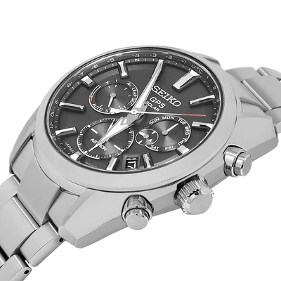
Garmin Forerunner Series
Known for advanced tracking features and activity-specific profiles, it’s perfect for athletes.
Apple Watch Series
Combines GPS functionality with smartwatch capabilities, offering fitness tracking and seamless iPhone integration.
Samsung Galaxy Watch
A stylish option with reliable GPS tracking and versatile fitness features.
Amazfit T-Rex Pro
Durable and affordable, ideal for outdoor enthusiasts.
Suunto Core
Offers robust features like altimeter, barometer, and compass along with GPS tracking.
GPS Watch Price in India
Prices for GPS watches vary widely based on brand and features:
Entry-Level GPS Watches: ₹5,000–₹10,000 (e.g., Amazfit Bip, Realme Watch).
Mid-Range GPS Watches: ₹15,000–₹30,000 (e.g., Garmin Instinct, Samsung Galaxy Watch).
Premium GPS Watches: ₹30,000–₹1,00,000+ (e.g., Garmin Fenix, Apple Watch Ultra).
Where to Buy GPS Watches in India
Online Stores: Amazon, Flipkart, and official brand websites offer a wide range of options with detailed reviews.
Retail Stores: Visit authorized showrooms for hands-on experience and expert guidance.
Conclusion
Whether you’re an athlete striving for peak performance or someone who loves exploring the outdoors, a GPS watch is an invaluable companion. With top-notch options available in India, finding the best GPS watch to suit your lifestyle and budget has never been easier.
0 notes
Text
How to Update Garmin GPS?
Need assistance with How to Update Garmin GPS? No worries! To do so, open the Garmin Express app on your smartphone and then download the available update of the device. Now, follow the on-screen instructions for the further procedure. To know the entire upgrade process in detail, get in touch with our professionals on our website freely!

0 notes
Text
Watch, Laser or both?
November is a wonderful time of year filled with crisp mornings and bright midday sunshine. But the darkness in the afternoon can certainly creep up on us.
Throughout the colder months, there’s a finite window of visibility on the golf course, and we’re often racing against the coming sunset to get those last few holes in.
These quick-paced holes are often rushed with plenty of guesswork as we try to beat the encroaching darkness, but the latest golf tech from Garmin can help us make the most of the twilight hours on the golf course.
Instant information with Golf GPS

It can be harder to detect distances with the naked eye, especially when the light is fading. It can also be hard to judge your shot distance by feel alone, and feel you’ve definitely got the right club for the shot in hand.
You can put all that uncertainty to rest however when you play golf with a Garmin laser rangefinder or golf GPS watch. These gadgets give you almost instant information when you use them to size up how far away the green is.
Instead of umming and ahing on whether you should be playing your approach shot with a 7 iron or an 8 iron, only to pick the wrong one and hit your shot too short or long, you’ll know your shot is exactly 138 yards and perfect for your 7 iron. Knowing the exact distance will give you total confidence to commit to your shot.
Watches, lasers, or both?

So, which distance measuring device is right for you? All the latest Garmin golf GPS devices are packed with fascinating tech to help you succeed on the golf course.
Garmin’s laser rangefinders are an excellent choice of device if you want to see as much of the course as possible. These handy devices take just a moment to hold in your hand and direct towards your target. Once locked on, they’ll give you a distance reading from up to 600 yards away – that’s even the longest par 5 holes pretty much covered!
Just as fantastic to use are golf GPS watches. These go beyond typical fitness trackers and smartphone apps and are primarily built for use on the golf course. The latest watches from Garmin have glossy colour touchscreens that display maps of upcoming greens in vivid detail.
So which one do you go for, and what are the benefits of using them both? Well, laser rangefinders give you complete pinpoint accuracy so you’ll know the exact distance to the flag, while GPS watches provide you with distance info to the front, middle, and back of each green.
Having the distance to the hole and each section of the green mapped out ahead of you will give you an excellent understanding of how best to plan your approach into the green. You’ll know the exact distance to each slope of the green as well as nearby hazards on every hole. You can never have too much info, and you’ll instantly benefit from pairing these devices together.
Join us as we cover the latest products from Garmin, and explain the benefits of adding them to your bag.
The Garmin laser rangefinders

The Z82 laser features Garmin’s Green View and Hazard view to give you a greater visual understanding of the hazards and dangers featured on the hole ahead of you. It also comes with Playslike mode that adjusts yardage readings by taking into account wind direction, so you can better appreciate the impact the conditions will have on your game.

The Garmin Approach S70 GPS watch
vimeo

Garmin’s enhanced golf course maps appear in vivid vibrant detail and allow you to zoom in on small intricate details. The AMOLED watch face displays all sorts of fascinating data, and the device even comes with a virtual caddie mode. With a multitude of bonus fitness features, if you live an active lifestyle, this watch will be perfect for you.

The Garmin Approach G12
vimeo
An excellent budget-friendly option that you can conveniently hold in one hand, the Approach G12 is a compact tablet that gives you super reliable yardage readings on a crisp no-nonsense high-resolution screen.

With both an IPX7 water-resistance rating and a sunlight-readable screen, the device is perfectly usable in all kinds of weather conditions. With various mounting options including a clip-on back and lanyard loop, this handy gadget can be worn and carried exactly how you’d like it.
Packing your bag with one or more of these devices will give you one less thing to worry about on the course. If you’re on the hunt for a new golf GPS device and you’re unsure of which one to settle on, we’d be happy to consult you in the pro shop.
1 note
·
View note
Text
Best Smartwatch for Working Men: Top Choices & Features
Introduction
In today’s fast-paced world, best smartwatch for working men has transformed from being just tech gadgets to becoming essential tools for working men. These devices blend fitness tracking, productivity tools, and connectivity into a single, compact accessory that supports busy lifestyles. For professionals balancing packed schedules, a smartwatch can be invaluable. However, with so many options available, finding the ideal smartwatch for working men can be challenging. This article explores the top smartwatch options and the features that make them suited to modern working professionals.

Essential Features of a Smartwatch for Working Men
For a smartwatch to serve the best smartwatch for working men effectively, it should combine productivity tools, health tracking, durability, and style. Key features include the ability to receive notifications, track fitness activities, monitor heart health, and offer GPS functionality. Battery life and compatibility with essential apps also play a critical role, ensuring the device blends seamlessly into a demanding workday. With these features, working men can stay organized and connected without constantly relying on their smartphones.
Benefits of Using a Smartwatch at Work
The best smartwatch for working men boost productivity by allowing quick access to notifications, messages, and calendar reminders, reducing the need for constant phone-checking. Health tracking features encourage an active lifestyle by monitoring steps, workouts, and heart rate, which is beneficial for those spending long hours at work. Additionally, smartwatches with voice assistants enable hands-free communication, allowing professionals to stay connected even in meetings or while on the go.
Apple Watch Series 8: Premium Choice for Professionals
The Apple Watch Series 8 shines with its sophisticated design, advanced health tracking, and seamless iPhone compatibility. It offers ECG, blood oxygen monitoring, and comprehensive best smartwatch for working men tracking, making it an ideal choice for health-conscious professionals. With GPS functionality, it’s a versatile device for working men seeking an all-in-one tool. However, frequent charging may be needed due to shorter battery life, so it’s best suited for those who don’t mind regular charging routines.
Samsung Galaxy Watch 5 Pro: Best for Android Users
Ideal for Android users, the Samsung Galaxy Watch 5 Pro combines a robust design with extensive fitness tracking capabilities. With a large screen, rugged build, and advanced sensors for physical activities, it provides durability and functionality. Health monitoring tools such as ECG and sleep tracking make it a strong choice for busy professionals. Additionally, the watch offers long battery life and reliable connectivity, making it an excellent option for those frequently on the move.
Garmin Fenix 7: The Outdoor Enthusiast’s Choice
For professionals with a passion for outdoor activities, the Garmin Fenix 7 is an ideal choice. It offers accurate GPS, topographical mapping, and a durable build suited for adventures. With Garmin’s comprehensive fitness tracking and health metrics like blood oxygen and heart rate monitoring, it’s tailored for high-performance lifestyles. Plus, its long battery life is a bonus for those who need a device that can keep up with both work and leisure activities.
Fitbit Sense 2: For the Health-Conscious Professional
The Fitbit Sense 2 caters to health-focused professionals with its comprehensive health metrics, including ECG, stress monitoring, and skin temperature tracking. This best smartwatch for working men offers productivity support with notifications and calendar integration, along with guided breathing sessions for relaxation. For working men prioritizing wellness, the Sense 2 provides a solid balance of health tracking and work-supporting features at an affordable price.
Amazfit GTR 4: Budget-Friendly Yet Reliable
For professionals on a budget, the Amazfit GTR 4 is packed with essential features, making it a reliable choice. It tracks fitness and health metrics, provides notifications, and offers decent battery life. Its sleek design and lightweight build make it comfortable for daily use. Though it may lack some premium features, it covers the basics of health and productivity well, making it a practical choice for work-life balance.
Fossil Gen 6: Style Meets Functionality
For men who value aesthetics, the Fossil Gen 6 combines style with useful features like heart rate tracking, Google Assistant, and customizable watch faces. It’s compatible with both Android and iOS, adding to its versatility. The Fossil Gen 6 also supports popular productivity apps, helping professionals manage tasks efficiently while maintaining a sophisticated look.
TicWatch Pro 3 Ultra GPS: Battery Champ
The TicWatch Pro 3 Ultra GPS is perfect for professionals needing extended battery life, lasting up to three days in Smart Mode. This best smartwatch for working men is ideal for those who can’t charge daily. It offers fitness tracking, heart rate monitoring, and GPS, while its dual-layer display allows users to switch between essential and advanced modes to conserve battery, making it a solid choice for demanding work schedules.
Polar Grit X Pro: For the Fitness-Oriented Executive
Polar Grit X Pro provides advanced fitness tracking within a durable design, making it a good match for active best smartwatch for working men. With precise heart rate monitoring, GPS, and rugged build, it’s perfect for executives who love outdoor workouts. The watch’s recovery insights also help busy professionals balance work and health, offering a well-rounded approach to wellness.
Suunto 7: Adventure-Ready with Google Fit Integration
For those who enjoy post-work outdoor activities, the Suunto 7 is equipped with Google Fit integration, offline map options, and a high-resolution display. With a rugged design and reliable fitness tracking, it’s ideal for active professionals. The option to download maps is convenient for hiking or biking, supporting a healthy work-life balance.
Tag Heuer Connected: Luxury Choice for Executives
The Tag Heuer Connected is a luxury option for professionals looking for elegance combined with cutting-edge technology. Running on Google Wear OS, this best smartwatch for working men features customizable dials and high-quality materials such as titanium and ceramic. Though a high-end investment, it offers productivity tools and health tracking, making it a functional accessory for executives who prioritize both style and performance.
Huawei Watch GT 3 Pro: All-Day Battery Life
Known for its impressive battery longevity, the Huawei Watch GT 3 Pro lasts up to two weeks on a single charge. This smartwatch offers comprehensive health tracking, GPS, and notification management, making it ideal for professionals needing reliable performance. Compatible with both Android and iOS, it’s a versatile choice for working men who need an enduring device.
Casio Pro Trek Smart WSD-F30: Durable for Harsh Environments
Built for rugged use, the Casio Pro Trek Smart WSD-F30 is a top choice for professionals in demanding environments. With military-grade durability, waterproofing, and GPS functionality, it handles high-performance demands effortlessly. The design emphasizes endurance, making it ideal for men whose work requires resilience in both their tools and their accessories.

FAQs
Why is battery life important in a smartwatch for working men?
Battery life is essential to ensure the best smartwatch for working men operates throughout working men without frequent charging. With long battery life, professionals can enjoy uninterrupted health monitoring, GPS, and notification management, staying connected without constant charging.
What health tracking features are essential for working men?
Health tracking features like heart rate monitoring, sleep tracking, and stress management are vital. These tools enable professionals to maintain wellness by providing insights into physical and mental health, promoting a balanced lifestyle amidst busy schedules.
Which smartwatch is best for frequent travelers?
Smartwatches with long battery life, GPS, and durability are ideal for frequent travelers. Models like the Garmin Fenix 7 and Huawei Watch GT 3 Pro offer robust battery life and reliable health tracking, ensuring dependable performance across various time zones.
0 notes
Link
Best Garmin deals for Amazon Prime Day We may generate revenue from ... https://healthyfamz.com/best-garmin-deals-for-amazon-prime-day/?feed_id=2215&_unique_id=670b1adf09359 #Evergreen #Exercise #Family #Fitness #Indoor #Outdoor #Recreation #Trade #Workouts
0 notes
Text
Mastering Adventure Motorcycle Navigation: Essential Tools and Tips for Your Next Journey
Why Motorcycle Navigation is Crucial
Adventure riding often takes you to remote areas where signposts are sparse, phone signals are unreliable, and road maps become outdated quickly. Unlike cars, adventure bikes demand a specialized approach to navigation, one that factors in rugged terrains, unpredictable weather, and the need for real-time decision-making.
Essential Tools for Adventure Motorcycle Navigation
Dedicated Motorcycle GPS Units
A reliable motorcycle GPS is a must-have for any serious adventurer. Unlike standard car GPS systems, these are designed to withstand the elements—dust, water, and extreme temperatures. The most popular units, such as the Garmin Zumo series or the TomTom Rider, offer advanced features like topographical maps, real-time traffic updates, and off-road route planning.
Modern GPS devices often have glove-friendly touchscreens, making it easy to navigate while riding. Additionally, their robust mounting systems ensure they stay in place even on the roughest trails. Some also come with Bluetooth compatibility for turn-by-turn directions through your helmet speakers.
Smartphone Apps
While a dedicated GPS system is invaluable, adventure motorcycle navigation smartphones can also be an excellent backup or even a primary navigation tool. Apps like Google Maps, Gaia GPS, or Rever offer detailed maps, turn-by-turn navigation, and route planning specifically for motorcyclists.
For off-road adventures, you can download offline maps through apps like OsmAnd, which allows you to navigate without a cellular connection. However, keep in mind that smartphones are more susceptible to environmental hazards, so investing in a rugged phone mount and weatherproof case is essential.
Paper Maps and Compass
Even in the digital age, having a paper map and compass as a backup is a smart move. Technology can fail—whether it's a drained battery, device malfunction, or loss of signal in remote areas. Paper maps give you a physical overview of your route and surroundings, offering clarity when all else fails. They can also help you see the bigger picture, like nearby towns or gas stations, that GPS might not highlight.
Route Planning Software
Pre-trip planning is just as important as on-the-road navigation. Tools like BaseCamp (for Garmin) or MyRoute-app allow you to create detailed routes, mark points of interest, and download maps for offline use. Planning in advance gives you the freedom to explore with confidence, knowing that you’ve already accounted for fuel stops, rest areas, and potential obstacles.

Key Tips for Successful Adventure Motorcycle Navigation
Study the Terrain Before You Leave
Before setting off on an adventure, familiarize yourself with the terrain. Check elevation changes, weather conditions, and the general difficulty level of the route. Websites and forums dedicated to adventure riding, like ADV Rider or Horizons Unlimited, are great resources for getting tips from other riders who have been there.
Stay Updated on Road and Trail Conditions
Adventure routes can change rapidly, motorcycle adventure gps especially in areas affected by weather, roadworks, or natural events. Use your navigation tools to check for road closures, detours, or any other changes before you hit the road. Some GPS units and apps provide live traffic and weather updates, which can be crucial when navigating challenging terrain.
Mark Key Landmarks
Along your route, mark essential landmarks, such as gas stations, food stops, or scenic viewpoints. This not only helps with navigation but also ensures you don’t miss out on significant points of interest during your adventure. Even if you prefer spontaneity, knowing where you can stop for a refill or a rest is always helpful.
Pack Extra Batteries and Charging Tools
A dead device in the middle of nowhere can spell disaster. Always carry extra batteries or a power bank for your GPS or smartphone. Consider equipping your motorcycle with a USB charging port or solar-powered charger to keep your devices powered throughout the journey.
Trust Your Instincts and Adapt
No matter how well you plan, adventure motorcycling is about adapting to the unexpected. Sometimes, the best routes are the ones you discover on the fly. Trust your instincts, be open to detours, and don’t be afraid to explore paths that might not be on the map.
0 notes
Text
Keep Your Navigation Accurate with GPS Update Services in US
Stay informed with the Latest GPS & Maps update services on roads, highways, and traffic patterns, Enhanced navigation, Avoid detours and find the quickest routes with updated data.
#GPS update services#how to update GPS devices#Garmin map update#Latest GPS & Maps update services#how to renew gps tracker#how to update garmin gps device
0 notes
Text
Why Every Adventurer Needs the Garmin inReach Messenger Plus
In an age where connectivity is often taken for granted, adventurers venturing into remote landscapes face a unique challenge: staying connected in the great outdoors. Whether you're trekking through rugged mountains, kayaking down remote rivers, or camping deep in the woods, the Garmin inReach Messenger Plus serves as an essential lifeline to the world. This innovative device not only keeps you connected but also provides peace of mind, knowing that help is just a message away.

Unmatched Communication Capabilities
One of the standout features of the Garmin inReach Messenger Plus is its comprehensive communication capabilities. Equipped with two-way messaging, this device allows users to send and receive text messages, ensuring you can stay in touch with friends and family, even when cellular service is nonexistent. The intuitive interface makes composing messages simple, and it even supports sending messages to email addresses and other inReach devices.
In addition to messaging, the inReach Messenger Plus offers a unique SOS feature. In the event of an emergency, you can trigger a 24/7 SOS alert to a dedicated monitoring center. This means that regardless of where you are, help can be dispatched quickly, giving adventurers an invaluable safety net in unfamiliar or challenging terrains.
Rugged and Reliable Design
Adventure is often unpredictable, which is why the Garmin inReach Messenger Plus is built to withstand the elements. With a rugged exterior that is both water-resistant and impact-resistant, this device can handle the harshest conditions. Whether you're caught in a rainstorm, navigating rocky trails, or facing the dust of a desert hike, the inReach Messenger Plus is designed to endure.
Furthermore, its compact size makes it easy to carry. Weighing in at just a few ounces, it can be attached to your backpack, belt, or even tucked away in a pocket without adding significant bulk. This portability is essential for adventurers who prioritize lightweight gear.
Long Battery Life for Extended Expeditions
One of the most crucial aspects of any outdoor device is battery life. The Garmin inReach Messenger Plus excels in this department, boasting an impressive battery life that can last up to 14 days in tracking mode. This means that even on extended trips, you won’t have to worry about running out of power when you need it most.
In addition, the device offers various power-saving modes, allowing you to customize the settings based on your expedition's needs. Whether you're on a short weekend hike or a long-distance trek, the inReach Messenger Plus can adapt to your journey, ensuring you remain connected throughout.
Seamless Photo Sharing
Another noteworthy feature of the Garmin inReach Messenger Plus is its ability to share photos. In today's world, sharing experiences instantly is part of the adventure. With this device, you can capture memorable moments and send them to your loved ones, making them feel connected to your journey. This feature is particularly appealing for adventurers who enjoy documenting their travels and sharing their stories with friends and family
.
Comprehensive Mapping and Navigation
While communication is essential, navigation is equally important for adventurers. The Garmin inReach Messenger Plus includes built-in GPS functionality that provides accurate location tracking and mapping. This feature is crucial when navigating through unfamiliar territories, as it helps you stay oriented and find your way back if you stray off the beaten path.
Additionally, the device integrates seamlessly with the Garmin Explore app, which allows users to plan trips, download maps, and access routes. This comprehensive navigation system enhances the overall outdoor experience, allowing you to focus on enjoying your adventure without worrying about getting lost.
User-Friendly Interface
Despite its array of advanced features, the Garmin inReach Messenger Plus boasts a user-friendly interface that makes it accessible for adventurers of all skill levels. The bright, clear display allows for easy readability, even in direct sunlight. Navigating through the various functions is intuitive, ensuring you can access the features you need quickly, without fumbling around in a crisis.
Subscription Plans for Flexibility
To maximize the potential of the Garmin inReach Messenger Plus, it’s important to note that the device requires a subscription plan for satellite communication. Garmin offers a range of flexible subscription options, allowing users to choose a plan that best fits their adventure frequency and communication needs. Whether you’re a casual weekend hiker or a frequent explorer, there’s a plan tailored for you, ensuring you get the most value out of your device.
Enhanced Peace of Mind
The true value of the Garmin inReach Messenger Plus lies in the peace of mind it provides. Knowing you can communicate with the outside world and summon help in an emergency transforms your outdoor experiences. It allows you to venture farther and explore more confidently, knowing that you’re equipped with a reliable lifeline.
Moreover, sharing your location with loved ones can ease their concerns while you’re off the grid. The ability to update them on your status and whereabouts makes for a more enjoyable adventure for both you and your family, ensuring everyone feels secure.
Conclusion
In the world of outdoor exploration, staying connected is paramount, and the Garmin inReach Messenger Plus is the ultimate solution for adventurers. With its robust communication features, rugged design, long battery life, and seamless navigation capabilities, this device truly stands out in the marketplace. It caters to adventurers of all levels, providing the tools needed to safely and confidently explore the great outdoors.
Don’t let the great outdoors keep you disconnected. Equip yourself with the Garmin inReach Messenger Plus and experience the freedom to roam, knowing that help is always just a message away. Whether you’re tackling your next big adventure or simply enjoying a weekend getaway, this device is an indispensable companion that can enhance your outdoor experience and ensure your safety. For every adventurer, the Garmin inReach Messenger Plus is not just a tool; it's a vital piece of equipment that turns the unknown into the unforgettable.
0 notes
Text
What Maps Come With Garmin 67i?
Have you ever wondered what maps come with the Garmin 67i? If you’re considering this GPS device for your outdoor adventures, you’re in the right place. Navigating the world of GPS devices and their features can be a bit overwhelming, but we’re here to make it easier for you. By the end of this article, you’ll know exactly what maps to expect with the Garmin 67i and how they can enhance your…
0 notes
Text
Discover the Best GPS Watches in India: Precision Meets Performance
In today’s fast-paced world, a GPS watch is more than just a timekeeping device—it’s a tool that enhances your lifestyle, whether you’re an avid runner, a hiker, or someone who enjoys exploring the outdoors. GPS watches offer a range of features that make them indispensable for tracking your location, monitoring your fitness activities, and even navigating unfamiliar terrains.

When it comes to finding the best GPS watches in India, there are several top brands and models to consider. These watches are designed with advanced GPS technology, ensuring accurate location tracking and route mapping. In addition to GPS functionality, many of these watches come equipped with heart rate monitors, activity tracking, and even smart notifications, making them versatile companions for both sports enthusiasts and everyday users.
Some of the best GPS watches available in India offer excellent battery life, which is crucial for long outdoor adventures. Brands like Garmin, Suunto, and Amazfit are renowned for their GPS watches, providing a perfect blend of functionality, durability, and style. Whether you need a watch for marathon training or mountain trekking, there’s a GPS watch tailored to your needs.
Shopping for GPS watches online in India gives you access to a wide selection of models and price ranges. You can easily compare features, read customer reviews, and find the best deals on top-rated GPS watches. With options ranging from budget-friendly models to high-end devices packed with advanced features, finding the best GPS watch in India has never been easier.
Invest in a GPS watch and elevate your outdoor experiences with precision, reliability, and style.
0 notes
Text
10 Best Motorcycle Gifts for Men: Top Picks for Riders in 2024

Are you searching for the perfect gift for the motorcycle enthusiast in your life? Whether it's for a birthday, anniversary, or just because, finding a gift that resonates with their passion for riding can be a challenge. To help you out, we've curated a list of the 10 best motorcycle gifts for men in 2024. These gifts range from practical gear to stylish accessories, ensuring you'll find something that every rider will appreciate.
1. High-Quality Motorcycle Jacket
A durable and stylish motorcycle jacket is a must-have for any rider. Look for jackets made from leather or advanced textile materials that offer both protection and comfort. Brands like Alpinestars, Dainese, and Rev'It! offer top-notch options with built-in armor and ventilation systems to keep riders safe and comfortable on the road.
2. Bluetooth Motorcycle Helmet Communication System
Enhance the riding experience with a Bluetooth communication system. These devices allow riders to stay connected with their riding partners, listen to music, and take calls without taking their hands off the handlebars. Popular brands include Sena and Cardo, known for their reliability and ease of use.
3. Motorcycle Maintenance Tool Kit
Every rider needs a reliable tool kit for motorcycle maintenance and repairs. A comprehensive tool kit with essential tools like wrenches, screwdrivers, and tire repair kits can be a lifesaver on the road. Brands like Craftsman and DeWalt offer high-quality tool kits suitable for motorcycle enthusiasts.
4. Custom Motorcycle Leather Gloves
Protective gloves are essential for any rider, and custom leather gloves offer both style and functionality. Look for gloves that provide good grip, protection, and comfort. Brands like Icon and Held offer a range of stylish and functional gloves for motorcycle riders.
5. Motorcycle Cleaning Kit
Keep the bike looking pristine with a specialized motorcycle cleaning kit. These kits typically include cleaning solutions, microfiber cloths, and brushes designed to clean and maintain motorcycle surfaces. Brands like Muc-Off and S100 offer effective cleaning products for motorcycle enthusiasts.
6. Motorcycle GPS Navigation System
A GPS navigation system designed for motorcycles can be an invaluable tool for long trips and exploring new routes. Look for units with features like weather resistance, glove-friendly screens, and motorcycle-specific routing. Garmin and TomTom offer excellent options for motorcycle navigation.
7. Personalized Motorcycle Keychain
Add a personal touch with a customized motorcycle keychain. These can be engraved with initials, names, or a special message, making them a thoughtful and practical gift. Many online retailers offer personalized keychains made from metal or leather.
8. Motorcycle Tank Bag
A motorcycle tank bag provides convenient storage for essentials like maps, phone, and snacks. Look for tank bags with easy-to-use mounting systems and features like waterproof compartments and expandable storage. Brands like Givi and Nelson-Rigg are well-regarded in the motorcycle community.
9. Motorcycle-Themed Apparel
For riders who love to show off their passion off the bike, motorcycle-themed apparel is a great choice. T-shirts, hoodies, and caps featuring popular motorcycle brands or logos make for stylish and comfortable gifts. Brands like Harley-Davidson and Ducati offer a range of apparel for motorcycle enthusiasts.
10. Motorcycle Riding Boots
Protective and stylish riding boots are essential for every motorcyclist. Look for boots that offer ankle protection, slip resistance, and comfort for long rides. Brands like TCX and Sidi are known for their high-quality motorcycle boots that combine safety and style.
0 notes