#Californiachart
Explore tagged Tumblr posts
Text
Trinidad Head to Cape Blanco Nautical Chart Tapestry

Check out the new nautical chart added to my Zazzle Store. Trinidad Head to Cape Blanco Nautical Chart 18600 was used to create a tapestry. Please follow the link to see this product and additional products made using the same chart
#oregonmap#oregonchart#oregonnauticalmap#oregonauticalchart#californiachart#californiamap#washingonnauticalmap#californianauticalchart#nautical#maps#nauticaldecor#nauticaltheme#beachousedecor#riverhouse#riverhousedecor#beachhouse#nauticalcharts#coastal#nauticalideas#decor#coastaldecor#map#oceanmaps
0 notes
Text
#NewportBeach#SantaMonicaBay#LosAngeles#Ventura#SantaCruzIsland#California#Californiachart#Californiamap#PacificOcean#PacificChart#nautical#nauticalchart#nauticalcharts#maritime#NOAAChart#navigationchart#sea#oceanchart#map#coastaldecor#nauticaldecor#WestCoast#coastal#beachhousedecor#riverhousedecor#boating#beach#typography#lakehousedecor#decor
0 notes
Text
San Diego to San Francisco Bay California Nautical Chart 18022
San Diego to San Francisco Bay California Nautical Chart 18022 has been cropped, modified, and enhanced from the NOAA nautical chart that covers an area along the California coast from San Diego to San Francisco Bay. This chart was used to create some interesting decor products in my Society6 Store. Please click here to see them.

#NewportBeach#SantaMonicaBay#LosAngeles#Ventura#SantaCruzIsland#California#Californiachart#Californiamap#PacificOcean#PacificChart#nautical#nauticalchart#nauticalcharts#maritime#NOAAChart#navigationchart#sea#oceanchart#map#coastaldecor#nauticaldecor#WestCoast#coastal#beachhousedecor#riverhousedecor#boating#beach#typography#lakehousedecor#decor
0 notes
Text
San Diego to Cape Mendocino California Nautical Chart 18020
This is the San Diego to Cape Mendocino California Nautical Chart 18020 has been cropped, modified, and enhanced from the NOAA nautical chart that covers an area along the California coast from San Diego to Cape Mendocino. Please follow the link to my Society6 store to see the products created from this chart.

#SanDiego#SanFrancisco#LosAngeles#SantaMonica#California#Californiachart#Californiamap#PacificOcean#PacificChart#nautical#nauticalchart#nauticalcharts#maritime#NOAAChart#navigationchart#sea#oceanchart#map#coastaldecor#nauticaldecor#WestCoast#coastal#beachhousedecor#riverhousedecor#boating#beach#typography#lakehousedecor#decor#nauticalideas
0 notes
Text
#SanDiegoBay#CapistranoBeach#SanClemente#PacificBeach#DanaPoint#California#Californiachart#Californiamap#PacificOcean#PacificChart#nautical#nauticalchart#nauticalcharts#maritime#NOAAChart#navigationchart#sea#oceanchart#map#coastaldecor#nauticaldecor#WestCoast#coastal#beachhousedecor#riverhousedecor#boating#beach#typography#lakehousedecor#decor
0 notes
Text
Gulf of Santa Catalina California Nautical Chart 18774
This is the Gulf of Santa Catalina California Nautical Chart 18774. It has been cropped, modified, and enhanced from the NOAA nautical chart that covers the California coast, focusing on the Gulf of Santa Catalina from Pacific Beach to Dana Point. Please follow the link to see products from this chart in my Society6 Store.

#SanDiegoBay#CapistranoBeach#SanClemente#PacificBeach#DanaPoint#California#Californiachart#Californiamap#PacificOcean#PacificChart#nautical#nauticalchart#nauticalcharts#maritime#NOAAChart#navigationchart#sea#oceanchart#map#coastaldecor#nauticaldecor#WestCoast#coastal#beachhousedecor#riverhousedecor#boating#beach#typography#lakehousedecor#decor
0 notes
Text
#SanDiegoBay#SanDiego#ShelterIsland#Coronado#California#Californiachart#Californiamap#PacificOcean#PacificChart#nautical#nauticalchart#nauticalcharts#maritime#NOAAChart#navigationchart#sea#oceanchart#map#coastaldecor#nauticaldecor#WestCoast#coastal#beachhousedecor#riverhousedecor#boating#beach#typography#lakehousedecor#decor#nauticalideas
1 note
·
View note
Text
San Diego Bay California Nautical Chart 18773
This is the San Diego Bay California Nautical Chart 18773. It has been cropped, modified, and enhanced from the NOAA nautical chart that covers a small portion of the California coast, focusing on San Diego Bay. Please follow this link to the products created from this chart in my Society6 store.

#SanDiegoBay#SanDiego#ShelterIsland#Coronado#California#Californiachart#Californiamap#PacificOcean#PacificChart#nautical#nauticalchart#nauticalcharts#maritime#NOAAChart#navigationchart#sea#oceanchart#map#coastaldecor#nauticaldecor#WestCoast#coastal#beachhousedecor#riverhousedecor#boating#beach#typography#lakehousedecor#decor#nauticalideas
0 notes
Text
#SanDiegoBay#SanDiego#PointLoma#Coronado#California#Californiachart#Californiamap#PacificOcean#PacificChart#nautical#nauticalchart#nauticalcharts#maritime#NOAAChart#navigationchart#sea#oceanchart#map#coastaldecor#nauticaldecor#WestCoast#coastal#beachhousedecor#riverhousedecor#boating#beach#typography#lakehousedecor#decor#nauticalideas
0 notes
Text
Approaches to San Diego Bay California Nautical Chart 18772
This is the Approaches to San Diego Bay California Nautical Chart 18772 has been cropped, modified, and enhanced from the NOAA nautical chart that covers a small portion of the California coast, focusing on the Approaches to San Diego Bay. It was used to create home and business decor products. You can find them in my Society6 Store.

#SanDiegoBay#SanDiego#PointLoma#Coronado#California#Californiachart#Californiamap#PacificOcean#PacificChart#nautical#nauticalchart#nauticalcharts#maritime#NOAAChart#navigationchart#sea#oceanchart#map#coastaldecor#nauticaldecor#WestCoast#coastal#beachhousedecor#riverhousedecor#boating#beach#typography#lakehousedecor#nauticalideas#decor
0 notes
Text
#SanDiegoBay#SanDiego#MissionBay#California#Californiachart#Californiamap#PacificOcean#PacificChart#nautical#nauticalchart#nauticalcharts#maritime#NOAAChart#navigationchart#sea#oceanchart#map#coastaldecor#nauticaldecor#WestCoast#coastal#beachhousedecor#riverhousedecor#boating#beach#typography#lakehousedecor#decor#nauticalideas#maps
0 notes
Text
San Clemente Island Pyramid Cove and Approaches Nautical Chart 18764
This is the San Clemente Island Pyramid Cove and Approaches California Nautical Chart 18764. It has been cropped, modified, and enhanced from the NOAA nautical chart that covers the California coast, focusing on Pyramid Cove and its approaches at Clemente Island. Please follow the link to see the products created in my Society6 store from this chart.

#SanClementeIsland#PyramidCove#ChinaPoint#PyramidHead#California#Californiachart#Californiamap#PacificOcean#PacificChart#nautical#nauticalchart#nauticalcharts#maritime#NOAAChart#navigationchart#sea#oceanchart#map#coastaldecor#nauticaldecor#WestCoast#coastal#beachhousedecor#riverhousedecor#boating#beach#typography#lakehousedecor#decor#nauticalideas
0 notes
Text
San Clemente Island California Nautical Chart 18762
This is the San Clemente Island California Nautical Chart 18762. It has been cropped, modified, and enhanced from the NOAA nautical chart that covers the California coast, focusing on San Clemente Island and the waters surrounding it. This chart was used to create home and business decor products. Please follow the link to see them in my Society6 store.

#SanClementeIsland#PyramidCove#California#Californiachart#Californiamap#PacificOcean#PacificChart#nautical#nauticalchart#nauticalcharts#maritime#NOAAChart#navigationchart#sea#oceanchart#map#coastaldecor#nauticaldecor#WestCoast#coastal#beachhousedecor#riverhousedecor#boating#beach#typography#lakehousedecor#decor#nauticalideas#maps#oceanmaps
0 notes
Text
Del Mar Boat Basin California Nautical Chart 18758
This is the Del Mar Boat Basin California Nautical Chart 18758. It has been cropped, modified, and enhanced from the NOAA nautical chart that covers the California coast, focusing on the Del Mar Boat Basin. This chart was used to create nautical-themed decor for homes and businesses. Please follow the link to find these products in my Society6 Store.

#OceansideHarbor#DelMarBoatBasin#California#Californiachart#Californiamap#PacificOcean#PacificChart#nautical#nauticalchart#nauticalcharts#maritime#NOAAChart#navigationchart#sea#oceanchart#map#coastaldecor#nauticaldecor#WestCoast#coastal#beachhousedecor#riverhousedecor#boating#beach#typography#lakehousedecor#nauticalideas#decor#maps
0 notes
Text
Santa Catalina Island California Nautical Chart 18757
This is the Santa Catalina Island California Nautical Chart 18757. It has been cropped, modified, and enhanced from the NOAA nautical chart that covers the California coast, focusing on Santa Barbara Island and the waters surrounding it. Please click here to see the great products created from this chart at Society6

#SantaCatalinaIsland#CatalinaHarbor#SanPedroChannel#California#Californiachart#Californiamap#PacificOcean#PacificChart#nautical#nauticalchart#nauticalcharts#maritime#NOAAChart#navigationchart#sea#oceanchart#map#coastaldecor#nauticaldecor#WestCoast#coastal#beachhousedecor#riverhousedecor#boating#beach#typography#lakehousedecor#decor#nauticalideas#maps
0 notes
Text
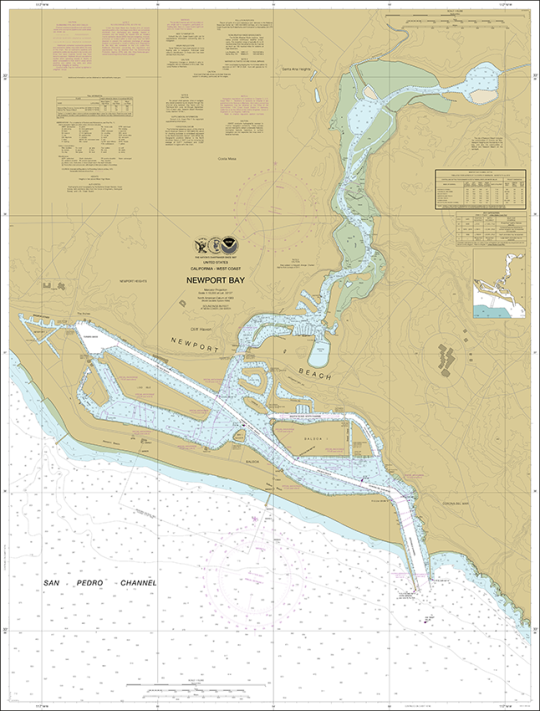
Newport Bay California Nautical Chart 18754
Newport Bay California Nautical Chart 18754 has been cropped, modified, and enhanced from the NOAA nautical chart that covers the California coast, focusing on Newport Bay | California Nautical Chart | Pacific Ocean Chart - Check out this chart made into some great products at Society6

#SanPedroChannel#NewportBay#BalboaIsland#NewportBeach#California#Californiachart#Californiamap#PacificOcean#PacificChart#nautical#nauticalchart#nauticalcharts#maritime#NOAAChart#navigationchart#sea#oceanchart#map#coastaldecor#nauticaldecor#WestCoast#coastal#beachhousedecor#riverhousedecor#boating#beach#typography#lakehousedecor#decor#nauticalideas
0 notes