#Cajon Pass
Explore tagged Tumblr posts
Visit Tumblr Blog
Explore Tumblr blogs with no restrictions, modern design and the best experience.
Last Seen Tumblr Blogs


Fun Fact
The total number of visits Tumblr.com received during January 2021 is 327 million.
Photo

mormon rocks, formed by the forces of san andreas fault 18ish million years ago.
cajon pass. san bernardino county, ca.
nikon em, expired kodak gold 400, helios-40-2n 85/1.5
133 notes
·
View notes
Photo

"Top of the Pass"
Summit, Cajon Pass, California, USA.
Friday 25 January 2008
122 notes
·
View notes
Video
youtube
The Cajon Pass - the narrow valleys that connect the Los Angeles Basin to the Mojave Desert, in-between the San Gabriel and San Bernardino Mountains. The jog in the road is literally the San Andreas fault.
#cajon pass#california#san gabriel#mountains#san bernardino#route 66#I-15#interstate 15#the earth story#geology#geography#history
52 notes
·
View notes
Photo


Cars, big rigs catch fire on 15 fwy during Cajon Pass brushfire, July 17.
46 notes
·
View notes
Photo

View from Mormon Rocks
45 notes
·
View notes
Photo

Cajon Pass SP8254 on flickr © 2012 Patrick Dirden Photography
45 notes
·
View notes
Photo

niches,
Mormon Rocks, Cajon Pass, California
#mormon rocks#cajon pass#southern california#desert#formations#erosion#rocks#landscape#color photography#fujifilm GFX 50R#photographers on tumblr#frank foster
40 notes
·
View notes
Photo

The Union Pacific 844 works it's way up the Cajon Pass, in America
40 notes
·
View notes
Photo

1950s postcard view of the Summit Inn along Route 66 at the summit of the Cajon Pass in San Bernardino County, California. The building was destroyed by the Blue Cut Fire on August 16, 2016. The building’s current owners plan to rebuild the restaurant, as it appeared before the fire. Photo from the Route 66 Mother Road Postcards & more facebook page.
33 notes
·
View notes
Photo


two more from the mormon rocks.
in the cajon pass, calif.
hasselblad 503 cx, planar t* 80/2.8, fuji (I forget which and what speed) 120 film.
95 notes
·
View notes
Photo

One of my favorite railfan photos featuring modern power. BNSF GE up front, CN SD50F, CN SD70, BN SD60 and another BNSF dash 9 on the rear. I doubt I'll ever see another consist like this again. On my only trip so far to Cajon Pass, 2008. Photo by Miles Callan
27 notes
·
View notes
Photo


Amtrak’s Rohr Turboliners in California.
Right: “The third Turbo heads east through Santa Ana in 9/1976.”
Left: “The first Rohr Turbo crests Cajon Pass at Summit in June 1976.”
15 notes
·
View notes
Photo

Harmonic convergence on Cajon Pass: ATSF and Union Pacific trains on Santa Fe tracks below, with a Southern Pacific train on the Palmdale Cutoff above. Photo taken on March 18, 1984 by Paul F. DeLuca via Flickr.
28 notes
·
View notes
Photo

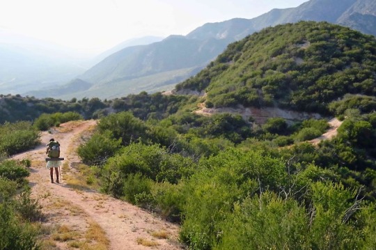

As promised, another photo set from Randy Godfrey. The top two photos were taken near Cajon Pass. The bottom photo was taken in the San Gabriels not far from Wrightwood.
Randy recounted one story from the “endless hillsides” between Lake Silverwood and Cajon Pass. “It was very windy and getting late,” he said, “as we searched for a camp site. I noticed Tod ahead of me suddenly stop and run up the backslope of the trail to an unseen location above. She popped back down on the trail to announce that there was a flat site up there that would work for cowboy camping. This was great news to me! We climbed up to Tod's postage stamp sized piece of trail real estate. She looked down to find a big rubber crocodile sunning itself on the rocky soil. We christened to place "Crocodile Flat" and immediately joined it, cooking a late dinner and then jumped into our sleeping bags. Tod should now be forever known as Crocodile. Whenever we were desperate and looking for a campsite in the weeks to follow "We have to find a crocodile flat!" was our mantra.”
What a beautiful spot it was (below).

14 notes
·
View notes
Photo

Life, more or less
Lytle Creek, CA
14 notes
·
View notes