Thanks for supporting my journey and donating! Follow my journey in more detail here as I walk the South Island along the Te Araroa Trail.
Don't wanna be here? Send us removal request.
Text
24th April 2023 - I love hiking
Happy Birthday to Father dearest. Fortunate to have had a single bar of reception at the hut, enough to send you a message already but still wanted to give you the birthday shout out.
Todays a slight detour from regularly scheduled programming as I left the TA trail yesterday, heading 16kms up an alternative valley to Sabine Hut. The plan is rather than making it out to St Arnaud today as TA routes, to instead go up the other side of the range and climb Mt Cedric, eventually make it then up to Angelus hut, a hut I had missed out on from a previous adventure with friends last year due to poor weather and unfortunate circumstances. Sabine Hut was lovely, situated on Lake Rotorua, shared it with a nice crew last night. The huts are busy again. The day was nearly all climbing, from 450m at Sabine, up to Cedric Pass at 1,800m and then back down to Angelus Hut at 1,500m. Once I made it above the bush line, the views quickly became unbelievable. Sun out, clear sky, panoramic views of mountains, valleys, lakes and tarns. As I crossed the ridge line, I managed to gaze on the ocean off way in the distance, the first time since I left the Foveaux Strait at the bottom of the South Island those many weeks ago. A great spot to eat my apple and meditate on all the amazing memories and experiences I’ve had. Today was a “I love hiking” sort of day. The unreal scenes didn’t stop once Angelus Hut came into view though, situated between two huge tarns (at what point do they become lakes?) surrounded by a vast ridge towering above. Making the most of arriving by lunch time, I had heard great things about Sunset Pass and potentially Angelus Peak, a three hour side walk with views over the other side of the valley. Dropping my bag at the hut, it felt like I was bouncing up the valley. The temperature had dropped a whole lot and I was walking through snow and ice, I have my suspicions it was below freezing and the wind chill certainly made it so. The pass was great, but I couldn’t help but look up to the peak at 2,070m and fell a little bit adventurous. Scrambling up scree and rock climbing my way up, I was again treated to spectacular 360 degree panoramic views. People had set up rock barriers to cowboy camp, sunrise would be so beautiful, freezing, but beautiful. I think I’ve perfected my downhill scree run, the Olympic downhill skiers haven’t delivered a smoother nor faster run down the slopes. Back at the hut by 4:30 for soup and relaxing finally. The last pic is of the peak I climbed, looking back at sunset (the one on the left). Huts full tonight and I haven’t booked, oops. Once more, a 10/10 day. Probably my favourite so far.
Day wrap up:
Journey: Sabine Hut - Angelus Hut
Side quests: Sunset Pass & Angelus Peak
Distance: 20.6km
Elevation: 597 flights!! 12x up the Skytower


2 notes
·
View notes
Text
22nd April 2023 - Though shall pass
Happy birthday to my younger brother Paulo, 25 years old!! Sorry I can’t call today, but a feature in this will have to do. No doubt you will be celebrating big in Portugal.
Trail notes describe this section as “the most demanding on this track. It is a fair-weather route, suitable for experienced individuals or parties with experienced leadership. Strong �fitness and agility is a prerequisite for all. These criteria aside, Waiau Pass is a Te Araroa highlight. Allow a full day for the journey.”
Arriving to the hut in rain last night, and with the forecast indicating a 50mm+ deluge overnight, continuing well through the morning, I had expected a hut zero day. Weather gods had other ideas as I woke up to clear(ish) sky peaking through the window. With the trail notes in mind, and 1,300m of climbing ahead, I managed to get going from Waiau hut around 8:30. Crossing a makeshift signpost indicating kilometre 1,000 an hour in to the morning felt quite an accomplishment, let myself enjoy that moment. Even before climbing started, the scenery was surreal. Vast mountains towering above the valley, the river rushing back down to face me, grand waterfalls up in the mountains, and then much closer as the climbing began. The actual climb over the pass of ~900m gradually increased in gradient and took about 4km. The last 1km was a rather aggressive 400m of elevation including legitimate rock climbing, requiring the use of all four limbs to clamber myself up the pass. Glad I was heading north and up
that section, wouldn’t have been a fun task to climb down. The views continued to get better and better with a nice flat section just 200m from the pass providing a great spot for lunch. This view hands down beats the Colliers B&G view and that’s a high bar. I think it was just the shear magnitude of everything in sight. The photos are ok, but being there in person, endorphins rushing through my blood had me feeling pretty proud of myself. Crossing the Pass, Lake Constance came into view, an impressive sight however slightly diminished by low clouds on this side. The descent was just as steep as the climb, but rather than rock face, it was scree allowing me to run/scramble down a large part. Semi damaging my shoes, but having a good time while doing it. Making it down far easier and faster than the ascent, it was then down and around the protected and beautiful Lake Constance. Getting to Blue Lake hut around 4pm, there were two other hikers, who turned out to be mountaineer extraordinaires Dave and Axel who’d arrived 20 minutes before me. After getting set up at the hut and chatting to Vicky the warden, (first hut warden all trip) I made my way down the 5 minutes to explore Blue Lake, namesake of the hut. While impressive from afar upon descent, up close it was incredible. To get an appreciation for how clear the water is, it’s officially the clearest natural found water in the world, and I’m not exaggerating. 40m is considered “excellent visibility”, Blue Lake has 70-80m visibility. Pure water has a hypothetical visibility of 83m. The evening stayed warm enough for dinner on the table outside with Dave, Axel and Vicky as we shared stories, hot chocolate and whisky for hours until we were gazing upon the stars. A truly great day on the Te Araroa. Overcoming great challenges, amazing scenery, witnessing the surreal essence of nature and sharing stories of adventures with others is what makes this journey so special. Feeling very grateful today. Incredible day all around.
Wrap up:
Journey: Waiau Hut - Waiau Pass - Blue Lake Hut
Distance: 23km, 35k steps
Elevation: 1,235m, 251 flights climbed.
Highlights: The whole day. 10/10. Grateful
Official KM: 1,012


0 notes
Text
April 20th 2023 - Pre Waiau Pass
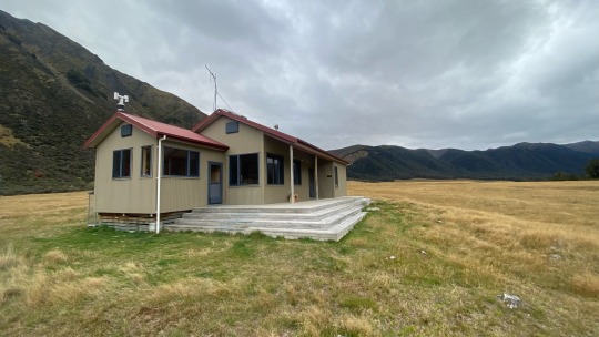
Unsure what to write about today, filler episode with a pretty chill and enjoyable day all in all. Magdalen hut was delightful in the day light. Lot of noise overnight though, possums were out for a big one. Got off about 8:30 in no real rush, I knew I only had 22kms to cover so had a relaxed morning. Following the Boyle river I walked between grass lands and nice bush with mostly well maintained paths. Few slips, quagmires and streams to cross. Morning turned to afternoon after crossing Anne Saddle where I had lunch. The classic wrap, cheese & salami with aioli and some nuts on the side. Mountain ranges to my left and right with wheat coloured grass through the middle. The hut came to view around 3:30, next huts not for another 6 hours and I don’t feel like camping so Anne hut it is. Probably the nicest, largest hut I’ve stayed in so far really. Big 20 person bunk all to myself with a spectacular view out the window.


0 notes
Text
19th April 2023 - Should have started earlier
A relatively light day today. A great curry, great sleep & hot shower will do great things for the mind and body. Felt like I had a lot of admin to do today. Time ticked on as I had my coffee, breakfast, grocery shopped (somehow spent $150 at 4square on this resupply!? One paper bags worth?!?), downloaded a bunch of new videos, audiobooks and podcasts and various other bits and bobs of admin and somehow it was 2:30pm and I still hadn’t left. Knowing there was a hut 12km in, I wasn’t too concerned. The concern did however start to grow as my attempts to hitchhike out of Hanmer took longer and longer. Thankfully Ben the farmer from Rakaia eventually came along and offered to take me out to the main road and then shortly after Paul the Frenchman in his camper van took me the balance of the 40kms to the trail head, making it by 4pm. So, 4 o’clock, fresh heavy pack and 12kms to go, off I ventured. Pretty classic NZ bush terrain, slightly less impressive than the Huranui ranges I’ve just come through but none the less pretty. It’s clearly been raining a bit as plenty of puddles and mud pits to parkour around. As day became night things got exciting. I still had around 3km to go when I took out my head torch. The forest canopy bringing forward the evening with complete darkness for the last 1.5km, including a swing bridge crossing which was plenty fun. Less fun was the shin deep river crossing 50m before the hut. Chicken and corn soup with coscos for dinner tonight. All around, good day. Bring on Waiau Pass!
Wrap up:
Journey: Hanmer Springs - Boyle trail head - Magdalen hut
Distance: 12kms
Resupply cost: $170 incl new gas canister.
Official KM: 949


0 notes
Text
18th April 2023 - Chocolate Pancakes
Yesterdays magic forest experience continued on with the Hurunui range rapidly rising up my ranks as one of my favourite sections of the walk so far. Walking past a group of 17 intermediate age looking kids and their guides, I became quite glad I did decide to camp on Lake Sumner the night prior. Upon making the hut and finding yet more hunters, my simple joy grew to elation as they offered me freshly made pancakes, with Whittaker’s chocolate melted over top no less. Who says the bush isn’t luxurious. Back to it freshly carbed up with a pep in my step. 15kms did seem to drag on, eventually making the trail end by 4pm to clock off the 113km section. Time to hitch to Hanmer Springs for a resupply.


0 notes
Text
17th April 2023 - Symphonies of the forest
Warmer nights/mornings, ie above 5 degrees mean I can actually get myself going at a decent time. Up and walking by 8am feels good. Even that used to be a late start, but as winter draws near, cold dark mornings have me huddling in my sleeping bag until the mercury is at least a few millimeters above freezing. The morning sun on the path and it’s parallel river does carry a nice glow, occasionally blinding, but there must be pain for there to be beauty right? Someone influential once said something along those lines anyway, The valley opened up to vast fields allowing me to make great time as I raced past Cameron bivy, then Hurunui no. 3 hut. Plenty hunters out and about. Lunch was at Hurunui hut with some more hunters who were kind enough to share some mushrooms and cookies. All lovely, large huts with great amenities save for Cameron hut which only had cots for beds and even then only one of the cots actually had the associated hammock. The Hurunui range quickly becoming a favourite section of mine with simply amazing diversity of flora and fauna. It feels like a great representation of NZ bush. The headphones were tucked away as the sounds of the forest become far more enjoyable to listen to, many types of birds singing to each other in symphony. Mushrooms of every design, in red, orange, yellow, purple, stark white, black and any other colour or combination you can dream in all directions. Trees towering above with golden leaves falling softly as autumn sets in. Native New Zealand bush at its best. Truly magic. The hunters from lunch had shared what I had initially thought was a gem of advice, in the form of a campsite on a peninsula into Lake Sumner where I decided I would camp and enjoy the tranquility, rather than my initial plan of pushing on to Kiwi Hope Lodge. The advice was initially sage. Setting up my tent quickly I noticed a bunch of sandflys starting to congregate. Sweaty from the days hiking, I was excited to jump in the lake for a dip. Freezing cold, but a good excuse to practise my Wim Hof. I returned to my tent absolutely covered in sand flys and they were not intimidated by me in the slightest. Strange. Dinner was a treat of Radix which I enjoyed while gazing upon the sunset over the lake. I even attempted a sketch of the backdrop in my journal for the second or third time. Not my best work but what’s a man to do with a simple black bic for a tool. Sounding like a poor workman there. As the sun set, so did my tolerance for sand flys and I retreated to my tent for another day. 25kms to go till civilisation.


0 notes
Text
16th April 2023 - Looking for one left foot hut shoe.
It all started with crossing the Taramuku river, which FarOut comments had been making such a massive deal about. Frankly after getting through Goat Pass, I was pretty confident I could cross anything. While the river was broad, waste deep at points and with some force, the lack of drop offs, slippery rocks and all around drama had me making light work of it. Once across, the morning was spent largely heading up the river bed making decent pace. The afternoon shifted to forest and heading up a valley. I was listening to a podcast about space stations (turns out there have been many) which was pretty interesting when I took a break to look back upon the valley I’d just climbed and discovered one of my hut shoes had somehow removed itself from its carrying carabiner. Devastated. I can see why people have been enjoying birks all these years. Fairly steep inclines with lots of slips and trail goblins making for slower walking with much bush bashing around fallen trees and other obstacles. Eventually a tiny, but quaint 2 man bivy tucked away in the bush arrived and my day of walking was done.


0 notes
Text
14th and 15th of April - Goats (just) pass.
Conscious my writing gets less inspired when I don’t do these daily so this is a bit of a multidayer and frankly, I wasn’t sure if I’d write a piece for this section, as honestly, one of the sketchiest and hardest sections I’ve done. Three days of continuous rain had made the section slippery, but more dramatically, full of high flow rivers. Generally speaking, day one after a resupply is always heavy, the only thing lightening the load is finally getting to let the new shoes rip after the old pair put up a respectable 820km innings. Journey started with a quick hitch out to the trail head from old mate Paul. Traversing up the Mingha River for a few hours, getting plenty of crossings in. Took me a while to build confidence in the new shoes tbh, they appear far less grippy than the last pair but by the end of the segment I’d warmed up to them. The river crossings were relatively benign for the first 8km or so, up to Mingha bivy, but the consistent rock hopping with a pack full of food meant the ankles were putting in a shift. Getting to Goats pass hut in time to catch the after school cartoons, I decided to push on to Upper deception hut. Oh boy did that change things. Now I know this section is run across for the Coast to Coast, but f me, the next 3km of descent was some of the toughest pieces of done. Bouldering, sliding, jumping, shuffling and climbing down rocks, into and across raging rivers with waist high, freezing cold water carrying plenty enough power to push me under. Probably dramatising a little here, but the three days of rain had built up a solid pipeline of “let’s fuck with Josh”. Upper deception Hut provided a short respite from the challenge overnight. Managed to get a fire going, but the chimney partially blocked meant a grey haze rapidly enveloped the hut. Next morning was back to the challenge. Definitely not feeling up to it, but also having not many alternatives, I got back to climbing down the slippery rocks, battling to cross the aggressive waterfalls and steep drops. I can appreciate how this would be great fun with warm weather, confidence in my shoes and 18kgs less on my back, but this was not that. Sub 5 degrees outside temperature, many steep descents down slippery raging waterfalls and the many other challenges that faced me before 10am had my heart racing. The river gradient slowly settled down to a more tolerable terrain which I followed for much of the day. Quite stunning when you’re not fearing getting wooshed down the river. Reaching the other side of the Arthur’s Pass/Morrison Footbridge early afternoon to close out the Goats Pass, it was onto the Taramuku river section which FarOut (the GPS/social app) comments had been making a huge deal of where up next. Two wasp stings, one in my ear later and it was time to find a camping spot by 5pm to relax and get hyped for what’s to come. We’ve made it this far, how bad can it get.


0 notes
Text
11th - 13th April - The Sanctuary
The rain didn’t stop. Just 2km of bush between where I left Dan and the road to Arthur’s pass turned out to be about 6kms of walking in the rain for the second day as no one wanted to pick up the soaking wet hitchhiker. Either that or I’m starting to look less approachable than I used to. A friendly elderly couple ended up pulling over to pick me up. I think they really wanted to be the ones who found the lost hikers truthfully. Getting into Arthur’s Pass a little after lunch, Bill of the Sanctuary let me in and showed me around. It felt good to be indoors and warm. This place is cozy. A warm shower, heaters, wifi, fire place, a full lounge full couches. This truly is a sanctuary from the moody weather outside. Giving a whole lot of Twilight. Knowing the next section started with Goats pass and deception river, a section which can flood and quickly become extremely dangerous, I wasn’t too keen to do in the rain after learning multiple people have died on the route. The rain didn’t relent for a further two days. At least there are Kea in Arthur’s Pass!


0 notes
Text
10th April 2023 - Big friends, big days
Overnight rain left our tents saturated, water becoming the theme of the day. Taking off at 8:30 for what was planned to be a big 36km day started alarmingly with a slight 2km warm up going the wrong direction (my bad). A few more checks on the directions and after only a short while walking, we reached the river mouth for the first crossing of the day. Walking up the Harper river for a fair distance we ended up crossing the river 15 of so times, a good few of them up to knees and moving at a fair click. With Dan along, actually managed to get a few action shots of me this time. Different perspectives are always welcome and appreciated. Light rain started about 30 minutes before Lunch. A quick stop to Hamilton hut from two Hamilton boys. 22kms down. 16 to go. The rain continued and as did the river crossings. With the continued rain, the rocks we had been walking up all day start getting slipperier. Crossing the 800km mark was highlighted by some pre lain sticks by some prior TAer. I wonder if they were thinking 800kms done or to go 🤔. Afternoon consisted of crossing a few waterfalls, few rivers and increasingly mud pools. Hiking up over Lagoon saddle, the afternoon light starting to fade. We were in a race, the setting sun, Dan returning to Christchurch tonight, we had to make the final 6km with dwindling light and then head torches for the final push. Still raining btw. Wee bit of slipping and sliding on the descent. Making it to Bealey hut by 6:45, well and truly dark, Dan still had the audacious task of getting the additional 1km out to the carpark and the road and then getting a hitchhike in the dark and rain all the way to a Christchurch. A task I later found the next day to be near impossible after walking for 4km in the pouring rain onto Arthur’s pass the next day - I was informed he made it home by 8:30. Ending up a monumental day, clocking in my biggest so far day at 48.4kms and 59k steps. Classic Dan stuff. Thank you very much for coming, I really appreciated the chat and as always love your company.
Day wrap up:
Journey: Harper Campsite - Bealey hut
Distance: 36kms, Apple: 48.4km
Official KM: 814


0 notes
Text
9th April 2023 - A wise man carves his own fortune
Today is a bit of a treat, and not the chocolate kind. My good friend Dan Popping is making a guest appearance, joining me for the section between Rakaia river and Arthur’s Pass. The day started about 7 at the Methven Campsite, cabin 4, otherwise known as Cheeseman, which you may refer to me as going forward. Getting picked up by Amanda -Dans parter, Dan and Johnny the German nobo for the 40 minute drive back to the trail head. Thank you very much Amanda for the ride. Starting with an Arboretum which featured 2/3rds of the worlds pine trees, a fair climb up, then walking along a super nice trail over to the beautiful Lake Coleridge. Got super excited for 5 minutes as I thought we were hiking around the lake for the day, turns out, the lake was hidden from view by a large range, as we walked along a gravel road for 20kms. Far more traffic on this road than two days ago getting into Methven. We passed Mt Olympus and some pretty impressive ranges. It’s funny how you end up picking up all these subtle changes in bush, scree, trees, colourings and everything in between across the various mountains and vistas as you slowly meander through them. All in all was honestly one of the easiest going, nicest trails today. Dan is going to think this TA stuff is a breeze. Making camp by around 4:30, outcomes a bottle of central Canterbury Pinot Noir. I love wine, it’s been too long. Thank you Dan.
Day wrap up:
Journey: Methven - Harper Campsite
Distance: 28kms, Apple: 38kms. Big gap?
Special guest: 1 - Dan Popping
Official KM: 779


0 notes
Text
7/4/13 - Rakaia glow
Clearly getting tired as the energy left at the end of the day for these write ups in diminishing but let’s give this another go. Waking up in my tent from a night of rain and wind, just over the saddle, I knew I had a big day ahead of me before hitting the road to hitch into Methven to finish a 6 day, two section, 150km combined excursion. Climbing down from the saddle through the valley was a similar story to that a couple days ago on the Two thumb track, cris-crossing the river down. This time the water was ice cold, and I had to get the feet wet 55 times. Yes I counted. Special mentions out to #44 the Lewis Hamilton speed trail down the river and #13 the unlucky for some slip up. Making it to Comys hut with bricks for feet, a hearty lunch of wrap, cheese, all the salami I had left and a generous serving of aioli as i let my socks dry briefly providing enough energy for the next 10* kms of trail. The first 5 proving comparatively ordinary, however still outstanding I was treated to what ill call the best Nobo highlight of the walk so far, hiking up over the 1,200m Turtons saddle, somewhat unexpectedly given I was rushing to the road, put quite simply as The Best view. The magnificent Rakaia river and surrounding valleys commanded my attention. I wish I could share pictures of its beauty, but after 6 days bush my phone had died, so this one will live on in my memory alone. A moment I’ll cherish and reminds me of how lucky I am to live and walk such a beautiful country. The view blessed me the whole way down for the next hour and a half as I raced to the road to try get the 4:30pm Friday rush hour to the pub in Methven for my next resupply. Turns out the road was as dead as they come. Figuring my luck wouldn’t improve any by staying still, I started walking in the right direction, hoping I would cross more farms and improve my chances as I dreamt of a pub meal and a cold handle of Speights. A dreamy sunset over the river and mountains with all colours from golden hour up in the ranges melting into cotton candy mountains in the distance. Not single car for 2.5 hours drove those spirits well down, with next to no food left, I was 5 minutes away from setting camp on the side of the road and getting the last of my coscos on the boil when, like I always tell myself; things worked out for me. Some hunters returning from a day up in the valleys pulled up on their way back to Chch. Making it to the aptly named brown pub, not to be confused with the neighbouring blue pub about 7:30 I did in fact get my loaded chicken schnitzel and fries, cold handle of speights and a room for the night in what felt like some old school western, staying at the town tavern as I passed through. This town felt about the right size for all of us truth me told.

Wrap up
Journey: Clent Hills Sadle - Methven
Kms: 21.8 offical TA + 13kms road. Apple: 32.5kms
River crossings: 55
Offical KM: 750.4


2 notes
·
View notes
Text
5th April
Pretty tired, don’t really feel like writing this cause 39kms and 30 river crossings.
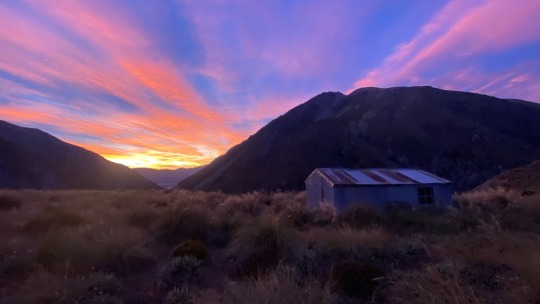
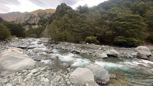
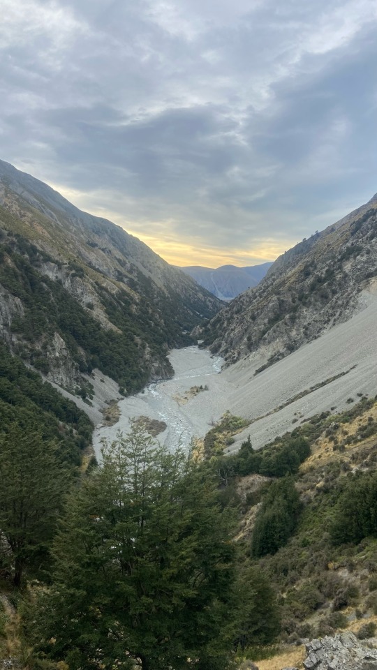
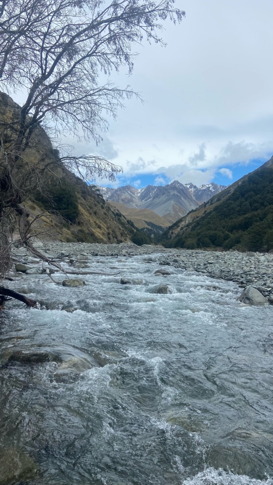
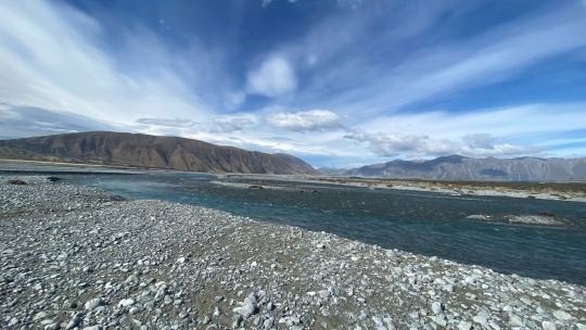
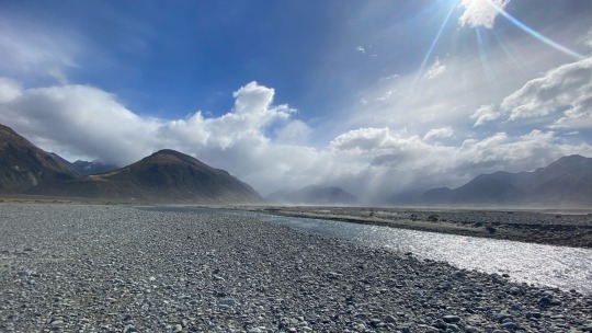
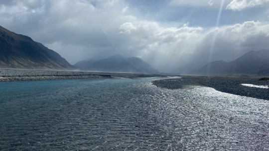
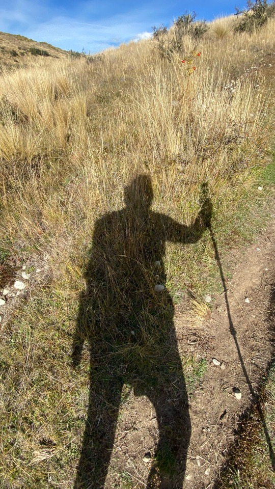
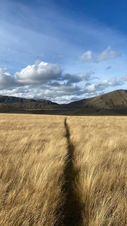
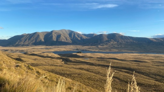
Left hut by 7:30, quite steep decent down through Forrest, first river crossing around 8:15, one of the hardest of the day, high flow and depth. Valley floor was criss crossing the river the whole way down, 15 or so proper crossings, between knee and upper thigh level with faster than walking pace flow. Lunch was had just at the track head as I got myself ready to cross the Rangitata river, a section the TA trust has deemed a hazard and not to cross, however with the alternative option being a days delay and $180 shuttle, my options weren’t considered long. Adventure beacons. Having a 4 day old water level of 85m3, an idea of how much it’s rained, knowing the suggested 50-60m3 benchmark, seeing rain in the upstream valleys I ventured into these rivers full stream. A 45 minutes crossing stones and rocks to get to the braided river, requiring then 18 solid river crossings, at least 4 that required full attention but all in all doable. Glad I pushed. Would have been a truly spectacular experience if it was sunny rather than windy and drizzling. Then pumping through rolling hills on other side. Great track. Very windy. Trying out the coscos/Back Country alternative Radix for dinner, solid.
Wrap up:
Journey: Croomed Spur - across the hazard to a camp site 12.5km up river.
Kms: 22.5+8km, apple: 37.8km, 49k steps
Rivers crossed: 30+
Official km: 694
1 note
·
View note
Text
4th April 2023 - Patterns
What a cry baby I was being yesterday.
Today was spectacular! I decided to late start and early finish and just enjoy what turns out to be a raw, beautiful and charmingly untouched part of the MacKenzie Country. Taking it easy, a good nights sleep, proper nutrition and most importantly I think, a blue bird day made for almost a polar opposite day from yesterday. An incredible day where I stopped and enjoyed the remarkable mountains and valleys many times. The River tomorrow.
Wrap up:
Journey: Stone hut - Crooked Spur hut.
Kms: 9.5kms
Offical KM: 671


1 note
·
View note
Text
3rd April 2023 - 2K, half time & a bad mood
Tough one today. 20kms between Bush Stream hut and Stone hut crossing the TAs highest peak across Stag Saddle then climbing another 150m up Beuzenberg peak to reach 2070 metres of elevation, and then eventually crossing Royal hut, the half way point of the SI. That was the spark notes version, but honestly the day just drained on me mentally today which made for tough going. Having not slept well, the day started out cloudy and cold which failed to kick me into gear. Climbing up a ridge of tussocks where the track was almost invisible (an apparent theme for the day) at which point a light drizzle continued for some time, leaving a good pool of water on all these tussocks, well and truly drenching my socks with every step forward. Making it to the rocky ridge line, supposedly a highlight of a view, was marred by the thick cloud cover so onwards I pushed. Again struggling with the track, turns out I climbed the ridge line further than I should have, resulting in a 500m scramble along scree and snow. Eventually making it to “nearly” Stag Saddle, I looked up for a path up the domineering 2,070m high Beuzenburg peak with its intimidating gradient, loose scree big rocks and snow sections had me wanting my lunch first. Kicking off at great pace, it was actually a lot of fun climbing up the peak, very steep, but without a pack made it feel a little more rock climbing/traditional exploring. I’d made it to above 2,000m! Fortunately the cloud cover had mostly burnt off by this point revealing 360 degree views. I grabbed a few pics before my hands froze (you can tell I was in a good mood from the photos). Another repeating theme I’m noticing here is that it’s always freezing cold. When do the warm snaps return? Running/sliding down the scree added a bit of excitement/risk to the day making it down far quicker than up. As I came an alternate route, it was now onto the official Stag saddle “The highest point on the TA”, a measly 1,929 metres but impressive views nonetheless.
After this point it became following a river down through valleys on almost no clear tracks, so bush bashing the whole way, repeated river crossings traversing the same cold fast moving flow. One highlight of the day was passing Royals hut at km 655.6km equating to passing half way officially. In my precarious mental state unsure if this was in fact a highlight or further fuel to the frustration. I gave myself a nice 20 minute moment there to try enjoy the accomplishment. After this I tried to challenge myself to stay dry as a means of staying positive. Largely successful, both in staying dry and feeling clever and nimble, there was of course the episode where my rock jumping resulted in the cap of my water bladder somehow snapping off and drenching me with my own water before disappearing into the river. I thought I had lost my water bladder for good.. I spent about 15 minutes looking for it and eventually found it under one of the big rocks, so much for staying dry. Another was the final two river crossings before the hut, it was darkening, cold and I didn’t feel like wet socks at this time so I took my shoes off to cross the river, somehow even more glacial without shoes on and then about 2m from the other side, lost my balance, putting my hand down to a submerged rock to catch myself, shoes included. Drenched. Then came the last river, probably 20m from the hut, simply impossible to cross without wet feet. Cruel. Other than that, just an overall mentally and physically draining day which had me pretty beat. If this write up has given the impression of a merry day, I apologise, it was a tough one, trust me. Even dinner was rubbish, my dehydrated soup veges I’m trying to add clearly need ages longer to rehydrate as they were chewy and not at all tasty. Like they say, each day only has 24 hours and this one is fortunately over. Let’s try again tomorrow.
Day wrap up
Journey: Camp stream hut - Stone hut
Kms walked: TA: 21kms, Apple: 26kms
Climbed: 200
Key moments: TA highest point, crossing 2,000m elevation, crossing half way mark
Official km: 662


1 note
·
View note
Text
2nd April 2023 - Daylight saving and money spending
Billy the Bard was quite a show last night. Using his laser pointer and story telling prowess to showcase the stars, constellations, Māori proverbs and history from a circular amphitheater outside the dark sky observatory while sharing stories and toasted marshmallows to a crowd of 30 or so. Today actually started by continuing my R&R and admin in Lake Tekapo. I’ve been well and truly supporting the local economy; new shoes (which I have sent on to meet me in Arthur’s pass in 150kms), new gloves, new headlamp, 3 weeks worth of food at a 4square, postage of the bounce boxs of food to Arthur’s Pass and St Arnaud (where I won’t have access to groceries), I splashed and got a nice room to myself for the R&R and to top it off a little treat by way of some online shopping for after the hike. Let’s just say it hasn’t been a cheap 24 hours. Something tells me I won’t be spending much the next 5 days so I should be alright.
Managed to sneak in a sausage roll from Greedy cow where I ran into some TA friends I met yesterday and we traded tips on the sections ahead. I’m about to climb to the highest point on the TA which is cool, above 2,000 metres for the only time. Stoked to be carrying a heavy well stocked bag. Walking around the nicely groomed lake front abruptly became a dull gravel road as the distance apparently deemed “far enough” by the regular Tekapo explorers. With that, so began a monotonous 13km gravel road walk, something I’ve come to despise. About 5kms in, a blue Hilux towing a boat appeared in the distance, much like Gandalf appearing to the east on the fifth day. The very friendly locals, who in fact were locals from way back, having lived a couple streets from me in Hamilton, decided to share some wisdom that a far more interesting, scenic, and non river crossing path was available further up. Anything to keep my socks dry, I happily obliged. No such thing as a free lunch though, this trail went straight up the guts over a saddle, climbing an additional 200m than originally required with a fresh resupply, allowing me to burn off some of the excessive calories consumed during my R&R. Arriving at the rather rustic, 125 year-old Camp Stream hut around 5pm (nee 6 pm) to a hut full of sobos. Another night in Casa de Atmos, a cozy residence for one. One last treat from Tekapo remained, a packet of basil and pesto Rana tortellini for dinner. Live life generously.
Day wrap up:

Journey: Lake Tekapo - Camp Stream hut
Kms walked: 17.5km, 23k steps
Climbing: 160 flights
Pies consumed: 1 Greedy Cow pork belly pie 11/10
Official TA KM: 641


1 note
·
View note
Text
1st April 2023 - Aprils fool and new shoes
Just like that, one month since I left Hamilton to begin this adventure! Crazy to think back on how much I have experienced and seen. 593kms of adventure to be precise. Waking up around 7:45 with all my batteries still dead, I got underway walking the final 14.5km into Tekapo. Honestly a pretty dull walk along the canal, however Mt Cook and the rest of the mountains had their morning glow on. Eager to get into town I was counting down each marker crossed before making town and heading straight to the greedy cow cafe to charge my phone and to indulge in a croque madam and a mocha for lunch, any excuse for extra calories! Perks of the job I guess. Booking into the YHA backpackers, it’s admin day. Picked up some new shoes from Outdoor Sports. Clocked up over a million steps in the Salomon speedcross 6s, Ive now gone for a fresh pair of Hoka one one challenger 6s alongside some new icebreaker gloves to hopefully keep my fingers from the bone chilling cold and a new gas canister. Groceries and a walk around Lake Tekapo to take in the sights followed. Personally rated Lake Pukaki as a better view but the blue of the water at both is otherworldly and not properly captured in the photos. You’ll have to come check it out for yourself and take on the Alps to Ocean bike ride. Hoping to check out Billy the Bard tonight and get a lesson in star gazing, other than that, washing all my clothes, setting up this blog and figuring out what I’ve got in front of me. Time to change my FarOut map. 700kms to go!
Day summary
Journey: Canals - Lake Tekapo
Kms walked: 15kms
Key events: New shoes! Changed FarOut map sections
Current Km: 607


1 note
·
View note