Don't wanna be here? Send us removal request.
Photo

Carsington Water Website: https://www.localwalks.co.uk/derbyshire-walks-blog/carsington-water-walk-and-map
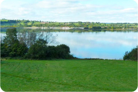
Carsington Water is a large scenic reservoir in Derbyshire. It takes it’s water from the River Derwent and is popular with outdoor and watersport enthusiasts. Here are 3 Carsington Water walks on the
Derbyshire Walks App
ranging from 4.25 miles to 8.5 miles in length.Carsington Water walk 1
4.25 miles
This is the shortest of the three walks from Carsington Water, a pleasant walk that travels along the northern edge of the water and then south through lovely woodland beside the reservoir. The route will then take you to the lovely conservation villages of Carsington and Hopton. This walk does entail walking along a road which is not too busy but has no pavements. You will also have to cross a busier road a couple of times. If you want to avoid this you can miss out the villages and return along the footpath that runs at the north end of the reservoir. This is a relatively easy walk with a bit of climbing in the woodland. The descent may be slippery in wet weather. You can get refreshments at the Carsington Water Visitor Centre and there is a pub and tea rooms in Carsington.
Carsington Water walk 2
6.5 miles
This pleasant walk includes some excellent scenery and the two picturesque villages of Carsington and Brassington. The walk also contains a short section of the Limestone way and the High Peak Trail and a rocky summit at Harboro Rocks. There is some walking on country lanes and a 700m stretch along a busier road on this route, so please be careful here. You will also need to cross one busy road towards the beginning and end of the walk. You can get refreshments at the Carsington Water Visitor Centre or there are pubs in both villages and tea rooms in Carsington.
Carsington Water walk 3
8.5 miles
This is a delightful walk around Carsington Water, one of Derbyshire’s most important tourist attractions. The walk is mostly level on easy paths through fields and woodland so is ideal for the whole family. However, there are a few little climbs and the walk is quite long for little legs, but there are great places to relax by the water’s edge on the way. There is a great Visitor Centre with shops and an exhibition to visit along with wildlife hides en route. The walk visits the lovely conservation villages of Carsington and Hopton but this entails walking along a road which is not too busy but has no pavements. You will also have to cross a busier road a couple of times. If you want to avoid this you can miss out the villages and stick to the footpath that runs at the north end of the reservoir. You can get refreshments at the Carsington Water Visitor Centre and there is a pub and tea rooms in Carsington.
0 notes
Photo

Wetton to Ilam Circular Website: https://www.nationaltrust.org.uk/ilam-park-dovedale-and-the-white-peak/trails/ilam-park-to-wetton-circular-walk
Ilam Park to Wetton Circular WalkWalking trail
We’re finding that popular spots like Ilam Park and Dovedale are getting extremely busy, especially at weekends. We expect our car parks to fill up very quickly by 9am on weekends, bank holidays and school holidays, so we encourage people to plan ahead and check our social media channels for updates and visit at quieter times. This will help us keep our places safe and enjoyable for everyone. We ask that all visitors please park safely and considerately in designated spaces and not on roads or grass verges, as this can block access for farm tenants, local residents and emergency services. We also remind people that BBQs/campfires are not permitted and ask everyone to help us look after our beautiful Peak District countryside by taking their litter home with them.
Useful to note
Much of the route crosses farmland grazed by cows or sheep, so please keep your dog on a lead at all times. There are stiles, hills and uneven ground throughout the route, as well as a small amount of road walking. There is very limited mobile phone reception in the area. Please be respectful of local communities and leave no trace of your visit.
0 notes
Text
Tissington Trail

issington is one of the prettiest and most unspoilt villages not only in Derbyshire but in the whole of the country. The entrance used by most visitors off the main Ashbourne to Buxton road, through large rusticated lodge gates.
An avenue of 200 year old lime trees, immediately creates an air of expectancy. Surprisingly this fine approach does not lead directly to Tissington Hall, but the village itself. Neat well tended gardens and limestone cottages, behind wide grass verges and backed by mature trees, give a feeling of peace and tranquillity. No planner designed it; the beauty of the village is the result of evolution.
Since the reign of Elizabeth I, the FitzHerbert family have managed the village, most of it having been rebuilt between 1830 and 1860 in traditional local style. The home of the FitzHerberts is an elegant Jacobean Manor, which stands just back from the main street behind a walled garden. The wall is broken only by a handsome 17th century gateway with wrought iron gates by the famous Derbyshire blacksmith, Robert Bakewell. The gateway was taken down and rebuilt in the 1950s because it was ten inches out of plumb!
Built in 1609 by Francis FitzHerbert, the house has been much extended by his descendants. It replaced an earlier hall, which stood on the opposite side of the road within the confines of an ancient Derbyshire Hill fort.
It has not always been peaceful in Tissington, as during the Civil War it was the site of a skirmish between royalists and parliamentarians. The FitzHerberts supported the Royalist cause and the family were lucky to escape the destruction of their home, the punishment meted out to many royalists by the supporters of Oliver Cromwell.
St Mary’s Church rises steeply above the main road through the village with a sparkling stream flowing close to the entrance to the churchyard. Built early in the 12th century, but heavily restored 700 years later, it has a massive Norman tower, with four foot thick walls and a well preserved Norman doorway. Inside there is a baroque style 17th century memorial to the FitzHerbert family, a finely carved communion rail and an early Norman font, which bears crude symbolic carvings.
The pillars of the doorway are worth close inspection, the grooves having been worn by archers sharpening their arrows in readiness for archery practice. This skill was much encouraged after the Black Death, which had left the country short of experienced bowmen.
Tissington is known as the mother place of well dressing and visitors come from all over the world to witness the annual well dressing ceremony. This takes place on Ascension Day, when five attractive wells are dressed together with a children’s well.
Dressing consists of erecting boards covered in clay, into which thousands of flower petals are pressed to create an elaborate tableaux of some biblical or topographical scene. It is probable that well dressing took place in 1350, in thanksgiving for the village’s escape from the Black Death, which was attributed to the purity of its water. Wells have been dressed ever since but not in unbroken succession. The precise origins of well dressing are unknown but may date from before the Romans.
When the railway came to the village in 1900 Sir Richard insisted that the line should be placed in a cutting. The Railway Company, it is said, built the cottages adjacent to the station in red brick in retaliation for the inconvenience. Following the closure of the line in 1963 the track was converted into the Tissington Trail and ever since has been very popular with walkers and cyclists.
In the heart of the village close by the green is the pond where the ducks still swim serenely. Tucked in the corner by the pond are the Old Kitchen Gardens where shrubs and other perennial garden plants are grown.
The Old School House, no longer a village school, is now used as a Kindergarten to educate the very young. Further along the road a surprise awaits at Yew Tree Cottage where part of the building has been turned into a small candle workshop. Formerly a Blacksmith’s house, which is decorated with motifs of the trade - the Wright family were blacksmiths in the village for 90 years. In front of the cottage is Yew Tree Well.
The Old Coach House to the hall has been sympathetically restored and offers morning coffee, lunches and teas in delightful surroundings. There is a gift shop in the village, a butcher and even a shop selling curtains and covers close to the A515 on the Buxton side of the village.
0 notes
Photo

Ilam Park to Dovedale stepping stones
Website: https://www.nationaltrust.org.uk/ilam-park-dovedale-and-the-white-peak/trails/ilam-park-to-dovedale-stepping-stones
We’re finding that popular spots like Ilam Park, Manifold Valley and Dovedale are getting extremely busy, especially at weekends. We expect our car parks to fill up very quickly by 9am on weekends, bank holidays and school holidays, so we encourage people to plan ahead and check our social media channels for updates and visit at quieter times. This will help us keep our places safe and enjoyable for everyone. We ask that all visitors please park safely and considerately in designated spaces and not on roads or grass verges, as this can block access for farm tenants, local residents and emergency services. We also remind people that BBQs/campfires are not permitted and ask everyone to help us look after our beautiful Peak District countryside by taking their litter home with them.
Plan your day out. Respect, protect and enjoy.
The walk starts at Ilam Park, where you'll find a National Trust car park, Stableyard Grab and Go and toilets. Some parts of the walk can be muddy so suitable footwear is advised. You'll pass farm animals and other wildlife along the way so please ensure your dog is on a lead at all times. To avoid cattle, please look out for the 'alternative route' sign to avoid the fields with cattle, and also avoids stiles. The route is not suitable for pushchair and prams due to the uneven ground and width of stiles and gates.
0 notes
Photo

Ilam Walk website: http://www.derbyshire-peakdistrict.co.uk/ilamwalk.htm THE WALKThe beautiful country park at Ilam is an ideal starting point for this walk that takes you through some of the Peak District’s finest countryside.After leaving the picturesque village of Ilam, the Izaak Walton Hotel is soon reached. Reminding us of the famous angler of the same name, who together with Charles Cotton wrote the best selling book The Compleat Angler, and loved Dovedale so much.Dovedale is one of the most treasured beauty spots not only in the Peak District but also in the country. Photographs of the stepping-stones across the Dove must have appeared on more calendars and gift boxes of all shapes and sizes than any other countryside scene in England.Lin Dale takes you round Thorpe Cloud, a cone shaped hill rising to nearly 1,000 feet, to the quiet limestone village of Thorpe. The church dates back to Norman times, or even earlier.After passing the church, the road soon turns into a rough track leading down to Coldwall Bridge. At one time it was a turnpike road to Cheadle. It was abandoned in 1910 as cars of that era found difficulty in negotiating the steep road.The final part of the walk takes you along the riverbank back to Ilam.
2 notes
·
View notes