#sorry this is badly formatted bc I'm on my phone but it was SO cool to see & I wanted to post it so hopefully it makes some sense
Explore tagged Tumblr posts
Visit Tumblr Blog
Explore Tumblr blogs with no restrictions, modern design and the best experience.
Last Seen Tumblr Blogs


Fun Fact
There were a total of 171.5 billion posts on Tumblr in 2019.
Text
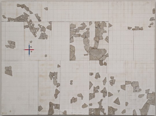
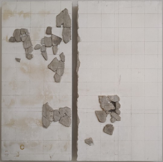
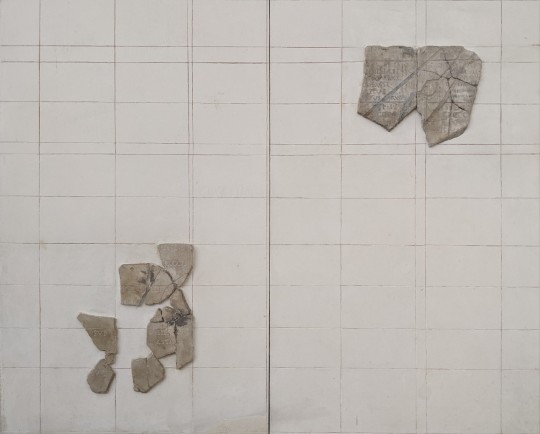
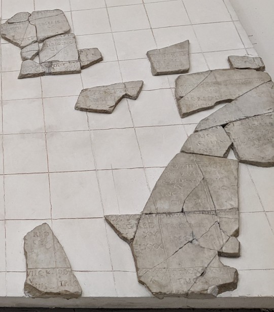
Cadastre B; Cadastre C; Cadastre A
The cadastres of Orange
Dating from 77 BC and commissioned by Vespasian, the three so-called Orange cadastres consisted of large white marble tablets, of which 300 fragments have been preserved. They represent the plan of the colony, and are the only surviving example of their kind for the entire Roman era. This cadastre provides us with information about the land and fiscal administration of the times.
The term 'cadastre' refers to the administrative organisation of ancient Roman territory for the requirements of land and fiscal administration. The cadastres covered the entire territory of the colony of Orange.
On cadastre B [image 1], the representation of the kardo and the decumanus [the two lines forming a crossroads created by a surveyor from which to measure land] enabled the territory to be divided into four major regions and determined the coordinates of each centuria. Each of these, measuring 750 x 750 metres, covered an area of 50 hectares (i.e. 200 jugeri, the unit of measurement of land area used by the Romans).
The inscriptions show the various legal statuses of the territories:
EX TR. [ex tributario]: land allocated to the settlers
REL. COL. [reliqua coloniae]: leased land (the amount of the lease and the name of the lessee are mentioned)
TRIC. REDD. [tricastinis reddita]: land restored to the defeated indigenous peoples (in this case, the Tricastini tribe).
-- Text from the Museum of Orange [with a couple clarifications]
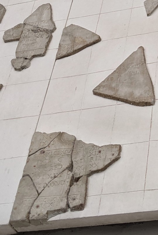
^ detail of a section of cadastre B [image 1] showing the outline of river
^ more example details from cadastre B
+ dad for scale:

#sorry this is badly formatted bc I'm on my phone but it was SO cool to see & I wanted to post it so hopefully it makes some sense#I wish I had better detail photos but I was sort of dying from heat when I took them so#the river in particular I found very cool#thoughts#+ dad for scale bc it was fairlyhuge but I couldn't work out how to show it in the photo
55 notes
·
View notes