#seabreeze2024
Explore tagged Tumblr posts
Text
Danube River cruise, Part 2. Zurich day 2.

After a nap we walked back into the old part of Zurich for dinner. Crossing the many bridges gives you a unobstructed view of the buildings. The swans were still feeding after dark.

Cheese fondue with morel mushrooms is phenomenal. Items to dip in the cheese are chunks of bread, small potatoes, pickled onions and best of all pickles. Second coarse was a rosti (hash brown) and sliced lamb with a mushroom sauce.


Just wandering around the city which is very safe.

Interesting 15 th century Tavern.

Not many wooden buildings.

This fountain is near the Cathedral, hence its motif.

A back ally bar.

Carriage at the museum.

Nancy with Heidi the cow.

Similar to Amsterdams 3 dimensional plaster figures on the building. This is a painting indicating to people who could not read what is sold here. This was a cobblers business back in the day.

Another example of a business advertisement is the double painting on the corner of an old printing shop. The words on the left say, “Book Printer.”

Nancy getting a sip from the “snail fountain” on Frog street. Someone had lined the top of the fountain with snail shells.

This is “Frog Street” several shops sold frog souvenirs.

Here a very wide fountain was made more user friendly by the first spout pouring into a funnel. Which has supported extension spout pouring the water out closer to the edge of the fountain.

The tops of the chimneys had small designs looking like little houses.

The Swiss knock off of Kentucky Fried Chicken.

We took the funicular car to the top which is where the University is.

View from the University level.

One of the University buildings.


Another example of colorful shudders.

Large water fountain with the Blue and White flag of the city of Zurich.


This was an observatory in town. The wind vane had the sun and moon symbols.

Classic Swiss lunch of Mac n’Cheese but you spoon in dollops of applesauce which sweetens it up. Again this is not Velvetta cheese.

Waiting at the train station looking for the gate number.

First class car for our trip of eleven hours to Wein (Vienna). Only a few people on the trip. We were looking forward to a beautiful ride through the farmlands of Switzerland. Unfortunately the windows were pretty dirty preventing photos. Worst of all the chairs did not recline at all. Making the trip horrible. It was a very fast train averaging 90 mph. Coming down hill from Innsbruck we were doing 136 mph. Barely felt the train moving. We arrived in Wein at 0140 in the morning. They closed down the train station and kicked us and the homeless out in the cold. Hotels were full. Drunks were screaming. Cold biting wind was blowing. Lucky for us we found a 24 hour bar and moved in for 4 hours.
4 notes
·
View notes
Text
Danube River Cruise, Part 7.
Durnstein and Melk Abby.

Another foggy start to the day. Three swans swim up to our window, to welcome us. Being on the very bottom deck of the boat we were eye ball to eye ball with them. They work along the edge of the boat eating the algae.

We climb to the Durnstein Castle with the help of a local guide. King Richard the LionHeart was held for ransom here in 1192 while returning from the Crusades.

View from the donkey trail to the castle. Durstein is a very, very small village. I believe only 40 local people live here year round. Most shops are owned by outsiders.

Walking into town.

A city gate into the city.

This was a self serve Riesling wine spot on the trail through town. Just put the cash in the tin on top and grab a local wine.

Apricot orchard.


The doors in town had very ornate handles.


We returned to the ship for lunch and a day cruise to Melk. Above you can see Durnstein in our wake.

Countryside is beautiful but it is cold outside.

Warm red wine and breaking out the blankets on deck.

Sharing blankets on deck as we sightsee on the Danube.
Left to right: Christina (England), John and Sarah (retired American pilot and Pediatrician), Nancy and a fellow American passenger.

Beautiful little towns and villages on the banks of the Danube.

More deserts served top side.

Ho hum…Another castle overlooking a small village.

This is one of two car ferries we saw. It is the black thing to the right of the photo. It does not have an engine, but it is attached by a cable tether to a main cable stretching across the river. I believe they just turn the rudder and the current moves them across the river to the other side, as their tether slides along the cable.

Beautiful wine country.

Very small castle perched on the very tip top of a rock.


About to pass another ship going the opposite direction. Passing port-to-port is standard procedure. Due to the curves in the river we are now passing starboard-to-starboard. Besides talking to the other ship and coordinating which side to pass. The Captain has deployed the blue panel with a light in the center, signaling a starboard-to-starboard pass. Once the pass is complete he will stow it horizontally out of sight.

With a quick stop in Melk, Austria we jump on a bus to tour the famous Benedictine Melk Abby founded in 1089.
It is now a coed school with approximately 900 students. We took a walking tour, but are not allowed to take photos in many of the rooms.

So here is an internet photo. Eight pounds of gold were used throughout the abby. The actual cathedral was beautiful as you would imagine.

The library has over 100,000 manuscripts and is a national Treasure. Researchers from around the world come here to read the original manuscripts. The illusionists artist can make a flat ceiling look rounded as above.
Ever walk from one side of a room to the other in front of a huge portrait painted by the Masters. The eyes will follow you and stare directly at you, no matter where you stand in the room. It is called, “The Mona Lisa effect.” It is simply how our brain interprets a two dimensional painted portrait to look three dimensional. The eyes are actually painted looking strait ahead. We just interpret it as looking our way.

This is the ceiling of the “Marble Room.” One of the most interesting rooms, it was the size of a basketball court. The queen would sit dead center in the room and read from the light of a window directly in front of her. When she looked at the painted ceiling above her. It would appear to her that the twenty or so painted gothic columns were reaching up to heaven and the gods. The columns are all angled differently to appear pure vertical when looked at from her chair alone. Here the ceiling is curved but painted to look flat.
While we were at the Abby our ship had continued to Linz, Austria. So our bus drove us to the ship, arriving after dark.
Tomorrow we will tour Linz.
3 notes
·
View notes
Text
Danube River Cruise, Part 4
Still in Budapest

Still doing walk about. So much to see and do in Budapest. This is their “Funnel Cake.” This is common street fare.

It is dough wrapped around a metal form and then turned over a charcoal fire. As it cooks it is periodically moved closer to the heat. Two different shapes. The one becomes a cone and can have ice cream placed in it. Mine was the “classic”, which is tube shaped, with Nutella chocolate smeared on the inside. They forgot the coconut on the outside. I think they all go through a sugar bath after cooking.

We were looking for this “Street Market” which was next door to the little food truck stop where I bought the funnel cake. The Street Market was not a Farmers market which we were expecting. Save your money on a “Bad acid trip” and visit this place.

Multiple bars and a couple of open air shops. Two floors of what you would expect to see in an opium den. A cross between Bourbon Street and Key West. I am sure it is wild at night.

This is the “Great Synagogue” in the Jewish District. Surprisingly we only saw a handful of Hasidic Jews in the district. Second largest synagogue in Europe. Lots of history and not all good. It did survive WW 2 fairly unscathed. But its people did not.

This is inside with our English speaking guide giving his talk. Very ornate. All men had to wear a yamaka. So they gave us a paper yamaka with a bobby pin. With my short hair, I more or less balanced it in place and held it on when outside in the wind. The bald guy really had problems.

This is a reminder of the Jewish hostages held in Palestine. We have seen much graffiti starting in Zurich and here of “Free Palestine” with some fighting back by the Jews. It has now been a little over a year of captivity for the hostages.
The Jewish faith forbids bodies to be buried near the synagogue. Yet there are over 2,000 bodies buried in the courtyard here. All were killed and left in the street at the end of the WW 2. Allied forces quickly buried these here in mass graves. Only half have been identified. It is also forbidden in the Jewish faith to exhume or move a body. So they are a grim reminder of what has transpired in the past.

From the Jewish synagogue we visited St. Stephen’s Cathedral. I need to specify it is St. Stephen Cathedral in Budapest. We visited several others with the same name in different cities. The largest Cathedral in Budapest. I would like to formally post my objection to the building of such tall Cathedrals. I can not get them in the photograph without it warping the image. I also have to strain my neck to see the spires and the ceilings inside.

Pictures just do not do these houses of worship justice. So much symbolism and artistry everywhere.
The Cathedral is named after King Stephen founder of the state. He died in 1038 and was later Canonized.

Before heading back we stopped by for a pint of Guinness. Which reminds of us Neil and Beverly and our trip through Anglesey, Wales.

Having a traditional Hungarian dish of pork knuckle. I can highly recommend it for meat eaters in the crowd.

Desert of caramelized strudel.

This is the after dinner drink of the local moonshine “Palinka”, no open flames please.

Next morning we toured the Parliament Building. It is so big you can not get it all in the photograph from street level. You will see the whole thing lit up when we depart on the ship the next night.

This is looking back at the front door. Unfortunately there are very few places where we can take photos inside. We saw the gold Crown studded with gems, protected by two soldiers at all times.

This is equivalent to the Senate floor. With students receiving a lecture at the time.

This is a monument of 60 pairs of shoes. Symbols of the 15,000-20,000 Jews who were required to remove their shoes, prior to being shot and their bodies dumped in the Danube. This happened during 4 months in WW 2. The shoes were considered valuable at the time.

After checking out of the “Hampton by Hilton” we took the subway to the ship. Budapest boasts about it being the second oldest electrified subway in Europe, opening in 1896. The strange thing is after buying your very small ticket above ground and riding the subway. It is not until you try to leave that you have to find the very small paper ticket in one of many pockets. Two very tough looking women, probably prior East German border guards, caught the women behind us.

We find our ship Avalon Illumination (warned: don’t call it a boat) at Dock 6. The cruise line is Avalon, which has been in tourism for 100 years. They supply us with an app that gives us all the information we need. Including the time and quickest way to find the ship if we are walking around town.

This is our sea cabin. We drop our bags and head back into the city.

We cruise through the large market two blocks away. Food stalls are on the first floor. Souvenirs and such on the upper floor. I buy some pork rinds.

Nancy finds a man with a chicken. He would not answer which came first, the chicken or the egg.

These are small pastries filled with different fillings. Walnut paste was the classic. It was a bit dry but very popular. The meat shop next door had every part of a duck on display.

This shows just how big the market is. So many people selling the same souvenirs or food, you wonder how they survive.

Back to the ship for our first night onboard. We get our safety brief and meet the Captain and crew. In an emergency we are all supposed to meet on the top deck. The Danube is so shallow there is a good chance the boat would sink to the bottom and we would still be 10 feet above the water drinking our beer and wine.

Nancy and I passed up the tours that the ship set up since we had already toured the city for two days. Instead we did a walking tour with a local woman who was passionate about history. The walking tours can really get into the specifics. This courtyard had just about all the architecture styles: Baroque, Gothic, neoclassical and neo-ugly. The far building was bombed and replaced with bland architecture, which our guide aptly labeled as neo-ugly.
This is the last day of us walking 5-7 miles a day with quick stops by the hotel room. Tours on the cruise are much less. Definitely trying to walk off as many calories as we can. So much to eat and see!

This is the “Chain bridge.” The chain refers to the links between the vertical columns. The chains are like huge bicycle chain links. Very ornate and the only bridge from Buda to Pest for years. Originally open in 1849 and one of the largest bridges in the world at the time. The bridge was destroyed by retreating Germans in 1945 and reopened 1949.
Back to the ship for our embarkation at 5:30 and sailing upstream to Vilshofen, Austria.

They dock up to 3 boats side by side. This is the bow of a second ship tied along side. We left first. So they untie from us and they move back and out a little. Then we untie from the shore, and pull ahead. They immediately retie to shore at the same dock. These guys make it look easy.
3 notes
·
View notes
Text
Danube Cruise, Part 9,
Passau, Germany

A beautiful church on the bank of the Danube. We will pull into Passau, Germany shortly. It is the most visited city in all of Germany. Mainly due to its best preserved medieval town in central Europe. Today there is a population of 50,000 of which 12,000 are students of the University.

Passau is known as the city of three rivers. The river Inn is south of the city. The Danube runs along the north edge of town. From the north the much smaller river Ilz flows into the Danube. Note the three different colors of water. The Ilz is black, the Danube is known as blue-brown. The Inn has glacial runoff and is silvery-grey.

Our boat is moored along side a second ship. To get to shore we head to the top deck and then cross a small gangway to cross the top of the other ship.

Walking into the old town with our guide.

Narrow cobblestone stone streets. Note the building on the left. Not exactly straight or vertical. The city was rebuilt after a massive fire in 1662, built back in the baroque style.

This is one of the prettiest cobblestone streets we saw. The top of the fan design always points up hill. This engineering helps slow down water running downhill.

Munich has a couple of arches between buildings. But it was kind of normal in this town to see this.


On this street were several beer houses that have been in business for centuries.

Our guide and an interesting window design. Just to the right of the window is the flood mark in July 1954. Not to be out done, just above the window on the right is the flood mark March 2013 12.89 meters (roughly 42 ft.).

Several places in town near the river have marks on the wall showing flood levels. Interesting to note the wide range of months they occurred. The earliest recorded flood is 1501 with it flooding into town on an average of every 5 years. The river Inn flows from the Alps and is the source of the floods.


Beautiful architecture. This claims to be the Venice of Germany.

Straight walls?

In the background is St. Stephens Cathedral. There have been churches on this site since 700AD. This church was rebuilt after the 1662 fire.


This church has the second most organ pipes in the world. There are 17,774 pipes and 233 registers. The cathedral has 8 bells, the largest weighs over 16,000 pounds. P.S. All is not what it seems. The organ pipes above are only a picture of the real ones hung on a canvas. The real pipes are out for maintenance for a couple of years.

Note the sun dial on the building to the right. Did you realize that shadows on a sundial mounted on a flat surface in the northern hemisphere, rotate towards the right. The first clocks were invented in the northern hemisphere and the hands are said to rotate clockwise. If clocks had been invented in the southern hemisphere they probably would rotate the other direction.


Many doors in this town are outstanding.

Back to the boat, where we are greeted with warm towels and a fruit drink.

Happy hour, with fellow passengers Sarah and John.

Last nights dinner, everyone departs in the morning.

The Captain gives us a farewell salute. Note the folks in the ship tied to us in the background.

It’s the last night and the ship parties hard. Here Sarah, Heather and Nancy are looking at which song they are going to sing karaoke to. First they sing backup for Keith.

Nancy doing the song “YMCA” with the girls.

We hoof it through town, clanking across cobblestones for 15 minutes to the train station. Here we are crossing the Inn river.

We jump the train to Munchen (Munich) Hbf (Train Station.)
This is the last of our story of the Danube. We spend 2 days in Munich doing the hop-on-hop-off train, and walking around the old town. Drinking at the Hofbrauhaus, eating roasted Pork knuckles, hot nuts from street venders, and sausages.
If you enjoyed these post, we can highly suggest you check out Avalon Tours on the Danube. We traveled on the off shoulder of the regular tourist season Nov. 4-7. Booking two weeks out the price was close to half off. Now we are looking at cruising Portugal’s Douro Valley aboard Avalon’s newest Suite Ship®—the Avalon AlegriaSM. Sailing through vineyards clinging to steep slopes along the shores where 2,000-year-old traditions of winemaking are cherished in the charming villages in one of Europe’s oldest countries. Including a stay legendary Lisbon!
2 notes
·
View notes
Text
Munich, Germany. Nov. 11-13, 2024

We arrived at the Munchen train station after a 2 hour train trip from Passau. It was a 1 mile hike to our hotel in downtown Munich. We passed by the famous Neus Rathaus (New Townhall) built in 1874. We passed by as the Rathaus-Glockenspeil did its thing on the fifth floor in the 278 ft. tower. The apparatus only does its mechanical merry-go-round and bell chiming 3 times a day. Hundreds of people were shoulder to shoulder watching the show as we walked through the crowd towards our hotel.

Nancy picked a great hotel in a perfect location just off of the main plaza. The Platzl Hotel let us check in early so we could go walk about.

Right around the corner from our hotel was Hofbrauhaus. You haven’t been to Munich, if you haven’t been to the famous Hofbrauhaus (court brewery) in Munich. Established in 1828 by King Ludwig I of Bavaria. Regulars have been Mozart and Lenin. 1920 saw the first meeting of Adolf Hitler and the National Socialist Party here.

Very open and ornate, with communal tables.

Mugs are 1 liter in size.
“Honestly officer, I only had two drinks tonight.”

The different beer houses host their “regulars” who have their own table and personal mugs. The Hofbrauhaus has 3,500 “regulars.” Not uncommon to see them wearing the traditional Lederhosen. This type of gathering is called a, “ Stammtisch” and a sign (see photo above) on their table signifies it is their tabel. (Photo from facebook).

Part of being a “regular” is having your personal mug locked up in your safe. There are 616 such stein safes in the Hofbrauhaus. Some of the steins are over a hundred years old.


As we wandered around the plazas we partook of warm red wine called, “Gluhwein.” Which translates into “Glow-wine”, referring to how you feel after drinking multiple small cups on a brisk December day. When you return your mug you get several euros back.
This is the May pole in the plaza.

Eating our way through the street venders.


Met an Aussie eating a pickle, he highly recommended it.

Pickles, pickles, and more pickles. Big pickles, small pickles, sour and sweet pickles. I think there is a Dr. Seuss pickle book in here!

The mushroom shop next door displaying their stuff.

Sights around town.

The Theatine church of St. Cajetan built from 1663 to 1690 situated on the Odeonsplatz.

This is the Feldherrnhalle monument to the Bavarian Army commissioned in 1848 by King Ludwig I of Bavaria. It was made famous during WW 2, by Adolf Hitler. In 1923 Adolf had started a revolt here and 15 of his group were killed. Adolf was arrested and sentenced to prison after that. When the Nazis took over in 1933, Adolf turned this into a memorial site. SS soldiers were on memorial guard duty here 24 hours a day. Any passerby was expected to give the one arm “Heil Hitler” salute. Many secretly abhorred saluting.


These are the bronze cobblestones on the “Shirker’s Lane.”


We visited this very small but beautiful church. Called St. Johann Nepomuk, better known as the Asam Church. It was built from 1733-1746 by two brothers as their private church. One was a sculptor the other was a painter.

It was darker than most churches we visited but was probably much more ornate. Definitely the smallest.

This was a great treat of mixed hot nuts, served in a paper cone.

Dinner was a spit roasted pork knuckle. I went home stuffed.

Breakfast was these light donut things and good coffee.

This group of regulars were playing music next to us in the back of the breakfast restaurant.

This was a cheese display as well as a huge cheese knife for cutting large cheese wheels. The far end of the knife is fixed with a bolt making a hinge. It is pulled down onto the table, which had many knife cuts in it. Right now the knife is propped up with a piece of wood.
Nancy took in a little spa time the last night in Munich at the hotel. Early wake up with a bag drag to the nearest underground subway. Then a 20 minute train to the Munich airport. One stop before the one way train to the airport, we got caught by the police for not “validating” our tickets. There is a small blue box that stamps a hole in your ticket, who knew?
We promised to leave the country. The police were happy with that.
So ends our Danube cruise, starting with several days in Zurich and ending with two days in Munich. Great trip, great memories!
1 note
·
View note
Text
Danube River Cruise. Part 8
Linz, Austria.

The ship traveled all night and passed through one lock. We wake up moored at Linz, Austria. Some of the 94 passengers will take a bus tour to Salzburg, Austria. It will be all about the “Sound of Music” and they will be gone 10 hours.

For the morning excursion multiple buses for each of the half dozen cruise ships show up. We all get corralled by color for the proper guide. Nancy and I elect to take a 2 hour walking tour around the historic downtown. We just walk from the ship 5 minutes to the plaza center.

This was a Saturday and a flea market was in the square near our ship. Here is the local Plague monument like so many other towns.
Linz was first a Roman Garrison town reborn as a trading and mercantile center in the Middle ages.

This is the doorway to the tourism office, notice the relief above the balcony. Here they have a large room with a goggle earth photo on the floor that gives a great point of view. Our guide walked all through the city pointing out interesting points.
Note the balcony above the doorway, now check out the following internet photo below. This is very interesting and important as a place Adolf Hitler gave a speech in his home town.

Very chilling to stand in front of this door and think what had transpired in this plaza.

From the main plaza we wonder through the back roads of the town.

Our guide points out one of the 20 Jewish Holocaust memorials in town. These are placed all around town where jews had lived prior to being forced out and possibly killed. There is a working doorbell with the name of the folks who lived there along with the dates of their birth and death. The site in the background was the Jewish Synagogue that was destroyed. This is so timely with the antisemitism that is going on in the world today.

One of the small courtyards off the side of the street. One of the other courtyards we walked through was where Mozart stayed and composed Linzer Symphonie in 1783.

This is the New Cathedral or Cathedral of Immaculate Conception. Plans started in 1855, this Cathedral will hold 20,000 people.

This cathedral still has many of the original stained glass windows. But several were blown out during WW 2. Usually when that happens they are replaced with plain white windows. Here they replaced them with modern stain glass motifs.

There are 7 bells in this cathedral with the largest weighing 8 tons. It is so large it had to be brought down one floor when it was first rung. Because it caused the spire to sway when it was swinging back and forth.
After the guide finished taking us through the cathedral, the tour broke up. Nancy and I found our way back to the ship for lunch.

Nancy has been to the infamous Dachau concentration camp before and passed on this tour. So I went on the two and a half tour of the Mauthausen Memorial myself. This labor camp was 12 miles out side of Linz. Unlike Dachau and other concentration camps that were built to strictly kill as many Jews as it could, this was a labor camp. This was the hub of 49 Nazi labor camps, that provided workers for munitions and arms plants.

Over 92,000 people died here. Most were Polish jews, some were Nazi objectors, but even some English and American airman were imprisoned here. The average life span was 4 months before the prisoners died of malnutrition.

Only a few wooden barracks were still standing.

This was the last concentration camp liberated in WW 2. When the Americans rolled in, 22,000 prisoners were here. The allied soldiers ended up burying around 2,000 prisoners in a mass grave. The prisoners were so weak at that point, they still died even though the camp was liberated. Large memorials are found outside the walls by a dozen countries that had their people killed here. Not what I had expected.
It was a somber bus ride back to the ship.

I would like to say this was the coffee bar in our room. It was actually in the guest lounge in the stern of the ship.

Here Nancy is checking her phone with a cup of coffee in the lounge.

The staff were constantly cleaning the cabins and frequently seen wiping down the walls of the companionway.

This is the center entry way in the ship, looking down from the upper deck of guest cabins. Nancy and Catherine are on their way to morning yoga.

Claudia is running the morning yoga class. Nancy in the foreground.

Meanwhile I visited the gym daily. Notice I didn’t say, “worked out in the gym daily.” Just visited.

Here we are locking through with another ship. This was the first lock we went through during the day, so several of the passengers turned out for the show. The top of the two ships are level with each other. As are the cabin windows. Our Captain warned us at the beginning of the cruise we will be side by side with other ships at time. Beware leaving your curtains open. Apparently the Captain of the other boat did not give the same briefing to his guest. As we pulled along side, everyone in our main lounge viewed a naked women coming out of her bathroom and then diving back in.

A foggy day for sure.

Another interesting church on the bank of the Danube.

Approaching the mouth of another lock. Seems to be some religious statue on the exposed rock.

The lock wall is on the right as we lock through with a second ship. As you can see we only have a couple of inches to spare.

The Captain has dropped the ships bridge down halfway. The ship next to us clears everyone off of the top deck and drop their bridge all the way down. We are still rising up in the lock and will barely pass under the lock bridge ahead.

Here the ship next to us is about to exit the lock. You can see they only a little over a foot of clearance.

Our crew has dropped the awnings covering the top deck tables and chairs.

We successfully pass under the bridge at the lock. We are off to Passau, Austria.
Passau is our all time favorite town on the Danube!
1 note
·
View note
Text
Danube River cruise, Part 6. Nov. 7, 2024
Vienna, Austria.
The Danube is the second longest river in Europe at 1,777 miles. Flowing from Germanys Black Forest to its delta on the Romanian and Ukrainian shores of the Black Sea.
Spring time snowmelt in the Alps causes floods of biblical portions.

We wake up to a very foggy morning docked in Vienna. We are moored as the third ship out. When we leave for our tour today we actually walk through two other ships to get to shore. One was the sister ship to our boat, the other was a more prestigious TAUCK cruise lines ship.
Vienna obviously has a tremendous amount of history and culture, but it is also a very modern and large city. So it was not that easy to just meander around old small streets, directly from the ship. So although impressive it just wasn’t a favorite stop of ours.

Tour buses pick up each of our groups. I am assuming almost all 94 passengers took the morning tour into town. Plus there are half a dozen other ships here needing buses.


This is the Parliament building.

Gate entrance with a Hercules sculpture.

More gates with Hercules saving the city.

This is a baroque monument to the ending of the Great Plague Epidemic of 1679. The “Plague Column” or “Trinity Column” has Emperor Leopold in the center praying to the gods above to end the plague. The sculpture of Leopold shows his genetically deformed lower jaw. Which was due to inbreeding of the Kings and Queens of the time. It was better to intermarry between the leaders of countries than to fight wars.

This is St. Stephan’s Cathedral completed in 1578. It is oriented to the sunrise of December 26 the birthday of St. Stephen. The tallest spire stands 447 ft. high. When the Germans retreated during WW2, orders were given to shell it 100 times and reduce it to rumble. Luckily the local Captain, Klinkicht, disregarded his orders.

The massive front door is called the “Giants door”, possibly due to a Mammoth’s thigh bone that was hung over the door originally. The bone was found when initial excavations started in 1443.

The insides of these Cathedrals are just spell binding, and photos do not do them justice.


The Cathedral has 22 bells and over 12,000 organ pipes.

As we walked around town, we came across Mozart’s house. Sigmund Freud did his studies in Vienna.

I took the afternoon off, while Nancy went to the 1,400 room Schonbrunn palace by bus. The Captain gave me a tour of the wheel house. All of his computer displays for navigation are below the counter height because the top half of the wheel house can be dropped down to just above the counter. There is even a hatch above his head that can be opened up for him to drive the ship, with his head and shoulders above the roof.
Note the carpenters level on the front of the counter. He can balance out the boat moving fuel and water around. Attention to detail! Wouldn't want the doors below swinging open.

Nancy at, Schonbrunn, the summer palace of the Hapsburg Empire. This was built to keep up with the Joneses. It was to rival Paris’s Versailles.


Happy hour was an hour earlier today so we could attend the opera.

We attended a show of classical music and opera at the Vienna Opera House. The “Blue Danube Waltz” was written by Johann Strauss, the younger, at the age of 42. He was Viennas most popular composer playing the Blue Danube Waltz for the first time in February 1867. It is the unofficial anthem of Vienna.
This concert was just a sliver of music, opera and dancing all done with humor and gaiety. Our fellow passenger, Christina, who works for the London Philharmonic and attends many concerts was not impressed. But, when in Vienna you have to go to a concert!


The operetta singer.
When we wake up in the morning we will be docking at Durnstein, Austria.
1 note
·
View note
Text
Danube River Cruise, Part 5. First day traveling by ship, Bratislava.

This is the Parliament building in Budapest all lit up as we start traveling all night.

Looking astern the city of Buda under a crescent moon.

Crossing under the “Chain Bridge” crossing from Pest to Buda.

Looking out the back of the ship from its small inside lounge.

We had cruised all night around 11 kts heading upstream. We are now in Slovakia, with the Slovakian courtesy flag flying from the right side of the radar mast. We will stop early enough in the day to do a tour of the next city before lunch.

First stop is Bratislava, the Capital of Slovakia. Bratislava is the fourth largest town on the Danube with a population of 500,000. We dock next to the old downtown where we walk with our “Adventure Host”, Claudia, to the Bratislava castle overlooking the town. Each day you can sign up for a tour by a local guide or go with a crew member, called an “Adventure Host.” The Adventure Host shows you the way to get someplace, but does not give any commentary such as the history. Claudia did all the Adventure Host tours either climbing to a castle or biking 21 kilometers. Claudia also leads the yoga class every morning.

This castle was pretty much a bust. Truthfully, it was only advertised as a great view of the city. But we later toured the old town which was very unique and fun to walk the streets.

This is Saint Martins cathedral, where 11 Hungarian Kings and 8 Queens were crowned. This city has been on the map for centuries prior to the Romans taking it.

Nancy found this sculpture of a man at work (see top of photo) and rubbed his hard hat.

Typical carriage entrance leading to a courtyard. The entrances where horse carriages drove through always have large “Guard stones” protrusions at the base. Protecting the walls from the carriage axle hitting it and damaging both the carriage and wall. In some countries they are now even protected by law.

One of several churches we visited. This one was unique because the figures were not adorned in gold. They looked like silver. Note all the figures in the churches look like they are made out of solid gold. They are actually hollow wooden forms with gold leaf applied. As ornate as a large cathedral is they may only use 3 pounds of gold.

This was the pulpit in the same church. Just so ornate! Most are dark wood, so this caught our eye.
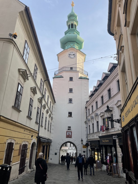
This was a city gate back in the day.

Hard to see in the photo but at the top corners above the doorway are the sheeves where the ropes ran through to raise and lower the draw bridge across the moat. Once we figured this out we were able to identify them at other castle entrances. The moat has now been filled in. Just imagine Kings and Knights riding their horses into the city through this same gate.

Back to the ship for lunch and drinks before exploring the old city again. At each stop the lunch or dinner on the ship represents the local culture. This is Slovakian Goulash on rice with pasta, Nancy has a light soup with wine. I think we walked every single winding road and ally in the old city. Only one church was locked, but we toured 3 or 4 others.

This is a monument to the Plague built in 1713. Monuments to the Plague were very common in the towns we visited.


There are a few “fixer-uppers” available in town. On the left is the most ornate “guard stone” we saw on the trip.

The city plazas were busy with Christmas market stalls being built. Several different embassies to Slovakia were in the buildings around the plaza.

Another curving ally covered in large cobblestone. Note the guard stone fender on the left side of the ally.

This is the city gate the King rode through on his way to the coronation.

The doors were just beautiful, you don’t see anything like this built today.
1 note
·
View note
Text
Danube River Cruise, Part 3. Budapest for 2 days prior to the ship.

We survived the train ride to Budapest. The ride from Wein had a homeless woman latch on to us. She tried to ride the first class car with us, even though she did not have a ticket. They threw her off the car at the next station. Nancy and I had a 6 seat compartment to our selves. At least these seats reclined enough we could sleep for a few hours. Above is Nancy at the Keleti train station in Budapest. We thought the hotel was a 5 minute walk away. Except there are two train stations in Budapest, this was not the close one. Today’s technology gave us a map with walking times on Nancy’s phone. So for 23 Euros we put our lives in the hands of a maniac taxi driver. We at least learned look way, way down the road before crossing as a pedestrian. I believe he may have been a retired Formula One driver.

Took this photo to recognize our street corner on the way back. Downtown Pest is very ornate and rather beautiful. Did you catch the fact that this is “Pest” and not “Budapest.” Turns out “Buda” is the other side of the Danube. They are referred to as one word “Budapest”, but they actually started out as two different cities. It is pronounced, “Buda-Pesh.”

Our hotel is a 5 minute walk to St. Stephen’s Cathedral. Here we hoped on the “Hop-on-hop-off” bus. A great way of riding around the city for an hour and getting acquainted with what is where. We bought the 24 hour pass.

Kunsthalle Hall of Art across from Hero’s Square.

Just a small part of Hero's Square. You just cant get it all in the picture.

This is a beautiful eclectic Castle/Church/Museum called, Vadjahunyad behind Hero’s Square. They purposefully incorporated several different castles from Europe into this one structure. It actually worked out very well.

Here we are crossing a symbolic mote and approaching the main gate. Cypress tree on the right is turning colors with a vendor in front of it selling Hungarian red wine and pretzels. A small charcoal fire was under the pot of red wine.

Jaki Chapel inside the Castle grounds.

Statue of “Anonymvs.” The statue of the hooded figure opposite Vajdahunyad Castle is that of Anonymous, the unknown chronicler at the court of King Béla III (r 1172–96) who wrote a history of the early Magyars. Note the pen with the shiny tip in his hand; writers (both real and aspirant) stroke it for inspiration.


Monument to George Washington. Very strong relations between the two countries for decades.

Desert and Hungarian Coffee at the famous New York Cave Budapest. Voted the most beautiful cafe in the world. Very rich coffee with honey, cream on top and a few raisins sprinkled on top of the cream.

This is inside the cafe. It could be a palace. Always a line outside.

The New York Cafe.

We took the hop-on bus over to Buda on the west bank and explored the Turkish Bath house.

Statue at the far end of the Gellert bath. You can buy slippers and are required to use a bathing cap.

More of the Gellert Bath hall. About 8 different bath houses. One had a two story bath with it opening to the sky on a street corner.


On top of the Citadel with the horse ring in the building behind the statue.

Beautiful statues outside the museum on top of the Citadel.

Entrance to the courtyard of the Museum.

View looking North East across the Danube with the “Chain Bridge” in the foreground and Parliament left of center.

The funicular car climbing the hill. We were crossing a bridge above it halfway to the top.

We took the hop on bus early the next morning while we could get to places we couldn’t easily walk. We jumped off in Buda and explored this 18th century baroque church.

This is the opera house lobby.

This is the front of the opera house where the less worthy people entered. The elite used the side door.

This is Nancy in the underground train station for the Opera house.
1 note
·
View note
Text
The Bahamas 2024, heading home Part 7.

Time to start working our way home. About 345 nautical miles, little to no sight seeing along the way. We refuel at Salt Pond, Long Island. Then spend one more night at a remote anchorage in Grey’s Bight Long Island, near the blue hole.

I collect 5 sheepwool sponges, and clean them everyday. The first couple of days are the worst. They stink and the flies are thick. So we leave them in the dinghy. Tailwinds are a problem heading downwind. Each day I change the water and squeeze them multiple times to clean out the organic material.

Heading up Comer Channel seas are flat. But the wind is forecast to pick up. We anchor behind a very small island on the back side of Great Exuma. Winds will be blowing from the East for the next couple days. But we can hide from the worst of the waves behind the Exumas and not burn fuel motoring.
We run 100 miles up the Exumas and then top off at Staniel Cay Yacht Club.
Buy the time we leave Normans Cay for our run to West Bay New Providence winds have died down making an easy crossing.

One night in West Bay. Weather window is holding for our crossing of Tongue Of The Ocean (TOTO) the next day.

Three dolphin send us on our way early in the morning.

Near “the pocket” of TOTO, fish are abundant. We cross paths with three Short Fin Pilot Whales, in the photo above. More than likely they are young males. As you can see seas are flat for a nice crossing. We will anchor on “the Bank” in 20 feet of water after a 75 mile day. We will hide from boat traffic on the back side of Mackie Shoal.

Above is the wreck of the Hesperus on “the Bank”, east of Bimini.

This is North rock just off Bimini, looks like a submarine with a periscope.

This is Radio Beach Bimini. Normally a great place to anchor out of the swells. With easy departure before daylight to cross the Gulf Stream. With the recent addition of cruise ships bringing tourist. A jet skies concession has opened up. So they were flying around. But at sunset things settled down.

Sunrise in the Gulf Stream with freighters passing behind us. Several hours out we hear a May Day call from a private vessel with a fire in the engine room. US Coast Guard could not hear them, so I answered them. They had lost all power. USCG could hear us, so we relayed information between the two. Fire was out, but they were adrift and required a tow.

We had a great crossing with calm seas and entered Biscayne Bay at Stiltsville. About a dozen weekend party homes still left. Turn down Biscayne Bay and check in with US Customs via their app. All goes well and we are cleared in to the country with out having to go to their office.

Once I get the above message it is a huge relief for me. People sometimes have to jump through some major hoops. Or even pay huge fines if they mistakenly bring in a food item. We end up anchoring for the night in the bay near Ocean Reef. Several dolphins cruise by at day break. We cross to the ocean but can only make 2 knots without overheating the engine. After anchoring behind Tavernier Key, Nancy finds a huge ball of seaweeed wrapped around the prop.

After we got home and prepared the boat for Hurricane season, I disassembled the heat exchanger on the engine. This is part of the reason the engine was overheating. It needs to be serviced every 1,000 hours.

This is the hose leading into the heat exchanger. The black oblong thing in the center is the only area the water could come through the rest is calcification. Had to throw out this hose and give the heat exchanger an acid bath. Ready for next years Bahamas cruise.
1 note
·
View note
Text
The Bahamas 2024, part 6. Conception Island.
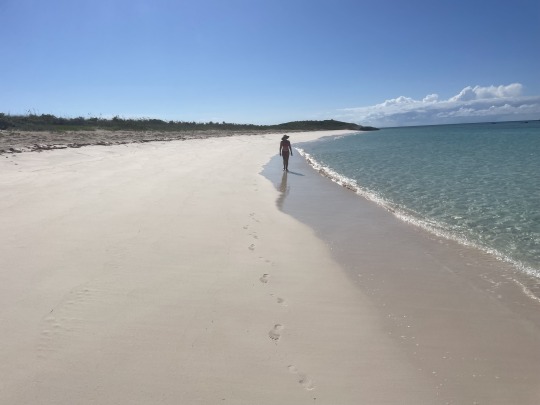
We made it to Conception Island! It was the bucket item for this short month long cruise. Being fairly late in the season very few cruisers were here. In the middle of the season when the weather will be good for 4 or more days. Up to 20 boats might be here. It has great bottom for anchoring but is exposed to the west and might have rolly waters in high winds from any other direction.

This is Conception Island. About 3 miles top to bottom and 2.75 miles at its widest.

It sits about 25 miles south of Cat Island, 15 miles north east of Long Island, and 15 miles northwest of Rum Island 30 miles west San Salvador. San Salvador claims to be the first landing of Christopher Columbus in the New World. Interesting that the island in this part of The Bahamas are called “Islands”, whereas most others in The Bahamas are called Cays (pronounced Key).
I always wonder how the early Bahamian sailors found their way around. No GPS, no chartplotter, no maps or compasses. But on the way here I could tell where the other islands were by the clouds building up over top of them. Cat Island to the north has some high ground which is easy to see from far off shore.
Rum Island and San Salvador are the bucket items for our 2025 cruise as well as returning to Conception.
Two boats came to the island about the time we did. But both left early the next day. Then we had the whole island to ourselves.
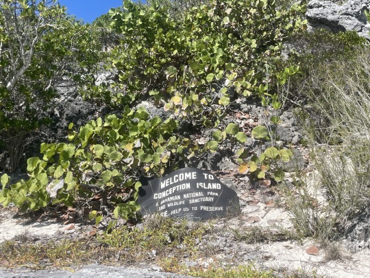
Conception Island is a national park and a no take zone. You would assume the corals would be alive and fish would be abundant. I understand it used to be. But due to climate change many of the corals in shallow waters have died off. Not that we did much diving.
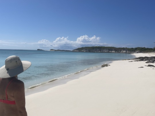
Miles of beautiful beaches on the west side of the island where the anchorage is.
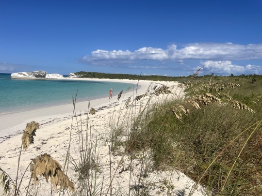
We walked up to the north tip and crossed the short spit of land to checkout the North East beach. We will climb the cliffs seen in the top left corner of the photo.
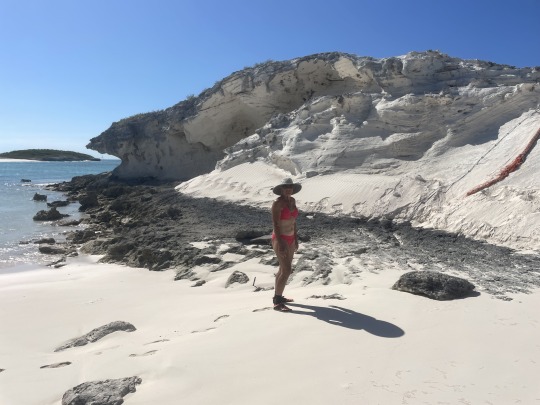
Nancy just prior to walking up the sandstone cliff with the assistance of the rope on the right.
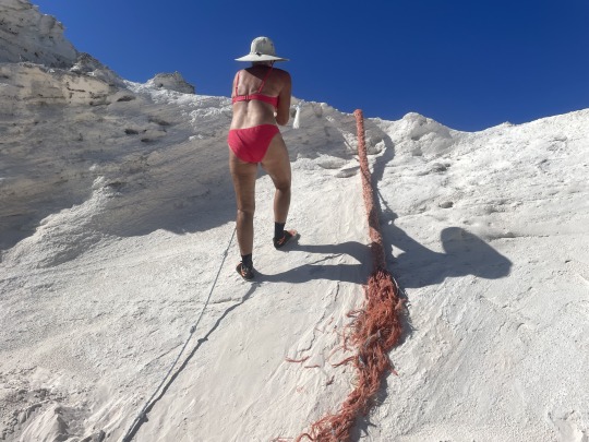
Previous cruisers have secured rope to help climb the slippery slope.
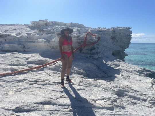
You never really know what the rope is attached too, until you get to the top. Being chivalrous I had allowed Nancy to go first.
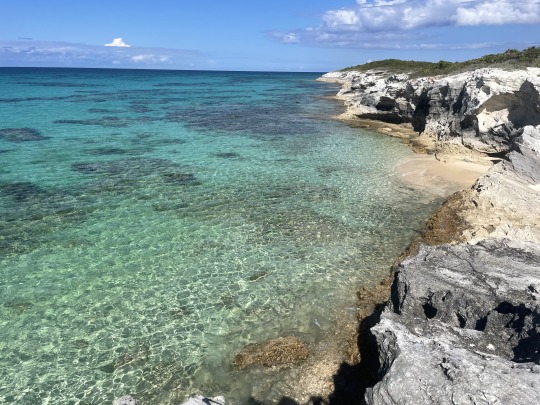
View from the top. There is a sunken boat in between the coral heads broken in thirds.
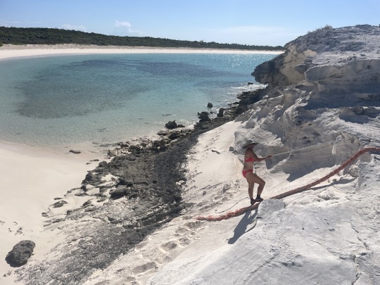
Nancy descending the cliff.
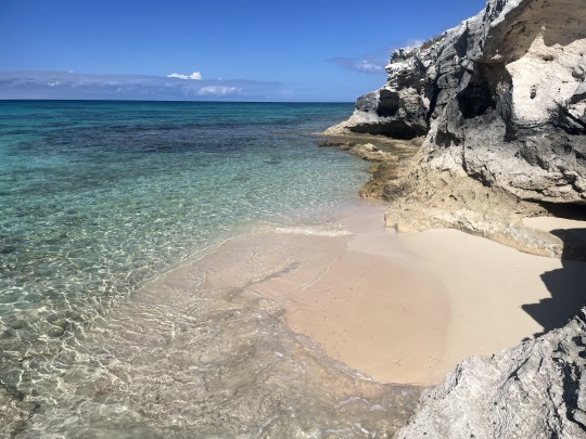
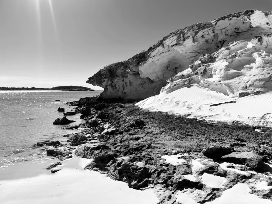
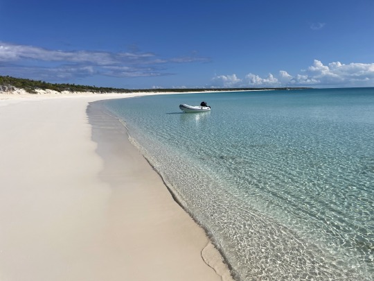
Our dinghy is still here. Always a good sign after being out of sight for an hour. We always use two anchors.
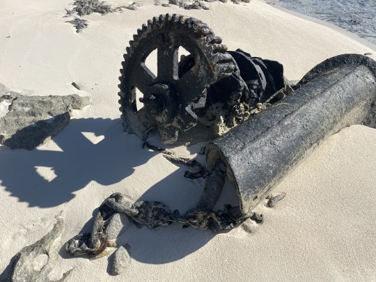
This is the remains of a ship wreck on the beach. It is the windless, chain and hawse pipe the anchor chain ran through.
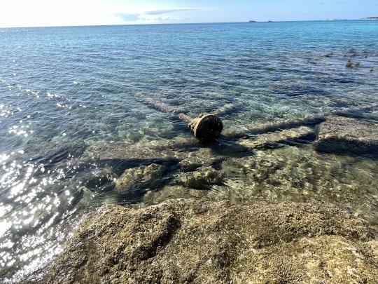
Very little else remains of the ship wreck.
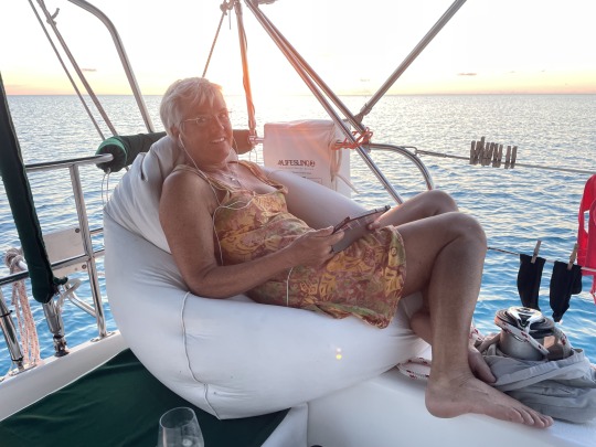
Another beautiful day comes to a close. Nancy relaxing in the bean bag with her wine nearby. Note no clouds on the horizon. We are in an excellent place to view the “Green flash” at sunset.
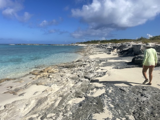
Our second day on the island we were totally alone and took the dinghy down to the southern end of the island to explore. On the top of the picture is where the Loyalists of the late 1770’s built 5 small houses. We tracked those down.
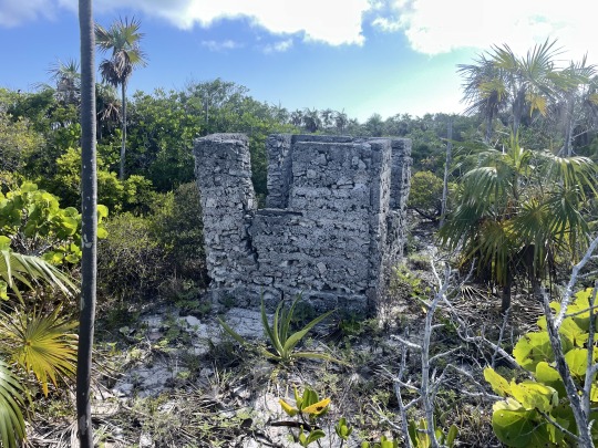
This was the smallest. It had three windows and a door. Just big enough for a bunk and a place to turn around in. Guessing only, but I think it might have been for a single slave to live in. If it was for a slave I believe it was referred to as a pen house. Trust me the other houses were not much bigger. Apparently the Loyalists did a slash and burn agriculture to plant cotton. Cotton crops only last 3-5 years in The Bahamas before the land was depleted and the crops failed. Meanwhile erosion on this island excelerated and changed the depth of the interior lake.

A quarter mile south is a fresh water well. Undoubtedly the reason the houses were built on the highest land nearby. High land is preferable for cooling breezes, sighting sailing ships and better survivability of hurricanes.
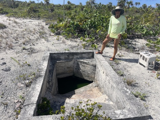
This is the fresh water well. Don’t know how much of it was hand dug. In the 1960’s the concrete was added to keep the sand from filling it in. Local fishermen relied on this water supply. Water was a yucky green when we visited. Next time we come back I will put a weighted line down in it to see the depth.

We continued further south to the entrance to the interior lagoon. Once we got through the mouth of rough water and shallow corals it smoothed out with sand bottom. We took the road less traveled and turned right to the blue pin in the bottom of the photo.
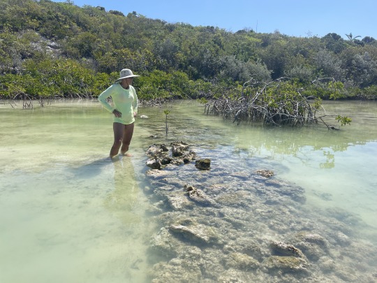
This is a man made dam across the narrowest point. The Loyalist trapped the saltwater behind the dam where it would eventually evaporate. Then they collected salt from the rocks and shoreline to be shipped out.
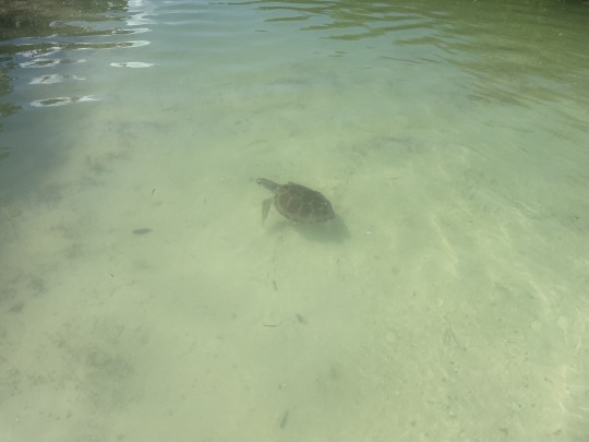
Green Turtles are everywhere.
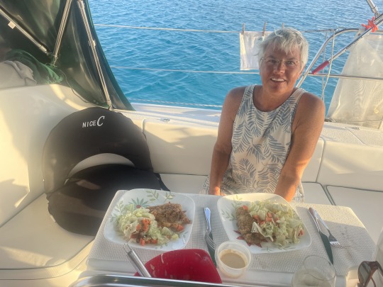
After cruising the west beach some more we headed back to the boat. While making water a couple of sharks checked us out. I believe the rhythmic noise transmitted through the hull by the watermaker attracts sharks. I need to check that theory out in the future. Probably not the best time to be swimming around the boat. Above is another great dinner of cracked conch and salad.
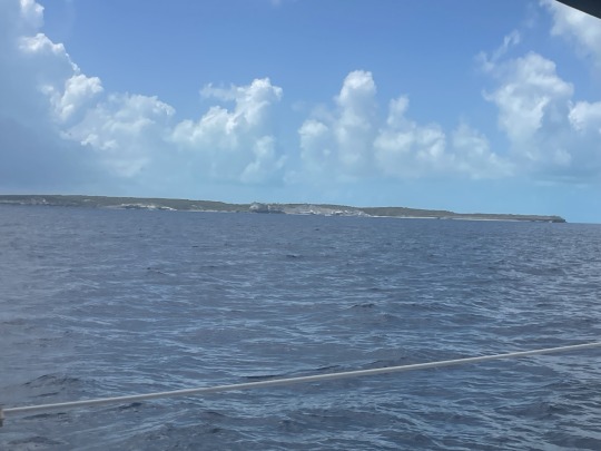
The next morning we motored to Long Island, while the weather was good. The Columbus Monument is on the high bluff in the photo above. We have driven there in the past and watched sailboat pass by. Now we are returning the favor. Now that we have left our bucket item island and it is late in the season it is time to scurry home before Hurricane season. Our insurance doesn’t allow us to be in the Bahamas after June 1.
I will end this part now, standby for Part 7.
1 note
·
View note
Text
The Bahamas, part 4. May 2024
Beach model on Cat Island.

Nancy contemplating a small milk conch. This a beautiful and remote 1 mile stretch of beach on the north side of Alligator Point, Cat Island. We anchored off of it for one night. These following photos were taken at low tide with a nice exposed beach.
How does a name like Alligator point end up in The Bahamas anyway?


Exploring the many nooks and grannies.

Nice bench seat where the waves come in and caress your feet while you dig your toes in the sand.

Private cove on a remote beach at an out island. It just doesn’t get much better.


0 notes
Text
The Bahamas, part 3. Cat Island
May 2024

We love the folks of Cat Island. Most of our interactions have been in the south half of the island. This was our first time in the north end. No sooner had we landed the dinghy at Orange Creek Settlement than two people stopped and started talking to Nancy. When I made it up to the road. A tall gentleman in his late 60’s early 70’s, heartily welcomed me to Cat Island. He introduced himself as Kingsley. He wanted to know if we had ever been here before. When I asked his last name, he answered he was a Johnson. So I asked if he was related to our friend “Pompey?”. Turns out they are cousins. So right off the bat we are making new friends on Cat. The woman speaking to Nancy was the Government Nurse, so they were hitting it off. Just such kind and open people, very refreshing to see.
Orange Creek is very small, we walked most of it in 15 minutes.

The next day we brought our LP gas container to shore for filling. Here Nancy is doing the Cruiser thing of lugging this up a road. If it is not LP gas, it is jerry jugs, groceries or laundry. You can always spot the cruisers!

The Propane business is supposed to be open week days 8-5. But the gate was locked and no one was around. On the wall was painted the one caveat. “CLOSED ON MAILBOAT DAY”. Ok that explains it. They shut down and head to the government dock at Smiths Bay half way down the island when the mail boat brings supplies. We stashed the tank in the woods to be retrieved later.

We hiked out Dickey Road. It is the one road cutting across the north end of the island to the Atlantic side. I knew there were two Blue Holes and a cave beside the road. The blue holes are fresh water and have some turtles in them. Locals used to wash their clothes in the nearest one to town called “Big Fountain.”

This is a diagram of the underwater cave system drawn by an English team in 1986. So they went down about 130’ and then sideways 300’ or more.

This is the front of Griffin’s cave. A small wall is built at the mouth. This cave like several on Cat Island are rumored to have been slave hideouts. Possibly also used by locals during Hurricanes.

Definitely bats in the cave. Which are mostly seasonal.

These caves all have the large crickets. It had started poring rain on us as we neared the cave. Which was very refreshing. Saw several wild orchids along the way.

Heading back out of the cave to the road.

This was the only live Boa constrictor we saw on Cat Island it was about 3 ft. long. Long Island seems to have many more. The old wives tale is: the islands with lots of baby chickens running around does not have many Boas. An island with only pen raised chickens around. Has lost most baby chicks to the snakes.

On our walk back to town we stopped and bought an Atlantic Triton (Charonia variegata) at a road side market. Paid $20 for this shell. I have never seen one in the wild. Nancy has only seen one in the Abacos. These prey on starfish.

We stopped at the general store and talked to Ms. Cleare (pronounced Clare) some more. The very young girl whose mother sold us the shell came in. She handed a list to Ms. Cleare with the $20 bill. All basic staples to feed the family of four. No sweets or luxury food. Above looking south along the shore is the afternoon thunderstorm over the island.

Nancy splurged on what used to be called an Eskimo pie. Now it is Edy’s Pie. What a beautiful view looking across Orange Creek.

More cracked conch and salad for dinner. We will pull anchor in the morning.

Here is one of the smaller mail boats leaving Smith’s Bay settlement.

Coconut rum with breakfast! Not really, Nancy put the last of the half and half in a rum bottle for safe keeping in the refrigerator. Shush…. it did have a bit of coconut taste to it.

Sunrise over Cat Island.

Nancy showing off a Red Cushion Starfish (Oreaster reticulatus). You don’t want to pull them out of the water for photos. It is said to be detrimental to them.

We anchored at Fernandez Bay which is the closest place to the New Bight Airport. Nancy drove me to shore. I was trying to find my way through the bungalows on the beach for a way to the main road. A gentleman reading his book on the beach, asked if I needed help. After I explained my mission of walking the mile to the airport for parts. He gave me the keys to his car. This turned into a nightmare. No internet, meant no cell phone. The part was there but I could not coordinate with the local shipping agent. After an hour I returned to the boat. Nancy was able to get cell service and contact the agent. After filling out the forms on line, I returned to the airport. This time I ended up walking. One young lady stopped and offered a ride. Since I was right outside the airport I declined. During our conversation I found out she was a Johnson and related to our friend “Pompey”. Finally I was able to retrieve our filters. They cost about $5 each on Amazon. After overnight Fedex to go across the street in Ft. Lauderdale and priority shipping by Makers Air, plus Customs tax and Shipping agent fees it cost around $200.

We ran up to Smith Bay for a grocery run in the dinghy. It is only a mile north of our anchorage in Fernandez Bay. After dropping Nancy, I anchored the dinghy away from the rocks and waded in to the Fish Fry Shacks. Only one was open with two guys sitting at the open air bar. So I ordered a Kalik beer. Then it dawned on me that I recognized one of the guys. He recognized me about the same time.

We bought each other a round of drinks. Then he said his uncle was sleeping in the car next to us. I look over and it is the infamous “Pompey.”

Here is Nancy with Pompey to the right. It was noonish and he was drunk as a coot. Which is normal for him. Alfred “Pompey” Johnson is a famous rake an scrape musician. He and his band “Bo Hog and the Rooters” have even played in Havana for Fidel.


Mail boat at Smith Bay Government dock.

This is the main restaurant and hotel lobby at Fernandez Bay Resort. We dinghied over for drinks and dinner. Typical of the small out island restaurants in The Bahamas. You need to make reservations earlier in the day. They have limited main courses and need to space out guest arrivals.

This is the outdoor self serve bar. The waitress brought out some appetizers for us. I asked if I could take a picture. She asked if I was going to post it online. When I replied “yes”, everyone broke out laughing.

Nancy is mixing her drink. Beers are kept cold in a cooler just inside.

There is a pad for you to keep track of your drinks. We labeled ours “Sea Breeze” after our boat. There was a bit of a mix up as one woman had been staying in a chalet for close to a week. Her tab was also labeled “Sea Breeze”, since that was the name of her chalet. One couple at the bar had done extensive sailing in the past, even anchoring at Fernandez Bay. You could tell they were envious of what we were still doing.

The lobby of the main building.
0 notes
Text
The Bahamas, part 2. Eleuthera and Cat Island 2024.

Being fair weather sailors we prefer crossing the open stretches of water when it is smooth. As you can see it was almost flat calm. Nancy saw a Hammerhead shark cruising on the surface as we crossed the reef outbound from the Berry’s. Then two porpoises came by us briefly.

This is our 59 mile route from the Berry Islands to Eleuthera crossing the North East Channel. In places it is 13,000 ft. deep.

We had anchored as close to Current Cut as possible so we could time our entrance in the morning. I have to juggle the nights forecast winds, best bottom to anchor in, threats of being thrown on a lee shore if I make a mistake, best route avoiding coral heads in low light, etc.
Current Cut is famous for its tidal current. If you get it wrong in a sailboat such as ours. You might be motoring at our full speed of 6 knots and still be moving backwards. There are only 11 Tide stations in all of the 700 Bahama Islands that accurately read the tides. So you need to offset by an certain about of time from one of the stations. Sometimes an hour and a half or more. Several different offsets are offered on the charts or internet forums. Not wanting to get this wrong. I checked several sites, and averaged them out. Double check my figures and then set our time to wake, prep and pull anchor. We had an uneventful passage but until you are completely clear of the cut you don’t relax. If you lose your engine in here you could be raked down a rock shore the whole way. The mind games start and self doubt is prevalent. When did I last check the fuel filter? Why didn’t I tightened up that fan belt when I had the chance? Think the fuel we picked up at Great Harbor could be contaminated? What if? What if?
Winds start picking up out of the East as forecast. Straight line to our next anchorage at Rock Sound, Eleuthera is around 50 miles. Which is on a nice beam reach but it also takes us 10 miles away from the protection of the shoreline. It is a wet and rough ride that was exposed to the waves. We had been beating on a port tack for a solid two days. Nancy went below to fill our water bottles. Between the boat being heeled over and carrying bottles, she was short handed. She took one step on the companionway ladder in the cabin and Yelped! The ladder had come loose and spun with her weight on it. Still being 3 feet above the cabin sole she could have really injured herself if she hadn’t been holding on. I will take a mechanical failure anytime over a medical emergency. Medical help is hard to get out here and takes a lot of time. Then considering there are only two of us onboard, it becomes problematic when one person is hurt and the other person has to administer aid as well as sail.
Never had an issue with the ladder before. Then I realized that with the boat being heeled over for two days the pins holding the ladder in place had slowly worked out of the hinge. Once I secured the two pins in place with a length of line we were safe again. It is always something!

You can see how much we were heeled that day by the horizon in the background.

The simple fix to prevent a medical emergency. As the proverb goes, “For want of a nail the battle was lost.”

We made it to Rock Sound Harbor, Eleuthera as planned. Since we have been here before and the winds were forecast to be from the south. I elected to anchor near a “Blue Hole” on the south side of the Sound. There was a small cave (dry) nearby and a nice little estuary for Nancy to paddle board through. All the anchorage notes indicated that it was shallow sand over scoured rock. Not ideal for anchoring with any wind. But we found some descent sand and stayed there for three days. There was one boat a half mile away which is far too close for our taste. We are just spoiled in The Bahamas and love being the only humans around. While I snorkeled the supposed deep and scary “Blue Hole.” Nancy fought her way to the estuary on the paddleboard. The blue hole was not even 20 ft. deep. Just a collapse of a roof of an underground cave. I went in search of the dry cave that should be visible from the water. Saw several small openings but decided against searching any further. Near sunset our neighbors reanchored a bit further away looking for more wind protection. Then the next day our neighbors moved completely across the sound. Hurrah! We are by ourselves again.

Above is a Goggle Earth shot of the area, (North being straight up). Drawing a line across the two prominent ends of rocks I was able to find the Blue Hole a third of the way west of the mouth. Nancy would explore the estuary due South. Very shallow and hard bottom. Somewhere along the line she dropped her mask and snorkel and didn’t realize it. Since we had a spare on board we gave up after awhile and returned to the boat.

This is a photo of our water filter, it starts out as white. Just about every other day I set up the watermaker and babysit it for two hours. This time I set it up and left the boat to check on Nancy. When I got back the watermaker was in a malfunction mode. I reset it and started it up again. In five minutes it shutdown. The watermaker makes our planning and life much easier. Contacting the US dealer and a great guy, Richard Boren, who helps troubleshoot on the internet. It is decided that we need a fresh 5 micron filter. Good news we can have one flown in. Now we have to figure where and when. Between the sporadic flight schedules, weekend off schedules, and our weather window. We decide to have it flown on Makers Air to Cat Island.

The nights dinner is Cracked conch and salad. Notice the can of sterno on the table to keep the flies away. With a plan set and the weather in our favor, plus a weekend to kill. We pull anchor in the morning and head out.

We pass the mailboat coming into Rock Sound. Then head west to Cape Eleuthera Marina for fuel and top off the water tank.

Super clean water in the harbor. The one thing The Bahamas got right, was making it mandatory to have two sources of water coming into manmade marinas. While paying for the diesel, I picked up 2 more bottles of Ricardo Coconut Rum.
Then we headed east for the north end of Cat Island. This will be a 67 mile day plus a fuel stop. We anchor north of Orange Creek near a couple of small resorts. It was still early enough I was able to dive the anchor and loved the deep sand it was buried in. No one is in sight on shore and no nearby boats. Our kind of place. As the sun was setting a catamaran sailed in from the Atlantic and anchored within a quarter mile of us towards shore. How dare they! In the middle of the night a gale came in from the open Atlantic. We had zero protection. Winds were at least 45 kts. and gusting much more. I donned my foul weather gear and all my survival gear to sit in the cockpit on anchor watch.

With the rain going sideways and our dinghy tied to the stern sometimes above my eye level, sometimes below. I watched the only light visible on shore and the mast light of the catamaran. Between a moonless night and the storm clouds, these were the only references to figure out if we were dragging or not. After an intense hour of being beat up in the storm it settled down. Comparing notes with Nancy after the storm. She had been reviewing where the passports and survival gear were. She just assumed our boat would be washed up on shore and she would have to abandon ship.
The next morning the water was glassy smooth and clear. The catamaran pulled anchor and I waved them over. Thanking them for anchoring where they had, so I could use their mast light.

We ran the dinghy around to the very northern beach on Cat Island. Being open to the Atlantic this would normally not be advisable, but the seas were calm and no swells. Here Nancy is exploring the desolate beach.

Deep pockets of sand in between coral rising within inch of the surface.

Nancy enjoying herself cruising around the coral formations.

Huge overhangs of limestone ready to calve off any second in the next 200 years. Years of wave action have worn away the limestone.

Heading back to the boat by dinghy.

Rum drinks and taco salad for dinner.
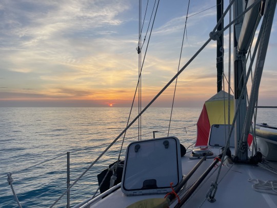
Dead calm winds and a beautiful sunset. The Wind Ghost is set over the forward V-berth to funnel in any available wind. All hatches are open and I sleep in the V-berth under the open hatch. As soon as I feel any rain, I get up and run on deck closing hatches.

The next day we explore the beach on the west side of Orange Creek walking to the far southern tip. In the afternoon we re-anchor on the southeast corner of the beach near the entrance to Orange Creek.

Nancy on the beach with the roots of Australian Pines sticking out of the sand.

Sea oats are this high.

Desolate beach for combing.

Land crab.

Re- anchored just outside of the Orange Creek settlement. We had taken the dinghy to the settlement and checked out the estuary. The current was strong and not much to see, so we skipped Nancy using the paddleboard.

This was the general store in Orange Creek. The woman who owned the store was Ms. Cleary. Her husband had just passed away. They had built this boarding house and General Store. She also owned the local Propane company, which we found out later.

This was the church next door. It is the St. Agnes Angelican, Church.

Sunset at Orange Creek.

Fresh scones for breakfast. Today the plan was to explore a cave walking about 2 miles. Along the way we planned on dropping off one of our LP bottles.

This is the small Blue Hole on the way to the cave. I have reached the max of 30 photos so I will stop here.
1 note
·
View note
Text
2023 Bahama Cruise. Part 11. Mar. 23 Georgetown, Exuma.

Cruising is not all sandy beaches, sunsets and “Pain Killers”. But sometimes it is! Sometimes you have to fix the dinghy outboard on the sandy beach at high noon then retire for Pain Killers later.

We have been in Stocking Harbor at Georgetown, Exuma for 4 days since Monday. Four wet days! Everyone in the anchorage is going stir crazy.

Every morning at 0755 the “net Host” comes on VHF channel 16 and 72, notifying everyone the net will start at 0800. This is the highlight of the day. Photo above has the VHF tuned to Channel 72.
Many anchorages have a net host. They follow a script each day. First they do a radio check for far ends of the anchorage.
Check for priority traffic. Explain local emergency contact phone numbers.
Give a weather and tide synopsis.
This is a “Controlled Net”. Please Answer with a boat name and wait to be acknowledged.
People leaving can say their farewell. Some people have been here 3 months and made many friends.
Shout out to local businesses.
People who need items or expert advice. Usually told to standby at the end of the net for longer explanation.
“For sale or give away”, with the warning taxes need to be paid. This is the fun segment. We once heard for multiple days in a row, folks willing to give of their extra stock of “Dry milk” for adult beverages. No takers, imagine that!
This week on Tuesday someone was missing a “blue sheet” from their laundry done on shore. On Wednesday, someone who must not have been listening on Tuesday, had a “blue sheet” slipped into their laundry done on shore.
It helps to take notes of boat names and what they needed.
Kids corner, where kids connect with each other.
New boats introduce themselves. The last thing is a quote, joke or thought for the day.

Rainey days. Little solar power. Stuck in the cabin. At least the clothes get a fresh water rinse!

What do you do during a rainy day. Maintenance and cleaning! Here I am checking the engine and give Nancy some cross training on the engine room. She gave up on cross training me on cooking. I can open a mean can of cold ravioli and that is about it.

Nancy does a lot of reading and movie watching. I research local history and flora and fauna.

I try and use the Single Side Band to download HF weather radio fax. No luck yet. Could be the many boats in the harbor with all their electronic interference. I have to be cognizant if even the Refrigerator is operating or not. All cause interference.

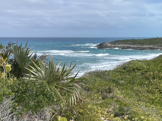
The weather broke for a couple of hours on Wednesday. Like everyone else, we made for the beach on our dinghy. While walking the beach at low tide we found a Flamingos Tongue. Just for clarification a shell, not the actually tongue of a Flamingo.


Wild Sapodillas on the trail. The fruit, the brown things in the photo, are about the size of a ping pong ball or slightly smaller.
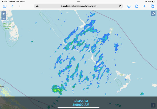
More rain bands. Have to get up in the middle of the night and close all hatches. I sleep in the forward V-birth and know exactly when it starts raining. Because it falls on me!
I can only ignore it so long, before I decide it is worth walking around on deck while it is raining and close all the hatches.

I am still having issues with my dinghy engine. Pulled the carburetor apart about 4 times prior to departure. Like an idiot I did not touch the engine after last season. The old fuel turns into a varnish and clogs the orifices in the carburetor.
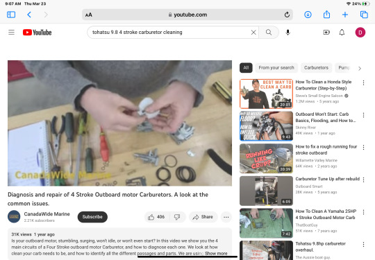
Watched a couple of YouTube videos during the rainy weather. Found some more information and ready to tackle it again. Ok, get a list together of exactly what tools are needed. Metric or Standard? Tohatsu equals Japanese, so need metric tools. Do I pull the engine cowl off while the dinghy engine is on the dinghy and floating over 20 feet of saltwater? Nope, not a good Idea. Should we haul the engine off the dinghy and lift it onto the rail of the sailboat? Lots of work and needs to be tested while on the dinghy. So twice as much work.
So how should I work on the engine with some control of the environment?
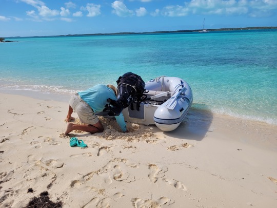
Nancy and I dinghy directly upwind of our boat to do engine work. Being directly upwind, helps if we have to oar back. Once on shore, we turn the dinghy around and I dig hole to allow the engine to be lowered to work on it.

Being careful not to get sand into the water intake on the lower unit of the engine, I start disassembling the carburetor. Repeat the days mantra after me: DON’T DROP ANY PARTS IN THE SAND….DON’T DROP ANY PARTS IN THE SAND……

Having done this before, I was not too worried about working on the beach and maybe having to oar home. But, you never know….
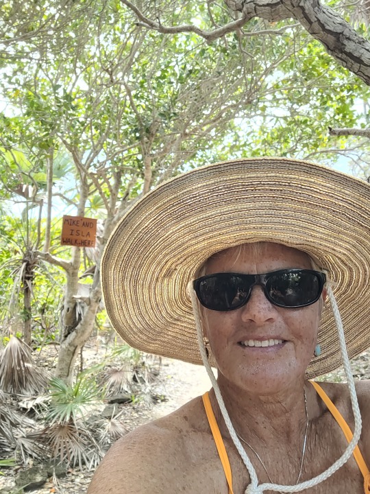
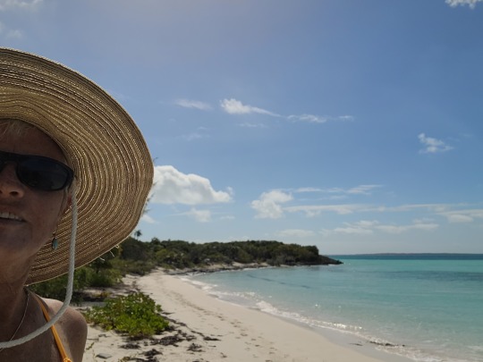
Nancy got tired of my terse answers and went “Walk about”.

She definitely had more fun than me! Anyway the engine ran, but I decided to tear it apart a second time. So we hauled it up the beach again. Nancy dug the engine pit in the sand this time. I tore the carburetor out a second time, while Nancy made a second loop of the beach and trails.
So far it runs ok, but have not done a true test. It runs at idle forward ok. Sun was out, so we dinghied at slow speed 1.3 miles in rough weather to Georgetown. I ran to the Hardware store for Carburetor cleaner $17. Nancy went grocery shopping at Exuma Market. We checked out with $53 worth of some essentials, which were stuffed in a waterproof bag. An 11 oz. block of coffee is $9. Swung by the liquor store for 2 bottles of Ricardo Coconut Rum, around $25 each.
It was an upwind slog home in 1 foot waves. Kind of wet. Groceries were dry. After a quick shower on the stern, we settled down for the evening.
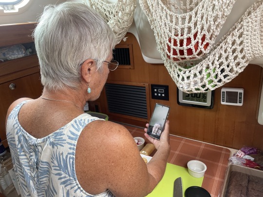
Here Nancy is What’s Apping her Mom in Fargo where it snowed again recently.
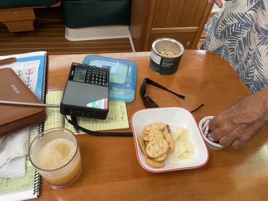
Evening appetizers while listening to the local FM station. After the long day, “pain killers” were the perfect ending that started on the beach.


Saturday the weather breaks and we will move down to “Water Cays” in the Jumentoes. We are taking fresh vegetables and other groceries to our friends who have been in the Jumentoes for three weeks. They are moving up from the Double Breasted Cays and we will both meet in the Water Cays.
This will be new territory for us. So far this is as far south as we have sailed. Not long after we leave our anchorage we cross the Tropic of Cancer. Approximately 23.4 degrees north of the equator. From there we cross just north of Hog Cay and head directly to Water Cay. We need to hit the Hog Cay Cut at high tide to make it through with our 5 ft. draft. Will be off the grid for the week or so. Luckily, we have a water maker that will make our week down there doable.
From there we plan on visiting Long Island (Bahamas) and will then be back on the grid. Hopefully we will have some good things to report from the Jumentoes.
S/V Sea Breeze. Sand Dollar beach, Stocking Harbor, Great Exuma, Bahamas.
4 notes
·
View notes