#puyehue
Explore tagged Tumblr posts
Text

Reserva Nacional Puyehue, Chile.
#chile tumblr#chilean#chileno#arhy#tumblr chilensis#chilegram#tumblr chilenito#chile#concepcion#iquique#puyehue#parquenacional#film#film photography#35mm#35mm film#35mm photography#color#river#falls#kodak#film phogoraphy#filmisnotdead#my post
9 notes
·
View notes
Text

Trekking hacia el 🌋 Puyehue en Otoño
#montaña#mountains#my photos#naturaleza#photography#sports#trekking#chile#fjallraven#volcán#volcano#trekkinggirl#parquenacionalpuyehue#cerro#puyehue#otoño#deporte#sur de chile#deportes#sport girls#explorar#explore#cordilleradelosandes#cordillerachile#los andes#trekkingchile#montañaschile
6 notes
·
View notes
Text
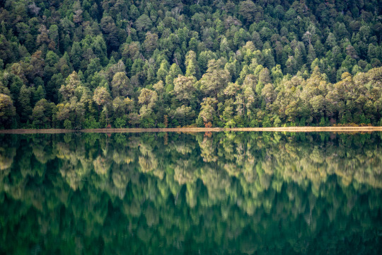
Lago Toro, Parque Nacional Puyehue, Chile
2 notes
·
View notes
Text
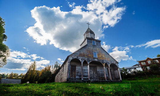
"10 Joyas Escondidas en la Región de los Lagos, Chile: Una Guía para Aventureros"
La Región de los Lagos en Chile es un verdadero paraíso para los exploradores, donde la majestuosidad de la naturaleza se combina con ricas tradiciones culturales. Desde imponentes volcanes y tranquilos lagos hasta emocionantes actividades al aire libre, aquí te presentamos diez experiencias imperdibles para cualquier viajero aventurero. 1. Explora el Parque Nacional Vicente Pérez Rosales Este…
View On WordPress
#Alerce Andino#Angelmo#chiloe#Frutillar#Iglesias#Lago#museo#osorno#Parque Nacional#Petrohue#Puerto Montt#puyehue#rafting#termas#todos los santos#Vicente Perez Rosales#volcan
0 notes
Text


Silent echoes
Lago Rupanco, Puyehue, Los Lagos, Chile.
#photography#art#nature photography#landscape photography#photographers on tumblr#artists on tumblr#travel photography#forest photography#waterfall photography#landscapes#adventure#los lagos#chile#patagonia#winter photography#aesthetics#lensbr#forestscape#waterfall#mountains#nature#patagonia chilena#south america
604 notes
·
View notes
Text

Chile's Puyehue-Cordón Caulle volcano spewing lightning-topped ash.
Photo - Ricardo Mohr
237 notes
·
View notes
Note
I just saw ur post asking for general name ideas and I love accumulating random words that could work as names someday so here's a bunch from that lol
Pinstripe
Parallax
Riprap
Moonshot
Sputnik
Conelrad
Aspen
Puyehue
Orrery
Coldwave
Hollyhock
Tephra
Xenia
Seiche
If u want definitions for any of these just say so and I can tell u what any of these mean/are from lol
THE TOP HALF IS VERY NAMES I WOULD USE THE BOTTOM HALF ARE REALLY COOL KIND OF ALIEN/ANCIENT DIETY NAMES I THINK MY GF WOULD LOVE... could you tell me about puyehue, tephra, xenia, and seiche?
8 notes
·
View notes
Text

Termas Aguas Calientes, Puyehue, Chile, 2024
2 notes
·
View notes
Photo
What is the topography of South America?
South America can be divided into three physical regions: mountains and highlands, river basins, and coastal plains.
Mountains and coastal plains generally run in a north-south direction,
while highlands and river basins generally run in an east-west direction.
1-Population Density, 57 people per square kilometer
2-Highest Elevation-Aconcagua, Argentina (6,901 meters/22,641 feet)
South America’s primary mountain system, the Andes, is also the world’s longest. The range covers about 8,850 kilometers (5,500 miles). Situated on the far western edge of the continent, the Andes stretch from the southern tip to the northernmost coast of South America. There are hundreds of peaks more than 4,500 meters (15,000 feet) tall, many of which are volcanic.
3-Largest Urban Area-Sao Paulo, Brazil (20.4 million people)
4-Amazon River (7 million square kilometers/2.72 million square miles)
A long time ago, those mountains were an island chain off the coast of the mainland. Then the South American continent collided with another tectonic plate, forcing the mountains higher. The mountains reconnected to the mainland, turning the strait into a massive lake. As the continent kept curling upward, the lake emptied out into the Atlantic Ocean via a massive river we call the Amazon. The depression where the strait and lake once sat is the Amazon Basin.
Fun fact: there are pink dolphins in the Amazon river that once lived in the strait and then the lake. The dolphins didn’t come upstream from the Atlantic.

VOLCANIC LIGHTNING In a scene no human could have witnessed, an apocalyptic agglommeration of lightning bolts illuminates an ash cloud above Chile's Puyehue volcano (map) on Sunday
Chile Volcano Plume Explodes With Lightning

The Global Infrared Satellite image shows clouds by their temperature. Red and blue areas indicate cold (high) cloud tops. Infrared (IR) radiation is electromagnetic radiation whose wavelength is longer than that of visible light, but shorter than that of terahertz radiation and microwaves. Weather satellites equipped with scanning radiometers produce thermal or infrared images which can then enable a trained analyst to determine cloud heights and types, to calculate land and surface water temperatures, and to locate ocean surface features.
South America: Physical Geography (nationalgeographic.org)
COUNTRIES IN SOUTH AMERICA
Argentina, Bolivia, Brazil, Chile, Colombia, Ecuador, Falkland Islands (United Kingdom), Guyana, French Guiana (France), Paraguay , Peru South Georgia and the South Sandwich Islands (United Kingdom), Suriname, Uruguay, Venezuela

South America elevation tile map : r/MapPorn (reddit.com)
Spanish and Portuguese are the most spoken languages in South America, with approximately 200 million speakers each. Spanish is the official language of most countries, along with other native languages in some countries.
South America - Wikipedia
DEVELOPMENT OF A 30-ARC-SECOND DIGITAL ELEVATION MODEL OF SOUTH AMERICA
DEVELOPMENT OF A 30-ARC-SECOND DIGITAL ELEVATION MODEL OF SOUTH AMERICA (esri.com)

South America elevation tile map.
by @cstats1
1K notes
·
View notes
Text
Die letzten 2 Tage waren wir am Puyehue und haben in einer kleinen Hütte biwakiert. Leider war der Gipfel in dem Wolken. Aber wir hatten eine traumhafte Abfahrt.
Heute geht es ab den Vulkan Casablanca und dann ziehen wir um an den Fuß des Osornos.
0 notes
Text
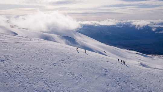
Camino a la cumbre...
🌋 Volcán Puyehue
#photography#montaña#sports#deportes#deporte#my photos#mountains#naturaleza#trekking#volcano#volcanes#chile#sur de chile#cordillera#cordilleradelosandes#dronelife#drone photography#drone#dronepilot#panoramic#panorama#montañaschile#cordillerachile#cerro#crater#explorar#explore#trekkinggirl#travel#hiking
10 notes
·
View notes
Text
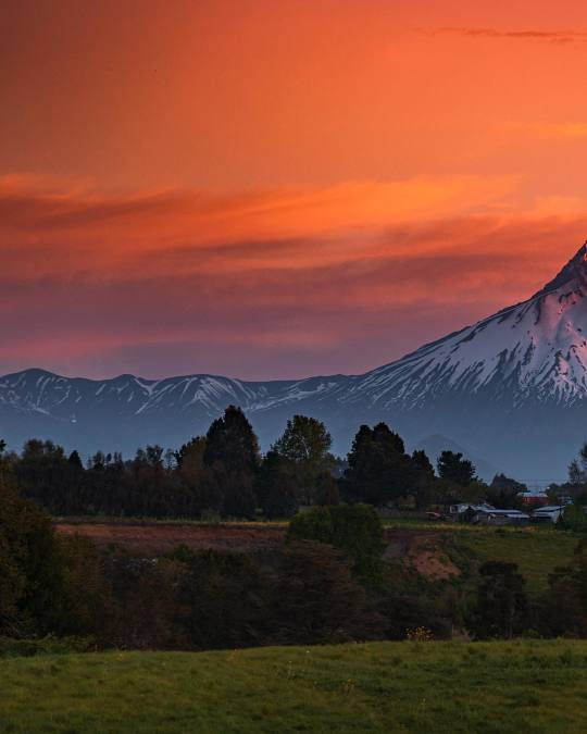
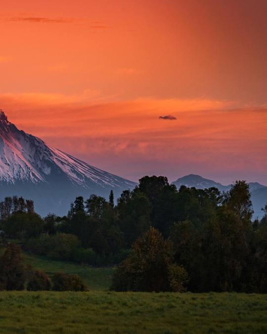
Winter skies
Entre Lagos, Puyehue, Los Lagos, Chile.
#photography#art#photographers on tumblr#nature photography#landscape photography#clouds photography#sunset#sunset photography#winter photography#travel photography#volcano#aestheitcs#lensbr#los lagos#chile#south america#landscapes#mountians#photoshoot#forest photography#mountains#adventure
2K notes
·
View notes
Photo

Puyehue volcano in Patagonia, Chile Calling all adventure seekers. Get ready to hike, explore, and witness the mighty Puyehue volcano in action in picturesque Patagonia, Chile.
1 note
·
View note

