#mosquito river campground
Explore tagged Tumblr posts
Text
Backpacking the Pictured Rocks National Lakeshore - Day 4
This video is the fourth day of a five day backpacking trip of the Pictured Rocks National Lakeshore. This is a 42 mile trail that starts at the Grand Sable Visitor's Center near Grand Marais, MI and ends at Munising Visitor's Center in Munising, MI.
This video is the fourth day of a five day backpacking trip of the Pictured Rocks National Lakeshore. This is a 42 mile trail that starts at the Grand Sable Visitor’s Center near Grand Marais, MI and ends at Munising Visitor’s Center in Munising, MI. Day four was 8 miles. Though not as many scenic views as Day 2 and 3, this trail still passes through some of the most scenic views in the world.…

View On WordPress
#chapel beach#Chapel Beach Campground#grand marais#grand portal point#miner&039;s beach#mosquito group campground#Mosquito River#mosquito river campground#muninsing#Pine Bluff Campground#potato patch campground#Spray Falls
0 notes
Text

”200,000 Steps on the Lone Star Hiking Trail” by Sergio Chapa, from the May/June 2023 issue of Texas Observer magazine:
I grew up in northwest Austin at the edge of the Texas Hill Country, where hiking through the woods and playing in creeks were daily activities. So, I’ve always been an “outdoors person.” After moving to Houston for a journalism job, I quickly began running and biking along the city’s mostly concrete-lined bayous. Then an environmental activist told me something intriguing: Just an hour north of the traffic and skyscrapers of downtown Houston is the 96-mile Lone Star Hiking Trail, the longest footpath in Texas.
During April 2020, I began a quest to hike the full trail along with a friend in my “COVID bubble.” It was a sunny and unseasonably hot day as we embarked from mile marker zero inside the 163,000-acre Sam Houston National Forest. So early in the pandemic, we hiked without seeing another person, hearing a car on the road, or spotting an airplane in the sky. The only sounds were chirping birds, squirrels and lizards scurrying, and the wind blowing through the leaves.
It was a Coronavirus-safe activity and I was hooked.
On maps, the national forest is depicted as a massive patch of public land. But on the ground, hundreds of U.S. Forest Service tracts are broken up by private timberlands, farms and ranches, and a growing number of rural homes and subdivisions. Mostly flat to rolling terrain, the forest is laced with creeks as well as the east and west forks of the San Jacinto River and the not-so-scenic lanes of Interstate 45.
Starting near Richards and ending near Cleveland, the Lone Star Hiking Trail proper is 96 miles through the forest with five optional loops adding another 32 miles. Depending on one’s height and weight, that’s roughly 200,000 steps. Given a pace of about three miles per hour, it would take roughly 32 hours to hike the entire trail nonstop. Hiking about eight hours per day means less than a week of hiking and camping.
But that’s not the path I chose.
It took me sixteen trips with various friends over two years to hike the entire trail. Confession: We weren’t disciplined about it; sometimes weeks or months lapsed between forays. Most often, I’d park my car at one of the 15 trailheads and we’d hike for five or six miles and then head back. On every visit, the trail provided valuable relief with its clean air, social distancing, and an escape from the four-wall confinement of lockdown and stress. Our slower approach allowed us to experience the forest in all four seasons.
Spring is marked by fresh light green leaves, wildflowers and white color pops of dogwood and magnolia blossoms. The summer can be brutally hot, but it’s the best time to enjoy Lake Conroe or Double Lake. The fall brings orange, red, and yellow hues as purple beautyberries and red yaupon holly berries ripen in the understory. Pine trees and oaks stay green during winter while colonies of colorful mushrooms and fungus sprout on the forest floor.
I shared our hikes on Twitter and Instagram, and the Lone Star Hiking Trail became a hit with my social media followers too.
It’s much easier to hike the trail virtually. To do it in person, you need plenty of water, snacks, insect repellent, spare socks, powder, paper towels and wipes, and willingness to rough it, since there are no bathrooms or vending machines aside from spartan amenities at the Stubblefield and Double Lake campgrounds. Good walking shoes and long pants with high socks reduce risks of scratches, bug bites and ticks. Snakes on this trail mostly flee from people. However, mosquitoes and spiders are fearless.
Early morning hikes meant the person in the lead breaks overnight cobwebs. Scat with fur signaled coyotes and bobcats, but the most worrisome signs were the wallows and rooting of feral pigs. My worst fear was encountering hogs, which can attack when frightened or startled. Luckily, we never saw any.
Sam Houston is one of the state’s four national forests created by Congress during the Great Depression. The timber industry previously clear-cut large swaths of the Piney Woods. State lawmakers bought hundreds of barren tracts in 1933, with the intent of adding them to the national forest system. President Franklin D. Roosevelt proclaimed Angelina, Davy Crockett, Sabine, and Sam Houston national forests in October 1936. Roosevelt’s Civilian Conservation Corps planted millions of trees. The U.S. Forest Service gave the Lone Star Chapter of the Sierra Club permission to build the trail in 1967. The trail and all its loops were complete by 1978.
It’s big enough that you can easily get lost. I’m an experienced outdoorsman, but we’ve gotten lost on the Lone Star Hiking Trail, marked by small reflective markers nailed into the trunks of trees. It’s easy to lose track of the markers after leaving U.S. Forest Service land and walking down a rural road to the next section. Cell-phone service can be spotty, so it’s best to download Lone Star Hiking Trail Club maps in advance.
But not all of this wilderness is protected. Legally distinct from national parks and refuges, national forests can be used for hunting, fishing, timber, grazing, mining, oil, and natural gas. By law, the U.S. Forest Service must manage Sam Houston with no single resource emphasized over others. To that point, the 163,000 acres also include trails for ATVs, mountain bikes, and horses. Lakes are stocked with bluegill, largemouth bass, and catfish. Oil wells and easements for pipelines and power lines are common.
Historically, wildfires kept the forest from getting too dense and unhealthy. Today, the U.S. Forest Service uses controlled burns and sustainable timber harvesting in efforts to control a pest known as the southern pine beetle and improve habitat for the red-cockaded woodpecker, an endangered species that favors open “pine savannas” and nests from April to June. Over the decades, environmentalists and forest managers have sparred in court over forestry practices related to the beetle and woodpecker.
I looked for those woodpeckers, but only heard their distinctive high-pitched chirps and tap tap-tapping hidden in the canopy.
Sprawl and suburbanization are the biggest threat to the forest and to this trail. I-45, the busy thoroughfare connecting Houston and Dallas, divides it in two, creating a formidable barrier for wildlife and people. The Texas Department of Transportation spent millions improving a 15-mile stretch of highway between Huntsville and New Waverly but spent little on allowing hikers or wildlife to cross safely under the roadway where cars speed past a white 67-foot statue of Texas founding father Sam Houston.
I wish the Texas legislature would use some of its $32.7 billion budget surplus to create a buffer for this trail—and improve the crossings that either don’t exist or have been damaged and make a through-hike so challenging. Unfortunately, this year has seen news in the opposite direction: The state recently lost a lovely park further north on the I-45 corridor that offered its own woodland paths.
In theory, animals can use the narrow corridor where Big Chinquapin Creek goes under the highway, but hikers must trudge four miles along three rural roadways and the I-45 frontage road in order to reach the next trail section.
Country-club communities such as Elkins Lake and the Texas Grand Ranch subdivision with its two- to five-acre lots allow people to live at the edge of the forest. As an unintended result, nonnative ornamental plants are escaping into the wild and becoming invasive species. The average person may not notice, but I kept spotting exotic plants like nandina, wax-leaf ligustrum, Chinese tallow, chinaberry, bamboo, and hardy orange all along the trail.
Volunteers with the Lone Star Hiking Club and the Houston area Sierra Club maintain the trail and try to clear out invaders. I’d love to give back and join them one day.
But it’s a big job—and progress is often slow.
A vehicle bridge to the Stubblefield Campground washed out during Hurricane Harvey in August 2017 but was not rebuilt until 2022. A footbridge over scenic and shaded bluffs of the east fork of the San Jacinto River in the Magnolia section of the trail was destroyed more than eight years ago and never replaced.
Hikers are forced to take a complex detour, though I opted to park my car at the next trailhead and walk to the opposite bank.
Even as the pandemic fades, I’m still going back for more, particularly to hike the loops outside the main trail. To me, this escape seems even more valuable with Houston growing at a pace that will see it overtake Chicago as the third-largest U.S. city. Even as the metropolitan area expands in all directions, the forest still offers respite.

7 notes
·
View notes
Text
West Ontario: Thunder Bay and Kenora
It feels like ages ago that I left Sleeping Giant as I'm currently in Calgary, three provinces further west 😅 but been busy traveling with very little internet access, so will aim to catch up by writing shorter posts! 🤞
On the way to Thunder Bay I visited the Terry Fox memorial - for non-Canadians, he was a young man who ran a "marathon of hope" to raise awareness for cancer; having started in St John's in Newfoundland, he ran 3,339 miles across Canada close to here, where he had to stop as his cancer returned & he died shortly afterwards. Supporting Terry Fox runs by friends were the first donations that I made in Canada (I must admit I never ran myself) and he has rightly so turned into an inspiration for many. The memorial serves both as a reminder that our health is the very first thing we should take care of, and as a motivation to never give up on life... ❤


In Thunder Bay I did the usual errands plus an unsatisfactory visit to a BMO bank branch, where I had hoped they would reinstate my credit card after a suspicious activity... however, they only could send a new card to my friends in Dundas (where I'll be back end September 🤔) so that stressed me out but luckily with the help of great friends 😍, I received the replacement card this morning in Calgary so I can now worriless continue spending ����.
Half an hour west from Thunder Bay I breaked for lunch at the Kakabeka Falls, the so-called "Niagara Falls of the North"... although pretty (& in a more natural setting than Niagara Falls), the comparison doesn't really hold true 🤣
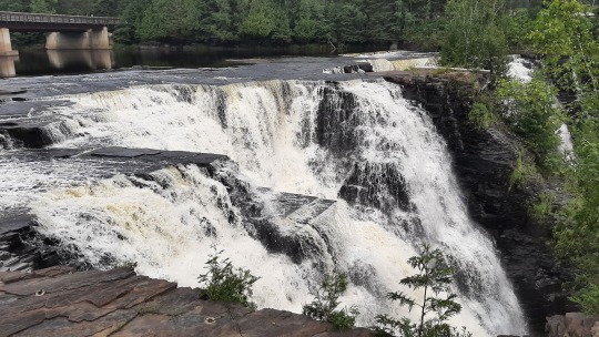
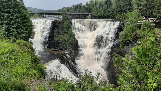
After that it was a 2hr+ drive to the little village of Ignace where I stayed in a lovely inn on a lake, run by a couple that used to live in Toronto but had moved here during the pandemic in search for a quieter life (which it certainly is with its 1,200p population!) .
Along the drive, the trees were still the same boreal forest (which I probably will never want to see again after this roadtrip 😁) and it was grey and boring so couldn't wait to stop for the day... the only interesting thing is that I changed another hour back in time, similar to Labrador not at a provincial border but just randomly somewhere 😅. Meant I had an extra hour to sit with my legs up!
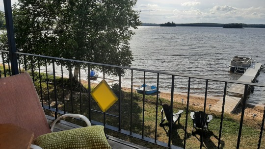
Next day, I made the last 3-hour push to arrive in Kenora, the most westerly town in Ontario and famous for being on the massive Lake of the Woods. The roads were much busier here with several links to the US border, and suddenly it became agricultural with rolling fields west of Dryden, a change from the forever-forest!
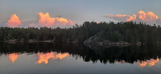
In the evening, the lake at my campsite at Rushing River provincial park became dead still and massive clouds turned pink when the sun set... pretty! 😍 As a really great plus, there were no longer flies and very few mosquitos which makes being outside so much nicer. As a really big negative, there was a snake that came my way when I was sitting at the picknick table chatting with a friend. After booing it away, I researched Ontario snakes and although the common eastern gartersnake is not poisonous and doesn't normally attack, I was less than pleased when it showed up next to me again! 😵
In the morning, the water was still very calm so had a beautiful paddle before breakfast. I never cease to be happy when I'm on the water!! 🤩
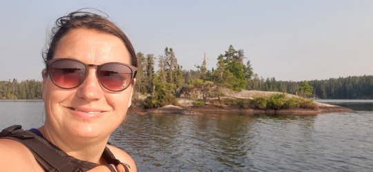
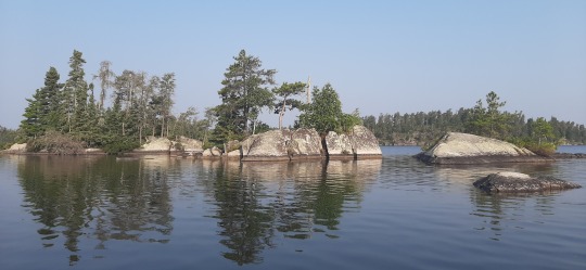
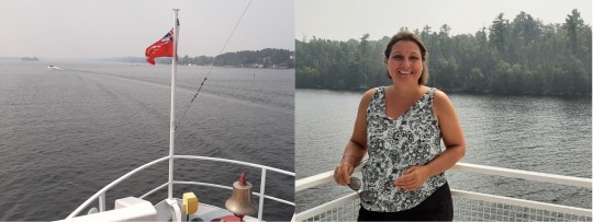
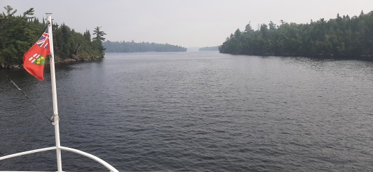
Thereafter, I drove into town for a boat tour on the MS Kenora along tons of islands, rich houses, "devil gaps", spiritual rocks as well as 6 bald eagles. It was pretty but very hazy due to the smoke so then everything turns into the same gray-yellow hue... 🤨
After visiting an art gallery dedicated to a local painter and an interesting exhibit on the 150th anniversary of Indigenous Treaty #3 - " which will last as long as the sun will shine and the water runs, that is to say forever", it was patio time for a drink & snack with view on the lake! ☀️ Back at the campground, it was so sticky hot that I went for another little paddle to the beach and a refreshing swim 🤓
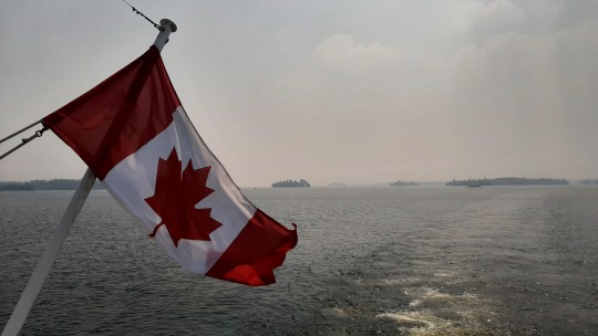
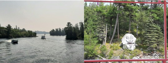
There was too much wind in the morning for another paddle so spent some time cleaning out and repacking the car, throwing away any items that I hadn't used for the last two months, no point in keeping those!
Although it was a great spot on the water, the campsite was a walk-in on a slope so I ended up hating it going up & down endlessly to my car... mental note never to book that again!
Before heading out, I did a small hike along the namesake rapids that the park was created for, but it was hot & humid so not enjoyable.
Time to say goodbye to Onario and off to Manitoba!
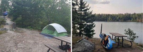
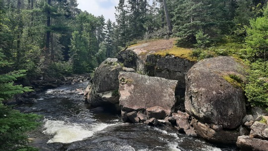
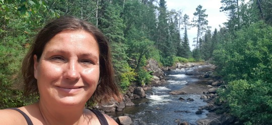
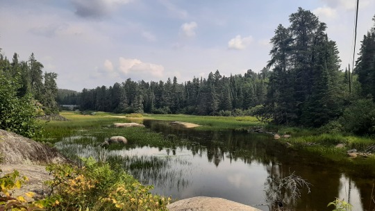
Wildlife: 1 deer (Dryden), 1 common eastern gartersnake (twice!), 6 bald eagles and 1 loud flying loon (Rushing River/Kenora)
SUPs: two at Rushing River
Hikes: one at Rushing River
2 notes
·
View notes
Text
Monday July 22
Island Mine (4.3 mi on map)
Apple Watch 5.05, total time 3:10, average pace 39’48”, 731 ft elevation gain
We were in pretty thick trees and there was a layer of thin clouds, so the sun didn’t wake me up this morning … but Jeff packing up his sleeping bag did. I snuggled into my sleeping bag and wished I could sleep for another hour, but the sound of the others moving around made me get up.
Made a smaller batch of Oatmeal this morning, remembered my spices and we threw in some strawberries and blueberries that Lynn & Kent’s daughter had dehydrated. We added some olive oil (Jeff accidentally burned the top last night so we were trying to use it up) and it was quite tasty - and just the right portion size for our group! Clean up took a little longer, and we had a few laughs while we were packing up as Dan, who didn’t have a belt along, tried to make suspenders out of rope to keep his pants up!
Three guys came in last night on a boat, we didn’t chat with them then, but did a little this morning when they came up to camp in search of the privy. They’re from Duluth, up here fishing. They mentioned it might rain today, but for now it was very thin clouds. For the second day though, Lake Superior was eerily calm!
By 9:30a, we were packs on and ready to go. We had some intel from the guys we’d met yesterday, plus there was a sign by the pier describing the best route to the Island Mine trailhead. That was to walk along the beach as the trail was overgrown and you could also be thrown off by animal trails!
There were two spots we had to leave the beach - one over the Siskiwit River on a rickety bridge, and then for a short cut over the peninsula. I led that portion, getting a face full of spider webs. I must have left the mosquitoes in my wake however, because the rest of the group came out to the beach and quickly put their bug nets on! The rocks on the beach on the other side of the peninsula were prettier, and I quickly spotted an agate! Most of Lake Superior’s shores are picked clean of agates these days, but I’m guessing few people actually traverse this beach! Lots of other cool rocks with algae or something that looked like hieroglyphics!
We had 1.8 miles of beach walk, then turned inland. I braced myself for more busting through the foliage, but was so delighted to find it was mostly beautiful trail! We had a packs off break at 3 miles and I unzipped my pant legs and took off the t-shirt underneath my long sleeve hiking shirt. We’d been climbing and I was hot!! I sprayed down with bug dope and wasn’t too irritated by them today.
We continued to climb, and most of us took another “lay down on the granite slab break” after a particularly steep climb (which made me feel like lap 13 on last years 29029 challenge!). We were delighted to come upon the Island Mine campground just after the 5 mile mark on my watch - about 1 pm.
It was a fabulous group campsite with more than 4 awesome tent sites and a fire ring, but the place was swarming with mosquitoes! We pitched our tents, and started gathering firewood. Good to get some smoke going to dissipate the bugs somewhat.
Tam brought out lunch and it was different to be eating lunch with a fire going and tents already pitched.
The guys from yesterday also told us they found a small stream for water about a quarter mile up the trail. A group of us ventured out there, Dan used his pump filter, Kent filled the gravity filter, and I used the steripen on the full Nalgene bottles. We calculated how much water we’d need for dinner, breakfast and hiking tomorrow - a lot! Just as we were finishing up, it started raining lightly. Lynn headed back to have Jeff and Gary help her set up their new awning. The campsite has a pretty thick canopy of trees, so not a lot of rain was falling in most spots of our side - just sprinkles on our tent.
Good to have the time to hang around this afternoon. It’s been hard to visit on these narrow, overgrown trails! Jeff retreated to the tent for a siesta, and I went in to write and read. The others stayed outside visiting, even though it was raining harder. I love being in the tent in a rainstorm!!
Jeff and I emerged from our tent about 5:30p and found the gang had water boiling for dinner. We shared 3 packets of Ginger Chicken with Rice - yummy, with chocolate bars for desert, plus we finished off our little bit of bourbon. While we were finishing dinner, we had a visitor. A guy from Kentucky camping on the single sites with his 17 year old daughter and 12 year old son. They came from Feldtman Lake today - about 17 miles - wow! They flew into Windigo and are hiking to Rock Harbor then will take the Ranger to Copper Harbor to rendezvous with his wife and younger two kids - hard core!!
Lynn and Kent were nervous about where their tent was pitched so after dinner we moved their tent to under their awning for the evening. We stood around the fire pit for awhile, stirring the ashes and soaking up the heat, wearing our rain jackets. We’d expected rain, and thankfully, this was perfectly timed.
Early night, planning on early departure so we can relax and clean up before our plane leaves at 3p EST from Windigo. The plan is to be hiking by 7am!!
0 notes
Text
Dugway Campground - Dugway Recreation Site, WY

We found our way to the Dugway Campground - trash cans, water, and vault toilets - what a nice free campground on the shores of the North Platte River! We backed into one of the 5 sites, which all have a fire ring/grill and a picnic table, along with a trash receptacle. All of the sites came with mosquitoes, too - haha! It is a pretty spot and, since we are in Wyoming, there is a nice breeze to help combat the mosquitoes.

The campground was a lot prettier than we expected - lots of greenery and rock cliffs.

Good night from Dugway Campground!
0 notes
Text
BOTR - Day 39 - July 23, 2024
Breakfast then break camp.
We left mosquito central and headed to Rocheport. There’s a trailhead there with lots of parking. We found a spot in the shade (shade for about an hour) and unloaded the bikes.

Downtown Rocheport.
We were a quick pedal from a tunnel that was well known on the trail. We pedaled to that just to experience it. Then we turned around and headed down the trail along the Missouri River. In general, the trail flows under a canopy of trees. Where we were riding, 50-100 foot bluffs pressed against the trail. Obviously runoff flows could be seen in the woods between the bluffs.

NO. Don’t stop there. Read the sign.
Pedaling past the trailhead.
On our other side was the river. It had a steady flow of brown water and was at least 100 yards from bank to bank. Army Corps of Engineers jetties protruded into the river from its banks and, in placed, sat in the middle of the river, blocking its flow.

Missouri River.

The bluffs.

More bluffs.

Food cache? Living quarters?

Just us!
However, the most noticeable feature were the mosquitoes. No issue if you were moving. However, I stopped to take a picture and was swarmed with dozens. I stopped a second time a few miles later and was attacked by twice as many as before.
Recent rains and flooding brought about the infestation. Next time, we will more closely watch the weather. This was not the time to be on the Katy Trail.
Post ride, we ate lunch at the Meriweather Cafe at the trailhead. We enjoyed bug-free dining on their patio. Breakfast for me. Lunch salad for Diane. While relaxing we found the Maramec Spring Park as a potential spot for the night. The campground appeared to be relatively empty so we had a target destination.
A couple hours later and we were in our spot at the campground. It was nicely shaded and, while there were some, there were far fewer bugs than our previous campsite.
We relaxed over beers, cooked smoked salmon and eggs for dinner, showered, and then had our first full game of scrabble in the van. By the time we finished, it was time for bed. By the time we climbed into bed, the rain started. Perfect timing for a cooldown!
1 note
·
View note
Text

Started on pavement, until the north of Whitefish Lakes.
Put on my bear bell and strapped on my bear spray as I hit the gravel.
Lunch at Red Meadow Lake campground. Covered up completely to avoid many mosquitoes. Picked a site in the shade to eat and kept getting wife's of kerosene - never found the source. Found a throwing ax.
As I pass vehicles I always wave, even if the trucks don't slow down and dust me in a cloud.
This afternoon a guy in a truck with his wife, who slowed down and asked if I wanted a beer. He reached into a cooler beside him and handed me one, shaking his head and saying "crazy.". I still had ice in my bladder, so I wrapped it around the can.
Parts of the North Forks of the Flathead River are like a lake due to all the beaver dams. Decided not to filter water there, but waited till Trail Creek, where I also soaked my shirt to cool off.
The road became rough as it followed the dry Yakinikak creek. Some sections were scree slopes. One section had a car size boulder to negotiate around.
Tuchuck Campground

0 notes
Text
Monday, June 12, 2023 Day 12
End Mileage 30117 4:00 PM MDT
Start Mileage 30887 7:40 AM MDT
Miles 230
Gas 15.50
Gas 20.65
Toothpaste 2.40
Car Wash 2.00
Camp 65.00
Total 105.55
Had breakfast at the main hotel, then I packed filled up with gas and I was on my way. Idaho US 89 began in a narrow valley with green sage bushes along the way on the hillsides closing in on the road. Not a gorge or canyon but a narrowing valley that was climbing in elevation until reaching a mountain pass with wide views. Descending I was debating how far to travel today. Passed by a pleasant lake - Palisades Lake Reservoir. Stopped a few times at pull offs and one time for a pose. Continued to Rigby and kept heading north to Ashton then headed east to Cave Falls in YNP. The 14 mile dirt road was a washboard so very slow going. The van shook the whole way. At the falls I took some pose shots and because my ankle was not feeling well I decided to not do any hiking. The falls were impressive with the water flow and the heavy mist in the air. Mosquitos were present in mass. Back at the forest service campground I planned to spend the afternoon, I found the campground closed. I parked at the gate and walked to the river – a northern wilderness Canadian river feel. I posed along the river. So onto the dirt road. At the beginning of the paved road was a golf resort campground. I got a site, but no bath facilities. So it was primitive site with electric and water service. And then the rain came. It was hard to prepare supper under a tarp. I showered outdoors using my new shower pump. Had a nice sleeping event. A good day.
0 notes
Text
CANADA - BRITISH COLUMBIA
The rest of the caravan went well. We got so busy, I didn't post anything for a while. We finished up in Whistler, British Columbia, then headed back into the United States on August 24th.
2023 Aug 17 (Thu) – At 7:30 a.m. we served breakfast to the group. Johnny & Linda cooked sausage and scrambled eggs in their rig; Paul cooked pancakes on a griddle in the pavilion. Everything was very good.
At 10:30 a.m. we went to the ‘Ksan Historical Village next to the ‘Ksan Campground for a tour of their longhouses. There are 7 buildings; we were shown 3. One lodge was used for sleeping. As many as 50 families slept in a lodge. They had many children; our tour guide’s grandfather was from a family of 14 kids. There was a fire in the center of the room used for warmth and cooking.
The next building was their community lodge where they held rituals and group activities. The last building was used to store the regalia of the chiefs. We learned there are 5 clans and each clan belongs to a house. They are a matriarchal society and the children follow the mother’s line. Our tour guide is a native and of the village and knew a great deal about their history and customs. She explained a great deal about all the artifacts arranged around the lodges as we listened to her tell us about their customs and beliefs.
Paul and I drove into town to get fuel and stopped at Zelda’s Travel Mug Café. Weird name. Even weirder set up with no real kitchen. They cooked on a stove and washed in a sink in a little area at the back of the tiny building. Our meal was good.
At 7 p.m. we had a travel meeting and prepared for a long move tomorrow.
2023 Aug 16 (Wed) – We packed up and drove 165 miles to Hazelton, a relatively simple drive over nice roads. The campground is run by First Nation and adjacent to it is the ‘Ksan Historical Village. There is one road that runs down the middle of the campsites with pull-thru sites on the right and left. It was so easy to park everyone.
During the drive, we stopped at a nearby street to look at some totem poles. Some of the oldest collection of totem poles is in the Hazelton and New Hazelton area.
2023 Aug 15 (Tue) – We had a travel meeting at 7 p.m. After that, several of us went to Fish Creek to see bears. We did not see any, although other people said they did. This time, there were gulls in the river. The ranger said they look for the eggs to eat. The poor salmon don’t have a chance – between the gulls eating their eggs and the bears eating the fish, it’s a wonder any survive. Yet, there are thousands in the river all trying to get back to their birthplace to lay their eggs then die. Nature can be strange sometimes.
Stewart, British Columbia is right next to Hyder, Alaska. You cross the border from BC to Alaska. There is not border agent there. Hyder is essentially a ghost town. It boomed during gold rush days but is now virtually deserted. A few hanger-oners live there and run a shop or two but the town is pretty empty. The Fish Creek Observation Site and the Salmon Glacier viewpoint are in Hyder. When you return to Stewart, BC, you have to go through the border crossing and there is a border agent there. They check your passport, ask the customary questions, and pass you through.
2023 Aug 14 (Mon) – The clouds parted and the sun came out so we drove back up to see Salmon Glacier this morning. A grader had worked the road last night and the first half of the road was so much better than yesterday. When we got to the top, we found 3 trailers camped up there. One was a small airstream. Who would take their trailer on that road?
The view of the glacier was phenomenal. It looked like a river of ice flowing down between the mountains and turning to glow down to Bear River. We saw a marmot hiding in the rocks. Mosquitos were fierce!
At 5 p.m. we had a potluck meal. The pavilion had been promised to another caravan in the park so we set up tents. Joe Padberg had a 10x12 and a 10x8 to go with our 10x20. Things were a little wet with the rain but it all worked out. The meal, as always, was delicious.
2023 Aug 13 (Sun) – We packed up and headed out to Bear River RV Park in Stewart. It was a long drive – 242 miles. It made for a long day. We got everyone parked then headed out to see Salmon Glacier. Unfortunately, it was foggy and overcast and we couldn’t see much once we got to the top. The road up was pitted, rutted, washboard and just plain worn out. It was a very rough ride on narrow, twisting dirt road. No guardrails either so it was a bit scary.
Half-way up the mountain, we came upon a mining operation. It wasn’t there 8 years ago when we came here in 2015. They had the whole side of the mountain reduced and large trucks were moving in and out of the area. There was a heavy duty electric yard set up and a huge building nestled into the side of the mountain.
When we came down the mountain, we stopped at Fish Creek to see if we could see any bears. There is a large raised wooden walkway that stretches along the side of Fish Creek. Thousands of salmon were in the creek, coming back from the sea to spawn. Bears come into the area and feast on the salmon. We saw no bears today.
2023 Aug 12 (Sat) – We packed up and left Watson Lake headed to Dease Lake. It was 146 miles; not too bad. The roads are slowly improving as we move south. We just stayed in Dease Lake for one night.
0 notes
Text
Hey MOOSE!
Sunday, August 6, 2023
We started the day with a walk along the Cheticamp River whence Riverside Retreat Campground gets its name. The birds and mosquitoes keep us company as we strolled along the banks of this lazy tannin-stained waterway.

After breakfast, Jeanne drove Margaret and Tim to the trailhead for the Skyline Trail. When Tim and Jeanne were last here, we did an out-and-back. This time, Margaret and Tim decided.to do the whole six-mile loop. This is the one trail in the park that prohibits dogs so we leave Jeanne to read and Dora to guard Jeanne.

The trail is flat and easy. We stroll along at a good pace listening for birds and deciding how to identify trees. We come across an enclosure with high fences. The sign reads, "If you see a moose in thisu area, call this number." Further on there is a lookout point and signage. The moose have been eating all the saplings of the boreal forest and turning the area to a grassland/savannah. How could this happen we wondered and read on. "Eastern moose are native to Cape Breton, but became rare by 1900 due to excessive hunting and habitat destruction, and were likely wiped out by the 1930s. Parks Canada decided to re-introduce moose to Cape Breton Highlands National Park, and 18 western moose from Elk Island National Park, Alberta, were released in Cape Breton Highlands National Park during 1947 and 1948." However, due to the lack of wolves, the moose population has grown to 4 times what it should be. So much for those baby spruce, tamarac, pine, balsam and other trees. The park has begun tree reintroduction work and showed 3 ways the planting is being done. The hope is to have the trees get a head start in the enclosures and eventually the moose will be let back in. No mention of reintroducing wolves.
On we go down the path to the boardwalk. This is a wide wooden stepped path that descends the hillside toward the Gulf of St. Lawrence. Wide, spectacular views. Tourists gazing, taking selfies, looking for whales, oohing and aahing. It's simply gorgeous.

Back on the path we find fewer hikers since this is the longer leg of the loop. 20 minutes along two women stop to tell us that there are 2 moose up ahead! Fingers crossed they are still there when we arrive. We walk gingerly forward not wanting to scare them away. No fear - they are calmly munching and munching and munching near the path. A few other hikers are stopped as well - everyone hushed, taking pics, smiling, gesturing. The moose are all nose and mouth, glancing at us briefly and then returning to the task at hand - eating 40-60 pounds of browse a day! We tear ourselves away and soon hear a hermit thrush. Margaret has now ascended into the 7th heaven.
When Tim and Margaret return, Dora greets the hikers with joy and wiggles. Jeanne has had a peaceful time, interrupted only by losing her cellphone and having it be returned to the rangers who give it to her. Phew!
We head into town, Cheticamp, for restocking the larder, then on to have dinner on Cheticamp Island. Margaret again realizes you don't have to plan ahead for your picnic, since you always have all your food, AND your kitchen with you when traveling in an RV. Down a long dirt road we arrive at the lighthouse and park overlooking the ocean. Bucolic with warm breezes, lapping waves, bounding puppy and cows grazing in the distance.
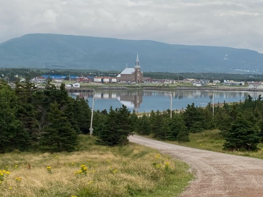
All of a sudden, Dora starts barking. Apparently the small herd has taken an interest in little dogs and Dora is ready to take them all on. Running right at them, barking, and jumping she's a force to recon with. And the cows too, seem to be ready for the duel as they keep marching forward. Tim and Jeanne decide Dora is too small for a bovine battle and bring her back to the RV. But the cows aren't done yet; they keep coming in for a closer look and need to be shooed away. Peace returns and we eat dinner overlooking the gulf and admiring the cliffs and mountains in the distance.

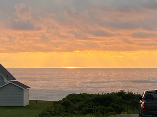
As we drive back towards camp we see a shimmering spot on the horizon just below the cloud bank. What could be doing that? It looks like a UFO just settling on the ocean. Or is it about to take off? The horizon is glowing, glinting and glittering, shimmering and shining, glistening and gleaming. A spectacular end to a terrific day!
1 note
·
View note
Text
Backpacking the Pictured Rocks National Lakeshore - Day 3
This video is the third day of a five day backpacking trip of the Pictured Rocks National Lakeshore. This is a 42 mile trail that starts at the Grand Sable Visitor's Center near Grand Marais, MI and ends at Munising Visitor's Center in Munising, MI.
This video is the third day of a five day backpacking trip of the Pictured Rocks National Lakeshore. This is a 42 mile trail that starts at the Grand Sable Visitor’s Center near Grand Marais, MI and ends at Munising Visitor’s Center in Munising, MI. Day three was 7 miles. Again, this trail passes through some of the most scenic views in the world. Turquoise water and cliff views to inspire most…

View On WordPress
#Beaver Basin Wilderness#Beaver Creek#Beaver Creek Campground#Chapel Beach Campground#Chapel Rock#Coves Campground#Coves Group Campground#grand marais#Lover&039;s Leap#Mosquito River#muninsing#Pine Bluff Campground#Spray Creek#Spray Falls
0 notes
Text
Chillin' by the Green River - Browns Park, CO

We have spent the last 4 nights here at Crook Campground in Browns Park along the Green River. When we arrived at the campground we found out that the mosquitoes here are awful - I think I used up a full bottle of bug spray just to survive! In addition, it was extremely warm and a bit humid. It would have been lovely if we could have sat outside to cool off a bit, but mosquitoes!!!
We did manage to take a couple of hikes - we walked along Wildlife Road, ended up walking 11+ miles on that one. Great views of the river and we encountered a few deer flies (as if the mosquitoes weren't enough to deal with) along the way, but it was a nice way to spend a warm afternoon.


We also took a 6 mile hike in Crouse Canyon on the other side of Swinging Bridge. We ran across a deer and a family of sage grouse - no pictures, they were all too quick to scatter up the hillside.

Swinging Bridge.

We saw these crickets EVERYWHERE - a bit disgusting on the highway from Dinosaur to Maybell, where they were smeared by the thousands on the roadway - ugh! There were just a few of them on our hike today, thank goodness!

Pretty day along the Green River.

Cheers from Browns Park, we head out tomorrow for Rawlins, WY - the golf tour continues!
0 notes
Text
Fielding to Eketahuna
Saturday, February 22nd, 2020
I had a major mosquito issue at 3 in the morning. I left the window open to let in some cool air and there are no screens in New Zealand. I woke to rain showers and this pushed all the mosquitoes inside. I spent the next hour hunting and killing them with my cellphone flashlight. I killed 12 in all.
I woke at 6:30am and started getting ready for my ride. I had a good breakfast of yogurt and fruit followed by a bowl of cereal and then some toast. I rolled out at 9am in a light drizzle.

I stopped at a small cafe for a latte after which I headed toward Bunnythorpe and into the big city of Palmerston North. The city was easy to get through because of the great bike trails along the river.
The road between Palmerston North and Pahiatua had little shoulder and a lot of cars and was the biggest climb of the day.
I stopped at a bakery in Pahiatua and had a chicken salad sandwich with lots of veggies and a custard tart. After I was done I rode toward Eketahuna. There were no cars and the road was excellent.

After arriving in Eketahuna I found the campground and set up my tent and site. I took a nice warm shower and then rode back into town for dinner. I had a chicken burger with an egg and pineapple slice with fries and 2 beers.

After dinner, I stopped by a 4 square and picked up an orange and giant chocolate bar. As I write this at 9:20pm there is a large group of women drumming very loudly and chanting at the campsite. I guess I'm wearing earplugs tonight.
2 notes
·
View notes
Link

Aerial view of the southern edge of the Brooks Range mountains. Credit: Christopher Miller for The New York Times
Excerpt from this article from the New York Times:
Up in the right-hand corner of Alaska, like something freezer-burned and half-remembered in the back of the national icebox, lies a place called the Arctic National Wildlife Refuge. The refuge is the largest wildlife sanctuary in the United States. It is the size of South Carolina. It is also home to the country’s second-largest wilderness area. It has no roads, no marked trails, no developed campgrounds. The Coastal Plain, the narrow strip where the refuge meets the sea, is home to more diversity of life than almost anywhere else in the Arctic. It is the kind of place where you can pull back the tent flap with a mug of coffee in hand, as I did one morning in June, and watch a thousand caribou trot past.
The animals came slowly at first, by twos and by threes, and tentatively, lifting their black noses to catch the strange scent of 10 unbathed campers. Then they tacked across the river. Near the front was a bull with a rack big enough to place-kick a football through its uprights. Mostly they were females in dun coats, serious mothers leading coltish calves that slid and played on the snowfields that still collared the tundra’s low places. Ungainly in looks, but a natural for work — each hoof a snowshoe, with hollow fur for warmth and to buoy them across gelid Arctic rivers. The calves had been born three or four days ago. Already they could walk farther in a day than a human.
The few caribou became dozens. They materialized by the hundred out of the heat-shimmer that rose off the tundra, like those lawmen bringing hot justice in old Sergio Leone films. Confident in their numbers, they surged past the encampment, urged by some twitch in the marrow to keep pushing toward the coast where ocean breezes would scatter the mosquitoes and bot flies that soon would torment them. We watched for a long time, not wanting to move and disturb anything.
“This,” someone whispered, “is sacred.”
In late 2017, a Congress controlled by Republicans badly wanted to pass the Tax Cuts and Jobs Act. To help win the crucial vote of Lisa Murkowski, the senior Republican senator from Alaska, the Senate added a sweetener, a provision that opened to oil drilling the refuge’s Coastal Plain, a roughly Delaware-size piece of ground where the Brooks Range reclines and the tundra tilts toward the Arctic Ocean like the baize of an old pool table.

Barren-ground caribou from the Porcupine herd graze on cottongrass in the Arctic National Wildlife Refuge. Credit: Christopher Miller for The New York Times
8 notes
·
View notes
Text
A geology field trip to remember
I personally loved petrology as a class, and I really enjoy looking at rocks under the microscope.
So naturally, I was stoked when we decided to leave for the field trip.
First, we had to stop in a little town for like 3 hours because one of the vans got a flat tire.... okay whatever, we'll just wander around this parking lot with used cars for sale in it.
Once we got going, we spent most of the day stopping at outcrops, giving our professor some real smartass comments (mostly like "what do you think this is?" "A rock" type of thing... nothing terribly creative)
Then, the preferred campground was full of families and whatnot, so we go to another that was so full of mosquitos, you couldnt breathe without inhaling a few. (Deet was literally the only thing that worked... it was disgusting)
We learned very quickly not to talk to the professor until he had his first beer and first cigarette (I think he smoked an entire pack in one night and drank a whole case... germans.)
In my class, theres a girl from Japan. Her english is amazing, but theres some nuances she doesn't quite get. So what do a bunch of mildly intoxicated college students do? We start teaching her the usages of words like b*tch, sh*t, and f*ck.... every now and then the professor would insert some comment.
The next morning my tent partner and I learned not to leave the tent until he had his first cup of coffee.
The next day, out in the field, the prof definitely "threatened" to hit all of us over the head with a rock hammer if we gave him one more sarcastic comment.
Back at camp (new place, near a river, bats are present, so much less of the mosquitos)
Same thing at the fire, teaching the poor Japanese classmate English nuances. More comments from German professor.
I stayed up later with a couple of other classmates (one of which was underaged and had brought out his flask of whiskey).
The next morning, I stayed in the tent until our professor woke everyone up. Underaged classmate was busy puking while we were breaking down our camp stuff.
All in all it was a fantastic trip, but oh boy, the shenanigans.... I'm gonna miss all these fools when we graduate...
#geologydepartments#geology#volcanologists#dammitandrew#Germans#Japanese#camping#fieldtrip#petrology#igneous rocks are hard#bring a sledgehammer#rockhammers do jack all to them
10 notes
·
View notes
Text
Day 7: Marfa
Started the day early, as you can see from our previous post. The sunrise was beautiful.
We didn’t even have that many bugs in the tipi when we woke up. No beetles crawling on the duvet or anything. I call that a win. But seriously: don’t go there if you can’t deal with bugs.
After making breakfast and lunch for the road, and cleaning the tipi as best we could, we drove down the dusty, up-and-down road from Basecamp, and found our way south towards Big Bend National Park. The whole area lacks cell reception, as we’ve said before, so we had to drive using a paper map today. It wasn’t too hard, though. The roads are clearly marked and relatively easy to see.
There’s so much to see in the national park, but there were two places we definitely wanted to visit.

First: Chisos basin and The Window. The nature is truly awe-inspiring, and I think our conversation mostly consisted of “Wow!” and “Look!” At first, we took a slight wrong turn and ended up at Chisos campgrounds, but a nice park ranger pointed us in the right direction.

Turns out we only missed our target by about 50 metres, but it was all for the best. If we hadn’t taken the detour, we would have missed the BEARS! Yes, that’s right! Not one, not two, but FOUR black bears just off the trail. The highlight of the trip, right there.

We walked around the bend to see the Window, and a gentleman with a camera shushed us and waved us over, mouthing “bears, bears”. I thought I heard wrong, but over on the ridge we clearly saw a mama bear and her three cubs. She was just wandering around in the shrubs and bushes, occasionally digging in the ground, probably for ants or something.
It took a long time before we could say anything, or even move along, but eventually it became too hot and we walked back to the car park - I almost stumbled over a road runner, but unfortunately I didn’t have my camera ready (but not before stopping in the shop to buy something cold to drink, and I finally got my sun hat! :)).
Taking the spiralling road back down the mountain, we continued south on Ross Maxwell Scenic Drive to the Santa Elena Canyon Overlook. We had our lunch on a bench, watching that spectacular view and feeling very small indeed.
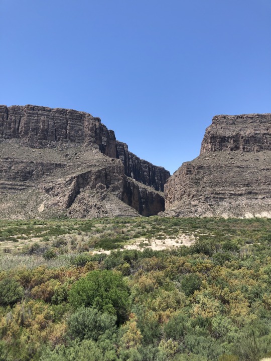

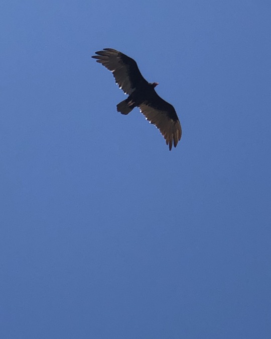
Finally got ID on the vultures we’ve been seeing. It’s Turkey vultures, if my knowledge and Google does not fail me. This one kept us company while we stood looking over the edge into the canyon.
After this, it was time to make our way to Marfa, backtracking up the Scenic drive, back to Terlingua and through to Lajitas and Big Bend State Park Ranch, following FM170 (The River Road) to Presidio, before turning north to Marfa. Let me tell you: part of the road between Lajitas and Redford would never have been approved in Norway. Deep dips and blind hilltops ending in blind turns, and it was equal parts exhilarating and terrifying.
But it was fun driving along Rio Grande and the Mexican border. Some places we could even see into Mexico as well.
The road from Redford to Marfa was pretty much uneventful, except for a small return of cell reception in Presidio, which quickly disappeared once we left the city limits again, but that meant we could use our digital map again. So helpful!
Tonight we’re staying in Hotel Saint George, the poshest hotel on this trip. It’s really luxurious after our trip through the desert, so I say we deserve it!
Marfa is one of the towns hosting Viva Big Bend (along with Alpine and Marathon), so after a mediocre dinner at Jett’s Grill (bacon penne with a red, creamy, tequila sauce for me, and a burger for Øyvind), we walked the few blocks to Planet Marfa to see some concerts. There were several venues with concerts, of course, but we started talking to a couple from Midlands, Melinda and David, if my memory serves me right, and we had a really pleasant evening. We totally forgot to go to the Lost Horse for the last concert we kinda wanted to see.
I really liked Planet Marfa. Wonderful ambiance, nice people, and good music!
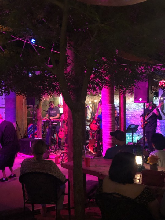

After the last concert, we headed back to the hotel for some well-earned rest (loved the guy dancing dressed in a t-shirt, what looked like pyjama shorts, cowboy boots, a cowboy hat, and with a sigar hanging from the corner of his mouth. He looked like he was having the time of his life :)). And some cooling insect gel. I haven’t had this many mosquitos try to eat me before on this trip – clearly they all live in Marfa.
Today’s wildlife:
Plenty of road runners (meep-meep) - I almost managed to photograph a few of them, but the moment I got close enough, they took off into the bushes, vultures and other birds of prey, I saw a bunny, and something that looked like a squirrel, but did not move like one (I only saw its hind legs and tail), a dead kangaroo rat, a couple of beautiful, bright blue lizards with red-ish tails, and of course: the black bears. I still cannot believe we saw bears!!!
3 notes
·
View notes