#loch linnhe
Explore tagged Tumblr posts
Text


high altitude
instagram.
#photography#original photography#photographers on tumblr#landscape photography#nature photography#nature#landscape#landscapes#mountains#hills#river#waterfall#mist#clouds#scotland#scottish highlands#highlands#loch linnhe
294 notes
·
View notes
Text

Ancient Ballachulish Goddess from Scotland.
Ballachulish is a small seaside village in the Scottish Highlands where this figure known as the Ballachulish Goddess was found. She is now in the National Museum in Edinburgh.
She is a figure carved from a single alder tree with stones for eyes and was dug up from the peat in Ballachulish and found with a stand of woven branches like the ones behind her. She may have been the Cailleach as this mountain was near where she stood looking out to the straits of Loch Linnhe.
#ballachulishgoddess#ancestors alive!#what is remembered lives#memory & spirit of place#ancient ways#sacred ways#folkways#Cailleach#goddess#scotland#highlands#alder tree#carving#Loch Linnhe
56 notes
·
View notes
Text
Diary of a Baggage Train: Day 10
Having learned from my disgrace of yesterday, I make it down to breakfast on time this morning. The dining room is set with placards with table names on them and the diners are North American or German. The two American tables are busy exchanging details of their medical histories with hitherto strangers, because of course. (I’m so glad I refrained from jumping in when they mention last night’s Portugal match, because then I would have to forgo the pleasure of pure eavesdropping.) One woman commiserates with a man at the other table who’s fallen ill while walking. Almost apologetically, she hypotheses it’s because she walked up Devil’s Staircase yesterday, getting all sweaty, and then got hit with rain and wind at the top. ‘I don’t think that’s an entirely medical explanation.’ As if the admonition you’ll catch your death is some grandmotherly hocus. Her scepticism of old wives’ wisdom does not extend to her father-in-law and his patented cold remedy of gargling a shot of tequila before bed. She followed his advice, but all it’s done is give her a pounding headache. The man confesses his illness might be alcohol related as he’s been sampling the local whiskies for the last eight days. I scrape the entirety of my mother’s full English into a takeaway container and make my escape.
This is my last leg as a baggage train. I will struggle to share my little fiefdom of a Fiat with my mother; everything is just the way I like. She feels somewhat guilty that we don’t spend the days together. But long covid is shaping my personality towards introversion. I wander another gift shop with the same natural soaps and a selection of eco-friendly travel accessories made from recycled water bottles. (I buy the shea butter bar but resist the lunch bag in Highland Cattle print.) I sit and watch the Corran ferry load and unload, load and unload. I finish an audiobook about a happy queer family of eighteenth-century highwaymen. I follow the trail up towards a waterfall and find a picturesque bench looking out over a plantation of seedling trees. Loch Linnhe sparkles in the distance, courtesy of a coy hint of sunshine.
It is absolutely gorgeous here, it really is, but could I survive the Highlands long term? I don’t think we’ve experienced anything over 15° or 16° and it’s summer. What about the dark months? There’s a rawness that makes me feel insubstantial in a way that has nothing to do with my weight. I am, as ever, an unrevealing ‘average’ on any measuring metric. My mother has always been the tougher one, with her athletic build and strong hands. My smaller bones and wider hips must come from the genetic wildcard that is my paternal gene pool. So it is a fresh surprise every time I notice how small she is now thanks to a diabetic diet and advancing age. I guess she notices it too. She’s remarked that everyone on the trail has meat on their bones. I observe the same of the locals, who radiate a certain ruddy robustness. Obviously, the imported walkers are a self-selected group of people who are more or less sure of their bodies. But the red-cheeked local open up the fantasy that one could become hardy simply by living in a hard climate in a remote location. Maybe, if I moved here, I’d start swimming in the loch every day and develop fantastic blood circulation and stride around bare legged within a year. That’s the fantasy.
Having set out at 5.30am, my mother fetches up at the Weatherspoon’s in Fort William – the new finish to the West Highland Way – at 8.30pm. She’s walked the last mile with a young Argentine woman who now stares at the city centre with tired, unfocussed eyes, struggling to formulate a plan beyond putting one foot in front of the other. We take the obligatory finishing bench photos with the bronze statue of a bald man ruefully rubbing his foot. ‘Where’s the car, dear?’ asks my ever-composed mother.


1 note
·
View note
Text
Here's what Davie might have seen on his journey down the west coast of Scotland, if the ship had stopped for sightseeing.
The Little Minch
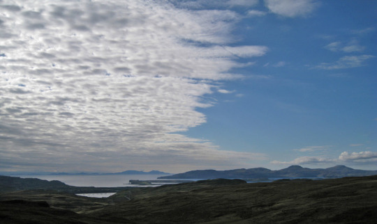
(image credit)
Isle of Canna
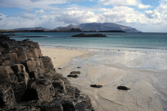
(image credit)
Isle of Eriskay
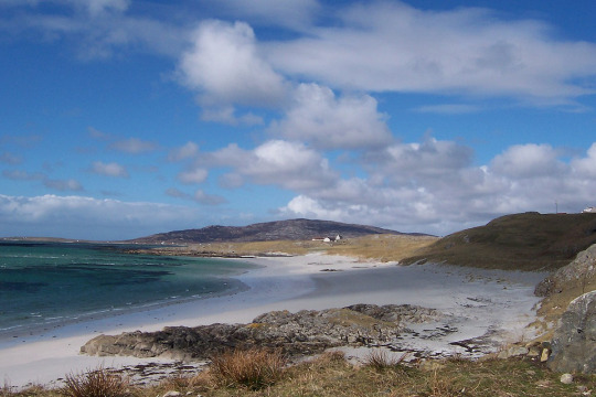
(image credit)
Davie says "Eriska" which is a different island, but Eriskay makes much more sense looking at the route.
Isle of Tiree
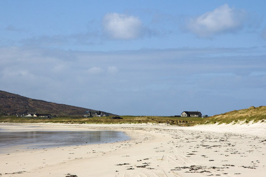
(image credit)
Isle of Mull

(image credit)
Loch Linnhe
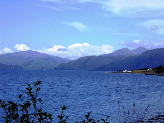
(image credit)
#kidnapped weekly#visit scotland#of course it remains to be seen whether he actually gets as far as Loch Linnhe#but i'm hopeful!
22 notes
·
View notes
Text

Good Morning from Scotland 🏴
Sun about to rise over Glencoe from Loch Linnhe
📸Bart on Flickr
17 notes
·
View notes
Text

Castle Stalker (Scottish Gaelic: Caisteal an Stalcaire) is a four-storey tower house or keep picturesquely set on a tidal islet on Loch Laich, an inlet off Loch Linnhe. It is about 1 1⁄2 miles (2.5 kilometres) north-east of Port Appin, Argyll, Scotland, and is visible from the A828 road about midway between Oban and Glen Coe. The islet is accessible (with difficulty) from the shore at low tide. The name "Stalker" comes from the Gaelic Stalcaire, meaning "hunter" or "falconer.
143 notes
·
View notes
Text
Port Appin to Loch Leven
Monday 8th July 2024
Leaving pretty Port Appin at coffee time we headed over to Lismore in the hope of landing and having a walk ashore. Anchoring in Port Ramsay was going to be a very long row so the walk was ditched and we headed on up Loch Linnhe, slowly against the tide! Paused at a small island on the east bank for lunch and were entertained by seal pups venturing into the cold water. We continued our passage north and went into Loch Leven, under the bridge, past Glencoe and up to Camas na H-eirghe on the north bank where the seafood cafe kindly said we could raft up to one of their fishing boats! The first really sunny evening since May so it was Scrabble on deck enjoying the amazing light over the mountains.


2 notes
·
View notes
Text
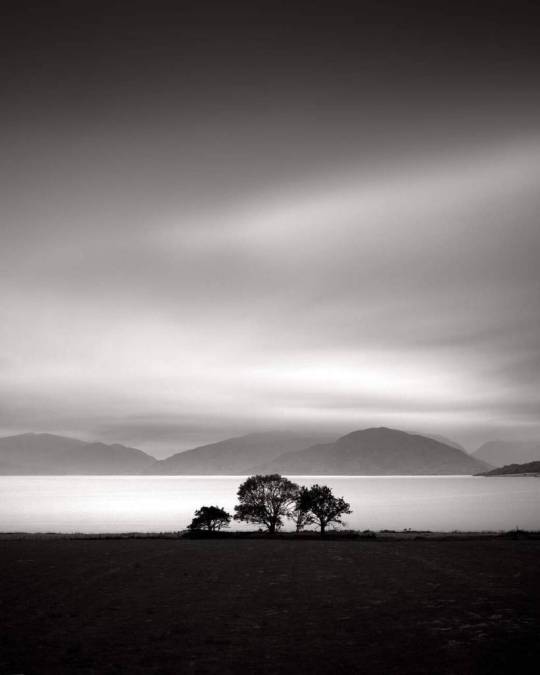
Loch Linnhe, Etude 2, Glencoe, Scotland. August 2022 by Denis Olivier https://www.artlimited.net/denisolivier/art/photography-loch-linnhe-etude-2-glencoe-scotland-august-2022-medium-format-film-nature-landscape/en/11936271
5 notes
·
View notes
Text
The Corpach Shipwreck, Fort William

A former fishing boat that sits, unmoved, at an odd angle on the shore of Loch Linnhe, residents of the town of Caol near Fort William discovered this odd wreck in 2011. Whilst local lore suggests it emerged from stormy waters to take in the majesty of nearby Ben Nevis, no one has ever fully understood why the boat – built in 1975 – emerged from the water and onto the shore. In its day it was a fishing vessel called MV Dayspring.
6 notes
·
View notes
Text

guiding lights
taken at corran lighthouse, ardgour, on the shores of loch linnhe
instagram.
#photography#original photography#photographers on tumblr#nature photography#seascape#landscape photography#landscape#landscapes#sunset#evening#moon#dusk#sky#clouds#lighthouse#nighttime#ocean#oceancore#ocean photography#sea#water#waves#coast#scotland#scottish highlands#highlands#fort william#loch linnhe
164 notes
·
View notes
Text
Day Fifty

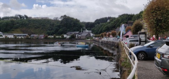
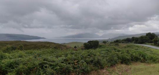
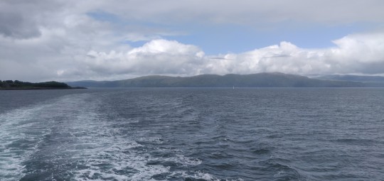


Waking to the sound of the waves lapping against the shore is always a great start to the day.
Up and at it by Ardnamurchan Lighthouse, the day starts with aome retracing of the long arduous ride out to here. It's some heavy going with a lot of ups and downs, but the weather isn't too bad and the backdrop of the tall hills in the sunshine is a nice sight to head towards.
After some stiff work through the hills the road descends back down into Kilchoan, where I turn off the route back and begin a little diversion.
Down to the ferry port I ride, just in time to roll onto the ship as it puts in, and a brief voyage across the windy waters brings us in to the home of the beautiful hills that have formed the backdrop for much of yesterday's ride - the Isle of Mull!
The ferry docks at the pretty port of Tobermory, where I get a small resupply loaded. The weather also decides to introduce itself here with some slow steady rain that will continue for some hours now.
The road out from Tobermory is a very steep climb up, and for the next few miles continues to offer some long ascents as it tracks around the northeast coast of the island along the Sound of Mull. It's a very green place though, and makes for pleasant surroundings despite the hard work.
Past Salen and the road begins to flatten somewhat, still tracking around the coast past the mist-shrouded hills opposite.
I do sometimes wonder, when having days like yesterday that feel like really tough grinds, whether I have made mistakes with my nutrition or health or something when finding the going so hard. But days like today help to remind me that no, nothing is wrong, it was just a damn tough route!
Mull's road here allows me to really chew through the miles ahead despite the rain continuing to pour down, and as I reach further round the coast the Island of Lismore emerges through the mists ahead, marking the entrance to Loch Linnhe. Much of the hills and mountains in the distance are covered in a heavy mist of falling rain.
With a good 20 miles ploughed through from Tobermory, I finally roll into my destination for this stretch on Mull: Craignure and the ferry port. I'm perfectly timed to nip into the ticket office and then jump aboard just before the ramps are raised, and finally get to have a bit of a sit in the dry and throw some lunch in me.
Departing from Mull, the weather clears a little and I am treated to some lovely views all around as the ferry crosses over the water and puts back in to the mainland at Oban.
The town has the largest supermarket I've been near since many days back in Tain, so I take the opportunity to have a good restock of some of my food stores.
After caffeinating, it's time to get going once more. The route south though is a very busy A road, and whilst I have a brief trial ride down it, the traffic is hell even well before rush hour, and feels faintly suicidal to attempt to slog down from here.
However, for the first time in weeks, I am back in the land of proper cycle paths! It's a bit of a diversion inland, but Route 78 will eventually kead southward bypassing the horrible A816.
So, instead if heading South, I strike out East into the hills around Oban. There's some tough climbs initially, but as the road climbs out of town I'm granted some beautiful views of the hills all around. The rain even decides to have a break and let the sun shine for a while.
It's off into some nice country lanes from here as the trail follows up the River Lonan into the valleys.
A good few miles further past fields full of sheep and highland cattle, and a big front of cloud can be seen rolling back in. It's around 7pm by this point and I feel happy enough with progress today, ao find a patch of trees to offer some shelter from the approaching weather front and pitch up to have a nice lie down for the evening a few miles short of Taynuilt.
Not a bad day overall! Here's to tomorrow!
2 notes
·
View notes
Text

“rocks at loch linnhe” by Ben Matthews
1 note
·
View note
Text

“rocks at loch linnhe” by Ben Matthews
1 note
·
View note
Text
Traveling in Europe Scotland
Traveling in the Scottish Highlands The beauty of Scotland The Scottish Highlands stretch from Inverness north to Thurso and are separated from the rest of the country by the Great Glen, Glen More. This ancient fault line was used to create the Caledonian Canal, a waterway extending from the west coast to the east, from Loch Linnhe to the Moray Firth with the amazing Loch Ness along the way.…

View On WordPress
0 notes
Text
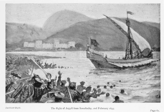


2nd February 1645 saw The second Battle of Inverlochy.
This was one of a series of stunning victories for the Royalist army led by James Graham, 5th Earl and 1st Marquis of Montrose, this battle saw him rout the Earl of Argyll's Covenating forces.
In August 1643 the Scottish Government and English Parliament signed the Solemn League and Covenant resulting in Scotland entering the war against King Charles I. In response the King appointed James Graham, Marquis of Montrose as Captain General of Royalist forces in Scotland. Although he had fought as a Covenanter commander during the Bishops War, he had opposed the subsequent power of the Presbyterian leadership under Archibald Campbell, Marquis of Argyll. Montrose effectively mobilised the Highland forces, many of whom were opposed to Campbell, and achieved a number of rapid successes including victory at the Battle of Tippermuir the previous September and an assault on Aberdeen in October.
The Covenanter forces consisted of men drawn from Campbell's territories within Argyll and also veteran troops drawn from the Scottish army fighting in England most of whom were lowlanders. The Royalists had a core of Highlanders but their numbers were being depleted as many returned home laden with the loot they had acquired from the raided Campbell territories. However Montrose also had a large contingent of Irish, headed by General Alasdair MacColla, who had joined with the Royalist force in November 1644.
At Glencoe the army crossed the high passes into Glen Nevis, moved around the north slopes of Ben Nevis, going round Inverlochy Castle, and then continued up the Great Glen, arriving at Kilcummin to re-supply. Montroses´ army was dwindling as his highlanders continued to head home leaving him with about 1500 men. He was aware that a Covenanter army under the command of the Earl of Seaforth was waiting to confront him at Inverness. Montrose was also aware that Argyll, with a force of 3000 men, was pursuing him and was only thirty miles behind at Inverlochy. What followed was one of the greatest flanking marches in British history across some of the toughest and wildest terrain in the British Isles. Instead of marching back down the glen, Montrose decided to surprise Argyll and marched south through the mountains around Ben Nevis to mount a surprise attack.
The Montrose army spent a cold night in the open on the side of Ben Nevis. Argyll was aware that a small force was operating in the area, he did not know however that it was the entire royal army. Just before dawn on 2 February 1645, Argyll and his covenanters were dismayed at the sight that lay before them, as far as they were aware Montrose should have been 30 miles north.
Argyll did not stay for the battle, but instead he left the command of his army to his general, Duncan Campbell of Auchinbreck, and retired to his galley anchored on Loch Linnhe. As seen in the pic. Auchinbreck lined up the covenanters in front of Inverlochy castle, which he reinforced with 200 musketeers to protect his left flank. In the centre he placed the Campbells of Argyll and put the lowland militias on the flanks. Unlike at Tippermuir and Aberdeen, where Montrose had defeated easily hastily conscripted and poorly trained militias, the troops he faced at Inverlochy were veterans of the war in England. Montrose lined his army up in only two lines deep to avoid being out flanked, placing his 600 highlanders in the centre with the Irish on the flanks, the right being commanded by MacColla. The fight did not start straight away and instead skirmishes broke out along the line. This is probably because Auchinbreck and his officers thought that they were only fighting one of Montrose´s lieutenants and not the man himself, believing he was still far up the glen. Just before first light, the Royalists launched their attack.
The Irish clashed with the lowlanders on both flanks and routed them while the highlanders closed with the Campbells in the centre. The Campbells broke, but their retreat to the castle was blocked by the Royalist reserve cavalry under the command of Sir Thomas Ogilvie. Auchinbreck was shot in the thigh while trying to rally his men and died shortly afterwards.
The remaining Covenanters briefly rallied around their standard, then broke and ran, trying to reach Lochaber. The small garrison in Inverlochy castle surrendered without a fight. Over 1500 Covenanter troops died, while Montrose may have only lost 250 men, the most notable being Sir Thomas Ogilvie who was killed by a stray bullet.
Montrose, through his lieutenant, MacColla, who commanded the 2000 Irish troops sent by the Irish Confederate), was able to use this conflict to rally Clan Donald against Clan Campbell. In many respects, the Battle of Inverlochy can be seen as part of the clan war between these two.
The first illustration is called The flight of Argyll from the Battle of Inverlochy, and is from 'Loyal Lochaber. Historical Genealogical and Traditionary' by W Drummond Norie, Glasgow, 1898.
12 notes
·
View notes