#granitedome
Explore tagged Tumblr posts
Photo
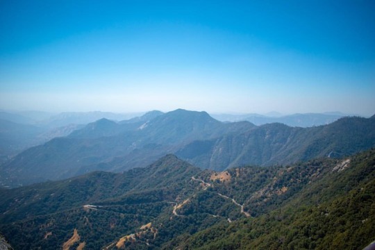
Generals Highway view from the top of Moro Rock. At this point, you will be at a height of 6725 ft. #granitedome #mororock #mororocktrail #generalshighway #blue #hiking #mountain #nature #travel #naturephotography #picoftheday #landscape #nikon #nikond5600 #nikonphotography #nikonlovers #nikkorlens #nikonusa #1855mm #pixelkey #pixelkeyphotography @nikonusa @natgeoyourshot #yourshotphotographer (at Moro Rock) https://www.instagram.com/p/BnodEl5lj6W/?utm_source=ig_tumblr_share&igshid=1wj74z6dbvjs3
#granitedome#mororock#mororocktrail#generalshighway#blue#hiking#mountain#nature#travel#naturephotography#picoftheday#landscape#nikon#nikond5600#nikonphotography#nikonlovers#nikkorlens#nikonusa#1855mm#pixelkey#pixelkeyphotography#yourshotphotographer
0 notes
Photo
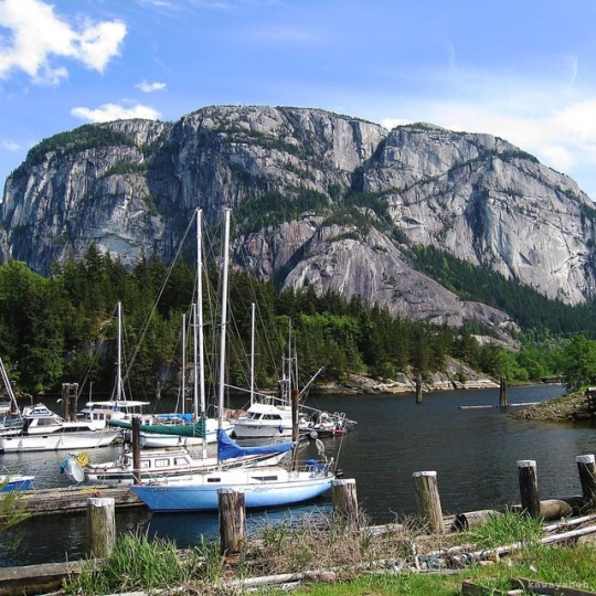
5/17/2009 Squamish, British Columbia, Canada View of the Stawamus Chief granite dome by the waterfront towering at 700 meters #water #sky #mountain #tree #boat #harbor #harbour #plant #marina #landscape #mountscenery #stawamuschief #thechief #chief #granitedome #waterfront #squamish #bc #britishcolumbia #canada #northemerica #travel (at Stawamus Chief)
#marina#tree#britishcolumbia#granitedome#harbor#mountscenery#thechief#harbour#waterfront#northemerica#sky#bc#squamish#plant#canada#chief#boat#water#mountain#stawamuschief#landscape#travel
0 notes
Photo
Tucked between silver-colored granite domes, just northeast of Yosemite Valley, is the basin of Tenaya Lake. The valley was formed long ago by a glacial flow from the Tuolumne Ice Sheet, the same one that poured into the Yosemite Valley and created Half Dome.
Day 341/366
Lake of the Shining Rocks - Yosemite National Park, California
#366challenge2016 #photoaday #photooftheday #Yosemite #NationalPark #California #photography #FindYourPark #TenayaLake #GraniteDomes #sunset #alpenglow #travel #explore #outside #beauty #nature #ThisLand #WanderInWonder
https://plus.google.com/+XMediaStudioValentin/posts/PhXFGjgSbDN
#366challenge2016#photoaday#photooftheday#Yosemite#NationalPark#California#photography#FindYourPark#TenayaLake#GraniteDomes#sunset#alpenglow#travel#explore#outside#beauty#nature#ThisLand#WanderInWonder
0 notes
Photo
The Texas Hill Country is a 25-county region of Central Texas and South Texasfeaturing karst topography and tall rugged hills consisting of thin layers of soil atop limestone or granite. It also includes the Llano Uplift and the second largest granitedome in the United States, Enchanted Rock. The Hill Country reaches into portions of the two major metropolitan areas, especially in San Antonio's northern suburbs and the western half of Travis County, ending southwest of Downtown Austin. The region is the eastern portion of the Edwards Plateau and is bound by the Balcones Fault on the east and the Llano Uplift to the west and north. The terrain is punctuated by a large number of limestone or granite rocks and boulders and a thin layer of topsoil, which makes the region very dry and prone to flash flooding. The Texas Hill Country is also home to several native types of vegetation, such as various yucca, prickly pear cactus, cedar scrub, and the dry Southwestern tree known as the Texas live oak. #Travel #Traveling #Vacation #Visiting #Trip #Holiday #Fun #Expedia #Texas #Austin #Resort #City #Skyline (at Austin, Texas)
0 notes