#dayhiker
Explore tagged Tumblr posts
Visit Tumblr Blog
Explore Tumblr blogs with no restrictions, modern design and the best experience.
Last Seen Tumblr Blogs


Fun Fact
Tumblr’s website traffic is steadily declining.
Text


We were going to ski Great Meadow yesterday morning, but bad road conditions caused us to call an audible and head out a bit late in the day to Stukel Mountain instead.
This mountain is a bit of a mind-numbing hike if you go up the road and then back down the road (seven-ish miles each way) but if you climb up via the fire trail and come down via the road it shaves off about three miles, introduces some variety and route-finding, and gives WAY better views.
We got to descend during the sunset and then through the dark, which was great. Really fuzzy "night shot" photos resulted.
Oh, and Doc, who is now eleven years "old," was out in front for all eleven miles, wanting us to go faster. Of course.
1 note
·
View note
Video
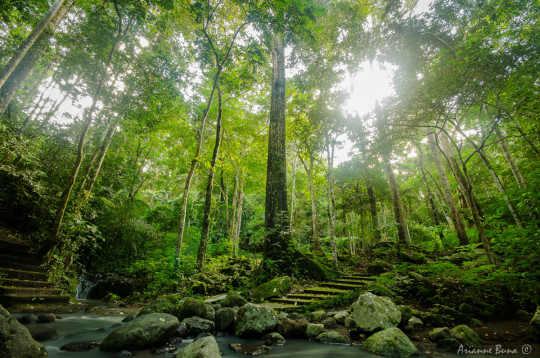
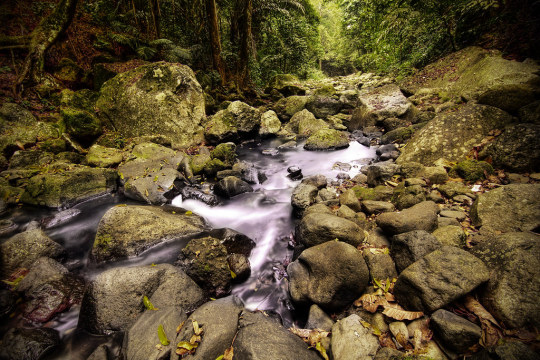
Cedar Creek Waterfall by Arlene Schag Via Flickr: Cedar Creek Waterfall and Pool in Ramona, California May 2010 Cedar Creek Waterfall is approximately 90 feet tall.
#Cedar Creek Falls#Ramona#hike#hiking#destination#things to do#fun#outdoor#place#trail#direction#water#pool#swim#backpacking#dayhike#flickr#Westcoast Wildlife
1 note
·
View note
Text
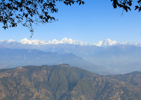
Chisapani Nagarkot Trek is a short trekking route near Kathmandu Valley, which you can do in 2–5 days. You see magnificent mountain views, unblocked sunrises and sunsets, captivating landscapes, lakes, wildlife, farming terraces, valleys, and more natural and cultural attractions. Also, there are several day hiking destinations around Kathmandu from where you can see the same mountains, like the Crom Chisapani Nagarkot Trail. Champadevi Hike, Nagarkot Changunarayan Hike, Jamacho Hike, Shivapuri Nature Hike, Kakani Suryachaur Hike, and many other hiking trails are around here. You also see pristine views from Chandragiri Hill, which you can reach by cable car.
0 notes
Text
Champadevi is a popular one-day hiking destination in Nepal, known for its religious significance and panoramic views. It's situated to the southwest of Kathmandu Valley. The Champadevi hiking trail offers a blend of natural beauty, cultural experience, and a moderately challenging hike.
#frolicadventure#nepal#travelwithfrolicadventure#nature#champadevihike#dayhikearoundkathmandu#dayhikenearkathmandu#dayhike
0 notes
Text

"The stories a wondering feather could tell..."
#hiking#hikingsocal#silverwoodlake#crestlinehikes#socalhikes#blackoakpark#nature#naturelover#feather#featherlight#naturesart#artwithnature#hike#hotsummerday#shadedtrail#mountains#adventure#travel#hikingtrail#dayhike#mountainhiking#lovehiking#outdoors#hikingtrails#solohike#hikelife#hiker#hikingadventures
0 notes
Text


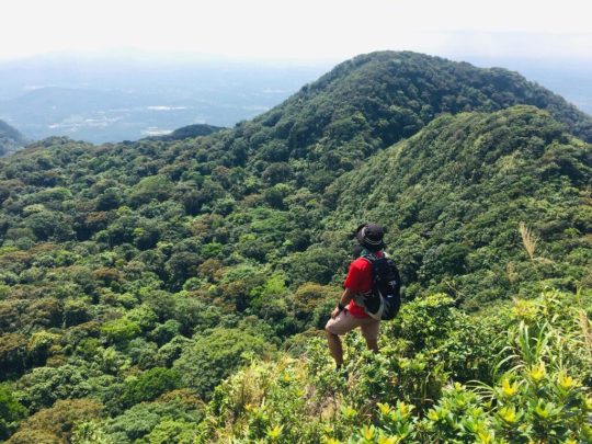
Mt. Apo (Dayhike) - Davao del Sur, Mindanao
Conquered the highest mountain in the Philippines!
3 peaks:
Kidapawan peak
Digos peak
Mother peak
#mt. apo#kidapawan peak#digos peak#mother peak#day hike#davao city#davao del sur#mindanao#photography#scenery#scenic photography#hiking#nature#mountains#bouldering#bluesky#volcano#foggy aesthetic#fog#sunrise#davao#boulders#philippines
8 notes
·
View notes
Text
few days left before hike and deym im still not freaking prepared hahahaha. i don't have hiking clothes, bag, and power food na sinasabi nila. i know this shouldn't be a barrier for you to hike but i know that this will also save my ass just in case hahahaha. well, sa bag keri na muna tong regular bag ko na nabili sa japan surplus 2 yrs ago and maraming travel na rin nakasama ko to. sa clothes naman, check ko sa decathlon or kaya mag ukay nalang bukas. natetempt ako bumili ng mga bago but since dayhike lang naman, wag na muna coz it will really cost me a lot.
sa physical naman, a lot of walking at pag aakyat ng hagdan ginagawa ko lately plus mini hike sa arayat so di na rin siguro mabibigla katawan ko.
19 notes
·
View notes
Note
8, 9, 12, 22, 23!!!!
omg it is copper ancientbygone sands :0 henlo
ask game!
8: Game of the year?
This year has been so unbelievably busy that I haven't been able to play anything other than. like. idle games on my phone and solitaire. Next year I wanna take some time to do fun things again :')
9: Best month for you this year?
Probably July! I started my actual career as an ✨industry professional✨. And though it's been crazy stupid busy, it's been so fucking nice to slow down from the 2 jobs + uni grind (and like maybe start to recover from years long burnout 🙃)
12: Talk about a new friend you made this year
Yeah yeah yeah you little shit—hi we're friends and I really appreciate getting to know you this year. Or something. Nerd.
This has probably been one of the happiest years of my life, like, ever. Since joining stblr, this is literally the first time in my life I've had multiple *actual* (as in, not just hanging out because they're friends with my current friend, and so we're friends by proxy) friends at one time and like. it's wild. Also overwhelming tbh, because I've never had to balance talking to this many people before. But just. Thank you mooties and beyond for being my friend :') I feel a little more like a perceivable human being nowadays
22: Favourite place you visited this year?
I think, literally, the one time I *went* somewhere this year was for a dayhike in the Rockies (Kananaskis, just outside of Canmore for the Canadians in chat) in September(?). Again, it's been so busy this year I haven't actually taken any time off from work other than appointments
Next year is a different story though!! I'm really excited for May, since I'm meeting Shatters in Vancouver to go see Spiritbox 🩷🩷 It'll be my first ever time travelling alone too, so it's gonna be an experience lol
23: If you could send a message to yourself back on the first day of the year, what would it be?
Hang in there. Just fucking grit your teeth and keep going—even if you've gotta have a few panic attacks in the washroom at work along the way—because it actually does get better eventually.
Like that might seem corny as fuck but like. It's been years of hard work/different kinds of intensive therapy/countless cocktails of medications/just kinda blindly sprinting through life. And even then, shit feels so hopeless. But holy shit am I glad I hung in there to see the other side of things. Again, this is the first time in my life that I've felt like an actual human person. And every drop of pain and wanting to die was so worth enduring (not in a glorifying way ofc, but it's so cathartic to look back and see that you've finally broken through the clouds a bit)
sorry ramble lol, it's just been. yeah. a year to say the least. I'm excited to see what getting more sleep with less classes is gonna look like next year lol. Lots of plans I finally have the energy and will to live for
#welcome to yap central it's me your host elkkie-“cannot shut the fuck up to save their live”-l#i am currently working on a secret extra project for u that i have not shown yet heehee#askkiel#copper-sands.ask
2 notes
·
View notes
Text

Sto. Tomas, Batangas and Los Banos, Laguna
Entry point: Sitio Jordan, Brgy. San Miguel, Sto. Tomas Exit point: UP College of Forestry, Los Banos, Laguna LLA: 14.13°N 121.20°E, 1090 MASL (Peak 2) Hours to Peak 2 / days required: 1-2 days / 5-8 hours
Specs: Major climb, Difficulty 5/9, Trail class 3 with roped segments Features: Roped segments, rocky face, limatik, rattan, tropical rainforest
The Makiling Traverse (which we first referred to as "Maktrav" in 2008), invented by Sky Biscocho in the early 1990s, is still a well-liked dayhike. The height of Mt. Makiling is 1090 meters above sea level, or 3576 feet. It provides climbers with a thorough view of the Southern Tagalog mountains, including Mt. Banahaw, Mt. Kalisungan, Mt. Cristobal, Mt. Obabis, and Mt. Prinza, from the summit.
According to Dr. Jose Rizal’s writings in the year 1890 about the story and myth of Maria Makiling: Once upon a time in a place called Makiling, there lived a god and goddess couple. They have a daughter named Maria. Maria is a very beautiful maiden or fairy. Her beauty is captivating and any young man will be charmed by her porcelain complexion and shining eyes. Their family is known to be kind and helpful to others, especially those in need, which is why the people around them love them so much. In those days, the gods were given the power to mingle with the people. One day a charming young farmer saw Maria one day, and upon seeing her beauty, he fell in love with her. Since then, he has always looked forward to it. The young farmer is the envy of his fellow farmers since, thanks to Maria Makiling's care and protection, neither plague nor bugs have harmed his crops. The young man thus always ascends the mountain to meet and be with his fairy lover. They quickly developed a romantic relationship, which the girl's parents learned about. Because a goddess cannot fall in love with a mortal, Maria's parents promptly cut off contact with that man.
8 notes
·
View notes
Note
this sign in a temperate forest was really confusing to me both times ive seen this pic. why can't you walk back from beyond it. why can't you camp there. dayhike distance is very individual. anyway turns out its from a ski resort (the sign having ski boots was a hint) and it's an out-of-bounds warning
this one is worded a little weirdly it seems like others usually say "don't ski alone" but it probably means where you won't be able to get back to lifts or roads without a significant hike.

damn
8K notes
·
View notes
Text
Lihat postingan ini… "Day Hiking Fuji, Timeline, Kurang dari 5 Jam Sampai Puncak!!".
regulasi pendakian gunung Fuji berubah, untuk kalian yang tidak dapat kabin, opsi lainnya adalah dengan day hiking. berikut referensi untuk timeline dayhiking yang bisa dilakukan.
0 notes
Text
McKenzie River Trail (1/2)
After successfully summiting Shasta on June 19th (which I promise to finally write about next!), I had eight days before Lindsey's parents passed through town en route to Idaho and ten days before my parents arrived for a longer stay and, eventually, our joint trip to Alaska. I'm not as young as I used to be, so I had to take a few days to let my legs recover from the descent down the West Face, but then I wanted to get one more short backpack in before nearly a month of more traditional traveling started.
As I already wrote about in my first Wahtum Lake Loop post, backpacking in the Pacific Northwest in June can be tough for a variety of reasons. Luckily, I had another new-to-me early season option in my back pocket for an occasion just like this one: the McKenzie River Trail.
I'd been meaning to tackle the MRT for years, but, like with the Wahtum Lake Loop, I'd often ended up either having other plans in early summer or hiking somewhere else I was more excited about. Also like the Wahtum Loop, there's nothing wrong with the MRT, but from my reading it seemed to garner a mixed reception from backpackers.
Everyone was in agreement that it's beautiful, and as a twenty-six mile trail that follows the McKenzie River through the forests of the "wet side" of Central Oregon, how could it not be?
But it also seemed to be best known as a trail for mountain bikers and dayhikers, which meant there was likely to be little quiet or solitude to be found when compared to something like, say, Sky Lakes Wilderness or even Three Sisters Wilderness. It was also a little unclear from my reading where and if you could camp overnight. Even with a four-hour drive to the trailhead on the first day, I was confident in my ability to cover twenty-six miles in two days and one night...but I didn't necessarily want to, which meant figuring out not just one, but two places to camp along the trail.
These were all reasons to not hike the MRT, though. I knew I wanted to hike it at least once in my life, and there wasn't anything "better" that was going to work with my schedule, and so my choices were to either take the opportunity now or just sit at home for a week.
Obviously, I chose to hike the MRT.
Since it's an out-and-back hike and not a loop (not even a "loop" like the Wahtum Loop!), and I was hiking it alone, I had to book a shuttle. Fortunately, I booked through the Horse Creek Lodge, and they were amazing. I basically paid them thirty dollars to let me leave my car at the lower McKenzie River trailhead and to drive me the half-hour or so drive to the upper trailhead. It doesn't get much better than that.
The shuttle was scheduled for 10:30am, which meant I was driving north from Klamath Falls by 6am to make sure I got there in time. I made it, but because of the early start to my day I feel like I was somewhat (unintentionally) antisocial toward the group of mountain bikers that I ended up sharing the shuttle with. They, on the other hand, were having a hell of a time, pounding beers and vaping in the parking lot, peppering me with friendly questions about backpacking while, hilariously, blasting Goose's "The Doobie Song." I excitedly told them how many Goose shows I'd seen and they kind of stopped talking to me after that, I think identifying me as a deviant zealot who couldn't be trusted.
Regardless, it was a fun ride north to the upper trailhead, with the shuttle driver stopping a few times along the way, both to point out fun facts about the area and to explain a few places where the trail became...less than easy to follow. A few of these points would have absolutely confused the crap out of me had I not been warned, so I really appreciated this after the fact.
We made to the upper trailhead by 11:15 or so, and after a brief but hearty farewell, the mountain bikers took off in a last blast of weed smoke, the strains of a live version of "Arcadia" fading into the distance as they sped downhill.
I was on my own. In a huge parking lot with an outhouse on the side of the interstate. I started walking south with three days' worth of food in my pack, with no plan other than to get to the end of the trail alive, eventually.
Gripes aside, it didn't take long before the MRT angled east away from Highway 126 and I got into some legitimate western Oregon forest.

Some of the pines along this trail were the kind that look like they have silver bark in the right light. I suck at tree identification, so I don't know what they're actually called, but they always make me think of the silver mallorn trees from Lord Of The Rings, because I'm a huge nerd.
Before long, I had the choice of either going left along the eastern shore of Clear Lake, or right along the western shore. I wasn't sure which was better, but went left because it led further away from the highway and the lodge on the opposite shore. Almost immediately after making this choice, I came upon Great Springs, my first preview of the unearthly-looking water quality that the McKenzie River and its associated waterfalls are known for.

The transfixing blue of the springs diluted a bit as the water flowed into and spread out across Clear Lake, but it still certainly lived up to its name.

The MRT followed Clear Lake's shoreline for what felt like a few miles, passing through black lava fields that contrasted in that quintessentially Central Oregon way with the beautiful, clear waters. At points, the trail was soft dirt, at other points it was surprisingly rocky and rough. At one point, strangely, it was paved?

Eventually, I hiked past Cold Water Cove Campground, which I suppose I theoretically could have paid to camp at. Sleeping in a campground didn't really appeal to me, though, and besides, it was way too early in the day (and too hot) to stop already. I kept on going south, and, eventually, the MRT crossed Highway 126 and I got my first view of its namesake (the McKenzie River) since I'd started hiking that morning.
This is one of the more famous sections of the MRT, and with good reason. The river from just north of Sahalie Falls to the Ice Cap Creek Campground runs fast and crashes over, around, and through rocks all along the way, which churns it up and makes the almost neon blue of the water even more vibrant.

I found myself stopping and taking tons of pictures throughout this section, which worked out in a way because it was also incredibly crowded by dayhikers and bikers walking their bikes (because of the dayhikers), and stopping now and again to appreciate the view kept me from getting frustrated by the congestion. And appreciating the view was certainly not hard.

Sahalie Falls was amazing, and surprisingly uncrowded, so I took a few minutes to clamber around on the western shore of the river, enjoying the view. Lindsey and I had hiked to this same waterfall as dayhikers years before, but we'd used the trail that follows the eastern shore of the river that time. I chose to go west this time both out of a desire to mix things up and because that trail branch is the "real" MRT, and that mattered to me for some reason.

Unexpectedly, the beautiful Koosah Falls was the most disappointing part of the trip. When I got there in mid-afternoon, there were no less than a hundred teenage- and college-aged kids there, the canyon full of the sounds of their Bluetooth speakers and the fog of their weed smoke. Crushed beer cans littered the trail, and someone's hammock was strung directly across the trail, forcing me into the underbrush for fifty feet or so to get around it. The couple piled inside didn't notice me when I struggled by, and I almost crashed into three other individual partiers along that brief section of trail, each of them walking north, barefoot, eyes glazed over in some altered state of consciousness or another and unable to perceive me fully enough to realize that we needed to share the trail for a moment as we passed each other. A slackline that seemed permanently bolted to a rock on the western side of the river stretched across to the eastern shore just downriver from the falls, in active use by a guy who was halfway across it, barefoot and in swim trunks with a wrapped-up shirt atop his head like a makeshift turban, one hand outstretched to help him keep his balance the other hand holding a smoking joint. Below him was a fifty-or-so-foot drop into the river.
I'm not making any of this up.
So look, I like (legal) drugs and it's sometimes fun to drink, though notably less fun than it was twenty years ago. I don't want to dump on someone else's party. But this was egregiously loud, egregiously messy, it made the trail actively difficult to use (God help you if you were trying to come through on a bike!), and couldn't possibly have been good for the trail or the wilderness area. I've been to music festivals that treated their site with more respect than these kids were treating the McKenzie River. So, yeah. It was a bummer.
I kept walking for a few more miles through a relatively tame, forested part of the MRT that has the distinction of being the part of the trail where the actual river goes underground (?!) for awhile. At least meant fewer encounters with other people for a bit.
Before too long, I reached the other most popular location along the trail: the Tamolitch Blue Pool. Lindsey and I hadn't made it this far south on our previous dayhike, so this was my first view of the Blue Pool, and it was pretty amazing. I definitely understood immediately why the other two hundred people that were there were there.

At least this mass gathering was less rave and more beach party.
I briefly toyed with the idea of scrambling to the shore of the pool and taking a dip, but I didn't want to get any of my clothes wet ahead of the cold night to come, and pushing through a bunch of teens and adolescent kids to dive into the pool as a solo, full-grown adult felt a bit weird. So I just admired the Pool briefly from above and continued to follow the MRT along the cliff edge for a bit.
I did come across the first semi-legit backcountry campsite I'd seen all day just north of the Blue Pool, and briefly considered stopping there for the night. It was a bit early to stop, and the site was close enough to the Pool that the cacophony of the day-use visitors was fully audible, but I also really enjoyed the thought that if I set up my tent and waited them out, I might have the Pool to myself in the dark of night. Plus, I had no earthly idea if or when I would find any other spots, and it was going to get dark eventually.
Ultimately, I decided to keep going.
I'm still not sure if this was a mistake or not, but it's what I did. I'd already hiked eight miles that day to get to the Blue Pool, and it would turn out that I'd have to hike four more to find a site that worked for me. Even on a trail as (relatively) flat as the MRT, going twelve miles in what was essentially a half-day (after the drive from K-Falls and the shuttle ride) was a bit much. Honestly, the last few miles passed in a bit of a frustrated daze as I continuously scanned the forest to the right and left of me in hopes of finding a place to sleep. The forest was surprisingly dense and not really apt to present anything clear and flat enough for even a one-person tent.
Throughout, I held out hope for a potential spot I'd read about online, underneath the Trail Bridge (an aptly-named Bridge that is part of the Trail). And it turns out that there is, in fact, a huge, open flat along the Smith River as it runs south in the McKenzie here: it's just that a group of ten campers, the only other backpackers I'd see on the entire three-day trip along the MRT, had already completely taken it over. I certainly couldn't blame them, but it meant I had to keep going.
Fortunately, I finally found a single spot alongside the river a mile or so later, just south of the Trail Bridge Dam. It certainly wasn't The Perfect Spot from my Wahtum Lake adventure, but it would certainly do, especially because by that point the sun had already set and it was starting to get dark. I scrambled to get my tent set up before dark, and then enjoyed a dark, cold-but-satisfying dinner.

I was a little put off by the paucity of camp spots along the trail, but otherwise it had been a successful and gorgeous (if occasionally weird and frustrating) day on the MRT!
0 notes
Text
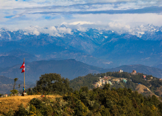
The Nagarkot Changunarayan hike descends from Nagarkot (elevation 2,175 m) through forests and villages to Changunarayan (elevation 1,400 m). It's mostly downhill on the way to Changunarayan. You see magnificent high mountains, charming landscapes, valleys, green hills, and more with unblocked sunrise and sunset from Nagarkot, from where the hike begins.
.
0 notes
Text
BEST WAY TO ESCAPE; FREE UP YOUR MIND
As the world immerse on travel, people tend to visit scenic destination to relieve from stressful life. Especially for the Millennial generation who are known as the "Busy people" with regards to their personal life. Millennials are too engaged to earn money which lead to forget to take a break and enjoy life .
Here are some places in the CALABARZON that offer different activities that may give millennial a escape on stressful life:
1. CRYSTAL WATER IN ALIBIJABAN OF QUEZON
It is on the top on the list , It is stunning because of its natural beauty . It is known for its pristine mangrove forest and coral reefs, with its crystal-clear waters, abundant marine life, and interesting floating cottages. Alibijaban is a paradise for people who want to get away from the noise and chaos of the city.

2. HIKING IN MT. DARAITAN
It is famous for Sunrise view as this is the highest peak in Calabarzon region. Mt. Daraitan is a great sampler for hiking up the relatively unexplored Sierra Madre mountains, and along with other attraction in Daraitan, particularly the scenic, lunaresque Tinapak River, is a highly recommended dayhike or overnight destination from Manila.

3. EXPLORE TAGAYTAY
This considered as the second summer capital of the Philippines. It is known for its cool climate, stunning views, and abundant activities, this city offers a serene retreat from the bustling metropolis of Manila.

4. 360 CLOUD 9 ANTIPOLO
It is one of the most visited places in Rizal province which is located on the Sumulong Highway in Antipolo City. The hanging bridge is one of the main attractions and it’s one of the most visited hanging bridges in Rizal. From the viewing deck it offers tourists a panoramic 360-degree view of Antipolo City, the Sierra Madre mountain range as well as the entire Metro Manila skyline. On a clear afternoon, visitors can have an impressive view of the sunset.

5. ROB'S KITCHEN & CAFE IN BATANGAS
This location is ideal for anyone looking to get away from the city while also enjoying wonderful cuisine.Rob's Kitchen & Cafe is a restaurant and café with beautiful views of the crystal-clear ocean and even more breathtaking sunsets. Food options at this establishment include a multi-course menu and a la carte servings of various cuisines. The food offered here is a combination of local and foreign favorites.

ARTICLE TYPE: WEEKENDER
TARGET AUDIENCE: BUSY MILLENNIALS
TOPIC: BEST SCENIC DESTINATION TO TRAVEL IN CALABARZON
1 note
·
View note
Text


Mt. 387 Batong Amat (Dayhike) - Puncan, Nueva Ecija
#mt. 387#batong amat#scenery#scenic views#scenic photography#grass#nature#hiking#day hike#mountains#puncan#nueva ecija#life#philippines#photography
3 notes
·
View notes


