#bracken 🏞️
Explore tagged Tumblr posts


Text
hi!!
we're futhark, a probably disordered, madd based, audhd, neuro/trauma/adaptive system. we're very queer and love learning abt stuff.
pretty much all of the system is alterhuman or entirely nonhuman, with two groups being dragons and elves.
we might switch between we and i a lot and also forget to sign stuff a lot so just. embrace the chaos
we do digital art sometimes and are thinking of making a new blog/accounts to post that stuff on.
no specific dni because that's what the block button is for. we're inclusive of all systems and good-faith queer id, mogai/liom, alterhumans, self diagnosis, etc. our m.o. is if you've properly, informatively reflected on it, you probably know yourself best and we believe you.
under the cut is the list of headmates!
the list™
home world: Nirn
kyria 🗡️ she/they
(theres also internal fictives of alduin, paarthurnax, and odahviing. all use he/him)
home world: The Void
echos (echo ⛅ ey/they, enn ☁️ ey/they, nym 🍃 ae/ey/they)
bee 🐝 she/they/bee
radio 📡 ae/they/cele/star
null ⚫ none, null/voi/x
home world: Earth2
morgan/izzy ⚔️ they/fae/fey (any variant on fae)
morganite 🍓 they/she
paige 🪴 lun/kit/zie/they
home world: Kestrel Earth
kess 🍏 fey/ae/they
bracken 🏞️ neos/they
kez 🌌 fey/they/xe
dusk 🌆 neos/they
io 🌠 they/them
moon 🌙 they/it
cass 🦇 xe/they/ix/it
amber 🌄 they/she
sæwine 🐚 mer/sai/ne
home world: Nightside
ash 🌑 they/them
ava 🌘 they/lun
nep 🌕 they/them
verdi ❇️ they/it
aspen 🌿 ae/ey/they
hazel 🌰 she/fae
3 notes
·
View notes
Text


🌿 Masham Moor Circular Walk, Including Dale Edge and Colsterdale
🗺️ There’s a brand-new walk now available on my website, and it’s a real gem for lovers of open landscapes and quieter trails. Starting from Gollinglith Foot, the circular route explores the rugged terrain of the Nidderdale Area of Outstanding Natural Beauty (AONB). It follows the Six Dales Trail through fields and woodland before heading out onto the windswept uplands of Pott Moor and Dale Edge. The route loops through remote Colsterdale and returns via Coal Road.
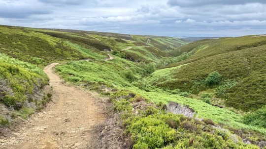
🌬️ Along the way, you’ll experience exhilarating exposed moorland to blow the cobwebs away, and a short section in a valley where the bracken can be high in summer—adding an extra bit of excitement as you push through the overgrown trail. There are also a few trickier sections where the path becomes faint and navigation requires care. This is a less well walked route, ideal for those who enjoy solitude, nature, and a true sense of the wild.
📏 The walk covers 11½ miles and takes around 5¾ hours to complete, with a total ascent of 351 metres. You’ll find full directions, walk statistics, and parking advice on the walk page. There are links to both Ordnance Survey and Outdooractive maps, giving you the option to print the route, download it to your device, or explore it using interactive tools.
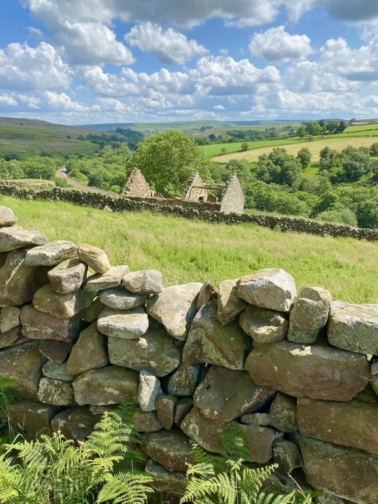
🏞️ Colsterdale is a remote valley carved by the River Burn, located within the Nidderdale Area of Outstanding Natural Beauty (AONB) and part of the Swinton Estate. The valley has a fascinating history, from medieval coal mining to military use during the First World War, when it served as a training camp for the Leeds Pals. Scattered throughout the area are old stone sighting towers, built during the surveying of nearby reservoirs and pipelines. Quiet, scenic, and steeped in heritage, Colsterdale is a hidden highlight of the English landscape.
📸 Highlights of the walk include a peaceful climb through woodland, followed by wide, open crossings of Pott Moor and Dale Edge with sweeping views towards Scar House Reservoir and the high ridges of Little Whernside and Great Whernside. The route skirts South Haw, marked by a lonely boundary stone, and descends into the valley along the banks of the River Burn. You’ll pass old farm buildings, Swaledale sheep, and colourful upland moorland filled with heather and bracken. The final stretch along Coal Road offers an easy finish with spectacular views across the Colsterdale valley.
🥾 If you're after a proper Yorkshire moors walk with big skies, peaceful trails, and a touch of adventure, this one’s well worth exploring. Head to my website for the full route, interactive maps, and all the tools you need to plan your day.
0 notes
Text


🚶 A few days back, I embarked on a little jaunt along a tiny portion of the Esk Valley Walk, a delightful stroll that stretches between the villages of Danby and Castleton. The entire route was approximately 3½ miles, there and back, on a lovely sun-kissed day in the heart of our delightful North York Moors countryside.
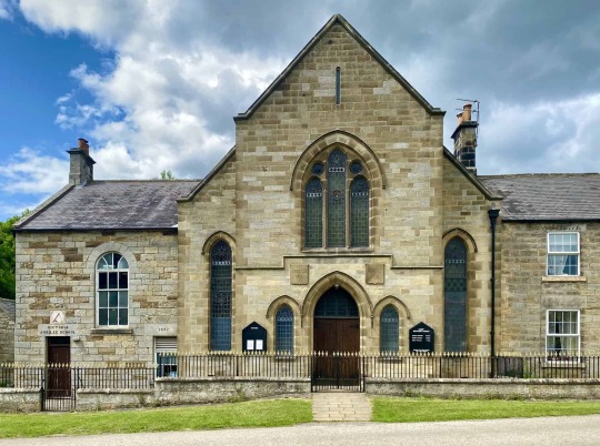
🌟 My adventure began in the village of Danby, a place that whispers history in every corner. I made sure to have a look at Danby Methodist Church before setting off. The church, a relic from 1811, boasts an extension called the Victoria Jubilee School, a tribute added in 1887 to mark the golden jubilee of Queen Victoria.
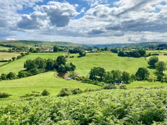
😍 No sooner had I stepped out of the village than I was greeted by the breathtaking vistas of Danby Dale, cradled within the arms of Danby High Moor. The River Esk was quietly going about its business below, carving its lazy trail through Esk Dale.
🌿 My journey soon led me along a lush grassy path towards Danby Park. And when I say 'grassy,' I mean this path was so well-kept, you'd think a groundsman from Lord's had been tending to it with a lawn mower and roller.
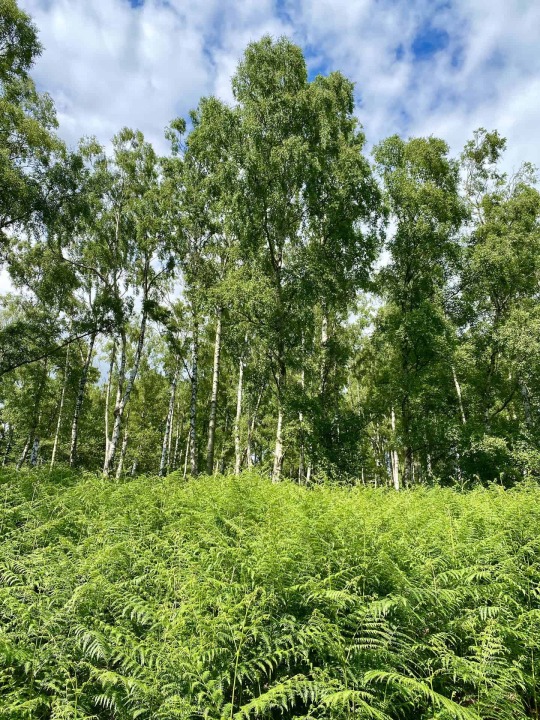
🌳 Before I knew it, I found myself in Danby Park, a sanctuary of Silver Birch woodland. The trees stretched upwards to create a light, airy canopy, allowing the sunlight to dance on the bark, making it shimmer and glisten.
💚 The bracken was standing tall, strong, and oh-so-green, a sight so vivid that it was even greener than the nugget of purest green discovered by Lord Percy in Blackadder II. (https://www.youtube.com/watch?v=TkZFuKHXa7w)
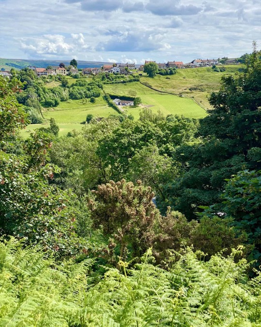
🏞️ Every now and then, small gaps in the foliage offered sneak peeks of High Castleton, perched on the hillside. I couldn't help but feel a tinge of envy for the fortunate individuals residing there; the views from their living rooms must be something extraordinary!
🔁 And just like that, my little adventure came to an end. I retraced my steps, once again enjoying the beauty of it all, but in reverse. It was an afternoon well spent.
0 notes
Text
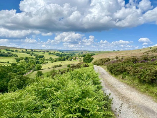
🕺 Just popped back from my jaunt 🚶♂️ in the North York Moors 🌳🌄. My path today? A dusty, stone-strewn 🌰 track stretching between the villages of Commondale and Castleton 🏘️, in the north-west of the North York Moors National Park, just a stone's throw from Guisborough.
The day was hot ☀️, with the sun beaming down but a moderate breeze 🌬️ kept things comfortable. The countryside was a painting 🖼️, filled with a myriad of vibrant hues today 🎨.
The deep blue sky 🌌 was stippled with white, fluffy clouds ☁️, over the verdant green tapestry of the bracken, trees 🌳, open meadows, farmland 🌾, and hayfields.
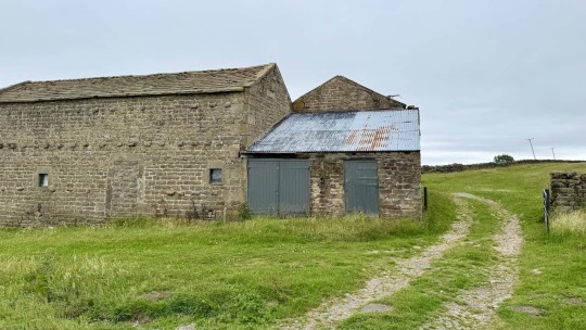
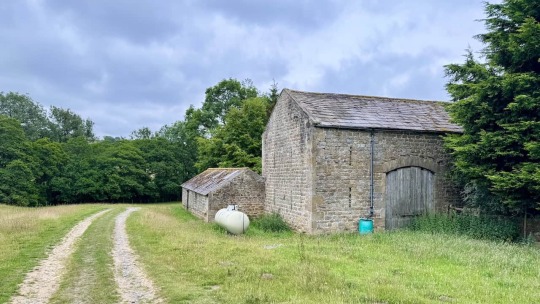
The beige path 🏞️ was lined with an ancient stone wall and I spotted an aged barn 🏚️, roofless and forgotten.
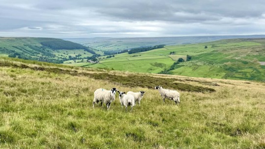
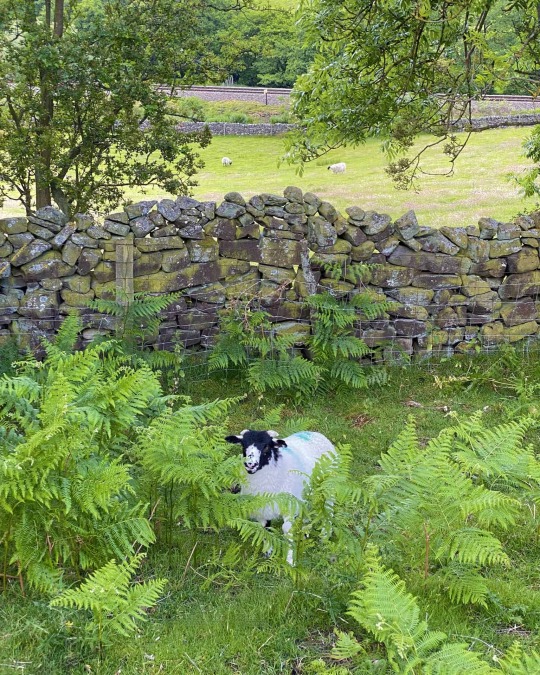
This year's lambs 🐑, now a few weeks old, are slightly losing their early cuteness, yet their voices, still soft and unbroken, are bleating a gentle 'baarr' 🔈 that never fails to bring a smile 😊 to my face.
Nestled in the valley below, a single railway line 🛤️ runs alongside the bubbling Commondale Beck. Every so often, a modern-day passenger train 🚄 whizzes past, its sleek form a stark contrast to the timeless landscape that cradles it.
What a marvellous spot indeed! 👌
0 notes